Quantcast
Channel: Written In Stone...seen through my lens

A Visit to the Miocene Sea at Maryland’s Spectacular Calvert Cliffs: A Geologic and Paleontologic Overview

$
0
0
In “101 American Geo-Sites You’ve Gotta See,” author Albert B. Dickas listed Maryland's Calvert Cliffs as number 32. With curiosity piqued and the Cliffs renowned for their diverse and well-preserved fossiliferous assemblages - having attracted tourists and scientists as early as 1770 - I decided to visit the site in July. Only a 90 minute drive southeast of Washington, the Calvert Cliffs is a spectacular and scenic, almost continuous 50 km wavecut bluff along the western side of the Chesapeake Bay.

A geological contradiction to the Eastern Seaboard's otherwise flat Coastal Plain, the Cliffs rise in places to as much as 40 meters. They are cut into actively eroding, unconsolidated sandy, silty and clayey sediments of the lowermost portion of the Chesapeake Group. Throughout much of the Miocene, the region was the site of a shallow, inland arm of the temperate Atlantic Ocean during climatic cooling, uplift of the Atlantic Coastal Plain and eustatic changes in sea level. The stratal package preserves the best available record of middle Miocene marine and, less frequently, terrestrial life along the East Coast of North America.


Looking obliquely at Calvert Cliffs from the cuspate foreland at Flag Ponds, the undeformed beds of the Chesapeake Group can be seen to have a regional dip of less than one degree to the southeast (about 2m/km). That allows the exploration of progressively younger strata in a southward direction and vice versa. The strata is primarily Miocene with a coarse-channel, fluvial and tidal deposited overburden variably from the Pliocene and Pleistocene. Typical of bluffs adjacent to the bay, the beach and cliff-vegetation is small or non-existent. Notice the slump and collapse material at the base. Its presence at the toe is generally short-lived. The beach at Flag Ponds is very popular for sunning, swimming and strolling, but fossil collecting at the cliff-toes, which is a very productive locale, is prohibited and prevented by the presence of a large fence.


WHO WAS CALVERT AND WHERE ARE WE?
The recorded history of the Chesapeake region is as varied as the geology, which began with the Spanish. The cartographer Diego Gutierrez recorded the Chesapeake on a map, calling it “Bahia de Santa Maria.” The English arrived with John White in 1585 and again in 1608 with John Smith’s entry onto the Calvert Peninsula. His mission was to explore the Chesapeake region, find riches, and locate a navigable route to the Pacific, all the while making maps and claiming land for England. On John Smith’s 1606 map (below), the Calvert Cliffs were originally called “Rickard’s Cliffes”, after his mother’s family name. 

The first English settlement in Southern Maryland dates to somewhere between 1637 and 1642, although the county was actually organized in 1654. Established by Cecelius Calvert, the second Lord Baltimore, English gentry were the first settlers, followed by Puritans, Huguenots, Quakers, and Scots. In 1695, Calvert County was partitioned into St. Mary's, Charles, and Prince George's, and its boundaries became substantially what they are today. Statehood wasn’t granted to Maryland until 1788. The Revolutionary War, the War of 1812 and the Civil War waged in the region. In fact, the peninsula was the training site for Navy and Marine detachments, and the invasion of Normandy was simulated on the lower Cliffs of Calvert.


John Smith's 1606 map of the Chesapeack (correct spelling) Bay. Note the location of Rickards Cliffes (English spelling) emptying into the Virginia Sea (aka Atlantic Ocean). North is to the right. Maryland was granted statehood in 1788 with the region referred to as Virginia.


The Cliffs of Calvert reside on the broad, flat, seaward-sloping landform of the Coastal Plain of Maryland on the western shore of the Chesapeake Bay in Calvert and southernmost Anne Arundel Counties. Located on finger-like Calvert Peninsula, the Cliffs are on the higher western section of the Plain, while the lower section, known as the Eastern Shore (always capitalized), is a flat-lying tidal stream-dissected plain, generally less than 60 feet above sea level. 


Red arrow indicates the region of Calvert Cliffs on the Atlantic Coastal Plain of the eastern shore of the Calvert Peninsula within the Chesapeake Bay.
Modified from USGS map


Chesapeake Bay is an estuary - the largest of 130 in the United States - with a mix of freshwater from the Appalachians and brackish water from its tidal connection to the Atlantic Ocean. The Bay's central axis formed by the drowning of the ancestral Susquehanna River by the sea that flowed to the Atlantic from the north during the last glacial maximum of the Pleistocene Ice Age some 20,000 years ago - when the planet's water was bound up in ice and global seas were lower.

Multiple advances of the Laurentide Ice Sheet blanketed Canada and a large portion of northern United States during Quaternary glacial epochs. Its advance never reached the region of Chesapeake Bay, having extended to about 38 degrees latitude. Being in a contemporary interglacial period - the Holocene - global seas are higher, but not at the level during the deposition of the Chesapeake Group at Calvert Cliffs during the Miocene.  


PASSIVE DOESN'T MEAN INACTIVE
During the time of deposition of the Calvert Cliffs, fluctuating seas drowned portions of southern Maryland. A shallow, protected basin of the Atlantic Ocean called the Salisbury Embayment was located in Virginia, Maryland, Delaware and southern New Jersey. It was one of many depocenters along the Eastern Seaboard, separated by adjoining highs or arches. The Salisbury Embayment structurally represents a westward extension of the Baltimore Canyon Trough that extends into the central Atlantic on the continent's shelf and slope.


Major Structural Features of the Atlantic Coastal Plain from New York to Florida
The embayments are depocenters - major sites of sediment accumulation. The Fall Line is the inner limit of deposits on the Coastal Plain at the Appalachian Piedmont Province. The Salisbury Embayment extends westward to the Fall Line.
Modified from Ward and Strickland, 1985.


The depositional history and relief of the Cliffs of Calvert are testimony to the elevated level of the seas in the Miocene. In addition, the Embayment resides on the “passive” margin of North America’s east coast, which is typified by subsidence and sedimentation rather than seismic faulting and volcanic activity found on the continent’s “active” west margin. The Embayment was and is in a constant dynamic state - passive but far from inactive. 


How did the passive margin and the Coastal Plain of Maryland form geologically? What is the sediment source of the depocenters? What fauna occupied the ecosystem of Calvert Cliffs? These questions can't be adequately addressed without gaining an appreciation for the geological evolution of North America's East Coast. Here's a brief synopsis.

THE GEOLOGIC PROCESSES THAT SHAPED THE EASTERN COAST OF NORTH AMERICA
The supercontinent of Rodinia fully assembled with the termination of the Grenville orogeny in the Late Proterozoic and brought the world's landmasses into unification. Rodinia's tectonic disassembly in the latest Proterozoic gave birth to the Panthalassic, Iapetus and Rheic Oceans, amongst others. Rodinia's fragmentation was followed by the supercontinent of Pangaea's reassembly from previously drifted continental fragments throughout the Paleozoic. 

A succession of orogenic events...
Using modern co-ordinates, the east coast of Laurentia (the ancestral, cratonic core of North America) experienced a succession of three major tectonic collisions during Pangaea's assembly – the Taconic (Ordovician-Silurian), Acadian (Devonian-Mississippian) and Alleghanian (Mississippian-Permian) orogenies. Each orogen built a chain of mountains that overprinted those of the previous event - closed intervening seas and added crust to the growing mass of the continent of North America. 


The Paleozoic Assembly of Pangaea
In the Early Devonian (400 Ma), following the Taconic orgeny, the Acadian collisional event has initiated mountain building on Laurentia's east coast with the closure of the Iapetus Ocean. The megacontinent of Gondwana, lying across the Rheic Ocean, is converging upon Laurentia towards its eventual subduction zone.
Modified from Ron Blakey and Colorado Plateau Geosystems. Inc.

 
A final orogeny assembles Pangaea...
The penultimate Alleghanian orogeny between Laurussia (Laurentia, Baltica and Eurasia) and the northwest Africa portion of Gondwana - the two largest megacontinental siblings of Rodinia's break-up - culminated with the late Paleozoic formation of Pangaea. That unification event constructed the Central Pangaean Mountains - a Himalayan-scale, elongate orogenic belt some 6,000 km in length within Pangaea at the site of continental convergence. Calvert Cliffs (red dot) had not yet evolved, but its deep Grenville basement was in place along with the orogen that would eventually blanket its coastal seascape with sediments from the highlands.

 
The Supercontinent of Pangaea
By the Late Pennsylvanian (300 Ma), the closure of the Rheic Ocean brought various microcontinents, magmatic arcs, and the northwest African and Amazonian aspect of Gondwana into an oblique transpressive collision with Laurussia (summarily Laurentia, Scandinavia and Eurasia). Convergence built the elongate Central Pangaean range composed of segments from South America and Mexico through North America and into Europe and Asia. The Chesapeake Bay, yet to form, is landlocked at the red dot.
Modified from Ron Blakey and Colorado Plateau Geosystems. Inc.

 
Supercontinental fragmentation...
Beginning in the Late Triassic, Pangaea’s break-up created a new ocean – the Atlantic – and fragmented the Pangaean range. As a result, the Appalachian chain remained along the passive eastern seaboard of the newly formed continent of North America from Newfoundland to Alabama, while severed portions of the range were sent adrift on rifted continental siblings. A supercontinental tectonic cycle is apparent between Grenville formation of Rodinia and its fragmentation and Alleghanian formation of Pangaea and its dissassembly.

The orogen's remnants form the Anti-Atlas Mountains in western Africa, the Caledonides in Greenland and northern Europe, the Variscan-Hercynian system in central Europe and central Asia, the Ouachita-Marathons in south-central North America, the Cordillera Oriental in Mexico, and the Venezuelan Andes in northwestern South America. As a result of Pangaea's fragmentation, the region of the future Calvert Cliffs (red dot) was finally positioned in proximity to the sea, awaiting the orogen to erode and Cenozoic eustasy to flood the landscape and deposit the Chesapeake Group during the Miocene.

 
The Continent of North America
The Atlantic Ocean began to form with the disassembly of Pangaea in the Late Triassic. In the Late Jurassic (150 Ma), the modern continents are drifting apart. The Appalachian Mountain range has begun to erode and shed its deposits on the developing Atlantic Coastal Plain (light blue). The Chesapeake Bay, yet to form, is located at the red dot.
Modified from Ron Blakey and Colorado Plateau Geosystems, Inc.

 
North America's new passive margin...
By the Cretaceous, the Appalachian highlands had eroded to a nearly flat peneplain, sending voluminous fluvial sediments to the continental margin and shelf in a seaward-thickening wedge. Under the weight and the effect of lithospheric cooling, the passive marginal shelf began to subside and angle seaward as global warming and rising seas drowned both the coast and cratonic core of North America. The Salisbury Embayment, along with others up and down the coast in a scalloped array, was created by the tilting and reactivation of normal faults that extended westward to the Appalachian foothills. Initially, the regional dip was to the northeast, but Neogene uplift left the Coastal Plain's beds dipping to the southeast.


North America in the Late Cretaceous (89 Ma)
The entire shallow, subsiding passive margin of North America's east coast (light blue), along with the depocenters of the Salisbury Embayment (ellipse), were drowned by global high seas beginning in the Late Cretaceous. Notice that the cratonic core of Laurentia has been submerged by two converging arms of the sea from the north and south that formed the Western Interior Seaway. Also, notice the narrow active margin at North America's west coast, the site of convergent tectonics. This eustatic condition will not prevail with sea level progressively dropping as it fluctuated throughout the Pliocene, the Pleistocene and Holocene.
Modified from Ron Blakey and Colorado Plateau Geosystems. Inc.


Subsidence and sedimentation...
Although classified as a passive continental margin, the "active" shelf received nonmarine 
deposition through most of the Cretaceous. With the exception of the Oligocene, the Tertiary saw wave after wave of marine deposition on Maryland's subsiding shore spurned by rising global seas. During the Late Oligocene, Miocene and early Pliocene, the Chesapeake Group was deposited. The Group's lower three stratal components are exposed as wave-eroded bluffs at Calvert Cliffs. Their ~70 m of strata preserve nearly 10 million years of elapsed time. It forms the most available sequence of exposed Miocene marine sediments along the East Coast of North America.


The depocenter of the Salisbury Embayment is drowned by high seas during the Middle Miocene (15 Ma). This eustatic condition will not prevail with sea level progressively dropping as it fluctuated throughout the Pliocene, into the Pleistocene and present.
Modified from Ron Blakey and Colorado Plateau Geosystems. Inc.


The Chesapeake Group's Cliffs of Calvert...
Vacillating seas consequent to Pleistocene glaciation-deglaciation periodically flooded and exposed the land, backflooding rivers and bays such as the Chesapeake. Our present interglacial epoch - the Holocene - has re-exposed the Chesapeake Group and the Cliffs of Calvert to erosion. In spite of not having experienced a significant phase of tectonic convergence for over 200 million years, the modern Appalachian Mountains have been rejuvenated during the late Cenozoic, possibly isostatically in response to ongoing erosion or by mantle forcing. That contributed to river incision and deposition across the Coastal Plain with sedimentation such as the Chesapeake Group.


A glowing Maryland sunrise illuminates the strata of the Calvert Cliffs looking south.
Photo Courtesy of Stephen J. Godfrey, Ph.D., Curator of Paleontology, Calvert Marine Museum


THE MID-EAST COAST'S PHYSIOGRAPHIC PROVINCES
North America's most easterly geomorphologic region is the siliciclastic sedimentary wedge of the Atlantic Coastal Plain that began to form with the breakup of Pangaea. It’s a low relief, gentle sloped, seaward-dipping mass of unconsolidated sediment over 15,000 feet thick, deposited on the margin of North America Appalachian-derived rivers and streams, and spread back and forth by the migrating shorelines of vacillating seas throughout the Cenozoic. In Maryland, progressing to the northwest from the Coastal Plain, one encounters the Piedmont Plateau at the Fall Line, the Blue Ridge, the Valley and Ridge and the Appalachian Plateau Provinces.


From east to west through the Appalachian orogen with an underlying Grenville basement, the physiographic provinces of Maryland are synonymous with those up and down the East Coast of North America. Notice the Fall Line, separating the Piedmont from the Coastal Plain, and the Chesapeake Bay, dividing the Plain into higher western and lower eastern subdivisions.


The five physiographic provinces are a series of belts with a characteristic topography, geomorphology and specific subsurface structural element. The overall trend is from  southwest to northeast along the eastern margin of North America. Their strike and geologic character have everything to do with the tectonic collisions that built mountains, recorded periods of quiescence, formed and fragmented at least two supercontinents, and opened and closed the oceans caught in between.


Location of Calvert Cliffs on the Chesapeake Bay's western shore of the Atlantic Coastal Plain (light colored)
Modified from USGS map


Calvert Cliffs is on the Chesapeake Bay's western shore of the Atlantic Coastal Plain, as are the major cities on the mid-east coast - Philadelphia, Baltimore, Richmond, Washington, etc. If you connect them on a map, you'll locate the approximate western boundary of the Coastal Plain called the Fall Line or Zone. It's the geomorphic break (and geographic obstacle) where a 900-mile long escarpment of falls and rapids separates the Coastal Plain from hard, metamorphosed crystalline rock of the Piedmont foothills to the west.

The Piedmont and Blue Ridge share similar types of crystalline igneous and metamorphic rocks of the core of the Appalachians. The majority of Blue Ridge rocks are related to events of the Precambrian and Cambrian from Grenville mountain building to the Cambrian rift basins, while most of the Piedmont rocks were transported and accreted to North America. A discussion of the details of tectonic derivation and geologic structure of the remaining westerly provinces is beyond the scope of this post. 


MIOCENE STRATIGRAPHY OF CALVERT CLIFFS
The Calvert Cliffs consist largely of relatively undeformed and unlithified strata of silts, sands and clays of the Calvert, Choptank and St. Mary's formations (Shattuck, 1904) in ascending order of the Chesapeake Group. The formations are interrupted by a series of erosional unconformities and other hiatal intervals and preserve nearly 10 million years of elapsed time.


Flag Ponds Nature Park
The cliffs in the distance are the same as the top of the post. Bluffs directly adjacent to the bay generally have very narrow or no beach material (0-3 m) and little to no vegetation on the face. The erosion rate there is historically uniform (0.3-0.6 meters per year), where they are susceptible to slumping and collapse facilitated by a slope angle of nearly 70 degrees. In this area of Calvert Cliffs and Cove Point to the south, "fossil" bluffs are stabilized and preserved inland of the shoreline as the beach acts as a barrier and protects toe slope erosion from wave action as it migrates to the south along longshore currents. At Cove Point the migrating-landform is a prograding cuspate foreland. Southward bluffs become protected from wave action as new beaches are deposited at the bluff-toes. As the foreland migrates to the south, the beach will recede and active bluff erosion will recommence. The changes induced by the foreland occur on a "decadal rather than centennial scale, which places the rate of slope failure on a human scale." This passive Atlantic margin is anything but!
 (Martha Herzog, USGS).


The Miocene succession was deposited as a complex package representing a first-order transgressive-regressive cycle with numerous superimposed smaller-scale perturbations of sea level. Overall, the record is one of gradual shallowing within the Salisbury Embayment and is reflected in the character of the strata that progresses from inner to middle shelf to tidally-influenced, lower-salinity coastal embayments. Deposition occurred under subtropical and warm temperate conditions in a shallow marine shelf environment at a maximum water depth of more than ~40-50 meters.

The exposures include not only the Calvert Cliffs but the Westmoreland and Nomini Cliffs along the Virginia Shore of the Potomac River. Debated for more than a century, estimates for the basal Calvert range from early Early Miocene to mid-Middle Miocene. 


Miocene Stratigraphy of Calvert Cliffs
The lower Chesapeake Group's Miocene section has been subdivided using a multitude of stratigraphic systems including three formations of 24 stratigraphic beds and molluscan zones, many of which have been renamed as members based on locality. In addition, various depositional sequences and events have been described.  Dates are in millions of years (Ma).
Modified from Ward and Andrews, 2008, and Carnevale et al, 2011.


RECESSION OF THE COASTAL BLUFFS
A general absence of beaches below the cliffs is a characteristic of the region. Direct wave undercutting at the cliff-toe, freeze-thaw erosion, underground seepage at sand-clay interfaces and mass-wasting (the average inclination is 70 degrees) are accompanied by rapid wave removal of colluvium (slope debris). Long-term rates can exceed 1 m/yr. Slumps, rotational slides and fallen trees are constantly being generated and removed. For these reasons, beachcombing for fossils and excavating the cliff-toes is a dangerous and prohibited venture. Collected is allowed in designated parks along the shoreline such as Calvert Cliffs State Park, Flag Ponds Nature Park and Brownies Beach, and private beaches given the owner's permission. 


Two vying factions in regards to the Cliffs are scientists that reap the benefit of ongoing erosion and the homeowners, who seek real estate in close proximity to the cliff edge for the sake of a bay view. For the former, the best way to preserve the Cliffs is to let them erode naturally, while the latter would like to riprap (with stone or concrete), bulkhead, sandbag and groin-field the Cliffs to preserve them and their property. In dealing with Mother Nature, in this regard, shoreline protection reduces the risk of cliff failure, although it doesn't eliminate it. It's only a matter of geologic time. 


Rocky Point just downbay (south) of the Calvert Cliffs Nuclear Power Plant
Exposed are the Choptank and the St. Mary's Formations, the latter often oxidized to an orange color. The boundaries between the members and subdivisions are readily discernible. Zonation of thinly laminated beds of cobbles, mollusk shells, molds and casts can be made out even at this distance. Uppermost strata (upland deposits) consists of undulating Pleistocene alluvium, possibly where Pliocene beds were beveled off during a Pleistocene embayment. Again, notice the slump and collapse material, and destabilized trees sliding down the slope from above. Many homes perched on the cliff-edge have met a similar fate.
Photo Courtesy of Stephen J. Godfrey, Ph.D., Curator of Paleontology, Calvert Marine Museum


To reach otherwise inaccessible sections of the Cliffs and lessen the inherent dangers of collapse and burial, this mode of exploration employs descent from above. Excavation into the unlithified substrate is facilitated by an air-powered drill using a scuba tank's compressed air.


From Google Science Fair 2014. See the video here.


THE CLIFF'S FOSSILIFEROUS BOUNTY
The formations preserve more than 600 largely marine species that include diatoms, dinoflagellates, foraminiferans, sponges, corals, polychaete worms, mollusks, ostracods, decapods, crustaceans, barnacles, brachiopods and echinoderms. The macrobenthic fauna (large organisms living on or in the sea bottom) act as good indicators of salinity. The Calvert and Choptank are dominated by diverse assemblages of stenohaline organisms (tolerating a narrow range of salinity); whereas, the younger St. Mary's Formation exhibits an increasing prevalence of euryhaline molluscan assemblages (tolerating a wide range of salinity). The changes within the assemblages reflect the fluctuating freshwater conditions within the Salisbury Embayment.  

Vertebrate taxa include sharks and rays, actinopterygian fish, turtles, crocodiles, pelagic (open sea) birds, seals, sea cows, odontocetes and mysticetes (whales, porpoises and dolphins).


In addition, the Cliffs preserve isolated and fragmentary remains of large terrestrial mammals (peccaries, rhinos, antelope, camels, horses and an extinct group of elephants called gomphotheres), palynomorphs (pollens and spores), and even land plants (from cypress and pine to oak) that bordered the Miocene Atlantic Coast and were carried to the sea by floodplains, rivers and streams sourced by the Appalachians.


In the Miocene, mammalian diversity was reaching unprecedented levels, increasing in size and filling every conceivable niche on every continent. Grass-grazing, multi-stomached herbivorous artiodactyls (such as giraffes, antelopes, cattle, camel, pigs and hippopotami) were slowly replacing dominant perissodactyls (such as horses, rhinos and tapers) that developed after the end-Cretaceous extinction.  
Modified from Jay Matternes


Miocene River Environment by Karen Carr with permission


SIFTING THE SURF FOR FOSSILS
Armed with a plastic garden rake in hand from the local hardware store, I collected this fossil potpourri (below) on a brief 60 minute stroll along the beach at Flag Ponds. Their abundance and availability is a testimony to the richness and diversity of the Miocene marine fauna. The fossils are continually being generated from the eroding cliffs and their underwater extensions. 

I am uncertain as to the specific origin of the mammalian bony fragments, but I suspect they are largely from marine fauna (i.e. dolphin, whale, seal, etc.) rather than terrestrial, since the former vastly outnumber the latter. Cetaceans such as the whale have repurposed an air-adapted mammalian ear for the differentiation of underwater sounds. The shell-like otic tympanic bulla is a thickened portion of the temporal bone located below the middle ear complex of bones. The large dense bone is well preserved and can easily be mistaken for an eroded fragment of rock.

The crocodile tooth is an indication that rivers and swampy habitats existed in the marginal marine environment of Calvert Cliffs. Shark teeth are the most common vertebrate fossils preserved at the Cliffs. Their numbers are commentary on the favorable paleoenvironmental conditions that existed in the Salisbury Embayment. Of course, sharks continually produce and shed teeth throughout their lives, facilitated by the absence of a long, retentive root structure, and are composed of durable and insoluble biogenic apatite, which favors their preservation. Calvert Museum collections contain as many as 15 genera. The main constituents are Carcharhinus, Hemipristis, Galeocerdo, Isurus and Carchrius. Carcharhiniformes shed about 35,000 teeth in a lifetime!


Appearing in the fossil record about 395 million years ago (middle Devonian), the Class Chondrichthyes (cartilaginous skeletal fish) is divided into two subclasses: Elasmobranchii, which includes sharks, rays and skates, and Holocephali (chimaeras). Elasmobranchii are distinguished by their 5-7 pairs of gill clefts, rigid dorsal fin, presence or absence of an anal fin, placoid dermal scales, teeth arranged in series within the jaws and the upper jaw being not fused to the cranium. Along with a dolphin tooth and a few gastropods, here are a few specimens collected from the surf at Calvert Cliffs State Park, about five miles southeast of Flag Ponds. 


Top Row: Hemipristis (Snaggletooth shark), Isurus (?), Carcharhinus (?)
Middle Row: Carcharhinus (?), Hemipristis (?), Porpoise tooth, Hemispristis (?)
Bottom Row: Ray plate, Turritella shell, ray plate, Scaphopoda mollusc shell.
Any corrections or additional insight regarding these fossils is welcomed.
  

From these small samples, one can glean the ancient habitat at Calvert Cliffs during the Miocene. The combined study of both fossils and rock layers are essential in reconstructing the paleo-geography of the Cliffs. 

C. MEGALODON
By far, the largest but rarest shark teeth at Calvert Cliffs (but widely distributed within the world's oceans) are those of a "Megalodon," an extinct species of shark that lived from the late Oligocene to early Pleistocene (~28 to 1.5 million years ago). Its distinctive triangular, strongly serrated teeth are morphologically similar to those of a Great White shark (Carcharodon carcharias), a fact that fuels the debate over convergent dental evolution versus an ancestral relationship.


An allometric relationship exists between tooth width and body length in modern sharks. A tooth that is 5.5 inches wide correlates with a body length of 60 feet, making Megalodon the largest shark to have lived, weighing as much as 100 tons. I calculated this Megalodon tooth in my collection to come from a 49 footer. That's ten feet longer than a school bus!


The controversy has resulted in a taxonomic name of either Carcharodon megalodon or Carcharocles megalodon - commonly abbreviated as C. megalodon. The “Meg” is regarded as one of the most powerful apex predators in vertebrate history. On rare occasion, extinct cetacean fossilized vertebrae have been uncovered with bite-marks suggestive of mega-tooth shark predation or scavenging. Megalodon is represented in the fossil record by teeth and vertebral centra, since the majority of its cartilaginous skeleton is poorly preserved.


C. megalodon dining on cetaceans
With permission from artist Karen Carr with permission


SKULLS AND BURROWS OF A NEW SPECIES
Dr. Stephen Godfrey of the Calvert Marine Museum has been conducting paleontological studies in the Calvert Cliffs for some 15 years. After rafting along the shoreline to the excavation site, this paleontologist is taking measurements of a trace fossil interpreted as an infilled tilefish burrow from the Plum Point Member of the Calvert Formation deposited some 16 million years ago. In a 2014 paper in the JVP (see reference below), well preserved,  partially complete, largely cranial remains of tilefish are described. They have been collected over the past three decades from Miocene deposits outcropping in Maryland and Virginia. 


Ruler in hand, paleontologist W. Johns investigates the exposed tilefish burrow.
Photo Courtesy of Stephen J. Godfrey, Ph.D., Curator of Paleontology, Calvert Marine Museum


Lopholatilus ereborensis, a new species of family Malacanthidae and teleost (infraclass of advanced ray-finned fish), inhabited long funnel-shaped vertical burrows that it excavated for refuge within the cohesive bottoms of the outer continental shelf of the Salisbury Embayment that likely inhabited other parts of the warm, oxygenated waters of the western North Atlantic outer shelf and slope. The species name was derived from 'Erebor,' the fictional name for the Lonely Mountain in J.R.R. Tolkien's The Hobbit. Like the mountain-clan of dwarves, the tilefish mined the substrate.


This is a close-up view of an infilled, cylindrical-shaped, tilefish-excavated burrow in erosional cross-section. Investigations of extant tilefish show they were shelter-seeking within horizontal clay substrates. The tilefish used as a head-first entrance and tail-last exit for protection from predators. The burrows were subject to infill and collapse, taphonomously preserving the tilefish if within.
Photo Courtesy of Stephen J. Godfrey, Ph.D., Curator of Paleontology, Calvert Marine Museum

Schematic drawing showing three Miocene tilefish burrows. The fish on the left is actively excavating a new burrow. In the center, the burrow has been infilled, preserving the fish that habitated the burrow. On the right, the fish has taken refuge within its burrow.
Photo Courtesy of Stephen J. Godfrey, Ph.D., Curator of Paleontology, Calvert Marine Museum

Lopholatilus ereboronsis moderately deep skull and short snout in left lateral view with interpretive illustration. For orientation, the large circular structure is the orbit with anterior to the left. Post-cranial structures (vertebral skeleton) are missing. The fossil preserves anatomical detail as if a live dissection. One can clearly differentiate the entire suspensorium (jaw connections) of the maxilla (upper jaw) and a few teeth, the dentary (lower jaw) and the quadrate (ancestral jaw-joint), etc. Five extant genera of tilefish inhabit the waters of the Atlantic, Indian and Pacific Oceans.
Photo Courtesy of Stephen J. Godfrey, Ph.D., Curator of Paleontology, Calvert Marine Museum


COLONIAL SMOKING PIPE
In an attempt to see what fossilized remains might have filtered down from overlying Miocene and more recent strata, I walked the beach until finding a break where a wash had carved a trough through the bluffs. I immediately spotted a white object glistening in the sun in a stream bed filled with gravel and tiny sharks teeth that turned out to be the worn remnants of a Colonial-era smoking pipe.


Pipes of clay were first smoked in England after the introduction of tobacco from Virginia in the late 16th century. Sir Walter Raleigh, an English sea captain, was one of the first to promote this novel habit acquired from Native Americans that practiced its ritual use for many centuries. By the mid-17th century clay pipe manufacture was well established with millions produced in England, mainland Europe, and the colonies of Maryland and Virginia. For various reasons, clay pipe demand declined by the 1930’s.


Clay pipes were very fragile and broke easily, and along with their popularity, they are commonly found at Maryland and Virginia colonial home sites. In Colonial-era taverns, clay pipes that were passed around were supposedly broken off at the stem for the next user in the interest of hygiene. Some clay pipes can be dated by the manufacturer's stamp located on the bowl, which was unfortunately missing in this lucky (but well calculated) find.

HIGHLY RECOMMENDED REFERENCES
• Evolution of Equilibrium Slopes at Calvert Cliffs, Maryland by Inga Clark et at, Shore and Beach, 2014.
 •Frequency of Effective Wave Activity and the Recession of Coastal Bluffs: Calvert Cliffs, Maryland by Peter R. Wilcock et al, Journal of Coastal Research, 1998.
• Geologic Evolution of the Eastern United States by Art Schultz and Ellen Compton-Gooding, Virginia Museum of Natural History, 1991.
• Maryland's Cliffs of Calvert: A Fossiliferous Record of Mid-Miocene Inner Shelf and Coastal Environments by Peter R. Vogt and Ralph Eshelman, G.S.A. Field Guide, Northeastern Section, 1987.
• Miocene Cetaceans of the Chesapeake Group by Michael D. Gottfried, Proceedings of the San Diego Society of Natural History, 1994.
• Miocene Rejuvenation of Topographic Relief in the Southern Appalachians by Sean F. Gallen et al, GSA Today, February 2013.
• Molluscan Biostratigraphy of the Miocene, Middle Atlantic Coastal Plain of North America by Lauck W. Ward, Virginia Museum of Natural History, 1992.
• Slope Evolution at Calvert Cliffs, Maryland by Martha Herzog, USGS.
• Stargazer (Teleostei, Uranoscopidae) Cranial Remains from the Miocene Calvert Cliffs, Maryland, U.S.A. by Giorgio Carnevale, Stephen J. Godfrey and Theodore W. Pietsch, Journal of Vertebrate Paleontology, November 2011.
• Stratigraphy of the Calvert, Choptank, and St. Mary's Formations (Miocene) in the Chesapeake Bay Area, Maryland and Virginia by Lauck W. Ward and George W. Andrews, Virginia Museum of Natural History, Memoir Number 9, 2008.
• The Ecphora Newsletter, September 2009.
• Tilefish (Teleostei, Malacanthidae) Remains from the Miocene Calvert Formation, Maryland and Virginia: Taxonomical and Paleoecological Remarks by Giorgio Carnevale and Stephen J. Godfrey, Journal of Vertebrate Paleontology, September 2014.
Variation in Composition and Abundance of Miocene Shark Teeth from Calvert Cliffs, Maryland by Christy C. Visaggi and Stephen J. Godfrey, Journal of Vertebrate Paleontology, January 2010. 


WITH GREAT APPRECIATION
I wish to express my gratitude and thanks to Stephen J. Godfrey, PhD., Curator of Paleontology of the Calvert Marine Museum, for providing valuable support (personal communications, October 2014), documentation and photographs of Calvert Cliffs and his recent excavation and publication.

GO VISIT!
Calvert Cliffs Marine Museum was founded in 1970 at the mouth of the Patuxent River in Solomons, Maryland. Visit them here, but do go there! You can join the museum here.

OR SUBSCRIBE!
The Ecphora is the quarterly newsletter of the Calvert Marine Museum Fossil Club. Ecphora gardnerae gardnerae is an extinct, Oligocene to Pliocene, predatory gastropod and the Maryland State Fossil, whose first description appeared in paleontological writings as early as 1770. Sadly, riprapping (rock used to protect shorelines from erosion) has covered one of only two localities in the State of Maryland where the fossil can be found. The other is on private land and off limits without permission. Ironically, Marylanders can find their state fossil in Miocene strata of Virginia. Download copies of current and past newsletters here or simply subscribe.

Richard E. Byrd III’s National Champion Eastern Hophornbeam Tree

$
0
0
“There are trees, and then there are trees.”
Dick Byrd, 2014


My neighbor, Dick Byrd of Newton, Massachusetts, has a lot to be thankful for. One of his biggest joys is growing or should I say towering in his front yard. It’s a tree, but not just any tree. It’s an Eastern Hophornbeam, and it’s the National Champion – the largest of its species growing in the United States!


WHAT'S A CHAMPION TREE?
We all know that a champion is a person who has defeated or surpassed all of his/her rivals in a competition. It includes someone who fights or argues in support of another person, cause or belief. But what's a champion tree?

It will come as no surprise, that to qualify, a tree must be big. It must be the largest species according to a standard measuring formula, and it must be re-measured every 10 years in order to maintain its champion status. To be eligible, a tree must be native to or naturalized in the continental United States, including Alaska but not Hawaii.


THE NATIONAL REGISTER OF CHAMPION TREES
American Forests is the oldest national nonprofit conservation organization in the United States. Their mission is to restore threatened forest ecosystems and inspire people to value and protect urban and wildland forests. Since 1940, their National Big Tree Program has been a testament to American Forests’ legacy of leadership in recognizing the beauty and critical ecosystem services provided by the country's biggest and oldest trees. More than 750 champions are crowned and documented in their biannual American Forests Champion Trees national register, located here.

For more than 70 years, the goal of the program has remained to preserve and promote the iconic stature of these living monarchs and educate people about the key role that these remarkable trees and forests play in sustaining a healthy environment.

DOES YOUR TREE MEASURE UP?
Trees are ranked by total points based on the following formula: Circumference (in inches) + Height (in feet) + ¼ Crown Spread (in feet). The tree with the most total points is crowned national champion. The nomination deadlines are March and September 15th for the spring and fall registers, respectively. Dick's champion Hophornbeam has 210 points! I'll tell you how to measure your tree later in the post.


WHAT'S A HOPHORNBEAM?
The Eastern or American Hophornbeam - Ostrya virginiania if you're trying to impress Dick - is a member of the birch family of trees. Also known as ironwood, hardhack (in New England) and leverwood, it's generally a small short-lived tree scattered in the understory of hardwood forests. The tree is generally a subordinate species or minor member of most forest communities, when present. That's another unique aspect of Dick's champion - its unusually large size. Perhaps thriving in "the open" and Dick's nurturing nature has facilitated its large growth. 

The Eastern Hophornbeam is a rugged, shade-tolerant tree with an oval or round canopy that grows to 50 feet in height. Dick's champion tops out at 66! It's found throughout the eastern United States and within the mountains of Mexico, south to El Salvador and Honduras. Over this large native range, it thrives in a diversity of climatic conditions and soils. Its small nutlets, which ripen in summer and fall, are used by birds and mammals during the winter. 

It's often grown as an ornamental plant and sometimes used as a street tree. Because of its hardness, it has been used to make tool handles for mallets and posts. It should not be confused with the hornbeam, which is also a member of the birch family. The bark of a hophornbeam has loose strips of reddish brown to gray, creating a rough "clawed" bark.


The hophornbeam's leaf is doubly-serrated with fine teeth at the margin and 2-4 inches long.


TREE TALK
I asked Dick what he knew of the age of his champion, it being slow-growing and having achieved such a large size. His best guess was about 135 years based on the age of his house. Dick speaks with the knowledge and ecological pride that comes from his BS in Forestry that he received from the University of Maine, although he doesn't pursue that profession, other than avocationally.

Gazing up at the hophornbeam and shaking his head, Dick says that it has lost a good two-thirds of its crown, and that it wasn't registered until it lost the first third. "After losing the first third, no one would ever know that you have a champion. That's why I registered it. I looked up the previous champion - a tree in Michigan. The Commonwealth came to measure it near the end of 2008."

Dick continued, "These types of trees are often culled early for pulpwood." Given its age and the deteriorated condition of its trunk, he fears that its days are numbered. "One good nor'easter, and that's it!" He's thought of cutting it down but is obviously highly reluctant.


Even before I met Dick, I couldn't help but notice the tree as I jogged through the neighborhood. Maybe it was the signage that he proudly placed on the tree that caught my eye - one high and the other low. "Why the low signage?" I asked. "It's for the kids, and it's fun for everyone to read about it." Unfortunately, the bark that held the signs has rotted off, and they're now displayed on the logs.


I was grateful for Dick telling me the story of his Eastern Hophornbeam and seeing his arboreal pride. He walked me back to my car, and quite sincerely added, "It's nice to find somebody that appreciates a championship tree!" And that I did! I must admit that I sneaked back the next morning to catch the morning sun illuminating its still majestic crown.


HOW TO MEASURE TRUNK CIRCUMFERENCE
1. Measure the distance around the trunk of the tree, in inches, at 4 ½ feet above ground level. This point is called the diameter breast height or dbh.
2. If the tree forks at or below 4 ½ feet, record the smallest trunk circumference below the lowest fork. Record the height at which the measurement was taken. Trees should be considered separate if the circumference measurement below the lowest fork places the measurement on the ground.
3. If the tree is on a slope, measure 4 ½ feet up the trunk on the high and low sides of the slope. The dbh is the average between both points. If the tree is on a steep slope, take the measurement at 4 ½ feet above the midpoint of the trunk.
4. If the tree is leaning, measure the circumference at 4 ½ feet along the axis of the trunk. Make sure the measurement is taken at a right (90 degree) angle to the trunk.


HOW TO MEASURE TREE HEIGHT
Measure the vertical distance, in feet, between the base of the trunk and the topmost twig. Height is accurately measured using a clinometer, laser, hypsometer, or other specialized tools.  If these tools are not available, height can be estimated using the following “stick method.”

1. Find a straight stick or ruler.
2. Hold the stick vertically at arm’s length, making sure that the length of the stick above your hand equals the distance from your hand to your eye.
3. Walk backward away from the tree. Stop when the stick above your hand is the same length as the tree.
4. Measure the distance from the tree to where you are standing. Record that measurement to the closest foot.


HOW TO MEASURE THE CROWN SPREAD
Two measurements of the crown spread are taken and recorded, in feet, at right angles to one another.
1. Measure the widest crown spread, which is the greatest distance between any two points along the tree’s drip line. The drip line is the area defined by the outermost circumference of the tree’s canopy where water drips to the ground.
2. Turn the axis of measurement 90 degrees and find the narrow crown spread.
3. Calculate the average of the two crown spread measurements using this formula: (wide spread + narrow spread)/2 = average crown spread.


2014 Posts That Never Quite Made It - A Lustrous Pearl for an Illustrious New Year; William Smith's Map That Changed the World; The Longitude Problem; Plaster of Paris Meets the Father of Comparative Anatomy; The Seine's Epic Journey to the Sea; Blue Sky, Green Water and Red Rocks on the Stove Pipe Trail; Born to Reproduce; The Oldest Cut Granite Building in America; The Granite Railway; and The Bridge that Spans Two Geologic Eras

$
0
0
Every blogger knows the challenge. What shall I blog about next? What photos should I use? By the time the end of the year rolls around, there are always a few posts that never quite made it. And so, with this final post of the year, here they are from here and there. Please visit the same for 2013 here and 2012 here.

January
A Lustrous Pearl for an Illustrious New Year


My wife and I ushered in the New Year with our traditional early dinner at a wonderful local restaurant. To our surprise, one of the saltwater oysters in her appetizer contained an opaque white, natural pearl - a one-in-a-million chance. 

Pearls begin as foreign bodies within the mantle of a mollusk. The bivalve’s response is to secrete layer after layer of nacre (NAY-ker), a hard crystalline substance around the irritant for protection. The result is a pearl, which is similar in finish to the shiny inside of oysters and mussels, known as mother of pearl and can take 5 to 20 years to form (1 to 6 years for freshwater pearls). Light passing through the nacreous substance is reflected and refracted, which gives the pearl its luster and iridescence. This is because the thickness of the platelets of aragonite - a form of calcium carbonate (the other being calcite) - is close to the wavelength of visible light. Unlike gemstones that are cut and polished to bring out their beauty, pearls require no such treatment. 

Finding a pearl is considered to be good luck, and looking back on this year, I would affirm that superstition. 

February
William Smith’s Map That Changed the World


"Sing, cockle-shells and oyster-banks,
Sing, thunder-bolts and screw-stones,
To Father Smith we owe our thanks
For the history of a few stones."
Anniversary Dinner by A.C. Ramsey, 1854.


This eight by six-foot Delineation of the Strata of England and Wales with Part of Scotland is easily mistaken for a modern geologic map. Yet, it was created by William Smith in 1815 and was the first national-scale geologic map of any country covering 65,000 square miles. By far, it was the most accurate at its time and the basis for all others. Concealed behind stately green velvet curtains, it is on display in the foyer of the Geological Society of London’s Burlington House in Piccadilly alongside a bust of William.

William Smith was born in 1769 in the hamlet of Churchill in Oxfordshire, the orphaned son of the village blacksmith. Raised by his uncle and with only a rudimentary education, he quickly learned the surveyor trade as an assistant. Fortuitously, he applied his skills with the Somersetshire Coal Canal Company, at which time he observed that rock layers within the canals were arranged in a predictable pattern and could always be found in the same relative positions. He also noted that each stratum was identifiable by the fossils that it contained and that the same succession of fossil groups from older to younger rocks could be found across the countryside, even as the layers dipped, rose and fell. In time, his astute observations led him to the hypothesis of the Principle of Faunal Succession – a major geological concept in determining the relative ages of rocks and strata. 

Travelling throughout Britain, he observed exposures of the strata and meticulously sampled and catalogued their characteristics. First mapping vertically and then horizontally in color, his first sketch in 1801 led to the publication of the geological map of Britain. The timing was right. This was the dawn of the Industrial Revolution in England. Coal was king, and maps were needed. Yet, Smith's maps were plagiarized by the Geological Society of London, forcing him into bankruptcy and debtor’s prison. Destitute but not deterred after years of homelessness, Smith's bad fortune began to turn. 

Over a decade later, he was eventually accepted into and honored by the Geological Society of London for his contributions as “the Father of English Geology.” In 1831, he was conferred the first Wollaston Medal by the Society in recognition of his achievements to the new science - all without a formal education in geology! It’s their greatest honor, bestowed by the very institution that denied him membership because of his low social status. Later, he was awarded an honorary doctorate of letters from Trinity College in Ireland. This uneducated surveyor rubbed elbows with famous astronomers, naturalists, biologists and geologists. 

Simon Winchester in his book The Map That Changed the World summed up Smith's map as the work of a lonely genius. He states, "The task required patience, stoicism, the hide of an elephant, the strength of a thousand, and the stamina of an ox. It required a certain kind of vision, an uncanny ability to imagine a world possessed of an additional fourth dimension, a dimension that lurked beneath the purely visible surface phenomena of the length, breadth and height of the countryside, and, because it had never been seen, was ignored by all customary cartography. To see such a hidden dimension, to imagine and extrapolate it from the little evidence that could be found, required almost a magician's mind - as geologists who are good at this sort of thing know only too well today."

The brilliance of William Smith’s achievement is demonstrated by comparing the accuracy and detail of his maps with the ones used by the Geological Society today and the rest of the world. His creation heralded the beginning of a new science and anointed him as its founding father. As for Dr. William Smith, nothing but goodness, recognition and respect attended the final years of his life.

February
The Longitude Problem

This is a High Dynamic Range photograph

"The College will the whole world measure;
Which most impossible conclude,
And navigation make a pleasure
By finding out the longitude.
Every Tarpaulin shall then with ease
Sayle any ship to the Antipodes."
Anonymous (circa 1660) from the Ballad of Gresham College 

On a foggy night in 1707, British Admiral Sir Cloudesley Shovell’s celebrated naval career was brought to a tragic end along with the lives of nearly 2,000 sailors, when his warship and three others in the fleet were wrecked on the rocks of the Isles of Scilly, off Great Britain's southwest coast. It was one of the greatest disasters at sea in British history and one of countless shipwrecks befallen to seafaring nations throughout history. The main cause of the British tragedy was the navigators’ inability to accurately determine their position at sea - longitude in particular. In response, Parliament established the Longitude Prize in 1714. The reward was for a "practical and useful" method for the precise determination of a ship’s longitude. The winner would collect £20,000 or roughly 4 million dollars in today’s currency, if accurate within half a degree (30 nautical miles at the equator). It was a large sum to pay for a desperate nation.

Back in school, we learned that our planet is divided into an imaginary grid. Hula hoop lines of latitude or parallels encircle it horizontally, the largest at the equator, while vertical, equi-length, pole-to-pole lines of longitude or meridians mark locations east or west of the Prime Meridian or 0º longitude. Unlike the equator, the Prime's location is arbitrary and is a universally-accepted reference line whose location has varied historically (Until 1911, the French used a Paris meridian). As of 1851, it runs through the Royal Observatory at Greenwich, England, which is located on a majestic hill overlooking the Thames River, where the above photo was taken looking north. The line is actually slightly to the right, but 500 happy kids were busy straddling the line with one foot in each hemisphere. Used together, latitude and longitude provide every location on our earthly sphere with a global address, and when calculated, indicate one’s whereabouts on a map – an important feat at sea when land is out of sight. If you know where you are, then you know where you're going. Admiral Shovell would surely have agreed.

One’s latitude is relatively easy to determine. Since ancient times, it was known that a star will consistently reach the same highest point in the sky, which changes with the observer’s latitude. By “sighting” the angle (declination) of the sun at it highest point from the horizon during the day or say the North Star at night, one’s position can be calculated from a table simply by knowing the time of measurement. On the other hand, finding longitude hasn't been so easy. Without it, ships at sea would follow a line of known latitude east or west, turn toward their assumed destination, and then continue on another line of known latitude. This process extended the voyage by days or weeks with increased risk of scurvy, bad weather, lack of potable water, starvation and worse - shipwreck. Another option was dead reckoning by using a predetermined “fix” and advancing that position based upon one’s known speed over time. Navigators threw a long, knotted rope overboard and counted the number of knots let out in a given interval to allow a distance and speed calculation. The process was subject to cumulative errors induced by wind, current and change of course.  

The longitude problem was viewed by astronomers as requiring a celestial calculation such as by viewing eclipses of Jupiter's moons or our own, which required extensive heavenly observations and complex charts - hence the observatory in Greenwich. Clockmakers, on the other hand, envisioned the problem as requiring a temporal calculation. As expected from such a large reward, there was a myriad of hair-brained solutions such as a fleet of globally-distributed anchored ships that fired position-signalling cannons as longitude locators.

Ultimately, it was John Harrison, a self-educated English carpenter and clockmaker, who, after over four decades of toil and experimentation, successfully invented a masterpiece of engineering. His H4 (earlier versions were H1 through H3) was a pendulum-less “sea clock” that was unaffected by movement and changes in temperature. At sea, a ship’s captain could, using Harrison’s marine chronometer, calculate longitude by comparing the time on his pocket watch to a constant clock at a predetermined location.  

Here's how the the concept worked. The Earth makes a complete rotation on its axis every day. If there are 24 hours in a day, one hour of rotation is equivalent to 15º of rotation (360º ÷ 24). Thus, there exists a relationship between time and longitude. If you set your watch to 12:00 noon (not temporal noon but astronomical noon when the sun is highest in the sky at its zenith) at say Greenwich time, and you observe the sun at 4:00 PM at another location, then you’re at longitude 60º W (4 hours x 15º/hour = 60º). Finding local time was relatively easy. The problem was how to determine the time at a distant reference point while onboard a rocking, swaying, storm-tossed deck - an impossible task back in Cloudesley’s day with pendulum-swinging clocks that required a stable surface for accuracy.

Harrison's H4, which basically looks like an over-sized pocket watch, achieved all that and more - pendulum-less, compact, portable, shipworthy and accurate. Harrison's many timepieces are on display at the Royal Observatory, and as for their inventor, he spent his final years tinkering and experimenting with many timekeeping innovations - a very wealthy man. 

February
Plaster of Paris Meets the Father of Comparative Anatomy

This is a High Dynamic Range photograph


Built of gleaming white travertine (a redepositional form of limestone), the Basilica of the Sacred Heart radically changed the profile of the once pastoral, hilltop village of Montmartre - located on the northern outskirts of Paris and now an integral part of the city. Beginning in 1875, its 39-year construction was no easy task, since its foundation was literally riddled with subterranean gypsum quarries. 

Gypsum- an evaporite mineral formed by dehydration in an arid environment - is used in the manufacture of Plaster of Paris by heating it and then reapplying water to get it to harden. It has been excavated from beneath Montmartre from antiquity through the 19th century. Amongst its many decorative and artistic uses, it serves as an effective natural fire retardant on wooden structures, akin to our modern plaster board. After the Great Fire of London in 1666, its use was decreed by French King Louis XIV and literally saved Paris from the destructive fires that ravaged all major European capitals. 

The gypsum of Montmartre and the limestone of northern France formed within the Paris Basin. It began as an epeiric (shallow inland) sea on the northeastern fringe of Laurentia (the cratonic core of ancestral North America) some 200 million years ago. When the supercontinent of Pangaea fragmented apart beginning in the Late Triassic, the basin (and the new continent of western Europe) was tectonically transported to the Eastern Hemisphere on the Eurasian plate across an ever widening Atlantic Ocean. Once part of northern France, the basin’s sedimentary rocks of limestone and gypsum were deposited some 45 million years ago during the Lutetian Period of the Eocene. 

Outspoken critics of the Sacre Cour project - not only because of its exotic architecture but its exotic ideology - feared a seismic outcome related to its enormous weight. The architect, who had been commissioned to build his design, thought an immense platform of concrete four meters thick would stabilize the structure over the quarries. Instead, 80 stone pilings were laid down through the lime and clay and deeper through the voids of the quarries until bedrock was struck over 30 meters down. In effect, the foundation of Sacre Cour rests upon stilts like a dock on pilings over water. If an earthquake was to strike Montmartre, after the dust settled some Parisians thought the edifice would remain intact as if floating in air. 

When you visit Paris or on Google Earth, you can catch a glimpse of the entrance to one the quarries beneath the basilica fenced off on the northern end of rue Ronsard. It was in these very gypsum quarries that the famous French naturalist and zoologist Georges Cuvier excavated Eocene mammalian fossils from the strata in the 1790’s. His investigations led him to the inescapable conclusion that fossils were the remains of animals long-extinct. A lifelong Protestant, he believed that periodic catastrophies had befallen the planet and its lifeforms. That implied God had allowed some of his creations to vanish, a rather blasphemous conclusion against the tenets of the English church and one of the foundations of modern paleontology. Cuvier's contributions and uncanny ability to reconstruct lifeforms from their fragmentary remains led to his appellation as the “Founder of Comparative Anatomy.”

March
The Seine's Epic Journey to the Sea


Four large rivers water France – the Loire, the Seine, the Rhine and the Rhone – linked by a system of interconnecting canals. The second longest is the Seine (pronounced SEN), which begins a 776 kilometer (482 mile) journey to the sea from a modest cluster of springs called the Source de Seine northwest of Dijon. This is the Cote d’Or, literally “golden slope” that arguably produces the best wines (and mustards) in the world. It’s the right combination of climate, soil, and of course, clean water. 

The Seine flows through a thousand tiny hamlets, fields and woodlands, and halfway to the sea, right through the middle of Paris. It divides the city into its two famous banks - the conservative Left Bank or Rive Gauche and the radical Right Bank or Rive Droite. The Seine is the heart and soul of Paris, where the Parissi tribe first settled and where Romans took residence in their conquest of Gaul in 52 BC. 

The Seine flows through an enormous geological depression flanked by huge escarpments that began to flood when it was part of an intricate network of inland seas when the Atlantic Ocean was just beginning to open. The supercontinent of Pangaea’s fragmentation sent the Paris Basin adrift on the Eurasian Plate across the Atlantic Ocean, along with a network of interconnecting basins in western Europe. Good thing for France. The River Seine is actually a recent waterform within the ancient trough, having originated when the Pleistocene ice sheet and enumerable alpine glaciers sent their waters to the sea from the highlands that encompass the basin. 

Twenty-six tributaries later, the estuarine Seine discharges into the ocean, more precisely the English Channel, between the twinports of Honfleur and Havre, seen above through the clouds.

May
Blue Skies, Green Water and Red Rocks on the Stove Pipe Trail


“The landscape everywhere, away from the river, is rock – cliffs of rock; tables of rock; 
plateaus of rock; terraces of rock; crags of rock – ten thousand strangely carved forms."
John Wesley Powell, 1875

Originating in the Wind River Mountains of Wyoming and skirting the northwest corner of Colorado, the Green River flourishes in Utah in all its glory. It's a 730-mile long, chief tributary of the Colorado River before reaching their confluence at the southern terminus of the Island in the Sky. In northeast Utah, the Green carves its channel over and through fluvial and marine rocks of Cretaceous age - grayish remnants of a vast inland sea that connected then-warm Arctic waters with those of the Gulf of Mexico, yet to form. In southeast Utah, things change dramatically, as the river downcuts through rocks of Jurassic, Triassic, Permian and Pennsylvanian origins.

This is Canyonlands, where John Wesley Powell in 1869 surveyed, mapped, described and named the landforms on the first of two expeditions to the region. First, through curvy Labyrinth Canyon and then more linear Stillwater Canyon, both appropriately named, the Green River slices its way back in time through confining cliffs of the Jurassic Glen Canyon Group and underlying erodible slopes and ledges of Triassic Chinle and Moenkopi Formations. The strata of these two geologic periods of the Mesozoic tell a tale of widespread Jurassic aridity in western Pangaea and distant Triassic mountain ranges draining across vast floodplains and river systems to the sea.

Our journey down the Green River - under the leadership of famous geologist Wayne Ranney and the supreme navigational skills of Walker Mackay and his family-run Colorado River and Trail Expeditions or CRATE - rafted us into camp at the foot of the Stove Pipe Trail in Stillwater Canyon, about seven miles upriver from the confluence. 

To work up an appetite for dinner, we ascended over 1,000 feet through a series of switchbacks and a palette of colors derived from cherty, chalky limestones and dolomites, pale-red sandstones, blue-gray siltstones and thin beds of evaporites of the Elephant Canyon Formation. At the top, where the photo was taken, the white to pale-reddish brown and salmon-colored Cedar Mesa Sandstone comes into view, forming the cliffs and ledges that hold it all up. These Permian strata are derived from the Ancestral Rocky Mountains or, more appropriately, the southwest range of the Uncompahgre Highlands that began their ascent in Pennsylvanian time. As they rose, the inexorable forces of erosion tore them down. Here too was an inland sea represented by the Uncompahgre's flexural trough that persisted with intermittent communications with the ocean and whose dimensions vacillated with the whim of South Polar glaciation an astounding 33 times. To see the strata within the trough, we had to wait for the following day in order to travel further down the Green. 

Both long gone, the highlands and basin left their signature deposits from Colorado to Utah. Uplift and erosion of the Colorado Plateau have put the finishing touches on the landscape. What's left is a rainbow feast for the eyes!

June
Born to Reproduce


On a glorious Spring afternoon outside of Boston, I exited the train station and began the short walk home. A bright colored object on the ground caught my eye, and, glancing down, I spotted this splendid Cecropia Silkmoth (si-KROH-pee-uh) on the pavement. A little worse for wear, I photographed it with my cellphone. I recognized the creature, having remembered a pinned specimen from sixth grade biology class so long ago. 

The cecropia is North America’s largest moth and are abundant east of the Rockies, although this specimen is the first I’ve seen outside of class. Females achieve a wingspan of seven inches! The larvae are mostly found largely on maple trees, which squirrels fastidiously dine on. I suspect this is a male, based on the more resplendent morphology of its antennae, having evolved as such for one specific purpose. 

Born to reproduce, nocturnally-active males lack functional mouthparts and a digestive system, and therefore survive only a few weeks. Unable to resist, males fly miles following the scent plume of wind-born female pheromones, guided by their antennae. Using an adaptive process called chemical mimicry, bolas spiders copy the pheromones produced by cecropia females, in order to lure males into their next meal. Predators and their prey exist up and down the food chain at virtually every level.

July
Architectural Geology of Boston – the Oldest Cut Granite Building in America


"In the love of truth, and the spirit of Jesus Christ,
We unite for the worship of god and the service of man."
King's Chapel Covenant

King’s Chapel in Boston was designed by Peter Harrision of Rhode Island and built in 1754 on the site of a smaller wooden Anglican church, itself built in 1688. It was situated on the public burying ground, because no resident would sell land for a non-Calvinist church. The stone church was constructed around the wooden church, so that the parishioners could continue to practice their faith, and was later disassembled and removed through the windows of the new church. 

The edifice is a classic example of American Georgian architecture – eponymous for the first three British monarchs of the House of Hanover, all named George in the early 18th and early 19th centuries. Its salient architectural features include a tall, boxy portico surrounded by 12 painted Ionic columns made of wood. The cornice has decorative mouldings and is topped off with a spindled-balustrade that terminates in a flat-roofed tower with four louvered, arched windows. The planned steeple was never built, which gives the church its distinctive "unfinished" look. Directly behind, the chapel has a characteristically four-sided, hipped roof. The Georgian style was big in eastern America, that is until King George III and the American Revolution turned the aesthetic sentiment elsewhere.

King’s Chapel was originally planned to be of English sandstone but was built with native Quincy Granite. It's the oldest, still-standing granite building in Boston but not the first to utilize granite, having been incorporated into many early foundations and associated structural elements. The blocks of granite demonstrate a patchwork color mix with pockmarked surfaces on the exposed “seam-faces.” 

The granite's appearance is reflective of the mode of quarrying from boulders scattered about rather than from excavated bedrock. The process involved heating and splitting the granite with heavy iron balls, followed by hammering, chiseling and shaping into stackable units. The "quarry" locale was Quincy (pronounced KWIN-zee), about 10 miles south of Boston. The town is officially called the “City of Presidents” after John Adams and John Quincy Adams, but its nickname is the Granite City. A hundred years later, the use of famous Quincy Granite in construction would become commonplace in Boston, and quarrying the bedrock would become a major commercial enterprise there.

By the way, in the bowels of King's Chapel is a 200-year old crypt and in the tower is the largest and last bell made by Paul Revere. It's located on the famous Freedom Trail, the red brick line on the pavement in front of the chapel.

October
The Granite Railway


In the face of great opposition to his idea, architect and engineer Solomon Willard traipsed all across New England looking for the perfect stone. His plan, after several architectural modifications, was the construction of a 221-foot tall obelisk out of Quincy Granite - the Bunker Hill Monument - situated in Charleston across the harbor from Boston. By comparison, the Washington Monument - built to commemorate George Washington - was completed in 1884 on the National Mall in Washington, DC, and is the world's tallest stone obelisk at 555 feet. Willard's edifice was built to commemorate the Battle of Bunker Hill, the first major conflict between the British Regulars and the Patriot forces of colonial militiamen in the Revolutionary War fought in 1775. Technically, the monument is not on Bunker Hill but on Breed’s Hill, where most of the fighting in the misnamed Battle of Bunker Hill actually took place.

In 1825, Willard recognized there was something special about the granite in the hills west of Quincy. It wasn’t its convenience, since the granite still had to be excavated - no easy or safe task back then. It wasn’t its proximity (although that helped), since a lot of varied terrain stood in the way of the granite’s final destination. And it wasn’t the granite’s massivity - not meaning lots of it (which there was) but referring to its consistent homogeneity for aesthetic purposes. 

It was from Quincy Granite’s unique mineral composition. The high percentage of alkali feldspar, as opposed to the plagioclase variety, affords the rock its dusty gray, greenish tint, aided by its variety of black quartz. Formed from the slow crystallization of magma some 450 million years ago when the micro-terrane of Avalon was in transit to Laurentia, the granite’s characteristic mineral of riebeckite, a brittle prismatic amphibole, allows the rock to achieve a high polish, in addition to its lack of micas. Quincy Granite was the rock that Willard sought - attractive, distinctive, stately, transports well, available, highly polishable and weather-resistant. 

However, a major obstacle in 1826 was getting multi-ton blocks out of the ground, down from the heights above Quincy and across 12 miles of swamp, forest and farms for construction. After considering an overland route, the solution of how to transport the blocks from the quarry to a dock on the Neponsett River was modeled after English railroads. The idea for the Granite Railway was conceived and became not the first public transportation railroad in the United States but the first purpose-built, commercial railroad. 

It ran only three miles with wagons pulled by horses, although steam locomotives had been in operation in England for two decades. Wooden and later granite rails on stone crossties were plated with iron. In 1830, a new section of railway called the Incline, seen above, was added to haul granite from the quarry, one of many above town. Wagons and horses moved up and down the 315 foot incline in an endless conveyor belt. From the docks, blocks were loaded on barges that traveled across Boston Harbor. Off-loaded onto ox-drawn carts, the cargo went up a hill at Charleston for construction of the obelisk. The capstone was laid in 1842 at a project cost of $101,680. Interestingly, the monument underwent a 3.7 million dollar renovation in 2007 - the cost of 36 monuments!

The Incline remained in operation until the 1940’s with metal channels laid over the old granite rails and motor trucks pulled by a cable. In 1871, steam trains carried the granite directly to Boston from the quarries.

These days, the quarries have been filled in for safety purposes with 12 million tons of dirt from the Big Dig highway project in Boston. In years past, many young persons were injured or killed while swimming and cliff diving into the abandoned quarries that had filled with water. Ironically, the steep quarry walls are used today by organized groups of rock climbers to hone their skills. As for the Granite Railway, it's listed on the U.S. National Register of Historic Places, while the Bunker Hill Monument towers over Charleston across the harbor from Boston proper. You could see it from the quarry, if it wasn’t for the city's tall buildings. The Bunker Hill Monument is managed by the National Park Service and is on Boston’s Freedom Trail. 

November
The Bridge that Spans Two Geologic Eras


Viewed from Upper Manhattan, the George Washington Bridge spans the Hudson River between New York and New Jersey. Its footings are secured in two geologic eras. Cross the bridge heading west, and you time-travel from the Late Proterozoic to the Paleozoic. During the Late Triassic, the supercontinent of Pangaea began its fragmentation and newly-evolving dinosaurs were trudging through the mudflats of the Jersey Meadowlands. That epic schism created the continents of our New World and the Atlantic Ocean within the void, while the North American and Eurasian tectonic plates continue to drift apart. 

During supercontinental breakup, aborted rift basins from the Canadian Maritimes to Georgia developed up and down the margin of North America. In northeastern New Jersey and southeastern New York, the Newark rift basin subsided and listrically tilted as molten mafic rocks injected through the depocenter’s sedimentary strata into black argillites of the Lockatung Formation. The prominent cliff seen above on the western bank of the Hudson represents the eroded edge of that angulated, tabular intrusive sheet – the famed Hudson River Palisades. Its obvious vertical jointing formed when the magma solidified, so spectacularly exposed by the carving of the Hudson Canyon during the last Ice Age. 

The Palisades was threatened by quarrying in the early 20th century, when J.P. Morgan, American financier, banker, philanthropist and art collector, purchased twelve miles of New Jersey shoreline. On the east side of the river in Washington Heights, John D. Rockefeller, American business magnate and philanthropist, acquired the land of Fort Tyron and the Cloisters, where this photo was taken. 

Thankfully, the natural beauty of the Palisades cliffs rising above the west bank of the Hudson has long been appreciated by generations of residents and visitors to the metropolitan area. But now, LG Electronics, a South Korean multinational electronics corporation, is planning to build an office tower that will rise high above the trees, and for the first time, violate the unspoiled ridgeline. Interested in preserving the Hudson River Palisades? Visit “Protect the Palisades” here.

That's all folks. Thanks for following my blog! Happy New Year!

Big Brook - New Jersey's Classic Late Cretaceous, Fossil-Collecting Locality

$
0
0
"At first it may seem to be a piddly little dribble through the farmlands and forests of rural New Jersey, 
but careful observation shows Monmouth County's Big Brook 
to be glass-bottomed boat sailing through a Late Cretaceous sea busy with life.” 
From the New York Paleontological Society Field Guide, 2002


Big Brook at a slightly high water level as seen from the Hillsdale Road bridge facing east


A WINDOW INTO A LATE CRETACEOUS CONTINENTAL SHELF
Step into the waters of this very ordinary-looking brook, and you’ll go back in time to North America’s continental shelf only a few million years before the Great Extinction that ended the Age of the Dinosaurs. In its lazy and short course to the Atlantic, Big Brook has carved a shallow, curvy trough through New Jersey's Inner Coastal Plain through the upper sediments of a Late Cretaceous paleoshelf. In so doing, weathering of the streambank provides a steady supply of fossils that are washed into the streambed.

Big Brook is one of the East Coast’s classic fossil-collecting localities with both amateurs and professionals alike. As early as 1863, the Smithsonian Institute in New York sent an expedition to explore and gather fossils from the brook and others within Monmouth County. Less widely appreciated amongst amateurs is that the strata through which Big Brook transects preserves an outstanding sedimentological record of the transition from an inner to an outer shelf environment during the Late Cretaceous as sea level rose.  

APALEONTOLOGICAL GRAB BAG
Although rare, be on the lookout for fragmented, water-worn dinosaur bones and teeth - hadrosaurs, theropods, ankylosaurs and ornithomimids - from the Late Cretaceous terrestrial shoreline to the west. Add to the mix, Pleistocene mammalian remains of mastodon, sloth, beaver and horse. From the Holocene, there's even an occasional Native American Lenni-Lenape arrowhead from the surrounding countryside and a coral from Paleozoic tropical seas entrapped within the Appalachian orogen that was transported to the area fluvially or via glacial outwash.


A Late Cretaceous terrestrial fauna similar in some respects to eastern North America
From National Geographic


But by far, the big attraction is teeth from Late Cretaceous chondrichthyans (shark, rays and skates) and, less often, osteichthyans (bony fish) and large marine reptiles (mosasaurs, turtles and plesiosaurs). 


The Late Cretaceous marine ecosystem teemed with life. 
From NHNaturalHistory.org 

In addition, abundant macro-invertebrate remains include brachiopods, bryozoans and molluscs (bivalves such as oysters, snails, belemnites and ammonites) and disarticulated arthropod carapaces and claws (lobster, crab and shrimp), all from the Late Cretaceous shelf ecosystem. 


The shelf's benthic and demersal zone was rich and diverse with brachiopods, bryozoans, molluscs and arthropods.
From Matthew McCullough on Flickr and license here.


WHERE ARE WE?
Big Brook is barely 50 miles south of New York City via the Garden State Parkway off exit 109 west. The brook winds its way through the rural New Jersey hamlets of Colts Neck and Marlboro to the Navesink River near the borough of Red Bank, and ultimately the Atlantic Ocean. Besides Big Brook, other nearby fossil-bearing tributaries include Poricy Brook in Middletown Township, Ramanessin Brook in Holmdel and Shark River (Eocene and Miocene) in Neptune and Wall Townships. They're all located in gentrified and well-healed Monmouth County, which is in the top 1.2% of counties by wealth in the United States. The County's website advertises itself as the "Gateway to the Jersey Shore", while locals know it as Springsteen country (“…sprung from cages on highway nine…”). 


The arrow points to the location of Big Brook within Monmouth County.
Modified from Roadside Geology of New Jersey


BIG PICTURE TECTONIC STUFF
Some sixty-seven million years ago, this lazy, oak-shaded stream and the surrounding countryside were a tiny submerged section of the newly-formed, Atlantic continental shelf. During the Late Cretaceous, global high seas drowned the shelf that now represents the broad, low relief of the Atlantic Coastal Plain through which Big Brook flows. But the geological story of the plain begins well before the Cretaceous. 

Paleozoic tectonic convergence...
Beginning in the early Paleozoic, Laurentia - the rifted megacontinental sibling of the Late Proterozoic supercontinent of Rodinia - was converged upon by a procession of magmatic arcs, micro-continents and megacontinents and their intervening ocean basins. 

Birth of Pangaea...
In a parade of orogenic events, they accreted to Laurentia's growing ancestral core - building mountains and adding crust with each collision. By the Pennsylvanian Period of the Paleozoic (below), their cumulative convergence had constructed the supercontinent of Pangaea and built a massive, centrally-located mountainous spine. By the Late Permian at the close of the Paleozoic, the mountains had been ravaged by erosion.


Subsequent to the collision of Gondwana (the other megacontinental sibling of Rodinia) with equatorially-positioned Laurentia in the Middle Pennsylvanian, Monmouth County is nestled somewhere within the lofty peaks of the Appalachians. The supercontinent of Pangaea is fully formed and awaits its imminent fragmentation.
Modified from Ron Blakey and Colorado Plateau Geosystems. Inc.


Demise of Pangaea...
In the Late Triassic, Pangaea’s fragmentation began. As the Atlantic Ocean began to open within the schism, the remnants of Pangaea's central mountainous spine began to fragment as well. A portion remained astride the Atlantic Coast in newly-formed eastern North America - today's Appalachians - while other remnants were carried across the globe on the backs of Pangaea's rifted siblings. Pangaea's breakup also endowed North America (and of course New Jersey) with a new passive shoreline characterized by seismic and volcanic inactivity, and most importantly, subsidence and sedimentation. 

Subsidence and sedimentation of the Atlantic margin...
Beginning probably during Jurassic time, lithospheric cooling of North America's newly-formed passive margin, in concert with the weight of voluminous sedimentation, promoted rapid subsidence and provided a vast accommodation space for the accumulation of clastic erosive products. With subsidence, the Atlantic margin was broken into a series of faulted-blocks, which experienced differential movements. 

Downward movement created embayments - deep indentations of the ancient shoreline in which sediments accumulated in greater thicknesses in greater water depths. Upward movement created structural highs, arches or uplifts - with thinner sequences and even the absence of deposition. One such coastal geo-indentation that would become a portion of the Coastal Plain - the Raritan embayment - influenced sedimentation in New Jersey between Staten Island at the western end of Long Island and Jersey's northern Coastal Plain.  


Map showing the outline of the Atlantic Coastal Plain and major structural elements that persist on North America's modern coast line. In particular, the Raritan Embayment between is encircled.
Modified from Summary of Lithostratigraphy and Biostratigraphy of the Atlantic Coast by Ollson


Formation of the Atlantic Coastal Plain...
Concomitant with crustal cooling and subsidence, deposition in the coastal plain began in earnest in the Early Cretaceous with fluvial sedimentation from the highlands of the Appalachians. However, in the Late Cretaceous (below), marine incursions representative of global high seas flooded low-lying regions of the world that included the newly-formed, low-lying Atlantic coast.

Progressing from the shoreline seaward, gravel and sand on the inner continental shelf gave way to silt and clay, and, in progressively deeper water, glauconitic sand and silt. The deposits record a progressive but discontinuous and fluctuating rise in sea level - perhaps four in Late Cretaceous time and three in the Cenozoic. Thus, the landform of the Atlantic Coastal Plain gradually developed, representative of some 150 million years of sedimentation.

Of course, the flood waters of the Cretaceous have receded exposing the broad Coastal Plain on the eastern seaboard. Although global seas continued to vacillate, erosion became the dominant geological process through the Tertiary. Ice Age glaciers made it to northern New Jersey but not to the south, while the Coastal Plain continued to receive a thin and varied veneer of colluvial and alluvial Quaternary and Holocene debris. Today, the modern shoreline is 10 miles to the east of Big Brook as it lethargically dissects its way to the sea through Late Cretaceous sediments. 


With Pangaea fragmented apart, the Late Cretaceous witnessed the initiation of the development of the ecosystem of Monmouth County (red dot) on the submerged Atlantic Coastal Plain (light blue). The Atlantic Ocean has opened between the north and south, and is actively spreading. Note the Mid-Atlantic spreading center (light blue) along the line of tectonic divergence. The Western Interior Seaway in central North America is about to become confluent between the waters of the Arctic and the Gulf of Mexico.
Modified from Ron Blakey and Colorado Plateau Geosystems. Inc.


A COLORFUL TAPESTRY OF TERRAIN AND TIME
The Paleozoic collisions that assembled North America formed geomorphic provinces that are seen in the colorful mosaic of the Tapestry of Terrain and Time map by the USGS here. The yellow and tan Cretaceous and Cenozoic deposits of New Jersey (within the ellipse) illustrates the extent of the Coastal Plain within the state, which is continuous with that of the entire Atlantic and Gulf Coasts from Cape Cod and Long Island, through northern Jersey at Sandy Hook to southern New Jersey at Cape May, and down to Florida and around to the Gulf of Mexico. Let's take a closer look at the provinces of New Jersey.


The geomorphic provinces of Northeastern and Mid-Atlantic North America with New Jersey encircled. 
Modified from the USGS Tapestry of Time bedrock map located here.


NEW JERSEY’S GEOMORPHIC PROVINCES
For an area its size, New Jersey has a diverse geological history. From west to east, from the mountains to the sea, and across the multitude of orogens that formed eastern North America, New Jersey’s main geological subdivisions or provinces are the Valley and Ridge, the Highlands (equivalent to the familiar Blue Ridge down south), the Piedmont and the Coastal Plain

By definition, the four geomorphic or physiographic regions are each unique as to relief, landforms and geology. Being inherited subsequent to the tectonic collisions that occurred throughout the Paleozoic, they're on strike from northeast to southwest in accordance with the direction of tectonic convergence. A fifth smaller province - in accordance with tectonic divergence - is the Newark Basin (green and red), which lies interposed within the Piedmont. It's a sediment-filled rift-basin, one of many along the east coast that formed during the initial stages of Atlantic opening in the Late Triassic and Jurassic.


Geologic Bedrock Map and Physiographic Provinces of New Jersey
The region of Big Brook within the Atlantic's Inner Coastal Plain is located at the red dot.
Modified from the Department of Environmental Protection, Division of Science, Geological Survey, 1999


THE COASTAL PLAIN
The Coastal Plain Province is relatively featureless, save a few gently undulating hills, and overlaps the rocks of the Piedmont Province to the west. It covers the entire lower half of New Jersey (see above map), dipping seaward from 10 to 60 feet per mile to the the southeast and extending beneath the Atlantic Ocean to the edge of the Continental Shelf at the Baltimore Canyon Trough. Its unconsolidated and compacted (but not cemented) sediments range in age from the Cretaceous to the Miocene. The composition of its bedrock and fossils confirms that it was submerged by Late Cretaceous high seas. 


This west to east cross-section through the modern Coastal Plain and continental shelf illustrates the increasingly deep seaward-facing wedge of sediments that extends from a feather edge at the Fall Line of the Piedmont to the sea, where it's over a mile thick.
From the USGS and the Roadside Geology of New Jersey


THE INNER AND OUTER REGIONS OF THE COASTAL PLAIN 
The Coastal Plain is further subdivided into two regions. Because it was uplifted, weathered and dissected, the Inner Coastal Plain is higher in altitude than the Outer Plain but not by much. Its composition is largely a mix of quartz sand, glauconitic sand, silt and clay. This fertile agricultural zone gave rise to New Jersey’s nickname as the Garden State. It's also the location of Big Brook within Monmouth County. The Outer Plain is a region of lower altitude where low-relief terraces are bounded by subtle erosional scarps. It consists of Tertiary and Quaternary sand, and being acidic and less fertile, is the location of Jersey’s heavily forested cedar swamps and pine-scrub oak of the Pine Barrens. 

THE MONMOUTH GROUP 
As mentioned, in the Early Cretaceous the Coastal Plain region of New Jersey received deltaic and floodplain-derived (non-marine) sediments from the Appalachian highlands to the west. In the Late Cretaceous and into the early Paleocene, sea levels rose and flooded the coastal region in a series of transgressions over land and regressions back again. Layer after layer, sequence after sequence (packages of strata deposited during a single cycle of sea level rise and fall), sediments of the sea were laid down beginning with the earliest Late Cretaceous Raritan Bass River Formation upon the latest Early Cretaceous fluvial Potomac Formation (chart below). 

In the late Late Cretaceous - from the Campanian into the Maastrichtian - the Monmouth Group, the state's youngest Cretaceous package, was laid down - a unit that is compacted but unlithified. New Jersey's Monmouth Group includes the basal Mount Laurel sand (5-60 feet thick), the transgressive marl of the Navesink (25-60 feet thick), the regressive silt and sand of the Redbank Formation (thin film to 100 feet thick) and the Tinton Formation's coarse quartzose and glaucontic sand (20-40 feet thick). 


As the sea transgressed and regressed, shorelines moved accordingly. Existing sediments were eroded, reworked and redeposited, leaving behind unconformities. Breaks between sequences were punctuated by lag deposits or "shell beds." The great majority of fossils at Big Brook such as within the Navesink Formation, which we will visit, were eroded from lag deposits and released into the streambed. They were deposited within the neritic zone - the relatively shallow waters of the ocean from the littoral zone (closest to the shore) to the drop-off at the edge of the continental shelf. 


STRATIGRAPHY OF BIG BROOK
Big Brook's journey to the sea, has excavated a channel into the Inner Coastal Plain. It cut through the Red Bank Formation's Sandy Hook Member (Krsh), through the Navesink Formation (Kns) and underlying Mount Laurel Formation (Kml), and in some areas, into the Wenonah Formation (Kw) - all deposits of the vacillating Late Cretaceous sea. You can find the complete map of the Freehold and Marlboro Quadrangles here. For orientation, the red arrow marks the location of the car park on the north side of the Hillsdale Road bridge. 


This map depicts the channel of Big Brook. The red arrow points to the car park on the north side of the Hillsdale Road bridge.
Modified from the Bedrock Geologic Map of the Freehold and Marlboro Quadrangles, New Jersey, 1996.


TWO PORTALS TO BIG BROOK
Two unmarked bridges are your portals to Big Brook- one on Boundary Road and the other on neighboring Hillsdale Road just east. On the north side of the Hillsdale Road bridge is a designated car park, while parking is on the street just south of the Boundary Road bridge (as of this writing). The photographs taken and fossils displayed in this post were from four visits to Big Brook on the east side of the Hillsdale Road Bridge. 

The countryside through which Big Brook flows is peppered with residential settlements, horse farms and wineries that are either private or post no trespassing. Big Brook's banks are private as well and off limits to excavation. They're dangerous too, since they are unconsolidated and slump and collapse with little provocation, especially by overzealous excavators. But the streambed is fair game. The only caveat is that on a nice summer day you may have to share it with a paleontologist, a geologist, a scout troop and a fossil club - all after the same piece of time.


The bucolic Hillsdale Road bridge over Big Brook facing south


YOUR FOSSIL-FORAGING ARMAMENTARIUM
To extract the fossil bounty at Big Brook Preserve, no geological hammers and chisels are necessary owing to the unconsolidated nature of the bedrock. In fact, they're prohibited by a posted Colts Neck Township ordinance in order to preserve the resource and minimize over-collecting. All you'll need are a pair of Wellies or suitable waders (there's some broken glass so don't go barefoot), and equip yourself with a garden trowel (with a maximum blade length of 6") and a small, homemade sifting-screen (no greater than 18” x 18”). I borrowed a kitchen colander from home. 


OFFICIAL RULES AND POLICIES
The Department of Recreation and Parks of the Township of Colts Neck has determined that "there is an increasing need for the preservation of the many natural resources located within Big Brook Preserve. It has been observed that natural resources such as fossils have been taken from the park in large quantities. It has also been observed that certain other dangerous conditions continue to threaten the natural beauty, assets and environmental resources within Big Brook Park." 

Therefore, "Fossil extraction is prohibited from the walls of the streambed above the stream waterline", and "No person may harvest more than five fossils per day." With all that in mind, you’re ready to “beachcomb” at Big Brook, panning and sifting for treasures buried within the streambed.


INTO THE WOODS
After parking your car in the designated area, assemble your regalia, and follow the short footpath through the woods on Late Cretaceous Navesink soil. You can make out the brook's shallow, shady trough running from right to left. I've been to Big Brook many times over the years and haven't seen one mosquito or tick. Having said that, come prepared! 


The short path through the woods to Big Brook


STEP INTO THE BROOK AND GO BACK IN TIME
Slide down the vegetated slope to the brook, and step back in time into the continental shelf. The deposition rate of the Navesink has been estimated to be about a meter in a million years, so from the footpath to the streamline, you're back about 2 million years. You can wade through the brook upstream (west) to the Boundary Road bridge about a half-mile or go downstream for a quarter-mile or so.


The Hillsdale Road bridge seen from Big Brook. 
The water level is somewhat high here, so the mudflats would be the best option for fossil-foraging.


TIME TO GET WET AND MUDDY
Within the brook's oak-shaded world, things become quiet and peaceful with gurgling waters, chirping birds, occasional hawks cruising overhead and gentle breezes wafting down from above. Only the occasional car flying across the bridge will remind you of the civilization that surrounds you. 

Many collectors choose to visit Big Brook in the Spring or after a heavy rain, thinking that new runoff refreshes the fossils that weather in from the banks. Others say it makes no difference. Cobbles and fossils tend to aggregate in horizons, so many collectors focus on sieving there. 

If the brook is at high water and the bed is totally flooded, it's safest not to enter, besides, hunting for fossils will be extremely difficult and unproductive. Trees and large limbs that have fallen across the brook add a measure of challenge to negotiating the stream, especially if the current is swift and you're forced to the center of the channel.


Seen here at high water, the brook's bed, gravel bars and mudflats are less accessible for foraging. 

Wade and trudge around until you've found a "good" spot, be it a mudflat or gravel bar, or simply excavate directly into the streambed. Just don't disturb off-limit streambanks. Although highly fossiliferous and tempting, once again, they are unstable. Groundwater near the base of exposures is under artesian pressure and continually discharging from small seeps and springs that undermine the cliff-face provoked by the slightest excavation - historically a potentially fatal mistake.

STREAMCUTS IN THE NAVESINK
The stretch of brook east of the Hillsdale Road bridge is largely within the Navesink Formation, while portions of the bed are in the Mount Laurel and deeper Wenonah. The age of the Navesink has been estimated to range from about 70 million years at the base of the formation to about 66 million years at the top, almost at the end of the Mesozoic. 

By the way, above the Tinton Formation of the Monmouth Group, the K-T boundary between the end of the Cretaceous and the beginning of the Cenozoic ("T" stands for Tertiary) has been identified in test borings beneath the Outer Coastal Plain and at Inversand Mine in the town of Sewell within the Inner Coastal Plain on the western part of the state across the Delaware River from Philadelphia.


The Navesink is a transgressive interval in the last of six depositional cycles of changing sea levels coupled with subsidence that includes the overlying Red Bank formation. An idealized cycle includes a basal glauconitic unit (of massive flooding and maxiumum faunal diversity), a superjacent clay or silt surface (representing the highstand tract deposited in shallower water than the previous tract), and a sandy unit (that may contain a lowstand tract at the top). The sequence of lower glauconite sand, middle clay-silt and an upper quartz sand was repeated some four or five times on the plain's inner to mid-shelf in the Late Cretaceous.

Glauconite sands of New Jersey...
The Navesink is a massively bedded, olive-gray, olive-black and dark greenish-black clayey, glauconite sand unit - also called greensand or marl - that is compacted but unlithified. Glauconite is an iron-rich mica (iron potassium phyllosilicate) that forms diagenetically at the sediment-water interface on the continental shelf from clay minerals during prolonged intervals of sediment starvation. Glauconite is not confined solely to the Navesink but is found in most of the Late Cretaceous formations within the Inner Coastal Plain. 

Geologic bedrock map of Late Cretaceous and Paleogene Formations of New Jersey's Inner Coastal Plain
Modified from Zehdra Allen-Lafayette


The coastal plain's glauconite beds are not only highly fossiliferous but, being nutrient-rich and holding water, were widely mined as fertilizer in the 19th century. In fact, the duck-billed dinosaur Hadrosaurus foulkii was discovered in an old marl fertilizer pit in Haddonfield, New Jersey, in 1858. It was the first almost complete dinosaur skeleton discovered in the United States and is now the New Jersey state fossil. The hadrosaur, being terrestrial as all dinosaurs, was thought to have been carried to the plain's former marine environment via a "bloat and bloat" or "fluvial-flood carried" scenario. The time-frame and curious marine burial are reminiscent of the therizinosaur Nothronychus graffami in Big Water, Utah. You can read about it in my post here.  

Highly fossiliferous and bioturbinated...
Big Brook's banks provide an excellent opportunity to inspect a portion of the Navesink in cross-section down to the streamline. Above the Navesink are fossil-depauperate sands of the Red Bank Formation, stained red by iron oxide. Within the Navesink are quartz-rich sand layers and sand-filled burrows containing granules, black phosphate pebbles and small lignite fragments. Unseen are planktonic microfossils (such as Globotrucana gansseri and Lithraphidites quadratus), and, to the unaided eye, disarticulated macrofossil horizons of bivalves

The latter form lag deposits exposed within the streamcut that are traceable for some distance. Lag deposits are common in the Late Cretaceous of North America and represent complex taphonomic histories that include multiple episodes of exhumation and reburial associated with sea level cyclicity. Although a work in progress, four or more distinct facies within the Navesink have been identified using these litho- and biofacies horizons that correlate to sequence boundaries and unconformities.  


Standing directly in Big Brook's stream, this cut bank is within the Navesink Formation with a portion of the overlying Red Bank Formation. The voids are where large clusters of bivalves have avulsed (or were excavated) from the glauconitic matrix. 


Iron-rich mineral seeps help to identify bedding interfaces. Note the myriad of overlapping vertical and horizontal burrows exposed within the bank. The extensive infaunal bioturbination is very evident. Not one visitor to Big Brook that I've seen has taken the time to study the streamcuts through the Navesink. There's a great story to be told in the banks, not just by what's washed into the bed!


Close-up of a heavily bioturbinated and water-saturated Navesink bank with an iron-rich mineral seep.


FROM STREAMBANK TO STREAMBED - THE FOSSILS OF BIG BROOK
The fossil fauna of Big Brook is in keeping with a thriving shelf environment. The following is a small sample of its bounty discovered on four visits to the brook east of the Hillsdale Bridge. 

It's easy to overlook small fossils from the brook's mud and gravel bed, especially tiny shark and fish teeth, some of which are a barely 2 mm in diameter. The screen affords an opportunity to patiently inspect your excavated sample. Note the camouflaged remnants of a Gyrphaed scallop shell, a Cephalopal belemnite rostrum and a Squalicorax shark tooth below.


A gravel bar alongside the streambed of Big Brook


SCAPANORHYNCHUS
Unquestionably, the major attraction at Big Brook is shark teeth, and there are many varieties to be found. To the geologically-uninitiated, they appear incongruous to the modern landscape. Their abundance is a testimony to the richness of the Late Cretaceous ecosystem. 

Shark teeth are well preserved, whereas their skeletal remains being cartilaginous are not, with the exception of an occasional vertebral centrum. All the dental specimens, particularly the radicular structures, being less calcified and more porous, are stained by iron derived from the host sediment. Some permineralization of the teeth has occurred during burial, fossilization and diagenesis (alteration induced by chemical and physical processes mediated by water and stopping short of metamorphism). 

Scapanorhynchus ("spade-snout") is an extinct genus of shark from the Cretaceous. Often referred to as the anatomically similar goblin shark, which is distinct enough to have been placed within its own genus, Scapanorhychus had an elongated and flattened snout with awl-shaped teeth suited for tearing flesh and seizing fish. 

S. texanus is the species that frequented the Atlantic shelf in the Late Cretaceous. The 35 mm long anterior tooth (below) is sigmoidal in shape viewed from a lateral aspect with prominent striations running from the root to the apex of the crown. It has a bulbous lingual cingulum (facing the viewer) between the furcation of the two roots, which have a prominent length. Two small, opposing cusplets are variably found on anteriors at the cemento-enamel junction (where the crown meets the root), while posterior teeth exhibit heterodontic variability, although shark teeth are generally homodontic - of the same or similar morphology.


A 35 mm long Scapanorhynchus anterior tooth


ARCHAEOLAMNA - CRETOLAMNA (?) AND SQUALICORAX
Some degree of difficulty can exist in identifying shark teeth from Archaeolamna kopingensis from Cretlamna appendiculata (lower left below). Likely the latter, both genera have teeth that are robust with heavy, triangular side cusps and a thick, bi-lobate root with a deep U-shaped furcation.

Squalicorax (lower right) is a genus of an extinct Cretaceous lamniform shark related to the Great White and Goblin sharks. Its blade-like teeth possess a distinctively curved and serrated crown with a prominent notch on the mesial aspect. Its bi-lobate roots are separated by a shallow furca. Squalicorax ("crow-shark") was both a coastal predator and scavanger, as evidenced by teeth having been found embedded within the metatarsal of a hadrosaur, obviously non-marine indigenous. The species is likely S. kaupi.


Shark teeth from Archaeolamna-Cretolamna (?) and Squalicorax


Here are a few more examples of the many shark and fish teeth found at Big Brook. The abbreviated radicular length assists in the exfoliation of teeth under stress, which are replaced within a week by a seemingly endless supply of unerupted teeth. With the assumedly large number of sharks feeding on the shelf in the Late Cretaceous, this accounts for the large number and diversity of teeth recovered from Big Brook. Many of the bones recovered from the seafloor show fossil evidence of shark predation and scavenging and bear the distinctive teeth marks of Squalicorax's serrations. Likewise, many serrations and cusp tips of shark teeth exhibit signs of wear and chipping related to lifestyle and behavior.


Top Row: Squalicorax, Odontaspis, Archaeolamna and Scapanorhynchus.
Bottom Row: Two Squalicorax, Four unidentified and Enchodus.  

On the left is one-third of a vertebral centrum of a shark with its characteristic concentric rings and saucer-like depressed center. On the right is possibly a vertebral centrum of a ray, also a chondrichthyan. 

Vertebral centra from a shark and a ray


Enchodus (upper right tooth above) is an extinct genus of small to medium-size bony fish in the Late Cretaceous. Thought to be a highly predatory species, it possessed fang-like teeth in the anterior, more conventional posterior teeth and a compliment of palatine teeth as well.


BELEMNITIDA
First appearing in the Jurassic, belemnites are Mesozoic molluscs and members of an extinct order of the class Cephalopoda ("head-foot") that superficially appear squid-like. They possessed 10 equi-length arms studded with small inward-curving hooks used for grasping prey but lacked the pair of specialized tentacles present in modern squid. Uniquely, they possessed hard internal skeletons (below) - not hydroxylapatite of phosphatic bone - composed of calcium carbonate (calcite) in the form of a bullet-shaped rostrum or "guard." 

Located on the posterior aspect and often mistakenly assumed to be anterior for propulsion through water, the rostrum (diagram) was attached to a chambered, conical shell called a phragmocone, and that to the tentacular head of the cephalopod. Based on the behavior of extant lifeforms, it is assumed that belemnites were powerful swimmers and active predators. 

The rostra found at Big Brook are plentiful and easy to spot but generally fragmented. Close inspection of a rostrum in cross-section shows its internal structure to be of non-uniform, radiating concentric crystallites that are interpreted as growth rings. Early colonists suspected they formed when lighting bolts struck the ground, hence they are referred to as "thunderbolts." Locals refer to them as "bullets."


Calcitic rostra from belemnites

Diagram of a belemnite from ukfossils.co.uk


EXOGYRA
Exogyra is an extinct genus of saltwater oyster, a common marine bivalve mollusc, that lived in great abundance within the benthic zone (just above, at and below the sediment surface) of the warm Cretaceous sea. Five species have been reported from New Jersey (C. cancellata, C. costata, C. erraticostata, C. spinifera and C. ponderosa), some of which are found at Big Brook. Exogyra and pycnodonte oysters are preserved in great numbers within the Navesink Formation's muddy glauconitic sands of Big Brook, typical of an outer shelf environment. Assemblages of the bivalves Exogyra, Pycnodonte and Agerostrea form biofacies horizons within the Navesink.  


PYCNODONTE MUTABILIS WITH CLIONA CRETACICA BORINGS AND EXOGYRA

Another extinct Cretaceous saltwater oyster in the same family as exogyra, Pycnodonte is also a bivalve that is well represented at Big Brook. Many of the upper valves (referred to as "left") preserve the original shell coloration in the form of reddish brown radial bands, which are often discontinuous or offset indicating growth lines. The upper valve is strongly convex with concentric growth rings. Pycnodonte can reach up to 10 cm across.

Many modern oysters fall victim to predation from crustaceans such as lobsters and crabs, and gastropods. The oyster might survive the invasive attempts by continually accreting new shell layers. Back in the Cretaceous, the predatory sponge Cliona cretacica created trace holes by boring into Pycnodonte's shell (lower left). The shell on the right is the lower (or "right") valve of Exogyra.


AGEROSTREA MESENTERICA
Also an extinct genus of Late Cretaceous fossil oyster, this bivalve was prominent within the Navesink beds. It's semilunar shape and highly recognizable scalloped edge are characteristic. Along with Pycnodonte, it served as a biofacies assemblage horizon. 


INOCERAMUS
Inoceramus ("strong-pot") is also an extinct species of bivalve, a saltwater clam that resembles an extant oyster. It had a worldwide distribution during the Cretaceous that included the Western Interior Sea way as well as coastal regions, the Atlantic included. Its prisms of calcite confirmed it with its typical pearly luster. Inoceramus, along with the bivalves previously mentioned, are found in lag deposits that weather into the brook and provide biostratigraphic facies recognition.


CARAPACES, PINCERS AND CLAWS
Common to the Late Cretaceous shelf's ecosystem were various arthropodal crustaceans - lobsters, crabs and shrimp - that left fragmented remains of their dorsal exoskeletal carapaces, pincers and claws. Many of the specimens may be molts rather than the remains of the parent lifeform.

The claws of the callianassid crustacean Callianassa are often preserved within infaunal burrows and, to the astute observer, can occasionally be spotted in situ within the stream banks. Many coprolites (fecal pellets) bear a striking resemblance to exoskeletal remains in terms of glossiness, black color and similarity in shape. Exoskeletons often possess a marked symmetry, have sutures between fused segments and have surface rugosities distinctive of arthropods (bottom row, far right). 


Top row are artifacts; bottom row are remnants of crustacean carapaces and claws.


ICHNOFOSSILS
Typical of a coastal shelf ecosystem, many invertebrates such as worms, digging bivalves and shrimp plied the seafloor and burrowed into the shelf's sand and mud seeking food and protection from predators. Callianassa is a genus of "mud" or "ghost" shrimp common to the shelf fauna that reinforced their burrows with fecal pellets to prevent collapse. In time, the burrows filled in with sand and became iron-cemented, which is what I believe are demonstrated below. The pointed specimen at the right is a belemnite guard. 

Trace fossils such as this - also called ichnofossils - are geological records of biological activity. They are impressions created on the surface and tunneled into the substrate of the seafloor. Ophiomorpha is a trace fossil classification or ichnotaxon of a burrowing organism in a near-shore environment. Callianassa is considered to be the best-known modern analog for this burrow. Trace fossils also include the organic digestive fecal remains or coprolites left behind by lifeforms, which are also found at Big Brook. 


I suspect that the following specimen, displayed from three perspectives, is a cross-section of a small sand-lined burrow - a remnant of a marine organism that lived on and within the seafloor. On the left, a small circular entry on the seafloor leads to the burrow; the middle photo shows the lobate burrow from below; and on the right, the sandy substrate and burrow are visible from a lateral perspective. Other interpretations of this specimen are welcomed.


Artifact or ichnofossil? The following specimens were extracted from Big Brook's streambed. The specimen on the left appears to contain an anastomosing network of iron-cemented burrows enveloping an oyster shell. On the right, a small section of cemented quart sand is enveloped by a similar burrow with extensive, irregular branching. Other interpretations?


Note the morphological similarities of Ophiomorpha from the Upper Cretaceous Blackhawk Formation of Utah to the burrows found at Big Brook.
From envs.emory.edu/faculty/MARTIN/ichnology/Ophiomorpha.htm


IRON-INFUSED CONCRETIONS
There are many specimens or artifacts at Big Brook that defy any attempt at identification. Iron within the Navesink can cement the clayey and sandy substrate together into strangely shaped concretions. Often the result is a "fossil" that is totally inexplicable, many with curious symmetrical holes running entirely through them. Some resemble vertebral centra with small foramina, and others appear as if man made. Again, any other interpretations?


Here's the belemnite rostrum (pictured above) that has begun to acquire a surface coating of gravelly iron-cemented material. One can envision, that once totally encrusted, it might defy identification unless visualized in cross-section.


CONTEMPORARY SUBSTRATE BURROWING
Unnoticed by a passing deer (and most of the visitors that come to the area), the mudflats of Big Brook are typically criss-crossed by a maze of horizontal burrows. The latter is reminiscent of the coastal shelf some 70 million years ago. 

Note that burrowing of marine substrates was not unique to the Cretaceous. Horizontal and vertical burrowing has been going on throughout the Phanerozoic beginning in the Cambrian with the Burgess Shale type-biota. In the latest Precambrian, largely horizontal mining of benthic surfaces has been identified amongst the Ediacaran biota. It is believed that vertical subsurface excavation (whether for protection or to feed) in the Cambrian reworked the seafloor to the extent that it disrupted the cyanobacterial mat to which the Ediacara biota attached and thrived. With the coming of the "substrate" or "agronomic revolution", it is thought that might have led to their demise.  


A heavily bioturbinated and deer-trampled mudflat alongside Big Brook


Most assuredly, there's a lot to experience and comprehend in the "piddly little dribble" of Big Brook.

OUTSTANDING SOURCES OF GEOLOGICAL AND PALEONTOLOGICAL INFORMATION
Bedrock Geologic Map of Central and Southern New Jersey by James P. Owens et al, 1998.
Bedrock Geologic Map of of the Freehold and Marlboro Quadrangles, Middlesex and Monmouth Counties, New Jersey by Peter J. Sugarman and James P. Owens, 1996.
• Big and Ramanessin Brooks by the New York Paleontological Society, Field Trip 2002. 
Callainassid, Burrowing Bivalve, and Gryphaeid Oyster Biofacies in the Upper Cretaceous Navesink Formation, Central New Jersey: Paleoecological Implications and Sedimentological Implications by J.B. Bennington et al, Department of Biology, Hofstra University.
• Cretaceous Fossils of New Jersey - Part I by Horace G. Richards et al, 1958.
Cretaceous Stratigraphy of the Atlantic Coastal Plain, Atlantic Highlands of New Jersey by Richard L. Ollson, Department of Geological Sciences, Rutgers University, GSA Centenial Field Guide-Northeastern Section, 1987.
Geology Map of New Jersey, Department of Environmental Protection, Geological Survey, 1999.
• Greensand and Greensand Soils of New Jersey: A Review by J.C.F. Tedrow, 2002.
• New York Paleontological Society. Established in 1970, individual and family memberships are open to all, regardless of education or previous experience, It's a fantastic way to visit Big Brook and many other fossil-collecting localities in the Northeast with an enthusiastic and well-informed group of amateurs and professionals. Meetings are held in the American Museum of Natural History in New York City and includes an outstanding newsletter. Visit them here to join. Yes, I am a member.
• Paleocommunities and Depositional Environments of the Upper Cretaceous Navesink Formation by J. Bret Bennington et al, Department of Geology, Hofstra University, 1999.
• Paleontology and Sequence Stratigraphy of the Upper Cretaceous Navesink Formation, New Jersey by J. Bret Bennington, Hofstra University, Long Island Geologists Field Trip, 2003.
Pictorial Guide to Fossils by Gerard R. Case, 1992.
Roadside Geology of New Jersey by David P. Garper, Mountain Press Publishing Company, 2013.
Shell Color and Predation in the Cretaceous Oyster Pycnodonte Convexa from New Jersey by J. Bret Bennington. Hofstra University.
Summary of Lithostratigraphy and Biostratigraphy of the Atlantic Coastal Plain by Richard K. Ollson, Rutgers University.
Uppermost Campanian-Maestrichian Strontium Isotopic, Biostratigraphic and Sequence Stratigraphic Framework of the New Jersey Coastal Plain by Peter J. Sugarman et al, GSA Bulletin, 1995.

Anatomy of a Cinder Cone Roadcut and Its Tale of Farallon Plate Geo-Gymnastics - Part I: The San Bernardino Volcanic Field

$
0
0

"Nothing in geology makes sense except in terms of plate tectonic theory."
Lynn S. Fichter, Ph.D., Department of Geology, James Madison University (here)


In spite of their global ubiquity and profusion, cinder cones don't typically reveal their internal plumbing, even when degraded by erosion or mined for the production of aggregate. Their simplicity of construction likely explains why they haven't attracted the attention of geoscientists in the literature. For these reasons, geologist Wayne Ranney and I couldn't resist the allure of an anatomy-exposing roadcut through a cinder cone catalogued as V2009, while on a geological journey through southeast Arizona.  


Facing northeast on Arizona State Road 80, the highway slices through the northwest apron of cinder cone V2009.


WHERE ARE WE?
Our rather ordinary and diminutive cinder cone is situated on the San Bernardino volcanic field in the northern third of a valley with the same name. Launch Google Earth, paste the following coordinates into search, and it will take you there: 31°32'07.35" N, 109°17'21.40" W. Fortuitously, the cone is transected by Arizona State Route 80, which runs from northeast to southwest across the San Bernardino Valley. Not to be confused with the one in southern California, the valley is situated in the extreme southeastern corner of Arizona's Cochise County, the adjoining corner of southwestern New Mexico's Hidalgo County, and across the international border into northeast Sonora, Mexico.


The San Bernardino volcanic field lies in the northern third of the San Bernardino Valley in the extreme southeast corner of Arizona. Clockwise, it is bordered by the mountain ranges of Chiricahua, Peloncillo, San Luis, Perilla and Pedregosa. Nearby are other similarly-situated basins and ranges such as the Animas, Sulfur Springs, San Simon and San Pedro. Modified from Shawn Blissett thesis, 2010 (left) and Drewes and Thorman, 1978.


The San Bernardino Valley is also within the Basin and Range physiographic province that extends across southern and western Arizona, northwest through the entire state of Nevada into eastern California, up to southern Oregon and Idaho, southeast into New Mexico and across the border into central Mexico. The geologic province differs from neighboring provinces in terms of topography, elevation, climate, population demographics, water availability, agriculture, industry and mineral resources, yet they share a commonality of evolution. Suffice it to say for now, the region is typified by crustal extension, which is responsible for the repetitive basins and ranges on the landscape, grabens and horsts in proper geological parlance.


Notice the locale of the San Bernardino volcanic field (arrows) within the Basin and Range province tucked into the extreme corner of Arizona. Modified from Wikipedia


THE INSEPARABILITY OF GEOLOGY AND HISTORY
The shrubby desert and grass covered plains of San Bernardino Valley are bordered by forested mountain ranges, while beyond in every direction, there are similar juxtapositions. The landscape is typical of the Basin and Range province. The ranges, called Sky Islands, have distinctive Spanish and Apache names - Chiricahua, Peloncillo, San Luis, Perilla and Pedregosa - that hint at the rich history of the region in this, the Land of Cochise and homeland of the Chiricahua Apache. 

Their story, like that of so many other Native Americans, is one of intrusion, oppression and subjugation. First came the Spanish, followed by the governments of Mexico and the United States. It's a story of bloody confrontation and retaliation between Apache Chief Cochise and warrior Geronimo, and the U.S. military stationed at Fort Bowie within Apache Pass between the Dos Cabezas and Chiricahua ranges. This extreme southeast corner of Arizona also tells a tale of the "Old West", about the gunfight at the O.K. Corral between Wyatt Earp, Doc Holliday and the outlaw Cowboys, and about Tombstone's Boothill Graveyard and a rush for Late Cretaceous silver, gold and copper. Geology and history. They're forever inseparable, wherever you go.

From the Geronimo Surrender Monument (below) just off highway 80 between the San Simon and San Bernardino Valleys, we're facing the Peloncillo Mountain range to the southeast. Nestled in the hills is Skeleton Canyon, the surrender site of Geronimo to the U.S. Army in 1886 and the pass to Animas Valley of New Mexico, another basin. Drive just a few kilometers south, and you enter the San Bernardino volcanic field, where we're headed. The terrain looks the same, but there are cinder cones and lava flows everywhere.


A FEW PERTINENT QUESTIONS
Why is the San Bernardino volcanic field peppered with cinder cones? If tectonics explains the location of magmatic systems along plate boundaries, what is the explanation for intraplate magmatism on the field? What did the cinder cone road-exposure reveal about its construction and emplacement mechanism?

On a grander scale, does a geologic relationship exist between the cinder cone, the volcanic field, and the sedimentary basin within which it emplaced, the physiographic province where it's situated, and even neighboring provinces? Is there a commonality of evolution that exists among these seemingly disparate entities? If so, how did it affect the geological development of the American Southwest? Lastly, is volcanism and deformation on the field active, dormant or extinct?

In this post, I address the details of V2009's construction and emplacement, and its relationship to the San Bernardino volcanic field. In Part II, which will follow, I'll discuss the tectonic big picture of the American Southwest and its relationship to V2009 and the volcanic field. 

Let's investigate.


Wayne Ranney rejoices in his position atop the west slice of cinder cone V2009. Notice the contour of the cone's slope across the road and three or four eroded cinder cones off to the northeast on the volcanic field.


WHAT'S A CINDER CONE?
It's a steep, straight-sided, low-profile, symmetrical volcano built of pyroclastic fragments. It's the most common type of volcano, the least destructive and the most simply constructed. It's found in a variety of tectonic regimes worldwide, both singly and in groups. Cinder cones range in diameter from .3 to 2.5 km, and vary from tens to 300 meters (1,000 feet) in height with a few exceeding 700 meters.

Their glassy, furnace-like "cinders", referred to as scoria (and hence the alternative name of scoria cone), contain voids from gas bubbles (1-2%) entrapped as molten magma forcefully explodes into the air. In contrast, pumice, along with ash, is the vesicular, light-colored, light-weight ejecta generated when magmas of intermediate (andesite) and felsic (rhyolite) composition erupt explosively. 


Pu'u 'O'o is an example of a large, active cinder cone with voluminous outpourings of magma that erupted from vents on the eastern flank of shield volcano Kilauea on the Island of Hawaii, the Big Island, in 1983. During its prolonged history, it has fed lava flows from crater-rim spillovers, vents along its flanks and from subterranean lava tubes that extend far downslope. Many flows have reached the sea to the south and recently advanced into the village of Pahoa to the southeast.


CONE GROWTH IN DAYS TO DECADES
Cinder cone eruption occurs when pressure builds in magma reservoirs and ascends as a melt within a cylindrical conduit that feeds the developing cinder cone at a vent or eruptive center on the surface. Ascending magma may forcefully eject from cinder cones as a spectacular fiery fountain in a series of pulses or a continuous jet. The gas-charged magma violently blasts ejecta airborne, which quickly fragments, cools and falls back to earth solidified. 

The combination of short-lived, non-sustained spurts and prolonged eruptive events - mostly within a month but often up to a year and on occasion, several years - conspire to built a well-defined, and exquisitely symmetrical cone of tephra around and downwind of the central vent. Anointing the summit, a bowl-shaped crater represents the area above the vent from which material was explosively ejected.  


Cross-section of an idealized cinder cone. Modified from a Wikipedia image


As fallen pyroclasts avalanche downward around the vent, they form a conical apron of deposits on the flanks of the growing cone, some welded and others not. "Loose" cinders can't tolerate a slope greater than 30 to 40 degrees without slumping, called the angle of repose. The angle also varies with clast size and angularity. It's an example of how cinder cones, as with all volcanoes, are characterized by their compositional material, which also dictates their behavior. The following cross-section of an idealized cinder cone illustrates its external and internal architecture.


Schematic cross-section through a typical cinder cone showing the volcano-sedimentary processes and geomorphologic structures. Modified from Kereszturi and Nemeth


A VOLCANIC RAIN OF TEPHRA
Classified by size, tephra (Greek for "ash") ranges from meter-sized, aerodynamic bombs, that form blocks when hardened, down to pea- and walnut-sized lapilli, and even fine-grained, millimeter-sized ash. The unconsolidated, pyroclastic fragments may weld together into an agglutinate and/or become compacted and cemented into a coherent volcaniclastic mass of agglomerate, which is mostly bombs (75%). 

The "cinders", as they are commonly called, are typically vesicular (pitted with cavities of "frozen" gas bubbles) and dark gray to black in color, due to a high iron content, which may oxidize to a deep reddish-brown. As the tephra rains down, the cinder cone becomes centrifugally layered into strata that reveal the history of their emplacement. Typically, fine-grained ejecta in buoyant plumes is transported by the wind, while coarser fractions are mostly ejected along ballistic paths.


Generally basaltic in composition, a potpourri of tephra conspire to build the cinder cone.


LAVA EXUDES IN THE FORM OF FLOWS
Molten lava may eject from a cinder cone's crater in a tall, fiery fountain or spillover from a breach in the crater, but typically exudes from a vent located at the base of the cone or an independent vent on the field. Following a path of least resistance, basaltic lava follows the topography of the landscape downslope in broad, thin sheets or stream-like ribbons in a manner that reflects its high fluidity (low viscosity), which in turn is related to eruption temperature (in excess of 950° C) and mafic chemistry (high ferromagnesium content). Individual flows associated with volcanic fields tend to be ~1-10 km long and several tens of meters thick. 

Against a backdrop of the San Luis range in Mexico, the eroded cinder cone (below) on the San Bernardino field possesses an amphitheater-like morphology largely attributable to agglomerate within the rim of the crater (Arizona Geological Survey map-verified here). Slumping, a type of post-eruptive cone degradation, can also contribute to the horseshoe shape, especially if an associated flow rafts pyroclastic material from the base of the cone. What appears to be an elongate, abruptly-terminating tongue of lava emanating from a breach in the crater or from its lower flank is in reality a large lava platform that surrounds the cone and its neighbors. The San Bernardino volcanic field was gradually built over a few million years from intersecting flows that have interbedded with Quaternary alluvium and colluvium. Notice the height of the flow front above the valley floor, an indication of the mass that has added to the field. The subtle concavity on the steep southeast (left) flank represents human excavation into the slope for aggregate. 


A few kilometers west of V2009 is this eroded cinder cone and its thick tongue of lava. 


WITH TIME COMES THE INEVITABLE
Once the eruption of a cinder cone has ceased, surficial processes gradually begin to degrade the cone. Unconsolidated and highly permeable pyroclastic deposits are susceptible to erosion, which is highly contingent on rainfall, temperature and climate. Morphological variations of cinder cones are not caused so much by erosion but by eruption characteristics such as the nature of the pyroclasts that blanket the cone. Retardation is contingent on the degree of welding, agglutination, and cover of compacted ash and lava. A resistant rim of agglutinate around the crater may delay erosion and a lessening of the slope angle. 

On a larger scale, tectonics is a factor if post-orogenic chemical weathering decreases atmospheric carbon dioxide concentrations. Wind direction during construction affects cone symmetry by distributing ejected ash downwind, but once eruption has ceased wind deflation may degrade the edifice by stripping the windward side. During the lifespan of a volcanic field, which can last millions of years, erosive processes on cones may vary as the climate changes. Cinder cones on the San Bernardino field are in a relatively good state of preservation, which attests to the youthful age of the field. They emplaced during the wetter, erosion-inducing climate of the Pleistocene, but today are experiencing degradation at a seasonally-intermittent rate due to the Southwest's semi-aridity.


On the San Bernardino field, an eroded cinder cone languishes against a backdrop of the Peloncillo Mountains and San Luis range across the International Border. Animas Valley is interposed between the two ranges and has extensive lava flow with a chemical signature and age similar to the San Bernardino field, hence, is related tectonically. The grass-covered field is constructed of many inter-layered flows, which have been partially identified by drilling for water into the aquifer. Flank flows along the range are interbedded with eroded deposits from the mountains and interbed with valley flows on the field.


Young cinder cones are generally steep with little scoria oxidation. Older cones lack large-scale erosive features and exhibit sparse vegetation but begin to demonstrate clay formation as silicate-bearing (feldspar and pyroxene), basaltic sediments are reworked. More aged cones are vegetated and support rills and gullies that begin to reveal internal dikes and ridges. Although vegetation retards erosion by anchoring the soil, it hastens rill and gully development. Degradation diminishes the slope angle and cone height, but the ratio of crater diameter to basal diameter doesn't change appreciably. Large cones, which are associated with more volatile-rich magmas, more intensive eruptions and finer particles, appear to erode more quickly than small ones; whereas, smaller cones tend to be welded by hotter, erosion-resistant particulates. Thus, erosivity is also related to cone size and explosivity. The final stage of erosion may expose the cone's innermost plug, but only a roadcut can provide an architecture-preserving transect through the body of a cinder cone for direct observation.

AN EXQUISITE CONE AND FLOW IN NORTHERN ARIZONA
In all of Arizona, I can't think of a more pristine cinder cone and associated lava flow than 71,000-year old SP Crater on the San Francisco volcanic field. Located 25 miles north of Flagstaff, this spectacular photo was captured by well-known geologist and author Wayne Ranney with glider pilot and photographer Ted Grussing at the controls. Its unweathered appearance is due to its youth, the semi-arid climate of the Colorado Plateau and the erosion-resistant agglutinate in the rim. Symmetricality implies minimal prevailing winds resided during emplacement. Notice older, eroded cones on the field.

SP is composed of basaltic andesite, while its flow bears a somewhat different chemical signature. That's not unusual, although not well understood, considering that lava generation is generally a late-stage development during cinder cone construction. Flow direction is dictated by the slope of the landscape, which dips slightly to the northeast. There are over 600 volcanoes on the Miocene to Holocene-age volcanic field. Please read my post about the San Francisco volcanic field here.

Does a genetic relationship exist between the San Francisco volcanic field in northern Arizona and the San Bernardino field in southeastern Arizona?


Photograph of SP Crater and associated 4-mile lava flow on the San Francisco volcanic field north of Flagstaff, Arizona. Courtesy of geologist and author Wayne Ranney and photographer and glider pilot Ted Grussing.


PHREATOMAGMATIC VOLCANIFORMS
In addition to cinder cones and lava flows, the San Bernardino field contains at least eight maar craters and associated tuff rings. They are the hydrovolcanic or phreatomagmatic (Greek for "well of magma") equivalent of cinder cones that erupt when ascending magma interacts with aquifers within basin-fill sediments or fracture-controlled groundwater. Molten contents are explosively evacuated via steam-blast eruptions leaving the funnel-shaped maar crater and tephra ring cut into the landscape, and a diatreme (Greek for "through perforation") as the substructure. When the rapidly expanding, superheated water contacts the confined space of the country rock, it breaks into fragments forming a microbreccia.


Schematic cross-section through a maar-diatreme (top) and a tuff ring (bottom) showing the typical volcano-sedimentary processes and geomorphic features. The left side of the diagram represents the characteristics of the volcaniform formed in a hard substrate, while the right side is a soft rock environment. Modified from Keresturzi and Nemeth


Seven miles due east of V2009 is horseshoe-shaped Paramore, the largest maar crater on the San Bernardino field at 1.5 km in diameter. Surrounded by a fine-grained, light-colored ring of laminar tuff beds, its depressed crater is covered with Holocene playa deposits. The steam-blast explosion has lifted fragments of older basalt flows along with unconsolidated detrital material out of the crater. As the conduit and fissure system gradually cooled down, post-eruptive subsidence of the crater occurs due to diagenetic compaction and lithification. That places the crater below the level of the surrounding bedrock, which accommodates subsequent playa formation and deposition. Interestingly, the initial phase of cinder cone emplacement may involve an unsorted, xenolith-rich basal phreatomagmatic layer associated with initial magma-water interaction.  


Surrounded by younger eruptions that somewhat obscure its surface morphology, the phreatomagmatic crater of Paramore is situated below the level of the bedrock. The Pedregosa (left) and Chiricahua (right) Mountain ranges frame the horizon.


WHERE ARE CINDER CONES COMMONLY FOUND?
Cinder cones typically reside: 1.) as satellites or parasitic cones on the flanks of shield volcanoes located over hotspots and rift zones; 2.) on the flanks of composite (strato-) volcanoes, their back-arc spreading regions and calderas in subduction zones, and 3.) isolated or in clusters of 10 to 100 within flat-lying volcanic fields in intraplate, continental settings, such as the San Bernardino field. Their global abundance makes cinder cones the most frequent volcaniform, while phreatomagmatic volcanoes reign second. Conical structures that resemble terrestrial, basaltic cinder cones have been tentatively identified on the Moon, Mars and Venus. They may provide valuable information regarding volcanic processes and planetary evolution, which has ironically spurned an interest in cinder cones back on Earth.

An example of a satellite cinder cone is Pu'u ka Pele, on the flanks of Mauna Kea, one of five shield volcanoes that comprise the Island of Hawaii, the "Big Island." Cinder cones and lava flows typically erupt from vents on the flanks of the parent volcano in Hawaii. Beyond the cone is a young flow distinguishable by its dark color that emanated from a vent on nearby Mauna Loa, the world's largest volcano measuring from the ocean floor. Vegetated, older flows are in abundance on the shield's almost imperceptible slope, which is, flow-upon-flow, how the Hawaiian Islands were built from beneath the sea. 


Pu'u  ka Pele, on the southeast flank of Mauna Kea, is 95 m in height and 400 m in diameter. Over 300 cinder cones pepper the upper slopes of Maina Kea largely along three principal rift zones. Hawaiian cinder cones generally don't emit lava flows, which emanate from vents on the flanks of the parent shield volcano.


PETROGENESIS
Still an unclear process, magma is generated at great depth within the Earth's convecting mantle. In order to reach the surface at the continental crust, it must pass through the lithospheric mantle. Partial melting (in that only a fraction of the available mass forms a melt while the remainder stays solid) in the upper mantle occurs and forms molten material with a mafic composition (described below) that buoyantly rises toward the surface through the lithosphere and ponds forming a magma chamber. 

On the flanks of shield and stratovolcanoes...
Cinder cones form when the supply of magma within the upper mantle begins to diminish or cease, and the magma chamber begins to cool and crystallize. First-formed minerals are high-temperature, olivine-rich mafics, which are mantle-abundant, rich in magnesium and iron, and silica-poor. Depleted magma minerals remain in the chamber and endow it with silica, which makes it viscous. Eventually, back-pressure forces a mafic eruption that emplaces cinder cones as satellites on the flanks of its parent volcano, which in turn may fuel mafic lava flows downslope.

On volcanic fields...
Investigations of mineral composition and thermodynamic calculations indicate the source region of volcanic fields at a depth of 67 km at a temperature of 1400°C, and any local magma chambers are at a depth of 33 km beneath the presumed crust-mantle boundary. Volcanic fields are characterized by a thin crust and lithosphere created by extension above an anomalously shallow asthenosphere with high heat flow. Volcanic fields can be formed by products of every composition, although they are most commonly basaltic. On the San Bernardino field, following Basin and Range uplift and extension, widespread basaltic volcanism formed pockets of melts. 

As pressure increased, magma began its buoyant ascent through the crust, dissecting to the surface along faults, structural weaknesses and sub-surface dike complexes. Episodic extension, variations in the geochemical, temperature and pressure states of the mantle, shifts in the locus of volcanism and magma supplies can add to the complexity of vent distribution. Thus, the emplacement of cinder cones on the field can form in a variety of distributions and geometries.


Cinder cones can form in a variety of geometries along faults or their intersections (A), offset laterally from the fault as a function of dip (B), and in an en echelon array along the fault trace. Modified from Buffalo.edu. 


In northern Arizona, at 11,820 feet on the saddle between Mounts Humphreys and Agassiz of the San Francisco Peaks north of Flagstaff, we're facing the eastern portion of the San Francisco volcanic field through the Peak's caldera. It contains many linearly-distributed and clustered cones including the O'Leary Peak lava dome (left) and historically recent Sunset Crater (right) cinder cone.


WHAT DICTATES A VOLCANO'S ARCHITECTURE AND ACTIVITY?
Temperature, gas content and chemical composition of magma directly influences the size, shape and activity of all volcaniforms. To varying degrees, these factors affect the magma's mobility or viscosity. In regards to cinder cones, its magma is "thin and runny" with a low resistance to flow, since it's very hot, gas volatile-rich (1-6% by weight of water vapor, carbon dioxide and others such as sulfur dioxide) and silica-poor (largely of basalt but even some andesite). Thus, cinder cones tend to erupt effusively and are constructed with a symmetrical, low-profile, layered architecture about a central vent. When present, lavas flow readily in thin, broad sheets for considerable distances. 


The behavior of lava depends primarily on its viscosity (resistance to flow), the slope of the ground cover and the rate of lava eruption. Because basalt contains the least amount of silica and erupts at the highest temperature compared to the other types of lava, it has the lowest viscosity (the least resistance to flow). Thus, basaltic lava moves over the ground easily, even down gentle slopes. Dacite and rhyolite lava, however, tend to pile up around a vent to form short, stubby flows or mound-shaped domes. Modified from USGS and J. Johnson illustration

TYPES OF VOLCANOES
Geoscientists, true masters at categorization, distinguish types of volcanoes by their eruption behavior, which are named after volcanoes where the behavior has been observed. Icelandic eruptions are typified by effusive eruptions of basaltic lava from long, parallel fissures. Hawaiian eruptions are similar, but lava exudes from the summits of shield volcanoes and from radial fissures along the flanks. Strombolian eruptions consist of initial moderate bursts of expanding gases with later continuous small eruptions. Vulcanian involves moderate eruptions of gas laden with ash in dark clouds that rapidly ascend and expand. Pelean are explosive outbursts with pyroclastic flows and dense mixtures of hot fragments and gas that pour down slopes with great velocity. Plinian are intensely violent eruptions of gas-rich magma that rocket gases and fragments into the stratosphere often generating lightning.


Types of Eruptions Based on Behavior (Explosiveness)
Modified from Encyclopedia Britannica 2006


Based on their explosivity, plume height, frequency of eruption, and volume, cinder cones on the San Bernardino volcanic field are thought to have been Hawaiian style eruptions, that is "calm" (relatively speaking) from vents and fissures, or low-level Strombolian eruptions, short-lived but more explosive with increased plume height and with magmas of intermediate viscosity. It is conceivable that during construction of a cone, as magma fractions, temperatures and chemistries evolve, a combination of eruption types may occur. In the V2009 roadcut (discussed below) upward increases in the abundance of coarse blocks and bombs, and sequences of welded agglutinate imply an evolution in the growth process of the cone. Strombolian eruptions, as opposed to Hawaiian, tend to produce more sustained fountains of lava and more extensive welded facies, also seen.

THE SAN BERNARDINO VALLEY
San Bernardino Valley is a 21-mile long and 18-mile wide, northeast by southwest-trending, gently-sloping, sediment-filled intermontane basin. The surface extent encompasses about 1,000 square kilometers in Arizona and about 90 in Mexico. The topographic gradient averages 49 feet per mile. Geologically, the valley, which is divided into northern and southern portions, is classified as an asymmetric, down-dropped block of crust called a graben. The northern portion is divided into smaller half-grabens by four transfer faults that strike NW-SE, aligned with the structural lineament (more on that later). Geomorphically, the valley has also been described as a semi-bolson, which is a wide desert basin with ephemeral playa drained by intermittent streams, and, in the case of San Bernardino, that cumulatively funnel south into Mexico.

Specifically, the valley is bounded by roughly-parallel mountain ranges of the Perilla, Pedregosa and Chiricahuas to the west, and Peloncillo and Sierra San Luis to the east. The ranges are riddled with Oligocene-age calderas, which are likely buried beneath the intervening valleys as well. All this overlies a basement of Paleozoic and Mesozoic sedimentary rocks. Excluding the deeply-buried Proterozoic foundation, the landscape is comprised of these three distinctive elements - sedimentary rocks, Mid-Tertiary eruptive centers, and Tertiary to Quaternary basalt lava flows and alluvial deposits. 


Sketch map of southeastern Arizona and southwestern New Mexico showing structural features most recently from Basin and Range movement, although the region has been deformed many times as early as the Precambrian. For orientation, Tucson is 100 miles to the northwest. Modified from Drewes and Thorman, 1978

Our geo-journey through the San Bernardino volcanic field began from camp in the Turkey Creek caldera of the Chiricahua range. Facing east, the valley is the San Simon that abuts the San Bernardino Valley basin to the south and is half its width and separated from it by an ill-defined hydrologic divide. Beyond is the Peloncillo range and further back in New Mexico, the Animas Valley and the Pyramid range. Repeating basins and ranges - grabens and horsts - can be identified on the landscape in this, the Basin and Range geologic province of southern Arizona.  


Facing east from the Turkey Creek caldera within the Chiricahua Mountains, the San Simon Valley basin is backed by the Peloncillo Mountain range, and it by the Animas Valley and the Pryamid Range.


The valleys are alluvial basins filled with volcanic and sedimentary deposits shed from the surrounding mountains, and volcanic rocks that have erupted within the valleys. They formed from extension on the landscape during the Miocene-Pliocene period of high-angle faulting during the Basin and Range Disturbance starting at least 15 million years ago and continues to the present. The details are discussed in my post Part II.


And yes! There are turkeys in Turkey Creek.


THE SAN BERNARDINO VOLCANIC FIELD
The major geomorphic feature in the San Bernardino Valley is the San Bernardino volcanic field (named by Lynch in 1972), which dominates its northern third. In older literature, it was referred to as the Geronimo volcanic field. Measuring some 850 square kilometers, the field possesses over 130 separate basaltic volcanic vents, associated lava flows and pyroclastic deposits. Four radiometric dates for basalts exist for the volcanic field. Older basalts are dated at ~3.3 to ~4.7 Ma, while younger flows fall between ~750,000 and ~274,000 years ago of the late Pliocene to Pleistocene.

Lavas within the valley are distinguished by their location, age and composition. Flank lavas, which originate along the fronts of bordering ranges, are older and composed primarily of alkali-olivine basalts and have low ratios of magnesium to iron; whereas, valley lavas are predominantly basanites and fall within the younger range with relatively high magnesium to iron ratios. Overall, their composition suggests an anomalous mantle, whose properties are consistent with the presence of areas of partial melting.

Most volcanic activity occurs between converging and diverging tectonic plates or over hotspots, often far from plate boundaries. The latter is an example of intraplate magmatism, which is found at regions of lithospheric extension where mantle-derived asthenospheric melts are permitted to passively rise. This scenario is typical of continental rifting and may develop into a divergent tectonic regime. In a region that defies generalities, this is found within the Basin and Range Province of western and southwestern North America and what we see within the San Bernardino volcanic field. 


 Being bounded by mountain ranges, the San Bernardino volcanic field is located in the extreme southeastern corner of Arizona and dominates the northern third of the San Bernardino Valley. Cinder cone V2009 on SR 80 and well-known Paramore maar crater are labelled. Captured from Google Earth


Scattered across the field and onto the flanks of the neighboring ranges, monogenetic (short-lived, single-eruption, small-volume) cinder cones are the most common volcaniform. Volcanic fields typically consist of volcanic clusters and/or alignments along fissures, which are dictated by structural influences and tectonic regimes. Vents on the field are aligned along a NNE trend, which cuts across the dominant N-S Basin and Range tectonic trend. Taking the cumulative volume of pyroclastics generated by the entire field into account over periods of hundreds of thousands to millions of years, monogenetic activity can exceed that of individual composite volcanoes.


Facing southeast from atop V2009, notice its layered apron across the road, and many cinder cones and lava flows on the San Bernardino volcanic field. The backdrop is formed by the closer Pedregosa Mountains (right) and further Mule Mountains (left). Our evening destination for this day's geo-journey was the copper-mining town of Bisbee up in the Mules.

Multiple (at least seven encountered in drilling for water), thin (5-20 meters) alkaline basaltic lava flows lie beneath volcanic field's grass covered plain. The flows interbed and are partially covered by a veneer of middle and late Pleistocene alluvium, aeolian material, and near the mountain fronts, colluvium. In the center of the field, such as around V2009, it consists of dark to reddish brown soils and clay-rich vertisols, and is littered with subangular to angular boulders and cobbles of vesicular basalt (below). Closer to the fronts, rocks of newer alluvial deposits are interbedded with flank lava flows and include basalts, rhyolites and sedimentary rocks.

Concordant remnants of oldest lava flows along the flanks of the bordering mountains on both sides of the volcanic field indicate that the basalt flowed onto pediments or alluvial embayments in mountain fronts of much lower relief relative to the valley floor than today. Subsidence in the valley, which lowered the floor relative to the mountains, continued (or was renewed) not long after volcanism initiated, which left older flows as remnants flanking the valley.


WHAT DOES THE V2009 ROADCUT REVEAL?
On the Google Earth image below, Highway 80 slices through a thin portion of V2009's northwest flank, thereby creating two exposures, herein designated "east" and "west". Wayne and I pondered as to why highway 80 didn't circumvent the cone altogether rather than dissect through it. Apparently, the now-empty railbed of the Arizona and Southwestern Railroad (built in 1888 to transport copper mined in nearby Bisbee to El Paso and beyond) "forced" the highway to transect the cone rather than make a circuitous detour around it. 

On Google Earth, the cone's diameter measures ~1,371 (west to east) by ~1,342 feet (north to south), while its summit is skewed slightly to the south of center. This fact is confirmed within the east cut and is suggestive of a southwest prevailing wind during eruption. Its eroded crater is revealed on the 3x vertically-exaggerated image. It is located at 4,641 feet and rises some 86 feet above the field. By comparison, the highest elevation in the valley is 5,135 feet on a cone to the east, and the lowest point is 3,700 feet in Black Draw that drains the valley across the International Border into Mexico. 

A few gullies (see image below) have dissected the flanks of the cone and formed a small debris apron of colluvium around it, while an ephemeral stream has carried alluvial debris to the southeast and converged with one from another cone forming a small playa (far right of center on the Google image and the map below). No lava flows appear to have emanated from vents associated with V2009, although the entire edifice resides on a multi-layered platform of interbedded flows that constitute the volcanic field.


View of cinder cone V2009 sliced by SR 80 as it cuts through a small portion of its northwest flank. Notice the empty railbed that parallels the highway and the other vertically-exaggerated cinder cones on the field.

Using Google Earth's Elevation and Profile tool, I ran a 1,574-foot, SW-NE linear transect through V2009 just south of its degraded summit crater. The average elevation gain/loss above the field was 73.7 feet, and the maximum slope was 21.1%. As with our observations in the field and on the Arizona Geological Survey map, the Google Earth profile of V2009 attests to its displacement to the northeast. 


In addition to the chemistry of its lavas, the life history of a volcano is preserved in its stratigraphy, structure and form provided by the "window" of the roadcut. The west exposure contains only pyroclastics, while the east exposure (below) exposes not one but two lava vents or possibly feeder dikes consisting of a dark-gray basalt. That fact is substantiated on Plate 3 of the Arizona Geological Survey map (here) and is designated as Qbvl, basaltic vent lava and agglutinate proximal to vent. It would be interesting to know if the cone's innermost plumbing are conjoined, the assumed emplacement architecture. The degraded summit is situated between the conduits, as anticipated geologically, since they both would have contributed to the rain of tephra that built the edifice. 

AGS MAP OBSERVATIONS
A few map observations, as previously mentioned, the pyroclastics are skewed to the northeast suggesting prevailing wind direction during emplacement. In addition, many of the valley lava flows progress in a northerly direction, while contemporary streams and alluvial deposits from the cones progress southerly, such as the serpentine drainage emanating from V2009, Qy on the map (arrow). This suggests, requiring substantiation in the field, that the basin has progressively tilted to the south following the cessation of volcanism, which directed drainage internally or externally to Black Draw across the border into Mexico. Recent tectonic activity could have renewed stream downcutting, while uplift would have entrenched older streams. Thus, drainage patterns are good indicators of recent and past tectonic activity. The implication is that Basin and Range deformation is on-going, whether or not volcanism is dormant or extinct on the field.


This AGS map shows V2009 transected by highway SR 80. Two vents are exposed within the roadcut on the east face. Also note the Quaternary alluvial deposits emanating from the apron of the cone to the southwest.  Relevant Map Units: Qbpc (Basaltic cinder deposits proximal to vent); Qbvl (Basaltic vent lava and agglutinate proximal to vent); and Qcb (Basalt-derived hillslope colluvium); Qy (Alluvial deposits in active drainages). Modified from the Geology and Geomorphology of the San Bernardino Valley, Southeastern Arizona, Arizona Geological Survey (map three of three) by Thomas Hi. Biggs et al 1999


Distal to the vents, and therefore circumferential to them, massive reddish-brown, oxidized agglomerate forms the internal bulk of the cinder cone. The agglomerate is highly brecciated and includes scoriaceous deposits of cinders, volcanic bombs of varying size and welded agglutinate. Progressing outward, the cinder cone possesses well-defined facies and a bedded, unsorted pyroclastic stratigraphy of brownish-red lapilli of varying size (2 to 64 mm by definition), which is layered and dips centrifugally (far left), reflective of the manner of emplacement. Lapilli are also somewhat interbedded with the agglomerate centrally. Large volcanic blocks of varying sizes are scattered on the surface along with various woody plants, forbs and grass typical of the field.


East face of the roadcut


Closeup of the northernmost vent in the east face of the roadcut

This view of the east exposure reveals dark gray to dark reddish brown basaltic vent lava and massive clumps of agglomerate proximal to it. The second vent (unseen and less well exposed) is off to the right in the photo. The flanks are composed of reddish-brown, indurated pyroclasts distal to and surround the vents. 


View of the east face of the roadcut


From atop the smaller west roadcut (below), angled beds of pyroclastics are visible across the highway on the cone's apron and a small portion of the second vent. Numerous volcaniforms and associated flows are scattered across the volcanic field. In the distance, the Pedregosa range is to the right, while the Mule Mountains, the location of copper mining town Bisbee (our destination), are to the left. Many of the lava flows on the field, if not all, contain sub-rounded to well-rounded, ultramafic xenoliths (rocks not from the parent magma but from the upper crust and mantle, and introduced during emplacement). 

Where might these foreign inclusions have been derived? Think "commonality of evolution" of the landscape!


Facing highway 80 south from atop the west slice of the roadcut


IN CONCLUSION
Having investigated V2009's construction, emplacement and relationship to the San Bernardino volcanic field, my post Part II will address the grander question. Does a geologic relationship exist between the cinder cone, the volcanic field and sedimentary basin on which it emplaced, the physiographic province where it's situated, and even neighboring provinces in the American Southwest? Is there a commonality of evolution that exists among these seemingly disparate features? 

REFERENCES ON CINDER CONES, THE SAN BERNARDINO VALLEY AND ITS VOLCANIC FIELD
• Ancient Landscapes of the Colorado Plateau by Ron Blakey and Wayne Ranney, Grand Canyon Association, 2008.
Arizona Water Atlas by Herbert Guenther et al, Volume 3, 2008.
• Basaltic Volcanic Fields by C.B. Conway and F.M. Conway, Encyclopedia of Volcanoes, 2000.
Basin and Range Volcanism as a Passive Response to Extensional Tectonics by Keith Putirka and Bryant Platt, Geosphere, 2012.
• Compositional Variations Within Scoria Cones by Mel Strong and John Wolff, GSA, 2003.
Fate of the Subducted Farallon Plate Inferred From Eclogite Xenoliths in the Colorado Plateau by Tomohiro et al, GSA, Geology, 2003.
Geological Causes of the Hydrogeology of Southern Arizona's Basin and Range Province by Jan C. Wilt and Gary L. Hix, source and date unknown.
• Geological Evolution of the Colorado Plateau of Eastern Utah and Western Colorado by Robert Fillmore, The University of Utah Press, 2011.
• Geologic Map of the Southern Peloncillo Mountains, Cochise County, Arizona, and Hidlago County, New Mexico, by Scott J. Skotnicki, Arizona Geological Survey, Digital Map DGM-24, 2002. 
• Geology and Geomorphology of the San Bernardino Valley, Southeastern Arizona by Thomas H. Biggs et al, Arizona Geological Survey, 2010.
Hiking Arizona's Geology by Ivo Lucchita, The Mountaineers Books, 2001.
Plate Tectonics: Continental Drift and Mountain Building by Wolfgang Frisch et al, 2011.
Major Geologic Structures Between Lordsburg, New Mexico and Douglas and Tucson, Arizona by Harald Drewes and C.H. Thorman, USGS, New Mexico Guidebook, Land of Cochise, 1978.
• Monogenetic Basalt Volcanoes: Genetic Classification, Growth, Geomorphology and Degradation by Gabor Kereszturi and Karoly Nemeth, 2012.
Monogenetic Volcanic Fields: Origin, Sedimentary Record, and Relationship with Polygenetic Volcanism by Karoly Nemeth, GSA, Special Paper 470, 2010.
Morphometric Analysis of Cinder Cone Degradation by Charles A. Wood, Journal of Volcanology and Thermal Research, 1980.
• Petrogenesis of Xenolith-Bearing Basalts From Southeastern Arizona by Stanley Evans, Jr. and W.P. Nash, American Minerologist, Volume 64, 1979.
Quaternary Mafic Lava Xenoliths from Southeastern Arizona by S.H. Evans and W.P. Nash, GSA abstract Vol. 10, 1978.
• Reconnaissance Assessment of the Geothermal Potential of San Bernardino Valley, Cochise County, Arizona by Claudia Stone and James Witcher, AGS Report 05-A, 2005.
Study of Volcanic Cinder Cone Evolution by Means of High Resolution DEMs by Jean-Francois Parrot, Geographical Institute, Mexico, date unknown.
• The Structure and Emplacement of Cinder Cone Fields by Mark Settle, American Journal of Science, Vol. 279, 1979.
Tectonically-Controlled, Time-Predictable Basaltic Volcanisn from a Lithospheric Mantle Source by Greg A. Valentine and Frank V. Perry, Earth and Planetary Science Letters 261, 2007.
The 1887 Sonoran Earthquake: It Wasn't Our Fault by Thomas G. McGarvin, Arizona Bureau of Geology and Mineral Technology, Summer 1987.
• The San Bernardino Volcanic Field of Southeastern Arizona by D.J. Lynch, New Mexico Geologic Society Guidebook, 29th Field Conference, 1978.
Volcanic History of Arizona by Stephen J. Reynolds et al, Field Notes, Arizona Bureau of Geology and Mineral Technology, Summer 1986.

Flying the Geology of the Island of Hawai'i: Part I - Introduction to Volcano Country

$
0
0
'Eli 'eli kau mai. 
"Let awe possess me."
Ancient Hawaiian chant

According to legend, Pelehonuamea is the goddess of volcanoes, fire, lighting and dance. She is one of a pantheon of gods, goddesses and guardians that Native Hawaiians recognize, respect and revere. Pele resides in the fire pit of Halema'uma'u within Kīlauea caldera, but her domain encompasses all volcanic activity on the island of Hawai'i. 

Referred to as Madam Pele or Tūtū Pele, as a sign of respect, she hurls molten fountains into the air, governs great flows of lava and reveals herself throughout the island. Her divine strength is often misunderstood because of her fiery nature and is frequently mistaken for an angry deity. Instead, Pele uses fire to purify and rejuvenate, and is considered to be both creator and destroyer of the Hawaiian Islands. In regards to the latter, with all due respect to the Madam, geologists beg to differ.


Halema'uma'u pit crater within Kīlauea caldera is hallowed ground to Hawaiians.


Pele was born in Tahiti and was among the first voyagers to Hawai`i by canoe, while being pursued for seducing her husband by her angry older sister Namakaokahai, goddess of the sea. She first landed on Kauai`i, but every time she thrust her digging stick into the earth to excavate a crater, her sister would deluge it with water. Moving down the chain from one island to the next, she searched for a place to bury her sacred fire that was safe from her sister's wrath. Eventually, Pele landed on the last island and dug her home deep within Halema'uma'u where she remains to this day. 


Artist Arthur Johnsen's version of Pele from Wikipedia


Handed down orally, the legend of the early Hawaiians shows they recognized that the islands were progressively younger moving down the chain from the northwest to the southeast, which happens to coincide precisely with contemporary geological observations. Of course the mythological explanation for the chain's evolution differs from that of most geologists. They advocate that the chain is the consequence of an oceanic lithospheric plate drifting over a relatively fixed hotspot of volcanic activity fed by an ascending thermal plume originating from within the deep mantle. Let's investigate.


A VIEW OF VOLCANO COUNTRY LIKE NO OTHER
Undeniably, the most intimate geological character of the Hawaiian landscape is achieved on foot, but over 90% of the islands are only accessible from the air. What better way is there to gain a "big picture" perspective of the island's volcanic terrain! This post is the first of four on the geology of the "Big" island of Hawai'i and the evolution of the Hawaiian Island chain. It covers my arrival on a commercial flight and ends with a private, two and a half-hour geo-tour of the island. Where contributory, I've interjected a few ground-level photos.

• Post I has some relevant Hawaiian geography and includes an introduction to two antithetical hypotheses regarding the evolution of the volcanic island chain, one popular and the other gaining ground. It ends with my arrival flight on the "Big" island.
 Post II includes a discussion of magma storage, plumbing and behavior, and basaltic volcano evolution and eruption style. The post initiates my geo-heli-tour from the Kohala Coast and proceeding south through the lofty Humu'ula saddle between volcanoes Mauna Kea and Mauna Loa. 
• Part III continues my flight over Kilauea caldera, its active Halema'uma'u pit crater and ancient Kilauea Iki crater, and then follows the East Rift Zone past Kilauea's active Puʻu ʻŌʻō cinder cone to the populated coastal town of Hilo.
• Part IV heads north at Hilo and follows the east coast's sea cliffs and over the dramatic gorges of the Kohala Mountains back to the heli-pad across the Waimea Plain.


Flight Paths
This oblique, north-facing view of the island of Hawai'i illustrates the flight path on the arrival of my passenger jet (Post I) and my helicopter geo-tour of the island (Posts II-IV). The Big Island's five volcanoes are labelled as such. Vertical exaggeration is increased and color-enhancement is utilized to better visualize the topography. Notice the the "Ring Road" (red) consisting of highways 19 and 11 that encircle the island. The Saddle Road between volcanoes Mauna Loa and Mauna Kea connects the coastal town of Hilo on the east with the Kona Coast on the west. The original computer-rendered Truflite image was generated by Martin Adamiker of Wikimedia Commons with permission. 


SOME HAWAIIAN GEOGRAPHY
The linear chain of Hawaiian Islands pokes through the waters of the north Pacific Ocean basin almost 1,900 miles from the nearest continent and a good 2,400 miles from Los Angeles. That makes it the planet's most isolated population center. It's also the world's oldest and longest chain of volcanic islands at 1,523 miles from Kure Atoll in the northwest to the island of Hawaii in the southeast. An atoll is a ring-shaped coral reef that encircles a lagoon, and in the case of the Hawaiian Islands, sits atop the eroded and subsided rim of an extinct volcano called a seamount. Oceanic isolation makes the length of the Hawaiian Island chain deceiving. If superimposed on the continental U.S., the chain would extend from San Francisco to Houston. 


Geography aficionados also know that the entire archipelago includes 137 or so islands, smaller islets, atolls and seamounts. It's subdivided into "upwind" Southeastern or Windward Islands, which are the "main" Hawaiian Islands, and "downwind" Northwestern or Leeward Islands. The 'wind' refers to the Trade Winds that blow from the northeast, north of the equator, and the reverse from below. The Windwards are part of the State of Hawai'i and consist of a few unincorporated U.S. Minor Outlying Islands such as famous Midway Atoll, appropriately named for its oceanic locale and is the site of the decisive naval victory over the Japanese in World War II. 


The Hawaiian archipelago includes an oceanic mix of seamounts, atolls and islands. Numerous seafloor topographic features appear such as fracture zones
From soest.hawaii.edu


THE "MAIN" HAWAIIAN ISLANDS 
The Hawaiian Island chain was originally known to Europeans and Americans as the "Sandwich Islands", named by the first European to discover the islands, British Captain James Cook in 1778, after his sponsor the fourth Earl of Sandwich. In 1819, the chain was renamed the Kingdom of Hawai'i by King Kamehameha, who united the islands. China referred them as the "Sandalwood Islands" in the early 1800's from the importation of 
sandalwood, which was used for its fragrance in incense and medicinal purposes. In the 1840's, the name of the largest island of Hawai'i was adopted by the entire chain. In 1848, Hawai'i was annexed by the U.S. for geopolitical reasons and became the fiftieth state in 1959.


Map of the Sandwich Islands made by one of Cook's officers in 1785. Although some claim it was drawn by midshipman William Bligh, of Mutiny On The Bounty fame, the British Office credits Henry Roberts as the hydrocartographer. It was created on Cook's fateful third voyage to the South Pacific, when he was killed by angry Hawaiians at Karakakooa Bay (inset) on the Big Island's west coast. By the way, Cook was looking for the Northwest Passage, a sea route connecting the North Atlantic and Pacific Oceans, which exists through the Arctic. Notice the older spelling of the island of Hawaii as "Owhyee."


The archipelago is ~1,500 miles long (2,400 km) and includes eight major islands on the southeast end of the chain: Ni'ihau (private), Kaua'i (the "Garden Isle"), Oahu (Honolulu, Diamond Head and Pearl Harbor), Molokai (highest sea cliffs in the world and former leper colony), Lana'i (think pineapples), Maui (Haleakala National Park), Kaho'olawe (uninhabited) and the volcanically active island of Hawai'i (think Kona coffee, macademia nuts and Volcanoes National Park). 

The eight islands comprise over 99% of the chain's 6,425 square miles of land, yet only 1.5% of the chain is actually above sea level - less than 6 square miles. The remainder represents an expansive, mountainous aseismic ridge (as opposed to a seismically-active mid-ocean ridge) of extinct undersea volcanoes. All the volcanoes in the Hawaiian chain, whether subaerial or submarine, are genetically related, are a shield type of volcano and grow progressively younger as one moves down the chain.


The Southeastern, Windward or "main" Hawaiian Islands extend from Ni'hau to submerged Lo'ihi. Progressing from northwest to southeast, the island's of the chain become younger, larger, taller, less eroded, less subsided and more volcanically active. Historic (recorded) eruptions on the island of Hawaii are in red and emanate from Hualalai, Mauna Loa and Kilauea.
Modified from Wikipedia


WHAT'S A SHIELD VOLCANO?
Without exception, every island is comprised of either one primary volcano or are a composite of coalesced volcanoes. Fifteen volcanoes formed the eight major islands, five of which reside on the island of Hawai'i. Every volcaniform is a shield volcano - gently-sloping, massive and broad with a low profile, generally effusive rather than explosive in eruptive behavior and composed almost exclusively of basalt. 

Idealized diagram of a Hawaiian eruption of a shield volcano.
Fed by a central conduit from a magma chamber and accessory dikes and sills, the summit crater holds a lava lake. Lava exudes from vents located along rift zones on the flanks of the volcano and is responsible for the edifice's layered architecture.
Modified image of Semhur from Wikipedia.

Basalt is a hard, dark igneous rock with a low silica (low quartz) content (less than 20%). That (along with its high temperature and gas content) confers basalt with a low viscosity (relative fluidity), which allows it to build a layered, shield-shaped volcanic edifice and flow smoothly across the landscape upon extrusion from vents on the shield's flanks or from the summit. The chemistry, temperature, eruptive behavior and appearance of igneous rocks are interrelated. Please visit my post Part II for more on basalt.

In the early 1900's, geochemist N.L. Bowen determined that different minerals crystallize at different temperatures during the cooling of magma. This chart demonstrates the reaction rates and where basalt is positioned in the sequence in its evolution of the various igneous rock types.
Modified from nature.nps.gov


THE "BIG ISLAND"
The island of Hawai'i is the largest (4,021 sq.mi.) in the Hawaiian chain and the only island with a presently active volcano. It's also the largest island, about the size of Connecticut and twice the size of all the major islands combined - and still growing, magmatically! It's also the youngest and southernmost in the chain, which is in keeping with the formative geological history of the entire island chain. 

The five shield volcanoes that form the island, in order of eruptive ages, are: Kohala (extinct, oldest and northernmost), Mauna Kea (dormant and tallest with the world's largest collection of telescopes); Hualalai (third youngest and third most historically active); Mauna Loa (recently active, largest and tallest volcano on Earth measured from the seafloor and almost twice the height of Everest!) and Kilauea (most active, youngest and southernmost). Our passenger flight ended at Kona Airport, built on an 1803 Hualalai flow that reached the sea.

The traditional nomenclature for volcanic activity is rather simplistic and nondescript: 
extinct (no eruptions for at least 10,000 years and not expected to erupt again); dormant (an active volcano that is currently not erupting); and active (since the last ice age). For Hawaiian volcanoes, geologists use a system of "life stages" that is temporally, structurally and geochemically more descriptive and relates to the distance from the Hawaiian hotspot. Life stages will be discussed in greater detail in my post Part II.


Map of the island of Hawaii and the surrounding ocean floor with water depths shown in colors. Gray areas are exposed land, while colors indicate water depth. The island includes five volcanic centers that have coalesced and two seamounts, inactive Makukona in the northwest and active Loihi in the southeast. Hilo and Puna Ridges, that extend some 50 km from the shoreline, have yielded the oldest known ages from pillow basalts for the island of Hawai'i at 1138 to 1159 Ka. They are interpreted as submarine rift zones from Kohala and Mauna Loa, one of three that typically radiate from Hawaii's basaltic volcanoes. The historical lava flows of Hualalai, Mauna Loa and Kilauea are highlighted in red. From hvo.wr.usgs.gov


VOLCANOES TRENDING
One can connect the Big Island's five volcanoes and those of the entire chain with two curvi-linear strands called trends. Hualalai and Mauna Loa lie along the Loa trend in the south, while Kohala, Mauna Kea and Kilauea lie along the Kea trend in the north. The trends likely extend beyond the islands beneath the sea and are geographically and geochemically distinct. They are important clues to the genesis of the volcanic chain and the construction of a mantle plume that is thought to feed the Hawaiian hotspot.


A SIXTH, SEVENTH AND EIGHTH "LOST" VOLCANO?
Although comprising five volcanoes, the island of Hawai'i actually began its formation with a sixth and will likely include a future seventh. Mahukona (map above), an extinct seamount on the island's northwest flank, ended its building stage some 470,000 years ago. It rose 700 to 800 feet above the waves before eroding and isostatically sinking beneath the waves to 3,600 feet below sea level. Mahukona lies on the Loa trend.

Consistent with age-progression and lying along the Kea trend ~35 km off the island's southeast shore is intermittently-active, seamount Lōʻihi volcano. Discovered in 1996, it's possibly ~400,000 years old. Its height is a respectable ~3.5 km (2.2 mi) above the seafloor, and although hidden beneath the waves, is comparable to Etna volcano in Italy and taller than Mount St. Helens prior to its 1980 cataclysmic demise. 


I captured this west-facing image of "long" Lōʻihi on the seafloor with Google Earth at a depth of some 16,000 feet below sea level, the average depth of the ocean around Hawaii. The submerged slope of the island of Hawaii can be faintly seen in the uppermost right corner.


Geochemically, Lōʻihi is transitioning from an alkalic basalt to a tholeitic basalt-generating seamount, thought due to its relationship to the Hawaiian plume. Should Lōʻihi emerge subaerially, estimated in a few tens of thousands of years, it will become the newest island in the chain and likely merge with the Big Island considering its proximity. By then, the existing volcanoes of the Big Island may be extinct or close to it, following the pattern that has progressed through the chain since the late Mesozoic and throughout the Cenozoic.

A "lost" eighth volcano? Isotopic findings by some researchers (Bilchert-Toft and Albarede, 2009) suggest the presence of lavas from more than one volcano in drill holes on the flanks of Mauna Kea. It stopped erupting some 550,000 ka., indicating that not every Hawaiian shield emerges from its submarine locale. 

THE CONJOINED HAWAIIAN-EMPEROR ISLAND SEAMOUNT CHAIN
Beyond a curious 130° bend (below), the Hawaiian chain it continues to the north as the Emperor Seamounts, named mostly after Japanese emperors. The two chains form the remarkably long, 3,600 mile (5,800 km) Hawaiian Ridge-Emperor Seamount chain - the distance from Los Angeles to Greenland! In the words of John McPhee in Annals of the Former World, the Emperor's volcanoes have been been "defeated by erosion" and "stand below the waves" as seamounts. And like the Hawaiian chain of volcanoes to the southeast, the Emperor chain continues the phenomenon of younging age-progression to the south and increasing subsidence and erosion to the north. I've inserted a few dates on the map for comparison from seamounts Lōʻihi to Meiji.


With the bend in between, the chains are dog-legged on the northern half of the Pacific plate, the world's largest at over 103 million square kilometers. It extends from the continental volcanic arc systems and divergent plate boundaries of North and South America to the Asian island arc subduction systems. In the south, it spans from the extensional mid-ocean ridge system of the Antarctic plate to the Okhotsk, North American and Eurasian plates in the north, where the oceanic plate is subducting into the extensive Kuril-Kamchatka and Aleutian trenches between Russia and Alaska (below). The northern boundary is a section of the circum-Pacific "Ring of Fire", the most seismically and volcanically active boundary zone in the world.  

WHAT'S DOWN THERE?
At the northern terminus of the Emperor chain, the ~85 million year-old Meiji seamount appears to be 'next' to subduct into the Aleutian trench, given the northwest drift of the Pacific plate. Might older seamounts have previously subducted into the trench's mantle abyss? And if they had, what might that tell us about the genetic evolution of the volcanic chain and even the structure of the Earth's mantle? 


And then, there's the strike of the two chains on either side of the bend. It implies that the Pacific plate changed its direction of motion some 50 million years ago at the time frame of the bend. Can a tectonic plate even do that, and so abruptly? Yet, linear fracture zones on the seafloor that are traceable from the western margin of North America fail to change their course in passing through the chains, the Mendocino F.Z. in particular that passes through the bend. Furthermore, the fracture zones, at the intersection with the chains, are Cretaceous in age....OLDER than the intersection! Possibly the Pacific plate didn't change course. If not, what's the explanation for the bend, and what does that tell us about the structure of the mantle? 

A TECTONICALLY-PUZZLING INTRAPLATE, LINEAR AGE-PROGRESSION OF VOLCANISM
More questions. Hawaii is almost in the geometric center of the Pacific plate and is about as far as you can get from any plate boundary. How did the Earth manufacture a melt that manifests itself on the surface in such an intraplate locale and along age-progressive volcanic track? In the midst of the plate tectonic revolution, Canadian geophysicist and geologist J. Tuzo Wilson asked himself the same question when he climbed to the top of Mauna Loa in 1963. 

"It thus seems likely that the volcanoes of the Hawaiian chain had similar, 
rather than identical histories, and that each volcanic island in turn went 
through a similar cycle of volcanism and erosion, one after the other." 
J. Tuzo Wilson, 1963.

A major tenet of the plate tectonic theory is that the majority of volcanic activity on our planet occurs at plate boundaries that are either converging at subduction zones or diverging at mid-ocean ridges and continental rift zones. Whether on land or water, the remaining 5% or so are located at a distance from plate margins in contradiction to tectonic theory. The Hawaiian Island chain is our case in point. 


Locations of volcanism (from left to right) at convergent plate boundaries between oceanic plates, at an intraplate "hotspot" locale (encircled), at divergent plate boundaries (an oceanic spreading center), at convergent plate boundaries (oceanic-continental) and at an intraplate rift zone.
Modified from USGS image


Wilson wasn't the first to offer an explanation for Hawai'i's geological peculiarities. In 1849, James Dwight Dana, the foremost American geologist of the nineteenth century, recognized the age-progressive nature and suggested that "extrusions of lava" indicated eruptions along segments of a "great fissure" on the ocean floor that formed by thermal contraction "cracking." His theory was eventually discounted since older "ends ceased to move", but it became a working hypothesis for subsequent studies. Interestingly, it has gained resurgence recently with a newer hypothesis for the genesis of the chain. Another theory espoused that a section of the Hawaiian ridge was part of the Pacific-Farallon mid-ocean ridge spreading system, which turned out to be submarine landslides. Today, the mainstay of geophysics relies on a plumaceous idea that originated in part some 45 years ago during Wilson's ascent.

VERY HOT SPOTS TO THE RESCUE
Wilson thought "a possible origin of the Hawaiian chain of islands" was that they arose from hot regions in the mantle. It came at a time when the then-new theory of plate tectonics could only explain magmatism at ocean ridges and subduction zones. He also felt the chain could not be explained by a shallow mantle process as required by plate tectonics; otherwise, the hotspot would migrate along with the Pacific plate and disallow a linear track from forming. In other words, the hotspot would no longer be fixed, relatively speaking (in global reference to other hotspots, tectonic plates or the geomagnetic poles). The following insightful drawing is from his seminal 1963 paper entitled "A Possible Origin of the Hawaiian Islands."

Wilson's diagram of a convection cell beneath a chain of volcanoes.
(A) illustrates that if lava is generated in the stable core of a convection cell, and the surface is carried by the jet stream, then one source can give rise to a chain of extinct volcanoes even if the source is not over a rising current; (B) is the island chain of volcanoes.

Building on the idea of "a system of convection currents in the earth", he proposed that the "source of lava is within a relatively stagnant center of a jet-stream type of cell, and if the surface layer (the Pacific seafloor) is moving past the source, then a chain of volcanoes could result. It is not necessary for the source to be immobile. It need only move more slowly than the near-surface current." Wilson's vision led to the concept of a "hotspot"- an area of anomalous and persistent volcanism.


As the Pacific plate drifts to the northwest over the stationary Hawaii hotspot, a line of volcanism forms on the ocean floor that reflects increasing age with distance from the hot spot. Thus, active volcanoes reside on the island of Hawaii, inactive volcanoes reside to the northwest, while Loihi seamount awaits emergence from the sea to the southeast. 


WHAT HEATS THE HOTSPOT?
Eight years later in 1971, geophysicist Jason Morgan proposed the Plume hypothesis as an explanation for hotspots. He postulated that they were surface manifestations of thermal plumes in the mantle that arose from the core-mantle boundary. Located at 1,798 mi (2,880 km), the 200 mile-thick boundary or D" layer is a seismic, thermal and chemically distinct region between the earth's hot, dense metallic outer core and the somewhat cooler, siliceous surrounding mantle. If you've seen a lava lamp, you grasp the concept.

Finger-like plumes in clusters rise through the mantle in a 3D numerical model (left). Another model shows a superplume (right) generated from the D'' layer that fuels upper mantle plumes from a second low-velocity zone (LVZ), partially melts, and then ascends through the asthenosphere. 
From G. Schubert, 2004 and Bres O'Hare (Wikipedia image)


Initially, Morgan envisioned about 20 stationary, long-lived, deep mantle plumes distributed around the planet, although his most recent list includes 69, while the world record is 5,200 (if you include a plume for every seamount). The sites that are underlain by plumes include Hawaii and others such as the Macdonald seamount (South Pacific), Easter Island (a Chilean island), the Galapagos islands, Yellowstone, Iceland, the Azores and the Canary islands (off the coasts of Portugal and Morocco, respectively). 


Morgan also suggested that plumes are the driving force of plate tectonics and that the material they transport from the deep mantle is primordial and compositionally different (such as helium isotopes from the deep mantle) from that derived from shallower mantle depths (such as mid-ocean ridges). His latter prediction of basalts that differ from their mantle source has been confirmed. Hawaiian lava from its hotspots is called Ocean Island Basalt or OIB, while mid-ocean ridge basalt from Iceland is called Mid-Ocean Ridge Basalt or MORB (please visit my upcoming post Part II on my discussion of basalt).

SURFACE VOLCANISM FROM A DEEP MANTLE SOURCE - THE PLUMACEOUS BIG PICTURE
Thermal conduction across the core-mantle boundary is thought to heat-nucleate a plume causing it to buoyantly rise through the viscous convecting shell of mantle. The ascending cylindrical diapir (a "thermal instability") is believed to be fixed in position with respect to one another and with a bulbous, mushroom-shaped head hundreds to possibly thousands of miles of kilometers across and a narrow, stem-like tail some tens to a hundred kilometers in diameter. As the head ascends through the mantle, it is inflated by injection from the faster-moving tail beneath it. 

Numerical simulation of a thermal plume. (Farnetani, 1997)

Upon arriving at the base of the lithosphere (oceanic or continental), the head ponds and spreads laterally causing a precursory domal uplift (500-1,000 m) on the surface that initiates lithospheric extension. Fed by the plume-tail acting as a feeder conduit, voluminous magma continues to penetrate through the crust to the surface, resulting in the extrusion of rapid flood basalt volcanism (large igneous province volcanism or an oceanic plateau) at the hotspot. Magma accumulates in a subsurface reservoir system which may rise and erupt at the summit or along the rift zone of a basaltic volcano. 

Three-dimensional simulation of plume head arriving beneath the Hawaiian hotspot.
Colors signify predicted mantle temperatures. (Maxim Ballmer,SOEST/UHM)  

On the surface, as the plate lithosphere (oceanic in the case of Hawai'i) continues to move, continuous volcanism from the relatively fixed plume-tail results in a volcanic trail. Thus, the youngest volcanism occurs above the present-day location of the plume and the oldest occurs progressively further along the trail. Voila, an age-progressive volcanic track! In a sense, plumes are the way the Earth's core gets rid of heat, while plate tectonics is the way the mantle gets rid of heat.


Halema'uma'u pit crater within the Kilauea caldera 
Does Kilauea sit atop a mantle plume or is there another explanation for the Hawaiian Island's intraplate, age-progressive volcanic track?


WHAT'S DOWN THERE IS A MATTER OF PERSPECTIVE
The Plume hypothesis provided an elegant explanation for volcanism at a distance from plate boundaries that is both time-progressive, relatively fixed and with distinct geochemical signatures. It's a picturesque and workable concept that was met with immediate praise and advocacy, and remains widely popular to this day. Most professional articles and textbooks expound, elaborate and embellish on the idea, but from the moment of its inception, the hypothesis was challenged by skeptics.

"The plume hypothesis has proven resistant to falsifications, 
because rationalizations have been adopted for all discrepant data." 
"It is the physics and the invalid assumptions that make the plume hypothesis untenable." 
G.R. Foulger, 2003. 

Opponents state that hotpsots are not fixed, that its predictions are not confirmed by first-level, field observations, that plumes have only been computer-modeled, have not been seismically-imaged and have "unobservable consequences." Plume devotees admit that mantle-plume behavior is not simple and that they don't necessarily ascend vertically straight, narrow and continuous, but swirl, plump-up, swell, thin-out, break-up, stagnate, pulsate and even shoot off laterally. Since many hotspots deviate from expected behavior, they began to modify the hypothesis with a multitude of variants that opponents say are untestable and amount to a "falsifiable hypothesis." 


From Geodynamics by Phillip A. Allens


Examples of variants that have been employed by plume devotees to explain discrepancies in data sets include baby plumes, fossil plumes, stealth plumes, mini-plumes, dying plumes, head-free plumes, cold plumes, pulsating plumes, subduction fluid-fixed refractory plumes, plume clusters, superplumes, plume swells, plumelets (split-plumes to explain paired Loa and Kea trends) and cactoplumes ("quasi-horizontal chonoliths of anastomosing ductoliths"). 

"The plume hypothesis survived largely as a belief system and had to be extensively modified to account for unexpected observations."
G.R. Foulger and J.H. Natland, 2007.

Anti-plumists accuse plumists of dodging, weaving, stretching and over-rationalizations of the hypothesis. They state that the most serious problem with the plume idea is the lack of evidence for high magma temperatures or high heat flow around hotspots or for thermal uplift. They ask, "Are hotspots really hot?", "How many kinds of plumes are there?" and "Do they even exist?" It begs the question "What alternatives are there to the plume model in which volcanoes can erupt within plates at a distance from their boundaries?" 

AN ALTERNATIVE GENESIS MODEL
The Plate hypothesis is a plumeless concept for mid-plate volcanism without changes in plate motion, without hotspots, but with melting anomalies on the surface that arise from shallow-based processes and with geochemistires that don't require a deep mantle source. Adherents prefer the term melting anomaly, which doesn't imply a process as do hotspots (that convey the assumption that volcanism is fed by an unusually hot, localized source). "Anomolous" term may not be entirely satisfactory term, because "what is an anomaly and what is merely a normal variation in a continuum is not easily decided" (Foulger). 

The continuum is part of a shallow, mantle-based process that relies on an existing hypothesis that geology already embraces - Plate Tectonic Theory"Simply put, it (referring to the Plate hypothesis) suggests that melting anomalies arise from permissive volcanism that occurs where the lithosphere is in extension" (Foulger)

"It is the plate-wide stress field that allows magma to rise. Then, the location of volcanism would be stable relative to the plate boundary system, which is what governs the pattern of stress in plates. As the seafloor moves, created at ridges and consumed at subduction zones, like an escalator, volcanic foci will remain roughly constant in position relative to the plate boundary system. So this theory predicts approximate fixity of volcanism in individual plates, just as the plume theory does. 
Personal communication with G.R. Foulger, July 3, 2015. 

"Tensional tectonics is essential for volcanism", and volcanism is controlled by lithospheric architecture and stress, not by narrow jets.  Extensional stresses and lithospheric fabric are the controlling influences on the timing and location of "midplate" volcanism. Island and seamount chains provide maps of stress and fabric, not plate motion.(Favela, 2000). 

Extension may be localized at continental rifts, mid-ocean ridges and plate triple junctions, or distributed in broad, intraplate continental regions such as the Basin and 
Range province of western North America and oceanic regions - vis-à-vis Hawaii. Volcanism is thought to occur where magma 'escapes' from the asthenosphere to the surface as a result of extension of the lower lithosphere and migrate through the upper lithosphere through fractures created by flexure of the plate. The following image from Plates versus Plumes graphically demonstrates the two models, one of sublithospheric melting anomalies (hotspots and plumes) and the other of propagating fractures induced by intraplate stress.


The Plume versus the Plate Hypothesis
Schematic cross-section of the Earth showing the Plume model (left) and the Plate model (right). On the left, two proposed kinds of plumes are shown - narrow tubes and giant upwellings - that originate from the core-mantle boundary. Subducting slabs penetrate deep into the mantle with convection driven by plumes. On the right, volcanism is concentrated in extensional regions and depths of recycling are variable. In contrast to the left, the upper mantle is inhomogeneous and active, while the lower mantle is isolated, sluggish and inaccessible to surface volcanism. The locations of melting anomalies are governed by stress conditions and mantle infertility.
Text and diagram from Plates vs. Plumes by G.L. Foulger, 2010.

PLUMISTS VERSUS PLATISTS
Hawaii is the type locality for the Plume hypothesis. It was inspired by observations of the chain's linear geometrics, age progression, coincidence with the northward rate of Pacific plate motion, melting anomalies with implied fixity, volcanic tracks that lead away from them, and its restricted area of active, high rate volcanism. Advocates of the plate hypothesis concede that the Emperor-Hawaiian system superficially appears to fit a deep mantle plume process, but they find fault with the Plume theory's failure to predict observations, which have been modified for every new data twist and turn.


Platists argue the following in regard to the Plume hypothesis (not a complete list)
(1) Seafloor measurements have failed to detect high heat flow that the Plume hypothesis predicts. 
(2) The time-progression of the Hawaiian chain has varied more than a factor of three. 
(3) There's no correlation between the time progression of the Emperor chain and the rate of motion of the seafloor when it was emplaced. 
(4) The melt extraction locus has not maintained fixity. It has geographically wandered to the south as the Emperor chain formed. 
(5) The contemporary surge of volcanism is without precedent. 
(6) The Emperor-Hawaiian chain lacks a flood basalt at its Meiji terminus, assuming it is the original terminus. No evidence exists that it may have subducted, although it's not known whether oceanic plateaus can subduct, but they do obduct. 
(7) There's no evidence for precursory domal uplift above an ascending plume-head. The bathymetric high of Hawaii does not require high temperatures in the mantle. 
(8) A conduit originating from the core-mantle boundary has never been observed beneath the Big Island, only computer modeled. 
(9) Plume fixity has not been observed using relative to the geomagnetic pole. 
(10) Other volcanic chains in the Pacific, such as the Austral-Marshall seamount chain, that bear a geometric resemblance and orientation to the Emperor-Hawaiian chain with a similar bend are unlikely candidates for mantle plumes. The Pacific chains, aside from being poorly dated, are not age-progressive and not timed with Pacific plate motion. 
(11) Young volcanoes with alkalic melts change to tholeitic and, in the late stage, change back. Petrological observations suggest that the melt is derived from the asthenosphere and relates to pressure conditions. 
(12) Plumists argue that the hotspots are not located at shallow depths. If sub-lithospheric mantle is displaced in response to seaward movement of subduction zones, then the hotpsots would move with the surrounding mantle, negating fixity.
(13) Plumists interpret the bend as a kinematic feature subsequent to the Pacific plate changing direction. They also interpret that adjoining oceanic plates have also changed their motion relative to the mantle. Some workers attribute the collision of India and Asia transglobally to account for the bend, which platists (Foulger) state is a "perpetuated myth" based on global plate motion models. The southward motion of the Emperor melt extraction locus makes the Emperor-Hawaiian chain unlikely to fit the Plume hypothesis. And there's the earlier-forming, previously-mentioned fracture zones on the Pacific seafloor that fail to change direction along with the bend.

Let's turn our attention from the hypothetical to the real and visit Hawaii's volcano country from the above the landscape.

LAND AHOY!
It's February in New England, and with over 100 inches of snow in my front yard excitement is running high for swaying palms, pounding surf and some world-class geology. My first sighting of Hawai'i from our passenger jet was the island of Hawai'i with four out of five shield volcanoes nudging above the cloud deck. You can just make out the outline of the island's rugged northeast coast (below). To not confuse the name of the island with the name of the state, everyone refers to it as "The Big Island." Each of its five volcanoes began their growth from the seafloor, emerged from the waves, and coalesced to form a single island over the span of some 800,000 years. 

Concealed by clouds, the east flank of Kohala (bottom right) faces the rainiest side of the island, which has carved it into dramatic, basalt-layered, near vertical-walled gorges with pendulous waterfalls at every turn. Kohala is the island's most eroded, most gorge-dissected, northernmost and oldest subaerial volcano, having emerged from the sea ~500,000 ka. It reached ~31 miles in width before erosion and subsidence took its toll. Its most recent eruption was ~120,000 ka. Plumists theorize that Kohala has migrated far enough from the hotspot that it is the least likely to re-erupt of the island's volcanoes.


We're facing the island of Hawai'i toward the southwest from about 20,000 feet. Poking above the clouds, four of its five volcanoes are in view. At the moment of this photo, the island of Maui could be be seen out of the right side of the plane.

Mauna Kea (center above) is appropriately called the "White Mountain" with remnant winter snows on the summit. You can ski, but there are no lifts or lodges. Someone will have to drive a 4WD vehicle to take you up. It's the highest mountain in the island chain at 13,979 feet but not the most massive. That honor goes to Mauna Loa, the "Long Mountain", the planet's largest volcano in mass and volume measured from the seafloor (right rear). In 1975, Mauna Loa awoke from dormancy with a single-day eruptive event and again in 1984 with a flank eruption that threatened the east coast city of Hilo. 

On the horizon (far right), lowly Hualalai clings to the west coast barely 11 miles from the Kona Airport, our immediate destination. The youngest and fifth volcano is Kilauea, hidden behind Mauna Kea and collapsed into a caldera. It's been erupting for 30 years in various forms with lava lake overflows, cinder cone eruptions and flank fissure eruptions emitting steam, gas plumes and an eerie red glow at night. That makes it the most active volcano in the world both temporally and volumetrically, and the only volcano in the entire island chain that is currently active subaerially. 

DESCENDING ON THE DRY, LEEWARD KOHALA COAST 
Turning south, our plane followed the Kohala Coast in the dry rainshadow of Kohala. On this western side of the island, the vegetation is noticeably brownish. Visible at this altitude and in stark color-contrast, a dozen or so upscale hotels have bulldozed 20 golf courses out of the barren lava flows that blanket the landscape.  


Following the island's northwest coast of Kohala, the harbor of Kawaihae is revealed. Further east, ritzy hotels and their golf courses stand in contrast to the lava fields from which they're cleared. That's Mauna Kea on the left and the long gradual slope of massive Mauna Loa on the right,

The aridity, sparse vegetation and desert-like climate is due to orographic precipitation, caused by the interaction of ocean temperatures, prevailing winds and lofty volcanic topography. Prevailing trade winds acquire moisture from the warm Pacific waters. Upon reaching the islands from the northeast, the moist air rises, cools, condenses and rains on east-facing, windward slopes of the volcanoes but not on their summits, which are mountain-top deserts. On west-facing leeward slopes, the warm, dry air descends creating an Arizona-like climate. The effect is most dramatic on the Big Island with the tallest volcanoes.   


Annual Precipitation on the Island of Hawai'i
The majority of precipitation is on the east and northeast sides of the island that faces the "trades", 
while the west and southeast sides enjoy a desert-like climate.
Modified from Hawaii-Guide.com

Thus, the leeward side of the island is sunny and dry, while the windward side of the island is rainy and wet. You can see the differences in the erosion of the landscape and the location of the waterfalls, the number of streams that reach the coast, the type of crops that are grown, the wildlife, cloud development, the location of the resort hotels and the natural vegetation - sparse, scrubby and brown on the west and lush, green tropical rainforests on the east. Our waitress at a restaurant in Hilo on the east coast said that when she wants to work on her tan, she drives an hour or so west. The following montage says it all. Each locale is separated by only 50 miles as the crow flies.


SACRED SUMMITS
Minutes from the airport, one million year-old Mauna Kea dominates the landscape. The volcano hasn't erupted in 4,500 years but is seismically active and capable of re-eruption. The arbitrary cut-off for volcanic extinction is 10,000 years, since the last ice age, even here in Hawaii. No visible caldera exists on the summit, but the ridge arrangement of cinder cones implies the presence of one, which was obliterated by the cones and their pyroclastic debris. It's past the active stage of edifice-building, typified by its over 300 cinder cones seen in profile. Each cone is asymmetric in keeping with the direction of the "trades" from the northeast. 


In the foreground, cinder cones on the northwest slope of Hualalai poke through the flat cloud-deck, induced by a temperature inversion in association with the trade winds. Photographed in February, there are only a few patches of snow on Mauna Kea's summit; however, earlier in the season it's very skiable, but there are no lifts (and no lift tickets!), no slope grooming or resorts. Skiers need a 4WD vehicle and driver to "get a lift" back up. 


Curiously, the 'trades' are also responsible for low clouds that blanket the landscape. Their formation is induced by a temperature inversion where a pronounced moisture discontinuity exists 50-70% of the time between 4,000 and 5,000 feet. The inversion embedded in the moving air suppresses upward flow, thereby restricting cloud development to the zone below the inversion. Towering clouds form along the mountains where the incoming trades converge as it moves up a valley and is forced up and over the mountains to heights of several thousand feet.


Orographic Lifting of Trade Wind Air
Source cited as requested: Giambelluca, T.W., Q. Chen, A.G. Frazier, J.P. Price, Y.-L. Chen, P.-S. Chu, J.K. Eischeid, and D.M. Delparte, 2013: Online Rainfall Atlas of Hawai‘i. Bull. Amer. Meteor. Soc. 94, 313-316, doi: 10.1175/BAMS-D-11-00228.1.

Mauna Kea's summit atmosphere is extremely dry and disturbance and cloud-free for optimal celestial viewing. Astronomers from eleven countries have assembled a 2 billion dollar-collection of 13 of the world's largest observatories on the summit for optical, infrared and sub-millimeter astronomy. Recently, there has been strong local opposition by Native Hawaiian, environmental and cultural groups to another observatory planned (a $1.3 billion Thirty Meter telescope, ten times more powerful than the Hubble) and an Army helicopter landing zone for high altitude training to be built on Mauna Kea and Mauna Loa's sacred summits.


The twin W.M. Keck Observatory domes atop Mauna Kea are among the largest optical telescopes in use with 33-foot primary mirrors.

SWAYING PALMS, POUNDING SURF, TURQUOISE WATERS AND MILES OF SAND
The prominent tongue of lava (below) originated from vents along the flanks of Kohala volcano and continues well beyond the water's edge. This region of the Kohala Coast is fronted by offshore fringing reefs and numerous pocket sandy beaches. A paucity of 
sediment-carrying perennial streams have conferred the west side with the cleanest and clearest water. Because of its clarity and the island's geological youth, it has the most live coral of the islands (57% or 29 sq. mi.). 

Terrigenous sediment run-off and deposition on reefs significantly affect their health by blocking light and inhibiting photosynthesis, smothering and abrading the coral, and triggering macro-algae growth. In Hawaiian mythology, corals were the first creature that came into being before any higher forms emerged. Their importance is also ecological and recreational. Warm, calm and clear waters have made fishing, snorkeling and scuba diving a multi-million dollar industry (~$385 million in 2002).


A dirt road cuts across a large platform of lava and connects remote and pristine Mahai'ula and Makalawena Beaches.


WHITE, RED, GREEN AND BLACK SAND BEACHES
The varied colors of Hawai'i's beaches convey the geological story of the islands. Coral reefs flourish along older more stable, volcanically-quiescent coasts on the Big Island and the older islands of the chain progressing to the north, where water is sediment-clear and shallow to the sun. 

Atoll formation was described as early as 1836 in the writings of Charles Darwin about the islands of Tahiti. As the Hawaiian islands age, erode and subside beneath the sea, they provide an environment for the formation of an encircling-ring of coral. Waves that pound offshore reefs and pulverize shells on the seafloor provide beaches with a steady supply of fine-grained, beige to yellowish calcareous sand. The small cobbles and smooth pebbles of black vesicular lava pleasantly clink underfoot while strolling on the beach.


Along this section of the Kohala Coast (below), beach composition is slightly more volcanically than biologically-derived but is clearly a mix of vesicular basalt cobbles and pebbles, pulverized bivalves abd fragmented reef material. The island of Hawaii has 428 miles of coastline but less actual beaches than the other islands in the Hawaiian chain because of its geological youth.

Over time, surf and currents erode fresh beds of volcanic ash and separate their component minerals by chemical erosion and mechanical action into greenish grains of olivine from lighter grains of black pyroxene by their differential densities. Besides green and black sand beaches, red sand beaches form on somewhat older shores via streams that carry black basalt and red oxidized cinder to the coast. 

FLOWS OF LAVA TO THE SEA AND BEYOND
The thick bench of lava beyond the palms traveled some 35 miles from vents on the flanks of distant Mauna Loa in 1859. In the haze, the sloping west flank of Kohala is far to the right. With the exception of infrequent tsunamis, this side of the island is protected from large waves by its shape and the direction of prevailing ocean currents from the northeast. But it's not immune, as indicated by buried sediments containing seafloor coral fragments, mollusk shells and outer shelf deposits indicative of ancient inland surges. 


A dramatic pyroxene-rich black sand beach lies at pristine and isolated Kiholo Bay on the Kohalo Coast. The lava in the foreground emanated from Haulalai in 1800-1801, while the thick bench of lava was derived from Mauna Kai in 1859. The flow partially destroyed the historic site of a tidal fishpond built by King Kamehameha the Great in 1820. It was two miles in circumference with rocks walls 6 feet and and 20 feet wide. With turquoise waters, a serene lagoon, swaying palms, green sea turtles and humpback whales offshore, this area is one of the island's best kept secrets.


Distant earthquakes and seafloor volcanic eruptions have and will continue to generate massive, fast-travelling walls of water. Even local flank landslides can displace water that "comes back" as a tsunamis. In a period of 157 years, a damaging or destructive tsunamis struck the islands every 12 years on average. All coastal regions post evacuation routes and have warning sirens that direct everyone to higher ground if a tsunami landfall is imminent. 

Hilo is the Big Island's largest city and the tsunami capital of the world, facilitated by its funnel-shaped bay. It was devastated in 1946 (by a 7.8 magnitude earthquake near the Aleutian Islands) and 1960 (from a 9.5 magnitude quake off the coast of Chile). It's also the only city in the U.S. threatened by a lava flow (from Mauna Loa in in 1984).


The population of the Hawaiian green sea turtle or honu, despite an overall declining trend globally, is increasing in abundance but is endangered nonetheless. Their lifespan is thought to be around 60-70 years and reach 200 pounds or more at maturity. They mate and nest in the Northwestern Hawaiian Islands chain and swim to the coastal areas of the main Hawaiian Islands to feed. Many are tagged with transponders on their flippers to track their behavior.


TOUCHDOWN IMMINENT 
Seconds from Kona Airport, I caught a glimpse of Hualalai at 8,275 feet shrouded in haze (below). The summit possessed a caldera, which has been obliterated by cinder and spatter cones typical of the volcano's late stage of eruption. Directly facing the viewer and largely in mist is Hualalai's Northwest Rift Zone with cinder and spatter cones along with faults, cracks and grabens from extension. It's one of three fissures that typically radiate from the flanks of Hawaiian basaltic volcanoes. Formed as the edifice settles under its own weight, the rift facilitates the lateral extrusion of lava rather than having to build sufficient pressure for a summit eruption, which also occurs.

Hualalai emerged from the sea prior to 300,000 years and is considered potentially dangerous, having erupted in 1801. In fact, the airport and neighboring coastal communities are built on the recent and underlying flows from 1,500 to 3,000 years ago. South of the airport begins the Kona Coast in the heart of the leeward side of the island in the rainshadow of Hualalai, Mauna Kea and Mauna Loa, which further insulate the coast from moisture-bearing winds. 


East-facing view of the summit of Kohala and the patchwork of interbedded lava flows that have emanated from flank vents as recent as 1801. Highway 19 (from left to right) encircles the island along with Highway 11 in the south. The island's third main road is Highway 130 or Saddle Road that slices through the lofty saddle from west to east between Mauna Kea and Mauna Loa. 

What I thought was atmospheric haze turned out to be vog, an odorless mix of volcanic gases, largely sulfur dioxide and water vapor carried some 35 miles by the wind from distant Kilauea to the south. The entire island is monitored for air quality by the state, and health advisories are issued if a plume of gas reaches dangerous levels. Persistent plumes generated by Halema'uma'u pit crater at Kilauea and its cinder cone Pu'u 'O'o have resulted in the closure of some roads in Volcanoes National Park.

TROUBLE IN PARADISE
Clumps of straw-colored fountain grass provide a striking color-contrast on the overlapping patchwork of pre-historic reddish-brown and relatively fresh, black lava flows that blanket Hualalai, but its unwanted. Introduced by man in the 1920's from Africa as an ornamental plant and still sold in nurseries, its has "escaped" to wilderness areas such as Hawai'i but also Arizona, Nevada and California. It's an invasive species that outcompetes indigenous plants for water and space in pasture lands and is a fire threat.

The story of fountain grass typifies Hawaii's ongoing struggle to prevent the introduction of non-indigenous species, prevent the extinction of indigenous species and reverse the island's declining biodiversity. Prior to human intervention, Hawaii's geographical isolation and varied topography have been the source of evolution and adaptation amongst the lifeforms that have reached the islands via the wind, ocean currents and attached to migratory birds. Unique birds and plants became perfectly suited to its environment and highly dependent on a fragile ecological balance to survive. 

With the arrival of man, both intentional and accidental introduction of new species have upset that balance. The rate at which new species is introduced is estimated to be 2 million times more rapid than the natural rate. Thus, it is more crucial than ever that invasive, unwanted species be kept off the island, which accounts for the rigorous screening we experienced at the airport, even on domestic arrivals. Volcanoes National Park on the Big Island is a highly protected environment of preservation.


Facing northwest from Highway 19, Kiholo Bay, Park and lagoon are nestled in the embayment. The lava in this section of the Kohala Coast are a mix of superficial flows from both Hualalai (1800-1801) and in the distance from Mauna Loa (1859). Older Mauna Loa flows between 1,500 and 10,000 years are underlying. 

Another non-indigenous example is the weasel-like Asian mongoose, introduced to sugar plantations in 1872 to control the destructive rat population that likely arrived on Polynesian canoes and later on European and American sailing vessels. Unfortunately, mongoose are diurnal and rats are nocturnal. They both have no natural predators in Hawaii and subsequently have overrun the island. I was amazed to spot a mongoose in downtown Hilo at noon scurrying across the main street between cars. Unfortunately, both have a taste for the eggs and hatchlings of native birds and endangered sea turtles. They also carry leptospirosis and other disease-producing bacteria in their droppings, which has entered some freshwater streams. And so it goes.

STAY TUNED FOR POST PART II AND MY GEO-HELI-TOUR OF THE BIG ISLAND
The Hawaiian Island chain inspired the theory of hotspots and mantle plumes. The ease of access and frequency of volcanic activity on the island of Hawai'i have established it as a type locality for basaltic volcanism; however much is still unclear and unknown such as the fundamentals of how Hawaiian volcanoes actually work, the structure of the mantle and the functionality of thermal plumes, if they really exist.

In posts Part II-IV, I'll cover my geo-heli-tour of the island of Hawaii and many of the details of what is known and what is sought after. Here's a sample of a video I took of a vegetated cinder cone as we climbed into the lofty Humuʻula Saddle between Mauna Kea and Mauna Loa. That's Mauna Loa in the distance. 


Aloha! 

RECOMMENDED PRINTED SOURCES OF INFORMATION ON THE HAWAIIAN ISLANDS
This rather lengthy list includes material on Pacific plate tectonics, hotspots, mantle plumes, theories on melting anomalies, mantle dynamics, Hawaiian glaciation, and basalt geochemistry and geophysics. The scientific articles, special papers, books, field trip guides and maps were used as reference information in the writing of this post. Have fun!

•  A Brief History of the Plume Hypothesis and its Competitors: Concept and Controversy by Don L. Anderson and James Natland, GSA, Special Paper, 2005.
A New Insight into the Hawaiian Plume by Jianshe Lei and Dapeng Zhao, Earth and Planetary Science Letters, 2006.
Annals of the Former World by John McPhee, 1998.
A Possible Origin of the Hawaiian Islands by J. Tuzo Wilson, Canadian Journal of Physics 41, 1963.
Archipelago - The Origin and Discovery of the Hawaiian Islands by Richard W. Grigg, 2014.
Convection Plumes in the Lower Mantle by W.J. Morgan, Nature 230, 1971.
Deep Mantle Convection Plumes and Plate Motions by W.J. Morgan, Bull. Am. Assoc. Pet. Geol. 56, 1972. 
Did the Atlantic Close and Then Reopen? by J. Tuzo Wilson, Nature, v. 211, 1966.
• Divergence Between Paleomagnetic and Hotspot Model Predicted Polar Wander for the Pacific Plate with Implications for Hotspot Fixity by William W. Sager, Texas A&M University, Revised Draft 23, 2006.
Evidence From Islands on the Spreading of Ocean Floors by J. Tuzo Wilson, Nature Publishing Group 197, 1963.
• Explore the Geology of Kilauea Volcano by Richard Hazlett, 2014.
Extensional Tectonics and Global Volcanism by J. Favela, Javier and D.L. Anderson, in Problems in Geophysics for the New Mellenium, 2000.
• Fast Paleogene Motion of the Pacific Hotspots from Revised Global Plate Circuit Constraints by C.A. Raymond et al, History and Dynamics of Plate Motions, edited by M.A. Richards, R.G. Gordon, and R.D. van der Hilst, pp. 359-375, 2000.
Geologic Map of the State of Hawaii by David R. Sherrod, John M. Sinton, Sarah E. Watkins and Kelly M. Blunt, USGS, Open File Report 2007-1089.
Hawaiian Volcanoes - From Source to Surface by Rebecca Carey et al, AGU, 2015.
Hawaii Volcanoes National Park - Geologic Resources Inventory Report, NPS, 2009.
Hawaiian Xenolith Populations , Magma Supply Rates and Development of Magma Chambers by D.A. Clague, Bulletin of Vulcanology, 1987. 
How Many Plumes Are There? by Bruce D. Malamud and Donald L. Turcotte, Earth and Planetary science Letters, 1999.
Geochemistry of Lavas from the Emperor Seamounts, and the Geochemical Evolution Hawaiian Magmatism from 85 to 42 Ma by M. Regelous et al, Journal of Petrology, Vol. 44, 2003.
Geology of Hawaii - Hofstra University Field Trip Guidebook by Charles Merguerian and Steven Okulewicz, 2007.
Hotspots and Melting Anomalies by Garrett Ito and Peter E. van Keken, Treatise on Geophysics, 2015.
Illustrated Geological Guide to the Island of Hawaii by Richard C. Robinson, 2010. 
• Is Hotspot Volcanism a Consequence of Plate Tectonics? by G.R.Foulger and J.H. Natland, Science, Vol. 300, 2003.
• New Evidence for the Hawaiian Hotspot Plume Motion Since the Eocene by Josep M. Pares and Ted C. Moore, Earth and Planetary Science Letters, 2005.
• Oceanic Island Basalts and Mantle Plumes: The Geochemical Perspective by William M. White, Department of Earth and Atmospheric Sciences, Cornell University, Reviews in Advance, 2010.
On the Motion of Hawaii and other Mantle Plumes by John A. Tarduno, Chemical Geology, 2007.
Plate Tectonics by Wolfgang Frisch, Martin Meschede and Ronald Blakey, 2011.
Plates vs Plumes - a Geological Controversy by G.R. Foulger, Wiley-Blackwell, 2010.
Pleistocene Snowlines and Glaciation of the Hawaiian Islands by Stephen C. Porter, Department of Earth and Space Sciences, 2005.
Plumes, or Plate Tectonic Processes by G.R. Foulger, Astronomy and Geophysics 43, 2002.
Revision of Paleogene Plate Motions in the Pacific and Implications for the Hawaiian-Emperor Bend by Nicky M. Wright, GSA, Geology, 2014.
• Roadside Geology of Hawai'i by Richard W. Hazlett and Donald W. Hyndman, Mountain Press Publishing Company, 1966.
Superplumes or Plume Clusters by G. Schubert et al, Physics of the Earth and Planetary Science Interiors, 2004.
• The Hawaiian-Emperor Volcanic Chain. Part I. Geologic Evolution by D.A. Clague and G.B. Dalrymple, Volcanism in Hawaii, Geological Survey Professional Paper 1350, 1987.
The Mantle Plume Debate in Undergraduate Geoscience Education: Pverview, History and Recommendations by Brennan T. Jordan, Department of Earth Sciences, University of South Dakota, in Mantleplume.org. 
The Plate Model for the Genesis of Melting Anomalies by Gillian R. Foulger, Mantleplumes.org, 2006. 
Tectonics - Continental Drift and Mountain Building by Eldridge M. Moores and Robert J. Twiss, University of California at Davis, 1995.
The Plate Model for the Genesis of Melting Anomalies - Chapter 1 by G.R. Foulger, GSA, 2007.
Three Distinct Types of Hotspots in the Earth's Mantle by Vincent Courtillot et al, Earth and Planetary Science Letters 205, 2003.
Through Thick and Thin by Neil M. Riber, Nature, Vol. 427, Barberry 2004.

NOTEWORTHY REFERENCES ON THE WEB
There's a ton of stuff on the web, but somehow I always ended up at these sites.

• The Hawaiian Plume Project: http://igppweb.ucsd.edu/~gabi/plume.html
The USGS Hawaiian Sites: http://search.usa.gov/search?affiliate=usgs&utf8=%E2%9C%93&query=hawaii&commit=Search
• Mantle Plumes from the Platist's perspective: http://www.mantleplumes.org
National Park Service site: http://www.nps.gov/havo/index.htm
USGS Hawaiian Volcano Observatory: http://hvo.wr.usgs.gov
On Wayne Ranney's blog, his well photo-documented field excursions always make you feel like you are right there: http://earthly-musings.blogspot.com/2011/06/hawaiian-geology-at-haleakala-crater.html and http://earthly-musings.blogspot.com/2011/06/trip-around-island-of-oahu.html

2015 Geology Posts and Photos That Never Quite Made It

$
0
0
New England's "Mini-Ice Age" of 2015; Niagara on the Rocks; The Confluence of Two Rivers Named Colorado; The Western Transverse Ranges, A Major Tectonic Anomaly; "Frozen" Hawaiian Lavacicles in Subterranean Lava Tubes; Middle Devonian "Turkey Tracks"; A Race Against Tides and Time; A Geological Traverse of Franconia Ridge

Every geo-blogger confronts the challenge. What shall I post about next? Is the subject matter worthy of discussion? By the time the end of the year rolls around, there are often posts that never got written and images that never got uploaded. And so, with this final post of the year - in what has become a yearly tradition on my blog – here are a few in abbreviated form. Please visit the same for 2012 (here), 2013 (here) and 2014 (here).


January 
New England's "Mini-Ice Age" of 2015

My front walkway and the Alps of MIT

Bostonians will be talking about the winter of 2014-2015 for a long time. After a slow start, it didn’t quit. In January, New England was hit with six major storms, and in February, we got three more, while persistent cold weather prevented any meaningful snowmelt in between. These are the climatic conditions that led to glaciation during the Pleistocene. It's a misconception that temperatures need to plummet to create an "ice age." In reality, it's a period of climatic cooling where snow accumulation exceeds ablation. It only takes a few degrees. 

This is my walkway with over three feet of snow at the end of January. I thought that was deep, but by the time winter ended the total accumulation exceeded nine feet at 110.3 inches, surpassing the 125 year-old record of 107.6. Across the Charles River from Boston, students were skiing down a five-story mega-mound they dubbed the “Alps of MIT” that was heaped onto the school’s parking lot. The Farmers Almanac predicted that “the northeastern quarter of the country will have above-normal snowfall, although below normal in much of New England.” This winter, it forecasts a long, stormy, bitter cold one. Bostonians are praying for regional global warming.

February 
Niagara on the Rocks

South-facing view of the Niagara River, Gorge and Falls between New York State and Canada

While escaping to Hawai'i from Boston, I snapped this chilling photo of Niagara Falls looking south. It's comprised of three falls - American, Bridal Veil and Canadian Horseshoe - on the Niagara River, which flows 35 miles from south to north (top to bottom) between Great Lakes Erie and Ontario. It was named after Ongniaahra, an Iroquois village meaning "point of land cut in two”, which defines the international border between Canada (right) and the U.S. (left). The plunge pool below the falls is as deep as its height, which reaches 188 feet. While not exceptionally high, it is exceptionally wide at 3,950 feet. It’s the most powerful waterfall in North America with the highest flow rate in the world. 

Unlike the Grand Canyon, which may have been carved in as little as 6 million years, the falls was excavated from bedrock in a mere 12,000. All it took was a lot of water, a gradient (meaning enough change above sea level over a river's length to encourage degradation) and an erodable substrate, assisted in the case of Niagara Falls by glacially-induced isostatic rebound of the landscape (and it's still rebounding!). It may seem like an overly simplistic statement, but it explains why the Mississippi River has no waterfalls or gorges unlike the Colorado and Niagara Rivers. Niagara Falls is a knickpoint - a sharp change in channel slope reflecting different conditions and processes - formed by slower erosion above the falls than below. Changes in slope increases the shear stress at the base of the channel, which allows a stream to erode underlying substrate more readily than in non-knickpoint reaches. Over time, the knickpoint retreats upstream. 


Similar in perspective to my photo, here's a "Birdseye View of Niagara Falls and the Surrounding Country"
By James Hall, The Geology of New York, Part 4, 1843


Niagara's water came from the final melting of the continental Laurentide Ice Sheet in the Wisconsinan Stage of the Late Pleistocene, whereas the basin of the five Great Lakes that it drains was glacially-gouged from bedrock during its advance. Torrents of meltwater poured over five spillways that eventually consolidated into the three falls of Niagara. Interestingly, the Great Lakes contains over one-fifth of the world's fresh water, all of which cascades over the falls except some for hydroelectric diversion. In addition, it's "fossil water" left over from the Ice Ages with under 1% annual renewal by precipitation.

As for the strata, the caprock consists of resistant carbonates of the Middle Silurian Lockport Formation (~420 Ma), lying over softer shales of the Lower Silurian Rochester Formation. They were deposited within a shallow, sub-tropical sea in a retro-arc basin during the Taconic Orogeny that ended some 440 million years ago, one of three or four mountain-building events that constructed North America’s eastern margin. Undercutting of the caprock has allowed the falls to retreat southward some seven miles in 12,500 years (~1.3m/yr), however, geologists speculate they could be replaced in a few thousand years by a series of rapids as climate change diminishes precipitation and retreat engages softer Salina shales.


Creationists use Niagara Falls as proof of a young Earth by arguing that if the planet were indeed billions of years old, the falls would have receded further. They also use the concept of a young falls to bolster their philosophy of catastrophism via a Biblical deluge. In defense of uniformitarianism - the geological doctrine of natural laws and processes operating now as they always have been - Charles Lyell, the famous nineteenth century Scottish geologist - calculated (albeit incorrectly) the age of the falls at 35,000 years, far in excess of Noah's Flood. Ironically, consistent with uniformitarianism, much of the fall's erosion has been in the last 5,500 years, although progressing catastrophically at times.

"Copy and Paste" the following co-ordinates into Google Earth and fly to Niagara Falls: 43°04'53.16"N 79°04'21.68"W

February 
The Confluence of Two Rivers Named Colorado

For John Wesley Powell and all others that followed, the Grand Canyon officially begins where the Marble Canyon ends at the Confluence of the Little Colorado and main Colorado Rivers in northern Arizona. Even at this altitude you can tell the river's direction by the downstream-V created by its rapids.

Still Hawai'i bound, I caught this lucky shot at the eastern edge of the Grand Canyon. Well beyond where tourists flock to peak into John Wesley Powell's "Great Unknown", two large rivers have joined forces - the Little Colorado (entering top left) and the main stem of the Colorado (entering bottom). At their confluence, the two carved a 3,400 feet trough into Middle Permian Kaibab Limestone down to Lower to Middle Cambrian Tapeats Sandstone. 


Everyone's highly anticipated meeting of the waters of the two Colorados.
Wayne Ranney river trip 2007.


To geographers and aficionados of the river, the Confluence has marked the end of Marble Canyon and the formal commencement of the Grand Canyon proper since Powell’s voyage of exploration in 1869. To river runners, it's a primary stopping point and highly anticipated destination at rivermile 61.5, measured from the put-in Lees Ferry. It's a place to relax and bodysurf in the warmer blue-green waters of the Little Colorado that often runs reddish-brown from upstream rain over iron-rich Early Triassic Moenkopi mud and siltstones. To the Navajo, Hopi and Zuni, the meeting of the rivers is a sacred place in their faith and traditions. To hikers on the Tanner Trail, it provides a majestic view of the Confluence from atop Cape Solitude and a much deserved reward after a four day scorching trek from the South Rim. To geologists, it holds vital secrets to the evolution of the Grand Canyon. 


Looking upstream at the Colorado River as the less turbulent Little Colorado enters from the right.
Wayne Ranney river trip 2007.

It's certain that the Colorado River or an ancestor is responsible for carving the Grand Canyon, but to what extent, how and when was it accomplished? Did an earlier river first head northeast? Did it bear any relationship to the modern drainage system in spite of its antithetical direction of flow? What effect was there on the northeast-flowing system, when its source area to the southwest began to subside? Why does the modern Colorado River below the confluence turn sharply from a southerly to a westerly direction into the heart of the Kaibab Upwarp, which would normally act as a barrier to a river’s course? Perhaps sinkhole-directed groundwater beneath the upwarp promoted its breach. Perhaps headward erosion into the upwarp from the west diverted flow by pirating the main river and the Little Colorado east of the upwarp, which reversed their directions, facilitated by a lowering of base level at the Gulf of California. 

Confused? There is no consensus, but several pieces of the puzzle are slowly coming together. You can read about it and more in Carving Grand Canyon, Second Edition (here) by Wayne Ranney.

"Copy and Paste" the following co-ordinates into Google Earth for the Confluence: 36°11'35.42"N 111°48'05.57"W

February
The Western Transverse Ranges, A Major Tectonic Anomaly


Marine sequence of uplifted and tilted conglomeritic strata with mixed gray shales of the Late Cretaceous Chico Formation (aka Tuna Canyon and Chatsworth Formations) in Temescal Canyon. The cobbles are granitic, metavolcanic and quartzitic in a sandstone matrix. These deposits are highly fossiliferous with mollusks, age-diagnostic ammonites and less common microfossils of foraminifera. As subduction of the Farallon plate progressed, sediment derived from the mountains was deposited in a marine setting of the developing forearc basin.


A few miles north of Los Angeles, where the Pacific Coast begins to bulge out and faces the south unlike the rest of the coast, is the Western Transverse Ranges. It acquired its distinctive name from its east-west orientation, which lies in sharp contrast to California's neighboring coastal ranges that are oriented parallel to the strike of the San Andreas Fault. In a sense, the Transverse Ranges even goes against the general grain of the lithotectonic fabric of most of North America (with one exception that comes to mind). Almost as if to accommodate the Ranges, the fault makes a swooping "Big Bend" (below) where it delineates its eastern extent. What can we make of these relationships?


The east-west oriented Transverse Ranges and many sub-ranges on the Pacific plate between the San Andreas Fault and the Pacific Ocean. Temescal Canyon is located at the arrow above Los Angeles.


The coastal "bulge" begins around the Pacific Palisades near Temescal Gateway Park (white arrow above and ellipse below) where we turned into Temescal Canyon and up into Topanga State Park. They're within the foothills of the 3,000 to 8,000 feet-high Western Santa Monica Mountains (below), wedged between the Pacific Ocean and the San Andreas Fault. The Santa Monica's are a sub-range along with others such as the San Gabriel, San Bernardino, Topa Topa and Santa Ynez Mountains. The Western Transverse Ranges is also a geomorphic province, a collection of mountain ranges and intervening valleys that share geologic attributes and evolutionary histories - a curiously "transverse" one. 

A closer look at the Santa Monica Mountains sub-range with Temescal Gateway Park and Canyon (ellipse). 
In contrast, the neighboring north Coastal and south Peninsular Ranges are oriented north to south.
Modified from nps.gov (here).

Sweeping views of LA (below) are available from the Temescal Ridge Trail, almost hidden in plain sight from the inhabitants of the city. Bound by mountains in the north, northeast and east, the city sprawls within a sediment-filled, lowland basin that hints at the common genesis it shares with other neighboring basins (such as the San Bernardino and Fernando Valleys) and neighboring crustal blocks (such as the Transverse Ranges and Continental Borderlands of the Channel Islands). They're all located on a narrow slice of the Pacific tectonic plate west of the serpentine line of the San Andreas Fault, drawn from Cape Mendocino, over 200 miles north of San Francisco, to a diffuse region of seafloor off the southeast tip of the Baja California Peninsula.


Tectonologists affirm that in 10 or 20 million years Los Angeles is destined to become an island suburb of San Francisco, as the Pacific plate pulls away from mainland California and subducts into the Aleutian Trench. The history is written in the active faults of the San Andreas Fault system that bound the region.


How did this major transverse anomaly evolve? The Transverse Ranges can be divided into three tectonic regimes that occurred as the Pacific-North American plate boundary and the San Andreas Fault system evolved: subduction (one plate descending beneath another) and two transform (strike-slip) processes of transtension (side-to-side motion with tension) and transpression (side-to-side with compression). Everyone knows how seismically destructive transform boundaries can be with the San Andreas Fault probably one of the best examples. But, they also have a constructive capability, not from the generation of crust but their "transformational" affect on the landscape.


Transform faults such as the San Andreas are responsible for the development of a host of complex structures with a varying geometry on the landscape. Transtension, where strike-slip motion is under tension, can produce rapidly-subsiding pull-apart basins fed by upland sediments (i.e. the Los Angeles Basin); transpression, producing compression, can result in reverse faulting and folding in adjacent crustal blocks (i.e. the mountains and intervening valleys of the Transverse Ranges).
Modified from Plate Tectonics - Continental Drift and Mountain Building by Wolfgang Frisch et al, 2011

In the latest Jurassic, the oceanic Farallon plate began to subduct eastward beneath the continental North-American plate's western rim. The Farallon was separated from the outlying Pacific plate by the East Pacific Rise spreading center, a divergent plate boundary. The region of the future Transverse Ranges was submerged and oriented north-south near the latitude of present day Anaheim and San Diego within the forearc region of the subduction zone, when it acquired the conglomeritic continental shelf sediments of the marine Chico Formation (see accompanying photos). 

By around 28 Ma in the mid-Cenozoic, the Pacific plate had made contact with North America. With the spreading center having entered the subduction zone, it "jumped" onto the continent of North America. That changed the continental margin from an east-northeast, oblique Farallon-North American plate subduction zone to a northwest Pacific-North American plate transtentional boundaryRemaining fragments of the consumed Farallon plate were captured by the Pacific plate and began to move with its motion to the northwest. 

The boundary is the 3,000 km-long San Andreas Fault, which is actually a complex, interlocking broad system of active faults rather than one big sliding margin. It defines the boundary between the North American and Pacific tectonic plates AND between the oceanic plate on the west and the continental plate on the east. With a displacement rate of 6 cm/yr, it's geologically categorized as a right-lateral (dextral) fault, since the block on either side of the fault moves to the right.


Tectonic history of the micro-blocks of continental crust of the Transverse Ranges (green TR) and Outer (OB) and Inner Borderlands (IB): 20 Ma, intitial collision of the Pacific and North American plates; 10 ma, transtension and rotation of the Transverse Ranges block, and Present, transpression and extrusion of the Transverse Ranges block around the larger transpressional bend of the San Andreas.
After Atwater, 1998 and  from Bartolomeo and Longinotti, 2010


So what about the Transverse Ranges block? The change in plate motion caused several blocks of continental crust to break off, including it. The other blocks were captured, but the Transverse Ranges became trapped at the north, causing it to rotate clockwise, ultimately 80-110°. If you've ever driven the bumper cars ride at the amusement park, you will know how your car rotates when you're hit obliquely from the side, if you're blocked on the front. The rotation also opened a slab window at the southern end with extension and thinning lithosphere, which was to evolve into the Los Angeles Basin (see the transform diagram above). 

As the captured microplates shifted to the northwest with the Pacific plate, tension captured Baja California in a similar manner, causing it to rift away from mainland Mexico, transport northwest and form the southern portion of the San Andreas system. The pressure of Baja pushing northwest against southern California created the two transpressional bends in the San Andreas at the Big Bend that trapped the Transverse Ranges block at the east against the larger of the two bends, extruding it westward while compressing it north-south. Compression created uplift and tilting in the range (in both photos). It's amazing how an anomalous transverse range and offset in the San Andreas Fault can be representative of a major tectonic process. 

Here's a Quicktime video by Tanya Atwater summarizing the later stages in the evolution of the Transverse Ranges block. It shows the growth of the Pacific-North American plate boundary from 20 Ma to the present and demonstrates the evolution of the San Andreas Fault system, emphasizing the rotation of the Transverse Ranges block within the plate boundary region. Credits to Tanya Atwater at http://emvc.geol.ucsb.edu (here).


The geologic history of the Transverse Ranges can be chronologically summarized as late Mesozoic Farallon plate subduction, Oligocene collision of the Pacific and North American plates with transition from subduction to a transtensional margin of the San Andreas Fault system, early Miocene microplate generation and capture, middle Miocene Western Transverse Ranges rotation and formation of the Los Angeles Basin and the Gulf of California, early Pliocene capture of Baja California with ongoing Ranges rotation and shifting to a transpressional tectonic regime, and finally Pleistocene transport of the Baja with Transverse Ranges ongoing rotation accompanied by compression, uplift and faulting.


Close look at the Cretaceous-deposited, Pleistocene-uplifted and tilted beds of conglomerate and interbedded shale of the Chico Formation on the Temescal Trail.

What's the other "transverse" range in the United States? It's the Uinta Mountains, a sub-range of the Rockies in northeastern Utah and a bit of southern Wyoming. Its genesis is also related to the geo-antics of the Farallon plate but in a different time frame and tectonic regime.


Quite by accident on our descent about 75 miles east of L.A. International Airport, I took this photo of the young and rapidly-rising San Bernardino Mountains, a sub-range of the Transverse Ranges. This is Mill Creek, a tributary of the Santa Ana River that follows the trace of the Mill Creek Fault, a now-inactive strand of the San Andreas Fault system. The narrow canyon is the result of erosion of the highly fractured rock around the linear fault, along which five miles of right-lateral strike-slip displacement occurred 500,000 to 250,000 years ago. Presently-active strands of the fault system lie to the south (top right) and lead to Palm Springs 35 miles to the southeast (upper left out of view).

"Copy and Paste" the following co-ordinates into Google Earth to hike in Temescal Canyon: 34°03'32.49"N 118°31'47.94" W

References Cited: 
• Tectonic History of the Transverse Ranges by Eleanor S. Bartolomeo and Nicole Longinotti, 2010
• Microplate Capture, Rotation of the Western Transverse Ranges and Initiation of the San Andreas Transform Fault System by Craig Nicholson et al, 1994.
Plate Tectonic History of Southern California with Emphasis of the Western Transverse Ranges and Northern Channel Islands by Tanya Atwater, Dept. Geol. Services, UC, 1998.
Plate Tectonics - Continental Drift and Mountain Building by Wolfgang Frisch et al, 2011.

February
"Frozen" Hawaiian Lavacicles in Subterranean Lava Tubes

Less than one inch in length, thousand year-old lavacicles dangle from the ceiling of the Kula Kai Cavern beneath the southwest slope of Mauna Loa volcano on the Big Island of Hawai'i. Kula Kai is a segment of the Kipuka Kanohina Cave Preserve, currently the world's second-longest surveyed lava tube system with over 20 miles of anastomosing caverns. The ceilings are as high as 20 feet with towering cathedral vaults. Kula Kai is open to the public by reservation only.

Common in the Hawaiian Islands, lava tubes are subsurface conduits of hardened lava formed beneath surficial lava flows that emanated from a vent on the flanks of a shield volcano. Being basaltic in composition with low gas content and at high temperatures, lava flows downslope with relative fluidity. Initially, channels form within pahoehoe, a ropy and smooth form of lava, which may break down and form a master tube as they coalesce. Alternately, they form when a channel roofs crusts over. 

Tubes are excellent insulators, allowing lava to efficiently and quickly (up to 35 mph) travel many miles to the flow front. Temperature drops of only 15°C have been recorded over 15 km within lava tubes. They may be filled with flowing molten lava, reactivated if invaded by a subsequent eruption or abandoned when evacuated. A long cave-like subterranean "master" channel may develop complex anastomosing connections, multi-level branching and perched tributaries. Red Slope Cave in Kilauea Crater is at least 1,828 feet long. Aerial photographs suggest that over 80% of surface flows are fed by tubes with thousands of cave entrances. Once the lava supply has extinguished, the lava tube drains leaving an evacuated cave system. It's important not to underestimate the significance of these subterranean eruptions pumping lava downslope by adding 10-170 acres/year of land to the island.


Roofing of Lava Channels: A, Surface crust develops across a channel; B, Crust breaks into rafts that jam constrictions and are welded into a roof; C, Overflow builds a levee that arches over and joins as a roof.
Modified from Lava Tube Formation by Ken G. Grimes, 2005


Lava tubes typically have flat floors built up incrementally by successive flows and are littered with blocks that have fallen from the ceiling and welded to the floor. They have a rounded architecture often punctuated with 20 foot-high cathedral ceilings, cooling cracks, accretionary lava balls and curb-like benches with flow lines and levees that mark the level of previous flows. If near the surface, dangling tree roots such as ʻōhiʻa may penetrate the roof. 


"Frozen" lavacicles are often found suspended a few centimeters from the ceiling. Referred to as lava stalactites, they form as lava cools over the course of hours to weeks, which differs from stalactites in limestone caves formed from the evaporation of carbonate saturated water over millions of years. Similarly, lavacicles may drip onto the floor of the tube and create lava stalagmites.


Lavacicles in Kula Kai Caverns coated with secondary minerals.

Frequently, secondary mineralization in the walls and ceilings occurs from the leaching of trace minerals from infiltrating groundwater followed by deposition. As opposed to primary mineralization that occurs during the formation of the lava tube, secondary occurs after the cave formed or during its cooling process. Calcite is common, appearing in the form of whitish coralloids (nodules), crusts and coatings. Gypsum and other sulfate salts appear as crusts and puffballs, formed by the evaporation of seepage waters similar to speleothems ("cave deposits") found in limestone caves. Unlike calcium-rich waters in limestone caves, calcium in lava tubes likely comes from the breakdown of anorthite (calcium-rich) feldspar, one of the prominent mineral fractions contained within basalt and one of the least stable. Bright olive-green patches are a hydrated copper-vanadium silicate, likely deposited from fumarole gases at high temperatures. 


Where water is present and promoted by the cave's protection from harsh surface conditions such as ultraviolet light, growth of greenish algae-like microbial coatings are favored such as seen on this shark-tooth, lava dripstone on the cave wall. These form as lava drains from the tube and leaves linings on the walls that begin to drip. Microbiologists study these biomarkers in light of recent evidence from Mars and other bodies in our solar system that might potentially harbor life in volcanic caves.


The Hawaiian Islands might be the best place to study lava tubes. On the Big Island, the only one with active volcanoes, you can watch them form on the surface, look into them via skylights from roof collapse and explore empty tubes in all stages of degradation. They are of interest to volcanologists (who study the process of volcano formation), biologists (who study obligatory cavelife called troglobites), chiropterologists (who study the endangered Hawaiian Hoary bat), microbiologists (who study microbial communities), archaeologists (who study early Hawaiians who used the tubes for shelter, burial chambers, petroglyphs, refuge during war and possibly rain catchment), vulcanospeleologists (who seek the thrill and challenge of exploration), tourists (out to have a good time) and geologists (who take it all in). 

"Copy and Paste" the following co-ordinates into Google Earth for Kula Kai Caverns: 19°04'00.50"N 155°47'57.92"W

July
Middle Devonian "Turkey Tracks"

Lichen-encrusted, Ordovician-age "turkey tracks" in Littleton schist of Mount Monadnock in the southern White Mountains of New Hampshire

In 1802, a central Massachusetts farm boy named Pliny Moody was plowing the family fields in the rural hamlet of South Hadley. By chance, he uncovered a slab of rock that contained a series of three-toed footprints set in mudstone from the Late Triassic strata of the Deerfield aborted rift basin. It was the first recorded discovery of dinosaurs in North America, but the definitive connection wasn't made until 1824 in England. At the time, Pliny's colossal discovery was identified as the footprints of Noah's raven from the Biblical flood. According to the story, the specimen became the door stop to Pliny's home, which was later substantiated as non-Biblical but definitely avian by Professor Hitchcock of Amherst College, Massachusetts, a leading vertebrate ichnologist. 

It wasn't so far fetched that a similar find should also have a similar ornithological explanation, only not related to Noah's Flood. On the upper flanks of nearby Mount Monadnock in the southern White Mountains of New Hampshire, stampedes of four-inch long "turkey tracks" abound, called as such for over 100 years. Only there, they're in much earlier, Ordovician-age metamorphosed rock of the Littleton Formation, a gray-weathering pelitic schist and micaceous quartzite. From a taphonomous (fossil preservation) standpoint, rocks such as these that have been submitted to considerable heat and pressure at great depth - which were deposited and later deformed in the Middle Devonian Acadian foreland basin - rarely preserve fossils.


Mount Monadnock in southern New Hampshire from the west

Pliny's ichnofossils are traces or tracks of lifeforms rather than preserved organic remains, whereas Monadnock's turkey tracks are pseudomorphs or "false forms". They are crystals consisting of one mineral but having the form of another which it has replaced. Thus, sillimanite pseudomorphs regionally metamorphosed from andalusite are found within the schist that preserve chiastolite cross-shaped inclusion patterns - our turkey tracks.

"Copy and Paste" the following co-ordinates into Google Earth to visit Mount Monadnock: 42°51'40.22"N 72°06'30.36"W
   

September
A Race Against Tides and Time

Sunrise on the southern Jersey Shore

In September, I spent a week on the "Shore", Jersey that is, downbeach from Atlantic City. No gambling. Off season. Just R&R with pleasant morning strolls on the beach (barefoot of course), while contemplating life's infinite possibilities and the geological evolution of the Atlantic coastline. 

"AC" and its abutting three towns are delicately perched only a few feet above sea level on a nine mile-long and barely one mile-wide barrier island called Absecon in southern New Jersey. By definition, it's a long, narrow and extremely flat, offshore deposit of shifting sand, unconsolidated sediments that lie parallel to the coastline. Typically, Absecon Island's sandy beaches and "world famous" boardwalk face the open sea, while escalloped "washouts" and "washovers" face a shallow tidal bay and the mainland. 

From global studies of beach morphodynamics, there are many different kinds of beaches from both a morphological and processes perspective. Beaches also differ in terms of composition and grain size. Suffice it to say that the main types are Arctic, bay mouth, sandur, composite, accidental, man-made and lagoonal barrier islands that occur in a wide range of environments.


Densely populated Long Beach Island is two barrier islands north of Atlantic City's Absecon Island. Typically, a beach faces the sea, while escalloped "washouts" and "washovers" face the mainland. Between the two is the open water of a shallow tidal bay, sound or lagoon, which provides a rich habitat for wildlife. Natural environments and habitat zones vary from island to island and generally include dunes, swales, maritime forests, marshes and tidal flats.

Barrier islands are found along 13% of the world's coastlines and are a characteristic of the Atlantic Seaboard's relatively flat Coastal Plain physiographic region. The geologic province extends some 2,200 miles from Long Island to Florida and west to the sea from the 900-mile long, fall line escarpment of the Piedmont region of the Appalachian Mountain Range. Barrier islands generally lack bedrock, although underlying structures may have a profound influence on their geomorphology. Why are they largely found on North America's east coast? Why not the Pacific Coast? Why not the coast of New England?


Schematic of a barrier island system from the seaward beach to the landward marsh with components labelled
Modified from Reinson, 1992


Barrier islands are generally viewed as static landforms, unless a storm rolls in with flooding and high winds that rearranges the beaches. The truth is that the entirety of barrier islands are dynamic places at ALL times. They're the buffers between land and sea. Like organisms, they're evolving entities, absorbing energy and changing their shapes in reaction to changing circumstances. They're in constant motion from wind-driven, microscopic sand-transport via saltation, constant waves and diurnal tidal cycles, and long-term global changes in the level of the sea. How did these coastal geological "lifeforms" evolve?

They're features of passive rifted continental margins in contrast to active margins that border the Pacific Ocean, which are plate boundaries between continents and oceans that are either subducting or slip-sliding along the infamous Ring of Fire. Active margins typically exhibit volcanism, mountain-building and seismic activity; whereas, passive margins, especially more mature ones, are typified by subsidence and sedimentation. 


North America's Atlantic shores, fronted by barrier islands, are products of the fragmentation of the supercontinent of Pangaea in the Mesozoic. Throughout the Cenozoic, an abundance of clastic sediments were largely derived from erosion of the Appalachian highlands and delivered to the coast by large river systems that were reworked by tides and fluctuating levels of the sea. 

Offshore, the ocean bottom is bordered by a broad, gentle continental shelf that played a crucial role in the origin and distribution of the Atlantic's barrier islands and their beaches. The wide shelf dissipates wave energy moving sand and acts as a repository for coastal landform replenishment. As sea levels rose and fell in response to tectonic processes and orbital parameters, the position of the shoreline transgressed landward and regressed seaward. Glacial cycles of the Pleistocene, that either sequestered or delivered water to the seas, are responsible for the appearance of the barrier islands we see today, a landscape that's only 8 to 10,000 or so years old.


Franklin the Border Collie (above) is demonstrating a few features of the beach, another ever-changing entity of barrier islands. He's standing on a berm of the backshore part of the beach that extends landward from the sloping, wet foreshore. It's a nearly horizontal terrace formed by the deposition of sediment by receding waves. The line of vegetation and extraneous debris is a drift or wrack line and is a good indicator of the high tide or storm wave limit. Lesser lines can be found, the lowest of which marks the normal high-tide line. Storms dramatically widen and flatten the above-water beach, which serves to dissipate wave energy. Below Frankie's droopy tongue is a storm scarp formed by wave undercutting. 

In reality, this is a daily-groomed, artificial beach that has been extensively and repetitively "renourished" for decades by the U.S. Army Corps of Engineers at great expense and is ultimately ineffective against rising sea levels. Tidal gauges at Atlantic City show the sea is rising at 3.8 millimeters per year or over a meter a century. That's over twice the global average eustatic rate of 1.7. That will force barrier islands to migrate landward, such as Absecon Island, up and down the east coast, as they have done repetitively throughout the Cenozoic. 


Why aren't barrier islands generally found off the coast of New England? Although the entire Atlantic coastline of North America share's a similar tectonic history, the north coast, above Long Island, New York possesses a glacial heritage that stripped the Coastal Plain sediments and deposited them south of the extent of glaciation, while bringing rocks of all sizes down to the coast from the oldest and first to form section of the Appalachians. There are regions of Coastal Plain sediments offshore in the northeast such as the Georges Bank 120 km off the coast of New England and the Grand Bank of the Canadian Maritimes.

"Copy and Paste" the following co-ordinates into Google Earth to stroll on the beach where the photo of Frankie was taken: 39°19'57.74"N 74°29'06.57"W

Reference Cited:
Atlantic Coastal Beaches by William J. Neal et al, 2007.

October
A Geological Traverse of Franconia Ridge

Perched at treeline and facing east from the Appalachian Mountain Club's Greenleaf Hut, before you lies the Franconia Ridge Traverse. In the foreground is proglacial Eagle Lake tarn. From right to left (south to north) and connected by cols are landslide-scarred Little Haystack, Mount Lincoln and Mount Lafayette at 5,249 feet. The bedrock is Jurassic Conway granite.

It's late October and close to freezing in the landslide-scarred Franconia Range of the White Mountains of north-central New Hampshire. An "ever-green" blanket of black spruce and balsam fir is at high elevations lies in contrast to glorious, deciduous fall colors down below. The range is a tiny section of the 2,160 mile-long Appalachian Trail that runs from Georgia to Maine along the spine of the Appalachian Mountains. Directly behind me (below), is a spectacular glacially-carved mountain pass in Jurassic Conway granite and a sediment-filled, U-shaped glacial-valley called Franconia Notch. It's one of dozens in the "Whites." 


Facing west from the summit of Mount Lincoln at 5,089 feet, the mountain pass of Franconia Notch is on full display. Cannon Mountain presents classic exfoliated granite with reverse steps on the cliff-face and a massive talus heap at the base. The now-collapsed, facial profile of New Hampsire's famous Old Man of the Mountain rock formation was on the far right of Cannon Cliff. Off to the south (left), the Cannon Range is juxtaposed to the Kinsman Range. In the foreground Agony Ridge, which defines the east side of the mountain pass, descends in a narrow landslide-prone spine from Mount Lafayette. Facing the Green Mountains of Vermont, the Bethlehem-Littleton lowlands to the north are outside the White Mountains proper and possess classic moraines and other glacial and postglacial features.

My son and I drove up from Boston to hike the famous Franconia Ridge Traverse (aka "The Loop"), which generally encompasses Little Haystack, Lincoln and Lafayette Mountains. National Geographic extols the 8.9-mile, 7-8 hour trek as "The World's Best Hike," but its not to be taken lightly. It's difficult, unforgiving and relentless, rising 3,480 feet in the first four miles! But once above the fall line, you remain there with stunning open views of Franconia Notch to the west, and to the east, the Pemigewasset Basin, and beyond, the high peaks of the Whites.


From above treeline and looking north from Little Haystack, the saddles connect the Mounts of Lincoln and Lafayette. The Franconia Range is second in height to the high peaks of the Presidential Range in the White Mountains of New Hampshire, a sub-range itself of the northern section of the Appalachians.

Tectonic cognoscenti know the Appalachians are the North American portion of a transglobal chain of mountains that formed during the collision of the minor supercontinents of Laurussia and Gondwana that led to the formation of Pangaea by the end of the Paleozoic. When Pangaea broke apart in the early Mesozoic, it divided the Central Pangaean Range into fragments that drifted across the Atlantic on the backs of the continents of the modern world. That event left the Appalachians in residence along North America's eastern margin. 

Most of the White Mountains consist of highly metamorphosized schists and gneisses formed during the Acadian Orogeny, which began in the middle Devonian. The majority of New Hampshire's Mesozoic rocks, such as the Early Jurassic Conway Granite of Franconia, belong to the White Mountain Plutonic-Volcanic Suite and are related to Pangaea's rifting, drifting, and the opening of the ocean. The Franconia Range forms a massive ring dike in the western half of the White Mountain batholith, a large composite of several bodies of magma.

Followed by 100 million years of erosion and exhumation, the icing on the cake occurred during the Pleistocene and Holocene, when the Laurentide Ice Sheet from Canada bulldozed across New Hampshire and left a myriad of erosional and depositional features on the landscape.


My son Will and Flash the Husky on the summit of Mount Lincoln in the Franconia Range of the White Mountains of New Hampshire.

"Copy and Paste" the following co-ordinates into Google Earth to visit Mount Lafayette: 44°09'39.11"N 71°38'40.36"W

References Cited: 
• The Geology of New Hampshire's White Mountains by J. Dykstra et al, 2013. 

That's it for 2015. Thanks for following and contributing to my blog. 
I'm humbled by your comments and most appreciative of your visits. 
Have a Happy and Healthy New Year! See you in 2016.

Flying the Geology of the Island of Hawai'i: Part II - From the Waimea Plains to the Humu'ula Saddle

$
0
0
E mālama i ka 'āina, a mālama ka 'āina ia 'oe.
"Care for the land, and the land will care for you."
Hawaiian saying (source unknown)

Against a backdrop of Kohala's southwest flank, a helicopter emerges through the haze of grayish volcanic gas that wafted 60 miles from Kilauea volcano on the Big Island of Hawai'i. Brownish grasses on this arid side of the island are ineffective in concealing undulating waves of lava of the Laupahoehoe volcanics that flowed 20 miles from Mauna Kea volcano 4 to 7 ka. We're in the Waimea uplands, the plateau between rugged Kohala Mountain and the northern slopes of Mauna Kea. 

Kohala's last eruption was 120 ka in the late Pleistocene and has since been ravaged by erosion, diminished by subsidence and dissected by landslides that slid far out to sea. It's classified as extinct with little chance of re-eruption, although rejuvenation has occurred on other Hawaiian Islands. Over a thousand flows of lava for nearly a million years conspired to build Kohala and, along with flows from four other shield volcanoes, constructed the Big Island from the depths of the Pacific seafloor.


Through seemingly omnipresent volcanogenic haze, our helicopter wends its way across the Waimea Plain back to the heli-pad.

ALOHA!
This is my second post of four on "Flying the Geology of the island of Hawai'i." In Part I (here), following a review of two genesis theories of the Hawaiian Island chain, I discussed the volcanic landscape as my passenger jet descended on the Big Island. In this post and the two that follow, I took to the air on a 175 mile counter-clockwise loop of the island by helicopter. I've added some ground-based photos where contributory.


Yours truly with one of Sunshine Helicopter's Black Beauties

A STATE OF SUPERLATIVES
Hawai'i is the only state that is subjected to earthquakes, tsunamis, hurricanes and volcanoes. It's also known for its tremendous biodiversity with over 150 kinds of natural communities. In fact, seven ecological life zones exist from the sea to the summits that are a function of the variety of landforms, elevations and climate.

The "Big" island is the namesake of the Hawaiian Island chain and of course the state. It's not only the largest of the eight major islands in the Hawaiian archipelago (all the others 
fit into it), but it's the southernmost Hawaiian island and of the fifty states, the youngest island geologically and the only one that is volcanically active.

Almost 1,900 miles from the nearest continent (and 2,479 miles from L.A.!), the 1,600 mile-long archipelago stands isolated within the Pacific tectonic plate (a relationship that has puzzled geologists for over a century) and spans the north Pacific Ocean basin to the Aleutian arc in the north (beneath which it's subducting) with its continuation as the Emperor Seamounts. All combined, it's the world's longest chain of some 137 subaerial (above the sea) island volcanoes, islets, coral atolls and volcanic seamounts (submarine). If the Emperor-Hawaiian chain was arranged linearly (it has a dogleg in the middle), it would stretch across the Atlantic Ocean from Boston to Rome, Italy! 


The principal Hawaiian Island chain of eight major islands makes up 99% of the land mass of the archipelago. The remaining 1% exists as small volcanic and carbonate islands. Progressing northwest, they become increasingly smaller, eroded and subsided to the point of submersion, a relationship tied to their genesis.
Modified from Wikipedia

FOUR BLOG POSTS ON THE BIG ISLAND
The following image shows the arrival path of my passenger jet and subsequent helicopter flight around the Big Island. They are the subject of four posts, this being the second.

Post I reviews Hawaiian geography and includes two antithetical hypotheses regarding the island chain's evolution. The post ends with my touchdown on the Big Island.
Post II contains a description of the "life stages" of Hawaiian volcanoes and is followed by a helicopter geo-tour of the Big Island from the Waimea Plain through the lofty Humu'ula Saddle between volcanoes Mauna Kea and Mauna Loa. 
Part III continues my heli-flight over active Kilauea caldera and then follows the East Rift Zone to the populated east coast town of Hilo.
Part IV heads north along the east coast's sea cliffs to the Hamakua Coast, over the dramatic gorges of the Kohala Mountains and finally back to the heli-pad at Waimea.


 The Big Island of Hawai'i with its five volcanoes are depicted with vertically-exaggerated relief. 
Roman numerals indicate my flight path on each post beginning with my arrival (I). 
Computer-rendered Truflite image generated by Martin Adamiker of Wikimedia Commons

THE BIG ISLAND'S VOLCANOES
The Big Island consists of five subaerial volcanoes: Kohala (northernmost, oldest, extinct, most eroded and subsided; Mauna Kea (tallest and dormant); Hualalai (smallest and active on the west coast); Mauna Loa (active and largest on the planet); and Kilauea (currently active and youngest). The latter three are among the most active volcanoes in the world, having erupted within the last 200 years. 

Two volcanoes are submerged, one old and extinct and the other new and active. The sixth is Māhukona, an extinct seamount lying offshore northwest of the island that preceded the eruptions on the mainland. The seventh is Lō‘ihi, the newest submarine seamount in the Hawaiian chain, and will possibly emerge and fuse with the main island. It's active 980 m beneath the sea some 35 miles off the southeast coast of the island. The Big Island's volcanoes reflect a northwest to southeast progression of volcanic activity and geomorphology seen in the entire Hawaiian Island chain. It's a vexing geological relationship that's far from being completely understood. Please see my post Part I for details (here). 

THE "RAIN SHADOW" EFFECT
My aerial geo-tour began from Sunshine Helicopter's Hapuna Heliport (red dot below), a few kilometers above the Kohala Coast on the northwest side of the island. We're on the dry rainshadow or leeward aspect of Kohala volcano. Aridity is reflected in the scrubby, brownish vegetation, the paucity of streams that reach the coast and subdued erosion on the landscape. Visible from space, Kohala's east coast is heavily dissected into lush rainforest-blanketed gorges that open to the sea. We'll fly into them on our return flight in Post IV.


The northern peninsula of the Big Island is typified by Kohala volcano. The rainshadow effect on vegetation and the landscape is dramatic. The dotted arrow indicates the direction of my flight path from the Kohala Coast southeast toward the saddle between Mauna Kea and Mauna Loa. 
Modified from Landsat 7 Satellite Image of Hunter Allen from USGS

The volcanoes of the Hawaiian chain block moisture-carrying, northwest trade winds from reaching the downwind sides of the islands. Moisture condenses as warm Pacific air rises and humidity increases. On leeward slopes of volcanoes, as moisture-depleted, cool air descends, it warms as relative humidity decreases. 


 From NOAA Climate.gov

The effect is most pronounced on the island of Hawai'i with the tallest volcanoes, but it can be observed throughout the island chain. Since they are the oldest, the islands of Kaua'i and Ni'ihau at the archipelago's northern end possess the most eroded volcanoes, the most soils and the most verdant vegetation since it has the smallest, moisture-blocking volcanoes. Notice the profound moisture-plume downwind of the Big Island. 


Seen from NASA's Landsat satellite, the wet and dry sides of the islands are juxtaposed in sharp contrast. 
Note the direction of the prevailing trade winds. The red arrow indicates the location of the heli-pad on the island of Hawai'i. Note the moisture-plume downwind of the Big Island.
Modified from NASA Landsat satellite photo

KOHALA VOLCANO
The view from Sunshine Helicopter's heli-port through the haze reveals five or six eroded cinder cones that erupted from vents along Kohala's Southeast Rift Zone. On Kohala's north side, another linear cluster lies along the Northwest Rift Zone. Forming the island's northern peninsula, it juts 20 miles into the Maui Channel (see map below). Rift zones usually appear as two elongate ridges or radiating fractures that transect the broadly sloping flanks of shield volcanoes. Fed from a magma chamber, it's easier for "fluid" basaltic lava to erupt laterally from the growing volcanic edifice than vertically through a tall central conduit to the summit, although both occur.

In addition to cinder cones, rift zones are the sites of spatter cones (lava blobs), pit craters (collapse structures along rift zones), faulting and open fissures on the surface. Kohala's Southeast Rift Zone is partially buried beneath hummocky lavas of later-erupting Mauna Kea that originated from the distant volcano. Typically, the Big Island's volcanoes, being massive and shield-shaped, coalesce at their bases with overlapping flows of lava. Their gentle slopes and large diameters are primarily a result of their composition of low-viscosity (low resistance to flow), mafic (dark-colored, mainly ferromagnesian minerals such as pyroxene and olivine) lava with relatively little tephra (ejected material).


An incoming Black Beauty glides into Sunshine Helicopter's heliport, which is built on flows from Mauna Kea that head downslope (left). Kohala's flank and cinder cones in the background consist of older Hawi Volcanics from Kohala that flowed almost directly toward the viewer.

A PERFECTLY PLUMACEOUS POSTULATION
Ancient Hawaiians recognized that the island chain possessed a northwest-southeast alignment, evidenced by their songs and chants. Their oral traditions conveyed they knew the islands were progressively younger moving down the chain. The observation was made by America's first volcanologist, James Dwight Dana, in the first scientific writings about the islands in 1849. But, it was independent workers - Canadian and American geophysicists J. Tuzo Wilson in 1963 and W. Jason Morgan in 1971 - that proposed fixed hotspots fed by a deep mantle plume for the genesis of the Hawaiian Islands. 


J. Tuzo Wilson, architect of the Hotspot hypothesis, and W. Jason Morgan, of the Plume Hypothesis.
Photos from Wikipedia and princeton.edu

The combined Hotspot-Plume hypothesis accounts for the Hawaiian Island chain's Pacific intraplate location and age-progressive volcanism with increasing distance from the hotspot. It is thought to be currently within the mantle beneath the Big Island's two active volcanoes (Mauna Loa and Kilauea) and/or under an active submarine volcano (Lo'ihi seamount). As oceanic lithosphere of the Pacific plate drifts across the hotspot, a linear progression of volcanoes is generated on the surface. Not only does the entire Hawaiian Island chain demonstrate a southward-trending age-progression, but the five volcanoes on the Big Island do as well, beginning with Kohala, oldest in the north, to Kilauea, youngest in the south. Our chopper flew through the age progression on the Big Island.


Diagram demonstrating the tectonic migration of the Earth's crust over the Hawaiian hotspot fed by a plume.
Modified from Wikipedia

Wilson and Morgan envisioned the global relevance to both continental and oceanic circumstances, the Hawaiian Islands is the type locality for the theory. Their explanation for the geological phenomena is the most popular but not the only one (again see Part I here).

THE "WONDERFUL LIFE" OF A HAWAIIAN SHIELD VOLCANO
The global system for classifying magma-generating volcanoes uses frequency of eruption: active (erupting recently or currently), dormant (not erupting for 10,000 years) and extinct (ceased erupting or unlikely to). A more descriptive, four-stage classification for Hawaiian shield volcanoes, proposed by Clague et al, takes into account their evolution through well-defined stages that are distinguishable temporally, geochemically, behaviorally, volumetrically and structurally. 

A Hawaiian volcano may not exhibit every stage, and the transitions may be gradual or rapid and may even involve substantial time gaps. Once manifested, they vary little and have implications to the stability and long-life of the hotspot. The following is a synopsis of the classic life stages expanded to incorporate post-eruptive processes:

1.) Pre-Shield "youthful" Stage - The seamount (submarine volcano) or alkalic basalt stage lasts about 100,000 years with infrequent low-volumes but increasing eruptions of "pillow" basalts (enhanced Na and K possibly due to less partial melting around hot spot margins). Slopes are steep (10-15°) and unstable with a repetitively infilling caldera. Example: Lo'ihi Seamount (in transition to the Shield stage).


Submarine Pre-Shield Stage
Modified from Caden on Pinterest

Pillow basalts lying on the seafloor are formed by rapid cooling of quenched lava, a sure sign of submarine eruption.
From Wikimedia Commons

2.) Shield "mature" Stage - Characterized by rapid and voluminous growth, 95-98% of the shield is built during three substages (submarine, explosive and subaerial) lasting perhaps 500,000 years. Alkalic lava transitions to tholeitic over the hotspot. Initial explosive sea eruptions form hyaloclastite pyroclastics (black sand) over pillow basalts from a shallow (3-7 km) magma chamber that generates voluminous subaerial flows of lava with greatest degree of mantle melting. The shield develops elongate subaerial slopes (5-8°) that feed eruptions via linear radiating rift zones. A large summit caldera forms with frequent slope landslides. Gravitational failure of unsupported, seaward-facing flanks exhibits submarine landslides across the seafloor. The volcano reaches maximum elevation during late Shield and early Post-Shield stages. 
Examples: Mauna Loa and Kilauea.
3.) Post-Shield "old" Stage - The declining stage of ~250,000 years transitions back to more viscous and explosive alkalic basalt (hawaiite, mugearite and trachyte), while moving off the hotspot with diminished magma supply. As the magma chamber cools, volcanism fades and cinder cones form, indicative of a plumbing system change from the central conduit to rift zone fissure eruptions. Degradation exceeds aggradation as erosion produces gullies, soils and coastal features. Lavas contribute 1% of volcanic mass, eventually ceasing as the magma chamber cools and crystallizes. The composition of ultramafic and mafic xenoliths (non-magma-derived foreign-rock from the encompassing rock) provides clues to the depth and state of the magma chamber, and volcanic and mantle processes. 
Examples: Mauna Kea, Hualalai and Kohala.
4.) Erosional Stage - The dormant stage of erosion as gravitational subsidence allows the development of coral reefs. 
Examples: Kohala and Northern Hawaiian Islands.


Subaerial Shield, Post-Shield edifice-building Stages and Erosional-Subsidence Stage
Modified from Caden on Pinterest

5.) Rejuvenation Stage - Activity may resume following a <1.2 Ma hiatus with alkalic basalts and basanites (silica-depleted). Erosion continues with small volume eruptions possibly related to a nearby active volcano or remelting from depressurization of the eroding edifice. No volcanoes of the island of Hawai'i have reached this stage.
Example: On the island of Maui.
6.) Coral Atoll, Seamount and Guyot Stage - The aged, extinct volcano has become a submerged seamount with a ring of coral atolls and finally a guyot (flat-topped seamount) with dead corals in colder waters. 
Examples: Northern Hawaiian chain and Emperor Seamounts.


Rejuvenation Stage, submarine Coral Atoll and Guyot/Seamount Stages
Modified from Caden on Pinterest

In summary, the eruptive life of a shield volcano can encompass 600,000 to a million years. Following a Pre-Shield Stage of slow growth with alkalic basalt (enhanced levels of Na and K), the volcano enters a long Shield-Stage of rapid growth with tholeiitic basalt that is followed by a Post-Shield Stage of reduced growth that transitions back to alkalic basalt. The chemical distinctions of basalt are thought to be related to the volcano as it approaches and departs from the hotspot. Older stages are demonstrated along the island chain AND on the Big Island from north to south, which has only younger, Pre-Shield through Erosional Stages.  

TEXAS TURKEYS IN TROPICAL PARADISE
While our pilot was conducting his pre-flight check, I was entertained by a most determined male turkey strutting around the heli-pad, displaying his plumage to a totally disinterested female who was more concerned with her next meal. Surprisingly, Hawai'i is a little known, tropical turkey paradise, popular among hunters. 

There's a large population on many of the islands, but they're non-indigenous to Hawai'i like so many of the flora and fauna. As early as 1788, they were reputedly descendants of free ranging domestic stock imported from Chile. In 1961, 400 wild Texas Rio Grande's were released at Pu'u Wa'awa'a Ranch on the Big Island. Some 16,000 feral turkeys now thrive on the islands of Hawai'i, Molokai and Lanai. There's more that meets the eye than courtship behavior!


An intent male Texas Rio Grande turkey and a highly indifferent female. Mating biology ultimately prevails.

Whether having arrived intentionally or accidentally (such as on early European and American sailing vessels), the subject of invasivity strikes at the heart of Hawaii's ongoing dilemma of protecting its evolutionary uniqueness and halting its declining biodiversity. When westerners first arrived, there were an estimated 70 native bird species. Today, 24 are extinct, and another 36 are endangered. How did this happen?

Hawai'i's isolation in the mid-Pacific Ocean has been conducive to the evolution of a vast array of plants and animals. Introduced naturally by insects and birds, it's estimated that only one plant every 90,000 years was added to the landscape, an astounding 90% of which exist nowhere else on the planet. Yet, non-native species such as the turkeys, of which there are many (here), have disrupted the natural balance that exists by over-competition or direct action. A classic Hawaiian example are rats and mongeese (plural?) that arrived in the last 200 years. The diurnal latter was introduced to exterminate the nocturnal, ship stowaway-former. Never the twain shall meet, while both eat native bird and turtle eggs.


GENTLY FLOATING ABOVE THE GRASSLANDS OF WAIMEA
Effortlessly, we lifted off from the heli-pad and began to cruise over the Waimea uplands (below) at about 1,500 feet, our altitude for most of the flight. A veil of atmospheric haze and blanket of vegetation fails to conceal the hummocky, overlapping flows of lava that solidified en route to the sea. 

Late in the Pleistocene, these lavas were buried by varying thicknesses of fine volcanic ash distributed by the wind. It formed the light brown to brownish-red Pahala Ash (as much as 55 feet thick near the town of Pahala south of Mauna Loa and 20 feet thick at Hilo). It chemically weathers to form the soils that support the grasses on which thousands of cattle once grazed in the uplands. They descended from five or so head that Captain George Vancouver brought over from England in 1793. The story is integral to the Big Island's fascinating history. 


Frozen in time, lava from Mauna Kea retains the surficial appearance when it was molten with the exception of a grassy cover and a network of streambeds pointing seaward.


Vancouver presented the cattle to King Kamehamela I, who ruled the eight Hawaiian Islands as one kingdom. The King allowed his cows to roam free, and it was, by his decree kapu, forbidden to kill them. In some 20 years, the cows exploded into a huge free-roaming herd that dominated the island by wreaking havoc on family farms and gardens. That proved extremely good fortune for a Massachusetts sailor named John Palmer Parker (from my hometown of Newton), who jumped ship in 1809 at the age of 19.


An elderly John Palmer Parker and portrait of King Kamehameha I
From Wikipedia

Parker tended the King's fish ponds for a while, departed for the War of 1812 and finally returned only with an American musket. The King allowed Parker to not only shoot the feral cows but supply meet and hides for local and foreign consumption. In less than a year, a thriving salt beef industry became a favorite provision on whaling ships and for native Hawaiians. It even replaced sandalwood, used in incense and for medicinal and ceremonial purposes, as the Island's chief export to China. They referred to the Hawaii as the "Sandalwood Islands."

Learning to speak Hawaiian and adopting their ways, Parker became a respected man of considerable wealth and influence. He married Kipikane, granddaughter of King Kamehameha I, and was awarded two acres of land on the slopes of Mauna Kea where they built homestead “Mana Hale” and started a family. At 500,000 acres, the ranch became one of the largest and most historic in the United States and was known for its Hawaiian paniolo cowboys. It was the beginning of the thirteen-generation Parker dynasty that played a prominent role in the next two centuries of Hawaiian history. 


In the Waimea uplands with a small cinder cone, the Parker Ranch headquarters as it looks today against a backdrop of snow-capped Mauna Kea

Greatly reduced in size today, yet the second largest landowner in Hawai'i, Parker Ranch is in trust and open to the public for touring and hunting. It includes 130,000 acres of working ranch and grazing land for 26,000 head of cattle and 300 breeding bulls. John's famous musket remains on display above the mantle in the Waimea main house.

KOHALA AND KONA WEST COASTS
From the uplands, we're looking down the south stretch of the island's west coast. Lava has flowed here from every volcano with the exception of Kilauea. Below the high clouds to the left and in the haze lies the edifice of 8,271 foot-high Hualalai volcano. On a clear day, we'd see the Kona Coast beyond Kona Airport. The green patch along the Kohala Coast to the right is a dozen luxury resort hotels and golf courses that were bulldozed out of thick flows of lava. Richard Smart, a successful theater entertainer and the Parker family's last descendant and sole heir to the estate, leased the land to the hotels back in the 1950's for financial reasons. Once again, this is the dry, sunny side of the island.


Semi-obstructed by volcanic haze from Kilauea and ever-migrating reflections on the helicopter's cockpit, we cruised over Waimea grasslands veneered by lava flows from Kohala, Mauna Kea, Mauna Loa and Hualalai (progressing southward) that drape seaward toward the Kohala and Kona coastline in the distance.

HUALALAI VOLCANO
Hualalai is the third youngest volcano on the island and has been in the Post-Shield stage for 100,000 years. Its most recent eruptions came from the Northwest Rift Zone in 1800 and 1801 and produced the Ka`upulehu and Hu`ehu`e flows, respectively. The latter forms a platform on which the airport is built. By definition, that makes Hualalai active and likely to erupt in the next century or two. In fact, 80% of its surface has been topped by lava flows in the last 5,000 years and poses a great potential threat to thousands of people that live along the coast.


This three-photo panorama of Hualalai, 20 miles to the south, is taken while standing on a barren, dark, recent lava flow from Mauna Kea (off to the left) that traveled 40 miles to the Kohala Coast. Typically, clouds are developing on its east flank (left) with none on the west (right). The 'bumpy' profile of cinder cones along the Northwest Rift Zone is typical of the volcano's Post-Shield Stage. Prominent Pu'u Wa'awa'a cinder cone (arrow) is discussed below.

Photographed on the Kohala Coast from within a historical (1859) unvegetated, twenty foot-thick fortress of lava that flowed over 40 miles from vents on Mauna Kea, distant Hualalai is peppered with over 120 cinder cones that are aligned along two rift zones. This is typical of late-stage, declining volcanic activity. Additional signs of magmatic activity include an intense earthquake swarm in 1929 that originated from its summit. 


View of the cinder cone-peppered summit of Hualalai from within a Mauna Kea ʻaʻā lava flow 
that traveled some 40 miles across the landscape to the coast.

PU'U WA'AWA'A HELPS CLARIFY A FEW ENIGMAS
North northeast on Hualalai's base and six miles from the summit, cinder cone Pu'u Wa'awa'a erupted about 105,000 years ago. It's the oldest surface feature on Hualalai and is surrounded by relatively recent flows. Geochemically, it's unlike the other cinder cones on Hualalai's flanks and reflects a transition back to alkalic basalt. It stands 1,220 feet and is over a mile in diameter. Scored by radial ravines, which explains its Hawaiian name "many-furrowed hill", the cinder cone is of great geological importance. 
  
Pu'u Wa'awa'a is a trachyte cinder cone located at the base of parent Hualalai volcano (to the right).
It has a unique geological, biological and archaeological history.


Mound-shaped Pu'u Wa'awa'a erupted from the Northwest Rift Zone and is constructed of trachyte pumice - a high-silica, steep slope-producing, viscous lava. Trachyte is a thousand fold increase in viscosity over that of more "runny" basalt. It's also rich in sodium and potassium, molecularly-large elements that impede flow, which explains the cone's domal massivity and steep flanks. Downslope from Pu'u Wa'awa'a extends the Pu'u Anahulu trachyte Ridge (Google Earth image below).


In this southeast-facing, Google Earth view (2x vertical exaggeration) of the Big Island of Hawai'i are the shield volcanoes of Mauna Loa and Hualalai. Hualalai's Northwest Rift Zone posseses aligned cinder cones with Pu'u Wa'awa'a trachyte cinder cone and Pu'u Anahulu ridge off to the north northeast. Notice the lava flows from Mauna Kea and Mauna Loa that made it to the Kohala Coast near the hotels, where the two photos of Hualalai were taken.

A PETROLOGICAL BAROMETER OF MAGMA DIFFERENTIATION
The igneous rock trachyte exists on no other Hawaiian Island. It's well-differentiated or "highly evolved", meaning an end member in the alkalic basalt series. To explain, igneous rocks commonly show a bimodal distribution, one being basalt and the other, felsic magmas. As fractional crystallization (chemical evolution) of basaltic parents produces a continuum of compositions, the paucity of rocks of intermediate composition - called the "Daly Gap" - puzzled petrologists since Reginald Daly first observed the phenomenon in 1925. The "magmatic gap" has numerous explanations, all of which hint at the petrological processes that occur within the mantle.

These magmas are associated with the Post-Shield alkalic Stage. One theory indicates a reduction in the supply of magma from the mantle or melting of sub-volcanic crust during the final stages of edifice construction. The Shield Stage, when the volcano is centered over the hotspot, occurs when tholeiitic magma is stored in a shallow reservoir some ~3-7 km of depth beneath the summit. As the volcano moves away from the hotspot (below), it enters the Post-Shield Stage with decreased mantle melting and magma supply, freezing of the reservoir and fractional crystallization of magma in deep reservoirs (~20 km). 

DALY'S MAGMATIC GAP FITS INTO THE VOLCANIC BIG PICTURE
Fractional crystallization occurs as magma cools and melts. Its blend of minerals form in a specific order becoming highly evolved. Thus, Pu'u Wa'awa'a's unique lava composition (see trachyte under 1% on the image below), which also includes xenoliths transported to the summit from Hualalai's central conduit. It serves as a "petrological geo-barameter" indicating not only the transition to the Post-Shield Stage but information about volcanic processes and late-stage magma evolution. It conveniently fits in with the Hotspot-Plume Hypothesis - the tectonic migration of the Pacific Plate over a hotspot anomaly.


Progression of magma generated from Hawaiian shield volcanoes as the Pacific plate migrates over the hotspot. The magma becomes alkalic at the beginning and end of volcano-building with distance from the hotspot. The magma is thought to remain within the crust longer which alters its composition.
Modified from luckysci.com and Clague, 1987

PU'U WA'AWA'A IS ALSO A BIOLOGICAL AND ARCHAEOLOGICAL TREASURE
Biologically, Pu'u Wa'awa'a is home to the Nene goose (the Hawaiian State bird), the ope'ape'a (the Hawaiian Hoary bat), the 'oka'i (the endangered Blackburn Sphinx moth), the yellow Hawaiian hibiscus (the State Flower) and a plethora of native plants, 40 of which are rare and 20 of which are endangered. 

The Nene (NAY-nay) is currently on the Federal List of Endangered Species. It has endured a long struggle against extinction from hunting during breeding season, predation by alien species such as mongoose, rats, and feral dogs and cats, and even frequent automobile strikes. An estimated 25,000 Nene were on the Big Island when British explorer Captain Cook landed in 1778, the first recorded European contact with the Hawaiian Islands. When Nene hunting was banned in 1907, around 30 were left. Today, conservation efforts have brought their numbers back to almost 1,000. This is a typical story of the struggle that ecologists and conservationists are engaged in on the Hawaiian Islands.


The Nene goose is the Hawaiian State bird with a characteristic deeply-furrowed neck.
Its lifespan may be 35 years or more.

Archaeologically, obsidian (a hard, dark, glass-like volcanic rock formed by rapid solidification of lava without crystallization) is found no where else in the Hawaiian Islands. It was a source of lithic tools for much of Hawaiian prehistory. Artifacts found at various sites have produced dates in the 17th to 18th centuries but was likely used far earlier.

A WORD OR TWO ABOUT HELICOPTER PHOTOGRAPHY ON THE BIG ISLAND
Aerial photography from a helicopter is a delight due to the low altitude, its hovering capability, reduced air speed, minimal vibration and ease of re-takes, but there are challenges. The haze on the island's western half affects clarity and contrast. You're inside a rotating fish bowl where even a small scratch or smudge on the glass becomes illuminated by the sun! You'll also have to contend with glare of the sun constantly migrating inside the canopy, the cockpit struts that block one's view and internal reflections of occupants on the glass. Photo tips: Wear black not white to reduce reflections, and use manual focus to prevent auto-focusing on the glass canopy. 

You can request a front seat and that the passenger door be left off, but you'll pay extra. Mornings and afternoons produce the best light, but the deep gorges won't be fully illuminated. They generally open to the east and face the morning sun. Fast shutter speeds will quell vibrations. Use a wide angle lens but not excessive or you'll catch the struts. Post-editing will help with the haze. Lastly, request speakable-headsets to allow communication with the pilot, otherwise you'll have to gesture photographic requests. 


Drifting internal reflections, glaring sun spots, canopy struts and volcanic vog can be challenging photographically. That's Mauna Kea with its cinder cones in profile.

BLOWIN' IN THE WIND
This sunny February morning, the haze seemed everywhere but was actually minimal according to the pilot. It's easily mistaken for low, thin clouds, but it's actually vog - a portmanteau of the words "volcanic", "smog" and "fog." It's a vaporous cocktail of 80% water vapor and lesser amounts of sulfur dioxide, carbon dioxide and hydrogen, and minute amounts (less than 1%) of carbon monoxide, hydrogen sulfide and hydrogen fluoride - all energized by the sun and all from Kilauea. 

Sulfur oxides in vog react with moisture and fine particulates to form an oxidized aerosol that scatters light. Carried by wind from fuming vents on distant Kilauea, it lingers between 300 and 6,000 feet but mainly 1,000 until dispersed. Kilauea emits 2,000 to 4,000 tons of sulfur dioxide every day! I found it ironic to leave mainland urban and industrial pollution, travel half-way across the Pacific Ocean and encounter smog, albeit in a natural form. Yet, man's contribution to a polluted atmosphere is small compared to volcanic emissions, which by the way are responsible for the generation of the Earth's early atmosphere through the process of outgassing


Although Kilauea (left) is a small to medium-sized volcano, it is the single dirtiest power plant on the planet, albeit natural. Of course, carbon dioxide emissions from human activity and the burning of fossil fuels have climbed at an ever-increasing rate and threaten to tip the scales.

This oblique, northerly view of the island of Hawai'i shows southwest-trailing plumes rising from Kilauea's summit crater (the thin plume) and cinder/spatter cone (lower to the right) on the East Rift Zone. In total, they create an ephemeral, low-lying blanket of vog that drifts over much of the island by the prevailing trade winds from the northeast. That's the island of Maui across the channel.


 From Wikimedia and the NASA Earth Observatory photographed by the NASA STS-125 crew of the Space Shuttle Atlantis, 2009

Vog acts as nuclei for condensation in the formation of clouds, which correlates with reduced rainfall. Being weakly acidic, vog enters the water supply and can damage crops. In sensitive individuals it can produce headaches, lethargy, allergy symptoms, and respiratory and eye irritations. In high concentrations, it's life-threatening in individuals with pre-existing medical conditions such as asthma and coronary artery disease. Should levels become high, health officials recommend leaving the area, minimizing physical activity, listening to civil defense updates and entering safe-rooms in homes and schools. 


Air quality warnings are ubiquitous in Hawai'i Volcanoes National Park.
This one is near Kilauea's fuming Sulfur Banks

LIVING ON THE EDGE IN PARADISE
Subject to the whim of the wind, vog can be problematic all across the Big Island and has even been detected on O'ahu, some 350 km northwest of Kilauea. Air quality is closely monitored and health alerts are posted to the website of the USGS's Hawaiian Volcano Observatory (here) and (here). There's even a downloadable app, but a low-tech way to assess air quality is to simply check the horizon for clarity. 

The emission of volcanic gases and steam is associated with active volcanism as are earthquakes, which may foretell the eruption of a volcano. It's all intensely monitored by the HVOSeismologists estimate a 50% risk of a destructive magnitude 6.5 or higher quake striking the Hawaiian Islands in the next 10 years. The USGS also maintains a Volcano Hazards Program, rating system and website online (here).


 This is a sample air quality posting for 10/9/15. Due to emissions from the Kilauea volcano, the State of Hawaii Department of Health Short Term Sulfur Dioxide Advisory is posted online for the Big Island.

THE "WHITE MOUNTAIN"
Continuing on our flight to the south, we approached 13,796 foot-tall Mauna Kea. The volcano dominates the landscape of the northern third of the island. It's also the highest point in the state and tallest volcano on the planet. Measured from its oceanic base, it's taller than Everest (29,029 feet) at 33,000 feet. Mauna Kea is a million years old and is considered active, having erupted only 4,500 years ago. That places it within the Post-Shield Stage like abutting Hualalai and Mauna Kea. Typical of late stage activity, over 300 cinder cones and alkalic lava flows of the Laupāhoehoe formation adorn its slopes that have buried tholeitic basalts of the Hāmākua formation that built the bulk of the shield.   


With only patches and streaks of winter snow at the summit, Mauna Kea hosts thirteen astronomical observatories and many cinder cones both on its summit and flanks.


The summit is thought to have collapsed into a caldera and subsequently buried by cinder cones and tephra. Although classified as active, the risk of re-eruption is considered low enough for an investment of over a billion dollars in 13 international astronomical observatories on the summit. Arranged in a semi-circular array, their positions imply the partial outline of a caldera. Another observatory and a military operations area are planned, subject to the resolution of ongoing cultural, religious and environmental objections.


Summit view of Mauna Kea's observatories facing west. Click for a larger picture.
With permission from Jean-Charles Cuillandre, astronomer/photographer at Canada-France-Hawaii Telescope

HAWAIIAN FIRE AND ICE
In Hawaiian mythology, Poliʻahu is one of four goddesses of snow, all enemies of Pele, the Fire Goddess and creator of the Hawaiian Islands. Poliʻahu resides on Mauna Kea, the most sacred of the Hawaiian volcanic mountains, and threw snow at Pele's lava, freezing and confining it to Mauna Kea. Mythology and geology are in full accord!

Winter snows on Mauna Kea persist at upper elevations, which explains why Hawaiians call it the "White Mountain." Just think - seasonal tropical skiing without lift tickets! It's a reminder that four glacial episodes blanketed the upper reaches of the volcano during the Pleistocene over a span of some 300,000 years. It might seem contradictory that a tropical island within 20° of the equator could have experienced glaciation, but during the Pleistocene, Mauna Kea was high enough to sustain climatic glaciation that affected the entire planet. In fact, Mauna Loa may have had an ice cap as well. 


Artist's depiction of the Hawaiian Island chain with the glaciated summit of Mauna Kea on the Big Island
From dailygalaxy.com

Left: Map of Hawaii showing the five volcanoes that comprise the island (contour interval 103 m). The summits of Loihi and Mahukona volcanoes lie below sea level. Only Mauna Kea has a definitive 
stratigraphic record of glaciations, but Mauna Loa may have had an ice cap during the last glaciation. The extent of the last Makanaka ice cap is outlined on Mauna Kea (blue). Right: Map showing extent and surface topography of the Makanaka ice cap at the last glacial maximum about 20,000 years ago. Bold dashed line represents the reconstructed full glacial equilibrium line (EL) of the ice cap, and dotted lines show east-southeast-sloping gradient of the equilibrium-line altitude (ELA) surface across the glacier.
Modified from Stephen C. Porter, 2005


On Maui, the next island to the north, Haleakala volcano is thought to have stood higher than the last glacial maximum snowline of Mauna Kea (16 to 19 ka). Unsorted mudflows (with glassy margins and crystalline plagioclase that imply rapid quenching) and gravelly diamictons (unsorted to poorly sorted sediment from clay to boulders, whereas, tills are specific to glaciers) infer a history of glaciation. Mauna Kea has provided the only opportunity to study a record of actual glacial deposition in the tropical Pacific Ocean and is of broad significance in understanding the nature of global climate change.


There's no mistaking the classic shield shape of a Hawaiian volcano such as Mauna Kea, seen from the Mauna Loa Observatory at the summit. The light-colored upper reaches of the volcano consist of glacial till, and the down-pointing lobes and ravines were created during glaciation. Silent cinder cones are in profile.
Wikipedia by Nula666

The conditions under which a glacier forms requires surprisingly little change from Mauna Kea's present climate. It's estimated all that was required for glaciation in the Quaternary (the last 2.6 million years) was an additional two inches per year in rainfall and an average temperature reduction in only a few degrees. It's enough of a climate change that accumulation over time exceeds melt.

How does that occur? Hawaii's marine reef terraces, along with Barbados, New Guinea and Australia, provide convincing arguments in support of glaciation's association with astronomical parameters (Milankovitch theory), tectonics (movement of continents to higher latitudes, creation of orographic barriers such as mountains, and closure of the Isthmus of Panama), and subsequent changes in ocean circulation (such as the Gateway Hypothesis), which affect marine temperatures and salinity. 

TROPICAL ICE
Mauna Kea's ice cap is defined by its moraines that reached 10 km in diameter as of the last glacial maximum about 21,000 years ago with an area of 70 square kilometers and average thickness of 70 meters with thickest ice exceeding 100 km. Light-colored, lobate deposits that circumvent the summit (photo above) represent till (unsorted glacial sediment derived by erosion) down to 10,500 to 12,500 feet. 

As the ice age ended, glacial ice globally began to diminish, but Mauna Kea's glacier began to re-advance about 14,500 years ago. That coincided with a slowdown of the Atlantic Meridional Overturning Circulation (AMOC) in the North Atlantic Ocean, a portion of the global circulation system that carries heat from the tropic to the North Atlantic. It created a warmer Europe in the winter in the process and made it habitable for the development of European civilization. Getting back to Hawaii, Mauna Kea's data shows the AMOC's decline correlates to global climate changes.


Northeast view of the summit of Mauna Kea from the Saddle shows two ridge-like lateral moraines of the Makanaka and Waihu glaciations at the top of Pohakuloa Gulch, deposited over interstratified post-shield lavas. The width of view at the moraine belt is 2 km.
From Porter, 2005.

SIMULTANEOUS GLACIATION AND VOLCANISM
At various times during the Pleistocene, lava from Mauna Kea contacted glacial ice, certainly a most violent and spectacular event. Flows within the moraine belt contain features that confirm this such as abnormally high and steep lava margins, pillow basalt structures and hyaloclastites (found in submarine eruptions in early life stage from rapid cooling). The crests of several cinder cones projected above the glacial surface and are marked by hawaiite erratics on their flanks, a fine-grained olivine-rich basalt. 

Lava of hawaiite that chilled against the ice provided early Hawaiians with an excellent source for chipping stone tools such as an adz, an axe-like tool. Post-glacial, unglaciated 9,000 year-old cinder cones have been useful in dating Mauna Kea's eruption rate, thought to be about once every millenium. Some of these cinder cones are so glacially gouged and dissected that the internal vents that were active during their formation have been exposed.


On Mauna Kea's south flank at 11,000 feet and about 2,000 feet from the summit, unsorted glacial till litters the landscape. An excavated and glaciated cinder cone clearly has till distributed about its base. Notice also the Makanaka morraine from the penultimate Waihu glaciation extending off to the right. This photo was taken from the Summit Road on a Mauna Kea Expedition ground tour.

Pleistocene glaciers occupied Mauna Kea's summit about 70,000 years ago, 40,000 and lastly at 13,000. The average thickness is estimated at 260 to 560 feet. Evidence for glaciation includes till, moraines, glacial striae on lava flows, and roches moutonnees (a "sheep-rock" shaped, erosional rock formation). 


Photographed from a bouncing Mauna Kea Expedition van, we're facing south, downslope from Mauna Kea at about 10,000 feet. The Mauna Loa Observatory Road winds in and out of cinder cones on a landscape littered with glacial till that terminates just below the cones. Poking through the clouds induced by ascending trade winds (upper right) is the east slope of massive Mauna Loa.

Even from a distance, Mauna Kea can be seen covered by light-colored till that marks the extent of the ultimate Makanapa glacial episode, which covered some 27 sq.mi. Several glacially-eroded canyons, locally called gulches, radiate from the summit and coincide with the location of glacial lobes, the source of erosive meltwater. In particular, Pohakuloa Gulch reached 10,200 feet (below left). Glacial outwash consisting of finely-ground rock powder, which would expected to be at the mouth of the gulch, was buried beneath recent flows from Mauna Loa. One such flow is in the foreground very bottom of photo). If Mauna Loa was covered by glacial ice, the evidence appears to be erased or buried by recent eruptions. 


North facing view of Mauna Kea from the Saddle Road within the Humu'ula Saddle. On the south side of the road is Kipuka Pu'u Huluhulu. Notice the dark, unvegetated lava flow immediately in the foreground and the older vegetated flow upslope. Mauna Kea, in keeping with its post-shield stage, possess numerous cinder cones in the vicinity of a buried rift zone.

As sea levels fell globally during Pleistocene glaciation, the erosion of paleo-coastlines occurred. Today, with sea levels high, they occur as submarine, wave-cut platforms and benches in coral reefs at prior high-stands.  


Drowned intertidal notch on the Hawaiian Island of Molokai. Its depth coincides with the coral framework stratigraphic record. Much work has also been done on the Oahu shelf.
From Charles H. Fletcher et al (Geology of Hawaii Reefs, 2008)


SAVING AHINAHINA. SAVING HAWAII ON MAUNA KEA.
The geographical isolation of Hawai'i has strongly influenced its biodiversity. Typical of all the islands, Mauna Kea's ecology became severely damaged beginning in the late 18th century when European settlers introduced cattle, sheep and game animals, many of which have subsequently become feral. There are countless examples of alien species outcompeting and destroying indigenous flora and fauna. By 1851, there were an astounding 3,000 feral sheep and 12,000 feral cattle on Mauna Kea, and in the 1930's, the sheep exceeded 40,000. Their foraging activities decimated Mauna Kea's population of indigenous plants, in particular the Haleakalā silversword plant, which is a prime example of adaptive radiation and evolution under restrictive ecological conditions. 


The Haleakalā silversword has an array of sword-like succulent leaves covered with silver hairs. It grows well on volcanic cinder that is subject to freezing temperatures and high winds at high altitudes. The skin and hairs are strong enough to resist climate extremes and protect the plant from dehydration and the sun. It may slowly grow in excess of 50 years.


Ahinahina, the Hawaiian name, is a member of the daisy family. It's a federally-listed, highly endangered, strikingly beautiful, endemic flowering plant that thrives in a high, harsh, dry environment such as found on Mauna Kea's wind-swept desert of cinders. It was thought that the plant was restricted to the alpine zone but was actually driven there by excessive grazing, especially wild goats - non-indigenous of course! In addition, the plants were harvested for dried table arrangements. Being so slow-growing, their numbers have been drastically reduced.

Near extinction (in 2003 only 41 existed in the wild), extraordinary and successful conservation efforts to preserve the species are conducted at an elevation of 9,000 feet by cultivating them in fenced enclosures. Hand pollination is utilized, since invasive Argentine ants have interfered with native bee pollinators in what seems to be a repetitive theme in Hawai'i. There are currently over 8,000 surviving plants in the wild, cultivated from only six wild founders!


Gated, goat-proof enclosure at 9,000 feet on Mauna Kea for the cultivation of the silversword


Back to the flight!

FORMER PARKER PASTURELAND
We're still flying over former Parker pastureland as the landscape reflects the rising northwest flank of Mauna Kea. Quite unexpectedly, we crossed a remote 2,000-acre master-planned community called Waikii Ranch; otherwise, the flanks are unpopulated. A cluster of cinder cones are in profile with elongated flanks to the west that conform to the direction of the prevailing northeast "trades." In the background, Mauna Loa's eastern flank has an almost imperceptible slope. We're approaching the saddle, the high plateau region between the two volcanoes. Mauna Kea's basaltic shield is buried by the eruption of voluminous, late stage pyroclastic materal. It's the source of the soils that nurtured the grasses on which the King's cattle fed. 


PRECIOUS LANDS WITH INFERTILE SOILS
Chemically and physically weathered soils in this region of the island are created from the aforementioned volcanic ejecta (andisols from Pahala ashfall deposits) and basaltic lava (infertile oxisols). Closer to the coast, mollisols are dark-colored, often reddish, nutrient-rich, high-iron soils. These volcanically-derived soils support the grasses on which Parker cattle and sheep grazed. On the wet, east side of the island, where sugar cane historically was cultivated and other crops such as  grow today, soils are also derived from organic materials (such as histosols).

The rusty-reddish color of the soil is deceiving in that it is extremely infertile. Silicate minerals in the volcanic constituents turn into various clays, while most of the phosphate, magnesium, calcium, sodium and potassium enter into solution. Precipitation, especially on the wet side, leaves the residue a kaolite clay and converts the tropical soil into laterite. Devoid of soluble fertilize-minerals, it's infertile, although stained red or yellow by oxides of aluminum and iron. The island of Hawai'i, being the youngest in the chain, possesses the least soil diversity, mapped below. In spite of that, the plants of its rainforests are highly adapted to grow in the highly acidic, extremely infertile conditions. 


Soil Orders of Hawai'i
From Soils of Hawaii (Deenik and McClellan), 2007.


HUMU'ULA SADDLE
Geologically, Humu'ula Saddle is a high-altitude plateau of overlapping Mauna Kea and Loa lava flows and intercalated pyroclasts formed by the coalescence of the two volcanoes. Geographically, it's the unpopulated, minimally to unvegetated center of the island. Militarily, it's the largest Department of Defense training center in the Pacific. 

The bedrock map (below) of the Big Island's interior illustrates the merging of the two volcanoes at their bases in the saddle (ellipse) and recent lava flows of Mauna Loa that diverged either northwest or east to the coasts. An eastern flow almost devastated the coastal town of Hilo in 1855-1856. Since 1843, Mauna Loa has erupted 33 times from the summit and downflank from vents along its two rift zones. Flows from the Northeast Rift Zone remain a significant hazard to Hilo, which is exploited by lava flows that funnel towards Hilo within the swale between Mauna Loa and Kea created by the Wailuku River from the eastern slopes of Mauna Kea. Hilo, the unofficial tsunami capitol of the world, is also "exploited" by tsunamis and hurricanes that enter shallow, funnel-shaped Hilo Bay.


Surficial bedrock map of the central portion of the isalnd of Hawai'i. The flows that emanated from vents of Hualalai, Mauna Kea, Mauna Loa and Kilauea are easy to indentify. Click for a larger view.


The Big Island has been divided into nine lava-flow hazard zones, but essentially there's little that can be done when flows encroach populated areas. At best, they provide an indication of risky areas to live (or not to live). As recent as 1942, Mauna Loa sent lava flowing into the saddle that went east within 23 miles of the coastal town of Hilo. Dr. Thomas Jaggar, director of the Hawai'i Volcanoes Observatory, persuaded the U.S. Army Corps of Engineers to drop 500-pound bombs on the lava in a attempt to halt its advance. Their efforts were unsuccessful and likely aroused the wrath of Madame Pele, the Hawaiian fire goddess. A notable exception to flow attenuation is Vestmanneay, a fishing village on an island off the coast of Iceland, that was inundated with basaltic flows from Eldfell volcano in 1973 and successfully doused and halted with sea water.

HISTORICAL ERUPTIONS OF MAUNA LOA
Early Polynesian settlers certainly witnessed active eruptions from Mauna Loa, but preserved no recorded accounts. The first written account was by a missionary who documented a June 1832 eruption from Maui, the next Hawaiian Island to the north. In 1882, American missionary and minister Titus Croan published an extensive 23 chapter book entitled "Life In Hawaii", which is available online by his son since 1997 (here). Croan met the preeminent American geologist and volcanologist James Dwight Dana, whom he corresponded with for four decades. His accounts were instrumental in assisting Dana in formulating his theory on the evolution of the Hawaiian Islands. 

Here's an example of his firsthand colorful and descriptive text:


"The great eruption of 1855-56 continued fifteen months and the disgorgement of lava exceeded by millions of tons that of any other eruption we have seen. It was first observed on the evening of the 11th of August, 1855, shining like Sirius at a small point near the summit of Mauna Loa. This radiant point expanded rapidly, and in a short time the glow was like that of the rising sun. Soon a deluge of liquid fire rushed down the mountain-side in the direction of our town (Hilo)." 
From Life In Hawaii by Titus Coan, 1882, Chapter XXI - The Eruption of 1855


CINDER CONES GALORE
As we climbed higher into the saddle, a field of cinder cones from Mauna Kea came into view, formed during the Post-Shield Stage in the Pleistocene. They varied in architecture 
from pristine and angular to eroded and diminutive. Mauna Kea's rift zones are less pronounced than on neighboring volcanoes, which results in a more scattered cinder cone distribution within the saddle, although some do exhibit some degree of alignment. 

Massive Mauna Loa with a snow-speckled summit looms large. Its flanks (as is the entire island) are composed of an intermingled patchwork of old and new flows. They are distinguishable by their color and degree of vegetation. New flows are darker, unoxidized and devoid of soils necessary for plant growth.


 Having entered the saddle, that's Mauna Loa in the distance.

Appearing like eroded, breached cinder cones, the occasional rises on the landscape are tumuli. Typical of basaltic lava fields, they form from the injection of very fluid lava beneath a still hot, deformable plastic crust. Many of these features partially collapse or deflate after their margins have solidified and form a central depression surrounded by a ridge that is steep-sided towards the volcano with the depression open downslope. The direction of the sea is obvious from the dip of the slope, strike of the flows and the direction of streams that have begun to dissect the landscape.


A tumulus on flows that originated from Mauna Kea

From above, concentric, overlapping pahoehoe (pah HOY HOY) lava appears like layers of an onion. Two types of lava emanate from Hawai'i's shield volcanoes. Both are basaltic in composition and chemically indistinguishable. Their low viscosity (relative fluidity) and flow characteristics are related to chemical and gas composition and temperature (please see Part I for details here).


Swirling concentric pahoehoe lava flows


Pahoehoe (pah HOY HOY), possibly from the Hawaiian word for "paddles" that cause water to swirl, forms in smooth, shiny, undulating ropy bands that form often when the effusion rate is low. With a temperature of 1,100 to 1,200°C (2,010 to 2,190 °F), it advances by the propagation of lobes and feeds well-insulated, subsurface tube systems. 


Shiny, smooth and ropy pahoehoe lava flow from Mauna Loa the emplaced during the 19th and 20th centuries along Saddle Road. Mauna Loa in the haze looms large in the background.

ʻAʻā (AH ah) lava, from the Hawaiian name for the brightest star Sirius (although many suspect it's for the pain experienced when walking on it) has a blocky, rough, clinkery, jagged and spiny surface. Erupting at 1,000 to 1,100°C (1,830 to 2,010 °F), it advances by widespread fracturing of the exterior of the flow and moves as a single unit. ʻAʻā flows tend to be thicker (2-10 m) than pahoehoe (0.2 to 2 m) and of higher viscosity with a higher volume flow rate and higher flow-front velocity.


Ropy and blocky juxtaposed, a recent ʻaʻā flow overlaps one of pahoepahoe along the Crater of the Moon Road south of Kilauea.

Higher in the saddle, this shrub-covered cinder cone has a road that spirals to its well defined, truncated (cut off) summit and funnel-shaped crater. Composed of gas-filled, "cinder-like"scoria, when molten basaltic lava emerges under pressure from a vent, cinder cones are frequently steep due to a high angle of repose, up to 30 as opposed to "parent" shield volcanoes with a slope of 5-7. In contrast, light-colored grayish pumice forms from rhyolitic magmas, which usually contain more gas. Its base has been mined for likely for light weight aggregate or use in construction cements. 


For the record, basaltic cinder cones also appear on monogenetic volcanic fields (see here) and on the flanks of steep composite (strato-) volcanoes (of felsic and intermediate igneous rocks) via the accumulation of basaltic bombs, blocks, rock fragments and scoria. There, lava frequently exudes down the landscape from a flanking breach (and here). 

"LONG MOUNTAIN"
Patches of remnant winter ice are visible on Mauna Loa's summit at 13,678 feet above sea level. Its low profile slope belies the volcano's enormous masssivity, which has depressed the seafloor making it 56,000 feet tall. Compared with Mount Shasta's volume of 80 cubic miles, the second highest peak in the Cascades of California, Mauna Loa has 18,000 cubic miles. Hawaiian for "Long Mountain", measured from its submarine base (~4,200 m below sea level), it's the both the largest and tallest mountain and volcano on the planet. These numbers don't convey Mauna Loa's true height, since the oceanic lithosphere on which it rests is isostatically depressed an additional 8,000 m. Thus, its "true" corrected height exceeds 17,000 m - double that of Everest, which is above sea level! On the surface, it covers over half the Big Island. 


If the early Hawaiians that called Mauna Loa the "Long Mountain" knew of its actual height measured from the ocean floor, they might have used a more superlative adjective to describe it. Compare its massivity to Mt. St. Helens that rests on continental lithosphere.
From opentectbc.ca

Having erupted 39 times since its first historical eruption in 1832, it's considered active, near the end of the Shield Stage, but in a state of slow demise, as evidenced by the initiation of a transition to alkalic lavas (from radial vents other than the summit and rift zones) and the anticipation of of a decrease in the rate of eruptions. In 1984, lava erupted along the Northeast Zone and came within four miles of Hilo. It erupts less frequently than neighboring Kilauea but produces a greater volume of lava over shorter period of time. 


With massive, ice-capped Mauna Loa dominating the landscape, the Saddle Road (Route 200) rises within the the lofty intermontane plateau between volcanoes Mauna Loa and Kea. A maze of barren, dark new flows heading northwest are easy to distinguish from older vegetated ones, some of which have reached 40 miles to both the east and west coast.


Mauna Loa has two rift zones from which its lava flows have emanated, a short Northeast Zone terminating at Kilauea and a long Southwest Zone that enters the ocean at the island's southernmost South Point. Summit crater Moku`aweoweo, named after a red Hawaiian fish, is comprised of three overlapping pit craters. 


From hvo.wr.usgs.gov


SLUMPS, LANDSLIDES, FAULTS AND ESCARPMENTS
Mauna Loa's west flank has been the site of extensive slope failure in the form of slumps (slides) and gravity-driven debris avalanches (volcanic landslides). Often demarcated by pali (headwall cliffs), the former can be 25 miles wide and six miles deep and can occur abruptly or gradually over time and extend offshore to great depths. A massive, down-dropped block lies between the seaward-facing faults of Kealalekua on Mauna Loa's west flank and Kahuku striking south that continues undersea. The latter fault defines the Kahuku Pali escarpment (far left below) at South Point that is shrouded in Kilauean vog. 

The most destructive earthquake in Hawaiian history, related to collapse along the escarpment, occurred here in 1868 with a magnitude 7.9 and generated a 45-foot locally-generated tsunami. The conical rise on the coast is Pu'u Hou, a littoral (shoreline) cinder cone. The beach has a green cast due to olivine, one of three main minerals that comprise basalt. Coastal erosion often forms low cliffs within a bench of lava that reached the sea.


View of South Point (Ka Lae) from Pali o Kulani Lookout on Route 11, the Hawai'i Belt Road. Downwind of volcanigenic gases emitted from Kilauea, it's the southernmost locale of the Hawaiian Islands and of the fifty states. To the left is the steep Kahuku escarpment along Mauna Loa's Southwest Rift Zone with a wind farm along the cliff face that supplies 18,000 homes with green, renewable electrical power. Kilauea to the east has a pali related to slope failure along its rift zone. Wai'ahukini Beach was the main residence of great chief Kalaniopu'u in 1782.


SIMULTANEOUS AGGRADATION AND DEGRADATION
The morphology and structure of Hawaiian shield volcanoes (and likely others globally) results from the complex interaction between the accumulation of lava flows that enlarge the edifice and gravitationally-driven processes that degrade it ("volcano spreading"). As mentioned, it includes submarine landslides and slumps related to slope failure. These entities are ever-evolving and reconfiguring as the edifice grows, deforms and collapses. Deceptively hidden from view, an example is rift zone reconfigurations that can breathe new life into an old Post Shield volcano such as Mauna Loa, which allows it to grow additionally in size.


North-facing view of the expansive subaerial shield of Mauna Loa from Route 11, the Hawai'i Belt Road.


Back in the saddle, small Pu'u ka Pele cinder cone has a pleasing symmetrical simplicity. Recognizable by rock color and degree of vegetation, it resides on old flows from Mauna Kea. In the background, flows from Mauna Loa occurred within the last 1,000 to 2,000 years, while the dark-colored unvegetated flow originated from Mauna Loa in 1832.


THE HISTORY OF SADDLE ROAD
Route 200, known locally as the Saddle Road, unites the Big Island's east coast at Hilo with the communities of Kohala and Kona on the west coast. At 6,500 feet, the topographic high of the road is lofty enough for some individuals to experience difficulty breathing if not adequately acclimatized. As one climbs into the saddle, either on the ground or in the air, the vegetation visibly changes, reflective of the elevation, temperature and diminishing degree of rainfall. Plant life is largely non-existent on young, dark flows largely from 1935 and 1936 from Mauna Loa that headed west. The recent flows are a subtle reminder that the volcano is still active. 

The road also has an interesting history tied to World War II and the development of the island. Following the attack on Pearl Harbor in 1943, marines quickly built a primitive, non-civilian road into the saddle to access their newly established 133,000-acre Pohakuloa Training Area (below). The road also provided an inland evacuation route should the Japanese re-attack. The Bradshaw Army Airfield was constructed in 1956. Today, the training area serves as a firing range for the Army and Marine Corps ground and air units. 


The Saddle Road winds past the Bradshaw Army Airfield, Pohakula Training Area and row after row of quonset barracks. A tank trail parallels a portion of the Saddle Road. Several endangered species are in protected reserves in the saddle such as the Hilo Forest Reserve that is home to the bird Palila. 

In years past, the poorly maintained, oft-foggy, unpaved, windswept road had a high accident incidence to the extent that rental car companies specified it off-limits in their contracts. It has recently been fully re-paved and re-aligned, which prompted rental companies to sanction its use. Travelers can now safely traverse the island in an hour.


Heading east, the Saddle Road ascends Humu'ula Saddle and slices through a portion of Mauna Kea's cinder cone field. The low-profile slope of massive Mauna Loa rises on the horizon. The saddle consists of coalesced and interbedded flows from both Mauna Kea (foreground) and Mauna Loa (background).


The lunaresque landscape of the Saddle facing Mauna Loa

ISLANDS OF LIFE AND SANCTUARIES OF BIODIVERSITY AND PRESERVATION
Within the saddle, the patchwork of intermingled flows from Mauna Loa have encircled slightly elevated topographical areas and formed "islands" in a sea of lava called 
kīpukas. Their "protected" locale, they contain soils and house a succession of vegetation that provides a habitat for plants and animals in this otherwise inhospitable environment. They have become a natural laboratory for studying insular biogeography (such as ecology, species richness, food web control and biotic resistance to invasiveness). The concept was originally developed for oceanic islands and was first developed to a large extent by Darwin and Wallace. 


On Mauna Loa's east slope, a patchwork of new flows meet old, creating insular kīpukas in between.

PU'U HULUHULU
Humu'ula Saddle, via the Saddle Road, provides access to the summit of Mauna Loa via the Mauna Loa Observatory Road, the summit and astronomical observatories of Mauna Kea via the Summit Road, and cinder cone-kipuka Pu'u Huluhulu, immediately astride Saddle Road, all of which are within Hawai'i Volcanoes National Park. Pu'u Huluhulu (meaning "hairy hill") is a 60 m high cinder cone that is surrounded by pahoehoe flows from Mauna Loa, most recent as 1935. 


Acacia koa trees (foreground) on cinder cone-kipuka Pu'u Huluhulu

By composition, Huluhulu's basalts are alkalic, and since Mauna Kea and not Mauna Loa is in the Post-Shield Stage, it originated from Mauna Kea. A quarry at the base of the cinder cone exposes a remarkable dike of tholeiitic basalt that intruded Huluhulu. Because of its chemistry, its source had to be from Mauna Loa.


Koa trees on the trail that leads to the summit of Pu'u Huluhulu. Although not that high, the view of the lava field is spectacular.

The kipuka is also an ideal sanctuary for rare forest birds and the nēnē, an endemic Hawaiian goose and state bird that has endured a long struggle against extinction. It also possesses a remnant of a dry montane koa forest, an endemic flowering tree in the pea family once common at mid-elevations on the island, but was reduced to 10% by logging, fire and livestock pressure. It's another ecological story heard frequently heard throughout the islands. Acacia koa was used by early Hawaiians to build dugout outrigger canoes and later, ukuleles and Hawaiian guitars.

KILAUEA IN SIGHT
Having traversed Humu'ula Saddle and a myriad of lava flows on the east flank of Mauna Loa, the ascending flume of gas in the distance is a sure sign that Kilauea volcano is near. Each of the remaining four subaerial volcanoes on the island possess a summit crater, although many are obscured by eruptions that have subsequently masked their presence. In contrast, Kilauea's summit is marked by a small (although it likely seems large to visitors), two by three-mile, circular caldera, an explosion or collapse-induced summit depression enclosed by a set of arcuate faults. 

Through either process, the magma chamber is thought to have evacuated its contents during the formation of the caldera. Being sourced by the mantle, the caldera has remained extremely active and has been erupting continuously since 1983. Most geologists accept the date of 1790 when Kilauea's caldera formed from a crater that collapsed of unknown dimensions.


Facing south from the saddle, the outer rim of Kiluaea caldera and the fuming Halema'uma'u pit crater is clearly visible. The wind is carrying Kilauea's vog directly toward the chopper. Lava flows in the foreground have emanated from Mauna Loa off to the right. Notice the "islands" of kipuka surrounded by more recent flows.

In Post I (here), I reviewed important Hawaiian geography and discussed two prominent antithetical hypotheses regarding the island chain's evolution. The post ended with my arrival on the Big Island and my observations of the volcanic landscape during our descent. In this, Post II, we traveled from north to south on the Big Island from the Waimea Plain between volcanoes Kohala and Mauna Kea to the Humu'ula Saddle between Mauna Kea and Mauna Loa. In Post III, we'll fly directly over fuming Kilauea and turn east along its hyperactive East Rift Zone. To follow in Post IV, we'll cruise over the coastal town of Hilo and head north along the island's east seacliffs to the gorges of the Kohala Mountains back to the heli-port.

Aloha!

RECOMMENDED PRINTED SOURCES OF INFORMATION
This admittedly exhaustive list includes material on Hawaiian shield volcanoes, Pacific plate tectonics, hotspots, mantle plumes, theories on melting anomalies, mantle dynamics, Hawaiian glaciation, and basalt geochemistry and geophysics. The scientific articles, special papers, books, field trip guides and maps were used as reference information in the writing of this post. 

•  A Brief History of the Plume Hypothesis and its Competitors: Concept and Controversy by Don L. Anderson and James Natland, GSA, Special Paper, 2005.
A New Insight into the Hawaiian Plume by Jianshe Lei and Dapeng Zhao, Earth and Planetary Science Letters, 2006.
Annals of the Former World by John McPhee, 1998.
A Possible Origin of the Hawaiian Islands by J. Tuzo Wilson, Canadian Journal of Physics 41, 1963.
Archipelago - The Origin and Discovery of the Hawaiian Islands by Richard W. Grigg, 2014.
Convection Plumes in the Lower Mantle by W.J. Morgan, Nature 230, 1971.
Deep Mantle Convection Plumes and Plate Motions by W.J. Morgan, Bull. Am. Assoc. Pet. Geol. 56, 1972. 
Did the Atlantic Close and Then Reopen? by J. Tuzo Wilson, Nature, v. 211, 1966.
Divergence Between Paleomagnetic and Hotspot Model Predicted Polar Wander for the Pacific Plate with Implications for Hotspot Fixity by William W. Sager, Texas A&M University, Revised Draft 23, 2006.
Eruptions of Hawaiian Volcanoes - Past,Present and Future, USGS, General Information Product 117, 2014.
Evidence From Islands on the Spreading of Ocean Floors by J. Tuzo Wilson, Nature Publishing Group 197, 1963.
Explore the Geology of Kilauea Volcano by Richard Hazlett, 2014.
Extensional Tectonics and Global Volcanism by J. Favela, Javier and D.L. Anderson, in Problems in Geophysics for the New Mellenium, 2000.
Fast Paleogene Motion of the Pacific Hotspots from Revised Global Plate Circuit Constraints by C.A. Raymond et al, History and Dynamics of Plate Motions, edited by M.A. Richards, R.G. Gordon, and R.D. van der Hilst, pp. 359-375, 2000.
Geologic Map of the State of Hawaii by David R. Sherrod, John M. Sinton, Sarah E. Watkins and Kelly M. Blunt, USGS, Open File Report 2007-1089.
Hawaiian Volcanoes - From Source to Surface by Rebecca Carey et al, AGU, 2015.
Hawaii Volcanoes National Park - Geologic Resources Inventory Report, NPS, 2009.
Hawaiian Xenolith Populations, Magma Supply Rates and Development of Magma Chambers by D.A. Clague, Bulletin of Vulcanology, 1987. 
How Many Plumes Are There? by Bruce D. Malamud and Donald L. Turcotte, Earth and Planetary science Letters, 1999.
Geochemistry of Lavas from the Emperor Seamounts, and the Geochemical Evolution Hawaiian Magmatism from 85 to 42 Ma by M. Regelous et al, Journal of Petrology, Vol. 44, 2003.
Geology of Hawaii - Hofstra University Field Trip Guidebook by Charles Merguerian and Steven Okulewicz, 2007.
Hotspots and Melting Anomalies by Garrett Ito and Peter E. van Keken, Treatise on Geophysics, 2015.
Illustrated Geological Guide to the Island of Hawaii by Richard C. Robinson, 2010. 
Is Hotspot Volcanism a Consequence of Plate Tectonics? by G.R.Foulger and J.H. Natland, Science, Vol. 300, 2003.
New Evidence for the Hawaiian Hotspot Plume Motion Since the Eocene by Josep M. Pares and Ted C. Moore, Earth and Planetary Science Letters, 2005.
Oceanic Island Basalts and Mantle Plumes: The Geochemical Perspective by William M. White, Department of Earth and Atmospheric Sciences, Cornell University, Reviews in Advance, 2010.
On the Motion of Hawaii and other Mantle Plumes by John A. Tarduno, Chemical Geology, 2007.
Plate Tectonics by Wolfgang Frisch, Martin Meschede and Ronald Blakey, 2011.
Plates vs Plumes - a Geological Controversy by G.R. Foulger, Wiley-Blackwell, 2010.
Pleistocene Snowlines and Glaciation of the Hawaiian Islands by Stephen C. Porter, Department of Earth and Space Sciences, 2005.
Plumes, or Plate Tectonic Processes by G.R. Foulger, Astronomy and Geophysics 43, 2002.
Revision of Paleogene Plate Motions in the Pacific and Implications for the Hawaiian-Emperor Bend by Nicky M. Wright, GSA, Geology, 2014.
Roadside Geology of Hawai'i by Richard W. Hazlett and Donald W. Hyndman, Mountain Press Publishing Company, 1966.
Superplumes or Plume Clusters by G. Schubert et al, Physics of the Earth and Planetary Science Interiors, 2004.
The Evolution of Mauna Kea Volcano, Hawaii: Petrogenesis of Tholeiitic and Alkalic Basalts by F.A. Frey et al, Journal of Geophysical Research, 1991.
The Hawaiian-Emperor Volcanic Chain. Part I. Geologic Evolution by D.A. Clague and G.B. Dalrymple, Volcanism in Hawaii, Geological Survey Professional Paper 1350, 1987.
The Mantle Plume Debate in Undergraduate Geoscience Education: Pverview, History and Recommendations by Brennan T. Jordan, Department of Earth Sciences, University of South Dakota, in Mantleplume.org. 
The Plate Model for the Genesis of Melting Anomalies by Gillian R. Foulger, Mantleplumes.org, 2006. 
Tectonics - Continental Drift and Mountain Building by Eldridge M. Moores and Robert J. Twiss, University of California at Davis, 1995. 
The Bend: Origin and Significance by Rex H. Pilger, GSA Bulletin, 2007.
The Plate Model for the Genesis of Melting Anomalies - Chapter 1 by G.R. Foulger, GSA, 2007.
Three Distinct Types of Hotspots in the Earth's Mantle by Vincent Courtillot et al, Earth and Planetary Science Letters 205, 2003.
Through Thick and Thin by Neil M. Riber, Nature, Vol. 427, Barberry 2004.

NOTEWORTHY REFERENCES ON THE WEB
There's a ton of stuff on the web, but somehow I always ended up at these sites.

• The Hawaiian Plume Project (here)
• The USGS Hawaiian Sites (here)
• Mantle Plumes from the Platist's perspective (here
• National Park Service site (here
• USGS Hawaiian Volcano Observatory (here
• On Wayne Ranney's blog, his well photo-documented field excursions always make you feel like you are right there (here) and (here

Death Valley Geology Calling: Part I - Where Is It? What Is It? What Isn't It?

$
0
0
"Death Valley is the Grand Canyon put into a juicer and minced!" 
Geologist, Author and Guide Wayne Ranney, 2016

Over the course of almost two billion years, the Death Valley region has experienced a long and varied series of geologic events with each progressively adding complexity to the former. They include the fragmentation of two supercontinents - Rodinia in the Late Proterozoic and Pangaea in the Mesozoic - at least four episodes of major volcanism, three or more intervals of marine deposition - one in the Late Proterozoic, another during the Paleozoic and a third during the early Mesozoic - at least four prolonged periods of large-scale tectonic deformation and two or more low-latitude, global glaciations in the Late Proterozoic. 

Beginning in the late Mesozoic, tectonic compression led to severe and widespread crustal extension in the late Cenozoic across western North America's Basin and Range province including Death Valley. Extension is thought, in part, to have operated synchronously under the influence of two superimposed stress fields, one tectonically-controlled and the other gravity-induced. 


Iconic and Photogenic Zabriskie Point Badlands Overlooking Death Valley
Beginning ~14 million years ago, before the lowering of adjoining Death Valley, Furnace Creek basin developed in response to right-lateral displacement along the Furnace Creek fault and detachment faulting along the northern part of the Black Mountains. The rhombochasm downdropped during middle Miocene to Pliocene time between the uplifting Funeral Mountains to the north and the Greenwater and Black Mountains to the south. As the northwest-elongated half-graben opened parallel to the Funerals front, the depocenter received Artists Drive, Furnace Creek and Funeral Formations in succession. On display at Zabriskie Point are colorful layered mudstones, siltstones, alluvia and ash of the Furnace Creek Formation that, upon exposure and uplift, have eroded into rills, gullies and extension-tilted badlands. The sentinel peak of Manly Beacon (right) overlooks Death Valley's Badwater Basin (center) and the Panamint Range (background). In the early 20th century, Christian Brevoort Zabriskie was the VP and GM of the Pacific Coast Borax Company. This photo was post-processed with tone mapping. Go there (36°25'12.49"N, 116°48'44.03"N).


Death Valley's landscape lies in contrast to the Grand Canyon in nearby northern Arizona. Their crystalline basements and sedimentary successions formed under closely related orogenic, rift-to-drift and Cordilleran miogeoclinal circumstances, but the Grand Canyon's rocks have remained uplifted, untilted and largely undeformed. If it wasn’t for the fortuitous erosive action of the Colorado River system, they would not have been exposed. 

Death Valley, on the other hand, possesses a diverse, complicated and beguiling terrain with a distribution of rocks that are variably faulted, folded, deformed, mangled, chaotic and nothing less than a challenge to interpret. In addition to being relatively uneroded, unobstructed by vegetation and unmarred by glaciation, extension has provided a landscape that is well exposed and highly accessible.


Tortured South Wall of Titus Canyon in the Grapevine Mountains of Northeastern Death Valley
With the exception of aptly-named Amargosa Chaos of southern Death Valley, perhaps nowhere else in the region better demonstrates the cumulative complexity of geological events experienced by the landscape than on a drive on Titus Canyon Road through east-west trending Titus Canyon in the Grapevines along northern Death Valley’s northeast border. Late Proterozoic through Quaternary strata are exposed in the range with lowermost representing siliciclastic rift strata acquired during the fragmentation of the supercontinent of Rodinia and overlying carbonates, sandstones and shales deposited on the early developing Laurentian passive margin sequence. Factor in compression related to the development of the Cordilleran fold and thrust belt in late Paleozoic and Mesozoic time and Basin and Range extension in late Cenozoic time. The result can be seen in folded shale and limestone beds of the widely-distributed Middle Cambrian Bonanza King Formation that form the south wall of Titus Canyon in the vicinity of the Leadfield Mine. Yet, the wall is even more tortured than it looks. The rocks are completely upside-down, so the oldest rock in the fold is in the core --which makes it an anticline. You can't tell that from the photo, but you can tell it by following the stratigraphy down the canyon. Therefore, it’s a synformal anticline. Think of it as an anticline (where the rock layers get younger away from the axial surface of the fold) that has been inverted, but it has the shape of a synform (with a trough-like shape). Multifolded stratigraphic layers such as this are typical of collisional environments. From the air, the upturned, upfolded (anticlinally), downfolded (synclinally) and recumbant folds (turned back on itself) of Titus Canyon make more sense. Visit Marli Miller (here) for a great perspective. Thanks for the help with the clarification, Marli!


OUR PLAN
In mid-winter 2016, our intrepid party of four, under the guidance of geologist and author Wayne Ranney (here), explored Death Valley from its heights to its depths. Our plan was to investigate the geology, experience the region's otherworldly aura, beat the heat and precede the throngs that arrive to see the colorful wildflowers that typically appear in spring. We succeeded on all accounts and, to our delight, arrived in the midst of a once-in-a-decade spectacular "super-bloom" spawned by El Niño rains in October. 


Helen is Regaled in the Midst of a Wildflower Superbloom
In the shadow of Copper Canyon Turtleback along the Black Mountains front on Death Valley's east side, the gently sloping, spring-fed apron of an alluvial fan provides fertile ground for a new carpet of Desert Gold wildflowers. To withstand the dry blistering heat, they blossom for only a short time and go to seed after just a few weeks. Lying dormant for years, they patiently await the appropriate conditions to germinate. The average annual rainfall in Death Valley is barely two inches, but October 2015 El Niño storms brought a deluge that exceeded that in one day. In February, over 20 species of spectacular wildflowers joyously appeared to celebrate the event. Go there (36°04'45.85"N, 116°45'50.63"W).

This is my first post of three on the geology of Death Valley. It begins with a compilation of some of the region's most vexing questions, many of which remain unanswered and hotly debated. It is followed by a discussion of the region's geographic and physiographic location in western North America. Part II presents a synopsis of Death Valley's geological evolution beginning with the acquisition its basement rocks in the Early Proterozoic. Part III offers a few examples of profound biologic resilience when confronted by Death Valley's environmental extremes and of the diverse human and mining history scattered about the region. Global co-ordinates have been added to each post that, when copied into a mapping program such as Google Earth, will allow you to "Go there."


Our Party of Four (Minus Me) at Ubehebe - Wayne, Helen and Dee
Late afternoon sun casts long shadows into erosion-gullied "big basket in the rock", named by the regional Timbisha Shoshone Native Americans. Ubehebe Crater is one of a dozen or so shallow maars in northern Death Valley volcanic field that erupted phreatomagmatically - a violent explosion of tephra and steam when magma contacts ground or surface water. Uppermost 50 or more beds of unconsolidated ash and fragmented bedrock overlie beds of tilted and faulted, iron oxide-stained, lower Miocene-age alluvium derived from the Grapevine Mountains. Passive volcanism in graben structures such as Death Valley is common and is related to a thinned lithosphere with alkaline magmas sourced from the partial melting of lithospheric mantle. Isotopic analyses of trace elements in the primary magma reveal a Precambrian mantle source in the Mojavia subcontinental lithosphere, suggesting the terrane genesis that formed the Death Valley region (see post Part II). Dating methods indicate a Holocene age of 2,000 to 7,000 years (one recent study found 300 years), recent enough to be considered active and potentially hazardous. It's a reminder that Death Valley's climate was once wetter, when pluvial lakes attained their peak size, and that the calm and motionlessness of the landscape was intensely interrupted in the recent past. Go there (37°00'35.12"N, 117°27'03.14"W).


WELCOME TO DEATH VALLEY
When conversing with individuals unfamiliar with its location - with the exception of geologists, residents of the Southwest and baby-boomers who watched Death Valley Days on television when they were kids - the most common questions are "Where is it?" and "Isn't it a desert?" The uninformed are gratified to learn that it is a desert but are surprised to discover that barely 10% of its surface is covered with sand. But, deserts are defined by lack of rainfall, not surface composition or elevation. And they're not all hot. In fact, the two largest deserts on Earth are located at each of the poles - sandless and frigid. In addition, they are astounded to hear that Death Valley is flanked by spectacular mountain ranges, some snow-capped and some that tower almost two miles above the desert floor, which is below sea level. Lets investigate the geography.


Simply stated, Death Valley is the geological centerpiece of Death Valley National Park in southeastern California along the southwest Nevada state line. The north-south basin of Death Valley is divided into three contiguous subbasins that vary somewhat in structure and timing of formation while sharing a commonality of extensional tectonics, from north to south: Cottonball, Middle and Badwater. They lie between the lofty Panamint Range on the west and the Amargosa Mountain Range on the east. The range-basin-range triad possesses a roughly N-S trend, in keeping with the alternating landforms of the Basin and Range physiographic province in which it resides.

The 110 mile-long Amargosa Range consists of three sub-ranges, from north to south: the Grapevine, Funeral and Black Mountains with the Ibex Hills in the south. Northeast of the Blacks, across Grand View Valley, stretches the smaller Greenwater Range that, along with the Funeral Mountains, defines intervening Furnace Creek Wash, a small basin that preceded the formation of Death Valley proper. State Route 190 follows the wash down into the valley from Death Valley Junction and Las Vegas further east.


Google Earth Image of the Death Valley Domain
Death Valley is bordered by the Panamint and Amargosa Ranges. The relationship of roughly north-south trending mountains and valleys - basins and ranges - that repeat across the landscape is characteristic and namesake of the Basin and Range province, while the endorheic hydrology, with waters that essentially are confined to each basin and never reach the open sea, is a characteristic of the Great Basin subprovince (see my post Part I for detailed explanations). Major roads in and out of the valley are labelled.


On Death Valley's west side are the Last Chance Mountains and the 100 mile-long Panamint Range. The latter consists of two sub-ranges: the Cottonwood and Panamint Mountains. The Owlshead Mountains are to the south. Beyond the Panamint Range to the west is Panamint Valley, and beyond that is Owens Valley - the westernmost valley in the Basin and Range province - and then the Sierra Nevada - the granitic mountainous spine of eastern California. On Death Valley's east side, beyond the Amargosa Range, lies the Amargosa Desert-Valley, and beyond that is Las Vegas Valley beyond the Spring Mountains.


Satellite Image of Death Valley
Flanked by mountain ranges on the east and west that embrace the desert floor, Death Valley extends from north to south for some 140 miles. Computer-enhanced, dark greens are forests of juniper and pine on high peaks that are still ascending, while the valley floor is filled with sediment, blanketed by alluvial fans that splay outward from the mountain fronts, scorchingly hot, dry as a bone and below the level of the sea - and still dropping! Various shades of brown and beige indicate bare ground resulting from varying mineral compositions in the surface. Appearing like limpid pools of water, bright blue-green patches are salt pans that hold little moisture on the surface. Below ground is a massive aquifer related to the region's hydrology and hint at a long-gone lake that once filled the valley in wetter times. Bright green circles off to the east are irrigation systems in Amargosa Valley. The south-flowing river in the lower right is the ephemeral Amargosa. It can be seen heading around the southern Black Mountains and then turning north into Death Valley where it terminates, typical of rivers in the region that never reach the open sea.
From NASA Earth Observatory and Landsat 7


VALLEY OF QUESTIONS
Death Valley's Early Proterozoic crystalline foundation formed during the assembly of the supercontinent of Rodinia on which are deposited Middle and Late Proterozoic shallow-marine, intracratonic basinal carbonate sequences of the Pahrump Group and latest Proterozoic to Early Cambrian sedimentary sequences on the newly-established passive margin of Laurentia. The Precambrian-Cambrian succession was acquired during Rodinia's dissassembly and is one of the best exposed in the world. It was deposited at a time of dramatic change in the biosphere that included putative "snowball earth" glaciations, fluctuating oceanographic and atmospheric chemistries, long-lived mantle convection patterns, and large-scale plate reconfigurations that led to eukaryote diversification prior to the Cambrian Explosion of animals.

•  What is the theorized association between Rodinia's fragmentation, global climate deterioration and biological evolution? 
•  The Pahrump Group contains intervals of carbonate rock directly over suspected glaciogenic deposits. These "cap" carbonates are found globally during the late Proterozoic. The unusual and abrupt facies registers strong negative (depleted) carbon isotopic signatures often associated with extinction events. Most assign them an oceanographic origin with flooding of continental shelves and platforms as low-latitudinal ice sheets melted. Do glaciogenic deposits in Death Valley correlate to similar successions regionally and globally? Do they bear relationships to "snowball earth" glaciations, the Sturtian and Marinoan ice ages in particular?
•  The Late Proterozoic world is also thought to have possessed a number of equatorial Death Valley "Pahrump-type" and Grand Canyon "Chuar-type" intracratonic marine basins. What have we learned from them regarding rifting, paleo-climate and biological evolution? 
•  Distinctive 'fingerprints' such as lithostratographic and geochemical similarities, paleontological correlates and detrital zircon geochronology are used to match rifted margins. What have we learned regarding the configuration of Rodinia? If the rift zone was positioned somewhere between the margins of SW Laurentia and perhaps Australia, Antarctica or Siberia, where was Death Valley in the big picture?


Dante's Spectacular View of Northern Death Valley
Named after the Middle Age Italian poet for his references to hell in the "Divine Comedy", Dante's View lies atop Coffin Ridge on the western front of the Black Mountains, one of three ranges that border Death Valley's east side. Across the valley along the Panamint Mountain front, over a dozen alluvial fans have coalesced into a massive bajada. At its termination on the valley floor, shoreline deposits record the presence of long-gone and enigmatic, oscillating Pleistocene Lake Manly. A mile below our overlook, eerie whitish swirls are precipitated evaporites that coat the salt pan of Badwater Basin among brownish sediments eroded from the ranges. Far to the north are tan sand dunes of Mesquite Flat. The rugated, convex-upward slope in the foreground is Badwater turtleback, one of three controversial features thought to be a region of Proterozoic crust brought to the surface by large-scale extensional faulting. Go there (36°13.582’N, 116°43.545’W).

Crustal thickness in the Basin and Range province averages only 30 km compared to 50 km of the adjacent Colorado Plateau to the east. Yet, before its Cenozoic collapse its crust was actually thicker than the Colorado Plateau, since it was the site of the Sevier Mountains thrust belt acquired during Farallon plate compression. Death Valley's landscape is partially a consequence of widespread gravitational collapse of the Sevier-orogenic, over-thickened Cordilleran crust. It's also the result of the slab's demise beneath the western rim of North America, when an oceanic-oceanic transform plate boundary system "jumped" onto the continent and changed the structural fabric of the Southwest. 

•  How did the development of the Pacific-North American plate boundary effect the structure of Death Valley and the Basin and Range province in which it resides? 
•  Most rifts occur between diverging plates along mid-ocean ridges, such as the East Pacific Rise, while only a few are on land. Continental rifts, whether wide or narrow, form in extensional tectonic settings typified by crustal thinning, sedimentary basins, and thermal activity. Does Death Valley's extensional regime demonstrate these processes?
•  Los Angeles resides on the Pacific plate, along with an "acquired" slice of coastal California and all of Baja California. If continental rifting continues, what is the future of the western continent? Will a new ocean basin form? Will Death Valley also  "depart" from the North American plate or will it "remain" on the plate in the vicinity of a new passive margin, as it did when Rodinia was breaking apart?


Birth of the San Andreas Fault System
Beginning in the latest Jurassic, the Farallon plate began to subduct beneath the westward-migrating (present coordinates) North American plate, driven by the fragmentation of Pangaea and the opening of the Atlantic Ocean. The East Pacific Rise spreading center between the two oceanic plates was likewise drawn toward the Farallon-North American converging boundary. Following the Farallon's demise, the spreading center entered the zone, bringing the Pacific and North American plates into contact along the newly-formed Pacific-North American plate boundary. The event converted the Farallon-North American plate, which was an Andean-style subduction zone (mountain-building and magmatism) into the Pacific-North American transform boundary (horizontal plate motion without the generation of new crust). On land, the boundary is best known as the San Andreas fault system.
Modified from sanandreasfault.org


Death Valley's landscape has undergone dramatic basin and range-style extension, consisting of a downdropped elongate basin flanked by bordering ranges. The ranges formed counterintuitively by crustal stretching rather than crustal compression, which typically drives uplift and continental volcanism. It has to do with strike-slip motion on the ~200 mile-long, north-south trending Death Valley fault system - a complex of zones, fault segments and strands that have been evolving over the past 14 million years. The system is confined to a relatively narrow zone from the northern end of Fish Lake Valley in Nevada, south along the entire eastern margin of Death Valley to the Garlock fault zone in California. The system's subdivisions include, from north to south: the Northern Death Valley, the Black Mountains and the Southern Death fault zones. The Furnace Creek fault system in Furnace Creek Wash branches southeast from the Northern system at the central basin and was a major player in the evolution of Death Valley in the late Miocene and Pliocene but largely inactive in the Quaternary. 

•  If the prevailing tectonic regime for Death Valley is strike-slip, how did the region extensionally "pull apart"? 
•  Furthermore, how did the mountain ranges ascend, if compression is generally required for uplift? 
•  Are the geodynamics ongoing? How do we know? What evidence of extension is there on the landscape that can be readily observed?
•  Why does Death Valley possess such extremes not only in relief but temperature and aridity?
•  For almost 150 years, the fact that topography in the Basin and Range province is controlled by normal faulting is recognized. But, what is the geometric behavior at depth of range-bounded faults as they dip beneath the intervening basins? Are some listric that dip steeply at the surface and abruptly flatten?


Fault Scarps and Tectonic-Induced Liquefaction in Alluvial Fan
Death Valley is bound by a system of relatively youthful, north-south trending active faults. The system extends over 200 miles valley along the mountain fronts on the valley's east side. John McPhee in his Pulitzer Prize-winning Basin and Range describes the system as "Basin. Fault. Range. Basin. Fault. Range. A mile of relief between basin and range." It's responsible for the region's astounding relief, varied landscape and even climate. Geomorphic features that affirm recent tectonic activity are abundant and observable, in spite of the fact that the faults are buried beneath thousands of feet of colluvia and alluvia. Immediately south of Badwater Basin and Badwater Turtleback, an alluvial fan that spills out from Badwater Canyon displays a series of eroded fault scarps (red arrow). Appearing as a series of eroded steps, they mark places where slip along the Black Mountains fault has displaced a portion of the fan. The fan is young geologically, which makes the faults even younger. Near the fan's terminus or toe, seismically-induced liquefaction (white arrow) has occurred in susceptible, unconsolidated and saturated coarse sandy gravel and sand that behaved in an aqueous manner. A series of deep, narrow grabens formed where the fan has extended by sliding downslope. On a large scale, liquefaction can be extremely destructive to population centers, especially in coastal and manmade fill-areas during earthquakes as small as magnitude five.

We frequently focus our attention on rapidly-moving, discrete faults where one or more continental plates interact such as the Pacific-North American plate boundary. Yet, a significant proportion of plate motion is also accommodated on complex, diffuse systems at hundreds to thousands of kilometers from interacting plate boundaries. Such is the case with the San Andreas fault system in coastal California, where of the 48-51 mm/yr of relative motion between the Pacific and North American plates, ~35 mm/yr is accommodated in a zone less than 100 kilometers wide or ~75%. The remainder of residual motion, some 15 mm/yr or ~25%, is distributed in a broad inland boundary of over a thousand kilometers wide in the Walker Lane belt, the Eastern California Shear Zone and the Basin and Range province.

•  How does the migration of strain transfer extensionally to Death Valley?
•  What is the relationship of Basin and Range volcanism to extensional tectonics? Is magmatism a passive response to crustal thinning or is asthenospheric upwelling (which accounts for the Basin and Range province's high thermal gradient, three times normal for continental areas) a trigger for extensional deformation? 
•  Do mantle processes such as a plume play an active role in promoting magmatism? Does a hot, buoyant mantle explain the province's high average elevation of 1,400 meters above sea level? Does that explain the magnitude of intraplate volcanism within the Basin and Range province? Where does Death Valley fit in?
•  Why does the Basin and Range province consist of a broadly-distributed region of strain instead of one or two elongate rifts of typical continental rifts? 
•  Does extension of the Basin and Range's orogenic (Sevier-thickened) lithosphere differ from extension of cratonic lithosphere?      


The Pacific-North American Plate Boundary in Southern California and Northwest Mexico
Jumping onto land, the spreading center converted the convergent plate boundary into a transform zone with dextral strike-slip, which reflects the northwest drift of the Pacific plate relative to the North American plate. The event terminated over 140 million years of continental compression in western North America with the exception of a few small Farallon remnants). , captured a sizable slice of coastal California for the Pacific plate, tore Baja California from mainland Mexico, opened the Gulf of California and initiated ongoing extension across the landscape of western North America including Death Valley. Today, Pacific-North American plate motion is distributed across the western United States primarily along the San Andreas system and the remainder in seismic zones to the east. The transform fault system, rather than linear in strike, warps and bends which produces transpressional and transtensional regions along its path. Death Valley is the type-example where lateral motion has given way to a transtensional pull-apart basin manifested by faulted mountain fronts, tilted and uplifted ranges, extensive saline playa, metamorphic core complexes and spectacular alluvial fans.

Modified from livescience.com, Rymer et al, 2002 and Fuis, 2003.

Death Valley is actually composed of three contiguous sub-basins, from north to south: Cottonball, Middle and Badwater. Their formative and structural histories differ, but they share a commonality of tectonic extension. The northern and southern sub-basins are parallel and trend roughly northwest, while the center sub-basin trends north to south. Faults in the north and south are strike slip, whereas those in the center are largely normal faults with oblique components. 

•  How did they evolve? Did they do so coevally?
•  How can strike-slip and normal faulting co-exist in one fault system? Is there an interplay? What's a pull-apart basin? What's a rhombochasm?
•  What is the relationship of Furnace Creek Basin to the adjoined younger and lower basin of Death Valley?
•  A relatively small Holocene-age volcanic field called Ubehebe lies in northern Death Valley. The field's eruptive style is phreatomagmatic - amagmatic explosions of steam and ash rather than effusive emanations of lava. Whether subterranean or surficial, where did all that water come from? Does the eruption imply a wetter paleo-climate for the region or was the abundance of water related to an underground remnant of paleo-Lake Manly that once filled the entire valley?
•  Mesozoic and Tertiary volcanic and intrusive rocks are found in Death Valley basin and some ranges. What's their genesis in regards to the region's evolutionary history?
•  On a grander scale, the relationship and interplay of tectonics and magmatism in the Basin and Range province has been a topic of long-standing debate. Is there a relationship between extension and magmatism in the Basin and Range province and Death Valley? Does it play an active role in extension or is magmatism merely a passive component of the region's thinned lithosphere? Is it possible that the initial phase of passive rifting could trigger more dynamic asthenospheric ascention? Where does gravitational collapse fit in?


"White Gold" of Death Valley
The story of borax is inseparable with Death Valley's human and geological history. For six years beginning in 1883, wooden wagons with a nine metric ton capacity, drawn by a team of mules led by two horses of the Harmony and Amargosa Borax Works, ferried borax out of Death Valley. The 165-mile, ten-day, whip-cracking, dusty and dangerous, arduous journey crossed the scorching salt pan, climbed over passes in the Panamint Mountains and traversed the arid Mojave Desert to the nearest railroad spur in Mojave, California. Used in detergents, ceramics, cosmetics, enamel glazes, insecticides and fire retardants, white cottonball-shaped crystals of ulexite ore mixed with mud were skimmed from the valley floor. Since 1891, the Pacific Coast Borax Company promoted the "20 Mule Team" trademark on boxes of laundry detergent and "Death Valley Days" radio and TV shows. Death Valley will likely be forever linked with the caravan as well as morbidity, foreboding and lifelessness, much to the consternation of many (especially one geologist I know). It's an unfortunate association, since the valley of death is in reality a "valley of life", perseverance, diversity and adaptation in the face of environmental extremes.


At one time, the Death Valley region was reputed to possess every mineral that put California on the map - gold, silver, copper and lead. But, it was unromantic borax - a whitish salt of boric acid - and everyday talc - a hydrated magnesium silicate - that propelled the region into prominence and led to Death Valley's long-term development. Borax, in particular, put Death Valley on the map, inspired a "white gold" rush and fostered the construction of a narrow gauge railroad, an elegant Spanish-style inn in the desert, a "castle" in a canyon, a radio and television western anthology series, a world famous National Park and a thriving tourist industry.

•  Why were the minerals of borax and talc in such commercial demand? Are they still? 
•  Where are they found? How did they form and when? 
•  What were the unique challenges associated with mining in Death Valley and getting the deposits to market? 
•  From the days of the "single-blanket jackass prospector" and the thousands of shafts and tunnels that probe the subsurface - more in Death Valley National Park than any other - what put an end to the industry that made Death Valley so famous in spite of modern techniques of exploration and mining?


Headframe of the Billie Borate Mine along the Road to Dante's View
Borax was first commercially produced in the U.S. north of San Francisco in 1864. It took almost 20 years before claims reached the arid salt pan of Death Valley in 1881. Encumbered by oppressive heat, lack of water for refining, and transportation difficulties, playa mining on the valley floor ceased when continuing exploration led to the discovery of a richer form of borate called colemanite in a larger and more concentrated lode in Furnace Creek Wash that adjoined Death Valley. Soon after, a narrow-gauge railroad was constructed to bring ore to market. Borates and other salts from the surrounding ranges that became dissolved in volcanically heated water became concentrated within long-gone Furnace Creek Lake and today resides in the lower part of the Furnace Creek Formation (behind and beneath the mine). Death Valley's mining history is punctuated with presidential and congressional closures and reopenings, but ultimately, mining ceased with the establishment of the National Park in 1994, although the underground Billie Mine is the only active operation in the park. Furnace Creek deposits on Ryan Mesa of the Greenwater Range (far left middle distance) are capped by basaltic flows of the Pliocene Funeral Formation of the southern Funeral Mountains. Across Furnace Creek Wash, the northwest-trending Furnace Creek fault zone lies before eastward-tilted sequences of the Funeral Mountains (background). Proterozoic and Paleozoic rocks were thrust-faulted and folded in late Paleozoic and Mesozoic contractional tectonism and then extended in the Cenozoic. That makes the range a transtentional horst block. The summit is Pyramid Mountain at 6,703 feet. Go there (36 20'30.20" N, 116 41'01.83" W).

WHERE IS DEATH VALLEY?
The 140 mile-long, 5 to 20 mile-wide, generally north to south-trending trough is situated mostly in Inyo County in southeast California, astride the border of southwest Nevada. Its central depression reaches 282 feet below sea level and is bordered by mountains as high as 11,049 feet. The dominant orientation is north to south, but many adjacent valleys and mountain ranges trend northwest-southeast. 

In 1933, President Herbert Hoover proclaimed the region a National Monument, along with a connected triangle of land athwart the Nevada state line. In 1984, a small detached unit in Nevada was set aside as a wildlife refuge for the endangered Devil's Hole pupfish. In 1994, the region was redesignated as Death Valley National park with over 3.4 million acres (5,307 square miles). It's the largest park in the contiguous 48 states with over 95% classified as "wilderness" - rugged, unsettled, undeveloped and undivided. Go there (36°27.70 N, 116°52.00 W) to the Death Valley Visitor Center at Furnace Creek Ranch.


Death Valley National Park
Located along the southeastern border of California with southwest Nevada (inset), the park occupies the Great Basin of the Basin and Range province and the Mojave Desert and typifies the morphological, structural, climatic and biological characteristics of each. The park includes two major valleys, Panamint and Death Valley proper, separated by the Panamint Range.
From mappery.com


In 1984, Death Valley became a UNESCO Biosphere Reserve, one of 699 internationally designated that are "reserved to protect biological and cultural diversity while promoting sustainable economic development." In 2013, the region was named an International Dark Sky Park and awarded a "Gold Tier" for the highest level of pristine nocturnal star-viewing away from urban light-pollution. The IDS in association with the National Park Service makes recommendations how dark skies can be protected such as advocating for ideal levels of outdoor light brightness, appropriate sky-shielding and hours of illumination.


Dark Skies over Racetrack Playa and its Mysterious Sailing Stones
Beneath the camera lens-bent arch of the Milky Way, the six-square mile, dry lakebed is nestled between the Cottonwood and Last Chance Ranges in the northwest corner of Death Valley. It's renowned for the locomotive mystery of its trail-leaving, "sailing stones", which has finally been solved. Mountain snowmelt that enters the playa freezes on cold winter nights along with underlying saturated silt and clay. The rocks have a higher thermal conductivity than water, which facilitates their lubrication such that even mild wind shear is able to move the thin ice sheet with its entrained rocks along parallel tracks. Once melted, the rocks are redeposited on the polygonal cracked surface of the playa. Some of the stones are sourced from the Grandstand, a granitic outcrop (center), but most of the dolomitic chunks are from the southeast. Go there (36°39.883’N, 117°33.350’W) to Racetrack Playa.
From Wikimedia Commons, NASA.gov, the NPS and Dan Duriscoe 

BASIN AND RANGE - A GEOMORPHIC PROVINCE
Death Valley lies within the extreme western extent of the ~800,000 sq km Basin and Range physiographic province and within the southern extent of its Great Basin subprovince. Both regions are without counterpart in North America for the extreme extension across the landscape and their average ~1,200 meter-elevation above sea level. In the late Cenozoic, crustal and lithospheric mantle thinning has occurred over an unusually wide area. 

Broad continental extension (as opposed to a narrow zone with a single downward-displaced block of crust) has given rise to the province's surface expression of alternating basins and ranges that extend over a region up to 1,000 km wide. The strain that created the extension is not uniformly distributed over the extended region. As a result, average extensions (and crustal thickness) of 50-100% can vary in areas from 100-400% and less than 10%. It is estimated that the Death Valley region, since the end of Mesozoic compressional thrust faulting, has undergone as much as 160 km of extension.

The province covers most of Nevada, portions of adjoining states and extends south into Arizona, west Texas and northwest Mexico where it engulfs the Sierra Madre Occidental Range. The province lies between the Cascade Ranges and Rockies in the north and the 600-km long granitic spine of the Sierra Nevada and Colorado Plateau in the middle and south. 


Physiographic Provinces of Southwestern North America
Death Valley (red arrow) is in southeastern California along the Nevada border. It's situated within the Mojave Desert in the rain shadow of the Sierra Nevada Range, within the Basin and Range physiographic province (dotted line) and the Great Basin subdivision.
Modified from Wikimedia Commons, image by Kmusser

Each region differs greatly in geology, age, topography, elevation, structure, hydrology, ecology, population density and human history but are related by tectonic processes that created them. Although uncertainty centers on the magnitude, style and timing of the Basin and Range formative event(s), the consensus is that it is the product of widespread, extreme extension, rather than from differential, fluvial erosional processes acting upon folded and faulted rocks in an arid climate or a compressional tectonic episode, as was once thought. It wasn't genetically linked to an extended crust until a faulting-extension connection was made. 

WHAT IS DEATH VALLEY?
The province's name "basin and range" is based on geomorphology, which includes surface and sub-surface rocks, structural elements and evolutionary history. The landscape is typified by abrupt changes in elevation between rugged, longitudinal, asymmetric, tilted and fault-bound, uplifted blocks of crust that form mountain ranges called horsts (German for "heap") and broad, flat, sediment-filled, downdropped blocks of crust that form basins called grabens (German for "grave"). Death Valley typifies the province's corrugated landforms, and is its most famous, most visited and most studied region with the greatest extremes in landscape and climate.


Crustal Extension Creating Horst and Graben Features on the Landscape
From the surface, horsts and grabens appear as a series of ranges and valleys that run perpendicular to the direction of extension. The structures are caused by normal faulting where extension creates failure along a planar fracture plane. This leads to subsidence of a graben's hanging wall between two horstic foot walls. Modified from geoscience.wisc.edu

Two kinds of extensional faults exist in the Basin and Range province: high-angle normal faults (that create the repetitive horsts and grabens and are responsible for the majority of horizontal extension) and low-angle normal detachments faults (with associated metamorphic core complexes). Both types of faults are related to the development of two superimposed stress fields in the province, one related to tectonics and the other to gravitational collapse.


Basin and Range Formation from Crustal Extension
 Normal faults (left) may not always dip in opposite directions. If dipping occurs in similar directions (center), half-grabens form and are accompanied by a domino-like tiling of the fault blocks along listric faults. Normal faults may concave upwards as the dip decreases with depth, where a deep detachment fault (right) follows a curved rather than planar path. Death Valley possesses a combination
Modified from geosci.usyd.edu.

In the late 1880's, geologist Clarence Dutton compared the Basin and Range's alternating topography to "an army of caterpillars crawling northward out of Mexico." The extremes in elevation posed a formidable impediment to westward travel for pioneers, prospectors and settlers in the 1800's and was one of the last regions to be settled in the United States.


Caterpillars Marching Across the Basin and Range from Space
The most striking feature of the Basin and Range province is the parallelism of the mountain ranges. There are hundreds of alternating linear, towering peaks dotted with green pinyon pine and juniper, the loftiest of which are topped with snow, while intervening valleys, the basins, remain low and elongate on the landscape, monotonous, sparsely vegetated, with strangled rivers and ephemeral, salt-rich playa lakes filled with sediment from the bordering ranges. Death Valley (encircled) is in the lower left quadrant, and the elevated Colorado Plateau and Grand Canyon are in the lower right. The NASA image from space is slightly rotated counterclockwise from north.
From geography.about.com


THE GREAT BASIN - A HYDROLOGIC SUBPROVINCE
The ~362,600 sq km Great Basin is the northern subprovince of the Basin and Range, where "The earth is splitting apart there" as well (author John McPhee). Thus, it also possesses the province's distinctive alternating landforms, but the appellation is misleading. Rather than defined by geomorphology, "great basin" is a hydrologic definition. Precipitation is not directed centrally into a massive catchment as implied but into range-flanked, below sea level, endorheic (Greek for "flow within") basins, over 200. 

Each range-basin-range triplet is a closed-system, whose waters, scant and variable as they may be, have no outlet to the sea. Each range  acts as a hydrologic drainage divide that runs down its axis. Water is directed from the ranges' relatively impermeable bedrock to broad basins where over 90% is lost due to evaporation and the rest enters playa or forms aquifers, dictated by regional structure and lithology. Aquifers are the principal source of ground water in over 120 alluvium-filled basins. Draped over this framework are erosionally-created features such as wine-glass canyons, triangular-shaped facets, spur benches, regularly-spaced catchments and omnipresent alluvial fans. Death Valley is representative of the province's geomorphology and the subprovince's hydrology.


Schematic of Types of Hydrologic Areas of Nevada's Great Basin
The Great Basin is a physiographic province based on hydrology, where all combinations of open, closed, undrained, partly drained, and completely drained hydrologic areas are found. Areas underlain and bounded by impermeable bedrock generally are undrained with no subsurface inflow or outflow, the water table beneath the valley floor is near the surface. In a completely drained area, the water table beneath the valley floor may be so deep that all ground-water discharge is by subsurface outflow.
From Maurer et al, 2004.

The Great Basin is a temperate or "cold" desert with hot and dry summers and snowy winters. Aridity is created by the massive rainshadow of the Sierra Nevada Range to the west in addition to local ranges that border each basin. Deserts are defined not by the presence of sand, which to the surprise of first time visitors comprises less than 10% of Death Valley, but by annual precipitation, which is generally less than ten inches. The Great Basin averages nine on the west side and 12 on the east. Before reaching the Great Basin, prevailing westerlies must cross the high Sierra Nevada and local ranges that border the basins such as the Panamints on Death Valley's west side where annual rainfall averages an incredible 2.36 inches!

The Rainshadow Effect
Forced upward against the Sierra Nevada by orographic lift, rising Pacific Ocean moisture-laden air adabiatically cools and generates precipitation on the windward side of the range. Dry air descends producing a vast rainshadow within the desert of the Great Basin on the leeward side. On the west of the range, rivers flow to the sea, while on the leeward side, waters of the Great Basin never reach it. Death Valley is one of the Great Basin's most extreme examples of aridity.
From Wikipedia Creative  Commons

VALLEY OF EXTREMES
As warm, moisture-laden air rises on the windward side of the mountains, it expands and loses heat and moisture in a process called adiabatic cooling. Descending drier air contracts on the leeward side and warms as its humidity plummets. In Death Valley's Badwater Basin, which reaches 282 feet below sea level, high pressure and dry conditions dominate due to the greater weight of the atmosphere above. By the time it reaches Death Valley's sunken floor, the super-heated air is dry as a bone.


Salt Pan of Devil's Golf Course against a Backdrop of Telescope Peak
What a contrast of extremes - snow on the summit of 11,049 foot Telescope Peak and the arid salt pan of Badwater Basin at 282 feet below sea level - separated by over two miles of relief! Devil's Golf Course at Badwater's northern end is a field of jagged pinnacles of silty halite fed by capillary action. Its name was acquired from a 1934 National Park Service guidebook that stated "Only the devil could play golf" there. The mix of hardened mud and halite evaporites is derived from the physical and chemical erosion of the surrounding mountains. Sloping away from the Panamint Mountains is a bajada, formed from coalesced alluvial fans, whose massivity is related to the size of the range and downward slope of the valley floor. Typical of arid sedimentary basins, the fans are signature Quaternary features of Death Valley. Go there (36°17.150’N, 116°49.574’W) to the Devil's Golf Course.

Snowmelt, mountain runoff, springs and water seeps along the fronts and negligible rain within the basins either accumulates in ephemeral, hypersaline playa lakes, infrequently makes its way to adjoining basins, enters the subsurface recharging aquifers or most likely evapotranspirates into the atmosphere in the intense heat. Although scarce, when rain does occur, it can have a catastrophic effect on the landscape by breaking down rock and transporting it down mountain. Alluvial fans, extensive bajadas, debris flows and thousands of feet of sediment basin-fill are commonplace. In Utah, the Great Salt Lake is the Great Basin's largest internal "drain", while Death Valley is arguably its most famous and most studied landform with classic basin and range topography and with an internal hydrologic basin that covers some 8,700 square miles.


Blue-Green Pools and Frozen Rivers of Salt
A serpentine stream has made its way to a short-lived, saltwater-rich, playa lake nestled in a small hollow of Badwater Basin in central Death Valley. The salt pan, one of the planet's largest, is a hot and dry desert of chemical salts (light-colored) and mud (dark-colored) baking in the sun. In addition to springs and mountain runoff, it receives the terminal reach of the intermittent Amargosa River from the south and equally-ephemeral, spring-fed Salt Creek from the north. Eventually, all water succumbs to the heat. Many scattered pools are remnants of heavy rains from late 2015. So heavy was the deluge that dry washes in the north were transformed into floodwaters 100 feet wide with 20-foot waves that left mud, rock debris and damaged roads in Grapevine Canyon. Still reeling from flash floods, Scotty's Castle will be closed for a year or more. Go there (36°11'30.02" N, 116°46'34.57" W) to Badwater Basin.

Death Valley lies within the northern arm of the Mojave Desert, North America's smallest, driest, most unspoiled and undivided North American desert with the greatest range of elevations. The Mojave is a rainshadow desert and serves as a transition zone between the hot Sonoran Desert to the south and cooler Great Basin Desert to the north. The Joshua Tree is considered the region's indicator species and occurs at elevations between 1,300 and 5,900 feet and defines the areal limits of Mojave's ecosystem.


Joshua Tree in the Ghost Town of Rhyolite in the Bullfrog Hills
A Joshua Tree with its dagger-like spines in the Bullfrog Hills of Amargosa Valley stands as a lone sentinel in the ghost town of Rhyolite. The cactus, a member of the Yucca genus and member of the Agave family, reminded Mormon settlers who crossed the desert in the mid-1800's of Biblical Joshua reaching his hands to the sky in prayer. Amargosa is the valley to the east of Death Valley and is separated from it by the Grapevine Mountains of the northern Amargosa Range (far left). Bullfrog acquired its name from the land claims of Frank "Shorty" Harris and Ernest L. Cross, legendary prospectors who discovered gold in 1904. Go there (36°53'59.12" N, 116°49'43.61" W) to Rhyolite.


DEATH VALLEY - A STRUCTURAL PROVINCE
In addition to occupying a locale within the Basin and Range and Great Basin, Death Valley is transitional between three partly overlapping seismic provinces - the Basin and Range, the Walker Lane Belt and the Eastern California Shear Zone. All three are actively deforming regions of extension and shear. Although some combine the latter two into a continuous zone, they are evolving components of the San Andreas fault system along the coast of California. 

The arrival of the East Pacific Rise spreading center at the Farallon-North American plate subduction zone initiated extension about 27 million years ago and 17-18 million years ago at Death Valley. What is the relationship of Death Valley to the San Andreas system, and how did it come to form? Please visit post Part II for an explanation.


Southwest Regional Structure Map of Southeastern California
Shown are the Basin and Range extensional province, the Walker Lane belt and Eastern California seismic zones, the Garlock Fault (a left-lateral strike-slip fault along the north margin of the Mohave Desert), the San Andreas fault system and the Death Valley domain. Death Valley is juxtaposed between a southern extension of the Walker Lane belt on the north and the Garlock fault on the south.
From Ian Norton, 2011.


The Mohave Desert is also a structurally transitional region, in that it contains the Mohave block. The block is a wedge-shaped zone with clockwise rotation between the dextral San Andreas fault on the west and the sinistral strike-slip Garlock fault in the north. The Garlock separates the Mojave region from the Basin and Range province to the north and connects with the dextral Southern Death Valley fault zone. The entire region - the Basin and Range province, the Mojave block and Death Valley region prior to the Oligocene - was a tectonically quiescent, lithospherically unextended, externally-drained plateau. These aspects were reversed when the Farallon-North-American plate subduction zone encountered the Farallon-Pacific spreading ridge. Please visit post Part II for more info.

WHAT ISN'T DEATH VALLEY?
Death Valley acquired its infamous moniker in 1849 when a member of "The Lost '49ers" - a group of pioneers and prospectors who made an ill-fated attempt to find a 500-mile short-cut to the California goldfields - looked back one last time and exclaimed, "Goodbye, Death Valley." The name stuck (to the dismay of at least one geologist I know). But don't be mislead....it's a complete misnomer. Death Valley isn't a valley, and it's far from dead - either biologically or geologically.


"Leaving Death Valley - The Manly Party on the March After Leaving Their Wagons"
Making the arduous journey on foot after butchering their starving oxen for jerky, the Bennett and Arcane families crossed Death Valley's barren desert and lofty Panamint Mountains to the west. Only one of the emigrants died within the valley itself, but the hardships and agony the group encountered were immense and legendary. The ordeal is recounted in William Manly's autobiography. "A man in a starving condition is a savage. He may be as blood-shed and selfish as a wild beast, as docile and gentle as a lamb, or as wild and crazy as a terrified animal, devoid of affection, reason or thought of justice." Manly and partner John Rogers left the destitute group and returned from California to rescue them with provisions. Manly's account did much to popularize Death Valley to the American public. Manly Beacon, Lake Manly and Manly Pass are tributes to his humanitarianism and heroism.
Illustration from Chapter X of William L. Manly's autobiography Death Valley in '49


Geologically speaking, Death Valley is a basin not a valley. Valleys might look similar - regions of low relief and sediment-filled between topographic highs - but their genesis is erosional, produced by the carving action of rivers or gouging of glaciers. Basins - whether bowl-shaped or elongate and often below sea level - sport a tectonic origin. They can be very small (hundreds of meters) or very large (such as ocean basins), but the essential element is the prolonged tectonic creation of relief. 

In Death Valley, extension has bestowed the basin with faults along its flanks, a flat or tilted, down-dropping floor that provides accommodation space for the deposition of thick sediment and parallel mountain ranges along the sides of the basin. The mountain ranges are more steeply sloped on their western flanks in contrast to the eastern flanks, which drops less precipitously to the neighboring basins. The architecture is perhaps visualized best on an elevation profile generated along a 77 km-long SW-NE geologic transect (red line) across the landscape of Death Valley through the ranges and basins that flank it.


Death Valley Transect and Elevation Profile
The SW-NE transect (red line) runs from the basins of Panamint Valley to Amargosa Valley and across Death Valley. The profile illustrates the characteristically steep western slope of the ranges. Subtle listric eastward tilt of the valley floor is disguised by voluminous sediment derived from the ranges but is betrayed by the magnitude of the alluvial complex on the valley's western side. Furnace Creek Wash is an elevated pre-Death Valley basin. Even with a vertical exaggeration of 1X, the dramatic height of Telescope Peak above the floor of Death Valley and the Black Mountains is evident. Note the higher elevation of Furnace Creek Wash, the steepness of Black Mountains' western front and the dimensions of the bajada on the west side of the valley.
Transect and profile generated on Google Earth. Click image for a larger view.

As for the absence of life, Death Valley's Badwater Basin with the Western Hemisphere's lowest elevation, maximum temperatures and near greatest aridity is indeed desolate, salt-infused and lifeless (with the exception of ancient, halo-tolerant prokaryotic Archaea micro-organisms recently discovered). Factor in scorching summers and freezing winters. Everything changes with elevation with increasing water exposure as temperatures become cooler and more life-tolerant. In Death Valley, life is defined and confined by the availability of water.


A Miracle of Germination
Enticed to germinate during the 2016 wildflower "superbloom", this purple, five-lobed, notch-leafed Phacelia (Phacelia crenulata) blossomed on a gravelly, spring-fed slope of an alluvial fan. It's a foul-smelling plant that produces a contact rash similar to that of poison ivy. Desert plants, as do animals, use physical and behavioral mechanisms to adapt to the extremes of heat and aridity. Xerophytes, such as cacti, store and conserve water, often with few or no leaves to reduce transpirational water loss. Phreatophytes adapt by growing long roots to acquire moisture at or near the water table, or shallow roots spread over a large area. Behavioral adaptations include lifestyles in conformance with the seasons of greatest moisture and/or coolest temperatures. Perennials survive by remaining dormant until water is available; whereas, annuals, such as Phacelia, live for a single season when seeds are stimulated to germinate by moisture. Growing, flowering and seeding quickly, they die. As temperatures rose with the approach of summer, flowers retreated to higher and cooler elevations.

HOT AND DRY BUT FAR FROM DEAD
Death Valley's lifeforms are specially adapted to cope with the region's extremes. Life and diversity appear within the Lower Sonoran ecosystem in the first 4,000 feet, where a host of specially evolved lifeforms have adapted to environmental extremes. Cacti, desert holly, scorpions, sidewinders, ravens, roadrunners, kit foxes and kangaroo rats thrive. From 4,000 to 8,500 feet, Upper Sonoran pinyon pine and juniper, and small mammals and reptiles persist. From 4,000 to 8,500 feet within the Transition Zone, sierra juniper, mountain mahogany, mule deer, bobcats, cougars and coyotes exist, and up to 9,000 feet in the Sub-Alpine Zone, where bristlecone pine, limber and bighorn sheep are found. These lifeforms defy our conventional images of Death Valley. Each has evolved creative solutions to the problems of survival.

DEATH VALLEY GEOLOGY CALLING: PART II - HOW DID IT FORM?
Late Cenozoic extensional forces wreaked havoc on the landscape of Death Valley. They uplfited, tilted, deformed, stretched and wrenched crustal blocks of Proterozoic through Cenozoic strata into elongate mountain ranges, while downdropping intervening blocks within basins that variably filled with range-derived colluvium and alluvium, long-gone Pleistocene lakes and saliferous playa. 

The basins contain the deposits that put the region on the map, while the ranges contain the region's oldest rocks and tell the story of Death Valley's ancient past. An excursion would be incomplete without a visit to both. In my next post, I'll present a condensed synopsis of Death Valley's geologic evolution that spans nearly two billion years. Thank you for visiting!

SPECIAL THANKS
Immense gratitude is offered to geologist and author Wayne Ranney for his knowledge, expertise, unlimited enthusiasm, endless wit, exceptional car-camping cuisine, friendship and great companionship. Please visit Wayne here. Great appreciation is also extended to Marli Miller for her personal communications, thoughtful explanations and photographic contributions. A stop at Bennie Troxel's Museum Rock Trail in nearby Shoshone, California is highly recommended. His outdoor chronologic collection of large rocks tells the geologic story of the Death Valley region. And of course, there's Death Valley National Park. Go there!


Thanks, Wayne, for another great trip and for taking me to the next level!

EXTREMELY HELPFUL BOOKS
•  Ancient Landscapes of the Colorado Plateau by Ron Blakey and Wayne Ranney, 2008.
•  A Trip Through Death Valley's Geologic Past by Kenneth E. Lengner, 2009.
•  Death Valley's Titus Canyon and Leadfield Ghost Town by Ken Lengner and Bennie Troxel, Second Edition, 2008.
•  Geology of the American Southwest by W. Scott Baldridge, 2004.
•  Geology of Death Valley National Park by Marli B. Miller and Lauren A. Wright, Third Edition, 2015.
•  Geology of the Great Basin by Bill Fiero, 1986.
•  Geology Underfoot in Death Valley and Owens Valley by Robert P. Sharp and Allen F. Glazner, 2012.
•  Geology Underfoot in Southern California by Robert P. Sharp and Allen F. Glazner, 2014.
•  Hiking Death Valley by Michel Digonnet, 1972.
•  Images of America - Death Valley by Robert P. Palazzo, 2008.
•  Plate Tectonics by Wolfgang Frisch et al, 2011.

ON-LINE MAPS OF DEATH VALLEY
•  Geologic Map of the Death Valley Ground-Water Model Area, Nevada and California by J.B. Workman et al, 2002.
•  Death Valley National Park Maphere

NOTABLE DEATH VALLEY FIELD GUIDES BOTH ON-LINE AND IN PRINT
•  A Trip Through Death Valley's Geologic Past by Kenneth E. Lengner, 2009.
•  Cal Poly Geology Club, Death Valley Field Trip– 2004 (On-line)
•  Death Valley National Park Visitor Guide - Winter/Spring 2016 
•  Death Valley's Titus Canyon and Leadfield Ghost Town by Ken Lengner and Bennie Troxel, Second Edition, 2008.
•  Field Trip Guide to Death Valley National Park, Geology of the National Parks, San Francisco State University, March 22-26, 2002 (On-line)
•  Geology of Death Valley National Park by Marli B. Miller and Lauren A. Wright, Third Edition, 2015
•  Hiking Death Valley by Michel Digonnet, 1972.
•  Hofstra University, Field Trip Guidebook, Geology 143D - Geology of California/Nevada, Spring Semester April 11, 2009 (On-line)
•  Proceedings of Conference on Status of Geologic Research and Mapping in Death Valley National Park, Las Vegas, Nevada, USGS, Open File Report 99-153, 1999 (On-Line)
•  Quaternary and Late Pliocene Geology of the Death Valley Region: Recent Observations on Tectonics, Stratigraphy, and Lake Cycles, Guidebook for the 2001 Pacific Cell—Friends of the Pleistocene Fieldtrip (Online)
•  Stanford Project on Deep-Water Depositional Systems, 23rd Annual Meeting and Field Workshop, Death Valley California, Field Guide: Upper Paleozoic Deep-Water Passive Margin Sequences of the Death Valley Region (On-line)
•  Virtual Field Guide of the Death Valley Region, Geology Program, Department of Earth Sciences, Palomar College (On-line)

VERY INFORMATIVE PROFESSIONAL PAPERS
•  Analogue Modelling of Continental Extension: A Review Focused on the Relations Between the Patterns of Deformation and the Presence of Magma by Giacomo Corti et al, Earth-Science Reviews 63, 2003.
•  An Imbricate Midcrustal Suture Zone: The Mojave-Yavapai Province Boundary in Grand Canyon, Arizona by Mark E. Holland et al, GSA Bulletin, September/October 2015.
•  A Positive Test of East Antarctica–Laurentia Juxtaposition Within the Rodinia Supercontinent by J. W. Goodge et al, Science, 2008. 
Assembly, Configuration, and Break-up History of Rodinia: A Synthesis by Z.X. Li et al, Precambrian Research, 2008.
•  A USGS Study of Talc Deposits and Associated Amphibole Asbestos Within Mined Deposits of the Southern Death Valley Region, California by Bradley S. Van Gosen et al, USGS, 2004. 
•  Basin and Range Volcanism as a Passive Response to Extensional Tectonics by Keith Putirka and Bryant Platt, Geosphere, 2012.
•  Cenozoic Extension and Magmatism in the North American Cordillera: The Role of Gravitational Collapse by Mian Liu, Tectonophysics 342, 2001.
•  Detrital Zircon Provence, Geochronology and Revised Stratigraphy of the Mesoproterozoic and Neoproterozoic Pahrump (Super) Group, Death Valley Region, California by Robert Clyde Mahon, Thesis, Idaho State University, 2012.
•  Evolution of Mountainous Topography in the Basin and Range Province by Michael A. Ellis et al, Basin Research, 1999. 
•  Extensional Tectonics in the Basin and Range Province and the Geology of the Grapevine Mountains, Death Valley Region, California and Nevada, Thesis by Nathan A. Niemi, CIT, 2002.
•  Geochronologic and Stratigraphic Constraints on the Mesoproterozoic and Neoproterozoic Pahrump Group, Death Valley, California: A Record of the Assembly, Stability, and Breakup of Rodinia by Robert C. Mahon et al, GSA Bulletin, 2014.
•  Geologic map of the Death Valley Ground-Water Model Area, Nevada and California by J.B. Workman et al, USGS 2381-A, 2002.
•  Geomorphic Evidence for Late-Wisconsin and Holocene Tectonic Deformation, Death Valley, California by Roger L. Hooke, GSA Bulletin, 1972.
•  Glacigenic and Related Strata of the Neoproterozoic Kingston Peak Formation in the Panamint Range, Death Valley Region, California, etc. by Ryan Peterson, Thesis, CIT, 2009. 
•  Gravitational collapse of the continental crust: definition, regimes and modes by P. Reya et al, Tectonophysics 342, 2001.
•  Groundwater Geology and Hydrology of Death Valley National Park, California and Nevada by M.S. Bedinger and J.R.Harrill, Technical Report NPS/NRSS/WRD/NRTR—2012/652, 2012.
•  Hydrogeology and Hydrologic Landscape Regions of Nevada by Douglas K. Maurer et al, USGS Report 2004-5131, 2004. 
•  Late Cenozoic Crustal Extension and Magmatism, Southern Death Valley Region, California by J.P. Calzia and O.T. Ramo, GSA Field Guide 2, 2000.
•  Late Quaternary Tectonic Activity on the Death Valley and Furnace Creek Faults, Death Valley, California by Ralph E. Klinger and Lucille A. Piety, USGA, 2001.
•  Nd Isotopic Composition of Cratonic Rocks in the Southern Death Valley Region: Evidence for a Substantial Archean Source Component in Mojavia by O.T. Remo and J.P. Calzia, Geology 26, 1998. 
•  Neoproterozoic Uinta Mountain Group of Northeastern Utah: Pre-Sturtian Geographic, Tectonic and Biologic Evolution by Carol M. Dehler et al, GSA Field Guide 6, 2005.
• Sliding Stones of Racetrack Playa, Death Valley, USA: The Roles of Rock Thermal Conductivity and Fluctuating Water Levels by Gunther Kletetschka et al, Geomorphology, 2013.
Supercontinent Tectonics and Biogeochemical Cycle: A Matter of ‘Life and Death’ by M. Santosh, Geoscience Frontiers, 2010. 
• Tectonic influences on the spatial and temporal evolution of the Walker Lane by James E. Faulds and Christopher D. Henry, Arizona Geological Society, Digest 22, 2008.
Tectonic Model for the Proterozoic Growth of North America by Steven J. Whitmeyer and Karl E. Karlstrom, Geosphere, 2007. 
•  Tectonostratigraphic Evolution of the ~780–730 Ma Beck Spring Dolomite: Basin Formation in the Core of Rodinia by Emily F. Smith et al, Geological Society of London, 2015. 
•  Terrestrial Cosmogenic-Nuclide Dating of Alluvial Fans in Death Valley, California by Michael N. Machette et al, USGS, Professional Paper 1755, 2008. 
•  The Laurentian Record of Neoproterozoic Glaciation, Tectonism, and Eukaryotic Evolution in Death Valley, California by Francis A. Macdonald et al, GSA Bulletin, 2013.
•  The Making and Unmaking of a Supercontinent: Rodinia Revisited Joseph G. Meert and Trond H. Torsvik, Tectonophysics, 375, 2003. 
•  The Relationship between the Neoproterozoic Noonday Dolomite and the Ibex Formation: New Observations and Their Bearing on "Snowball Earth" by Frank A. Corsetti and Alan J. Kaufman, Earth Science Reviews, 2005. 
•  Toward a Neoproterozoic Composite Carbon-isotope Record by Galven P. Halverson et al, GSA Bulletin, 2005.
•  Two Diamictites, Two Cap Carbonates, Two Carbon 13 Excursions, Two Rifts: The Neoproterozoic Kingston Peak Formation, Death Valley, California by A.R. Prave, Geology, 1999.
•  Two-stage Formation of Death Valley by Ian Norton, GSA Geosphere, 2011.
•  U-Pb Geochronology of 1.1 Ga Diabase in the Southwestern United States: Testing Models for the Origin of a Post-Grenville Large Igneous Province by Ryan M. Bright et al, Lithosphere online, 2014.
•  Variations Across and Along a Major Continental Rift: an Interdisciplinary Study of the Basin and Range Province, Western USA by Craig H. Jones et al, Tectonophysics 213, 1992.

Neighborhood Mushroom Watch (Someone’s Got To Do It): Part III – Spore Release and Dispersal

$
0
0
“For the rain had ceased at last, and a sickly autumn sun shone upon a land,
which was soaked and sodden with water. Wet and rotten leaves 
reeked and festered under the foul haze which rose from the woods. 
The fields were spotted with monstrous fungi of a size and color
never matched before - scarlet and mauve and liver and black. 
It was as though the sick earth had burst into foul pustules; 
mildew and lichen mottled the walls, and with that filthy crop 
Death sprang also from the water-soaked earth.”

From Sir Nigel by Sir Arthur Conon Doyle, creator of Sherlock Holmes

The summer of 2016 in southern New England was mired in the most severe drought in nearly a decade. While everyone reveled in the near "perfect" weather, wells began to dry up, lakes became historically low and waterways withered into ponds and long stretches of exposed beds. Watering restrictions and bans were issued as some towns purchased water from the state's back-up reservoirs. Farmers lost millions in production, and officials declared many regions a natural disaster area.

Welcomed rains triumphantly arrived in late August, but it was too little, too late for stunted crops - but not so for fungi. As if waiting for the appropriate conditions, they responded with astounding speed to the call of wet weather by fruiting on forest floors, suburban lawns, tree bark, rotting stumps, decomposing leaves, wood mulch, compost and manure. The myco-celebration was brief, but it generated and released countless gazillions of spores throughout the night and before dawn. It's fungi's sole mission - species perpetuation assisted by gravity, wind, water, insects, mammals and ejection ballisitics.


With a Foul Stench, the Erotic and Vile, Rude and Provocative,
Shameless Mutinus Elegans Demands Your Fervant Attention

This is my third post on the fungi of New England in which I investigate various modes and mechanisms of spore release and dispersal. Part I (here) discusses fungal basics and their otherworldly lifestyles, while on a quest to study local members of Kingdom Fungi. Part II (here) is a "Summer Sampler" of some remarkable specimens that fruited overnight in my neighborhood.

MUTINUS ELEGANS - PUTRID GOO ENTICES AGENTS OF DISPERSAL
Emerging mysteriously overnight after three days of soaking rain, over two dozen M. elegans magically sprang up in gregarious clusters from a bed of decomposing wood mulch and leaf litter in my yard. Its genus name, Mutinus, refers to the Roman phallic deity, and its order name is Phallales, as one might expect. For obvious reasons, it’s commonly called the Dog Stinkhorn, Headless Stinkhorn and the Devil's Dipstick. A related and frequently mistaken species, Mutinus caninus, is more reddish in color and smaller. 

They're both edible but hardly tempting, although they've been used in potions and ointments for gout, epilepsy and gangrenous ulcers and fed to cattle in parts of Europe as aphrodisiacs (no surprise). Not uncommon among fungi (Penecillium is the best example), the stinkhorn possesses antibiotic (anitbacterial and antifungal) properties.


And plants at whose name the verse feels loath,
Filled the place with a monstrous undergrowth.
Prickly, and pulpous, and blistering, and blue,
Livid and starred with a lurid dew.

From "The Sensitive Plant" by Percy Bysshe Shelley, 1820.
The poet is "loathe" to include the name stinkhorn in verse.

The somatic phase of growth begins with the stalk's (stipe) emergence from a partially-submerged, creamy-white, two to three centimeter, egg-shaped volva that is attached to the soil by a thick mycelial cord. Within hours, the capless mushroom acquired almost five centimeters of height. The jaw-dropping spectacle is accomplished so quickly since the stinkhorn is fully-formed in a compressed state within the "egg" - its appearance related more to expansion than cellular growth. The stinkhorn's slightly curved and erect body is hollow internally with an orange peel-like, spongy external surface that is punctuated with minute interconnecting chambers. 


During the reproductive phase of growth, which quickly follows, the apex of the stalk becomes smeared with an olive-brown, fecal-smelling, mucilaginous slime (gleba). The malodorous goo is enriched with spores produced within the volva and passively exudes from a small opening at the tip during its erection. The lively color of the stinkhorn is visually enticing to insects as is the gleba, which is an offensive olfactory mix of skunk-smelling methylmercaptan and rotten egg-infamous hydrogen sulfide. The gelatinous mass of spores irresistibly attracts mycophagous (fungi-eating) insects such as the metallic-colored Bluebottle fly that traipse through and ingest it.


Rather than relying on wind and gravity to disperse the spores, the two commonest dispersal modalities for all fungal spores, the appendages and bodies of insects serve as vectors of dissemination. Called entomophilus dispersal, the cache of spores are unknowingly removed during its grooming elsewhere. Spore ingestion may also contribute to dispersal, since they're acid resistant and can germinate elsewhere following defecation.

In a day or two with its reproductive obligation fulfilled, the fruiting body has begun to wither, becoming limp and flaccid with little remaining gleba, yet a lone fly is still attracted by the fetid scent. Off to the left, also promoted to germinate by the wet weather, a bevy of tiny cup-shaped Bird's Nest fungi are awaiting the next rain to facilitate spore release via a uniquely different mode and dispersal mechanism.


CYATHUS STRIATUS - SPLASH-CUP RELEASE MECHANISM
Sprinkled around the stinkhorns and easy-to-miss by virtue of their tiny 3/8th inch-diameter, Bird's Nest fungi easily can catch the eye by their grouping into tight clusters on rotting wood mulch. Its fluted fruiting body resembles a miniature bird's nest replete with eggs, which are lens-shaped periodoles - packets of millions of spores and the specialized cells that form them. The "nest" (peridium) is a cup-shaped structure that quickly loses its membranous, lid-like cover structure (epiphragm) upon germination. 


Cyathus Striatus - A Master at Spore Dispersal
Initially, Bird's Nest fungi have immature fruiting bodies that are spheroidal with a hairy projections on the exterior and contain lens-shaped periodoles that contain spores. a striated interior.  When mature, the mushrooms rupture exposing the striated namesake-interior and appear like tiny eggs with spores enclosed within the protective sac of the periodole "eggs." They fruited in concert with the stinkhorns and like them, are saprophytic - enzymatically feeding on decomposing organic remains.

As do plants, fungi utilize two modes to extend their range: growth into a neighboring area, which is a slow process (fairy rings are an example) or the dispersal of spores utilizing various vectors. Compared to seeds, spores are microscopic (~2-5 μm), lighter, less dense and more aerodynamically-designed and can travel considerable distances via the wind - the dispersal vector to which most spores subscribe. 


The Mushroom is the Elf of Plants-
At Evening, it is not-
At Morning, in a Truffled Hut
It stop upon a Spot

From "The Mushroom is the Elf of Plants" by Emily Dickinson

A region of micro-still air surrounds the spore-producing gills of mushrooms, which spores that rely on the wind for dispersal must first clear. In addition, most fungi are below the thin, non-turbulent "boundary layer" of air at ground level. When air flows over a surface, such as the ground, friction reduces current flow and creates a transition zone of calm air between the two stable systems. In order to become airborne, many fungi have developed highly creative mechanisms for assisting spores to penetrate through the layer in order to utilize the wind for dispersal.


A Cluster of Bird's Nest Peridia Filled with Lens-Shaped Periodoles Awaiting the Next Rain
The Bird's Nest mature fruitbodies are cone-shaped and covered externally with shaggy, dark brown hairs, whereas, the inside wall is smooth, striated and gray and filled with lens-shaped periodoles. The fungus typically fruits on beds of decomposing woody mulch.

C. striatus has adapted to the problem of both discharge and dispersal beyond the boundary layer via ballistospory, by literally catapulting spores into the air. The Bird's Nest's "splash-cup" mechanism is accomplished when one-eighth inch raindrops travelling at 13 to 26 fps strike the cup and eject periodoles a foot or two from the "nest." Each periodole is attached to the cup's inner wall by a cord-like funiculus, which tears from the cup and serves as an attachment mechanism by entangling a sticky holdfast called a hapteron to a nearby plant. Once above the boundary layer, wind currents disseminate the spores. Voila!


The Innovative "Splash-Cup" Mechanism for Releasing and Dispersing Spores
 (A), Forceful raindrops strike the peridium; (B), Periodoles are ballistically ejected through the boundary layer; (C), The holdfast attachment snares onto anything in its trajectory; (D), Spore release and dispersion follows. 

Modified Images and Courtesy of Nicholas Money, Professor of Botany, Miami University.

FUNGI AT THE MICROSCOPIC LEVEL
Both M. elegans and C. striatus are members of phylum Basidiomycota. Along with larger, sister-phylum Ascomycota ("sac fungi"), they are members of the "higher fungi" sub-kingdom Dikarya, which is contained within Kingdom Fungi. Basidiomycetes (a non-taxonomic, obsolete class but convenient and informal term) produce most of the large fruiting bodies found in nature - the specialized reproductive structures that house basidia such as mushrooms, puffballs, bracket fungi, yeasts and so on. 

Its members largely reproduce sexually via specialized cavate (club-shaped), microscopic spore-producing and spore-bearing cells called basidia that typically blanket the gills located outside the fruiting body such as found on the underside of mushrooms. In the case of the Dog stinkhorn's volva and Bird's Nest's periodoles, spores mature inside the fruiting body instead of discharging them directly into the air. The internal production of spores accounts for the number of creative ways they are released in order to "get them outside." The gasteroid fungi were originally classified as gasteromycetes or "stomach fungi", another obsolete term of reference since many members are unrelated.


Cross-section of a Mushroom
Modified from nomadsonwheels.com 

Fungi are constructed of a thread-like network of mycelia (pl.). It's the whitish, fuzzy cobweb-like growth found on the forest floor beneath an overturned log. The mycelium permeates throughout the body of the fungus. On a microscopic level, it's comprised of an interconnecting and branching mass of tubular cells called hyphae (2-10 μm in diameter) that are responsible for the growth of the fungus and its nutrition. The hyphae and mycelium channel nutrients to form fast-growing fruiting bodies. 


SEM of Fungal Mycelium and Basidia with Spores
(Left), Mycelial mass of interconnecting and branching hyphae. It's role is to penetrate
(Right), Scanning Electron Micrograph of basidia and associated basidiospores. Basidiospores have a single haploid nucleus. 


COMING TO TERMS
Mutinus elegans typically appears on decomposing woody substrates, which makes it saprobicobtaining nutrition from a dead or dying host. In contrast, plants are autotrophic, capable of providing and creating their own "food" (glucose) by converting carbon dioxide and water in the presence of sunlight (photosynthesis). Fungi and animals are heterotrophs, obtaining nutrition from their surroundings by secreting enzymes that break down (decompose) complex molecules into smaller, more absorbable compounds. Fungi digest foods externally via "chemoheterotrophic extracellular digestion" and then absorb it versus animals that ingest foods and digest it internally. Fungi are often parasiticderiving nutrition from an unhealthy substrate such as a tree, and can continue as saprobic, after the host succumbs (or contribute to its demise). 

Along with soil bacteria, fungi are the great decomposers and recyclers of our terrestrial ecosystem. The disassembling of large organic molecules into simpler forms is a vital process that nourishes other life forms by re-entering the food chain. Without rot and decay there would be no life.

Fungi's Essential Role in the Ecosystem
The complex organic molecules of detritus (dead plant material, animal remains and fecal material) are broken down by decomposers such as fungi, bacteria and earthworms into inorganic derivatives such as carbon dioxide, water and minerals (such as nitrogen and phosphorus). Fungi decompose organic matter by releasing enzymes, after which they absorb nutrients made available within the decaying material while returning (recycling) carbon and nutrients to the ecosystem for other living organisms such as vascular plants for growth and replenishing carbon dioxide to the atmosphere.
Modified from biotrick.com

IN A KINGDOM OF THEIR OWN
The study and classification of fungi - mycology - was initially a naked-eye endeavor based on morphology and reproductive structures. It was originally a branch of botany, although fungi were always recognized as different from plants. The science became more exacting with the invention of the light microscope in the 16th century and far more precise with the advent of SEM (Scanning Electron Microscopy) and molecular genetics in the 20th century. It led to the placement of all fungi within Kingdom Fungi of which taxonomists have classified perhaps 140,000 types, but the numbers suggest that only 10% are known.

Fungi were originally included within Kingdom Plantae based on anatomical and lifestyle similarities such as vegetative growth (the period between germination and reproductive stages), nonmotility (rendered via firm attachment to a substrate), rigidity (although fungal cell walls contain the rigidity-conferring, carbohydrate-polymer chitin occurring in arthropod exoskeletons, whereas plant cell walls are made of cellulose and animals lack a cell wall) and seed-like spores (superficially similar to plant seeds but fungal spores are immensely different and of course animal seeds are gametes and totally different). Remember that superficial resemblances are not a reflection of phylogeny, only convergent evolution


Many Aspects of Fungal Growth are Plant-like
The striated and gilled mushrooms of Mycena leaiana are visible with the naked eye, and are thus classified as macrofungi, which are largely found in subdivisions Basidiomycota and Ascomycota, although many are capless. Growing laterally from the forest floor in clusters, Mycena, like many mushrooms, orient themselves via negative gravitropism (plants orient to the sun called phototropism), so that the spores fall directly downward but above the boundary layer. It also protects the developing spores from rain. Fungi are also capable of plagiotropism, in which the apical portion of the stem bends upward towards vertical and not just at the base.

Unlike plants, fungi lack true roots, stems and leaves, lack vascular tissue as do plants, and don't possess chlorophyll, and therefore can’t manufacture food via photosynthesis as do plants. And unlike seeds, spores are microscopic, unicellular, produced in far greater numbers and don't contain miniature plant embryos and food stores. Seeds and spores share haploidy and diploidy conditions (half and normal chromosomal numbers), but there are major differences regarding the ultimate goals of sporogenesis - mass production of spores versus fewer spores but with genetic variability (explained in post Part I here).

Fungi and the Phylogenetic Tree of Life
The three-domain system of life (Carl Woese, 1990), which uses ribosomal RNA protein sequences, adds a level of classification "above" kingdoms and divides life forms into Bacteria, Archaea and Eukarya. All life is theorized to have evolved from a "universal common ancestor." First classified as plants, fungi (red arrow) are thought to have diverged from plants and animals but are more closely related to the latter. Fungus-like slime and water molds, although structurally similar to fungi, belong to Kingdom Protista (Protoctista). Unlike single-celled bacteria and archaea that are prokaryotic (lack membrane-bound cellular organelles) and are classified within separate domains, fungi, like plants and animals, are eukaryotic (contain membrane-bound organelles, especially a nucleus).
Modified from Biology of Plants, Seventh Edition, W.H. Freeman and Company, 2005

WHO'S RELATED TO WHOM?
Most of the scientific community believes that dinosaurs and birds are phylogenetically related, as are mammals and reptiles, apes and humans, and so on. They all belong to Kingdom Animalia and, along with plants, are eukaryotes (organisms with cells that contain membrane-bound organelles, especially a nucleus). So, how are plants, animals and fungi related being in separate kingdoms? Is there a common ancestor?

Although relationships are unresolved, molecular analyses suggest a three-way split between between fungi, plants and animals estimated at 1,576 +/- 88 Ma and that fungi and animals were derived from a common ancestor that existed ~1 billion years ago. Subsequent to that, terrestrial colonization of land by fungi remains somewhat speculative and obscure (see Prototaxites below). No ancient fossils exist, since fungi don't biomineralize (produce preservable minerals within biological tissues). 

Plants and fungi exist in symbiotic relationships that are thought to have developed long ago. Co-operative interactions with fungi may have helped early plants adapt to the stresses of the terrestrial realm. Thus, it's likely that fungi were on land with plants in the Devonian, although molecular clock estimates indicate fungi gained ground earlier in the Cambrian. 

Fungal Columns of Prototaxites Dominate a Speculative Landscape
Although alternative older views suggest it was a large vascular plant, it is currently thought that, in the Late Silurian to the Late Devonian, Prototaxites formed large trunk-like structures up to 1 meter wide and 26 feet high, the largest organism of the period. It possessed a tubular structure identified in fossils most like fungi of phylum Glomeromycota and must have had an extensive mycelium to have obtained sufficient organic carbon to accumulate the necessary biomass for the giant fungus.
Used with permission from scientist F. Hueber (who redescribed Prototaxites as a fungus in 2001 after 20 years of research). Painting by M. Parrish with permission and courtesy of the Smithsonian Institution.

OMPHALOTUS ILLUDENS - BULLER DROP BALLISTOSPORY
Commonly referred to as the Jack-O-Lantern mushroom, for obvious reasons, and the fact that it fruits in the fall, Omphalotus illudens is saprobic, in this case deriving nourishment from the roots of an unhealthy acacia tree. It's typically found in large clumps on decaying wood, buried roots or at the base of hardwood trees in eastern North America. Its agaric (mushroom-shaped fruiting body) is bright-orange with decurrent (descending on the stalk) gills (thin plates beneath the mushroom cap that contain spore-producing basidia). Don't be enticed by the seductive, culinary beauty of the mushrooms. They are extremely poisonous when ingested!

Omphalotus spores are gravity-released from the undersurface of the fruiting body, which allows wind currents to disperse them called anemophilous dispersal. The large number of mushrooms in clusters (many of which reach six inches in width) and the massive numbers of spores that are generated (a large mushroom can shed 40 million spores per hour) better the odds that at least a few spores will germinate somewhere downwind if the conditions are right. How do the spores get off the gills and away from the mushroom cap?


All members of phylum Basidiomycota, such as the Dog Stinkhorn, Bird's Nest and Jack O'Lantern fungi, possess spore-producing basidia cells. As mentioned, they line the gills on the undersurface of mushrooms or equivalent reproductive structures. Each spore secretes a small amount of sugar that absorbs moisture from the humid air around the gills, which condenses on the spore's surface in a thin film. Condensed water also forms a tiny Buller's drop at the base of the spore at the sterigma, a tiny extension of each basidium (sing.) As the drop gradually increases in size, it suddenly contacts the film and quickly collapses as it "feeds" additional moisture to the spore's surface. 

The micro-event shifts enormous mass to the spore providing sufficient momentum to accelerate the "ballistospore" 25,000 times the force of gravity and discharge it through the micro-thin boundary layer of air around the gills to the wind. By comparison, the NASA Space Shuttle possesses a maximum acceleration of only a few times the force of gravity. The mechanism of ballistospory is utilized in many unrelated mushroom groups and is the result of parallel co-evolution.


(Top), Time-Lapse Photos of Micromechanical Forcible Discharge of a Spore Using a Buller's Drop
The transfer of energy from the drop to the spore releases the spore from its supporting structure. During the early phase of coelscence process, the sterigma provides the external force that prevents the spore from moving toward the drop. In the late phase of the coalescence process, the sterigma is now put under tension and should fracture easily to prevent dissipation of the spore energy. The kinetic energy of the spore after ejection ejects it through the boundary layer. 
From Xavier Noblin et al, 2009.
(Bottom), High-Speed Video Imaging Demonstrating Ballistospore Discharge
From YouTube


There is no known analog in nature of this unique, musculature-less, micro-mechanical process in animals, plants or bacteria. The production of many trillions of spores ensures that some will survive once dispersed by the wind. Some basidiomycetes lack forcible discharge such as the stinkhorns that use insect vectors, which is considered an evolutionary loss ancestral to all basidiomycetes.

PARASOLA PLICATILIS - AUTOLYSIS OF THE FRUITING BODY
Subsequent to genetic investigation, many coprinoid fungi - all members of Basidimycota - have been reclassified, many with a name change. In fact, binomial scientific names of all fungi often change with the advent of more refined genetic analyses. This is true especially of "gill" fungi. 

With Parasola plicatilis, the group acquired the coprinus genus name, because they frequently "live on dung", while plicatilis in Latin means "folded" or "wrinkled". Although this sole, delicate beauty fruited one morning on wood chips, they are also purported to live in grassy areas and forest litter. With a delicate, long stalk, cover of tiny hairs and a gracefully unfurled parasol, P. plicatilis doesn't remain too long in the heat of the day. There's a reason, and it's related to spore release and dispersal. 


As the mushroom matures, the stem begins to rapidly elongate followed by liquefaction of the cap and gills within hours via the mushroom's autolytic enzymes. "Self-digestion" allows the mushroom's black spores to release to the wind, facilitated by the elongate stalk well above the boundary layer. The blackish goo that forms following lysis provides the group's more common name "inky caps", which actually can be used for writing. 

GANODERMA AUSTRALE - GRAVITY DOES ITS THING
This common perennial, semicircular-shaped, large fungus protrudes in a shelf-like manner from its host, a rotting stump. G. australe's spores are produced inside tiny, rigid tubes rather than gills that line the underside of the fruitbody. They open to the exterior and lend a perforated appearance to the fungus, hence the species common name polypore and bracket fungus due to its shelf-like growth on the sides of trees and stumps. Unlike mushrooms that morph into a putrefying mass in days following the reproductive phase, bracket fungi can last months, through winter and some years owing to their woody consistency.


Various Spore-bearing Surfaces Under Caps
Modified from maturehealth.files.wordpress.com

It's parasitic in early stages (fungal tree pathogens produce biodelignification or white heart rot in oak, birch, beech, chestnut and a few others) and becomes saprobic as the host dies (which can have enormous economic and environmental impact). They're commonly called "conks", because the fungal "wood" is corky in texture with a tough, leathery and shiny surface (ganoderma means "shining skin"). Not surprisingly, they're inedible, although some members of the genus have been used to make tea and for medicinal purposes in China and Japan for thousands of years. 

With a drab, brownish uppersurface, the brilliant white, rounded collar and undersurface are an indication that brown spores are ready to be released by basida that line the tubuli. Succumbing to gravity, they have colored the fruiting body, adjacent bark and underlying soil with a fine, brown dust upon their release. You can even ascertain the direction of the prevailing wind to the east from the color of the adjacent bark.


The Shelf or Bracket Fungus Ganoderma Australe
Growing on trees that are naturally elevated from the ground, a stalk is unnecessary to elevate the fruiting body above the boundary layer's still air. Success of germination is ensured by the enormous number of spores that are generated over the many years that the fungus can live, which often can be calculated by counting the growth zones or furrows on the cap as the cap extends outward and downward. 


SCLERODERMA CITRINUM - WINNING BY THE NUMBERS
In contrast to mushrooms and like the aforementioned stinkhorns and bird's nest fungi, S. citrinum produces spores inside the fruit body. It's often confused with puffballs, which are soft and spongy when ripe, Scleroderma ("hard skin") citrinum is an earthball fungus. Superficially, the two are similar but are unrelated. Also known as Common Earthball or Pigskin Poison Puffball, it's typically found found solitary or in groups in the woods on rotten wood and leafy, twiggy ground. 

Because they are often partially buried, they have been mistaken as truffles, a non-farmable ascomycete fungus that is highly prized for its culinary attributes. That would an unfortunate mistake for the forager, since earthballs have an unpleasant flavor and are mildly poisonous causing GI disturbances, chills and sweats. It would be financially beneficial to recognize the difference in the field, since this year a 4.16 pound white truffle sold at a Sotheby's auction for $61,250. And yet, it was a bargain, since abundant rainfall in Italy has produced a bumper crop that brought prices down.


S. citrinum is yellow-brown in color and covered with a scaly raised and ornamental mosaic of attractive brownish geometrics on its tough, rind-like peridium (skin). It typically has an ellipsoid or globose (round) to pear-shaped fruit body that contains trillions of spores that develop within locules (small cavities or glebal chambers). Unlike puffballs that are saprotrophs, earthballs are mycorrhizal ("fungus-root"), entering into a symbiotic relationship with vascular plants. 

In fact, over 90 percent of all plant families are known to partner with mycorrhizal fungi. By doing so, the fungus provides increased water and nutrient absorption while deriving carbohydrates formed from photosynthesis. It often explains why crops fail and why a newly planted sapling doesn't "take." Gardeners recognize this from their active use of compost.
  
Typical Fine-Branching Mycorhizzal NetworkContrary to one's common perception, the white fungal network of hyphael cells in intimate contact (ectomycorhizzal, outside of root cells and penetrating within, endomycorrhizal) with the roots of vascular plants and trees is responsible for the uptake of nutrients, not the plant roots.
From motherearthnews.com and illustrated by Michael Rothman

S. citrinum's is a member of Basidiomycota, but unlike mushrooms it's spore-producing basidia cells line and mature within the puffball's enclosed, globular interior. It's 
considered to be a gasteroid ("stomach") fungus for obvious reasons. Puffballs, when provoked by rain, implode and release trillions of spores to the wind in a powdery, smoke-like puff through a small aperture on the the superior surface of the fruiting body. On the other hand, earthballs, which also rely on a massive release of spores, develop fissures when ripe in order to release their bounty.

PUNCTELIA APPALACHENSIS - GONE WITH THE WIND
Instead of parasitizing or scavenging other organisms, some 13,500 fungi to date have discovered farming by being intimately involved in a symbiotic relationship. It's a mutualistic and intimate partnership with dissimilar organism(s). The affiliation allows the lichen to endure extremes of temperature, nutrient availability, solar radiation and aridity, seemingly everything adversely environmental with the exception air pollution. As a result, lichens are typically not found in big cities ("lichen deserts") and industrial regions due to high levels of sulfur dioxide.

There is a low mist in the woods—
It is a good day to study lichens.

From A Year in Thoreau's Journal by Henry David Thoreau, 1851.

The interdependent partnership is between a mycobiont, a lichenized fungus (the major partner and usually a member of Ascomycota), and a photobiont, a green alga or cyanobacteria (formerly called blue-green algae) or both. The mycobiont derives organic molecules (generally simple carbohydrates such as glucose) from photosynthesis carried out by the photobiont, while the alga is protected against desiccation and excessive solar radiation, and receives mineral nutrition from the mycobiont's atmospheric and substrate surfaces. Cyanobacterial partners provide nitrogen to its fungal partner.


Schematic Cross-Section of a Typical Foliose Lichen
Arranged in a layered sheet-like manner, a foliose lichen's thallus consists of: 1.) A colorful upper cortex of interwoven, highly-compacted, physically-protective ultraviolet light-filtering pigment of fungal hyphae); 2.) A green or blue-green algal photosynthesizing photobiont surrounded by the strands of the mycobiont; 3.) A spongy, middle medulla of loosely-packed, thread-like hyphae; 4.) A lower cortex of; 5.) Anchoring hyphae on the substrate (rhizines) without vascular capabilities like plants. The thallus of a lichen is the vegetative, non-reproductive "body" of the lichen. Other lichens possess a somewhat different morphology such as a missing lower cortex.
Modified from Wikipedia, artist JDurant and www.autocww2.colorado.edu/~toldy2/E64ContentFiles/AlgaeAndFungi/Lichen.html

Very common in deciduous woods and forests of New England, foliose Punctelia appalachensis is accompanied by various tiny crustose lichens was growing on a rotting log in my back lot (below). The lichen has a greenish, mineral-gray thallus (vegetative body) with divided lobes and non-ciliated ("hairy") margins. Notice the green photosynthetically-active center section. That classifies it as a chlorolichen, whereas a lichen with a cyanobacterial partner is a cyanolichen


A Large Foliose Lichen Shares a Decomposing Log with Numerous Diminutive Squamulose Forms
This Punctelia appalachensis is covered with spores. Lichens are found in many growth forms: foliose (leaf-like lobes that are easily removed from the substrate), fruticose (shrubby or pendant), crustose (most common, crust- or coral-like and firmly-anchored by root-like rhizines), leprose (powdery) and squamulose (scale-like lobes).

Lichen reproduction is not a straightforward event, since lichens consist of two or even three distinct organisms that each participate in the process. Lichens reproduce asexually utilizing openings on the thallus called soralia that contain dust-like granular particles (soredia) and that contain fungal and algal cells from the parent lichen and grow into a new thallus. Alternately, tiny, cylindrical projections (isidia) on the surface that incorporate both mycobiont and photobiont can easily break off (fragmentation) and grow elsewhere on a suitable substrate.

Sexual reproduction occurs when lichens produce miniature-appearing, cup-shaped fungal fruiting bodies (apothecia) that contain spores and require the appropriate photosynthetic partner to lichenize. Our Punctelia specimen, being a member of Ascomycota (the other higher "true fungus" along with Basidiomycota and the most common mycobiont), asexually produces ascospores that take to the wind for dispersal. 


By the way, symbiosis exists between many other life forms. Jellyfish contain an alga (zooxanthellae) within their tissues as do reef-building coral, neither of which can survive on their own. It explains why jellyfish frequently swim inverted or dwell in shallow sunlit waters within the photic zone. Lichen's fungal members can't live and grow without their communal partner and are never found in nature without it, whereas, the photobionts, whether algal or cyanobacterial, can survive independently in nature. 

A DEDICATION
This post is dedicated to botanist, geologist, naturalist and fellow blogger Hollis Marriott, who always seems to like it when I post on something that grows. Please visit her blog par excellence "In the Company of Plants and Rocks" (here).

VERY INFORMATIVE RESOURCES IN PRINT
• Kingdom Fungi by Steven L. Stephenson 
• Macrolichens of New England by James W. and Patricia L. Hinds
• Mushroom by Nicholas P. Money 
• Mushrooms Demystified by David Arora
• Mushrooms of Northeast North America by George Barron 
• Mushrooms, Simon and Schuster’s Guide by Gary H. Lincoff

A FEW OF THE MANY EXCELLENT PAPERS ON-LINE
•  A Higher-Level Phylogenetic Classification of the Fungi by David S. Hibbett et al, Mycological Research III, 2007 (here).
•  Field Guide to Common Macrofungi in Eastern Forests and Their Ecosystem Functions by Michael E. Ostry et al, U.S. Forest Service, 2010 (here).
•  Mycelium Running by Paul Stamets, Ten Speed Press, 2005 (here).
•  Towards a Natural System of Organisms: Proposal for the Domains Archaea, Bacteria, and Eucarya by C.R. Woese et al, Proc. Natl. Aca. Sci., June 1990 (here).
•  Weathering of Rocks Induced by Lichen Colonization — A Review by Jie Chen et al, Elsevier, Catena 39,2000 (here).
•  Surface Tension Propulsion of Fungal Spores by Xavier Noblin et al, The Journal of Experimental Biology 212, 2009 (here).

2016 Geology Posts and Photos That Never Quite Made It

$
0
0
A "Worm Rock" from the Middle Holocene; A Little Swamp Geology; Geological Torture in the Grapevines; Ubiquitous and (Almost) Forgotten Brick (and Clay) ; The Many Marbled Monument to George; Finding "Needle Ice" on Little Haystack; A Late Triassic Redbed Foretells the Fragmentation of a Supercontinent; Heroes' Tunnel Dives into an Early Mesozoic Sill; Persistent "Fairy Rings" of Late Summer   

What shall I post about next? Is the subject matter worthy of discussion? What shall I say? What shall I omit? It’s the blogger’s never-ending dilemma. By the time the end of the year rolls around, at least for me, there are always a few posts that never got written and a few images that never got uploaded. And so, with this final post of the year – in what has been a tradition on my blog for five years running – here’s my end-of-the year post (although a little belated). Please visit the same for 2012 (here), 2013 (here), 2014 (here) and 2015 (here).

January
 A “Worm Rock” from the Middle Holocene
Naples Beach, Southwest Coastal Florida


In spite of the fact that Southern Florida is almost virtually flat and hasn't experienced any significant form of tectonic deformation since it "emerged from the sea" some 25 million years ago, it has a fascinating geologic history (here). But with a paucity of telltale outcrops, no hills to speak of let alone mountains, no roadcuts or readily accessible quarries, doing geology is a challenge.

So, while on vacation with clear blue skies and 1,350 miles of accessible coastline, it seemed logical to head to the beach and see what the tide had brought in. To my surprise, I discovered a fossil remnant of a unique, marine bivalve colony that is responsible for the geomorphology of southwest Florida's carbonate-producing coastline and offshore islands. 


How am I going to do any geology here?

Southeast of Marco Island along the southwest coast of Florida is the archipelago of Ten Thousand Islands. It’s a maze of oyster shoals, mangrove trees and brackish tidal channels that are a few miles wide and up to 20 miles long. The islands are actually part of an interesting stratal sequence deposited some 7,000 to 3,000 years ago. 

Following the Pleistocene ice age, Holocene transgressions began to flood the Florida shelf. A basal peat layer formed below sea level that overlies eroded Pliocene and Pleistocene limestones. Quartz and shelly sands followed as the sea level rose. Overlying the sands of the inner islands are Holocene-age oyster reef beds that are overlain by modern peat and support the region’s mangroves. The right conditions of rising seas, climate and sedimentation converged over this interval to promote reef development.


Extant Vermetid Marine Gastropod Serpulorbis squamigerus
Rather than having regularly coiled shells, the elongated tubular shells of vermetid worm snails grow on hard surfaces either solitary or cemented together. The adult or apertural end portion of the shell is free and directed upward.
From Wikipedia

The outer islands, in addition to oyster beds, have an up to 10 foot-layer of the worm-like mollusk Petalochonchus varians. The marine gastropod is of the Vermetidae family but doesn’t resemble the coiled shell of the average sea snail and is frequently interpreted as a marine annelid, tube worm, and vice versa. The "worm snails” grow cemented together in complex, anastomosing colonies locally known as “worm rocks.” From about 3,000 years ago, they formed a small barrier reef system until recently, when they began to experience an inexplicable global decline. On occasion, dislodged erratics wash ashore and await discovery by unsuspecting geo-beachcomers.

January
A Little Swamp Geology
 Big Cypress National Preserve, Southern Florida

An Alligator-infested Open Strand in Big Cypress Preserve Surrounded by Cypress and Deciduous Hardwood Trees

The foundation of the Florida Everglades and Big Cypress Preserve is essentially a limestone-based, former ocean bottom. The Everglades fills the 4,000 sq mi expanse between Miami on the Atlantic Coast and Naples on the Gulf Coast and resides in a shallow geological basin or paleo-trough confined by the topographically low (a maximum of eight feet above sea level) and narrow Atlantic Coastal Ridge on the east. 

Water lazily flows to the south and southwest at a barely perceptible rate since the landscape is almost virtually flat - only two inches per mile! As a result, it is subject to extraordinary extremes of wet and dry weather. Far more than just a stagnant pool with a high watertable, the “River of Grass” is a wide, slowly moving, freshwater sawgrass prairie or marsh. "Sheet-flow" is the frequently used, descriptive term.

Southern Florida's hyrologic ecosystem includes the Everglades, Big Cypress and Ten Thousand islands

The Everglades system is no longer a single hydrologic unit. For purposes of flood control, agricultural irrigation, habitable real estate and fresh water, its natural flow has been re-engineered into a "water management system" that has been compartmentalized, fragmented and sub-sectioned with a network of canals, flood gates, levees and highways that criss-cross and subdivide it. It's a nutrient-poor ecosystem supplied by rainfall and plant decay, which over eons has created a stratum of peat in depressed areas. But now, it's in a state of nutrient overload from fertilizer that has drifted downstream from the agriculture district below Okeechobee and from both animal and human waste. The result is a stressed, altered and unsustainable ecosystem without natural flow. 

West and southwest of the Everglades and confined by the limestone Immokalee Rise lies the state's other major wetland, the 1,200 sq mi swamp of Big Cypress. Eastern America's "last great wilderness" is named for its area rather than the size of its flood-adapted, deciduous trees. It's actually an extension of the Everglades hydrologic system. The two are integrally-related and similarly nutrient-poor, but their character, biology, ecology and geology are surprisingly quite different. 


Over half of the Big Cypress Preserve is a cypress swamp, but its includes open stands of small cypress trees that grow seasonally among seasonally-flooded grasslands known as cypress prairie. Another quarter is comprised of various forms of treeless wet prairies and marshes, while some 15% supports pine forests, less than 4% is elevated enough to support upland hardwood forests and around 1% extends into the mangrove zone along Florida's southwest coast. Exotic invasive plants (such the Australian tree melaleuca was introduced in the early 1900's as an ornamental and lumbar source) live within the preserve that often place native species in peril by competition. The same holds true for native sawgrass in the Everglades and fauna such as the Burmese python. Can you spot the alligator lying in wait?


In common, they occupy one of the lowest, youngest and most geologically stable platforms in North America. And like the Everglades, due to its low topography, Big Cypress has repeatedly been submerged and exposed by the sea within the last 50,000 years. But, the bedrock beneath Big Cypress - thousands of feet of carbonate strata - is harder and less porous, which is reflected in the growth conditions of the vegetation, although, like the Everglades, it can store a great deal of water.  


The Swamp Lily or String Lilly (Crinum americanum) is actually an Amaryllis.

Reduced drainage into the underlying rock during the dry season in the Everglades promotes periodic soil fires, which are actually beneficial and no longer extinguished (and even prescribed), since it releases nutrients back to the soil and promotes biological diversity. It is lethal to cypress with the exception of their resistant above-ground portions. Big Cypress bedrock is more protective of the vegetation. Water is from direct rainfall without significant contributing flow from the north in contrast to the Everglades that is fed from the vast and shallow headwaters of Lake Okeechobee.


Big Cypress's Majestic, Swamp-loving Wading Bird, the Great Blue Heron (Ardea herodias


Water outflow from Big Cypress is eastward to the southernmost Everglades but also westward into the mangrove swamps and the Ten Thousand Islands coastal region on the Gulf of Mexico that serves as a buffer between the salty sea and freshwater marsh. For information on the geological evolution of the Florida Platform, please visit my post here.


February
Geological Torture in the Grapevines
Lost Valley and Titus Canyon, Death Valley National Park

Looking NNW into Lost Valley From Red Pass Towards Leadfield and Titus Canyon
Enter the following coordinates into an online mapping program such as Google Earth,
and it will take you there: 36°49' 44.12"N, 117°02'03.21"W.

Geological torture and Death Valley are synonymous. A good example is at "Lost Valley" or "Canyon" below Red Pass at 5,250 feet in the Grapevine Mountains on Death Valley’s northeast side. The landscape has seen it all - twisting, gnarling, folding, faulting, extension and compression. The "Bloody Pass" lies midway on a spectacular, 26-mile, single lane, high clearance drive westward from Amargosa Valley on the east to Death Valley that finishes with a climactic drive through narrow Titus Canyon. The excursion is a complicated exercise in structural and stratigraphic geo-gymnastics.

The strata of Lost Valley spans time frames from Cambrian to Recent and represents continental clastic sedimentary rocks deposited on the miogeosyncline of western Laurentia (the rifted passive margin of the supercontinent of Rodinia), ash flow tuffs (the products of volcanic eruptions related to the middle Miocene multi-calderic southwest Nevada volcanic field) and lavas (Miocene to Pliocene in age). Multi-colored conglomerates and sandstones in the walls belong to the Eocene to Oligocene Titus Canyon Formation. Alluvial fan and lacustrine deposits, megabreccias and conglomerates were deposited within a fault-controlled basin and provide evidence for Early Oligocene extension before the formation of Death Valley. Banded grays are mostly limestones of the Cambrian Bonanza King Formation, while beyond are volcanics.


The Upper Narrows of Titus Canyon
Geologist, author and guide Wayne Ranney (here) takes in the solitude and shade of the wider, upper narrows of Titus Canyon. Water (and the rocks and boulders that it carries) funneled down from the watershed of Lost Valley are responsible for the erosive-genesis of this otherwise bone-dry canyon. It's a commentary on the tremendous carving capacity of stream cutting in association with tributary erosion and mass wasting. But in what time frame? Geologists estimate that a 1-inch rainfall over the region's 35 square-mile watershed can excavate a few hundred thousand cubic feet of material in merely 50,000 years to create the massive fans that radiate outward from the canyon's mouth at Death Valley, not far from this point. Of course, these are arid times, and don't take into account the wetter post-Pleistocene climate that came before.

Haven't seen enough torture? Beyond Red Pass the road drops some 1,100 feet. Beyond the region of the notorious Leadfield mining district and ghost town, it almost abruptly enters the narrows (the reason the excursion is one-way) of 8.8 mile-long, rugged and cliff-walled Titus Canyon, named after a mining engineer that mysteriously perished in these parts back in 1905. A low-angle, normal fault dominates the structural framework of the canyon, which places younger strata above the fault in association with older rocks below the fault. On close inspection, the bedding appears to be horizontal and undeformed, but don't be fooled. A "big picture" stratigraphic and structural analysis will indicate that it is over-turned!


Counterintuitively, a drive down Titus Canyon takes you topographically downward into progressively younger rocks. It's because the strata has been inverted within a folded anticline.

One distinctive canyon wall is a massive mosaic of erosion-polished, brecciated (angular, flat-sided) dark carbonate fragments of the Middle Cambrian to early Late Cambrian Bonanza King Formation. It was deposited offshore - as was the familiar and geo-equivalent Middle Cambrian Muav Limestone of the Grand Canyon to the east - on the passive margin of Laurentia subsequent to the fragmentation of the supercontinent of Rodinia. How did the "mosaic" form? Analyze it a minute before you answer.


Dee and the Enigmatic Jigsaw Puzzle Wall of Titus Canyon

Here's one explanation. The white rock is crystalline calcite that lacks bedding planes and appears to hold Bonanza King fragments in suspension. It's a clue as to how the carbonate matrix formed. In addition, small lenses or tongues of calcite penetrate the Bonanza fragments, which almost fit together like the pieces of a puzzle. There are no obvious faults here. Therefore, the breccia is likely not a product of faulting but progressive fracturing. 

The mosaic may have formed under severe stress, deep underground and concurrent with the formation of an anitformal recumbent syncline (large-dimensional folds that are younger at the core and lie on their side). The host rock, the Bonanza King, fractured along with the intrusion of the molten, now flowable calcite that was derived by pressure solution of the host rock. Proof of recumbency is that older formations lie above younger ones. What's your interpretation?

April
Ubiquitous and (Almost) Forgotten Brick (and Clay)
Financial District of Boston

A Collage of Building Materials and Architectural Styles in the Financial District of Boston

The modern metropolis of Boston was built from a variety of local, regional and imported rock and stone assembled in every architectural style imaginable. Examples used in early construction include Late Proterozoic slates and conglomerates of Cambridge Argillite and Roxbury Conglomerate from the Boston Basin, middle Paleozoic granites from nearby Chelmsford, Quincy, Milford, Rockport and Stony Creek, early Mesozoic Portland brownstones from Connecticut's Hartford Basin and New Jersey's Newark Basin, and early Paleozoic marbles from Lee in Vermont. It’s easy to overlook the role that common brick has played in the growth of the city and New England. It's a ceramic structural material with main ingredients that arose from the weathering of igneous rocks and brought together by Pleistocene glacial depositional processes.

Take a drive through any town of considerable size in New England situated on a river that powered its mills in the nineteenth century. Even where building stone was available, the buildings are all composed of brick for reasons of economy and speed of construction. Things changed for brick at the turn of the twentieth century when the demand for high office buildings and less susceptibility to earthquakes increased, resulting in the use of cast and wrought iron, and later, steel and concrete. As for the mills, they closed in New England when alternatives to water power were developed and textile production became more profitable in southern states where cotton was grown and winters were warmer.


Postcard of the Brick-built Mill Town of Manchester, NH, on the Merrimack River

The first Europeans to arrive in New England needed brick for the chimneys of log cabins, which were built of stone plastered with lime made from the endless supply of crushed clam shells. Much needed New England timber was shipped to England, which required stone as a ballast in the empty holds on the return sail. Legend has it that river cobbles were used that were repurposed as street pavers. But, apparently “ballast” brick was substituted, found throughout New England in Period fireplaces, chimneys, street and sidewalk pavers, and foundations. Before long, as the demand rose, the colony’s growing population sought out local sources of clay for brickmaking, as kilns began to fire up everywhere. In New England, the first brick kiln was erected in the town of Salem, Massachusetts, in 1629.

Colonial Brick Buildings, Sidewalk-lined, and Cobble-paved Acorn Street in Boston's Beacon Hill
Although cobblestones were noisy under hooves and wagons in the old city, the cobbled streets didn't succumb to the degradative effects of long New England winters and remained mud free. Eventually they fell out of favor to rectangular granite setts in the 1800's and asphalt in the 1900's.

Clay is an essential ingredient in brick that happens to be extremely plentiful in New England. During the Pleistocene the Laurentide continental ice sheet made multiple advances and retreats over northern North America. Glacial scraping and gouging of the landscape began to end some 20,000 when the climate warmed, and it made a final retreat bringing the northeast into its current interglacial period. Erosional and depositional glacial features littered the landscape in the form of outwash (well-sorted and well drained sand and gravel) and till (an unsorted, non-stratified mix of clay, sand, silt, pebbles cobbles and boulders). 

Typical Gray to Greenish New England Glaciolacustrine Clay Pit
Wikimedia Commons

Clay was typically excavated from clay pits that formed at the bottom of the many post-glacial lakes that dot the landscape, delivered and sorted by glacial rivers and streams. The glacio-lacustrine deposit has a particle size smaller than 2 µm (which differentiates it from silt) and is defined as a fine-grained rock or soil combined with organic matter and certain minerals that form in the presence of water (commonly hydrous aluminum phyllosilicates and various metallic oxides such as iron and magnesium). Its silicate composition is a result of weathering of the glacially-scoured, granitic bedrock commonly found in upper New England. If clay remains in the soil long enough and is subjected to sufficient pressure, it may become a shale, argillite or metamorphose into slate.

The Old South Meeting House of Boston Constructed of Colonial-era Brick from Local Clay Pits
A walk on the Freedom Trail in Boston is a veritable geological field trip of the rock and stone that built the city. A good example is "Old South" built in 1729, a historic church and cherished landmark in the heart of the old city. It's the second church that occupied the site, all of which were constructed by Puritans. During the siege of Boston, British troops used the wood of the parsonage for firewood, while the church's brick construction likely saved it from a similar fate as it did during the Great Fire of 1872 that ravaged the city.

Clay's small particle size and unique crystalline structure confers it with desirable properties of plasticity (due to high water content), and brittleness, hardness and heat- and fire-resistant (upon drying and firing in a kiln at about 2,000° F). Under these conditions, clay is "metamorphosed" and undergoes a permanent physical and chemical change converting it to a ceramic material and, in the case of brick, a colorful (due to metallic oxides such as iron and magnesium), load-bearing material that is also valuable in pottery, chinas, porcelains and tiles. 

Clay is one of the oldest building materials on Earth, used by the Persians, Assyrians, Egyptians, Greeks and Romans, sun-dried in its most primitive form. The Byzantines devised a technique for exposing brick and giving it decorative expression especially when arranged in various patterns. At the beginning of the nineteenth century, mechanical brickmaking processes were employed that replaced ancient hand-fashioning methods. Between one-half and two-thirds of the world's population, in both traditional societies as well as developed countries, still live or work in buildings made with clay baked into brick.

May
The Many-Marbled Monument to George
District of Columbia


I snapped this iconic photo of the George Washington Monument from my seat on the National Mall, while waiting for my daughter’s college commencement exercises to begin. It's the world’s tallest stone structure and tallest obelisk at 554 feet and 7 11/32 inches. I couldn't help noticing that the color and texture of its stones differed markedly and wondered about its construction history. A little research confirmed that its 36,000 stones weren’t excavated from the same quarry, which explains the difference in the stones at the bottom one-third. Accounts indicate they matched initially, but differences in the composition of the carbonates have allowed weathering to accentuate the two since construction was initiated in 1848. 

Apparently, funding and concerns over the region’s swampy foundation - the original site designated by Pierre L'Enfant was moved - delayed construction for 25 years after the base had been initiated. When construction was about to resume in 1876, the builders discovered that the foundations were inadequate and the monument was sinking and tilting. To stabilize and straighten the monument, wider sub-foundations were constructed to a depth of nearly 37 feet. When construction resumed, a different marble was used. Actually, a third type of marble was used in the transition zone.

First Phase of Construction
The Washington Monument was the tallest building in the world upon its completion in 1884. The structure was completed in two phases, one private (1848-1854) and one public (1876-1884).

The first stone consists of Cockeysville Marble from quarries in the Piedmont province at Cockeysville and Texas, Maryland, just north of Baltimore. It’s a fine-grained, magnesium-rich, clear white stone with a few pale streaks or bands, which give an effect of pale gray. The marble from the Texas quarry is whiter and coarser grained and is nearly pure calcium carbonate. Some specimens of both marbles contain veins and pockets of mica and pyrite, which have stained the marble from exposure to the elements. 

In 1879 work began again on the upward projection of the monument, and four courses or rows of white marble from Sheffield, Massachusetts, were laid above the Texas marble. However, because of difficulties with timely delivery and quality control, the contract with the Sheffield quarry was annulled in 1880. The upper part of the monument was finished with Cockeysville marble.

October
Finding "Needle Ice" on Little Haystack
Franconia Ridge of the White Mountains of New Hampshire


While ascending Little Haystack Mountain on the Franconia Ridge Trail in the western White Mountains of New Hampshire, my son and I came upon a large area of “needle ice” on the trail at about 3,000 feet of elevation early in the morning. It was late October, and the night had brought temperatures below freezing but without any precipitation. It was the first time I experienced such a variant of frozen, ribbon-like water and was fascinated how it forms.


Franconia Notch State Park of the Western White Mountains of New Hampshire
Located in the heart of the White Mountains National Forest, the notch - a New England geological term for a glacially-scoured mountain pass - is a product of the last advance and retreat of the Laurentide continental ice sheet. Eight miles of north-south Interstate 93 slices through it with spectacular cliffs of Cannon Mountain on the west (former site of the "Great Stone Face" of the Old Man of the Mountain) and peaks of Franconia Ridge (Mounts Lafayette, Lincoln and Little Haystack) on the east. The ridge is notorious for its unpredictably inclement and dangerous weather at any time of the year. Its also famous for classic glacial geomorphology. Louis Agassiz, the renowned Swiss naturalist, geologist and Harvard professor, confirmed in 1847 that continental-scale glaciers were responsible for the appearance of the landscape. In fact, the terrain north of the gap (seen above) contains Alpine-like "ancient moraines" that he studied.
Aerial photo courtesy of Bill Hemmel. Please visit him at here.

Appearing as thin, curved, filamentous and striated combs, the needle ice grows from moist, water-penetrable soil generally before melting in the warmth of the sun. Unlike frost or rime, which obtains moisture from the air, the water source for needle ice is contained within the soil. When the air temperature drops well below freezing, water in the soil may become “super-cooled” well below freezing. The cold water is drawn upward through the soil via capillary action and is rapidly frozen into ice crystals near the surface, while being “fed” as additional water seeps out from the soil and freezes. While “growing”, needle ice may lift small soil particles. Along with cyclical freezing and thawing, frozen water in its many forms contributes to soil creep and even the erosion of mountains.


My son Will and I on Little Haystack
The Franconia Ridge Traverse and the nine-mile, seven-hour Loop are one of the most popular climbs in New England. It's a small segment of the 2,180 mile-long Appalachain Trail that stretches from Georgia to northern Maine. National Geographic promoted the traverse in an article entitled "World's Best Hikes: Twenty Dream Trails", and it's just over a two hour drive from Boston! You remain above treeline for each peak on this second highest range in the White Mountains. But beware, since the weather can change on a dime. On this beautiful day, the wind was intermittently gusting upslope at 40 to 50 mph! The fascinating geology on this part of the Whites, a Jurassic ring-dike, will be the subject of a future post.

November
A Late Triassic Redbed Foretells the Fragmentation of a Supercontinent
 Route 15 Roadcut in South-Central Connecticut

The Late Triassic New Haven Arkose of the Hartford Rift Basin of Central Connecticut
The lowest beds in the exposure tilt to the southeast, the direction of the Eastern Border Fault, while upper beds appear horizontal, indicative of intermittent tilting of the basin.

Along the westbound lane of south-central Connecticut's Route 15 is a small but glorious roadcut of the Late Triassic New Haven Arkose. Likely unnoticed by passersby and unappreciated for its regional albeit global significance, the redbed was deposited in the Hartford Basin during embyronic stages of the Late Proterozoic supercontinent of Pangaea's breakup. Rivers and streams delivered sand, silt and rocky debris from neighboring highlands into the rift basin as it subsided and tilted eastward on the landscape. The arkose is the lowest sedimentary succession of four that filled the basin and are intercalated by three lava flows. 

Simplified Cross-section of the Hartford Basin of Connecticut
Flanked by the Western and Eastern Uplands acquired during the Taconic orogeny, the half-graben is floored by a pre-Triassic Paleozoic crystalline basement. The has subsided to the southeast along the Eastern Border fault.
From Window into the Jurassic World

The sedimentary successions of the Hartford Basin formed in a tripartite stratigraphic sequence: the fluvio-arkosic Late Triassic (to possibly Early Jurassic) New Haven Arkose as the basin initiated subsidy and tilting; followed by Early Jurassic, dinosaur track-infused, climate and celestially-controlled, ephemeral lacustrine-playal silt- and mudstones of the Shuttle Meadow, East Berlin and Portland Formations; and a final arkosic cap of the Early Jurassic (upper) basin subsidy-ending Portland Formation.  


Idealized Cross-section through the Hartford Basin
Four Late Triassic through Early Jurassic sedimentary successions are interposed by three lava flows that in the Hartford Basin that progressively tilted across the landscape to the southeast at the Eastern Border fault. Intrabasinal faults and various rider blocks comprise the basin's internal structure.
From Window into the Jurassic World

The north-south trending Hartford Basin constitutes the Central Lowlands of Connecticut and is flanked by the Western and Eastern Uplands. It's a subbasin of the "greater" Connecticut Basin along with the Deerfield Basin of central Massachusetts. The two subbasins possess similar temporal, stratigraphic and formative histories and are members of a large system or rift province of basins called the Newark Supergroup (after the first and most studied rift basin in northern New Jersey) that lie up on down the eastern seaboard landward of North America's passive continental margin. 

The basins are either exposed, buried or submerged and formed during the early stages of continental extension that ultimately led to the fragmentation of Pangaea and the opening of the Atlantic Ocean that led to the rifting and drifting of the continents of the modern world.

Early Mesozoic Rift Basins of the Circum-Atlantic and Eastern North American Domain
(a), Rift Basins landward of the rift zone on North America, Greenland, Great Britain, Iberia, North Africa and South America (not shown); (b), Rift basins that form a serpentine arc landward of the eastern margin of North America. Note the generally parallelism of all the basins on strike with the Appalachian orogen and Mid-Atlantic Ridge. Note also the Connecticut Basin (red arrow) and others such as the Fundy, Pomperaug, Newark, Gettysburg, Culpeper , Taylorsville, Richmond, Danville, etc.

Modified from Roy M. Schlische

The majority of the rift basins are either NNE to NE-trending and are grabens or contain half-graben type of subbasins (lithospheric extensionally-related, subsiding and tilting, fault-bound troughs). Their trend roughly parallels the Appalachian orogen that assembled throughout the Paleozoic as Pangaea assembled. In addition, the rift basins roughly align with the Mid-Atlantic Ridge spreading center that developed between the diverging continents of North America and Europe. 

The schisms and sutures are inherited tectonic structures that have dictated not only the assembly and disassembly of the supercontinents of Rodinia and Pangaea but the general, parallel trend of the early Mesoozic rift basins of the Supergroup. You can easily see it on a geologic bedrock map of northeastern North America (lower left). You can experience it on a west-to-east drive anywhere across the Appalachian orogen or regionally within Connecticut. Every mile that you travel to the west takes you back in time, as the geology changes accordingly. It explains why the regional geology and terrain doesn't change much from north to south, since you're travelling along the preserved margins of accreted and rifted terranes.

Left: Tapestry of Time and Terrain (USGS); Right: Map showing the record of tectonic inheritance through two complete Wilson cycles in eastern North America: the assembly of Rodinia, opening of the Iapetus Ocean, assembly of Pangaea, and opening of the Atlantic Ocean (William A. Thomas, 2005 GSA Presidential Address).


Consistent with the time frame of the Late Triassic and Early Jurassic, both quadrupedal and bipedal tracks of various reptiles including crocodylomorphs, theropods and lepidosaurs are found in sedimentary strata of the Connecticut Valley and other early Mesozoic rift basins, although osseous remains are scant. It was not known at the time of discovery and for a time afterward, the tracks and trackways of the Connecticut Basin, the Deerfield Subbasin in particular, were the first evidence of dinosaurs found in North America.


A Tridactyl, Bipedal Dinosaur Track in a Rippled Bed of the East Berlin Formation
Medium to large bipedal tracks of theropods in the East Berlin Formation of the Hartford Basin are abundant. This one is located near Rocky Hill, Connecticut, the location of Dinosaur State Park (Go there). We are unable to make a positive identification from a track, thus we can only surmise what particular dinosaur left these prints. As a result, tracks are categorized by an ichnotaxonic classification system that includes characteristics such as number and length of pedal digits, axial alignment of the metatarsalphalangeal pad and squamation (degree and arrangement of scales). Best guess? Dilophosaurus or coelophysis.

November
Heroes' Tunnel Dives into an Early Mesozoic Sill
Route 15, New Haven in South-Central Connecticut


Everyone knows the location of "the tunnel" on Route 15 in south-central Connecticut, just north of New Haven. More than just a geographic landmark for travelers, Heroes' Tunnel has both geological and American historical significance as well. To reach it from the west or east, the highway drops into a hollow on the landscape, eroded into soft sediments of the Hartford Basin, and then plunges into the 1,200 foot-long tunnel cut into West Rock, an erosion-resistant, north-south trending, basaltic "mountain" ridge.


If your eyes are able to depart from the road long enough (something all geologists are highly skilled at), you would see massive, postpile-like pillars of dark-colored, fine-grained, orthogonal columnar basalt called diabase - locally called trap rock (after the Swedish word "trappa" for stairway) - standing guard at both portals.


The cliffs of West Rock seen from the southwest. The rusty brown color is due to iron contained within the basalt.

As mentioned, the early stages of continental extension across the Pangaean landscape promoted the formation of a number of rift basins on the eastern margin of North America and continents yet to form bordering the Atlantic Ocean, yet to open. Within central Connecticut, the Hartford Basin began to receive prolific Late Triassic through Early Jurassic sediments from the surrounding highlands on the east and west. 

As the lithosphere beneath the basin stretched and thinned, the Central Atlantic Igneous Province that is thought to have initiated fragmentation of the supercontinent (or was a passive component as some advocate), fed basalts via a swarm of dikes into the Hartford Basin. Intrusive dikes and sills and extrusive flood basalts flooded the landscape and became emplaced between the basin's four sedimentary sequences in three events around 200 Ma over the course of 600,000 years - the Talcott, Holyoke and Hampden Basalts.


Almost adjacent to the New Haven exposure to the west, this roadcut exposes the Talcott Basalt and overlies the arkose.

The traprock ridge of West Rock (and nearby East Rock, the Sleeping Giant and Barndoor Hills) is the product of the Fairhaven-Higganum feeder dike that supplied the several basalt flows that blanketed the sedimentary successions that filled the Hartford Basin. Due to tilting and erosion, the West Rock intrusive sill appears as if its an extrusive lava flow tilted eastward, such as the Talcott Basalt that flowed at that same time. West Rock's prominence on the landscape, as others in the Hartford Basin, is the result of topographic inversion subsequent to the erosion of the intervening, erosion-susceptible, sedimentary successions that filled the basin.


1849 Painting of West Rock by Frederic Edwin Church
Wikipedia Commons, Public Domain

What process fed the basin's largely tholeiitic basalt, extrusive and intrusive flows, sills and radial dike swarms? Some workers believe the flows weren't just confined to the basins but may have extended across much of eastern North America in association with the Central Atlantic Magmatic Province or CAMP. Its presence is concurrent with the early breakup of Pangaea and spans four million years from 208-202 Ma. Its original extent is estimated to cover more than 7,000,000,000 square miles, and its remnants span the continents that share the Atlantic domain that were once contiguous across Pangaea before its disassembly.

Categorized as a large igneous province (LIP) - the largest on the planet - the CAMP's emplacement is debated as to the underlying mechanism that drives the process and causes continental breakup. Models range from changing plate boundary forces to mantle dynamics. In regard to the latter, was a deep mantle plume an active agent in Pangaea's fragmentation process or merely a passive, buoyant asthenospheric upwelling in response to lithospheric thinning caused by tectonic extension? 

Possibly it was a hybrid of both whereby peripheral subduction causes plate extension, and the subsequent arrival of a plume weakens the fabric of the continent causing it to split open and form a new ocean. Regardless of the mechanism, the large igneous province poured greenhouse gases into the atmospheric and is suspiciously viewed as the cause of a devastating tetratodal extinction at the Triassic-Jurassic time boundary.


The Central Atlantic Magmatic Province on the Continents of the Atlantic Domain
The Connecticut Basin and its Deerfield (D) and Hartford subbasins (H) are labelled in association with extrusive and intrusive volcanics.
From Whiteside et al

December 
Persistent "Fairy Rings" of Late Summer
Rocky Hill, Connecticut


Having just completed a late summer post on fungi (here), I was quite surprised to discover a cluster of fairy rings on a suburban Connecticut lawn and in mid-December, well after the region's first frost. Their annually, concentrically-enlargening growth is the result of successive generations of some 60 mushrooms of Basidiomycetes fungi that germinate as mushrooms when conditions are right.

Fungi, being saprotrophic, feed on decaying organic matter such as typically found in forests (called "tethered" and are related to mycorrhizal symbiotic associations with trees) and lawns (referred to as "free", since they are not associated with other organisms). The fairy ring is detectable by a circle of mushrooms as well as a necrotic zone of dead grass or, counterintuitively, a ring of thriving, dark green grass, as seen above. In the latter circumstance, the below-ground mycelium, which is somewhat analogous to the roots of vascular plants, absorbs nutrients via the secretion of enzymes from the tips of hyphae, the thread-like, microscopic filaments that comprise the mycelium.

The mycelium gradually moves radially from the center of the expanding ring, when nutrients (generally nitrogen and iron) become sufficiently depleted. When the center dies, the ring become obvious outside the necrotic zone. Surprisingly, some fungi produce chemicals called gibberellins that act like hormones, which favorably affect plants causing rapid luxuriant growth.


Modified from victoriaweb.com 

Fairy rings are the subject of folklore, myth and the supernatural, especially in Western Europe. In France, they are referred to as “sorcerers’ rings” and in Germany “witches’ rings.” Some believe that anyone stepping into an empty fairy ring will die young. Those that violate the perimeter become invisible to those outside and may be unable leave the circle. The fairies force intruders to dance till exhausted, dead, or in the throes of madness. One of the largest fairy rings ever found is near the city of Belfort in northeastern France. It measures some 2,000 feet in diameter and, based on the rate of growth and expansion, is estimated to be 700 years old.


December
Cenozoic Sunrise over a Widening Atlantic Ocean
In another place. In another time. 


Thanks for following my blog, and have a Happy and Healthy New Year!

Urban Geology - Part I: The Filling In of Boston's Back Bay

$
0
0
"Well, I love that dirty water.
Oh, Boston, you're my home"
The Standells, 1965

PROLOGUE
Some 600 million years ago, a chain of volcanic arc-islands and related arc-basins rifted from the northern margin of the massive South Hemispheric continent of Gondwana. In particular, the Avalonian arc and Boston Basin initiated a transequatorial tectonic journey across a closing Iapetus Ocean and welded to Laurentia, the North American craton. Following Gondwana's amalgamation, the microterrane and basin became landlocked within the Appalachian orogen of Pangaea in the late Paleozoic. They achieved a seaside locale in eastern Massachusetts only after the supercontinent's fragmentation and initiation of Atlantic seafloor spreading in the Mesozoic.

Today, the Boston Basin is a fault-bound, tectonic lowland filled with volcanogenic sediments and surrounded by resistant highlands of Greater Boston and its harbor. After the final retreat of the continental ice sheet some 14,000 years ago, the landscape directed the Charles River and its tributaries to the sea. As little as 175 years ago, Boston's Back Bay was mired in malodorous mudflats at low tide within an embayment of the river estuary. The time had come for man to re-engineer the natural landscape. If Back Bay was ever to become the urban showcase that it is now and persuade Boston's Yankee elite to remain in town, more habitable land had to be created. But how, with what and from where?


A Glorious Back Bay in Fall From the East
 Immediately east of Back Bay on this side of Arlington Street is the Public Garden, America's first botanical garden. Back Bay is an officially recognized neighborhood of Boston, as are well-known Beacon Hill, the "Italian" North End, Chinatown, Southie and 19 others around town. Many of its neighborhoods were municipalities that were annexed over time as opposed to Back Bay that was "made" by filling in the waters of The Charles. 


For the interest of everyone familiar with the city, I have included present-day landmarks parenthetically. This is the first post of two on Back Bay's geological journey, only in reverse order.
Part I - The Filling In of Boston's Back Bay
Part II - The Geological Evolution of Back Bay's Boston Basin

WHERE IS BACK BAY?
Ask any Bostonian. They'll probably delineate Back Bay by its boundaries with Arlington Street on the east (they might even include the Public Garden), Charlesgate on the west (near Kenmore Square), the Charles River on the north (along Storrow Drive) and the tall buildings of Boylston Street on the south. But, they'd only be partially correct. 

Back Bay is considerably larger - more than twice the area - if you include land created by filling in the shallow embayment of the Charles River on the "back" of the bay, the assumed derivation of its name. That would extend it further south to a narrow isthmus of land that once connected the peninsula on which colonial Boston was located to the mainland. 


Boston Basin - its city, its harbor and its Back Bay
Built completely on filled in land of an embayment of the Charles River, Back Bay's residential district is readily recognizable with its rectangular shape and orderly arrangement of streets and buildings. In the middle distance is Beacon Hill and Flat across Beacon Street from the Public Garden and Boston Common. The tall buildings in the foreground are in Back Bay's commercial district, while those on the skyline include the West End, Government Center and the Financial District on the Shawmut Peninsula of Old Boston. Barely visible is Charlestown across the Charles River from the "Italian" North End.

Back Bay is one of over 20 neighborhoods within the city of Boston. Use this easy to remember jingle to get oriented: Southie is South Boston, but the South End is just that. Directly west of East Boston or Eastie is the North End, which is east of the West End that doesn't exist anymore. The center of Boston is Roxbury, and from there, the South End is due north. North of the South End is East Boston, which lies directly east of the South End, while southwest of East Boston is the North End. As for Back Bay, it's been filled in for over a hundred years. 

Don't look for signage. It's probably not there. Don't try to drive in town. The one-ways always seem to go in the wrong direction. You'll come to know the meaning of the New England phrase, "You can't get there from here." Lost and confused? Stick to the historic Freedom Trail of red bricks embedded in the sidewalk or just use your GPS. Plug the following co-ordinates into any online mapping program such as Goggle Earth and travel to the center of Back Bay: 42°21'04.73"N, 71°04'49.31"W

A TALE OF TWO CITIES - ONE OLD AND ONE NEW
Since its establishment, Boston has increased in size dramatically. It's easiest to grasp the magnitude on a map of the 1630 city superimposed on a map of the modern one. Surrounded almost entirely by water, everything outside the old city's shoreline (dotted line) is land that has been created by filling in between wharves and within dams and seawalls to a level above the high tide. Everything within (light brown) denotes land of the original Shawmut Peninsula including the Neck to the mainland. 

Titles (in red) are many of Boston's annexed towns, neighborhoods and districts. Take special note of the Mill Dam, "Cross Dam", the Full Basin and Receiving Basin, and Beacon and Washington Streets. Their histories are important in the evolution of the city and Back Bay in particular.


Map of Colonial Boston in 1630 Superimposed on a Map of the Modern City
With its orderly grid of streets along the Charles River, Back Bay is readily recognizable in map view. The filling of an embayment of the river extends to the narrow isthmus of land between the peninsular city and the mainland traversed by Washington Street, the only road to the mainland at the time. Boston's neighborhood of the South End now includes a portion of the original landfill.
Modified from Mapworks 2005.


The original area of about 487 acres is currently surrounded by about 500 acres of filled in land, essentially doubling it in size. Note that the colony included Boston Common but not the adjacent Public Garden, which was marshland on the western shore of the peninsula. Compare (above) the random, densely packed, meandering streets of the old city to the orderly, planned grid of Back Bay that was filled in well after the Garden was established.

The modern city of Boston, which has an area of 89.6 square miles, remains 54% land and 46% water, even with its history of extensive landmaking! Boston has always had a unique and intimate relationship with the sea, while Back Bay has had one with the Charles River. Surely, the sea and river have directed the evolution of both, in part, the subject of this post (with lots of history thrown in).


Maps Displaying Boston's Growth Between 1795 and 1912
Whether by annexation or filling in land, the area of Boston has increased exponentially.
Modified from radicalcartography.net

WHAT IS BACK BAY?
It's an officially-recognized neighborhood of Boston, having been reclaimed from shallow estuarine wetlands - tidal mudflats and salt marshes of the "Charles" - beginning some 175 years ago over the course of 100 years. Although many waterfront cities are built on filled in land, likely Boston and certainly Back Bay have more than any city in North America.

Back Bay's residential district is immediately recognizable by its uniformity, lack of high-rises, rectangular shape paralleling the river, orderly grid of gas-lit streets lined by rows of architecturally-significant nineteenth century churches and buildings, and its Paris-inspired, broad Commonwealth Avenue and tree-lined mall running down the center. On Back Bay's south side, the commercial district is the "High-Spine" of buildings, fashionable shops and galleries of Newbury and Boylston Streets. This is the Back Bay that everyone readily acknowledges, but in reality, it extends further to the south away from the Charles River. More on that later.  

A Welcomed Sign of Spring in Back Bay - Dogwoods and Magnolias in Full Bloom
From Andrew Harper

You'll repeatedly hear the same adjectives used to describe Back Bay (especially in real estate ads with prices that are through the roof) - upscale, unique, prestigious, civilized, historic, elegant, serene, fashionable, trendy, chic, sophisticated and affluent. What's interesting about Back Bay is that it isn't one of those parts of a city that acquired those descriptives over time or by urban renewal or radical makeover; it was that way from the start by intent. It was filled in and built up using a carefully planned design that was motivated by political, sociological and geological factors. 

WHAT WAS BACK BAY?
Only 175 years ago, Cambridge and Boston were separated by nearly two miles of river water flowing gently to the sea and thousands of acres of brackish-water wetlands. The Charles River "was" an estuary with a free connection to the open sea and received an in-flux of salt water from the Boston Harbor twice daily. The region that Back Bay now occupies was formerly an embayment of the Charles River. 

Larger than a cove but smaller than a bay and before filling in, it was bordered by foul-smelling (although natural) mudflats punctuated by braided streams and a salt marsh, flooded and drained by saltwater brought in by the tides. Various transgressions of the growing city heightened the people's awareness of the mudflat's odors.


A Typical Estuarine Salt Marsh and Mudflat

Back Bay was constructed in the nineteenth century above the level of the high tide to minimize the risk of flooding. These days, the river is officially the Charles River Basin. Flood-controlled, placid, lake-like and no-longer free-flowing into the sea, the river was impounded at the mouth by the Charles River Dam erected in 1910 and 1979 (although in the course of the river's history numerous mill dams existed upriver). That virtually eliminated the tidal mudflats and tidal flux of the river estuary (not so upriver where it's punctuated by numerous thriving wetlands), although denser cold water still enters the basin through any of three locks in the dam that are opened for navigation.

WHAT'S IN A NAME
Back Bay's parent Boston lies on the Atlantic Coast of eastern Massachusetts where the Charles River meets the sea. It's the 48 square-mile capital of the Commonwealth of Massachusetts, designated as such by the English for the "common good" and a reminder of the colony that England ruled before 1776. 

The city was first called Trimount, alluding to its three dominant hills, all drumlins of glacial origin. They have since been either whittled down or completely eradicated from the landscape to fill in various parts of the city. Boston was renamed by the Massachusetts Bay Colony, whose most prominent members were from Boston, England, a small port in the county of Lincolnshire. It explains the derivation of the town names scattered throughout New England.

Trimount
At the time of settlement, colonial Boston had five hills of varying size, three of which comprised Beacon Hill. Fort and Fox Hill were completely removed for the filling in of land, while the third, the three-peaked Trimount, was gradually reduced to one and is now Beacon Hill. The summits are remembered in the name Tremont Street that courses along the base of Beacon Hill and the name of the original settlement.
From Gleason's Pictorial Drawing-Room Companion periodical of 1850, Courtesy of the Trustees of the Boston Public Library/Rare Books and Wikimedia Commons 

As early as 1858, Boston was referred to as the Hub of the Solar System or simply "The Hub"(referring to the gold-domed State House and coined by poet Oliver Wendell Holmes, Sr.). Other monikers include Beantown (of debated origin), Titletown (goes without saying), Athens of America (a city of educated, spiritual and cultural guiding-members), the Cradle of Liberty (all those revolutionary events), America's Walking City (with its many neighborhoods and Freedom Trail) and the shining "City Upon a Hill" (from Jesus's Sermon on the Mount and delivered aboard the sailing ship Arbella by John Winthrop to his Puritan shipmates on arrival to the New World). The "hill" refers to the glacial landforms of the peninsula (and everywhere in the Northeast) and Winthrop's idealistic vision of the New World. 


The Boston Common, Beacon Hill and its Flat
The gold-domed Massachusetts State House proudly resides near the crest of Beacon Hill on the northeast corner of the Boston Common across from Beacon Street. The Flat of Beacon Hill, along the Charles, rests on landfill. The steepled Park Street Church marks the Common's southeast corner. The Longfellow "Salt and Pepper" Bridge crosses a languid Charles River Basin to Cambridge's Kendall Square neighborhood. History is everywhere, inescapable and connected by the Freedom Trail.


LAY OF THE LAND
The Shawmut Peninsula...
Almost an island, the 789-acre peninsula that the Puritans first settled pendulously jutts into Boston Harbor. It was called Shawmut by Algonguin-speaking Native Americans, possibly of the Massachusetts tribe. The name is thought to be derived from Mashauwomuk, which may allude to the saltwater that surrounds the peninsula or the freshwater springs that enticed the Massachusetts Bay Colony to settle there. It was defensible, well forested, dotted with hills and graced with the necessity of freshwater. Water and geology have always been a factor in the evolution and destiny of the city of Boston.


"Colored Plan of Boston and its Environs"
A pendulous Shawmut peninsula, the location of colonial Boston, juts into Boston Harbor, suspended from the mainland at Roxbury by the Neck, as the Charles River delivers freshwater to the sea. Before damming, the unimpeded river was brackish from the mixing of saltwater and freshwater for miles upstream. Today, nothing remains of the tidal estuary that was once the lower Charles River. It's an entirely man-made waterscape/landscape. To the west of Shawmut is the small, shallow peninsula of Gravelly Point and to the south lies Dorchester Neck. Across the Charles to the north is the colonial settlement of Charlestown.
Modified and cropped inset from 1773 map of Boston by Lt. and artist William Pierie from King George III's collection and the Norman B. Leventhal Map Center at the Boston Public Library

As the population of the new settlement grew within the confines of the peninsula, it developed its famous and infamous, haphazard arrangement of streets that still exists today, some 400 years later. The narrow and crooked "cowpaths" - a myth initiated and now perpetuated in a poem by Oliver Wendell Holmes, Sr. - remain the bane of confused drivers and lost sightseerers in the oldest part of town. 

The confusion is apparent in a photograph taken from a hot-air balloon in 1820. As more space on the peninsula was needed, "wharfing out" was employed, which consisted of filling in the slips (or docks) between wharves as they were extended, which gradually increased the dimensions of the city circumferentially. In time, Bostonians looked to the embayments and coves around the peninsula to create space to grow.


"Boston, As the Eagle and the Wild Goose See It"
Boston's hodgepodge of streets remains to this day, a vestige of the old city. For orientation, the steepled Old South Meeting House is on Washington Street, which slants across the photo. It was the longest street in Boston and the only way to reach the mainland before Beacon Street, which, as we shall see, was related to the filling in of Back Bay. This was the first aerial photograph in America in 1860 by Block and Whipple from a hot-air balloon tethered 1200 feet above the city.
From Smithsonian.org  

The Neck...
When Boston was first settled in 1630, the peninsula was connected to the mainland by a narrow, rather tenuous low-lying isthmus of land called The Neck. It united the colonial city of peninsular Boston to the mainland at the town of Roxbury. Only 50 to 100 feet wide in places, it frequently flooded in storms and was threatened at high tide. As early as 1735, wooden "wharffes", and by 1790, stone wall dams were erected to hold back the sea. 


1776 Map of Boston Showing the British Lines on The Neck
Washington Street was named in honor of George after the American Revolution with every cross street changing its name out of respect. Thus, Winter becomes Summer, Kneeland becomes Stuart, and State becomes Court, the latter being King and Queen before the Revolution.
From the Library of Congress

There was room for only one road across the Neck from Boston to the mainland at Roxbury. It went from from Cornhill Street to Marlborough to Newbury and finally Orange near the mainland. After the American Revolution, in honor of George, its names were unified into Washington Street with street names that cross it changing their names out of respect. It was the Commonwealth's longest street and continues through Roxbury to the Rhode Island state line. It's roughly paralleled by the tracks of the MBTA's Orange Line that inherited its name from Orange Street. 


As for the town of Roxbury, like so many others that surrounded Boston, it was annexed in the nineteenth century, 1868 for Roxbury. The "dissolved municipality" is one of 23 others (including Back Bay that was later "created") that are now official neighborhoods of Boston.


1775 Print of the Neck with British Lines and John Hancock's House
The phrase "One by land, and two if by sea", coined by Longfellow in his epic poem, describes the signal to alert the Patriots about the route the British troops might choose to advance to Concord. Unknowingly, it also describes the routes the two Sons of Liberty chose to leave the Shawmut peninsula of colonial Boston. Paul Revere's 1775 "Midnight Ride" began with a north crossing of the Charles River by water, in this case rowboat, before heading to Concord, while William Dawes galloped into oblivion via a land route across the Neck, just in time before the British sealed off the town of Boston on the Neck. His mission was to warn John Hancock, just off the Neck, and Samuel Adams to avoid their arrest and then join Paul in Concord.
Painting by British officer and surveyor William Richards, Norman B. Leventhal Map Center of the Boston Public Library

"The Charles"...
Boston's famous and infamous river was named by the Prince of Wales, soon to be King Charles I of England. New England's waterforms and surficial landforms are products of the last advance and retreat of the late Wisconsin Laurentide Ice Sheet that flowed through the region between 30 and 15,000 years ago. It left a thick blanket of unconsolidated till, outwash sands and gravels, and glaciomarine clays and silts, some of which formed prominent drumlins and eskers across the landscape that played a role in the creation of Back Bay. 

With a watershed of 308 square miles and flowing through 35 cities and towns, the lazy Charles River makes its way to the sea. Roughly within Route 128 (currently I-95), the ring-road that surrounds Greater Boston, the river enters the Boston Basin and erodes through bedrock of the Cambridge Argillite (much more on that in post Part II) that floors the city and Back Bay (much more on that in post Part II). Before emptying into Boston Harbor, the unimpeded River Charles flowed between Cambridge and Charlestown on the north and the Shawmut peninsula and its Neck on the south. 


Lower Charles River Basin
Facing east, a surface frozen Charles River flows beneath the Longfellow Bridge past the Museum of Science and then swerves to the right ending at the Charles River Dam. The ancestral river was a tidal estuary of Massachusetts Bay - carrying tidal water seven miles upstream as far as Watertown - on the Atlantic Ocean and partially drained at low tide and was brackish at high. These days, in spite of the new Charles River Dam built in the 1970's (the original was built in 1908), the waters are brackish, since denser saltwater flows beneath freshwater when boats enter locks from the Inner Harbor.
Wikimedia Commons

South Cove and Bay...
Immediately north of the Neck and west of the peninsula lay salt marshes and mudflats exposed at low tide sliced by braided networks of stream channels of the river estuary. Originally 737.5 acres in extent, the bay was unequally divided by a small promontory called Gravelly Point (in the vicinity of today's Massachusetts Avenue) that left the largest portion to the east. The embayment eventually succumbed to the the city's growing pains by being filled in as did the cove on the south side. 

On the south side of the peninsula, between The Neck and Dorchester Point/Neck were South Cove and South Bay. After filling in that began in the late eighteenth century, the area became the Leather District, Chinatown and the confusion of "Big Dig" ramps to Fort Point Channel, which is a stunted river-like remnant of South Bay.

FIRST TO MAP
Captain John Smith of the Virginia Company of London explored, mapped and named coastal New England and many of the bodies of water from Penobscot Bay in Maine to Cape Cod, Massachusetts in 1614. The newly-penned River Charles emptying into an island-studded, as yet unnamed Boston Harbor appears on his map. He surely must have seen Boston's many hills from Boston Harbor. 

A young Charles, Prince of Wales, the future King Charles I, provided much of the region's nomenclature, most of which does not survive today. Notable exceptions are the River Charles, Cape Anne and Plymouth. Boston appears on this pre-settlement map, since its the ninth to have been produced. It provided much of the incentive for the English to settle in eastern Massachusetts in the following decades.


The Foundation Map of New England Cartography Dated 1614
John Smith's map, of which there were numerous, was published in 1616 with his A Description of New England. It was a self-promotional propoganda piece for Smith and the Virginia Company advertising the fertile land, abundant resources and general plentitude to found in the New World. It was a place for settlers to start their lives over and was in opposition to the reasons the Pilgrims and Puritans set out for migrating to the New World. The location of the Boston Basin is encircled. The geologic entity was not to be described for over 250 years.

FIRST EUROPEANS TO SETTLE
The dissenting Anglican priest William Blackstone first settled on farmland of the future Boston Common. He invited the group of Puritans that had settled on the peninsula across the river in future Charlestown (another neighborhood of Boston) in 1629 to make the switch in 1630, since the only freshwater spring was accessible at low tide. They were Protestants escaping the sins of Stuart London and seeking a reformed or "purified" form of religious freedom in the New World under the leadership of John Winthrop, lawyer and first governor of the Massachusetts Bay Colony. 

Blackstone eventually departed for Rhode Island, weary of their intolerance of anyone that disagreed with them in spite of their intolerance of the Church of England. On the land that Blackstone had vacated, the Puritans established the city of Boston. 


"Arrival of the Winthrop's Ships in Boston Harbor"
With John Winthrop and his Puritans onboard, the Talbot, the flagship Arbella and the Jewel left England for America on April 8, 1630. The hills of Boston are in the background.
Image courtesy of National Archives by American artist William F. Halsall c. 1880

CUTTING DOWN SHAWMUT'S HILLS
One of the earliest land reclamation projects that Boston undertook occurred in the 1640's, soon after the colony had been settled. It's relevant because of where the earthen material came from, how it affected the landscape and the precedent that it set. It began with a large cove that was dammed off on the peninsula's north side and converted to a reservoir. It supported a number of grist mills for grinding corn and wheat into flour, distilling rum, sawing lumber and even milling chocolate. 

They were tidal mills - powered by the slow release of river water from Mill Pond at low tide that entered from sluices of the West Floodgate at high tide. The concept dates back to Roman times on the River Fleet in London. Once the tide periodicity was predicted, it became a renewable energy source free from drought and with saltwater that didn't freeze in winter. 


Top: Mill Pond and Dam in 1805 With the Mill Pond impounded by the Mill Dam, water from the Charles at high tide entered the West Floodgates and was released at low tide to power the mills. Bottom: Bulfinch's Triangle in 1814 The triangular street plan that was created in the filled in pond became known as the Bulfinch Triangle, the work of the illustrious architect Charles Bulfinch in 1808 and is preserved as a historic district. Modified from Norman B. Leventhal Map Center of the Boston Public Library

But by the end of the 1700's, the mills had become unproductive and left to deteriorate, while the pond had become sediment filled, polluted by wastewater and seepage from residential privies and a "capacious receptacle and reservoir of all the filth and putrescent substances of (the) town....covered with the putrid bodies of dogs, cats, and other animals...offensive and unhealthy." The townspeople rightfully considered it a health risk in the common notion at the time that diseases occur from noxious vapors or miasma. Malaria is a classic example, which means "bad air" in Medieval Italian. 

FILLING IN THE POND
After seven years of debate, the solution was to fill in the pond in spite of losing its "cheering westerly breeze." In 1807, the project began by "cutting down" Boston's hills. The initial contribution came from a portion of Copp's Hill in the North End (a stone retaining wall marks the site alongside the 1659 North Burying Ground). By the early 1820's, much Trimountain's three peaks had succumbed, largely from the middle and highest called Beacon Hill.  

The excavation was accomplished with hand tools and transported via horse-drawn tip-carts to the Mill Pond. The 21 year project added some 50 acres of land to Boston at Mill Pond and was the beginning of Beacon Hill's diminution but not elimination. The story of Boston's missing hills is part of the story of the creation of Back Bay. 


Beacon Hill from the Top of Mount Vernon Street
The drawing of the excavation is in the rear of the present-day State House. The three peaks of Trimountain include Beacon Hill (originally Sentry Hill), Pemberton Hill (Cotton) and Mt. Vernon (or Mt. Whoredom for its red light district). When you visit Boston's State House, note that the monument has been moved from its original location. Bullfinch's column that was perched on the half demolished hill was taken down. The eagle and tablets are preserved within the State House, while a replica the site today. Nearby, William Thurston's house above Bowdoin Street eventually succumbed to the excavation and was torn down, which resulted in a celebrated lawsuit.
Drawing by John Rubens Smith, 1811 and Boston Athenaeum.


For familiar Bostonians, the filled in cove lies between the West and North Ends and the Government Center Garage to the TD Boston Garden and North Station Rail Terminal, which are just outside the dam. Causeway Street was built along the embankment of the Mill Dam, while Canal Street runs along the site of the intended connection with the Charles River. Now a historic district, the Bulfinch Triangle has preserved its original street design for residential, warehouse and commercial use.


1895 Drawing of the Filled in Mill Pond in 1828
Archaeological excavations during the Big Dig project to submerge the highway uncovered remains of wharves, docks, bulkheads, landfill and living spaces from the 17th through 19th centuries. An early success of the filling in of the Mill Pond was the creation of an extension of the Middlesex Canal to Charlestown. Notice the ships travelling from right to left through the canal and the open draw bridge along Causeway Street, which fronts the Boston Garden on the modern landscape.
From Boston Athenaeum and Wikipedia Commons

THE FILLING IN OF BACK BAY
Most Bostonians are aware that Back Bay resides on filled in land, but the perception is that the official process was initiated in the late 1850's. Although it's technically not a part of Back Bay, the project actually began immediately to the east of Back Bay at the site of the future Public Garden. Surprisingly, it was precipitated by a seemingly unrelated catastrophe on the opposite south side of the peninsula. 

In 1794, seven ropewalks and 96 buildings burned down at Fort Hill, one of the region's many glacially-derived hills now long gone (the site of present International Place). Ropewalks were long and narrow, usually wooden buildings where men walked backwards while twisting spun hemp into rope, essential for Boston's fleet of sailing ships to secure anchors and rigging. Dry hemp dust often ignited by open flames of tar vats used to make rope more water-resistant. As a result, ropewalks frequently burned to the ground with everything around them, which is why they were allocated to the outskirts of cities.


Print of an Early Ropewalk
The majority of early coastal communities, irrespective of their size, had ropewalks, a necessity in the days of sailing vessels and the mining industry. Boston had 14 of them in 1794. The illustrator took the liberty of making the rope appear far shorter than it really was. You can visit a preserved ropewalk at the Charlestown Navy Yard across the harbor from Boston. At over 1,300 feet long, it is the only standing facility in existence in the United States, which survived due to its stone construction and is a pending Boston Landmark.


Following the fires, the ropewalks were relocated to the western side of the peninsula at the foot of the Common (red ellipse). To accommodate the construction of the 700 to 900 foot-long buildings, a seawall was built to facilitate the filling in of the adjacent wetlands. But by 1822 and numerous fires that had struck again, the city, concerned about proximity to the Common, acquired the ropewalk land and adjacent mudflats used for dumping trash and soil. 


1805 Map of Boston Showing Ropewalks at the Foot of the Common
Separated from the Common by Charles Street, the ropewalks were built on made land from wetlands on the west side of the peninsula.

After a lengthy debate as to whether the acquisition should be developed for residential use, annexed to the Common or remain "open and free" to bathe the city in "a constant current of fresh air", the city, in 1825, approved taking earth from nearby Fox Hill to fill in the ropewalk land and grade it down to the river. Unknowingly, land was created for the new Public Garden, which also was the "unofficial" beginning of Back Bay in a manner of speaking.

A PUBLIC GARDEN BEGINS TO FLOWER
Established in 1837 when philanthropist Horace Gray petitioned for the use of the land, it's the first public botanical garden in the United States. The Public Garden is incorrectly regarded as part of Back Bay. It's actually an independent entity separated by almost 200 years of creation by Arlington Street, the first cross street of Back Bay. Its 24 acres are criss-crossed with strolling paths, brightly colored flowerbeds, happy ducks (both alive and statued) and a suspension bridge over a lagoon replete with swan boats. 

With the Boston Common immediately to the east that predates its establishment and the Commonwealth Mall to the west that postdates it, they comprise the northern terminus of Central Park architect Frederick Law Olmsted's "Emerald Necklace." It's an 1,100 acre, seven mile-long chain of eleven connecting parks and waterways throughout Greater Boston that "hangs from the neck" of the Shawmut peninsula. Several components of the Emerald Necklace pre-date the plan to unite them.


The Tranquil Lagoon of the Public Garden
Upon visiting this sublimely serene and idyllic enclave in the middle of the city, it's hard to believe not only that it's in the center of town but that it was once submerged beneath a shallow, muddy edge of the Charles. It's reminiscent of beautiful Parc des Buttes-Chaumont of Napolean III in Paris that emerged from a bleak gypsum quarry and refuse dump for sewage and horse carcasses. You can read about it here.

Proof of submersion are 4, to 5,000 year-old staked remains of fish weirs discovered during construction of the Boston Common Parking Garage across from the Garden. Native Americans used the ebb and flow of tides in the Charles estuary to entrap fish as brackish water flowed back to the sea, just as the mill dams harnessed the tides to power textile mills. They would be used once more in Back Bay before its filling in.


Artist Depiction of Boston Fish Weir Some 5,000 Years Ago
The stakes of fish weirs were first discovered in nearby Boylston Street in 1903, during the excavation of the subway line and later during the construction of high-rises in Back Bay.
From fishweir.org

THE SECOND MILL DAM OR THE INDUSTRIALIZATION OF BACK BAY
Reminiscent of the Mill Pond, Back Bay's filling began as a power project, when, between 1818 and 1821, an ambitious dam was built by the Boston and Roxbury Mill Corporation. The one and a half mile-long Great Dam extended across Great Bay - the embayment of the Charles River - from the foot of the Common (intersection of Charles and Beacon Streets) on the east to Sewall Point in Brookline (Kenmore Square) on the west. It was intersected by a shorter cross-dam that ran from the low peninsula of Gravelly Point (today's intersection of "Mass" and "Comm" Avenues). 

The two dams divided Great Bay in two. Upriver on the west was Full Basin that received water at high tide through five pairs of floodgates. Water was then shunted through sluices to power mills located on Gravelly Point and then through raceways at low tide to a larger Receiving Basin downriver (the part that is known as Back Bay), and finally back out to the main river. The intent was to power the mills to serve and give Boston a competitive edge over steam-powered mills in New York and Philadelphia, while costing less than obtaining items from Europe in short supply from the War of 1812. 


The 50 and later 200 foot-wide Great Dam housed Western Avenue, which was the forerunner of today's Beacon Street (much of the dam is buried beneath it). Originally, Beacon Street only ran a short distance down Beacon Hill next to the Common as far as the waters of Back Bay but later linked colonial Boston with Brookline to the west as did Washington Street with Roxbury 200 years before. In the mid-1840's, the BRM Corporation added a short seawall at the Boston end of the dam that increased the width of the Mill Dam. Eight adjoining houses soon followed. Back Bay was starting to populate!


Map of Boston and Environs Before the Back Bay Reclamation Project c. 1855
The once narrow Neck has been widened for the development of the South End in the region of Washington Street and south. The solid ellipse encompasses an unfilled in Back Bay, criss-crossed by the Mill Dam, cross dam at Gravelly Point, two railroads travelling on raised embankments through the center of the Great Bay and a ghosted street and lake design for Back Bay. The tracks of the Boston and Providence and Boston and Worcester railroads cross within the Receiving Basin. The Boston Common and adjacent Public Garden (green) await the initiation of landfill for Back Bay. The Charles is still a free-flowing river, crossed by a network of rail lines that converge flats of the filled in Mill Pond on the peninsula's north side (dotted ellipse).
Modified from Joseph Hutchins Colton map from Colton's Atlas of the World, 1856


ARRIVAL OF THE IRONHORSE
In the 1820's, railroads began to appear in Boston. Inspired by the advent of steam-powered railroads in England and the horse-drawn railroad locally that brought blocks of granite down from the Quincy Quarry for construction of the Bunker Hill Monument in Charlestown, they came from Lowell, Worcester, Providence, Maine and New York. By the end of the nineteenth century, eight separate railway terminals existed in Boston, which were consolidated to two. Rail lines criss-crossed the Charles on elevated embankments as they heading to the flats north of Causeway Street (the site of the Mill Pond at today's North Station), from the south (at South Station, which coincided with final landmaking in the South Cove in the 1890's) and the future Back Bay. 


Trains Crossing Back Bay in 1844
Viewed from the Cambridge side of the river (near the Mass Ave MBTA Orange Line Station), much of the Receiving Basin can be seen. A passenger train of the Boston and Providence Railroad (now Amtrak), riding on an elevated embankment, heads in the direction of the State house and will cross (near the Back Bay Orange Line Station) the rails of the Boston and Worcester Railroad (the commuter rail along the Mass Pike), seen at the far left. Little regard or comprehension of the adverse ill effect of preventing natural river flow existed at the time.
From bostonbackbay.com

The railroads were highly welcomed in the commercial competition that was developing with New York, Philadelphia and Baltimore. They not only became the principal reason for creating land in the second and first halves of the nineteenth and twentieth centuries (largely at the expense of Mount Pemberton, Trimountain's easternmost peak), but the railroads were the means by which Back Bay was filled in. Without them, the task would have been far more laborious and lengthy.

HISTORY REPEATS ITSELF, YET AGAIN
In the mid-1840's, it was clear that tidal power and the capacity of the Receiving Basin were insufficient. The Corporation had envisioned some 81 mills and a major industrial district, but only four were operational at one time. Worse, damming impeded the river's natural flow and beneficial tidal flushing twice daily as did the network of railroad embankments that "roofed the river" in addition to interfering with navigation. The entire situation was worsened by the spillage of raw sewage and the dumping of waste. 

Back Bay had become a "great cesspool (with)...a greenish scum"...whilst the surface of the water (was) bubbling like a cauldron with the noxious gases...exploding from the corrupting mass below." With an 1849 cholera epidemic in the overcrowded and unsanitary Fort Hill district fresh in the minds of the townspeople, the perceived health hazard was real.


Map of Sewers Draining Directly into the Back Bay's Southeastern Shoreline in 1850
 The Receiving Basin was kept as close to empty as possible in order to maximize infilling at high tide. As a result raw sewage from 18 sewers from the east and south shorelines of the Neck land discharged onto the mudflats and accumulated at the shoreline, additionally cut off from from river flushing by the Mill Dam and railroad embankments.
From Newman and Holton and the State Library of Massachusetts

With metropolitan Boston's population increasing (571,789 in 1850), the more profitable and productive use of the tidal mudflats was to convert it to habitable residential land. The small and confining Shawmut peninsula of old Boston had fulfilled its requirements of a defensive position, a high point for the location of a beacon to warn ships at sea, and freshwater springs and wells. But in 1850, overcrowding occurred as the population quadrupled in 40 to 50 years. 

Two solutions to the problem became obvious - either improve the bay's drainage or fill it in and convert the "putrid worthless marsh" to "solid and wholesome dry land" with "clean gravel" rather than with perceived unclean, clay-rich (poorly-drained) dredged river mud. The latter option was agreed upon, but, there was another reason - a covert one that was both political and sociological in motivation and related to Irish potatoes. 

GROWING PAINS AND EMIGRATING IRISH
Starting in 1845, a virulent fungal blight devastated the potato crops in Ireland. It deprived Irish families of their main source of food and subsistence and was responsible for over a million lives lost from famine and another million that emigrated to America (read about it here). 

In 1847 alone, 37,000 Irish refugees landed in Boston on the edge of death and despair, which almost instantly made the Irish a quarter of the city's population. The development of the South End, in addition to providing more living space, was an attempt to encourage members of the upper middle-class to remain in town as tax payers and voters to counter the arriving masses of impoverished and struggling Irish Catholics - unskilled, unemployed and unwise to the ways of city life. But things changed in the 1860's when the desirability of many neighborhoods including the South End diminished for the city's Proper Bostonians, who would became increasingly attracted to the grandeur of Back Bay.


Irish Famine Memorial on the Freedom Trail at the Corner of Washington and School Streets
The roughest welcome to the emigrating Irish was in Boston. With no one to help them, they settled into the lowest rung of society and began a daily battle for survival. “Native Bostonians might have been willing to send money and food to aid the starving Irish, as long as they remained in Ireland,” wrote historian Thomas H. O'Connor. Despite hostility from some Bostonians and posted signs of "No Irish Need Apply", the Irish transformed themselves from impoverished refugees to hard-working, successful Americans.
Statute by artist Robert Shure

FILLING IN THE BACK OF THE BAY
Filling in the tidal mudflats of the Charles was a concerted but not always seamless and cooperative agreement between the city (such as the Boston Water Power Company), the state and various commissions, flat owners, entrepreneurs and corporations (such as the Boston and Roxbury Mill Corporation) that had a vested interest in its establishment. What was needed was agreement of the interested parties, a design for Back Bay, financing, a plan for filling it in, a source of earthen material and a means of getting it there. 

In the beginning, the majority of sand and gravel came from the town of Needham to the west of Boston. The source were kame terraces and eskers - fluvioglacial depositional structures deposited during stagnation or retreat of the Laurentide continental ice sheet. "Steam-powered excavators" loaded two shovel-fills per car (a six-ton load) onto a gravel train of some 35 cars in length - a 35 minute-job! Needham's loss was Back Bay's gain as fifty foot-high hills were "transformed to a desert." They worked day and night as 145 gravel cars and 80 men made 25 trips per day - loading, transporting and dumping onto the shores of Great Bay's Receiving Basin.


Engraving of Steam-powered Excavator Loading a Gravel Train in 1858
A multi-car gravel train is being loaded. "Back Bay" is written on the tender behind the locomotive. The presence of dignitaries and ladies implies it was either perhaps a planned visit or the artist took creative liberties. Today, the region is largely residential and office parks. It's noteworthy that a beautiful esker is preserved at Cutler Park on the upper Charles River.
From Ballou's Pictorial Drawing Room Companion, Boston Public Library

The railroads that entered Boston in the 1830's provided an inexpensive long-distant means of transporting massive amounts of sand and gravel to the Receiving Basin, although additional spurs had to be added and locomotives, side-dumping gravel cars and steam shovels had to be financed and purchased. The trains made the nine-mile, 45-minute trip to Back Bay by initially taking a spur to the New York and Boston mainline (Penn Central tracks), then to the Green Line's Riverside Branch in Newton, and finally the lines of the Boston and Worcester Railroad (the commuter rail along the Mass Pike) from Brookline to Boston.


A Steam-powered Locomotive and Gravel Train Makes its Way Through the Town of Newton
Jackson Homestead Archival Photograph Collection

Filling Back Bay began in 1858 at the edge of the Public Garden. The defunct Mill Dam provided the retaining structure for the fill. Railroad spurs were continually revised to facilitate dumping further and further outward over the mudflats in the directive of the Mill Dam. Four separate areas of Back Bay were simultaneously filled to speed up the process, while progressing from east to west toward the cross dam. 

Dumping specifications required that sand and gravel be built up over the mudflats so that the elevation of streets were 18 feet above mean low tide called the Boston City Base, which was the level of the Mill Dam, while house lots were filled six feet lower to conserve the transportation of material where basements would be located. Although particular attention was given to concerns over the water table, problems exist across Back Bay's modern landscape related to fluctuating groundwater levels and flooding. Leaks in train and subway tunnels, highway underpasses, basements, sewers and drains lower the water table forcing cracks to occur in foundations and exposing wood pilings to rot and subsequent collapse. 


West and Southwest View of Back Bay c. 1858
In panoramic view taken from the dome of the Massachusetts State House over the rooftops of Beacon Hill buildings, Back Bay was in the earliest stages of filling in. A widened Mill Dam with Western Street running due west to Brookline appears on the right with a newly-built seawall containing new brick housing. Boston and Worcester and Boston and Providence Railroad lines cross the center on mudflats of the Receiving basin on elevated embankments. Notice also the open spaces and strolling promenades of the Boston Common and a newly-planted, tree-lined Arlington Street. The hills in the distance frame the Boston Basin. 
Modified from the Boston Athenaeum 

West and Southwest View c.2017
Here's the approximate view seen above with the gold dome of the State House in the foreground. In all its splendor, the Back Bay (ellipse) has been filled in and built up with the residential district on the north (left) and commercial district on the south (right). Beacon Street heads down from Beacon Hill and then continues on the site of the Mill Dam to Brookline and ends at Newton's western town line.

Image generated on Google Earth

Here's a view of the same landscape in 1855 from the opposite direction, facing east. Again, notice the new construction along the seawall of the widened Mill Dam. Boston and Roxbury Mill Corporation stockholders bought lots and constructed eight adjoining houses, of which two remain. Unfilled mudflats of the Receiving Basin are visible along Arlington Street with newly-planed trees, while mature plantings completely surrounds the Common across Charles Street. Dust blowing east from the flats to the many residential structures that followed were a source of great annoyance to the occupants.


Birds-eye View of Boston Facing East c.1855
This is the exact opposite perspective of the above image. In the foreground are unfilled mudflats of the Receiving Basin. A domed State House resides on Beacon Street that ends on Charles Street and continues out onto the Mill Dam as Western Avenue. Notice the many railroad bridges that converge on the north side of the Shawmut peninsula, all on land fill of the Mill Pond. In the distance, wharfing has significantly expanded the dimensions of colonial Boston into a very busy Boston Harbor sprinkled with Harbor Islands. Everything in view, including the harbor and islands, is within the Boston Basin tectonic depression.
Modified from Boston Athenaeum's digital collection online

Horse-drawn graders then contoured the landscape for streets under construction. Wood pilings were driven through the cover of land fill and underlying mud to hard, marine clay, which was typically 30 to 40 feet below ground surface. As long as they remained submerged in groundwater, they would last for centuries. If groundwater dropped, the pilings would become exposed to air, attacked by microbes, eventually rot and collapse causing severe foundation problems. The potential problem isn't solely Back Bay's but wherever land was "made" in Boston - the Fenway, South End, Bay Village, Beacon Hill Flat, Chinatown, Leather District, Bulfinch Triangle, North End, Downtown waterfronts, Fort Point Channel section of South Boston and parts of East Boston. Observation wells at various locations monitor water levels. (Read about it here).

Buildings were erected starting from Arlington Street at the Public Garden as filling was progressing to the west. The process progressed westward when Massachusetts Avenue was reached in 1870. In time, sand and gravel was obtained from other sources such as Hyde Park, Canton and Dedham to the southwest of Boston. In 1865, the sluiceways of the mills were filled in, a major milestone in the filling of Back Bay. Ultimately, the area to the west that included the Muddy River, a tributary of the Charles, resulted in the creation of the freshwater Back Bay Fens - another link in Olmsted's Emerald Necklace.


ESE Bird's-eye View of Back Bay c.1870
With Commonwealth Avenue's freshly-planted, tree-lined mall leading to the Public Garden across Arlington Street, the buildings are completed and occupied in easternmost Back Bay as far west as Clarendon Street. Beyond, the street grid has been laid out and construction is progressing in various phases with wooden ground piles being driven in to serve as foundations. On the site of the widened Mill Dam are Back Bay's first eight houses (two still stand) on Western Avenue, soon to become Beacon Street. Off to the left (out of view) is the Flat of Beacon Hill.
Modified from artist F. Fuchs and Boston Public Library

BACK BAY TAKES SHAPE
The meticulous planning of Back Bay was realized when construction for residential buildings was initiated as "well to do" families began to move in, even as landfill was progressing just to the west. A conscious effort was made to insure upper middle-class residential occupancy by prohibiting the presence of mechanical, mercantile or manufacturing. Height restrictions, setbacks, facades, number of stories and service alleys at the rear of residential buildings were mandated as well. Even lot sales to the "right sort" were carefully controlled. 

It was apparent that Back Bay would become the antithesis of colonial Boston - "new", flat, clean, orderly, systematic, spacious and well-planned - the result of a multitude of land reclamation projects that were conducted governmentally, corporately and individually. Even east-to-west streets were assigned alphabetical names that alternated di- and tri-syllabically. Beginning with Arlington Street along the western edge of the Public Garden, it's followed by Berkeley, Clarendon, Dartmouth and so on. At Back Bay's western boundary at Charlesgate, where the tributary of Muddy River enters the Charles, the naming convention continues with Ipswich, Jersey and Kilmarnock Streets.


East View of Back Bay from Commonwealth Avenue c. 1885
From the corner of "Comm Ave" and Exeter Street, horse-drawn carriages carry patrons through a most elegant  "new" Back Bay. The mansard-roofed, Second Empire design of the c. 1871 Paris-inspired Vendome Hotel (first in Boston with electric lighting) gleams in Italian white marble compared to the drab "brownstone" of the neighboring Victorian structures. 1,156 buildings were constructed in the residential district. By 2015, 99 had been demolished and replaced with newer buildings, parking lots or playgrounds. The last family dwelling was built in 1908. Visit Back Bay Houses here for a house-by-house, detailed history.
From Boston Athenaeum.org

The architectural design that was employed was systematic as well, although not plan-specified. As filling in proceeded from east to west, construction progressed accordingly and reflected the popular architectural design and building stone - mansard-roofed French Academic, Gothic, Ruskinian Gothic (High Victorian Gothic), Queen Anne and Panel Brick, along with many revival styles such as Italian Renaissance, German Renaissance, Beaux Arts, Chateauesque, Georgian, Federal and Adamesque. 

Boston's proximity to several sources of stone encouraged its incorporation into the construction of Back Bay's buildings. Thirty-six early churches had foundations of Late Proterozoic Roxbury Conglomerate ("puddingstone"). Facings progressively included Portland and Longmeadow Jurassic sandstones ("Brownstones") from the Connecticut Valley and Newark Basin in New Jersey. Common brick was fired from Holocene Boston Blue Clay. Paleozoic granites came from Dedham, Quincy, Chelmsford, Westerly Rhode Island, and the Maine coast, and later Indiana Limestone and Vermont marble arrived by rail. 

LOOKING BACK OVER 400 YEARS OF URBAN EVOLUTION
Back Bay had become the elegant and fashionable neighborhood that had been envisioned. But its evolutionary journey was far from complete once the embayment was filled in and the neighborhood became occupied. In the early twentieth century, the last filling in (east of Massachusetts Avenue) includes the narrow park of the Boston Embankment along the Charles River, later widened to form the Esplanade in the 1930's and the addition of the Storrow Drive highway along the river in 1950.

Here's a look back at Greater Boston in 1873. Present day Boston bears little resemblance to the peninsula that jutted out into the harbor some 400 years earlier.


The City of Boston in 1873 (Click for a Larger View)
Looking west from high above Boston Harbor, the view includes many important additions to Boston's landscape from the 1630 settlement. Back Bay (K) can be seen on Boston's west side with a considerably large, soon to be filled in Muddy River tributary entering the Charles. Across the Charles, the Bunker Hill Monument has been erected in Charlestown (F) and the Naval Yard (G) is in operation with the Mystic River (T) to the north. Cambridge (S) is upriver to the west. Fort Point Channel (L) leads to South Cove Bay (N), yet to be filled in South Boston (M) and Dorchester (P). A domed State House (A) is on Beacon Street that runs alongside the Common (I), Public Garden (J) and Back Bay (K) straight to Brookline (R) and Newton beyond. Old South on Washington Street (D) leads across the filled in Neck to Roxbury (Q) past the South End (O). In colonial Boston on the Shawmut peninsula, note the Old State House (E), Custom House (C), Faneuil Hall and Quincy Market (D) and the many wharves of the Central Waterfront (F). A plethora of rail lines on raised embankments criss-crosses the Charles converging on the Bulfinch Triangle (E), site of the filled in Mill Pond. Everything in view including Boston Harbor (U) and the surrounding uplands are within the Boston Basin.
Modified from a Currier and Ives print, Boston Athenaeum

Tucked into the northwest corner of the Public Garden at the corner of Arlington and Beacon Streets is a dramatic and powerful bronze statue by Daniel Chester French completed and dedicated in 1924. It's entitled "Casting Bread Upon the Waters" from Ecclesiastes 11:1. Entirely meant for a different message, the angel is ironically casting bread upon what was once the tidal waters of the Mill Dam's Receiving Basin.


"Cast They Bread Upon The Waters For Thou Shalt Find It After Many Days"


We've seen what an industrious, dedicated and imaginative group of Bostonians have created in Back Bay by re-engineering the shallow embayment of the Charles River. The only thing left to explain is how Greater Boston and its harbor arrived on the landscape in the first place. Please join me for a discussion in Part II of Urban Geology - The Geological Evolution of Back Bay's Boston Basin. 

MAPS OF BOSTON ONLINE
•  Boston Athenaeum (here).
•  David Rumsey Map Collection (here).
•  Digital Commons at Salem State University (here).
•  Norman B. Leventhal Map Center at the Boston Public Library (here).

SELECTED REFERENCES
•  Avalonian Perspectives on Neoproterozoic Paleogeography: Evidence from Sm-Nd Isotope Geochemistry and Detrital Zircon Geochronology in SE New England, USA by M.D. Thompson et al, GSA Bulletin, 2011.
•  Boston - A Topographical History by Walter Muir Whitehill and Lawrence W. Kennedy, The Belknapp Press of Harvard University Press, 2000.
•  Boston's Back Bay - the Story of America's Greatest Nineteenth-Century Landfill Project by William A. Newman and Wilfred E. Holton, Northeastern University Press, Boston, 2006.
•  Cobblestones, Puddingstone and More: Boston's Use of Stone as an Essential Urban Element - A Walking Tour by Dorothy Richter and Gene Simmons, Guidebook for Geological Field Trips in New England, 2001 Annual Meeting of the GSA, Boston, Massachusetts.
•  Digging up Boston: The Big Dig Builds on Centuries of Geological Engineering by Bradford A. Miller, Geotimes, American Geosciences Institute, October 2002.
•  Gaining Ground - A History of Landmaking in Boston by Nancy S. Seasholes, The MIT Press, 2003. Encyclopedic in content with great maps and images!
•  Houses of Boston's Back Bay: An Architectural History, 1840-1917 by Bainbridge Bunting, 1967.
•  Reinventing Boston: 1630-2003 by Edward L. Glaeser, Journal of Economic Geography 5, 2005.
•  Sedimentology of the Squantum 'Tillite',  Boston Basin, USA: Modern Analogues and Implications for the Paleoclimate During the Gaskiers Glaciation (c. 580 Ma) by Shannon Leigh Carto, Thesis, Graduate Department of Geology, University of Toronto, 2011.
•  The Application of Geographic Information Technology and Ground-Penetrating Radar in the Study of the Evolution of the Charles River Basin by Lars E. Anderas, Masters of Science Thesis, University of Massachusetts Boston, 2013.
•  The Geology and Early History of the Boston Area of Massachusetts, A Bicentennial Approach by Clifford A. Kaye, U.S. Department of the Interior, Geological Survey Bulletin 1476.
•  Urban Geology of Back Bay and Beacon Hill, Boston, Massachusetts by James W. Skehan et al, Guidebook for Geological Field Trips in New England, 2001 Annual Meeting of the GSA, Boston, Massachusetts.

The Geology of Iguazú Falls of South America: Part I - Late Precambrian through Early Cretaceous Evolution of the Paraná Basin and Volcanic Plateau

$
0
0
"Let your soul be satisfied
with the odd beauty of this landscape
that although the world you travel
you'll never find anything like this."
First stanza of Garganta del Diablo by Alfonso Ricciuto, 1950s

There's generally more than meets the eye to a given landscape or landform. Investigating its geologic and genetic history regionally and even globally invariably adds a depth of color that goes far beyond the visual and enriches one's understanding of the natural forces at work that shape our planet. Such is the case with Iguazú Falls of South America. This post is dedicated to geologist Wayne Ranney, who taught me how to appreciate what I can see and what I can't.

Straddling Rio Iguazú that forms the border between southeastern Brazil and northwestern Argentina is a semicircular waterfall of astounding proportions and incomparable beauty. Composed of Early Cretaceous basaltic magma that blanketed the Paraná Basin's vast and thick Paleozoic sediments, Iguazú Falls is a very recent addition on the landscape in geological terms, having formed in the Pleistocene. 

And yet, its geomorphology, which is simple in construction, is the interaction and culmination of a complex succession of large-scale tectonic and regional geologic events that spanned more than a billion years of Earth history, and involved the assembly and break-up of three supercontinents. This is its evolutionary story from the bottom up in space and time, presented in three posts.


The Falls of Iguazú from the Upper Circuit
 Iguazú Falls is the second most popular tourist attraction in South America after Machu Picchu, drawing more than one million visitors annually. Here's a fantastic video of the Iguazú Falls taken from a drone.

Part I summarizes the evolution of the Paraná Basin from its Rodinian roots in the late Precambrian through its transition from a West Gondwanan depocenter in the Paleozoic to a pre-rift Pangaean large igneous province in the Cretaceous. 
Part II, forthcoming, discusses various theories on the continental rifting process that separated the once-unified, pre-rift Paraná-Etendeka Volcanic Province of Western Gondwana and the hypothesized association between large igneous provinces, mantle plumes and mass extinction events, and ends with the acquisition of Iguazú Fall's modern geomorphology in the Pleistocene.
Part III offers a photographic glimpse of the surrounding rainforest's rich and colorful biodiverse flora and fauna. 

Pertinent definitions are italicized and important names are emphasized in bold. Photographs were taken on a recent visit to Iguazú Falls in February 2017.


FAR MORE THAN JUST A BEAUTIFUL WATERFALL
•  What geologic events culminated in the formation of Iguazú Falls across Río Iguazú in the Pleistocene? How did the Paraná Basin acquire its Proterozoic foundation, Paleozoic sedimentary supersequences, Mesozoic volcanics and Cenozoic epeirogeny? How did each acquisition influence those that followed?

•  What promoted the emanation of continental flood basalts of the Serra Geral Formation across the basin? Why are they largely basaltic? What is the relationship of the Paraná Volcanic Province in South America to its trans-Atlantic counterpart, the Etendeka Province in Africa? Did its emplacement cause a mass extinction similar in global-scale to that suggested of other Large Igneous Provinces ? If so, how? If not, why? 

•  What triggered rifting between the South American and Africa plates during the break-up of West Gondwana? What accounts for uplift and segmentation of the Paraná Basin? Was the timing related to the onset of surface volcanism? What does it suggest about magma melting? Was it mantle plume-related or was it a plume-less, lithospheric process? What's the Tristan-Gough hotspot plume? Where is it now? Is it really there?

•  When did the Paraná fluvial system and its Iguazú tributary become organized? What is the relationship of the development of the river basin to the dismemberment of Gondwana? How does its tectonic framework control drainage patterns? Why did Río Iguazú choose a westerly course over three plateaus instead of emptying eastward into the Atlantic Ocean? 

•  Why does Rio Iguazú's channel dramatically change course below the falls and convert from shallow, wide and serpentine to narrow, deep and linear? Are there lithologic and/or structural contributing factors to the channel's evolution and the fall's geomorphology? How and when were they acquired? Where does all the iron in the region come from?

•  By what process of fluvial incision did the falls develop? How have knickpoint development, headward migration and channel-bed degradation been affected by the region's erosion-resistant bedrock? What is the fall's rate of regression, and where and when did it initiate? How does the genetic pattern and stratigraphy of Iguazú Falls compare to other great waterfalls? 


Iguazú Falls and Isla San Martín Facing East from the Upper Circuit on the Argentine Side

"WETTING" ONES GEOLOGICAL APPETITE
In regional native Tupi-Guarani, "Great Amount of Water" is thought to have been first seen by Europeans when the Spanish explorer of the New World Álvar Nuñes Cabeza de Vaca in 1542 baptized the falls Salto de Santa Maria. It was returned to its native name of Iguazú in Spanish and Iguaçu in Portuguese, pronounced yee-gwa-SOO. 

In 1944, "Poor Niagara!" was First Lady Eleanor Roosevelt's purported response upon seeing the spectacular waterfalls for the first time. And yet, it's not the world's largest. Based on combined width and height, Victory Falls on the Zambezi River in southern Africa has that distinction. Iguazú is not the tallest. With an uninterrupted free fall, Angel Falls on a tributary of the Orinoco in Venezuela claims that title. Iguazú doesn't even possess the greatest rate of flow, ranked sixth below Boyoma Falls on the Lualaba River in the Congo. 


But, it is the widest, four times Niagara and has the highest flow rate, although variable. Most times, it plummets as much as 269 feet over some 275 individual cascades down a three-tiered, nearly two mile-wide, J-shaped escarpment. And at flood stage, the falls becomes a single mesmerizing wall of iron-stained, sediment-laden water. 

Indeed, Iguazú is arguably the planet's largest waterfall system. And, it's all on intimate display via a well-engineered system of metallic catwalks and balconies from both countries, a powerful Zodiac boat that plies the rapids below the falls or a helicopter for a thrilling bird's eye view. 


Where there's whitewater, there's always geology and adventure.
Inflatable Zodiac boats make their way up the turbulent waters of Rio Iguazú directly below the falls.

With roaring falls, iridescent rainbows, drenching mist, alligators in the river, noisy parrots and toucans, hawks and vultures flying overhead, curious monkeys howling in the jungle and exotic butterflies fluttering everywhere, it's a spectacular sensory display of nature that you can't get enough of. It's no surprise that over 1.5 million visitors pay homage to the falls annually.


WHERE IS IGUAZÚ FALLS?
Cataratas do Iguaçu in Portuguese or Cataratas del Iguazú in Spanish straddles Rio Iguazú on the border of the northwestern corner of the Argentine Province of Misiones and southwestern corner of the Brazilian state of Paraná in central-southeast South America. Two-thirds of the falls are on the Argentinian side and are within sister national parks of both countries, which were declared World Heritage Sites by UNESCO in 1984. 

Chosen by a global poll of 100 million votes in 2011, a confirmation of its enormous popularity, Iguazú Falls was elected to the list of man-made New7Wonders of the World (correct spelling) and is regarded as a distinctive Geomorphological Site by the Brazilian Commission of Geologic and Paleobiological Sites.

Copy the following co-ordinates into an on-line mapping program such as Google Earth and go to the Falls: 25°41'36.37"S, 54°26'16.33"W


The Paraná Fluvial System in South Central South America
The Paraná (dotted arrows) is South America's second largest river and merges first with the Paraguay River and the Uruguay further downstream. They reach the sea at the wide delta and estuary Rio de la Plata between Uruguay and Argentina. Rio Iguazú River, flowing inland, is one of the Paraná's main tributaries and lifeblood of Iguazú Falls (arrow). 
Modified from Kmusser image of Wikimedia Commons

The regional climate is humid subtropical with hot summers year-round (14 to 21 ºC). The falls is enveloped by a dense, intensely green, highly biodiverse rainforest, fed by abundant rainfall (1,275 to 2,250 mm/yr) that varies with season and is regionally drained by the large and complex system of the Rio Paraná and locally by Rio Iguazú. We'll take a closer look at the flora and fauna in post Part II.


Salto Bernabé Mendez, Adan y Eva and Bosetti
Iguazú Falls is composed of some 275 separately named waterfalls that meld into one great wall of thunderous water when flow is exceedingly high.

THE WATERS OF IGUAZÚ FALLS
Iguazú River is the lifeblood of the eponymous falls and important tributary of Rio Paraná, which is second in length to the Amazon in South America and sixth largest in the world. With a drainage basin of some 78,800 sq km, Rio Iguazú rises near the Atlantic Ocean within the Serra do Mar range. But, rather than heading a short distance east to the sea, Rio Iguazú River chose a meandering westerly course over sedimentary and volcanic rocks of the uplifted, fault-segmented, cuesta escarpment-punctuated, three-plateaued, 
Paleozoic-Mesozoic Paraná Basin. 

Through rainforests and farmlands, it continues over many minor falls and rapids that are neo-tectonically re-activated NW-SE lineaments that date back to the origins and evolution of the basin - the subject of this post. Eventually, near the western side of the basin, the river reaches Iguazú Falls where its fury is dramatically unleashed as it plunges off the plateau.


Cross-sectional Schematic Model of the Iguazú River within the Paraná Basin
 From its source within the linear Serra do Mar coastal range above the Atlantic Ocean, the Iguazú River travels west to join the Paraná River after spilling off the uplifted Paraná Basin and Volcanic Plateau. The channel cuts through cuesta escarpments of the São Luiz do Purunã and Cadeado Ranges and in its middle and lower reaches over basalts of the Serra Geral Formation.
Modified from Marini and Xisto in MINEROPAR 2006 and Stevaux and Latrubesse 2010

THE LEGENDARY ORIGIN OF IGUAZÚ FALLS
Native Guarani legend tells us that Iguazú Falls originated when members of the ancient Cainguengue tribe sacrificed a young girl during their annual ritual to appease the serpent god Mboi, son of Tupa, who lived in the river. Several tribes came to witness the event, which is how the young warrior Tarobá met the current offering Naipi, the beautiful daughter of Cacique Igobi. Tarobá pleaded that she be spared, but his requests were denied. To escape, the lovers fled downstream by canoe on the River Iguazú.


Artist's Depiction of Naipi and her warrior lover Tarobá
Image from Iguazú Falls Tours, artist unknown.

Enraged, Mboi sliced the river in two to prevent their union. The depression that formed created the falls and swallowed the young lovers in the deluge. As punishment, they were transformed into the landscape, Naipi turning to stone bathed by the waters of the river and Tarobá into a palm tree along its banks. Their fate was separation for an eternity, ever forcing them to gaze at one another from afar. It is only when the sun desires to shine that their loving hearts join with a rainbow that signifies their reunion. 


Of course, geologists entertain a less mythological perspective. The evolution of Iguazú Falls is not merely the immediate consequence of erosion of the underlying strata that dictates its geomorphology but the culmination of large-scale, global events that produced the region's distinctive volcanic plateau. 

That said, let's travel back in time a billion years to the acquisition of the region's oldest assumed basement foundation on a hypothesized supercontinent long gone. Where reconstructions, relationships and timing have been the subject of ongoing debate, I've tried to reflect the views of the consensus.

THE GEOLOGIC ORIGIN OF THE FALLS
Its story begins in the Middle to Late Proterozoic with the supercontinent of Rodinia and continues with its successors, Gondwana and Pangaea. The transition proceeds according to the Supercontinental Cycle that hypothesizes how all or most of the world's landmasses cyclically assemble, dissociate and reassemble every 600 to 800 Ma. It includes the acquisition of new crust and the closure of intervening ocean basins. The process is speculated to influence biogeochemical cycles, which enhances biological productivity, biodiversity and alters the course of evolution. 

Each supercontinent in the succession is geomorphologically and compositionally unique, yet each retains within its core elements of the parent continent that preserves a long-term record of the Earth's history that was acquired from it. In a sense, it mimics the genetic evolution of life as ancient building blocks are tectonically passed on to continental progeny in addition to newly acquired crust. Indeed, tectonics and evolution are related on many levels, the former providing the impetus for the latter. Driven by plate tectonics, the cycle is a fascinating concept - mimicking life and being responsible for its evolution and diversity!


The Late Proterozoic Supercontinent of Rodinia Superimposed on Modern Outlines
This proposed reconstruction, referred to as SWEAT, is one of numerous cratonic configurations based on the correlation of orogenic (mountain-forming) belts, passive margins, cratonic blocks, radiating dike swarms, LIPs and paleomagnetic data. It depicts the once-juxtaposed American Southwest and East Antarctica. Others include AUSWUS (Australia-Western U.S.) and AUSMEX (Australia-Mexico). All show Rodinia's core of Laurentia surrounded by cratons of Amazonia, West Africa, Rio de la Plata, São Francisco, Congo, Kalahari and Siberia. 

Modified from the SWEAT version of Scotese.com.

First conceptualized to have existed in 1970, long-lived, pole-spanning, crescent-shaped and massive, Rodinia (a.k.a. Paleopangaea) is thought to have achieved final assembly through worldwide Grenvillian (an elongate mountain range spanning North America from Mexico to Labrador to Scandinavia) and related orogenic (mountain and continent-building events) during the Middle and Late Proterozoic (~1.3 Ga to 0.9 Ga). 

The process of plate tectonics is thought to have been shaping the planet for well over a billion years, possibly as much as three of its 4.6 billion-year history. Rodinia wasn't likely the first continent, although its predecessors were likely much smaller. Few doubt its existence, and no universal agreement exists regarding timing of assembly, its longevity, details of fragmentation, and the number and configuration of its constituent cratons (an interlocking Archean and Middle Proterozoic maze of basement-forming, rigid and stable crustal blocks). 

BASEMENT-FORMING CRATONS
Relevant to our Iguazú discussion and the dictates of the Supercontinental Cycle, the Paranapanema cratonic block (red ellipse) was an inherited remnant of a preceding continent that was incorporated within central Rodinia between ~1000 and 850 Ma. It likely was associated with neighboring cratons of Amazonia (which is definitely Rodinian in origin by consensus) and Río de la Plata, Kalahari and Congo-São Francisco (which are likely "Non-Rodinian" that may have assembled during Gondwana's earliest collisional events). 

In the Paleozoic within central Gondwana, the successor supercontinent to Rodinia, the Paranapanema block would provide a stable foundation beneath a thick sequence of sedimentary rocks of the Paraná Basin, the location of Iguazú Falls.


Simplified Map of Cratonic Rodinia
The Paranapanema craton (encircled) lies within the core of the supercontinent and is in relative proximity with cratons of Amazonia, Rio de la Plata, Kalahari and Congo-São Francisco. Although explicit reconstructions of Rodinia before assembly, during and after disassembly remain mired in controversy due to limited geologic and paleomagnetic constraints, a number of feasible scenarios exist for its crustal components. 

Modified from Li et al


FRAGMENTED RODINIA
After 150 million years of gradual accretionary cratonic assembly, Rodinia began to progressively break apart according to the hypothesized Supercontinental Cycle. It was a protracted (100-plus Ma) and diachronous (age varying from place to place) process. Rifting first occurred at its western margin (present co-ordinates) possibly as early as ~750 Ma and then southeast about the same time with complete break-up after ~600 Ma. 

Mechanically and geothermally unstable and attributed by most to the presence of a mantle plume (or even the absence of one, stuff for post Part II), Rodinia rifted apart and spawned a flotsam and jetsam of landmasses both large and small separated by newly opened seas as they tectonically drifted across the globe. 

Surrounded by the Panthalassa Ocean (a.k.a. proto-Pacific), the two largest were equatorically-situated Laurentia (North America's cratonic core) and australly-situated Gondwana (a South Pole-sprawling, massive parent to the continents of the Southern Hemisphere). The two mega-continents and sundry smaller micro-continents were separated by a widening Iapetus Ocean, named after the mythical Greek titan who fathered Atlas. The eponymous Atlantic Ocean would become the Iapetus successor, but first worldwide ocean closures and supercontinental re-assemblages would have to occur. 


Rodinia During its Demise in the mid-Late Proterozoic
The Paranapanema cratonic block is South Polar in locale. One of many reconstructions, a waning Rodinia is surrounded by waters of the global Panthalassic Ocean. Its fragmentation led to the opening of the Iapetus Ocean between Gondwana, the continent of Baltica and Laurentia.

Modified from the Paleontology Portal.org

THE BIRTH OF GONDWANA, NEXT IN THE SUCCESSION
Gondwana is frequently referred to as a megacontinent or superterrane, since it not only formed in a shorter interval but didn't include every global landmass. Regardless, it was the largest continental unit at the time and remained that way for over 200 Ma, spanning all southern paleolatitudes from the South Pole to over 20°N for most of the Paleozoic. It formed from the unification of over ten Precambrian cratons and covered almost 100 million sq km with remnants constituting 64% of all present-day land areas including the present-day continents of South America, Africa, most of Antarctica and Australia, Madagascar and India. 

Another cycle contradiction, even in the final stages of Rodinia disassembly Gondwana had already begun to assemble in the latest Late Proterozoic and earliest Cambrian. It was largely together by ~600 Ma, although oceans (that would eventually close) still existed between Australia-East Antarctica, India and eastern Africa. Gondwana finally amalgamated by ~540-530 Ma. 

Like its parent, Gondwana assembled from a collage of cratonic nuclei largely acquired from Rodinia (which were relics of older landmasses) and from newly-acquired crust as intervening oceanic domains closed. During the process, Rodinia's Paranapanema craton was a passive tectonic passenger that participated with numerous other cratons in Gondwana's assembly. In this manner, the future foundation of the Paraná Basin of Iguazú Falls transferred from Rodinia to Gondwana and will do so twice more!


Cratons of Fragmenting Rodinia and Assembling Gondwana
The transition from a disassembling Rodinia to an assembled Gondwana occurred in stages over the course of some 200 million years. Rodinia (left) rifted apart at many fronts with numerous block rotations (~750 to 650 Ma). West and East Gondwana (right) assembled along a number of subduction zones (~650 to 550 Ma). The arrow (right) indicates the hypothesized location of the Paraná Basin (arrows).
Modified from the Council for Geoscience Field School blog

EAST MEETS WEST
As with Rodinia, although the precise configuration and mechanisms of assembly are the subject of great ongoing debate, paleomagnetism and geochronology confirm that East Gondwana (yellow Australia, India, Madagascar and Antarctica, blue) and West Gondwana (largely South America, Africa and Arabia, blue) unified through a succession of collisions and ocean closures via the consolidating Pan-African and Brasiliano orogenies.

Reminiscent of Rodinia's jigsaw-puzzle, building block construction, West Gondwana was an interlocking maze of cratonic blocks, shields (exposed, eroded Precambrian cratons) and mobile belts (ill-defined mountain-building, continent-unifying orogenies). 


West and East Unified Gondwana and Late Proterozoic Orogenic Belts (~800 Ma)
Rodinia's Paranapanema craton and others are grouped within central West Gondwana. Building on this foundation, the Paraná sedimentary basin (arrow) is poised to undergo a dramatic transformation between the Late Ordovician and Late Cretaceous. The superimposed outline of the majority of modern South Hemispheric continents is clearly visible, while numerous orogenic mobile belts criss-cross the continent. Those associated with Gondwana's final assembly include the East African orogen (red), Brasiliano-Damara (blue) and Kuungan (green). Modified from Meert and Lieberman

The cratonic mass contains a complex framework of faults, lineaments (linear surface features) and discontinuities (crustal structural changes that reflect bedding, faults, etc.) that influenced sedimentation patterns due to differential subsidence and uplift of the blocks. Many of the faults persisted within the crust and later tectonically reactivated. 

Over time, cratonic relationships have remained fairly constant (note the yet-to-form Paraná Basin, arrow) during the evolution of West Gondwana, Pangaea and present-day South America within the tectonically stable, Precambrian-cellared South America platform of the eponymous tectonic plate. 


Three First-order Tectonic Provinces of South America
The Paraná Basin (arrow) and its cratonic affiliates occupy the South American platform (encircled). It's the oldest, stable portion of the South American plate with a Precambrian crustal foundation. In South America, Paleozoic sediments are largely preserved in five individual basins, four in Brazil and one in Argentina. The Brazilian basins are named after the large rivers that flow along their major axes and cover an area of about 3,200,000 sq km - Solimões, Amazonas, Parnaíba and Paraná. The Patagonian platform in the south is thought to have formed independently (allochthonous) in the late Paleozoic or as a Late Proterozoic precursor of Gondwana that re-amalgamated with West Gondwana (parallochthonous). The Andean Cordillera in the west and northern Caribbean Mountain provinces uplifted following Nazca and Caribbean plate subduction in the Cretaceous-Neogene. Only indirectly did they affect the SA Platform. Modified from Chulick et al

WEST GONDWANA'S RESPONSE TO MARGINAL TECTONICS 
Evolution of the Paraná Basin, the location of Iguazú Falls, was markedly influenced by the geodynamics of the southwestern region of Gondwana when it was subjected to a nearly continuous succession of orogenies of subducting oceanic lithosphere. In fact, a defining tectonic feature of Gondwana was the establishment of a peripheral subduction system that has arguably existed ever since.

Yet, Gondwana's stable continental interior and cratons remained relatively undistorted and undisturbed, even during the break-up and dispersal of Rodinia. In spite of this, their morphology was influenced by extensional regimes that resulted in their conversion to large sag basins. Also referred to as cratonicintracratonic, interior and intercontinental basins, they are characterized by rapid subsidence and a multi-layered geomorphology of mainly siliciclastic deposition (non-carbonate, sandstone-based eroded rocks) with support conferred by a stable and rigid foundation - the Paranparema in the case of the Paraná Basin!


Simplified Cross-section of a Cratonic Sag Basin
They form on deep roots of stable lithosphere and are thought to experience extensional stress during and after supercontinental break-up. Major fault systems often form the boundaries of the depositional area. It has been suggested that many lie at the tips of failed rifts that extend into the continental plate and possibly formed by downwarping due to decreased mantle heat flow above a "cold spot." Subsidence occurs predominantly in response to moderate crustal thinning or to a slightly higher density of the underlying crust in comparison to neighboring areas. Modified from Zhou et al

Cratonic basins are long-lived, circular or oval and saucer-shaped in cross-section with extents on the order of a few hundred thousand to a few million square kilometers. Marginal West Gondwanan collisions produced internal continental extension that induced flexural downwarping of the basins that created accommodation space for massive, polycyclic, gradual sedimentation. 

Contingent on tectonics and climate, the Paraná Basin filled with ~3–6 km of mostly shallow marine and terrestrially-derived, layer-cake sediments that include estuarine and lacustrine, marginal and epeiric seas (shallow-shelf marine) with shales, limestones, aeolian sandstones and even glacially derived diamictites.

CRATONIC BASINS ARE FOUND GLOBALLY
Sag basins are some of the largest sedimentary basins on Earth. They cover over 10% of its continental surfaces and are abundant on the four continents that border the Atlantic domain (below). Inboard of passive margins, they often bear epeiric connections to the sea via failed rifts or even failed arms of triple junctions. 

With all that is known, many aspects of origins and dynamics remain enigmatic such as their mantle associations.  A large number of mechanisms have been invoked to their formation such as thermal contraction following heating, extension related to magmatic upwelling, deep crustal phase changes, reactivation of pre-existing sags, emplacement of basaltic underplates and the subduction of 'cold' oceanic slabs.  

Attention is directed to the Paraná Basin (pink PAR) in south-central South America.


Global Distribution of Typical Cratonic Basins Surrounding the Atlantic Ocean
Basins are color-coding according to the timing of initiation.
Modified from Philip A. Allen et al

The Paraná Basin (encircled) initiated within the core of Gondwana subsequent to the break-up of Rodinia and continued forming within its supercontinental successor, Gondwana. Northern Canada's Hudson Bay is a familiar example of a large cratonic basin in North America encircled by rocks of the Canadian shield. The Anglo-Paris Basin is another in western Europe, delivered to the continent subsequent to Pangaea's break-up (read about it here).


Selected Cratonic Basins Showing Timing of Basin-fill during Two Phanerozoic Tectonic Cycles
It appears their formation 
bears a relationship to the break-up and assembly of supercontinents, Gondwana and Pangaea in this example. West Gondwana's Paraná Basin (encircled) experienced Ordovician to Early Triassic sedimentation after the rifting apart of Rodinia. Tres Lagoas basalts (first blue line) of the Neo-Ordovician (~443 Ma) suggests a rift beneath the foundation of the basin or the passage of melts into its fractured basement. The eruption of Serra Geral basalts (second blue line) coincides with Pangaea's break-up. 
Modified from Philip A. Allen et al, 2012.

THE PARANÁ BASIN - A BACIA DO PARANÁ
The Paraná and neighboring sag basins began to form shortly after Gondwana consolidation about 500 to 470 Ma. Named after the river system that flows through its central axis, the elliptical-shaped basin strikes NNE-SSW and occupies a wide area of the central and eastern portion of South America. About 65% lies in the Brazilian state of Paraná with the remainder in Argentina, Paraguay and Uruguay (bottom left). 

The ~1.6 mil sq km and ~1,500 km wide depression classically represents the morphology of cratonic basins worldwide. Rather than viewed as a single entity, it consists of three superimposed basins (bottom right) that formed during the Silurian-Devonian, Permian and Jurassic-Cretaceous, although it was intermittently separate or linked with the Chaco-Paraná Basin to the west across the Asuncion Arch. Its protracted history has greatly assisted in understanding the origin and evolution of both Gondwana and Pangaea!


Stratigraphy of the Paraná Basin and Historical Basin Outlines
Left, Isopachs (stratal connecting points) of basin-fill reached >5 km in the basin center in a concentric pattern representative of the basin's geometry. The location of the future Iguazú Falls is at the arrow. Right, Superimposed, three stages of basin outlines are shown for the Silurian-Devonian, Permian and Jurassic-Cretaceous. In the Early Paleozoic, the Paraná thickened toward the Asuncion Arch in the west, whereas the Permian and Mesozoic basins are concentric with an open corridor to the sea.
From Zalan, 1990 and Philip A. Allen et al, 2012.

POLYCYCLIC SUPERSEQUENCES OF THE PARANÁ BASIN
Its sedimentary origin began in the Late Ordovician (~450 Ma) when Gondwana was an insular supercontinent, continued when Gondwana collided with and participated in the formation of Pangaea in the late Paleozoic and ceased at the end of the Cretaceous (66 Ma) with widespread magmatism (typical of many cratonic basins). Early Cretaceous volcanic activity within the Paraná was a precursor to break-up of West Gondwana (and of course greater Pangaea) in the Mesozoic!

The sedimentary record consists of a thick package (~7.5 km) of six unconformity-bounded, lenticular-shaped, lithostratigraphic units (a.k.a. supersequences, megasequences and Sloss sequences after the geo-pioneer). Deposited in intervals of roughly tens of millions of years and classified by mechanism of subsidence, the sequences are second-order (formed during tectono-eustasy) versus first-order (during global tectonic cycles). The concept is a long-standing paradigm of stratigraphic geology. 

From bottom to top, the supersequences are Rio Ivaí (Ordovician-Silurian) and Paraná (Devonian) that correspond to early and middle Paleozoic marine transgressive-regressive cycles. The remainder are continental sedimentary packages acquired during and following Pangaea amalgamation: Gondwana I (Carboniferous-Early Triassic), Gondwana II (Middle-Late Triassic), Gondwana III (Late Jurassic-Early Cretaceous) and Bauru (Late Cretaceous) Gondwana III's penultimate sequence, the Serra Geral Formation, is directly responsible for the geomorphology of Iguazú Falls.


NW-SE Cross-sectional Stratigraphy Map of the Paraná Basin in Brazil
 Overlying a Rodinia-acquired crystalline basement, six supersequences were deposited within the Paraná Basin of West Gondwana from the Late Ordovician to the Cretaceous. Uppermost, Serra Geral basalts were acquired during the break-up of Pangaean Gondwana in the Late Cretaceous. 

From Mineropar and Milani and Zalan, 1998

Late Ordovician to Silurian...
During the early Paleozoic while in the Southern Hemisphere, Gondwana was surrounded by a number of lesser continents within the global Panthalassa Ocean. The nascent Paraná Basin (encircled), in communication with the Rheic Ocean that opened with the rifting of the Avalonia magmatic arc (that accreted with Laurentia's eastern margin), formed an epicratonic embayment when it received the transgressive supersequence of the Late Ordovician to Early Silurian (~440 to 370 Ma) Rio Ivaí Group. 

Deposited unconformably on the assumed Paranapanema basement, the shallow gulf includes sandstones, mudstones and glacial deposits (white star indicates the South Pole). Glaciation resulted in the deposition of diamictites and shales of the Iapó Formation.The following schematic maps are found in Torsvik and Cocks (see references).


Paraná Basin in the Late Ordovician (~450 Ma)
Gondwana is positioned askew over the South Polar (white star) glacial ice cap.
West and East Gondwana have merged into one with the outline of modern continents superimposed. South America and Africa are juxtaposed with nearly equivocal subsidence histories and stratigraphy of neighboring cratonic basins. Influenced by tectonics and climate, the Paraná Basin (encircled) received shallow epeiric sediments from a marine incursion and glaciogenic deposits from the ice cap both during Late Ordovician to Middle Silurian and from Late Devonian to early Permian.

Devonian...
In the Early Devonian, the Paraná Basin was at the inbound end of an epeiric sea (shallow continental shelf-flooding) recorded by transgressive shales of the Silurian Villa Maria Formation and post-glacial transgressions of the Devonian Paraná Group, the basin's second supersequence

As Gondwana drifted from higher latitudes towards Laurentia between the Carboniferous and Early Permian, the Paraná Basin again received glacial deposits during the longest ice age of the Phanerozoic of ~90 million years. As the event waxed and waned, it affected eustatic sea level change that in turn influenced deposition in coastal basins globally. Foreland basins in communication with the sea were affected such as the Paradox Basin of the Ancestral Rockies with 30 transgressive-regressive cycles (read about it here).


Paraná Basin in the Early Devonian (~400 Ma)
Subduction zones (solid red triangular lines) are developing around Gondwana, which had profound influence on subsidence and sedimentation within intracontinental cratonic basins. Throughout the Devonian, the Paraná Basin (ellipse) remained at the inboard end of the epeiric Rheic Ocean that opened between the North African-rifted Avalonia arc and West Gondwana. The basin was
influenced by global high and low sea levels that flooded and exposed a portion of the shallow shelf light blue). The Iapetus Ocean between Laurentia and the Avalon arc has closed with Avalonia poised to collide with Laurussia (Laurentia and Eurasia). All that stands between Gondwana and the Laurentian cratonic core of North America is the Rheic Ocean, whose closure will form Pangaea and build the elongate Central Pangaean Mountain range.

Carboniferous to Early Triassic...
The 'second' Parana Basin began with a collisional cycle when an extensive mountain belt formed southwest of the basin. The event flexed internal portions of Gondwana that overloaded the continental lithosphere and contributed to basin subsidence. The marine Gondwana I Supersequence during the Carboniferous to Permian is the basin's largest and most complex sedimentary package. 

It represents the invasion and exit of the Panthalassa Sea as the Paraná Basin finally closed, entrapped within continental West Gondwana. The basin records dramatic paleoenvironmental changes through time from glacial epochs in the Pennsylvanian (the Itararé Group and Aquidauana Formation), a marine transgressive section (Guatá Group) with sandstones and coals (Rio Bonito, Palermo, and Irati Formations), redbeds (Rio do Rasto) and the arid Triassic period of central Gondwanan Pangaea.


Paraná Basin in the Early Permian (~280 Ma)
During the Carboniferous, Gondwana ceased to become an independent supercontinent, since it collided obliquely. merging with Laurussia to form Pangaea around 320 Ma. Glaciogenic rocks were deposited in the region of Paraná in an event that heralded the start of the global icehouse period, the most long-lived glacial period of the Phanerozoic. Although the bulk of Pangaea remained unified, there was break-up initiated at some margins, especially with the opening of the Neotethys Ocean. The Permian ended with a substantial mass extinction related to global atmospheric and temperature deterioration related to basaltic outpourings of the Siberian Traps at ~251 Ma. 

Paraná Basin in the Permian-Triassic (~250 Ma)
As intracontinental subsidence and sedimentation, Gondwana en masse has drifted across a closed Rheic Ocean and merged equatorially with Laurussia to form Pangaea with enormous strike-slip faulting, enough to bring round today's southern Laurussia to face the northwestern sector of Gondwana. Subduction of the Gondwanan orogen is underway along Gondwana's southern border, promoting internal basin subsidence and Gondwana I terrestrial sedimentation. Pangaea was beginning to break-up, well before the end of the Paleozoic, as noted by the opened Neotethys (and closing Paleotethys) well in advance of the Atlantic Ocean, the commonly viewed initiation event. Most of Gondwana though remained a coherent entity.

Basin-fill records radical paleoenvironmental changes through time that Gondwana was experiencing, everything from Pennsylvanian glacial to a marine transgression and then arid Triassic sands. Owing to the proximity of intracratonic basins within South America and Africa, nearly equivocal, syn-depositional supersequences are found across the Atlantic within Namibian-Angolan basins. 

IMPORTANT GEOFACTS WORTHY OF MENTION
The Paraná Basin possesses famous and important paleontological representatives. Waning glaciation in the Middle Permian allowed Gondwana I shales to preserve fossils of Glossopteris (extinct order of seed fern) and Late Permian Mesosaurus (extinct freshwater crocodylian)Prior to the concept of plate tectonics, the enigma of their transoceanic locations were thought related to land bridges that spanned stable continents. 

But their pronounced fit and distribution of related glacial deposits when plotted on a global geometric reconstruction led early 19th century geoscientists - such as Alfred Wegener in 1915 - to the concept of continental drift (a simple rift-to-drift theory) and the idea that the southern continents once formed a Pangaean supercontinent from a once-unified, dispersed Gondwana. Of course, more recent dating, paleomagnetic evidence and a better understanding of mantle dynamics led to the theory of plate tectonics in the 1960s.


Important Fossil Locations in West and East Gondwana and Future South Hemispheric Continents
The geological fit of the South Hemispheric continents and fossilized remains of extinct reptiles and plants (specially Glossopteris) gave support for continental drift and a once-unified Gondwana. The red ellipse indicates the location of the intracontinental sedimentary basins of West Gondwana including Paraná with Mesosaurus and Glossopteris. The conjugate margin in Africa contains identical strata and fossils. 
Modified from Pearson Prentice Hall 2005

Middle to Late Triassic...
Once formed, Gondwana remained independent for ~200 myr. Insulation ended in the Permian after completing a transequatorial tectonic journey across a closing succession of Iapetus and Rheic Oceans. It was then that the South American portion of West Gondwana obliquely collided with the eastern margin of southern Laurentia and African portion collided with northern Laurentia. The event formed Pangaea, the next supercontinent in the succession.

The collision marked a major depositional change for South America's sag basins, the Paraná in particular. Previously, they acquired marine, nonmarine and glaciogenic lithologies when Gondwana was insular. Subsequent to amalgamation with Pangaea, continental sedimentation (subaerial, lacustrine and fluvial deposits) prevailed within the basins entrapped within unified Pangaea. Thus began Middle to Late Triassic Gondwana II supersequences of fluvial and lacustrine red beds locally. 


A Unified Pangaea in the Latest Permian
In the early and middle Paleozoic, Gondwana existed as an insular South Hemispheric supercontinent. Things changed depositionally in the late Permian following Gondwana's transequatorial migration and amalgamation with Pangaea, when continental sedimentation took over within West Gondwana's intracontinental intracratonic basins. The geometric fit of the continents within West Gondwanan Pangaea is very evident as are the juxtaposed Paraná and Etendeka provinces of South America and Africa (encircled).
Modified from Paleontology Portal

Late Jurassic to Early Cretaceous desertification and volcanic activity...
Two major events affected the Gondwana III supersequence that formed within the 'third' superimposed basin: desertification of interior Pangaea and the formation of a massive igneous province that heralded the dawn of global tectonic change. 

Reflective of the extremely arid paleoclimate within the central supercontinent and West Gondwana, the region preserves 2 million sq km of cross-bedded eolian sandstones of the Botucatu Formation. Today, it holds the Guarani Aquifer, one of the world's largest beneath the surface of Argentina, Brazil, Paraguay and Uruguay. 

Gondwana II's second member, the Serra Geral Formation, closed the the sedimentary depositional history of the Paraná Basin. It consists of extensive and voluminous basalts that flooded the continental landscape. The volcanics may have caused some degree of basin subsidence due to overloading and/or cooling of its deep intrusive plumbing. The extrusion of Serra Geral basalts was a sign of impending large-scale, global tectonic reorganization, and regionally, was responsible for the geomorphology of Iguazú Falls


Paraná Basin in the Triassic-Jurassic (~200 Ma)
At this time, the majority of Gondwana remains unified with Pangaea, having amalgamated at the internalized Iapetus and Rheic sutures (heavy black lines). Two impending divergent tectonic boundaries exist (white dotted lines), one between Gondwana and Laurussia and the other between West and East Gondwana. The Central Atlantic is about to open (~195 Ma) between South America and Africa but only after the emplacement of the CAMP LIP (~201 Ma). Final break-up of East and West Gondwana (~175) Ma was related to passage over plume generation zones (PGZ, red dotted line) relate to the formation of large igneous provinces. Active deep-plume-sourced hotspots are commonly linked to LIPs such as the Tristan, which is linked to the ~134 Ma Parana–Etendeka LIP (ellipse).

In the north-central corner of the Paraná Basin, a downwarped retro-arc basin formed in the Early Jurassic subsequent to Andean orogenics along South America's western margin. It accommodated the deposition of the region's final sedimentary unit, the post-basaltic Upper Cretaceous Bauru Group

It consists of alluvial, fluvial and eolian lithologies and contains important plant, reptile and dinosaur bones, and eggs and teeth of gigantic titanosaurian sauropods in particular. The discoveries led to the assertion that Southern Hemispheric dinosaur biogeography was largely controlled by the progressive break-up of Gondwana.


Columnar Flood Basalts of the Serra Geral Formation
Blanketed by dense rainforest, Isla de San Martin lies mid-channel below the falls. A palisade of columnar basalt basalt and polygonal debris have been exposed by fluvial-erosion and reveals flows of basalt that form three tiers of the falls. After arriving via Zodiac boats, steps lead to a balcony that faces the thunderous Devil's Throat of the falls. The island is the home of Iguazú's Black Vultures (Coragyps atratus), whose range extends from southeastern U.S. to southern central South America.

SERRA GERAL FLOOD BASALTS OF THE PARANÁ VOLCANIC PROVINCE
Also called Arapey (flows) and Cuaró (sills) in Uruguay and the Alto Paraná Formation in Paraguay, the Serra Geral Formation, its most cited name, is derived from the eastern Serra Geral escarpment in Brazil in the southern portion of the Serra do Mar coastal range. Lying above the flat-lying Atlantic Coastal Plain, the eroded and dissected cliffs mark the easternmost extent of the massive lava field of the Paraná Basin. 

With an area of ~917,000 sq km, volume of ~450,000 cu km extrusives at the surface and an estimated 112,000 intrusives within the subsurface as sills and dikes that propagated the ascent of magma and delivered lava to the surface, the Serra Geral lava field forms the Paraná Volcanic/Magmatic Province of the Paraná Basin of Brazil, Uruguay, Argentina and Paraguay. In its entirety, it also includes continental flood basalts that emplaced in the Etendeka region of southwest Africa in Namibia and Angola in the Early Cretaceous that were disproportionately divided by continental rifting. 

Serra Geral basalts are a package of some 32 or more flows that emplaced between ~140 and 129 Ma and peaked ~133-130 Ma. The eruption period is relatively brief but poorly constrained and spans variably ~2.4 to 10 Myr. 


The Eastern Escarpment in Serra Geral National Park
Relief up to 1,820 m is controlled by a system of tectonic lineaments that transect the region and erosive differences between basaltic and rhyolitic flows. The escarpments were created when intense en echelon faulting (closely-spaced, parallel, step-like features oblique to the structural trend) that parallel the coast separated large blocks that cascaded into the newly-opening Atlantic Ocean. East-directed rivers festooned the escarpments, while others, such as Río Iguazú, headed west controlled by tilting of the Paraná Plateau. Modified from Costao da Fortaleva

Typical of extensional tectonic regimes, Serra Geral rocks are predominantly basalts, high volume, brief eruptions of low viscosity-fluid mafic magma (low-silica, dark-colored ferro-magnesian minerals) but also include some intermediate and felsic rocks (high-silica, light-colored, rhyolitic-granitic rocks). It's a bimodal igneous rock distribution that is asymmetrically distributed throughout the volcanic province and has implications for its evolution (more on that in post Part II). 

The igneous lava rock distribution is as follows: 
•  ~90% tholeiitic lavas (a basalt sub-type with reduced olivines and higher quartz-mafic saturation typical of oceanic spreading centers)
•  ~70% tholeiitic andesites (intermediate)
•  ~3% rhyolites (light-colored, iron and quartz-rich felsic rocks). 

In addition, a silicic geochemical subclass or suite of magma types with high- and low-Ti (titanium) exists (with additional incompatible elements) within various intermediate igneous latites (<5% quartz) and quartz latites. The distribution of igneous rocks within the Parana Basin has marked provinciality to the extent that volcanological genetic, magma melting and emplacement mechanisms are implied (again, Part II).


"Monuments to the Departed World"
So wrote English scientist Edward Jenner in 1816, suspecting that polygonal-shaped basalt columns were the dental and tentacular remains of terrible beasts frozen in rock. The columnar remnants are strewn about the Paraná landscape and are seen in profile on Isla de Martin below the falls. The polygonal geometry, size and orderly arrangement is determined by basalt's rate of cooling, which results in its distinctive contraction pattern.

Earliest flows intercalated with uppermost arid Botucatu eolian sediments as pre-existing, re-activated NE and NW tectonic lineaments subdivided the flows, which further delineated the basin. Notable are Ponta Grossa arch, a major NW-SE-trending domal feature and site of the province's most important dike swarm. The N–S Asuncion Arch on the west separates the Paraná Basin from the Chaco-Paraná Basin. It's a western extension of the Paraná in Argentina with a contrasting evolutionary history that includes Andean foreland orogenics.

LARGE IGNEOUS PROVINCES
Our planet's geologic history is interspersed with the rapid extrusion of massive volumes of mainly flood basalts - upwards of 100,000 cu km and often exceeding 1,000,000 - that emplaced over a relatively brief time interval across the landscape of pre-rift continents. Unrelated to seafloor spreading at mid-ocean ridges and at subduction zones that occur at plate margins, these infrequent intraplateLarge Igneous Provinces (LIPs) or Continental Flood Basalts (CFBs) are linked to regional uplift, continental rifting and break-up, and global environmental catastrophes and mass extinction events. 

Consisting of Serra Geral basalts, the Paraná Volcanic Province is one such continental LIP that preceded rifting apart of the West Gondwanan component of Pangaea. Its emplacement resulted in the opening of the South Atlantic Ocean and dispersal of the continents that border the Atlantic realm - South America and Africa. Postulated genetic connections between the emplacement of LIPs, mantle plumes, hotspot activity and continental rifting have resulted in the emergence of several contrasting genetic models. 


THE PARANÁ-ETENDEKA VOLCANIC PROVINCE
Before continental rifting and South Atlantic seafloor spreading separated West Gondwana and greater Pangaea broke apart, the future continents of South America and Africa were juxtaposed. Serra Geral basalts extruded over the cratonic basins of both continents in a once-unified LIP before the opening of the South Atlantic Ocean. 

The massive lava field formed the combined Paraná (~1.2 mil sq km and up to ~1.7 km thick) in southeastern South America and Etendeka Volcanic Provinces in southwestern Africa (~78,000 sq km and ~1 km thick). Having formed coevally over a relatively short duration, the two provinces possess a close commonality of temporal, geochemical, petrological, stratigraphic and tectono-genetic attributes, although some differences do exist.


Early Fragmentation of Pangaea in the Early Jurassic
In the Jurassic, continental rifting had not yet initiated in West Gondwana, the southern portion of Pangaea. At this time, the lava fields of Paraná in South America and Etendeka in Africa (ellipse) were contiguous across the as-yet unopened South Atlantic Ocean. Pangaean fragmentation had previously begun in the Central Atlantic in the Late Triassic-Early Jurassic but not yet in the North Atlantic between North America-Greenland and Eurasia. Technically, Pangaea's dissociation first began not with Atlantic oceanization but with closure of the Panthalassic Ocean on Pangaea's west margin and the Tethys Ocean (pre-Mediterranean) on the east. Modified from Paleontology Portal  

The bulk (~95%) of the formerly-unified, ocean-separated volcanic province is presently located within the Paraná Basin in Brasil and Argentina. In Africa, Etendeka Group Tsuhasis Basalts emplaced within the Huab Basin (~80,000 sq km, 900 m thick) of northwestern Namibia and the Kwanza Basin of southwest Angola within the Novo Redondo and Lucira Formations. In both provinces, massive dike swarms are exposed in areas of deeper erosion.

The Paraná-Etendeka Volcanic Province is the largest preserved LIP on the planet in terms of size and volume and is increasingly one of the most studied. Greatly eroded and likely once larger as implied by the location of central conduits and an extensive centrifugal array of dike swarms and ring-complexes that fed the volcanic fury, it currently ranks as the world's second largest LIP of the Phanerozoic and is surpassed only by the Siberian Traps (Swedish for eroded steps of basalt) in Russia's Tunguska sedimentary basin.


Although also bimodal in composition, the percentage of silicic volcanics in the Etendeka (~50%) is proportionally higher than the Paraná (only ~3%), possibly related to asymmetry of the LIP.

Three LIP events are linked to the opening of the Atlantic Ocean along its entire length, listed chronologically:
•  the Central Atlantic Magmatic Province (CAMP) - between North America and Northwest Africa starting at ~195 Ma.
•  the Paraná-Etendeka LIP - between South America and Africa starting at ~120 Ma.
•  the North Atlantic Igneous Province (NAIP) - between Europe and Greenland at ~55 Ma. 

The association of LIPs, continental break-up and the opening of the Atlantic suggests a definitive rift association (Yup! Part II). Obviously, the story of the Paraná Basin and Volcanic Province is far from over. Many important questions remain unanswered, and Iguazú Falls has yet to form. 

•  What was the trigger for magma generation, volcanism and continental rifting? 
•  Paraná-Etendeka magmatism is closely associated in space and time with continental rifting. Was the long-lived Tristan da Cunha-Gough mantle plume involved or was it a plume-less process related to plate tectonics?
•  Did the plume provide passive heat for lithospheric melting or did it play a more active role by contributing material as well? Does the plume really exist? In fact, what's down there?
•  To what extent was the sub-continental lithospheric mantle and depleted asthenospheric mantle involved? What do Serra Geral chemistries suggest? What is the correlation between the bimodal association of the Paraná-Etendeka's basaltic and silicic rocks? How does basin provinciality based on geochemistry play into volcanological genesis theories? 
•  Once the Paraná Basin acquired its Paleozoic sedimentary supersequences and Cretaceous igneous cover, what happened during the Cenozoic in regards to uplift, deformation and plateau segmentation?
•  Recognizing the hypothesized temporal association between LIP eruptions and mass extinction events, how does the Paraná-Etendeka Volcanic Province compare to others of the Phanerozoic?
•  What about Iguazú Falls? How did a billion years of geologic events affect its geomorphology? Does it behave like other falls on resistant bedrock globally?

Please visit my forthcoming post Part II for a continuation of this discussion.


SPECIAL THANKS
Odysseys Unlimited...
Our "custom-designed, small group" excursion to Iguazú Falls was sponsored by Smithsonian Journeys and conducted by travel partner Odysseys Unlimited of Massachusetts (here). From Buenos Aires to Ushuaia, Tierra del Fuego and Cape Horn, from the Drake Passage to the Chilean fjords and Chile's Torres del Paine National Park, and up the coast via the Lakes District to Santiago, the Iguazú "pre-trip" was a prelude to the Patagonian Journeys' tour in southern South America by land and sea.

Odysseys' Patagonia Tour Director Gabriel Blacher...
Virtually indispensable, his knowledge, expertise, attention to detail and adept handling of every conceivable situation (including the weather) was highly appreciated by all. Gabe's thoughtfulness, willingness to accommodate to everyone's needs, endless wit, amiable personality and sexy tango lessons on the bus will long be remembered.


Smithsonian Journeys Expert Wayne Ranney...
Wayne is a passionate geologist, experienced educator, river and trail guide, and well-published, multi-honored author that has acquired a wealth of knowledge on his travels to all seven continents and 85 countries. With a keen interest in archaeology, anthropology, history, foreign cultures, languages and everything related to our planet, his engaging and informative presentations always packed the house with the greatest of anticipation. His thorough explanations and insightful interpretations of the landscape and its evolution always puts things into a new and clearer perspective. No trip anywhere is complete without Wayne! Look for him here.


The Intrepid "Iguazú Crew"...
Forged by the bonds of world-class geology, travel adventure and central air conditioning, it was great fun exploring the falls and surrounding rainforest together! And thanks again to "Arizona" John for thoughtfully providing everyone with solar eclipse sunglasses. Fortunately, my vision has almost returned to normal.


John, Pat, Ed, local guide Eduardo, Dee, Sandy and Sharon

Personal communications...
Lastly, I am extremely grateful to Edgardo M. Latrubesse, PhD of the University of Texas at Austin and Professor Eduardo Salamuni, PhD of the Federal University of Parana State in Brazil. Each contributed extremely helpful information on the evolution of the Paraná Basin and geomorphology of Iguazú Falls. Dr. Salamuni's personal communications (June, July and August, 2017) were of great value in formulating many of the ideas found in these three posts.

EXTREMELY INFORMATIVE RESOURCES
• A Revised Chemo-Chrono-Stratigraphic 4-D Model for the Extrusive Rocks of the Paraná Igneous Province by Otavio Augusto Boni Licht, Journal of Volcanology and Geothermal Research, 2016.
•  Assembly, configuration, and break-up history of Rodinia: A Synthesis by Z.X. Li et al, Precambrian Research 160, 2008.
•  Contemporaneous Assembly of Western Gondwana and Final Rodinia Break-up: Implications for the Supercontinent Cycle by Sebastián Oriolo et al, Geoscience Frontiers, 2007.
•  Continental Rift Evolution: From Rift Initiation to Incipient Break-up in the Main Ethiopian Rift, East Africa by Giacomo Corti, Earth-Science Reviews 96, 2009.
•  Cratonic Basins by Philip A. Allen et al, Tectonics of Sedimentary Basins: Recent Advances, First Edition, Chapter 30, 2012.
•  Cratonic Basins and the Long-term Subsidence History of Continental Interiors by John Joseph Armitage and Philip A. Allen, Journal of the Geological Society, 2010. 
•  Deep Crustal Structure of the Paraná Basin from Receiver Functions and Rayleigh-wave Dispersion: Evidence for a Fragmented Cratonic Root by J. Julià et al, Journal of Geophysical research, 2008.
•  Foz do Iguaçú: Geomorphological Context of the Iguaçú Falls by Marga Eliz Pontelli and Julio Cesar Paisani, Landscapes and Landforms of Brazil, Chapter 31, 2015.
•  Geophysical Definition of Paranapanema Proterozoic Block and Its Importance for the Rodinia to Gondwana Evolutionary Theories by M. Mantovani et al, Abstract 8053, EGS-AGU-EUG Joint Assembly, Nice, France, 2003.
•  Gondwana Collision by T.S. Abu-Alam, Miner Petrol, 2013.
•  Gondwana from Top to Base in Space and Time by Trond H. Torsvik and L. Robin M. Cocks, Gondwana Research 24, 2013.
•  Gondwanaland from 650–500 Ma Assembly through 320 Ma Merger in Pangaea to 185–100 Ma Breakup: Supercontinental Tectonics via Stratigraphy and Radiometric Dating by J.J. Veevers, Earth-Science Reviews 68, 2004.
•  Landscapes and Landforms of Brazil by Bianca Carvalho Vieira et al, Springer Science, 2015.
•  New Insights on the Occurrence of Peperites and Sedimentary Deposits within the Silicic Volcanic Sequences of the Paraná Magmatic Province, Brazil by A. C. F. Luchetti
•  Orogenias Paleozoicas No Dominio Sul-Ocidental do Gondwana e Os Ciclos de Subsidencia da Basin do Parana by Edison J. Milani and Victor A. Ramos, Revista Brasileira de Geociências 28, 1998.
•  Paleomagnetic Poles and Paleosecular Variation of Basalts from Paraná Magmatic Province, Brazil: Geomagnetic and Geodynamic Implications by Luis M. Alva-Valdivia et al, Physics of the Earth and Planetary Interiors 138, 2003.
•  Planation Surfaces on the Paraná Basaltic Plateau, South America by Daniela Kröhling et al, Gondwana Landscapes in Southern South America, 2014.
•  Review of the Areal Extent and the Volume of the Serra Geral Formation, Paraná Basin, South America by Heinrich Theodor Frank et al, Pesquisas em Geociências 36, 2009.
•  Seismic Structure of the Crust and Uppermost Mantle of South America and Surrounding Oceanic Basins by Gary S. Chulick et al, Journal of South American Earth Sciences 42, 2013.
•  Tectonics and Sedimentation of the Paraná Basin by Pedro Victor Zalán, Atlas do III Simposio Sul-Brasileiro de Geologica 1, 1987.
•  The Cretaceous Opening of the South Atlantic Ocean by Roi Granot and Jérôme Dyment, Earth and Planetary Science Letters 414, 2015.
•  The Faroe-Shetland Basin: A Regional Perspective from the Paleogene to the Present Day and its Relationship to the Opening of the North Atlantic Ocean by David Ellis and Martyn S. Stoker, Geological Societyy, London, Special Publications 397, 2014. 
•  The Formation of Pangaea by G.M. Stampfli et al, Tectonophysics 593, 2013.
•  The Origin and Evolution of the South American Platform by Fernando Flávio Marques de Almeida et al, Earth-Science Reviews 50, 2000.
•  The Paraná Basin, Brazil in Interior Cratonic Basins by P.V. Zalan et al, Memoir Vol. 51, 1991.
•  The Paranapanema Lithospheric Block: Its Importance for Proterozoic (Rodinia, Gondwana) Supercontinent Theories by M.S.M. Mantovani and B.B. de Brito Neves, Gondwana Research 8, 2005.
•  The Cretaceous Alkaline Dyke Swarm in the Central Segment of the Asuncion Rift, Eastern Paraguay: Its Regional Distribution, Mechanism of Emplacement, and Tectonic Significance by Victor F. Velazquez et al, Journal of Geological Research 2011, 2011.
•  The Fossilised Desert: Recent Developments in Our Understanding of the Lower Cretaceous Deposits in the Huab Basin, NW Namibia by Dougal A. Jerram et al, Communs geol. Surv. Namibia, 12, 2000.
•  Thermotectonic and Fault Dynamic Analysis of Precambrian Basement and Tectonic Constraints with the Parana Basin by L.F.B. Ribeiroa et al, Radiation Measurements 39, 2005. 
•  Volcanological Aspects of the Northwest Region of Paraná Continental Flood Basalts (Brazil) by F. Braz Machado et al, Solid Earth 6, 2015.

The Geology of Iguazú Falls of South America: Part II - The Paraná-Etendeka LIP, Mass Extinctions, Supercontinental Break-up, Hotspots, "Not-spots" and the Evolution of a Spectacular Waterfall

$
0
0
"Meditate and feel the emotion
contemplating the vibrant climax
that surrounds the eternal mist.
And do not try to describe it
Only tilt your head forehead into the abyss
that is the reflection of God."

Closing stanzas of the poem Garganta del Diablo by Alfonso Ricciutto (Argentina, 1950)

The grandeur of Iguazú Falls in central-eastern South America is vastly enhanced if one looks beyond its stunning beauty. Even though it's a recent addition on the landscape with geomorphology that is simple in construction, its evolution is the product of a long succession and complex interaction of tectonic events and geologic processes that span over a billion years. The revelation adds a depth of color far beyond the visual and enriches our understanding of the natural forces at work that shape our planet. 


THREE POSTS
Part I (here) - From the late Precambrian through the late Mesozoic, three supercontinents in succession endowed the region of Iguazú Falls with a Late Proterozoic crystalline foundation, an overlying Paleozoic sag basin and a capping veneer of Early Cretaceous volcanic rocks. 
Part II - The Paraná-Etendeka Volcanic Province has much to tell about the genesis of regional uplift, mass extinctions, mantle dynamics, supercontinental fragmentation and the creation of the South Atlantic realm that set the stage for the creation of the falls in the Pleistocene.
Part III, forthcoming, concludes with a photographic glimpse of the astoundingly rich, bidiverse and colorful rainforest that encompasses the region. 

Pertinent definitions are italicized and important names are emphasized in bold. Photographs were taken on a recent visit to the falls in February 2017.

IGUAZÚ FALLS
Comparisons of the world's greatest waterfalls invariably include elevations, widths, freefall, flow rates and volume. With a height of 269 feet, width of 9,500 feet and an average volume of 61,660 cfs that pours over a complex of some 275 discrete waterfalls at normal flow, Cataratas del Iguazú in Spanish) or Cataratas do Iguaçu Falls in Portuguese straddling Rio Iguazú on the border of Brazil and Argentina in south-central South America is at or near the top of the list. What's more, it's likely the most spectacular.

Pronounced eee-gwa-ZOO from the native Tupi-Guarini language, it means Great (guassu) Water (y). With an annual mean in excess of 1.5 million visitors in Argentina and Brazil, two-thirds of the falls are on the Argentinian side within 2,500 cu km sister national parks of both countries, all within a 1984-6 UNESCO World Heritage site. 


Copy the following co-ordinates into an on-line mapping program such as Google Earth and travel to the brink of Iguazú: 25°41'36.37"S, 54°26'16.33"W


SUMMARY OF POST PART I - THE ASSEMBLY OF GONDWANA
The austral-sprawling supercontinent Gondwana amalgamated in the early Paleozoic from cratonic building blocks largely acquired following the Late Proterozoic disassembly of Rodinia, its massive supercontinental predecessor. In addition to closure of intervening seas and the incorporation of unifying mobile belts (ancient continent-forming, mountain-building orogenies), Gondwana's disparate landmasses came together by ~530 Ma. 

Gondwana was sutured together from two landmassesWest Gondwana (present-day South America and Africa) and East Gondwana (Antarctica, Australia, India and Madagascar). Surrounded by the Panthalassic Ocean in the South Hemisphere, it remained insular until the late Paleozoic when it amalgamated with Laurentia (the ancient cratonic core of North America) to form Pangaea, Gondwana's successor.


Final Stages of the Latest Proterozoic Fragmentation of Rodinia
The Late Proterozoic supercontinent's dissassembly was a protracted event that lasted over 100 Ma and ended ~600 Ma. Disparate rifted landmasses drifted across the globe with the two largest forming equatorial-positioned Laurentia and South Pole-sprawling, massive Gondwana. The latter began to assemble even as Rodinia began to break apart and ultimately amalgamated from East and West halves by ~540 to 530 Ma.
Modified from Paleontology Portal.org

INHERITED PRECAMBRIAN CRATONIC COMPONENTS MORPH TO PALEOZOIC SAG BASINS
A number of Rodinia-acquired, stable and rigid Archean to Early Proterozoic cratonic fragments (old and stable continental lithosphere) - the Paranapanema block in particular - became conjugate neighbors within Gondwana. Almost from the time of assembly in the Early Cambrian, West Gondwana's margins were accosted by subducting oceanic lithosphere. It resulted in extension within the supercontinent's interior that formed a jigsaw puzzle mosaic of sag basins (aka cratonic, intracratonic, intracontinental basins). Most of the contiguous basins remained associated through a long succession of assembling and disassembling supercontinents.

Assumedly floored by Paranapanema gneissic-granitic crust, the Paraná Basin initiated formation in the Ordovician (red arrow). Minimally deformed and saucer-shaped, the intracratonic-intracontinental basin exhibited crustal thinning and subsidence that began continued through the Cretaceous (Please see post Part I here for more details). 


Crustal Building Blocks of Cambrian-Amalgamated West and East Gondwana
Along with genetically similar sag basins, the Paraná Basin (arrow) formed over an assumed Rodinia-acquired, granitic-gneissic Paranapanema crustal foundation within West Gondwana. Its association with contiguous basins was perpetuated following the break-up of Rodinia. 

Modified from Cordini et al

BASIN-FILL, POLYCYCLIC SUPERSEQUENCES
Six supersequences (unconformity-separated, fault-bound, multi-member sedimentary packages at ~10 million year intervals) accumulated within the Paraná Basin. The ~6,000 meter-thick stack was relatively undistorted during most of the Phanerozoic, as subsidence provided the massive accommodation space for deposition.

At first, the Paraná Basin initiated within West Gondwana as an embayment (gulf opening) of the Panthalassa Ocean but became entrapped within the supercontinent's interior, where it remained throughout its history. Basin-fill occurred not only while Gondwana was in the Southern Hemisphere, in tectonic transit across the equator and amalgamated with Pangaea in the late Paleozoic. The supersequences (below) record a host of tectono-climatic lithologies that include shallow marine, coastal and deltaic, fluvial to lacustrine and desert through glacial.


NW to SE Schematic Cross-section through the Uplifted Paraná Basin
Cratonic basins within central West Gondwana, subsiding subsequent to collisional events that occured on the periphery of the supercontinent, subsided as sag basins. It provided accommodation space in the case of the Paraná Basin for six supersequences from the Ordovician through the Early Cretaceous, when it acquired flood basalts of the Serra Geral Formation.

From Mineropar and Milani and Zalan, 1998

The Paraná's sixth and final supersequence - the Serra Geral Formation (brown stratum) - occurred in the Early Cretaceous. Lavas emanated from fissures fed by a vast system of dikes and sills and blanketed the basin's uppermost sedimentary strata. It's one of the planet's greatest manifestations of continental flood basalts

It not only ended the basin's protracted fill-history but heralded a period of large scale global tectonic change that continues to this day - the opening of the Atlantic Ocean and dispersal of the world's continents. And most relevant to this post, the process(es) that resulted in the extrusion of the flood basalts uplifted the Paraná Basin and directed its nascent fluvial system continentward. But of course, I'm getting ahead of myself.


Isla San Martin within the Channel of Rio Iguazú below the Falls
Although heavily vegetated on its uppermost surface, the island beautifully displays columnar basalts of the Serra Geral Formation. Zodiac tours reach the island by negotiating the rapids of Rio Iguazú Inferior and allow visitors to ascend stairs and view Iguazú Falls its Throat of the Devil from below.

THE SERRA GERAL FORMATION
Serra Geral lavas not only flooded the surface of the Paraná Basin in South America but its basinal counterpart in the Etendeka region of western Africa with the Awahab and Tafelberg Formations. Emplacement occurred before West Gondwana rifted apart and the South Atlantic had begun to open. The two-country region is referred to as the Paraná-Etendeka Volcanic Province (purple blob) and includes a number of enigmatic but genetically related volcanic features on the intervening Atlantic seafloor. 


Incipient Break-up of Pangaea (~120 Ma) and the Paraná-Etendeka LIP
In the Lower Cretaceous, Pangaea had already begun to fragment apart with the opening and subsequent closure of the earlier Paleo- and later Neo-Tethys oceanic realms. The event geometrically and kinematically correlates with opening of the Atlantic Ocean that followed, which occurred in overlapping, discontinuous, rate-variable stages beginning with the Central Atlantic and progressing to the South and North regions. 

THE PARANÁ-ETENDEKA LIP
It's one of the world's largest preserved and well-exposed Large Igneous Provinces (LIP). Earth history has been punctuated with a number of these flood basalt episodes of high volume, short-lived magmatism that don't fit into the current tectonic plate paradigm (Keep reading!). With a present-day volume in excess of 1,500,000 cu km, the timing and duration of Paraná-Etendeka magmatism has been a matter of debate with the main pulse at ~132 to 134 Ma and lasting from ~1 to 17 Ma, which is a relatively short geological interval at either extreme. With the South Atlantic opening between South America and Africa shortly afterward at ~120 Ma, the timing has fueled a number of genetic hypotheses regarding LIPs, rifting, seafloor spreading and even mantle architecture.

Rifting divided the volcanic province with the Paraná Basin receiving 95% of magmatism in Brazil, Argentina, Paraguay and Uruguay and the remainder in Namibia and Angola. The rift-separated provinces consist of nearly coeval and lithological and geochemical counterparts. Volcanic rocks, however, are formed of heterogenous lava packages with distinct architectural, morphological and geochemical differences. What might this imply?


Distribution of Serra Geral Igneous Rocks and Main Tectonic Structures
 The continents of South America and Africa are shown in an early rift, early-drift reconstruction with the South Atlantic initiating opening. The bulk of the Paraná-Etendeka LIP is located within the Paraná Basin. Its pre-volcanic sediments are blanketed by volcanic rocks of the Serra Geral Formation. Geosyncronous, syntectonic and nearly geochemically equivocal magmatic counterparts are within the formerly juxtaposed Etendeka region of African Namibia and Angola. Notice rhyolitic rocks (pink Acidic Units) along both continental margins and the two regions based on TiO2 basaltic geochemistires (blue and green PEIP). 
See text below for explanation.
From Rosetti et al

WHAT ARE SERRA GERAL GEOCHEMISTRIES TRYING TO TELL US?
Compositionally, they're basalts and basaltic andesites (97.5%) with minor quantities of acidic rhyolites (2.5%). Typical of many LIPs where silicic components are often present, Paraná-Etendeka's rhyolitic rocks (pink map regions above) are located near southeastern South America's and southwestern Africa's continental margins from its pre-rift locale. 

Together, they cover the bimodal compositional spectrum (red ellipse below) from mafic ("basic"/basaltic) to felsic ("acidic"/granitic) igneous rocks. The association is not unique to the Paraná-Etendeka Province, which is an extensional, mafic-dominated, continental rift regime. Bimodality is also recognized in a number of tectonic settings such as collisional felsic-dominated subduction zones. And, there's more!

In two distinct regions within the Paraná-Etendeka Volcanic Province, tholeiitic basalts (the most common volcanic rock and produced at mid-ocean ridges and continental rifts) exhibit two chemically similar subtypes that overlap temporally and spatially: a low-TiO2 lava field in the south and high-TiO2 in the north (blue and green regions above). The northern phase appears younger than the southern and Etendeka, which is also stratigraphically demonstrable. What is the genetic implication of the subtypes and their distribution?


Bowen's Igneous Rock Reaction Series
Discovered by geochemist Norman Bowen in the 1920s and 30s, the series depicts the production of igneous rocks and their mineralogical components during crystallization (cooling). The process has profound implications for the fundamental physics of the Earth and the evolution of igneous rocks. Paraná-Etendeka volcanic rocks are bimodal in their chemistry and distribution across the province's landscape.

MORE QUESTIONS (MANY WITHOUT ANSWERS)
There are a number of explanations for the origin of LIPs, the wide range of magma chemical compositions and source of magmatism such as plumes, hotspots, mantle or crustal sources and decompression melting. Regardless of the diverse theories, continental volcanic margins exhibit thinning and extension that led to break-up, seafloor spreading, the formation of oceanic crust and passive margins on the continents that of the newly formed Atlantic realm. 

• What mantle process(es) explains Serra Geral geochemistries, distribution, timing and duration of emplacement?  
• Does bimodality suggest a single volcanic source? 
• Did LIP emplacement trigger rifting and South Atlantic opening? On a grander scale, is the process responsible for the break-up of Pangaea and opening of the North and Central Atlantic?
• What are some of the mantle models for Paraná-Etendeka magmatism? Was magmatism attributable to decompression (upwelling magma-melting due to less pressure), conductive heating or the ascent of an asthenospheric plume that triggered lithospheric mantle melting?
• Does partial melting (a portion of solid rock melts and forms minerals different from the solid) of coevally emplaced basaltic rocks explain the presence of silicic rocks? 
• Both basaltic and alkaline igneous complexes are asymmetrically distributed across the LIP, while silicic magmatism is more symmetrical at the site of continental break-up. Does it suggest a link to lithospheric extension?
• What does the V-shaped orientation of seafloor magmatism imply about the process that formed them? If the South American and Africa plates are diverging, why aren't the ridges aligned linearly? 
• Does the LIP's south to north age progression of magmatism reflect the direction of rifting?


What's Down There?

THE TRISTAN DA CUNHA MANTLE PLUME - HEAT OR MELT SOURCE?
Although not without controversy, the consensus is that the Paraná-Etendeka LIP was fed by the Tristan mantle plume. Its name is derived from the Tristan da Cunha volcanic island group and adjacent Gough Islands. They are located some 500 miles east of the South Mid-Atlantic Ridge spreading center, the divergent boundary between the North American and Eurasian plates) where the plume is currently thought to reside. They are all associated with the opening of the Atlantic and represent a single genetic province some 9,000 km broad. 

The Paraná and Etendeka LIP includes two V-shaped, aseismic (without seafloor spreading or earthquakes except at the hotspot) submarine volcanic chains on opposite sides of the Mid-Atlantic Ridge. They are the NW-oriented Rio Grande Rise on the west and NE-oriented Walvis Ridge to the east, respectively on the South American and African Plates. The assumption is they all arose from a single source - a deep mantle plume.


Simplified Structural Map of the South Atlantic Ocean and the Paraná-Etendeka Volcanic Province
Formerly juxtaposed, the Paraná (P) and Etendeka (E) Volcanic Provinces lie across the opening Atlantic realm. The Tristan hotspot (T) is thought to initially lie beneath the Mid-Atlantic Ridge and is responsible for the LIP and Rio Grande Rise and Walvis Ridge. The Paraná-Etendeka LIP is also referred to as the South Atlantic Igneous Province, which is named in accordance with the North and Central Provinces and their similarly named LIPs.

THE PLUME HYPOTHESIS (IN SIMPLE TERMS)
The majority of volcanoes are located at plate boundaries - mid-ocean ridges and subduction zones. About 5% are within plates such as the Hawaiian Islands. The magmatism is classified as a hotspotstationary, time-progressive regions of local surface volcanism. Some are coincident with or near mid-ocean ridges - such as Iceland and the Paraná-Etendeka LIP - and are thought by many to be produced by mantle plumes. 

Hotspots and the Plume hypothesis have become incorporated into Tuzo Wilson's almost universally accepted 1960s Theory of Plate Tectonics (a rigid outer lithospheric layer glides over a plastic, partially molten asthenospheric layer). It provides a mechanism for continent assembly and disassembly and volcanism both at plate boundaries, while convective upwellings of the Plume hypothesis account for volcanism elsewhere such as at the Emperor-Hawaii ridge within the Pacific plate. Since its inception by Morgan in 1971, the 20 initially identified have ballooned to about 122, although the record is 5,200.

Plumes are deep-seated (sub-lithospheric), fixed (spatially persistent in location), diapirs (narrow vertical upwelling columns of unusually hot (but not molten due to extreme pressure), mantle-derived material that is heated by the Earth's core. Plumes are thought to originate from the core-mantle boundary and buoyantly ascend to the asthenosphere-lithosphere boundary where they produce a high rate of hotspot volcanism at the surface. 


Model of Plume Head and Hotspot Volcanism and Extension
Left, A modeled plume head with a narrow tail at the top of its ascent at the base of the lithosphere where it is predicted to flatten. Right, In this simplified and vertically exaggerated diagram, the head is drawn into the developing spreading center where melting forms a flood basalt province. Its arrival leads to uplift and extension, continental break-up, and eventually, the formation of a new ocean basin - the Plume hypothesis.
Modified from Ian Campbell

In concert with the descent of subducting lithosphere, plumes drive plate tectonics, explain flood basalts on land and sea, produce unidirectional time-progressive volcanic chains and even break up supercontinents forming new oceans! It's a grand picture that explains the genesis of the Hawaiian Island system and was actually inspired by it. 

The concept makes great sense (but not to everyone). Why is there no evidence of plume-induced precursory uplift, flood basalts and a hotspot conduit beneath the volcanically active Big Island? How can the chain's "bend" and time-progression possibly occur given slow plate movement? Why do geochemical signatures indicate a shallow mantle source? Why are there are no reliable seismic tomographic images, only computer models?


Convection Currents in the Mantle Drive Plate Tectonics
Melted magma is returned to the surface via upwelling plumes and redelivered during subduction. The convective process drives plate tectonics (and more) and is a manifestation of our cooling planet.
Modified from "Hotspots and Mantle Plumes" from Earth's Dynamic Systems, Chapter 22

THE TRISTAN PLUME - THE DRIVING FORCE IN WEST GONDWANA BREAK-UP
At the top of its ascent, a plume head is thought to flatten into a 2,000 to 2,500 km disk and enter a continent's spreading center where eruptive products generate a hotspot. Beneath the continent, magma becomes molten due to adiabatic decompression (decreased pressure due to ascent without heat transfer, raising temperatures or adding flux like water). Basaltic magma then penetrates the crust and is influenced by it. As it melts, it fractionally crystallizes (Bowen's process whereby magma differentiates into a progression of igneous rock types as it cools)

Initially, it is thought that plumes actively force a continent apart and more recently, thermally and chemically erode the base of the lithosphere and promote a melt that exacerbates lithospheric weakening. The process is thought to account for Paraná-Etendeka bimodality and geochemistry of rocks of lower mantle origin versus basalts of mid-ocean ridges that are asthenospheric in origin (higher mantle) that develop by partial melting (the chemical differentiation of crustal rocks). 


The Plume Hypothesis
This scenario illustrates the release of sulfur-rich volatiles (extinction discussion below) but also nicely shows a mantle plume ascending into the lithospheric mantle beneath a continent. This model does not entirely account for the wide-range of trace-element signatures in basalts and, to some, indicate that the melts are derived from both convecting AND lithospheric mantle.
Modified from Guex et al

The Tristan plume head is thought to cause domal uplift followed by crustal extension and flood basalts at the plume tail. The formation of seafloor ridges on a time-progressive track, continental break-up of West Gondwana and the opening of the South Atlantic ensues. Paraná-Etendeka basalts erupted just ~5 Ma before seafloor spreading started. The timing of voluminous magmatism and the LIP preceding the opening of the South Atlantic as well as the geochemistries seem to fit, but the concept is not without opposition. 

PLUME-LESS ALTERNATIVES
The Plume hypothesis is challenged by a number of anti-plume alternatives. One is edge-driven by changing plate boundaries on continental margins with slab-pull that stretches the lithosphere and initiates rifting. Another contends that the Plume hypothesis has more difficulties than certainties and relies on ad "hoc variants" and contrived modifications for any given situation. Proof is over 70 colorful plume types such as singles, clusters, superplumes, cactoplumes, fossil plumes, stealth plumes, dying plumes, finger plumes, baby plumes, pulsing plumes and even spaghetti plumes. 

The Plate hypothesis contends that the location of volcanism and plumes are "inconsistent with many first-order observations" (Foulger) such as a lack of evidence for geophysical indicators (mantle temperatures, time-progressive volcanic tracks or seismic anomalies in the lower mantle). They believe hotspots aren't there or are even needed!


"The cactoplume – the ultimate fix for any surface phenomenon"
From mantleplumes.org by platist Erik Lundin

Rather than being contrived as an adjunct to the tectonic plate hypothesis, the Plate hypothesis is fully in keeping with it and simply postulates that "anomalous volcanism" results from lithospheric extension. Thus, melts are permitted to passively ascend from the asthenosphere. It is the conceptual opposite of the Plume hypothesis in stating that volcanism is a shallow, near-surface process not a deep-seated plumal one and that it is a consequence of lithospheric processes rather than an active driver of them. 

In other words, like a rift valley that permits melts to ascend from shallow depths, intraplate surface magmatism is explained as a passive response to the stretching of lithospheric plates.

THE PLATIST VIEW OF SOUTH ATLANTIC OPENING
Platists disavow that the Tristan plume severed the West Gondwana continent and opened the South Atlantic. Instead, they believe the northward-propagating mid-ocean ridge crossed a preexisting zone of weakness - a major transtensional intracontinental structural discontinuity with prior rifting history - the Paraná-Chacos basin shear zone between the Paraná and Chacos Basins (See Part I). Some interpret it as a failed rift arm of a triple plate junction where magmatism was focused. The assumption is in keeping with the Plate hypothesis that operates under the geologically established premise that ancient collision zones may re-activate and transform into regions of extension with associated magmatism.

Non-plumists believe that a plume head was not a driving force in the opening of the South Atlantic or even existed during its opening. In addition, anomalous mantle melting occurred only locally. In fact, its purported size is surprisingly small in comparison to the oft-cited diameters of plume heads. What's more, its location is poorly constrained with some placing its location near the Paraná flood basalts and others at the African plate. 


Schematic of Non-plume Induced Break-Up Model for the South Atlantic
A, Hotspot forms low-degree melts that vent to the surface at the hotspot; B, Changing plate boundary forces stretch the lithosphere and initiate rifting as high-degree. Adabiatic decompression melting at thinned areas generates a melt manifested as flood basalts on the surface and the formation of a LIP. The onset of seafloor spreading is characterized by by melt extraction that builds volcanic margins. C, Additional plate movement over the hotspot forms the two aseismic ridges and seaward dipping basaltic reflectors.
From T. Fromm et al

THE PLATISTS' VIEW OF THE NORTH ATLANTIC
They believe the Paraná-Etendeka LIP in the South Atlantic is one of many examples of plumeless magmatism. A similar scenario explains the evolution of Iceland in the North Atlantic, where it is almost universally assumed to be underlain by an ascending hot plume from deep within the mantle. Instead, platists believe that Iceland's presence is explained as a natural consequence of relatively shallow processes related to tectonics. 


Conceptual Schematic of the Icelandic Plume
From Geovolcanix

Iceland lies where the Mid-Atlantic Ridge crosses subducting crust of the Caledonian suture, a structural discontinuity of the disintegrating Pangaean supercontinent. It formed ~400 Ma by closure of the Iapetus Ocean when Baltica (Greenland and Scandinavia) collided with northern Laurentia (in concert with Avalonia's collision with southern Laurentia). Its re-activation permits the ascent of magma from the shallow, upper mantle and results in the formation of the island in the Mid-Atlantic at sea level. There's no need for plumes, if hotspots don't exist.


The Plume-less Emergence of Iceland
Confirmed by geochemical analyses of generated melts and studies of tectonic structure, Iceland may have formed along a transverse branch of an ancient suture zone (dashed line) where it crossed the North Atlantic mid-ocean ridge (red line). The Caledonian collision zone is associated with the closure of the Iapetus Ocean at 400 Ma by convergence of Laurentia, Avalonia and Baltica. A similar process may explain LIPs elsewhere such as the Paraná-Etendeka that is attributed to an ascending mantle plume. 
Modified from Foulger et al

V-SHAPED SEAFLOOR GEOMETRY EXPLAINED TWO WAYS
Getting back to the Paraná-Etendeka's enigmatic V-shaped seafloor ridges, plumists attribute their geometry to northerly components of three diverging oceanic plates (called an RRR junction) that formed over the Tristan plume. Platists, on the other hand, believe the ridges formed via the accommodation of stress in the lithosphere due to rifting. Release may have occurred along several transform fault segments or failed rift arms or from remelting of detached continental lithospheric mantle. The orientation developed as the South American and African plates diverged, while following a relative track to the NW and NE along arms.


Vector Diagram of South American and African Absolute Plate Motions
If one knows the relative motions of the plates to the mid-ocean ridge, then absolute motions can be deduced. It accounts for the geometry of the Paraná-Etendeka seafloor ridges.
From mantleplumes.org

In addition to mantle dynamics and genesis, the Paraná-Etendeka Province finds itself in the midst of another controversy, one involving an enigmatic extinction-volcanism association. 

DID THE LIP TRIGGER A MASS EXTINCTION OR MERELY A MINOR BIOTIC CRISIS?
The crux is a near-perfect temporal association between mass extinction events, catastrophic global climate change and at least a half-dozen LIP eruptions of massive basalts in the Phanerozoic with rapid magma extrusion rates. No other phenomenon indicates such a high correlation, even bolide impacts. The most compelling and dramatic are the end-Permian Siberian Traps and Deccan Traps in India. Although coincidence doesn't prove causality, the frequency of a volcanism-extinction connection is compelling.

Typical of the many continental LIPs in the mid-Phanerozoic, the Paraná-Etendeka's vast surface outpourings emplaced over a short geological time frame, although the duration is only variably constrained. Considering the magnitude of the eruption, which is thought comparable to other LIPs associated with mass extinctions, massive volumes of atmospheric gases were likely released with a strong potential for adverse environmental impact. Yet, the LIP has fostered little attention, since it appears to have formed when extinction magnitudes were low. What's up?


Worldwide Distribution of LIPs and Associated Volcanic Basins
Besides the Paraná-Etendeka LIP (encircled), other volcanism-extinction examples include the Permian Emeishan Traps, the end-Permian-Triassic Siberian Traps (the most severe known extinction), the end-Triassic Central Atlantic Magmatic Province (precursor to Central Atlantic opening) and the Cretaceous-Paleogene Deccan Traps (possibly bolide related). The three LIPs associated with the opening of the Atlantic - NAIP (North Atlantic Igneous Province), CAMP and Paraná-Etendeka - are investigated for their association with mass extinction events. 

All that may change with the discovery of Early Cretaceous Valanginian age (~137 to 132 Ma) black shales in pelagic (bottom) sediments of the Tethysan oceanic realm (that opened in eastern Pangaea before break-up). They reveal major positive δ13C perturbations of the global carbon cycle, the earliest of the Cretaceous system, and a warmer climate. The shales suggest a biocalcification crisis of nannoplanktons that best tolerate low nutrient conditions.

Volcanic activity coincident with the Paraná-Etendeka LIP, prior to the break-up of West Gondwana, may have played a major role in this environmental change by increasing adversely tolerated nutrient conditions, ocean acidification or both via outpouring of bio-limiting atmospheric gases from the mid-ocean spreading center. The crisis may be tied to a global episode of anoxic (oxygen-poor) ocean deposition called the Weissert Event.


Mass Extinction Intensity Associated with Volcanism
The strong temporal association between LIPs and mass extinctions suggests causality. Three of the largest crises are Siberian and Deccan Traps and the CAMP. The graph suggests an association for the Paraná-Etendeka does not exist, although recent data possibly suggests otherwise. The magnitude and duration of genera affected in extinctions is represented by the gray field. The band size is related to continental LIPs or oceanic plateaus and represents estimated volume of lavas plotted as a function of their respective age. Continental LIPs are color coded as a function of age of the underlying lithosphere. Modified from Guex at al


If no extinction occurred, it may be due to emplacement over a shorter timescale or lower volatile concentrations or less deleterious ones, fluorine and chlorine in particular that degrade the UV-shielding ozone layer and cause ecosystem stress. It may even be due to the age and composition of the underlying mantle. The Paraná-Etendeka erupted through thermally eroded Proterozoic lithosphere versus the Central Atlantic Magmatic LIP and Deccan Traps, both with high extinction correlations that emplaced through Archean cratonic lithosphere and releasing atmospheric sulfur (above graph).


Tonemapped Photo of Salto Bosetti on the Eastern Side of Iguazú Falls 
Bosetti Falls is one of some 275 individual falls that comprise Iguazú Falls. Who would suspect, that while standing at the brink as its waters cascade off tiered basalts of the Paraná Volcanic Province that a mass extinction of life was in the making some 130 million years ago?

A NUMBER OF UPLIFTING EXPERIENCES
Thus far, the Paraná intracratonic sag basin formed in West Gondwana in the Ordovician first as an embayment and later became landlocked within the continent's interior. The subduction of Panthalassa oceanic lithosphere along the continent's southwest margin resulted in intracontinental extension and basin subsidence that provided accommodation space within the Paraná Basin for a thick stack of sedimentary supersequences

The emplacement of Serra Geral continental flood basalts in the Early Cretaceous, whether from hotspot activity or alternative genetic origin, terminated the basin's protracted depositional history and gave rise to the Paraná-Etendeka Volcanic Province, one of the largest in the world. The event was a precursor to rifting that fragmented West Gondwana into South America and Africa and the opened the Atlantic. 

Marginal oceanic slab compression not only induced intracontinental extension within the Paraná Basin but caused uplift at various intervals in the Paleozoic. The most significant is thought to have occurred prior to rifting, when the basin was also tilted down to the west and segmented into a succession of three "compartimentos" or planalto (plateaus). 


Três Planaltos Paranaenses
Beginning on the east, the geomorphological units of Paraná include: the Atlantic Littoral Plain (coastal shoreline); the Serra do Mar (coastal range that borders the crystalline plateau on the east); First Paranaense Planalto (Precambrian crystalline terrain); Second (Paleozoic terrain); and, Third (Cretaceous basaltic plateau). 
Modified from sanderlei.com

Uplift of the Paraná Basin has undoubtedly been influenced to a degree by east-directed, flat-slab subduction of the Nacza oceanic plate beneath the western margin of South America. The collision uplifted the Andes in the Neogene and transmitted compressional stresses further into the continent than normal-angle subduction. Some uplift may have also occurred from isostatic flexural rebound consequent to erosional-unloading of the Serra do Mar coastal range and as offshore basins downwarped.

TRÊS PLANALTOS PARANAENSES
The three plateaus of Paraná are separated by escarpments that progressively expose younger strata of the basin's billion-year history. The First Planalto is formed by igneous and metamorphic rocks with Serra do Mar its eastern boundary. The Second constitutes outcrops of uppermost Paleozoic supersequences sediments that is overlapped by Serra Geral volcanics of the Third. Quaternary sediments occur in all regions especially river valleys. A third subbasin exists in the northwest with


West to East Schematic Cross-section of the 
Modified from sanderlei.com

DEVELOPMENT OF THE PARANÁ RIVER SYSTEM AND TRIBUTARY IGUAZÚ
Although poorly understood despite its long history and highly controversial, the river system assuredly began to develop concurrent with the rifting process. Megadomal rift-arches developed centrifugal drainage patterns that remain partially evident on the landscape, but the history of the modern system didn't begin until the complete break-up of Gondwana. 

Initially, as South America and Africa broke apart, a single, large, longitudinally elongated basin - the Afro-Brazilian Depression - captured drainages and gave rise to an interconnected lake system. The two continents became separated at the end of the middle Cretaceous between 98 and 93 Ma. Following Gondwana break-up, erosive denudation of the uplifting Brazilian crystalline shield occurred as grabens (subsiding rift-blocks) formed offshore sedimentary basins (such as the Santos and Spirito in southeastern Brazil) while isostatic uplift may have occurred in the Sierra do Mar or possibly also related to Mid-Ocean Ridge "push" and far-field Andean orogenic slab "pull. 

Uplifted rift-blocks resulted in isolated endorheic drainages (closed basins without outlet) that extended continentward under arid to semi-arid conditions (evidenced by a vast sand sea across southeastern Brazil that directly underlies Serra Geral basalts) probably were the first evidence of a fluvial system.  


Granitoid Massifs of the Serra do Mar Coastal Range Rise Above the South Atlantic
The otherwise heavily deforested Serra do Mar complex of mountains is protected by a system of national and state parks, ecological systems and biological reserves in easternmost Brazil. With a Precambrian  crystalline metamorphic basement derived from supercontinent Rodinia, granitoid igneous rocks derived from the Brasiliano-Pan-African orogeny during Gondwana assembly and basaltic magmatism from the arrival of a plume head in the Late Cretaceous-Paleogene, the composite range runs some 1,500 parallel to the Atlantic Ocean between the coast and eastern uplifted Paraná Basin.

Concomitant with rifting and uplift into the Neogene, onshore basins became separated from coastal drainage systems on the newly-formed, "Atlantic-style" passive margin by the uplifted, fault-scarped, coast-paralleling, 1,500 mile-long Serra do Mar hydrologic divide. Its eastern escarpment (above) initiated E-W erosive retreat concomitant with deformation that further delineated the evolution of drainage patterns in addition to the capture of surrounding headwaters from adjacent hydrographic systems. The current drainage system developed between the Miocene and Pliocene, concomitant with the initiation of the modern Paraná system.

JOURNEY OF RIO IGUAZÚ
Numerous contemporary rivers headwater within the west flank of the Brazilian Highlands as does Rio Iguazú that originates within Serra da Baitaca State Park. It is directed to the west by basinal tilt, many faults and old and deep episodically active NW-SE, E-W and NE-SW structural lineaments re-activated during Gondwana break-up. 

Patterns of topography and drainages, block faulting and river capture provide suggestive evidence of more recent uplift such as from neotectonic (Neogene) compression from far-field stresses from the Andean orogeny in the Miocene, all of which likely contributing to the reorganization of the fluvial basin to the morphology we see today.


The Paraná River System and Iguazú Tributary
With an asymmetric drainage basin of about 1,081,000 square miles, the Paraná River in south-central South America is second in length to the Amazon river and runs through Brazil, Paraguay and Argentina for some 3,030 miles. Downstream, it merges first with the Paraguay River and further on with the Uruguay River to form the estuary-delta Rio de la Plata that empties into the Atlantic Ocean. Upstream, its eastern, left-hand tributaries headwater essentially from the west flank of the coastal Serra do Mar mountain range. 
Modified from ce.utexas.edu

RIO IGUAZÚ
It completes a ~1,320 mile, cuesta-escarpment and waterfall-punctuated journey as the river and its floodplain meanders cratonward across sedimentary and volcanic rocks of the Paraná Basin's three plateaus. After cascading off Serra Geral basalts of the Third Plateau at Iguazú Falls, the river joins mainstem Rio Paraná as a left-hand tributary at the Triple Frontier, the confluence of Uruguay, Brazil and Argentina. The system's collective waters reach the Atlantic at the estuary-delta Rio de la Plata between the cities of Montevideo, Uruguay and Buenos Aires, Argentina. 

Iguazú Falls is the largest waterfall of the Paraná River Basin, although prior to 1982, it was rivaled by Sete Quesdas. The series of seven waterfalls, also on the Serra Geral Formation, was inundated by the impoundment of the locally controversial and largest in the world Itaipo Reservoir and Hydroelectric Dam upstream on the Paraná River in 1982. 

To be discussed, notice that following a dramatic bend in the serpentine river channel immediately above Iguazú Falls (below), the otherwise broad river curiously undertakes a near reversal of direction, while below the falls, it constricts into a narrow gorge that strikes linearly away from a U-shaped chasm called the Devils Throat (tiny white spray). 


The Region of Iguazú Falls
Below the falls, the confluence of the Paraná River and Iguazú tributary form the border between three countries, while upstream the latter separates two. The region around Iguazú Falls has clearly succumbed to deforestation, agriculture and human settlement (computer-enhanced). Sharply delineated, Argentina and Brazil have notably set aside park land, whereas, Paraguay has permitted development.
Modified from 2001 NASA Earth Observatory image

Where does all that water go? Downriver, Rio Paraná is joined by Rios Paraguay and then Rio Uruguay before emptying into the Atlantic Ocean at Rio de la Plata between Buenos Aires, Argentina and Montevideo, Uruguay.  


The Mainstem Paraná River and Wide Floodplain below the Confluence with Iguazú River

From the waterfront of Buenos Aires, Rio de la Plata looks more like a huge, placid lake than a river. Geographically, the 290 km-long estuary (where tides enter the mouth of the river) is either a gulf of the Atlantic or the world's widest river (256 km). Historically, the "River of Silver" was named for the abundance of the mineral assumed to be in the region, which is plentiful but only since it was brought downriver from far inland Bolivia, which is less accessible by the Paraná's Paraguay tributary than the Amazon River.


Summer Photo of Rio de la Plata from Space
The Paraná River empties into Rio de la Plata and the southern Atlantic Ocean. The current forms a massive delta and carries a long plume of iron-stained sediments out to sea. Also delta-like in shape is the city of Buenos Aires, visible on the southern side of the river as is smaller Montevideo across the river on Uruguay's southern side. A marshy floodplain and braided stream system accompanies the river through rich farmlands. It's the largest wetland corridor in the world and extends well beyond Iguazú Falls in the north.
Modified from NASA's Visible Earth Catalog

IGUAZÚ SUPERIOR
Directly above the falls, Rio Iguazú is known as Iguazú Superior, where it flows over a number of small steps carved into basaltic bedrock and skirts a slew of small vegetated islands set precariously in the channel. In the midst of initiating another clockwise meander, the river channel dramatically shallows and widens to 1,500 m, as if doubling back on itself.


Iguazú Superior
The mid-channel islands above the falls provide a sanctuary for birds such as toucans and parrots and exotic tropical butterflies. In the near distance, the Throat of the Devil sends a plume of mist skyward that is easily mistaken for a low cloud as one approaches on one of three metallic catwalks. 

Paseo Graganta del Diablo, the metallic catwalk above the falls that is reached by taking a short train ride from the visitor center, leads you to the chasm from island to island. With every approaching step the roar of the falls grows louder. Colorful birds and butterflies are everywhere.


THROAT OF THE DEVIL
Frothy, brilliant white and churning violently, about half the river's flow plunges off the volcanic plateau in a huge 2.7 km arc from Argentina to Brazil, while sending a cloud of spray skyward that's visible from space. At the brink, a large portion of Iguazú Superior converges into an enormous mist-shrouded, thunderous funnel that's 230 feet high. Called Garganta del Diablo in Spanish or Throat of the Devil. Curiously, it aligns with the strike of the river channel and gorge downstream from the falls, which is best seen from the air or on map view. 


Staring into the Throat of the Devil
Shouting to be heard over the roar, the spray is welcomed relief in the 90 degree heat.

IGUAZÚ INFERIOR
Below the falls, Iguazú Inferior tumples into a broad, shallow plungebool that is littered with large blocks of displaced basalt. The channel has completed a hair-pin reversal of direction as it converts to a linear, narrow (~80-90 m) and deep gorge (~70 m) that is somewhat steeper along the north, right bank (below). The channel-chasm-gorge morphology begs the question, what structural aspects caused the river to double back on itself and contribute to the distinctive upfalls and downsfalls morphology? 


Iguazú Inferior
Oblivious to the turbulence of the falls it has just experienced, Iguazú Inferior calmly flows away in a linear and relatively narrow gorge. It will soon join parent Rio Paraná at the three country confluence.


THE MOST IMPORTANT INGREDIENT
About 20,000 years ago, the regional climate changed for the last time from cold and dry to hot and rainy, But, the continental rainfall regime in southeastern and southern Brazil is a result of moisture from the Amazon to the north. Interacting with cold masses from the south accounts for the Paraná Basin's high rainfall. Of the major tributaries of the Parana River - the Paranaíba, Grande, Tietê, Paranpanema and Iguazú- the latter's importance to the system is based on its drainage basin of 62,000 sq km, length of 1,320 km and an annual mean volume of 1,746 cu m/s. Thus, it has great capacity to generate exceptional discharge (a maximum of 12,799 cu m/s), the lifeblood of the falls. 

Although subtropical, unlike many other South American rivers where annual temperature variations are relatively limited, the volume, color and content of Iguazú's waters vary considerably with season. During summer rains from October to March, the reverse of the North Hemisphere, the river swells within its channel and becomes laden with silt and clay from basaltic red soils stained with oxidized iron and aluminum acquired from basaltic mafic minerals - largely pyroxene, feldspar, hornblende, mica and magnetite.


Wide, Calm, Turbid and Meandering, a Swollen Rio Iguazú Superior Approaches the Falls in the Wet Season

The region's soils, called latosols that typically develop in tropical rainforests, form from the same minerals. They endow the region with its fertile, deeply colored "red earth " known as "tierra roja" in Argentina and "terra roxa" in Brazil and promote its agricultural bounty beginning with coffee in colonial times.


CLIMATIC VARIABILITY AND EXTREMES
In the dry, winter season from April to July, Rio Iguazú transports a relatively low quantity of suspended sediment, running clear or slightly greenish and unhurried within a moderately wide, basalt-floored, shallow channel across the gently downwest-sloping Paraná Plateau. During these times to the joy of millions that visit it, water copiously spills off the Paraná plateau at ~1,500 cu ft/s. It's a jaw-dropping spectacle for all the senses that visitors can't get enough of!


During an extreme drought in May and June of 1978, the falls actually dried up completely for 28 days due to nonexistent flow. In contrast, 2014 rains in the Argentine and Brazilian regions of Misiones and Paraná reached historic levels that resulted in a flow rate of 46,300 cubic meters per second - 33 times the usual flow rate. The previous record of 36,000 was reached in 1992. Both times, officials closed the catwalks for safety as the discharge completely obliterated the falls within a single wall of murky-brown water.


Iguazú Falls During Extreme Drought and Overflow of Biblical Proportions
Modified from airpano.com

GEOMORPHOLOGY OF IGUAZÚ FALLS
Iguazú's construction is surprisingly simplistic in light of the billion year-plus processes that contributed to its formation. Essentially, three uppermost layers of Serra Geral lava give rise to a two-step staircase effect. At normal rates of flow, the system consists of some 275 individual waterfalls, although the number fluctuates from 150 to 300. About half the river funnels into Garganta del Diablo that lies on strike with Iguazú Canyon below the falls. The remainder spills over a curvilinear front that lies perpendicular at the apex of the channel's sweeping, clockwise turn. The falls of San Martin, Adam and Eva, Penoni, and Bergano are the largest of the individual waterfalls along the front.

The explanation for the linear geometry of the gorge and chasm is a NNW to NW intraformational, of which there are a number locally that strike N 80° and N 170°. Large-scale structural controls also exist from re-activated NW and WNW lineaments and epeirogenic (unwarping) since the Pliocene-Pleistocene that mobilizes large-scale blocks.


South-Southwest View of Rio Iguazú, the Falls and Downstream Gorge
The massive steps of Iguazú Falls are clearly visible as is the sweeping change of direction the river makes on its approach to the falls. Below the falls, a narrow gorge strikes linearly away from the mist-enshrouded plunge basin of Garganta di Diablo. Elliptical-shaped Isla di San Martin stands midriver below the falls. With the border essentially lying mid-river, the red roofed hotel is in Brazil, while everything else is Argentine. From Wikimedia Commons

As one might expect, waterfalls form slower in erosion-resistant, homogenous, stratified bedrock-channeled rivers such as the igneous rocks of the plateau. Characteristically, trapps (or trapps, Swedish for "stairway" in mafic rock) form that are controlled by bed thickness, degree of consolidation, bedding plane discontinuities, joints and fractures.

Schematic Profile of Iguazú Falls
Surfaced with vesicular basalt, two traps control the falls' staircase morphology.
From Latrubesse

From the Argentine side, the lava flows can be seen laterally in the system of prismatic, horizontally fractured, vertical columnar jointing in the vegetated walls of Isla de San Martin, the blocky island below the falls. It displays the lower two of the plateau's superficial-most three basalt flows against a background of the falls' three flows.


Movie goers will recognize the island and waterfall from The Mission filmed in 1986. 
A species of Black Vultures calls the island home.

FLUVIAL DYNAMICS
One of the most conspicuous and yet not completely understood features occurs along downcutting bedrock-floored channels such as found on the volcanic plateau. Knickpoints, rapids and waterfalls form at an abrupt break or sharp change in slope in longitudinal channel profiles that dip upstream. In conjunction with bedrock erosion (degradation), the knickpoint and waterfall retreat upstream (headward migration). Upstream advancement occurs as blocks of bedrock are hydraulically plucked (quarried) from the lip of the falls by material travelling as bedload (versus suspended load).

Channel incision typically occurs as a flowing body of water finds its way to the lowest point to which it can flow (base level) on the way to the sea. The process is facilitated by climatic change, tectonism, bed lithology, stream kinetic energy and entrained load. Quarrying is the most rapid means of eroding a bedrock channel and is facilitated by hydraulic wedging (where clasts forcefully ratchet apart fractures and joints).


Undercutting of the waterfall cliff (headwall) from rocks that scour and abrade the riverbed at the plungepool (deep depression in the streambed below the falls) causes collapse of the knickpoint lip. It occurs more readily when erosionally susceptible rock (footrock) underlies the strata at the lip (caprock). 

As the waterfall retreats, a gorge (80-90 m wide and 70-80 m deep) typically develops in the channel downstream, linear in the case of Iguazú as it follows a fault along the edge of the volcanic plateau. The entire process of waterfall evolution occurs in the youthful stage of river development, which typically occurs in a river system's upper reaches where gradients and channel slopes are greater (oversteepened), water supply is more abundant and flow velocities are faster. 


Pothole Formation and an Undercutting Waterfall with Plungepool
Retreat is often viewed largely as a function of pothole consolidation and the erosion and toppling of susceptible, loosely or weakly consolidated, or jointed or fractured stratal blocks at the brink and the consolidation of plunge pools below waterfalls that undermine or undercut the headwall and cause collapse.
Modified images from People.uwec.edu and Highforcewaterfalls.com

POTHOLES
Cylindrical holes in the riverbed above and below the falls form when repetitive current eddies cause sediment and pebbles to abrade the bed. The action progressively exposes pothole walls by keyholing (from below) and incising (from above). Their consolidation promotes vertical and lateral channel incision, headward migration and knickpoint advancement. River polish and fluting commonly occurs on resistant bedrock surfaces.


Pothole-riddled, Surface Polished and Fluted Bedrock Exposed above the Falls
Many of the potholes, some with trapped bedload, have consolidated, while others have begun to keyhole, where erosion through the wall creates an opening in the downstream face leaving behind an arch of bedrock. The keyholes provide a path to flush or evacuate erosive material and enable vertical and lateral incision of the channel floor. The reddish-gray color is due to weathering of iron-rich minerals.

The pothole remnant in the gorge's wall below the falls has been progressively exposed by channel quarrying to the extent that it reveals its structure laterally. Abandoned potholes and plungepools provide evidence of upstream retreat and when linear, imply the direction of flow. Notice the stratigraphy of the flows in the transected wall. Characteristically, basalt forms a columnar jointing pattern upon cooling, which, when supplemented by horizontal fractures, facilitates channel excavation and waterfall formation. 


Fully incised Pothole

It's currently thought that, at least since the Pleistocene, Iguazú Falls has been advancing upstream from the confluence of Rios Iguazú and Paraná by headward erosion and knickpoint retreat some 21 km to its present-day location at Garganta del Diablo. The rate is estimated to be 1.4 to 2.1 cm/yr over the last 1.5 to 2 million years.


IN CONCLUSION
Many waterfalls of the Paraná River's tributaries have succumbed to the needs of the region's growing population and have been eliminated by hydroelectric projects and dams. It leaves Iguazú Falls as a poignant last example of the greatest falls of the river system. Fortunately, this precious resource remains protected within the two national parks and UNESCO World Heritage site. 

In this post, I've attempted to show there is often far more to a landscape or landform than meets the eye. And, that by looking deeper - both in time and space - the revelation adds a profound dimension of richness and enhances our understanding of the natural forces at work that shape our planet.

SPECIAL THANKS
I am extremely grateful to Edgardo M. Latrubesse, PhD of the University of Texas at Austin and Professor Eduardo Salamuni, PhD of the Federal University of Parana State in Brazil, who contributed extremely helpful information regarding the evolution of the Paraná Basin and geomorphology of Iguazú Falls. Dr. Salamuni's personal communications were of great value in formulating many of the ideas found in this post. Special thanks are also in order for his addition of my blog to his Facebook page (here).

RECOMMENDED RESOURCES
An Alternative Model for Iceland and the North Atlantic Igneous Province by G.R. Foulger et al, Journal of Volcanology and Geothermal Research, In press 2017.
Climatic Events During the Late Pleistocene and Holocene in the Upper Parana River: Correlation with NE Argentina and South-Central Brazil by Jose C. Stevaux, Quaternary International 72, 2000.
Contrasting Stress Fields on Correlating Margins of the South Atlantic by Eric Salomon et al, Gondwana Research, 28, 2015.
F,Cl,andS Concentrations in Olivine-hosted Melt Inclusions from Mafic Dikes in NW Namibia and Implications for the Environmental Iimpact of the Paraná–Etendeka Large Igneous Province by Linda Marks et al, Earth and Planetary Science Letters, 392, 2014. 
Foz do Iguaçú: Geomorphological Context of the Iguaçú Falls by Marga Eliz Pontelli and Julio Cesar Paisani, Landscapes and Landforms of Brazil, Chapter 31, 2015.
Iceland is Fertile: The Geochemistry of Icelandic Lavas Indicates Extensive Melting of Subducted Iapetus Crust in the Caledonian Suture by G. R. Foulger et al from Reasearchgate.net.
Iguazu Falls: A History of Differential Fluvial Incision by José C. Stevaux and Edgardo M. Latrubesse, Geomorphological Landscapes of the World, Chapter 11, 2010.
Large Igneous Provinces by Richard E. Ernst, Cambridge University Press, 2014.
Morphostructure of the Serra Do Mar, Paraná State, Brazil by Edenilson Roberto do Nascimento et al, Journal of Maps, 12, 2016.
• On the Causes of Mass Extinctions by David P.G. Bond and Stephen E. Grasby, Palaeogeography, Palaeoclimatology and Palaeoecology, 478, 2017.
Origin of the Paraná-Tristan-Etendeka Igneous Province by G.R. Foulger, available on-line.
Origin of the South Atlantic Igneous Province by G.R. Foulger, Journal of Volcanology and Geothermal Research, 2017.
Paraná Flood Basalts: Rapid Extrusion Hypothesis Confirmed by nNw 40Ar/39Ar Results by David S. Thiede and Paulo M. Vasconcelos, Geology, 38, 2010.
Petrogenesis of Early Cretaceous Silicic Volcanism in SE Uruguay: The Role of Mantle and Crustal Sources by Michele Lustrino et al, Geochemical Journal, 44, 2010.
Petrology and Geochemistry of Early Cretaceous Bimodal Continental Flood Volcanism of the NW Etendeka, Namibia. Part 1 and 2: Characteristics and Petrogenesis of the High-Ti Latite and High-Ti and Low-Ti Voluminous Quartz Latite Eruptives by A. Ewart et al, Journal of Petrology, Vol. 45, 2004.
Review of the Aareal Extent and the Volume of the Serra Geral Formation, Paraná Basin, South America by Heinrich Theodor Frank et al, Pesquisas em Geociências, 36, 2009.
Tectonic History and the Biogeography of the Freshwater Fishes from the Coastal Drainages of Eastern Brazil by Alexandre Cunha Ribeiro, Neotrop. Ichthyol. 4, 2006.
Thermotectonic and Fault Dynamic Analysis of Precambrian Basement and Tectonic Constraints with the Parana Basin by L.F.B. Ribeiroa et al, Radiation Measurements, 39, 2005.
The Link Between Large Igneous Province Eruptions and Mass Extinctions by Paul Wignall, Elements, Vol. 1, 2005.
Thermal Erosion of Cratonic Lithosphere as a Potential Trigger for Mass-extinction by Jean Guex et al, Scientific Reports, 2016.
• Timescales and Mechanisms of Plume–lithosphere Iinteractions: 40Ar/39Ar Geochronology and Geochemistry of Alkaline Igneous Rocks from the Paraná–Etendeka Large Igneous Province by S.A. Gibson et al, Earth and Planetary Science Letters, 251, 2006.
Zircon U–Pb Geochronology from the Paraná Bimodal Volcanic Province Support a Brief Eruptive Cycle at ~135 Ma by Viter Pinto, Chemical Geology, Vol.1, 2011.

2017 Geology Posts and Photos That "Never Quite Made It"

$
0
0

Chile's "Towers of Blue"; Rounding the Horn at the End of the World; A "Warm" Remnant of the Patagonian Ice Sheet; A Sure Sign of New England Spring; Iceland's "Golden" Waterfall; Hrafnabjörg - A Classic Table Mountain; Hutton's Section and "Deep Time"; Eroded "Bridal Path" Dike of the Franconia Range; A Sentinel Butte with an Uplifting Story to Tell; Roundup on the Coconino Plateau; Trekking the Geology of the Tonto Platform.   

By the time the end of the year rolls around, there are always a few posts that were never written. And so, with this final post of the year – in what has become a tradition on my blog for six years running – here’s my end-of-the year post of some of the stuff that "never quite made it." Please visit the same for 2012 (here), 2013 (here), 2014 (here), 2015 (here) and 2016 (here). Coordinates have been provided that will take you there when pasted into an on-line mapping program such as Google Earth.


February
Chile's "Towers of Blue"
Torres del Paine National Park, Chile
Go to the summit of Cerro Paine Grande: 50°59′56″ S, 73°05′43″ W 


View of Cordillera del Paine and Valle Frances from Lake Pehoé Facing North

Cordillera del Paine is the majestic centerpiece of Chile's Torres del Paine National Park, established in 1959 and anointed a UNSECO Biosphere Reserve in 1978. Pronounced PIE-nay, which means "blue" in the language of the native Tehuelche, it's an eastern subordinate range of the Southern or Patagonian Andes. The Andes is the southern component of the American Cordillera, the mountainous backbone of North and South America, which in turn, forms the eastern component of the Ring of Fire, the circum-Pacific region of volcanic and seismic activity. They all share a common tectonic genesis, having formed subsequent to the break-up of the supercontinent of Pangaea. 

Concomitant with the opening of the Atlantic Ocean, the Pacific initiated consumption along the Ring, as one global ocean widened at the expense of the other. As the North American and Eurasian and South American and African plates diverged, North and South American were driven westward, all as the Farallon plate initiated subduction beneath the North America plate. In South America, the Nazca plate - a Farallon fragment - descended beneath the South American plate, uplifting the Andes including the Paine Cordillera. Further south, the Antarctic plate was eventually involved in the process. 

Cordillera del Paine's mafic and felsic magmas formed a laccolith at a shallow depth of 2-3 km some 12 million years ago in the Miocene. During ~90,000 years of emplacement, the mushroom-shaped molten mass intruded basin deposits of Cretaceous-age continental and shallow marine sandstones and mudstones, elevating the overburden into a dome. The Torres de Paine Intrusive Complex was exhumed in the Neogene and glacially carved in the Quaternary into the spectacular "Towers of Blue" we see today.

March
Rounding the Horn at the End of the World
Cape Horn and the Drake Passage
Southernmost Headland of the South America
Go there: 55°59′04.93" S, 67°16′22.87" W 

"I am the albatross that waits for you at the end of the world.
I am the forgotten souls of dead mariners who passed Cape Horn."
English translation of first stanza of poem by Chilean Sara Vial on a marble plaque at Cape Horn


With the ship's bell ringing loudly to celebrate our rounding of the Horn, this was our view from the Chilean Stella Australis.

Contrary to what we learned in school, Cape Horn is not the southernmost point of South America. The geographical distinction belongs to Chile's Diego Ramirez islands. The Cape IS the southernmost headland of the continent. It's also the northern boundary of the Drake Passage between the South Shetland Islands of Antarctica some 500 miles south. The notoriously rough waters and westerly gales are where the Atlantic and Pacific meet. The "sailors' graveyard" has claimed more than 1,000 ships and over 10,000 lives. In March, we "rounded the Horn" on the Stella Australis on the roughest seas the captain had seen in 35 years of service.

The Drake Passage was closed some 41 million years ago when South America and Antarctica were unified and much warmer without an ice cap. That changed when the continents rifted apart and with the introduction of the Scotia tectonic plate that formed a collage of deep basins and a volcanic island arc. Once open, the Antarctic Circumpolar Current formed, the largest ocean current in the world with 600 times the flow of the Amazon. The result was Antarctic glaciation, triggering of Oligocene global cooling and the confirmation that ocean currents play a part in climate change. As for the Cape, it's part of the South Patagonian Batholith that formed from the amalgamation of subduction-related plutons during the Andean orogeny from the Late Jurassic to Neogene.

By the way, there are two famous interoceanic passages within the archipelago of Tierra del Fuego at the tip of South America. But, unlike the Drake that is "open water", the Beagle Channel and the Strait of Magellan are fjords that are too narrow for large ships and frequently icebound with headwinds often too great for sailing vessels. In common with the Cape, they were created during Andean orogenics and carved by repeated Pleistocene glaciations.

March
A "Warm" Remnant of the Southern Patagonian Ice Sheet
Glaciar Águila
Agostini Fjord, Tierra del Fuego, Chile
Go there: 54°28′42.06" S, 70°26′38.88" W

Glaciar Águila 
With bedrock exposed at the glacier's terminus, the ice front is stranded above a tranquil rock flour-infused proglacial lake that formed during Aquila's retreat. Bound by a system of moraines (accumulations of till), a lazy meltwater stream drains across a broad outwash fan that leads to the fjord that contains occasional chunks of rafted ice. Aquila's intense blue is due to dense ice absorbing long wavelengths such as red and transmitting scattered blue short ones. The fluted appearance is due to melting, and the corrugated furrows are aligned parallel to the direction of ice movement.

Similar to ice sheets of the Northern Hemisphere, South America's high latitudes were covered by the thick Patagonian Ice Field during the Pleistocene and began to melt after the Last Glacial Maximum some 21,000 years ago. Changing climatic conditions during the ensuing interglacial period, accelerated by anthropogenic changes to greenhouse gases, resulted in ablation (sublimation and melting of snow and ice) that exceeded accumulation. Fluctuations in the Patagonian Ice Field in the southern part of South America have contributed to the debate on climate change.

The end result has been the retreat of the once expansive ice field. Vestiges remain in the form of the Northern and Southern Patagonian Ice Sheets and a large number of alpine (mountain) and outlet glaciers. The latter, in Chile, either reach the Pacific via glacially carved fjords or the Atlantic via Patagonian lakes and rivers that empty eastward. Águila is an example of the former that empties into the Agostini Fjord located within the maze of Tierra del Fuego islands in the Magallanes region of southern Chile.


Panoramic Photo of Aquila and the Smithsonian Travelers Entourage

Currently extensive in Greenland and Antarctica, continental ice sheets have cold bottoms and remain frozen to the bedrock, whereas, alpine and outlet glaciers are on the move. Spawned by ice sheets such as the Patagonian, they are the predominant sculptors of the landscape. Although the Águila is retreating, it's fed above the equilibrium line where precipitation contributes to its growth. It's nestled on and confined by scoured late Paleozoic to early Mesozoic metamorphosed rocks overlain by Jurassic volcanic and Cretaceous clastic sedimentary rocks of the Cordillera Darwin range of the Austral Andes. 

May
A Sure Sign of New England Spring
Boston, Massachusetts


The male robin takes his turn at tending to the brood of hatchlings.

What could be more convenient for nature photography than a robin's nest right outside my window? In May, two red-breasted American Robins sat on four eggs for 12 days. Rather than a bed for sleep, the nest is a well-insulated incubator, which is why neither rarely left it for more than 10 minutes at a time and repeatedly turned the eggs for even heating. Their sleep, which is actually torpor (reduced metabolism and consciousness), was accomplished by roosting on a nearby branch with "one eye open" for predators.

The female's plumage is subdued compared to the male's rich coloration. Darwin recognized that sexual dichromatism facilitates mate selection (and natural selection, if it includes something like horns) but also protects camouflaged females during incubation from predatory cats, squirrels, chipmunks, hawks, jays and owls. Why are the eggs blue? The pigment may confer a biophysical advantage to the eggs by striking a balance between harmful UV radiation and beneficial IR warmth during brooding. 


Evolution has also adjusted the timing of the breeding season to maximize the number of young produced. In New England, robins mate and hatchlings emerge when food is abundant in May. Their appearance coincides perfectly with that of tasty lime green, foliage-eating Geometrid caterpillars that appear by the gazillions and dangle from the canopies of oaks and maples on long silken threads. Robins are an altricial species with unfeathered hatchlings that require intense care and feeding versus precocial chickens and ducks that are born feathered and soon on their own. Unfortunately, I missed the magical moment when the fledglings left the nest, which will likely remain empty since the weather-beaten, parasite-ridden, feces-laden nest won't be used again. 


June
Iceland's "Golden" Waterfall
Gulfoss National Park
South-central Iceland
Go there: 64°19′34″ N, 20°07′16″ W

"Kemst þó hægt fari."
You will reach your destination even though you travel slowly.
Icelandic proverb


The Second Tier of Gulfoss and Gorge on Strike Downfalls with Paleo-terrace Above
Facing Gulfoss downstream at the mist-shrouded, second step illustrates the the step's alignment with the columnar basalt-walled gorge. On the far side appears to be an elevated paleo-river terrace that likely formed in the early stages of downcutting before the formation of the falls and gorge.


The "Golden Falls" name is derived from the color of its glacial sediment in sunlight, something we didn't see in Iceland. It's the most famous of Iceland's countless waterfalls and part of every Icelandic Golden Circle tour along with Þingvellir, a region of seafloor-spreading on land, and Geysir, that lends its name to all spouting hot springs. River Hvítá's waters flow over the falls and originate from Langjökull, Iceland's second largest glacier to the north. The genesis of the falls may have been triggered by a jökulhlaupI, which is an outburst flood produced by subglacial volcanism, or formed from meltwater generated during the glacier's retreat at the end of the Younger Dryas period of cooling that occurred during Holocene warming ~11,700 to 10,500 years ago. 

The "White River" plummets 32 meters over Gulfoss's two main steps of erosion-resistant lava and continues within a 70 meter-high, columnar basalt-walled gorge called Hvítárgljúfur. The upper step is a thin flow that overlies a thick, conglomeratic sedimentary sequence, and the lower step is a thicker flow. They differ in orientation to each other and the trend of the gorge, related to two strike-slip (horizontal) faults typical of the South Iceland Seismic Zone. The gorge's linearity is on strike with the second step and then parallels the normal fault zone (vertical movement) of Þingvellir. The faults offer a path of weakness that Hvítá has exploited and account for the zig-zag geometry of the falls and gorge. 

In the early 20th century, foreign investors wanted to harness Gulfoss within a dam and hydroelectric plant. Construction was prevented in part by Sigríður Tómasdóttir, the daughter of the land owner. To protest, she walked barefoot 75 miles to Reykjavik on unpaved roads and threatened to throw herself over the brink if the project was initiated. Icelanders are a hardy breed, intensely dedicated to resource preservation. Fortunately, the falls is in safe possession of Iceland as Gulfoss National Park.

June
Hrafnabjörg - A Classic Table Mountain
Central-Southwest Iceland 
Go there: 64°16′ 21″ N, 20°55′ 18″ W


Hrafnabjörg as seen from the Southeast
Lava flows cover the top of the mountain and rest on thick layers of hyaloclastites. About 11% of Iceland's total area - some 100,000 sq km - is currently covered by glaciers and ice caps, but during the Last Glacial Maximum at the end of the Ice Age, the entire country was covered as was northern Europe and northern North America. It explains why table mountains are so prevalent across the rift region of central Iceland around the Neovolcanic zone during the Pleistocene and why they are less eroded, being younger.


Only some 25 km from Reykjavík, Þingvellir is of great geological, historical and cultural significance. I've been there twice - once in a blinding snow squall and the other in fog and rain - which is a brief commentary on the country's weather. The geology is of seafloor spreading on land, where the North American and Eurasian tectonic plates are drifting apart at about 0.6 cm/yr. The event has been going on for ~200 million years in the North Atlantic, although Iceland formed only 16 to 18 million years ago.

Rupturing of the crust produced a number of NNE-SSW parallel grabens (German for "grave") on strike with the plate boundary. Extension has permitted the emanation of successive flows of lava from fissures that blanketed the graben and built volcanoes. Þingvellir is circumscribed by volcanoes that belong to four active volcanic systems:  Prestahnúkur and Hrafnabjörg on the north and Hengill and Hrómundartindur to the south.

Hrafnabjörg is a classic table mountain or tuya that formed subglacially during the last glacial period some 20,000 years ago when basaltic lava emanated from an elongate fissure. The flat-topped, steep-sided, ridge-like volcano is the most common of a number of volcaniforms in Iceland. Subglacial and submarine (water confines and cools molten magma as does ice) volcanoes may initially form a móberg ridge over a fissure or cone over a vent. A table forms, if the edifice remains confined as the lava quickly cools. 

Submarine eruptions may form islands, and subglacial ones may trigger catastrophic outburst floods and release great volumes of steam and water. Rocks are typically breccias (fragmented rock), hyaloclastites (water-induced aggregate of glassy fragments), pillow lavas (submarine basaltic eruptions in rounded heaps) at the base and layered lava flows across the summit. Hrafnabjörg's source fissure is related to the developing Þingvellir graben and is on strike with it. Use the above coordinates to locate it, and you will see this.

June
Hutton's Section and "Deep Time"
Arthur's Seat
Edinburgh, Scotland
Go there: 55°56′34.36″N, 3°09′59.77″ W


"The result, therefore, of our present inquiry is, 
that we find no vestige of a beginning, no prospect of an end.“
James Hutton, 1788


Yours Truly at the Basalmost Exposed Portion of Hutton's Section
At the base of Hutton's Section at Salisbury Crag on Arthur's Seat, a small block of cementstone has prised upward by the intrusion of a wedge of teschenite. The interface of the two rocks types exhibits contact metamorphism forming trachyte, a basaltic glass. At several locations within the sill, xenoliths (displaced) of cementstone are to be found.

Of all places, about a kilometer from the center of Edinburgh lies one of Scotland's most famous geological localities that has been instrumental in helping form the ideas of modern geology. It's within 640-acre Holyrood Park near the 251 meter-high summit of Arthur's Seat, which was formerly a royal hunting park and now open to the public. The Seat is the largest of three volcanic plugs (solidified vent magma) within the city that date back to the Carboniferous Period ~340 million years ago. The second is Castle Rock that leads to Edinburgh Castle, and the third is small, monument-topped Calton Hill nearby. Ice Age glacial sculpting has created their distinctive geomorphology of crag (rocky hill) and tail (glaciated ramp). 

In the Devonian, the Old Red Sandstone continent (British term for sedimentary rocks of North America's northeastern seaboard, Great Britain and Scandinavia) was built primarily via a collision of Laurentia (North America's Precambrian cratonic core) and the continent of Baltica (Europe, Scandinavia and Siberia). The event uplifted the Caledonides Mountains of northern Britain and Scandinavia. In the Permo-Carboniferous, the South Hemispheric megacontinent of Gondwana collided with Laurentia at the expense of the intervening Rheic Ocean. Oceanic plate subduction triggered back-arc extension within the overriding plate. The extensional, fault-controlled basin that formed had the structure of an ancient rift valley with sedimentation, basaltic magmatism and sill intrusion of sediments in the Midland Valley region of central Scotland. Arthur's Seat represents the time-eroded and Ice Age glaciated remnants of a volcanic plug where magma lithified within its vent. 


My Friend Tony and I Atop Arthur's Seat
Magnificent views of the Midland Valley, farther Highland Mountains, the Firth of Forth and Edinburgh are to be had from the greatly eroded and glaciated summit of Arthur's Seat on Lion's Head. 

Our sought after locality is Hutton's Section at the cliffbase of Salisbury Crags. The Section is composed of a granular limestone called cementstone (the granular carbonate equivalent of mudstone) that deposited within the aforementioned basin, while the Crag is a columnar-jointed, transgressive sill of teschenite (a type of igneous intrusive rock). In the mid-1700's, geologist James Hutton observed that the deposition of sedimentary rocks and the subsequent emplacement of the sill's molten igneous rocks must have occurred at different times and even in a different manner than geological wisdom at the time dictated. It was a ground breaking concept (pun intended) for a planet thought to be 7,000 years old - biblically speaking. 
  
July
Eroded "Bridal Path" Dike of the Franconia Range
The Franconia Subbrange
White Mountains of New Hampshire
Go there: 44°09'23.31"N, 71°39'49.15"W


Looking Almost Straight Up at the Eroded "Bridal Path" Dike
The extremely steep and slippery, eroded dike on the Bridle Path Trail leads to the summit of Mount Lafayette. The host rock is Conway granite, a medium- to coarse-grained, pink, biotite-bearing two-feldspar granite. Lafayette lies on the Franconia Ridge trail, which is a small leg of the Appalachian Trail that runs some 2,200 miles from Georgia to Maine. It's also part of the Franconia Loop, which is one of the east coast's most popular and scenic hikes.

The White Mountains reside in northern New Hampshire and a tad of western Maine. It's part of the Northern Appalachians and in turn, that of the 2,400 km-long Appalachian Mountain chain from the Canadian Maritimes to Alabama with disconnected portions in Arkansas and Oklahoma. The "Whites" includes the Presidential Range and five subranges such as Franconia, the second highest range in the system. 

The Appalachians began to form 480 million years ago but continued to grow incrementally as fragments of disassembled Rodinia and Gondwana successively reassembled during the Paleozoic (which includes the accretion of intervening oceanic lithosphere). Five phases (up from the traditional three) are assigned to the protracted event: Ordovician Taconic; Silurian Salinic; Devonican Acadian; Devonian to Carboniferous Neoacadian; and Permian Alleghenian. Each added crust to and uplifted mountains along the eastern continental margin of North America. It culminated in the formation of Pangaea and the Appalachians on strike with the zone of tectonic convergence. 

In New Hampshire's White Mountains, sedimentary and igneous rocks of the Taconic phase are found along the Vermont border to the east and are the oldest rocks. Progressing east across the orogen, Silurian marine and finally sedimentary Devonian rocks of the successive phases are encountered. The latter represents the Acadian orogenic collision of the Avalonian terrane that uplifted metamorphosed sands and muds of the Presidentials. So, how did the Franconia Range come to form later in the Mesozoic with different rocks types and to the west of the older Presidentials? What's this got to do with the "Bridal Path" dike?


My son Will and I at Galehead Hut on the Appalachian Trail of the White Mountains

Beginning in the early Mesozoic, Pangaea began to break apart. The event formed the Atlantic Ocean and present-day continents of the Atlantic realm. When Pangaea's lithosphere began to rift apart, rift-parallel grabens developed up and down the newly-active continental margin and the White Mountain Plutonic-Volcanic Suite emplaced in New England and Quebec fed by an extensive, subterranean plumbing system of dikes. As a result, most of the White Mountain's rocks are Early Jurassic granite plutons, the source of the Granite State's moniker. Many of the dikes fed the plutons or were part of ring-dike systems following the plutons' collapse into calderas. 

The "Bridal Path" dike eroded out from Franconia's Conway granite, the host rock in which it and others emplaced. Pleistocene glaciation has since sculpted the region and excavated and polished a number of erosion-voided dikes turning them into slick sluiceways for runoff such as the one in the photo. Just think of all the large-scale global tectonics and geological processes that resulted in the formation of this seemingly insignificant and largely unnoticed landform!


Will in the Bunkroom of the Galehead Hut
Sometimes, after a long day of climbing, you're still not finished. 

October
A Sentinel Butte with an Uplifting Story to Tell
Red Butte
Coconino Plateau, Northern Arizona
Go there: 35°49′14″ N, 112°05′23″ W


Red Butte seen on Approach from Arizona State Route 64
It's known to the indigenous Havasupai as Wii'i Gdwiisa, meaning "clenched fist mountain" and is regarded as a sacred site, one of many on the southern Colorado Plateau. The insulberg is held up by a cap of basaltic lava.

Begging to be climbed for the great view from its 912 foot-high summit, the sombrero-shaped sentinel lies about half-way to the Grand Canyon from the San Francisco Volcanic Field north of Flagstaff. Just off the highway, it rests on Middle Permian Kaibab limestones that extend to the canyon's South Rim. Above the base, Red Butte consists of Mesozoic-age brick-red Early Triassic Moenkopi mudstones followed by Late Triassic basal Shinarump Member sandstones of the Chinle Formation. 

The butte owes its existence to a remnant cap of dark gray, basaltic lava that protected it from erosion since its emplacement some 9 million years ago. The flow likely originated from a vent in the San Francisco Volcanic Field perhaps 50 miles or so to the south. The subtle tilt of the Colorado Plateau sent the low silica, low viscosity lava far from its source, but its trail across the landscape has long since eroded away along with undoubted other flows that never made it this far north.


San Francisco Volcanic Field Facing South from the Summit of Red Butte
During its six million year history, the field has produced more than 600 volcanoes over an area of 1,800 square miles. The volcaniforms range from cinder cones, lava domes and the majestic caldera-collapsed crater of the San Francisco stratovolcano known as the Peaks. Partially hidden below the vegetation of the Kaibab and Coconino National Forests, the field consists of many layers of lava and cinder cones. Red Butte's geological history provides clues as to the extent of erosion that has taken place across the field.

Mesozoic rocks once covered the Colorado Plateau and certainly the Grand Canyon since they were deposited at sea level. They are are found in southern Utah but are largely absent except in regions of northeast Arizona and isolated knobs like Red Butte. Under what geological circumstances caused the rocks to have been removed from the region?

The Laramide orogeny - the Late Cretaceous to mid-Paleogene tectonic mountain-building event related to progressive shallowing of subduction of the Farallon plate - is responsible for uplifting the Rocky Mountains and Colorado Plateau and creating its tilt. Uplift provided the impetus (in part) for the Colorado River system to carve the Grand Canyon and "unroof" most of the Mesozoic rocks from northern Arizona - of course with the exception of lone sentinels such as Red Butte with a great geological story to tell.


October
Cattle Drive on the Coconino Plateau
Northernmost San Francisco Volcanic Field
Northern Arizona
Go there: 35°35′24.27″ N, 111°34′10.66″ W


Just north of Flagstaff is the inwardly collapsed caldera and remnant peaks around the rim of the once-towering San Francisco stratovolcano. One of them is Mount Humphreys, Arizona's highest summit at 12,633 feet. The 1,800 square mile volcanic field extends many miles to the west, east and north of "The Peaks", almost half way to the South Rim of the Grand Canyon. You can't fully appreciate its size until you drive around and through it. During its six million year history, it produced over 600 volcanoes, mostly cinder cones, a few lava domes and layer after successive layer of basaltic lava flows. Its youngest volcaniform is Sunset Crater cinder cone. Its eruption date of 1066 AD tells us that the volcanic field is dormant and likely poised to awaken.

This October day some 25 miles north of Flagstaff, while exploring the field and cinder cones on the northern flank (and eventually climbing 71,000 year-old, 3,900 feet-high SP Mountain), I was four-wheeling my way across the Coconino Plateau on a dusty dirt road. The landscape gently undulates with Holocene to Middle Pliocene basaltic lava flows that variably blankets Early Triassic Moenkopi mudstones and Middle Permian Kaibab limestones. 

I was forced off-road to skirt a large herd of Herefords on the expansive Babbitt Ranch. Around this time of year, cowboys trail cattle from their summer grazing lands on the north side of the Peaks to winter refuge on the east side. Looking back at the herd, I chanced this fortuitous shot. It's time like this that have taught me to never get caught without a camera on the Colorado Plateau (or anywhere for that matter).


November
Trekking the Geology of the Tonto Platform
Grand Canyon National Park
Northern Arizona
Go there: 36°5'25.45"N, 112°7'53.45"W 

"Although this trail constrains itself to one geologic layer for most of its length,
it is anything but monotonous."
From "Hiking the Grand Canyon's Geology" by Lon Abbott and Terri Cook, 2004. 


The Gently Undulating Tonto Platform is full of "ups and downs" and "ins and outs."
The Tonto Platform, with the Tapeats Sandstone at its base, lies directly above the Great Unconformity, the monstrously long, global time gap when Rodinia fragmented apart and rifted continents drifted across the globe forming tranquil margins on their new shores.

The break-up of supercontinent Rodinia in the latest Proterozoic gave rise to a plethora of continents large and small and the consequent opening of intervening oceanic basins. The event left Laurentia, the ancient, stable cratonic core of North America, the largest domain, although assembling Gondwana would soon dwarf it in size. Rifting created passive continental margins along Laurentia's periphery. For hundreds of millions of years beginning in the Cambrian, its western shore (present coordinates) was characterized by the absence of tectonic and volcanic activity, while gradual subsidence provided accommodation space for massive deposition. During this tranquil time, the Grand Canyon's horizontal stack of layers were deposited at or near sea level and are revealed today in the colorful slopes and cliffs that tower to its rim.

With fits and starts, fluctuating Panthalassic (proto-Pacific) seas advanced ever-eastward, flooding Laurentia's western margin including the region of the future Grand Canyon. Reworking sediments derived from the land, the shores were blanketed with medium to coarse-grained Tapeats sands as deeper waters received Bright Angel Shale's fine-grained silts and muds, and even deeper, beyond the terrestrial sediments, Muav limestones were crystallized from the sea and built from shell fragments of newly-evolved marine organisms. These three lithologies form the Grand Canyon's Tonto Platform. It's a classic transgressive, onlapping and interfingering, sedimentary sequence that records the gradual migration of the shoreline as the sea advanced onto land.  

The establishment of the Tonto Group as an east-west, river-paralleling, broad and relatively flat geological bench occurred during the carving of the Grand Canyon. As the Colorado River system eroded into the deepening abyss, it eventually reached soft deposits of the Bright Angel Shale. The river began to meander, gradually undermining the cliffs of stronger strata and causing them to collapse and retreat. A similar canyon-widening phenomenon happened previously during the formation of the more elevated Esplanade Platform, when the river reached erodable shales of the Hermit Formation.

The Tonto Platform formed when it became stranded as the river began to chisel into the erosion-resistant deposits of the Granite Gorge, Rodinia's basement suite of metamorphic Vishnu schist and igneous Zoroaster pegmatite granites. The platform, therefore, survives as a mid-canyon paleo-terrace some 4,000 feet below the rim and some 1,000 feet above the river (both on average). 


Yours Truly on the Tonto Trail at Sunrise
The 95 mile-long Tonto Trail - one of the classics of the Southwest - follows the platform largely on the Bright Angel Shale and is anything but flat (and easy). It has seen use as a transcanyon route by everything from indigenous native Americans to miners, feral burros and adventurous, overnight backpackers where shade is rare and water is scarce (depending on the season). The trail rises and falls with the platform's dramatic undulations and swerves in and out to follow the innumerable massive drainages that repeatedly punctuate it from the rims. Photo by geologist, author and guide Wayne Ranney. Shameless plug - Wayne's and Ron Blakey's newest book is out "Ancient Landscapes of Western North America" by Springer Publishing (here). 


Well, that's it for 2017. 
Thanks for following and contributing to my blog. 
I'm humbled by your comments and most appreciative of your visits. 
Have a Happy and Healthy New Year! See you in 2018.


Will during our Ascent of Mount Lafayette in the Franconia Range of the Whites

The Geologic Evolution of Iceland - Land of Hot Rocks, Water in All of Its Forms and Hotspot-Mantle Plumes

$
0
0
"Fjarst í eilífðar útsæ vakir eylendan þín."
"Far in the eternal yonder sea your island wakes."
Icelandic poet and playwright Stefán Guðmundur Guðmundsson, 1853-1927.

Continental rifting of the Late Paleozoic supercontinent of Pangaea, progressive break-up and initial spreading of the Atlantic Ocean was preceded by the intraplate emplacement of large igneous provinces in the Mesozoic-Paleogene. Fragmented by seafloor spreading, eroded remnants of the dissociated continental flood basalt events are distributed on formerly conjugate margins of rifted and drifted landmasses across the Atlantic domain.


The View from North Rekyjavik
Separated by 30 km-long fjord Hvalfjordur, steep-sided table mountains Aktrafjall (left) and Esja (right) backdrop Faxaflói Bay on Reykjavik's North Shore. They originated some 35 km to the east in the West Volcanic rift zone and were carried on the migrating North American tectonic plate to their present location. They consist largely of hyaloclastites (a water-quenched, shattered basaltic magma) and pillow lavas 
(rounded masses of lava erupted under water) that formed when Pleistocene glaciers confined eruptive fissures on the landscape and subsequently capped by a succession of lava flows.
Go there: 64°8'51.40"N, 21°55'20.78"W

The break-up of the boreal region of Pangaea between Greenland and Europe led to opening of the North Atlantic beginning in the Paleocene following the formation of the North Atlantic Igneous Province. It too was fragmented by seafloor spreading between the North American and Eurasian tectonic plates on opposing sides of the diverging Mid-Atlantic Ridge.


Krýsuvík-Seltún Geothermal Field
Subterranean groundwater in proximity to a volcanic system's magma chamber ascends fractures in the upper crust and reaches the surface superheated. Seltún is a high-temperature geothermal sub-field of five within the Krýsuvík field, one of five on the Reykjanes Peninsula of southwest Iceland. It's where the Reykjanes Ridge, an extension of the submarine Mid-Atlantic Ridge, comes ashore. Within Iceland's zones of volcanism and faulting, about 30 geothermal fields reach 200°C at a depth of one kilometer, while some 250 low-temp fields under one km flank the zones. High-temp fields are characterized by a number of geothermal features, sparse vegetation (mostly mosses, lichens and sedge) and light-colored hydrothermally-altered, acid-leached (metal-depleted) bedrock mainly of microporous hyaloclastites. Go there: 63°53'45.38"N, 22°3'9.07"W

The entire northern Pangaea event and more - LIP emplacement, extension, rifting, break-up and seafloor spreading - is widely attributed to the buoyant arrival of the hot, deep-seated Iceland mantle plume. Its interaction with the mid-ocean ridge produced persistent voluminous and effusive hotspot magmatism that culminated with the formation of Iceland.


Fault-Controlled Lake Kleifarvatn in the Reykjanes Peninsula
Hyaloclastite ridge Sveifluháls (left) and table mountain Kistufell (right) formed subglacially during the Pleistocene, the former erupting from an elongate fissure (linear vent) and the latter from a central vent and acquired a lava cap supra-glacially. They and the intervening lake-filled, fault-bound topographic depression lie on NE-SW strike, en echelon (obliquely parallel) with the peninsula's four or five volcanic systems, which are subjected to shear stress along the Reykjanes' spreading axis. Precipitation charged without stream input, the lake drains ~1 cm/day and diminished 20% after a year 2000 earthquake. Its formation and orientation are indicative of tectonic processes operational on the peninsula. Go there: 63°55'11.47"N, 21°59'9.75"W

The rate of magma production along the Mid-Atlantic Ridge has remained unusually high. Iceland, at the center of the northern North Atlantic Ocean, is the only part of the North Atlantic Igneous Province that remains magmatically active, albeit at a reduced flux rate. 


Kerið Crater
Originally thought to be a maar (formed by violent phreatomagmatic explosion when magma contacts water) or caldera (gravitationally-collapsed volcano), both common in Iceland, the 50 meter-deep pit crater is believed to have collapsed into a section of its lava conduit system during a monogenic (single eruption) fissure, evidenced by the shallow, elliptical shape. It's in the 8,-10,000 year old Grímsnes Volcanic Field of the Western Volcanic Zone. Normally dark gray to black, basalt is in the form of highly-vesicular (due to entrapped gas bubbles), brick-red scoria (frothy oxidized cinders of lava) and spatter (pancake-like clots of spray). Intense heat rewelded (agglutinated) the tephra (airborne pyroclasts) into pseudo-stratified rocks of the crater walls. Go there: 64° 2'26.91"N, 20°53'5.37"W. Photo by Julia Share 

An alternative genetic origin to the plume hypothesis, one that is gaining ground, relies solely on shallow kinematic processes. In this scenario, plate tectonics, a nearly universally accepted process, drives lithospheric extension that permits the sub-lithospheric mantle to passively ascend and generate surface magmatism at a "meltspot."


Kirkjugólfið
As if man-made, the "Church Floor" is a protected national monument in the southern highlands. The outcrop is the uppermost surface of a glacially-eroded colonnade of porphyritic basalt (large, well-formed crystals surrounded by finer-grained ones of the same mineral). The characteristic polygonal morphology of lava flows, dikes and sills, which may also occur rhyolitic in composition, is due to rapid horizontal contractional cooling that produces columnar jointing (regular array of vertical rock columns). The feature is on the edge of the moss-covered Eldhraun lava field, the largest in the world. Photo by Julia Share

Regardless of the formative mechanism, the result is the elevated Iceland Basalt Plateau, the world's largest volcanic island. Young geologically, it's thought to have formed within the last 24 million years in spite of the fact that the oldest exposed rocks on the island are only 14 to 16 million years old.


The Amphitheater of Svartifoss
Surrounded by a colonnade of dark basalt that gave rise to its name, 12 meter-high Dark Falls is in the Skaftafell Wilderness region of Vatnajökull National Park in southeast Iceland. The falls is sourced by meltwater from Svinafellsjokull, which is a slender tongue of massive glacier Vatnajökull. Irregularly-jointed, curvy entablature basalt (upper left) forms by water-quenching, rapid cooling and stress distribution during emplacement. Effusive surface magmatism produced the layers of basalt in the falls and the entire island of Iceland. Go there: 64°1'39.16"N, 16°58'31.09"W. Photo by Julia Share

It’s one of the most active and productive terrestrial regions on Earth. There are some 55,000 km of diverging plate boundaries on our planet, and along most of their length, they are submarine features. Iceland is one of only two places where a mid-ocean spreading center rises above the level of the sea. 


Reykjavik, Faxaflói Bay and Esja to the North
Penned "Smoky Bay" by first settlers for rising geothermal steam, the capital's flats and rolling hills are built on eroded bedrock of Late Pliocene to Early Pleistocene Grey Basalts and capped with thin Holocene basalts that extruded when the region was ice free. Bay islands are remnants of ~2 Ma caldera Viðey that provides the city's buildings with geothermal heat, hot water and snowless roads. Across the bay, Esja's lavas from a synclinally dip eastward toward the West Volcanic Zone, the major spreading axis at the time of Esja's emplacement. It replaced the more westerly Snæfellsnes Zone ~6-7 Ma, which hints at transitional tectono-dynamics operative across the landscape of Iceland.

Iceland is a geological paradise with an on-land continuation of the Mid-Atlantic Ridge, volcanism that is subaerial, subglacial and submarine, at least 120 historical eruptions in the last 1,100 years that represent 60% of all recorded volcanic activity, ubiquitous Tertiary flood basalts and an eruption frequency about every five years.


Spouting Geyser Geysir
The "spouting hot spring" (gesya means "gush" in Icelandic) is the surface expression of a high-temperature hyrdothermal system, the first described in print to Europeans but on record in Iceland following s series of earthquakes in 1294. As first elucidated by Robert Bunsen (of chem-class burner fame) in the mid-19th century, water circulating in deep fissures is heated to 120°C at the margin of a shallow magma chamber. After hundreds to thousands of years, it reaches the surface and releases pressure and gas - the champagne cork effect - as gushing hot springs and geysers. Along with nearby geyser Strokkur, Geysir has been active for some 10,000 years. And along with waterfall Gulfoss and spreading center Þingvellir, they're the Golden Circle's major geological attractions. Photos by Julia Share

Although undeniable, Iceland borders on the inexplicable. Few places are as pristine, remote, otherworldly, serene and stunningly beautiful. It’s a sought after destination for its breathtaking landscapes and the unparalleled opportunity it affords to observe magmatism, active tectonic processes on land and their interaction with climate.


NNW Oblique View of Fracture Almannagjá
The east-facing normal fault marks the easternmost extent of the North American Plate and the westernmost boundary of Þingvellir graben. On the opposing side to the east is the more diminutive boundary fault Hrafnagjá. Both faults are surface expressions of deeply-rooted fractures that extend through the crust. Within the walls of the fault scarp, a sequence of ~9,100 year-old Þingvallahraun pahoehoe flood basalts is exposed that emplaced post-glacially during the Holocene. Evidence of rudimentary columnar jointing is evident but is less developed than those found in flow intrusions. A line of tension fractures can be seen in the middle distance on strike with the main fault. Snow-capped Upper Pleistocene hyaloclastite mountains Syðstasúla and Vestursúla í Botnssúlum bound the rift valley to the north-northwest.

If you seek to comprehend the fascinating history, culture and heritage of Iceland, then understanding its geology is essential. If you seek to better understand the natural forces that shape our planet or simply contemplate the enigma of mantle structure and geodynamics, it's the place to be. 


Steeple of Church Hallgrímskirkja in Upper Reykjavik
 Completed in 1986 but 45 years in the making, the Lutheran Church towers over Iceland's capital city of Reykjavik on its tallest hill. Although the church wasn't built of 'Iceland Stone", its striking exterior is clearly reminiscent of columnar basalt found throughout the country. The pahoehoe (ropy smooth) lava flows on which the city is built originated on the Reykjanes Peninsula immediately to the southwest between 100,000 and 200,000 years ago. Not-to-be-missed are circumferential views of the city, bay and mountains that are to be had from the church's observatory for a small fee. Go there: 64°8'30.33"N, 21°55'36.47"W

ABOUT THIS POST
The photographs in this post were taken by my daughter Julia Share (designated as such) and me on two separate visits to Iceland with the exception of a few contributions from a friend and colleague. Our excursions began in the capital district of Reykjavik (arrow) and included the Golden Circle region, the Reykjanes Peninsula, the South and Southeast Coastal Lowlands, and the Snæfellsnes Peninsula. Our plan is to return and negotiate the 1,332 km-long Ring Road that encircles the island and allows access to Iceland's rugged, isolated and largely uninhabited highlands and more remote geological features.

Relevant definitions in this post are italicized and important names are emphasized in boldface. Global coordinates of select locations are provided and can be pasted into a mapping program such as Google Earth. Click on images and maps for a larger view. Voluminous additional references beyond those provided are available upon request.


Boiling Mud Pots and Cooked Bedrock
Surface expressions of vented geothermal water include sinter (precipitated) deposits of travertine (calcium carbonate from mafic lava minerals), iron and sulfur oxides, geysers (far less common), boiling and steaming hot springs and boiling mudpots (with thermophilic and ethanol-fermenting microbes), fumeroles (steamy vents of H20, CO2, H2S and H2 gas) and occasional maar craters (when steam pressure in near-surface aquifers explosively exceeds overlying lithospheric continuity). Greenish to bluish-gray colors are due to palagonized hyaloclastite glass (hydrothermally- and chemically-altered primary minerals with precipitation of new ones) that form various clays such as smectites.
Go there: 63° 53' 49.064" N, 22° 3' 17.117" W

OUR GEO-ITINERARY

The Golden Circle region is on everyone's must-see list. Northeast of Reykjavik, it includes Iceland's famous and celebrated rift valley, national park and UNESCO Site of Þingvellir, geothermal fields with hot springs, mud pots and geysers such as Geysir and Strokkur, the massive and famous waterfall Gulfoss and enigmatic Kerið crater. 

Southwest of the capital extends the elongated Reykjanes Peninsula. It's a landscape of volcanic fissures, lava fields, fault-bound lakes and geothermal activity. It includes Keflavik International Airport, the man-made Blue Lagoon spa, the Svartsengi power station and four volcanic systems arranged en echelon. The peninsula is a UNESCO Global Geopark with 55 listed sites, lying on strike with the Mid-Atlantic Ridge as it rises from the sea.


The Touring Regions of Iceland
The volcanic island is typically divided into eight or nine touring regions. My daughter and I focused our efforts on exploring those on the West, South and Southeast in addition to the Golden Circle region. Many use Reykjavik as a base, but driving the the 1,332 km-long (828 mi) Ring Road that follows the perimeter of the country allows greater exposure and access to Iceland's geological features.

The South and Southeast Coasts are regions of coastal lowlands, sea cliffs, sea crags and caves, countless waterfalls and expansive glacial outwash plains that extend to the sea. They provide access to a number of active volcanoes, south highland glaciers and associated geomorphological features, the largest of which is glacier Vatnajökull and National Park, one of three in Iceland and Europe's second largest.

North of Reykjavik, after following zig-zagging fjords along the coastal plain, is 80 km-long, 10-30 km-wide Snæfellsnes Peninsula in West Iceland. "Iceland in miniature" has some of everything to offer geologically. Dominated by dormant stratovolcano Snæfellsjökull and its eponymous glacier and National Park, the diverse region includes Iceland's most photographed Kirkjufell mountain and scenic fishing villages that cling to the coast.


Palagonized Hyaloclastite Tuff on the Eastern Flank of Sveifluháls
The unvegetated, stratified and volcanic clast-sorted brown rock (foreground) is a palagonized hyaloclastite tuff. The ash formed when water (submarine or here subglacial) violently quenched and shattered molten lava into glassy shards and consolidated it into porous rock. Sveifluháls ridge formed in the Upper Quaternary during the region's last glaciations. Its hyaloclastites are sorted into lithic fragments that are distributed into distinct horizons of breccia. The lowest slopes (far right) contain pillow lavas (rounded aggregations formed in water or subglacially here). A normal fault, scoriaceous material deposits and an erosion-resistant section of a NE-SW oriented dike swarm are visible on the ridge. Go there: 63°54'24.82"N, 22° 1'18.88"W 


OUR EXPERIENCES
Our late May weather included everything from impenetrable fog and pelting, icy rain to cloudless, brilliantly blue skies, which is a brief commentary on Iceland's variable climate, travel preparedness and the never-ending photographic challenges one encounters. 


Our Intrepid Iceland Gang of Four
It might not look it from our dayglow rain suits, but this was one of the more pleasant weather days on our Icelandic geo-journey. Undaunted and prepared for whatever the sky has to deliver (as opposed to the day before), from left to right we are Diane, me, Robin and "Mountain Bike" Tony.

A few tips: Bring rain and wind-proof layers for blink-of-an-eye weather changes. Summers are beautiful but not hot. Bring a bathing suit for geothermal pools found everywhere. Look beyond the high-tech but very communal, touristy Blue Lagoon. Icelandic króna (ISK) is unnecessary except for small purchases and some rural areas, but bring those credit cards. Venture out of Reykjavik! Hire a guide with a SuperJeep or rent a car or 4X4 for backcountry F-roads (gravel roads with river crossings). Off-road driving is forbidden. Everyone speaks English. Campgrounds are plentiful. Bring a sleep mask for the midnight sun. The food is good but expensive. Mobile connections are spotty on the road.


Dyrhólaey from the Black Cobble Beach of Reynisfjara
 The "Door Hole" and sea crags was Iceland's southernmost peninsula until Katla erupted in 1918 beneath glacier Mýrdalsjökull to the north and formed Kötlutangi spit that extended the shoreline 3 km. Such is Iceland, forever changing. Dyrhólaey originated as a submarine Pleistocene volcano of the East Volcanic Zone when the coastal plains were submerged. Its core is a phreatomagmatic (steam-welded) hyaloclastite (angular glassy lava fragments) tuff (pyroclastic ash) and partially capped by erosion-resistant lava during the eruption's subaerial phase when cone growth isolated the vent from seawater. The eruption dynamics and rock sequences are Surtseyan, after the volcanic island that formed in 1963. Dotted at the base with sea caves, the peninsula is a nature preserve with puffin and eider ducks. 
Go there: 63°24'0.71"N, 19°7'36.27"W


WHERE IS ICELAND?
It's in the middle of the northern North Atlantic roughly between Greenland, Scandinavia and the British Isles. After Great Britain, it's Europe's second largest island, slightly larger than Ireland. With an area of about 103,000 sq km (40,000 sq mi) only 30% is above sea level. If you take the shallow, circumferential shelf into account, the dimensions swell from 300 x 500 km to 450 x 750. Owing to the large numbers of elongate fjords that were carved into its peripheral landscape, Iceland's coastline is an astounding 6,090 km-long.

Contrary to popular perception (or just geographic confusion), Iceland is part of Europe, even though it's divided between two tectonic plates. In reality, so is coastal California, part of North America but vertically sliced by the North American and Pacific plates.


Iceland in the North Atlantic
Iceland lies between eastern Greenland (~300 km), western Norway (~900 km), northwestern Scotland (~850 km) and the Faroe Islands (~450 km). Proximity to the surrounding landmasses has everything to do with Iceland's tectonic evolution.

HOW ÍSLAND GOT ITS NAME
It's a common myth that the "ice-land" was named to deter enemies in pursuit and encourage seafarers to continue on perhaps to a seemingly more hospitable, greener Greenland. It was not only discovered and settled after Iceland in 985 but was penned by Norwegian Viking Erik the Red, remembered in medieval and Icelandic saga sources, to actually encourage visitation and settlement (unless that too is a myth). 

Previous known names for Iceland were Snæland or "Land of Snow" by Naddoddur Ástvaldsson, the purported Norse discoverer of Iceland, and Garðarshólmi or "Isle of Garðar" by Garðar Svavarsson, a Swedish Viking who briefly resided there. So, who actually named the country and why?


Islandia Map ca 1590
Iceland is depicted with deeply incising fjords, fiery volcanoes, elongate mountain ranges, massive glaciers and fierce Arctic winds. Sea wrecks testify to ship-swallowing maelstroms, sea serpents, whales, driftwood and polar bears on ice flows. The map is by the Flemish geographer Abraham Ortelius. Based on their geometric similarity, he may have been the first to imagine the continents were once joined before drifting to their modern positions, a concept expanded by German geophysicist-meteorologist Alfred Wegener in 1912 that led to Plate Tectonic Teory with the contributions of many that followed. 
From Wikipedia Commons.

Icelandic sagas (ancient manuscripts written in 'Old Norse') tell of western Norwegian seafarer and explorer Flóki Vilgerðarson, who settled in Iceland in 865 during the Viking Age (800 to 1066 AD). Nicknamed Hrafna-Flóki, which means "Raven Floki" for the birds he released to find land, he cursed the country after a particularly harsh winter after failing to gather enough fodder (winter food) for his starving cattle. He was prevented from departing by an ice-choked fjord and therein gave the country the name that finally stuck.


Statue of Hrafna-Flóki with One of his Land-Locating Ravens
His story is documented in the Landnámabók manuscript, written in medieval Icelandic and describing the settlement of Iceland in the 9th and 10th centuries. It states that he was the first Norseman to deliberately sail to Iceland. Statue located at the Vikingaheimar Viking World Museum in Reykjanesbær
 Go there: 63°58'33.64"N, 22°31'43.12"W  

First to briefly occupy Iceland were Gaelic monks seeking isolation and religious freedom. According to two ancient books - one by an Icelandic priest in the early 12th century and by Landnámabók, the Norse's Book of Settlements in the 9th and 10th centuries, settlement in earnest began in the second half of the 9th century when Norse settlers (Germanic inhabitants of Scandinavia) began migrating across the North Atlantic. The accursed name "Land of Ice" did little to deter Ingólfr Arnarson, Iceland's first known permanent settler and founder of Reykjavik in 874.


"Ingolf Tager Island i Besiddelse"
Danish painter Johan Peter Raadsig in 1849 glorified Ingolf Arnarson, who is "Taking Possession of Iceland" in Reykjavik by commanding the erection of a Nordic high-seat pillar (throne), where the head of the household sits. Notice the Viking sailing vessel and table mountain Esja across Flaxa Bay. 

From Wikimedia Commons Public Domain

HERITAGE, TRADITION AND LANGUAGE
The Icelandic language of Íslenska is derived from 'Old Norse', brought over by Norwegian Vikings and influenced by Scandinavian and northern European neighbors. Without dialects and having many runic alphabet letters from Germanic languages before the adoption of the Latin alphabet over a millennium ago, it's barely changed in some 800 years. What's more, spoken and written purity are protected by the Icelandic Language Institute that approves every new word such as tölva for computer, which means "number-prophetess".

"Icelandic Tongue" is celebrated on Language Day every November 16th. It's an example of nationalism and independence that allows sagas from the earliest days to be read in the language they were written to help preserve ancient culture and heritage. Íslenska is the most basic element of the national identity, but connectivity and globalization are taking their toll with words like "OK" that have crept into the lexicon.


Modern Day Vikings Parading through the Streets of Reykjavik
The word "Viking" is possibly derived from the Norwegian coastal region of Vik, from vikingr meaning "sea pirate" or the word vika for "sea mile", which is the distance between two shifts of rowers. It's embedded in place-names of Reykjavik, Húsavík and Vík í Mýrdal. Reminders of the heritage abound. Toy swords, axes and helmets along with souvenir trolls, elves and fairies - Huldufólk or the "hidden people" - are sold in stores and images are displayed on mugs, T-shirts and logos, while tales of their mischief and magic abound in folklore. 

GEOLOGICAL NAMES
Like other Germanic languages, Íslenska combines difficult to pronounce words into longer ones. Geologic and geographic prefixes and suffixes are perfect examples: -jökull meaning glacier; -foss, waterfall; -eldfjall, volcano; -jökulsá, large river; -höfn, harbor; -ey, island-fells, isolated mountain; -breidur, broad volcanic shield; -vatn, lake; -fjöll, mountain; -hraun, lava; -fjallgarður, mountain range; -öskjur, caldera; laugar-, hot spring; reyk-, steamy; -dalur, river valley; -vellir, field; -vegur, road; -falljöklar, icefall; -stapi, table mountain or tufa; -sandur, glacial outwash plain and -ur, for place names. 


As a result, Eyjafjallajökull is the "English Island-Mountain-Glacier"; Snæfellsjökull, the "Snow-Mountain-Glacier"; Dimmifjallagardur, the "Dark-Mountain Range"; Reykjavik, the "Smoky Bay", Laugarvatn, the "Hot Spring Lake", and Surtsey, the island volcano that is the genitive case of the mythological Norse giant of fire.


Lake Jökulsárlón Beneath Vatnajökull
Developing since 1934 in the trough beneath the retreating terminus of outlet glacier Breiðamerkurjökull, the proglacial lake is a product of climate change as is melting of parent glacier Vatnajökull. Since 1890, the outlet retreated a total of 5.6 km. Proglacial lakes 
can dam with ice, bedrock, moraine, landslide debris or a combination of materials. The glacial tongue is actually floating on the lake and calving into the water. Its highly photogenic scenery is ever-changing with clouds that often block the view of the domed glacier behind it. In spite of its lifeless appearance, a diverse aviary community of terns, gannets and skuas fill the skies, while herring, trout, salmon and seals ply its waters. Go there: 64° 4'54.87" N, 16°13'17.79" W

LAND OF FIRE, ICE, RAIN, SLEET AND SNOW
The Arctic Circle passes through the tiny Icelandic island of Grímsey, and yet, the mainland enjoys a moderate maritime climate. With small seasonal variations in temperature due to the north and west-flowing Irminger Current, a branch of the North Atlantic Current and northeast extension of the Gulf Stream, it delivers relatively warm, high-salinity Atlantic waters and plentiful moist air to the southern and western coasts. 

Persistent precipitation in the southern and central Highlands, where snow accumulation exceeds ablation (loss from melting, sublimation and evaporation) fuels glacier formation in a tundral climate. They're remnants of the vast Iceland Ice Sheet that blanketed the island to the shelf break and northern Eurasia in the Pleistocene. Today, volcanoes display two shapes depending on the age of generation: plateau-shaped formed during glacial periods and shield-shaped if formed in the post-glacial Holocene.


Hjörleifshöfði Bathed in a Sea of Purple Lupine
The inselberg (isolated outcrop) towers over outwash plain Mýrdalssandur of glacier Mýrdalsjökull. The mountain formed offshore submarine or subglacially when the coastal plain was submerged in the Pleistocene. Holocene streams and jökulhlaups (glacial outburst floods) from volcano Katla transported sediments that incorporated it within the lowland. Although beautiful in bloom and used to combat topsoil loss, Nootka lupine is an invasive species imported from North America in 1945. It suffocates more delicate indigenous flora such as Icelandic graymoss and is the focus of conservationists that desire to eradicate it. The "floral hazard" is part of a polarizied debate on invasive life and Icelandic values and morals. 
By the way, Hjörleifr was the brother-in-law of Iceland's first settler Arnarson, who was slain by his slaves and buried on the summit.
Go there: 63°25'20.85"N, 18°45'14.75"W. Photo by Julia Share

During the Last Glacial Maximum, the last time ice sheets were at the greatest extent in Late Weichselian-time of the late Pleistocene and early Holocene. It's thickness exceeded 2,000 m and covered mountain summits. It extended as far as the shelf break doubling the size of the island, evidenced by ice-contact landforms such as 100 km-long and up to 50 m-high terminal moraines on the sea floor over 100 km around West, South and East Iceland.

Before glaciation blanketed the landscape of Iceland, Miocene through Pliocene lavas were the dominant landform. In the Pleistocene, major glaciation influenced landforms in volcanic zones across the landscape with hyaloclastite ridges and mountains (essentially melted cavities within ice) and steep-sided table mountains (the same with extruded lava on the surface). Both formed subglacially (or submarine), whereas the former emplaced from an elongate fissure and the latter from a central vent. 


Reynisdrangar
According to Icelandic folklore, trolls forcing a ship aground were turned to sentinels of stone by the morning sun just offshore on Reynisfjara black cobble beach. Of course, geology adheres to a volcanic origin for the basalt sea stacks, isolated crags and inselbergs that punctuate the broad sandur of coastal central South Iceland. As with various coastal table mountains, they formed subglacially or submarine offshore when sea level stood higher and the coastal plain hadn't yet formed during the Pleistocene. The spired sea crags lie on strike with hyaloclastite mountain Reynisfjall (extreme left), with which they are eruptively associated.

Go there: 63°23'57.81"N, 19°1'54.08"W

Spurned by climate deterioration and controlled by rising global seas, due in part to melting of ice sheets such as the Laurentide in North America and the Eurasian, rapid deglaciation began between 18.6 and 15 k before the present.


Map of the Iceland Ice Sheet during the Last Glacial Maxiumum
Easily extending twice the size of Iceland, the LGM ice sheet (red line via thermomechanical modeling and black lines via observed ice-contact landforms on the seafloor) covered the entire island as far as the shelf break (dotted line) in the late Pleistocene and early Holocene. 
Modified from Pétursson et al 
  
Iceland's glaciers are long-standing reservoirs of ice that turn to meltwater dependent on climate and locale. Released water enter the subsurface to feed aquifers and source rivers, the largest and most energetic of which are harnessed for hydropower. It accounts for more than ~75% of domestic energy production, while geothermal energy is used for heating and electricity.

Glacial runoff, which is frequently enhanced by jökulhlaups (catastrophic outbursts from subglacial eruptions, geothermal areas and sudden release of ice dammed lakes) may carve gorges into the successions of lava that built the volcanic island and blanket the landscape and spill over countless rapids and waterfalls leaving deposits across broad sandur outwash plains. 


River Hvítá and the Serene World of the Central Highlands
 Named for its silica-rich, milky suspension, the White RIver originates from glacier Langjökull to the north (left) that also sources glacial lake Hvítárvatn in the Highlands. The sandur is a vast and barren desert, a melancholy and subdued-hued expanse of erratics, cobbles, eskers, moraines and glaciofluvially transported volcaniclastic sediment on a bed of countless lava flows, formed from a mix of outburst floods and meltwater. Not far to the south, Hvítá spills over Gulfoss (below), one of Iceland's most iconic waterfalls (below). The region is bound by the active West and East Volcanic Zones, the latter possesses a chain of towering central volcanoes including Hekla, Iceland's largest active volcano.
Go there: 64°27'15.07"N, 19°59'21.22"W 

The Geometry of Gulfoss - A Study in Icelandic Lithology and Structure
In less than 10,700 years, Hvítá exploited lithologic zones of weakness in creating the Golden Falls, although a jökulhlaup flood-origin is a possibility. Its course is due to fractures of differing orientations that course through Iceland. They are San Andreas-type, strike-slip faults (compression of crustal blocks with horizontal, side by side movement) of the South Iceland Seismic Zone, whereas, the downfalls canyon is a normal fault (extension pulls apart blocks) typical of the forces yanking Iceland apart. Upper step's mini-cascades consist of erosion-resistant, interglacial lavas alternating with erodable glacial period sedimentary rocks, while columnar jointed basalts form the lower step and canyon walls. 
Go there: 64°19'37.46"N, 20°7'11.81"W

"WARM" GLACIERS
Holocene warming caused rapid deglaciation, controlled by rising global sea level due to melting of ice sheets such as the Laurentide in North America, which began between 18.6 and 15 k before the present. Ever since, glaciers have been retreating and re-advancing (due to climate deterioration such as the Dryas) inside the coastline. Distinct shorelines formed, represented by sea cliffs along the central South Coast.

By 8.7 k, deglaciation had obliterated the Eurasian and Iceland Ice Sheet, and segregated Iceland's ice sheet it into some 269 named glaciers at higher elevations in the Highlands. Their location mirrors the maze of volcanic zones and belts that have been forming for over 16 million years. The result is a landscape that's about 11% glaciated, while overall, snow and sleet account for ~7% and ~35% of annual precipitation. Indeed, Ísland - EES-lahnd in Icelandic - is most deserving of its appellation.


Topography of Iceland with Glacier Distribution
Superimposed over Iceland's active volcanic zones and central volcanoes (inset) that controlled the dynamics of the ice sheet, 60% of Iceland's main ice caps are located within the zone in the south and central highlands and are bordered by smaller glaciers at high elevations. The regional distribution is indicative of the direction of precipitation arriving by prevailing southerly winds. They respond actively to climatic fluctuations, while acting as long-standing reservoirs of meltwater that feed Icelandic rivers, some of which have been harnessed for hydropower, and source glacier-related floods. From H. Björnsson and F. Pálsson, 2008.

BAROMETERS OF CLIMATE FLUCTUATION
Succumbing to climate change, Okjökull in West Iceland, which has been severely diminished by ablation, lacks the sheer mass to move under its own weight. In 1890, it was 16 sq km in size and is the first to no longer qualify as a glacier, simply known as “Ok” (rhymes with 'talk'). Future climate scenarios indicate even larger glaciers will follow suit in 150-200 years (some say as much as 500), perhaps with the exception of those on the highest peaks.

Melting of Icelandic ice's 3,600 cu km of water would raise global seas by 1 cm. Regardless of the time frame, it's the current trend seen in Iceland, as backwasting (peripherally), downwasting (on the surface), the terminus (toe-end of the glacier) and firm line (that separates the zone of accumulation and ablation) retreat upvalley. It is predicted that the Arctic Ocean could be ice-free mid-century as well. Prescient-thinking, lowly Reykjavik on the coastal southwest has even begun to reassess its harbor infrastructure.


Comparative Satellite Images of Glaciers Eyjafjallajökull and Mýrdalsjökull
The neighboring ice caps have dramatically changed in 28 years. Left, In 1986, smaller Eyjafjallajökull and Mýrdalsjökull (fourth largest ice cap that covers closely-monitored, hyperactive subglacial volcano Katla) were connected. Right, In 2014, the connection melted away and outlet glaciers, such as pendulous Sólheimajökull in the southwest, are greatly depleted, having retreated up to 50 m/yr. Other signs of deglaciation are sulfuric acid emissions in proglacial rivers that warn of impending outburst floods and ice cauldrons (surface depressions) formed from subglacial geothermal activity. Modified from NASA Earth Observatory

ISOSTATIC GLACIAL REBOUND

Counterintuitively, sea level at Iceland has dropped as its landlocked glaciers have melted. It's due to isostatic rebound of the landscape following glacial unloading of the lithosphere, a normal process of deglaciation. Parts of Iceland, especially on the southwest Reykjanes Peninsula, gradually relieved of the massive weight of ice some 2,000 meters thick and extending out to sea far enough to double the size of Iceland, are rising faster than any place on Earth - as much as 1.4 inches per year.

As the crust rebounded, it carried the landscape with it, exposing the volcanic shelf as the new coastline, while former sea cliffs became stranded inland from their original location and markedly uplifted, appearing as if formed by erosion or fault scarp uplift. Evidence is along Iceland's South Coast that occurred in the warmer Holocene beginning ~13,000 years ago when sea level rose some 100-150 m above the present level. The escarpments are known for its spectacular waterfalls that source from highland glaciers. 


View from behind Seljalandsfoss during a Relentless Driving-Rain
Towering over the coastal sandur that reaches a foggy sea, the 60 m-high waterfall is fed by meltwater from glacier Eyjafjallajökull that spills off the former sea cliff. Subsequent to isostatic emergence of the cliff within the last 13,000 years, Highland glacial meltwater spills off the escarpment in countless cascades and delivers basaltic sediment across the broad, flat sandur of the Markarfljót River of the South Coast. Sandur formation has extended the coastal plain and in so doing, isolated a variety of volcanic landforms from the sea in which they erupted or emplaced such as volcanic necks, stacks and table mountains.

Interestingly, crustal rebound appears to have triggered earthquakes and pulses of volcanic activity as subsurface pressures and stress adjustments act on magma chambers and melt generation, especially if shallow. It's a reminder of the interrelatedness of Earth's processes.


The Waterfall-Punctuated, Remnant Sea Cliff of the Central South Coast
The cliff was cut by wave erosion when sea level was much lower some 13,000 years ago. Although sea level rose following deglaciation, isostatic rebound of sea cliffs outpaced it. The rocks are a layered mix of hyaloclastites and successive lava flows. Below the cliffs, braided-streams and rivers course through a long and broad sandur. Many areas have been vegetated to reclaim and preserve soil for pastureland with lupine and crops such as barley, rutabaga and potatoes. Discharge across sandurs can fluctuate wildly, especially following thaws and heavy rains, causing them to flood with severe damage. Iceland is indeed a dynamic landscape in so many ways. 

GLACIERS GALORE
Almost every type is found in Iceland - ice sheets (continental-size masses not necessarily associated with mountains), ice caps (miniature sheets), ice fields (even smaller), ice streams (slowly-moving and ribbon-like), outlet glaciers (tongues that drain a sheet or cap), surge (fast-moving and short-lived), alpine (many over active volcanoes and geothermal areas), valley (originates from mountains), piedmont (spilling onto a plain), cirque (bowl-like) and tidewater (recurring advance and retreat with calving).


"Hollywood Glacier" Svínafellsjökull
The outlet glacier of Vatnajökull is energetically melting at 1m/yr. Its history is recorded in tephra that, since Iceland's settlement, records over 80 subglacial eruptions. Julia is clinging to a glacially-scoured lava wall on a steep lateral moraine of till (unstratified, unconsolidated mix of bedrock). Ash-stained crevasses (tensional cracks) are products of internal deformation as the glacier creeps over bedrock. In response to gravity, movement is facilitated by a thin layer of water, plastic ice deformation, regelation flow (melting and refreezing under pressure) and bedrock deformation. The proglacial lake is a consequence of deglaciation and ice-front retreat, whose milky meltwater flows across Skeiðarársandur, the world's largest outwash plain. The glacier has appeared in numerous productions and advertisements, most recently Game of Thrones.

Go there: 64°0'25.07" N, 16°52'23.52" W 

By far, at 8,300 sq km, Vatnajökull in the southeast is not only Europe's largest ice cap - covering ~13% of Iceland's surface - but the largest outside the polar region. It has over 30 outlet glaciers that flow outward centrifugally, each constrained by valleys and troughs they've created. 

Hidden beneath is a diverse landscape of U-shaped valleys, canyons, rivers and lakes, and seven volcanoes. It's also the location of Europe's largest National Park. Some of Iceland's largest rivers originate in Vatnajökull such as Jökulsá á Fjöllum to the north that, on its way to the Greenland Sea, has carved Jökulsárgljúfur, the country's largest canyon with famous waterfalls Dettifoss and Selfoss.


Jökulsárlón in the Shadow of Massive Vatnajökull
 Glaciers appear motionless, yet are constantly on the move, advancing or retreating. Flow velocity is slowest along the lateral flanks and base due to friction with the bedrock. Velocity variations are indicated by ogives (light banding in summer and dark in winter. Formed in the 1930's, the proglacial lake is an iceberg-choked, saltwater lagoon in tidal communication with the sea. It lies at the southern terminus of surge-type, outlet glacier Breiðamerkurjökull of parent Vatnajökull that towers above it. Its lateral moraines line the encompassing valley walls and medial moraines are fed debris from volcanic nunataks that project above the glacier. With a 300 meter-deep channel carved below sea level, the lagoon's dimensions have increased four-fold since the 1970's due to melting. Go there: 64° 4'54.87" N, 16°13'17.79" W

WHAT IS ICELAND GEOLOGICALLY?
It's the world's largest, solitary volcanic island, not to be confused with volcanic island chains along interplate subduction zones (eg. Antilles arc in the Caribbean and Aleutians in the North Pacific) or intraplate chains (eg. Hawaiian-Emperor Seamounts). It's a basalt plateauan elevated geological feature of relatively low relief but considerable overall elevation (over 4,000 m above the seafloor and emerging to an elevation of 1,775 m), crustal thickness (3 or 4 times thicker at 10 to 14 km) and area of 350,000 sq km.

It was built by vigorous and effusive magmatism that repeatedlyflooded the landscape with largely basaltic lava flows that accumulated over time. A subject of considerable debate is how magmatic productivity allowed a mid-oceanic ridge on which Iceland resides to emerge from the seafloor and construct an elevated basalt plateau above the level of the sea. 


Landscape of the Southwest Reykjanes Peninsula
Keflavik Airport and nearby Reykjavik, in spite of the region's former level of volcanic activity, are built on 

"safe" bedrock outside of the peninsula's four active volcanic systems. Roads rise and fall over undulating, hummocky terrain the landscape built of multi-layered flows of ropy, smooth-surfaced pahoehoe and blocky, spiny a'a lava, Hawaiian names for the two types found globally. Notice tumuli, small domed-hillocks of lava that ponded in surface depressions and buckled beneath incoming flows. Formed recently, the lava field has an unglaciated, unaltered topography.


Iceland's sharply-delineated volcanic passive margin differs from the broad shelf of its Atlantic neighbors such as the North American East Coast that constitutes a passive continental margin, marked by thermal subsidence, massive sedimentation and seaward dipping lavas (flood basalts). Both types of margins are related to continental break-up, but in Iceland, it is commonly thought to occur over a hotter mantle with a high rate of lithospheric extension and is related to the development of a large igneous province. 

UBIQUITOUS "ICELAND STONE"
Iceland's rocks are less varied from those of other regions and consist mainly (>90%) of volcanic basalt. It's the building block of Iceland generated mainly from rift zones.  Sedimentary rock comprises only 5-10% and is greatest after the end of major glaciation. With the exception of rock formed at the margin of basaltic intrusions such as dikes, metamorphic rocks - formed under high pressure and temperature - do not occur.

Basalt typically has an aphanitic (fine-grained) texture due to rapid-cooling at the Earth's surface, enough to allow crystalline growth yet slow enough to form dramatic, vertical colonades that are mainly hexagonal in cross-section if the lava flow is sufficiently massive. Lava surface morphology is either pahoehoe (shiny, smooth, glassy, ropy and thinner), a'a (rubbly, slower and thicker) or blocky (even thicker). 


Assorted Common Icelandic Rocks of Mafic Origin
A, Basalt bomb, shaped in flight with aerodynamically-elongated vesicles from the force of ballistic ejection. B, Small multi-layered, ejected pyroclast from volcano or fissure with an oxidized core  and crust acquired in flight. Smaller tephra are lapilli (2-64 mm) and ash (<2mm). C, Section of razor sharp a'a lava. D, Highly-vesiculated scoria or cinder, a frothy pitch black tephra oxidized brick-red. Light-colored pumice is a felsic tephra. E, Typical glaciofluvially-polished basalt cobble from the coast and stream beds. F, Vesicular basalt with bubbles voids captured in the matrix. G, Hyaloclastite, is a common Ice Age Icelandic rock, which is an aggregate of glassy fragments that forms during quenching, instant cooling and shattering. Palagonization hydro-thermally and chemically-alters the rock turning it brown.

Basalt is a dark-colored, mafic igneous rock - a ferro-magnesian silicate rich in Mg, Fe, olivine, pyroxene and plagioclase. Its low-silica and low gas content (45-52% SiO2) in a partially molten state (984 to 1,260°C) results in low viscosity (fluidity). That allows basaltic lavas (extrusive magma) to be non-explosive and flow considerable distances (tens of km) at variable speeds (6 to 30 mph) from its source (a single vent or long fissure), all facilitated by a high rate of effusion (eruption rate) and steeper topography.

Gabbro is the intrusive (subsurface), chemically-equivocal, phaneritic (coarse-grained, slow-cooling) version found in shallow magma chambers and exposed dikes. Less common in Iceland are intermediate and explosive-erupting felsic igneous rocks (light colored, high SiO2, feldspar, quartz and muscovite), which is called a full spectrum or bimodal association when occurring together. 


Polygonal Stacks of Columnar Basalt
Slow-cooling of massive basaltic flow results in the formation of columnar-jointing. In cross-section, it typically forms five and six-sided polygons as downward-propagated cooling and horizontal mass contraction sets in. The sides of the columns often display a uniform corrugation of horizontal bands (striae) and inscribed circles on horizontal surfaces in positive or negative relief with plagioclase mineral laths (long and narrow) on microscopy. This display is along the black sand beach and sea cave of Reynisdrangar of central South Iceland.

Go there: 63°24'9.59"N, 19°2'23.76"W 

As a result of basalts physical and chemical properties, countless blanketing successions of basaltic lava are underfoot, cover the landscape and form hyaloclastite ridges and table mountains


Gerðuberg Cliffs of West Iceland's Snæfellsnes Peninsula
The 500 meter-long lava flow was, rather than confined subglacially, formed as a subaerial eruption across the landscape. It's composed of dolerite, a dark coarse-grained basalt found in dikes and sills. Its vertically-jointed, 5 to 7-sided colonade formed in a warmer period of the Quaternary within the last 500 ka. Although not fully understood, the polygonal geometry in cross-section is related to the rate of thermal contraction, geologic setting, basalt chemistry and external factors. The sides of the columns possess horizontal banding, while superior surfaces have inscribed circles with radiating hackles related to cooling.

Go there: 64°51'38.30" N, 22°21'21.91" W 

Table mountains or tuya are basalt flow-constructed. Ubiquitous across the landscape, many formed as a submarine intrusion but most over an elongate volcanic fissure (móberg ridge) under glacial ice during the Pleistocene, when Iceland was covered by an ice sheet. As geothermal heat melts a confining ice cover, it forms a subglacial lake with signature pillow lavas that convert to brecciated hyaloclastites (glassy, quench-fragmented rock in a fine-grained matrix). When the eruption conduit reaches the surface, pahoehoe lava typically blankets the flat-topped, steep-sided edifice.


Tilted Strata of Table Mountain Ljósufjöll
The coastal drive north from Reykjavik to Snæfellsnes Peninsula in West Iceland is a jaw-dropping, perspective-humbling, camera-clutching experience. It travels across sandurs of glaciofluvially-delivered sediments. The Ljósufjöll fissure volcanic system erupted during the mid- to late Pleistocene ~700,000 years ago within the still-active Snæfellsnes Volcanic Belt with the last eruption about 1,000 years. The inclination of the strata is toward the Borgarfjörður anticline (see JUMPING RIFTS below) rather than Iceland's central axis as is implied. Magmatic overloading in active zones generates large-scale bending and synclinal landforms that reverse outside the rift zone. Go there: 64°49'22.01"N, 22°13'51.16"W

LARGE IGNEOUS PROVINCES
The Iceland Plateau is the mid-ocean centerpiece of a Large Igneous Province (LIP), a large accumulation of igneous rock, referred to as the North Atlantic Igneous Province (NAIP) that spanned the North Atlantic from Greenland to the northern British Isles (Morton and Parson, 1988). LIPs are intraplate magmatic events that formed relatively rapidly within oceanic and continental environments in a few million years, although some persisted for tens of millions extruding immense volumes (>100,000 cu km and often >1,000,000) of mainly mafic magma.

LIP emplacement is distinct and separate from magmatism associated with plate-boundary seafloor spreading and subduction events. They're an essential process in shaping our planet that precede continentalrifting (extension, break-up and subsequent seafloor spreading). Beginning in the Proterozoic but likely in the Archean, Earth history has been punctuated by these crustal provinces (regions with common geomorphic, structural, temporal and genetic attributes) but are best preserved in the Mesozoic and Cenozoic. They include flood basalts, volcanic rifted margins, oceanic plateaus, giant dike swarms, etc. 


LIP Basalt Cliffs of Krýsuvíkurbjarg of Reykjanes
 Erosion and post-glacial rebound along the southern coast of the peninsula in southwest Iceland reveal multi-layered lava flows interbedded with sedimentary intervals that testify to the formation of Iceland as the centerpiece of the NAIP. This is the Reykjanes Volcanic Zone, one of four NE-SW trending volcanic systems, arranged en echelon due to extension-reducing compressive horizontal stress in the direction of plate separation. Just to the north is the active Krýsuvík volcanic system of crater rows, small shield volcanoes, hyaloclastite ridges, maar craters and geothermal fumaroles and mud pots. 

Go there: 63°50'8.31"N, 22° 5'58.80"W

LARGE IGNEOUS PROVINCES OF THE ATLANTIC REALM
Three discrete Mesozoic-Paleogene LIPs emplaced before break-up of the late Paleozoic supercontinent of Pangaea and the subsequent opening of the Atlantic Ocean. On the present-day landscape, the once-unified LIPs exist as fragmented remnants vastly reduced in size by erosion and distributed across the ocean by tectonic fragmentation on pre-rift conjugate margins of the continents of the Atlantic domain:
• the North Atlantic Igneous Province (NAIP) that opened the North Atlantic ~55 Ma between Greenland and Europe with Iceland at the center; 
• the Central Atlantic Magmatic Province (CAMP) ~195 Ma between northeastern North America and northwest Africa; 
• the Paraná-Etendeka Igneous Province (PEIP) between South America and southwest Africa that opened the South Atlantic ~120 Ma. 


Remnants of Large Igneous Provinces of the Atlantic Realm
The emplacement of LIPs and continental rifting precede the break-up of continents and the opening of intervening seas. In regards to Pangaea, LIP remnants (red) remain along the borders of the new landmasses that border the newly-formed Atlantic realm. In the North Atlantic, they are the Eocene-Oligocene NAIP from eastern Greenland to the British Isles with Iceland (Ic) athwart the Mid-Atlantic Ridge (green), its only remaining active centerpiece; the Central Atlantic, the Late Triassic-Early Jurassic CAMP from the eastern North American margin to the northwest African margin; and in the South Atlantic, the Early Cretaceous PEIP from southeast South America (Pa) to the southwest margin of Africa (Ga and Et). From Lundin, 2005.


Related to the extrusion of massive quantities of flood basalts and associated gases, many LIPs have been associated with alteration of atmospheric and oceanic chemistries, rapid climate change and large-scale extinction events. Most notable in regards to the Atlantic domain is the end-Triassic CAMP extinction, one of the largest of the Phanerozoic. It enabled dinosaur domination of land and is attributed to climate change associated with voluminous degassing of basalt flows in addition to temperature, sea level change, marine anoxia, salinity and acidity, which may not be mutually exclusive. 

Similarly, NAIP volcanism and methane degassing of seafloor sediments into the atmosphere appears to be associated with short-term warming but an extinction event of uncertain magnitude, as is the PEIP. 

GALLERY OF NAIP, CAMP AND PEIP REMNANTS 
The following photos depict various remnants of the NAIP, CAMP and PEIP on conjugate continental margins that were separated by seafloor spreading and plate divergence. Again, Iceland forms the volcanically active centerpiece of the NAIP, while the other LIPs are magmatically extinct. What might account for this volcanological phenomenon?


NAIP - Scotland's Waternish Peninsula on the Isle of Skye of Northwest Scotland's Inner Hebrides
The NAIP (aka Tertiary British Igneous Province in the northern British Isles) emplaced about 60 million years ago. Columnar basalts of the Giant's Causeway in Northern Ireland and Scotland's Staffa Island and Fingal's Cave on the Isle of Mull are familiar examples. The landmass across the Little Minch strait (above) is the Outer Hebrides of Scotland. Go there: 57°33'20.91"N, 6°38'29.08"W 


CAMP - The Majestic Palisades of the Hudson
The Early Jurassic diabase sill (intrusive basalt) of the CAMP is interposed by climate-forced, dinosaur track-containing 
sedimentary sequences. It's the easternmost hinge-margin of the Newark Basin, which is an aborted rift basin (failed to the extent that the fault-bound Newark basin subsided but never formed the rift-proper that opened the Atlantic). Conjugate trans-Atlantic remnants of the CAMP, the African equivalent, are located in Morocco. The Palisades is one of the most recognizable intrusive bodies in the world and a familiar part of the western skyline for New Yorkers. Go there: 40°51'53.51"N, 73°55'54.22"W

PEIP - Iguazú Falls of Brazil and Argentina
 Comprised of 275 individual falls at normal flow, the falls complex spans Rio Iguazú between southwestern Brazil and northeastern Argentina. Its waters spill off the uplifted, fault-segmented Paraná basin of the rift-separated Paraná-Etendeka Igneous Province in South America and Africa, the two fragmented when the South Atlantic opened in the Early Cretaceous. Read about it in my posts and here.

Go there: 25°41'4.52"S, 54°26'41.13"W

GEOLOGIC SETTING OF THE NAIP AND ICELAND
Iceland, representing the active center of the NAIP, is situated at the juncture of two elongate seafloor structures of volcanic origin: the Mid-Atlantic (MAR) and Greenland-Iceland-Faeroe Ridges (GIFR). The interpretation of the relationships of these features with Iceland is the crux of a longstanding debate not only about the formation of the volcanic island but the structure and behavior of the Earth's mantle, and not just in the North Atlantic but globally! 


Subaerial and Submarine Feature Map of the North Atlantic
The elevated plateau of Iceland lies in the northeast Atlantic Ocean roughly between Greenland, the Faeroe Islands, northern Great Britain and western Norway AND at the intersection of ridge segments Kolbeinsey and Reykjanes (orange line) and the Greenland-Iceland Ridge (red line) intersects Iceland with approximate positions (red dots) of the postulated Iceland Plume (discussion forthcoming). The NAIP includes subaerial (black blobs) and submarine components (light gray). Modified from Thordarson and Larsen, 2007.

THE GIFR AND MAR
The Greenland-Iceland-Faeroe Ridge is a roughly W-E trending submarine aseismic ridge or rise. With abnormally thick oceanic crust, it is a mountainous chain of seamount-volcanoes that extend from Greenland through Iceland (GIR segment) to the Faeroe Islands (IFR). It doesn't produce seafloor spreading or earthquakes except at its end beneath Iceland, where the theorized head of a mantle plume is centered. 

Straddling the Mid-Atlantic Ridge, Iceland is the longest area of subaerially exposed mid-ocean ridge on the planet. The spreading center is a NS-trending, 10,000 km-long, volcanic mountain chain from Bouvet Island near South Africa to 330 km short of the North Pole and bisects the ocean floor between the drifted continents of the Atlantic realm.

It's offset (laterally-interrupted) by relatively short transform faultsA consequence of plate tectonics on a sphere, they are strain-relieving fracture zones that convey mainly strike-slip motion (horizontal, side-to-side) that neither create nor destroy lithosphere. The Jan Mayen Fracture Zone is on the north and Bight FZ and Charlie-Gibbs FZ are on the south of Iceland. The former's history of eruptive magmatism is thought by some members of the scientific community to be part of the mantle plume that formed Iceland or a fragmented micro-continent beneath Iceland.


Bathymetry and Topography of the North Atlantic Region
The MAR separates the diverging North American and Eurasian plates with the elevated Iceland Plateau athwart the spreading center. To the north and south, the MAR intersects Iceland at the Kolbeinsey and Reykjanes Ridges, respectively, while the Iceland plume currently lies beneath glacier Vatnajökull in southeast Iceland. The Jan Mayen and Charlie-Gibbs Fracture Zones offset the Mar. The former may be related to the Jan Mayen hotspot and development of the northern North Atlantic before the formation of Iceland. 
Modified from ngdc.noaa.gov.

The submarine MAR is a slow-spreading-type divergent plate boundary between the North American-Eurasian and South American-African plates that are separating at the rate of about 1.8 cm/yr. The mid-ocean spreading center is also a constructive plate boundary, where most of the Earth's crust is generated in diverging conveyor-belt fashion (red arrows). Over 70% of all spreading centers in the world's mid-ocean ridge systems are oriented obliquely to the direction of absolute plate motion.

To complete the concept, existing crust is removed via subduction at destructive margins, while plates that meet at a transform fault margin move parallel to each other called conservative margins.


Schematic of Mid-Ocean Seafloor Spreading and Volcanism
Modified from whoi.edu  

On a global scale, the MAR is part of a 80,000 km-long, mid-ocean seafloor-system that includes a volcanically-active 65,000 mile-long mountain range, the longest in the world. It encircles the planet like the raised seems on a baseball with crests that rise on average 1,000 to 3,000 meters above the adjacent ocean floor. Mid-ocean ridges are found in every major ocean in Earth. Normally, they don't build up above sea level with the exception of Iceland athwart the MAR in the North Atlantic. 
 
Bathymetric Map of the Global Mid-Ocean Ridge System
The diverging MAR separates the North American-Eurasian and South American-African plates (arrows) and is part of an elevated and continuous, world-girdling mid-ocean ridge system of predominately active normal faults (lithosphere extension perpendicular to the ridge and parallel to the direction of inferred plate motion). The system is both seismically and volcanically active. The Iceland Plateau (encircled) lies athwart the MAR in the northern North Atlantic. Modified from One Man's World.


The MAR and GIFR ridges, fracture zones and NAIP - played a role in the evolution of Iceland and the North Atlantic, but not everyone agrees on how. One widely accepted interpretation is challenged by several alternative hypotheses - one of which that is gaining ground. Let's briefly explore that notion and then return to a discussion of Iceland.

A NEW GEOLOGICAL PARADIGM
During the Plate Tectonic revolution of the 1960's that accounts for volcanism at 
interplate boundaries, geoscientists sought an explanation for exceptions such as 
intraplate volcanism of the Hawaiian-Emperor seamount chain (within the Pacific plate, thousands of miles from the nearest plate boundary of any kind, read about it here) and the persistent and voluminous interplate volcanism of Iceland. 

The solution was provided in 1963 by Canadian geophysicist-geologist J. Tuzo Wilson's Hotspot hypothesis. In it, the uindirectional, time-progressive volcanic island chain formed as the Pacific oceanic plate migrated over the relatively small, stationary melt anomaly of a hotspot (persistent hot region of the underlying Earth's mantle) where magma continuously breaks through the lithosphere. All that was needed was a mechanism of heating that came eight years later in 1971 when geophysicist Jason Morgan enumerated the Mantle Plume hypothesis.


Architecture of Columnar-Jointed Basalt with Two Facies
The rocky coastline around the fishing village of Anarstapi on Snaefellsnes Peninsula's is particularly scenic. Exposed columnar jointing demonstrates two jointing facies: colonnades with regular columns and near-planar sides and an entablature sections with thinner and less regular columns with curved sides. The latter is often found independent of the colonnade or capped with an upper section. Based on grain-size, crystalline textures and mesostasis (groundmass graininess), rate of cooling was influenced by water immersion at the time of emplacement. Alternative explanations include mismatch of joints or different stress distributions where they meet. Smaller columnar diameters are possibly due to reduced isotherm velocity (rate of propagation) at the flow margin.

THE MANTLE PLUME HYPOTHESIS
As originally defined, there were about 20 mushroon-shaped plumes of long-lived, fixed (stationary relative to one another) diapirs (narrow, cylindrical heat-flow conduits), each with a pendulous tail and bulbous head. Less dense, solid but not molten, they are theorized to originate at great depth (~2,892 km) from the core-mantle boundary (the Mohorovicic discontinuity or Moho, a thermal boundary) to which they anchor ("deeply-rooted").

The unusually ("anomalously") hot, buoyantly upwelling material ascends through the uppermost mantle to the surface and, flattening against the more rigid lithosphere, fuels a region of hotspot volcanism via adabiatic melting (partial melting of a portion of solid mantle with a different resulting composition) from decompression (rapid decreased pressure like a champagne cork popping open).

The result is the extrusion of basaltic magma onto the surface. The process commonly occurs at divergent tectonic plate boundaries, such as at mid-ocean ridges but also explains volcanism in association with continental lithospheric extension (e.g. Basin and Range and Yellowstone). Of course, Iceland is unique in that a mantle plume is thought to be rising up through the Mid-Atlantic Ridge. In fact, the concept of a plume rooted in the deep mantle beneath Iceland dates back to the definition of Morgan's hypothesis.


Simplified Schematic of the Hotspot-Plume Concept
1.) Rising mantle plume anchored at the core-mantle boundary; 2.) Decompression melting and 3.) Surface extrusion of basaltic volcanic rocks 

From wmblogs.wm.edu

Simple and elegant, it made sense and found near universal acceptance. It integrated well with Plate Tectonic theory while providing its driving mechanism, a process for cooling our planet, recycling of the crust and explaining hotspot melt anomalies. Replacing Hall and Dana's Geosynclinal Theory of 1859 - Earth cooling and contraction that ultimately builds mountains - it has served the scientific community well for over 50 years.

Unified with tectonic theory, the concept of hotspot-plumes explains a world of possibilities regarding crustal thinning and extension, flood basalts, rifting, seafloor spreading, large igneous provinces and their distinctive isotopic signatures. 

THE SAGA OF THE ICELAND PLUME - A PLUME-RIDGE INTERACTION
In the case of Hawaii, the magma source is from the top of a plume, fixed relative to the mantle below the migrating Pacific plate that produces a time-progressive track. In the North Atlantic, hotspot-plume advocates espouse Iceland's elevated and thickened oceanic crust and unusually high level of persistent volcanism is due to the interaction of the Mid-Atlantic Ridge spreading center and the Iceland plume that feeds the hotspot. 


Modeled Mantle Plume Beneath Iceland
About 24 million years ago, the center of the postulated Icelandic mantle plume was positioned at the intersection of the Reykjanes and Kolbeinsey Ridges. The present-day plume as a 200-300 km-wide and extending to a depth at least 400 km, cylindrical zone somewhere beneath the northwest corner of the Vatnajökull glacier. 
Revealed by anomalously low seismic wave velocities and computer modelling, it's described as a cylindrical, upwelling diapir with a higher temperature than that of the surrounding mantle. The plume accounts for the genetic origin of the Iceland Basalt Platuea as well as its earthquakes, volcanism and geothermal activity.

The plume's arrival beneath the migrating plate formed the GIFR hotspot track, the trail of volcanism indicative of where the plume had been (see dated track on map above). In essence, the Iceland hotspot was 'captured' in the MAR spreading system following NAIP break-up that formed as North America and Greenland drifted away from Europe following the rise of the plume.

A "PLUMELESS" ALTERNATIVE EXPLANATION
Plume skeptics or "platists" (Foulger, Natland, Anderson et al, 2001), using lines of argument that "plumists" use as confirmation, find fault with inconsistencies within the plume hypothesis. Contending that first-order observations fail to exist, only imaging, modeling and indirect chemical assays, proposed plumes don't meet the standard criteria to be called as such.

They say the extreme variability of hotspots and their tracks can't possibly fit into a "one-size-fits-all" model to explain them. Furthermore, they contend that hotspots aren't any hotter than normal and plume isotopes (such as helium) can be generated at shallow depths. As for Iceland's volcanism, it's remained entirely on the MAR since the opening of the Atlantic at ~54 Ma, not tracking along a GIFR hotspot time-track. 


Two Antithetical Views of the Earth's Mantle
Left, Mantle plumes from the core-mantle boundary ascend to sub-lithospheric depths, where partial melting occurs, and to the surface, where hotpsot lavas erupt forming features such as large igneous provinces. The plume head's arrival contributes to continental break-up and "punctuates plate tectonics by creating and modifying plate boundaries", while the tail forms a hotspot track beneath a migrating plate. Right, Without deep and shallow mantle communication and denying the existence of plumes, superficial hotspots (better called "meltspots") are the result of lithospheric tensile stress and decompression melting that permits anomaloulsy hot material to ascend to the surface. Modified from Torsvik et al, 2016

Platists believe Iceland is a "natural consequence of shallow processes related to plate tectonics" and that lithospheric spreading and thinning permit melted rock to escape to the surface. Thus, melting anomalies - hotspot volcanism - are the result of passive rather than active processes that occur where lithosphere is in extension along lines of structural weakness within the crust such as transform zones, old sutures and faults. 

They further contend that their plumeless model accounts for every major observation at Iceland - geophysical, geological, petrological, geochemical and seismological. They assert that the concept is consistent with plate tectonics and doesn't have to invoke an endless barrage of "ad hoc plume variants" of every imaginable shape, size and number. For example, some plume models - such as cactus and spaghetti plumes - have acquired an extremely complex geometry and internal composition to refine and accommodate any given situation.


Birch Forest along the Geothermal Field of the Laugarfjall Rhyolitic Dome
Most first-time visitors assume the treeless terrain is due to the inhospitable climate, but fossil evidence indicates heavy forestation with sequoia, magnolia and others during the warm and temperate middle to late Tertiary as recent as 5-15 million years ago. Late Pliocene cooler temps brought boreal pine, spruce, birch and alder, and Pleistocene glaciations made flora increasingly species-poor with dwarf and downy birch. At the time of settlement over 1,150 years ago when the climate was comparable to today, trees covered 25-40% of the landscape, negating the climate explanation. Man's need for fuel, building material, charcoal for smelting and tool making, livestock fodder and sheep that devoured birch seedlings devastated the trees down to 1% especially in the lowlands. A century ago, most locals had never seen a tree, but preservation, reforestation and afforestation (where tree-cover was nonexistent) now account for ~2% of the land.


THE ICELAND "PLATE MODEL"
Platists believe Iceland began to form where the MAR - the line of opening of the Atlantic Ocean that formed at ~54 Ma when Greenland and Eurasia rifted apart - crossed a transverse outer branch of the relict Caledonian suture on the Atlantic seafloor at shallow depth (lower right panel). The suture is the site of a ~440 year-old subduction zone created when what are now Greenland and Scandinavia collided as the intervening Iapetus Ocean closed during a phase of the multi-stage formation of Pangaea. 

Iapetus closure (part of the Wilson Cycle) occurred when three Paleozoic continental cratons (stable crustal blocks) collided - Laurentia (the Greenland region of ancestral North America), Baltica (ancestral Scandinavian micro-continent) and Avalonia (an elongate micro-terrane of volcanic islands that rifted from Gondwana as a prelude to the formation of Pangaea). For clarification, Rheic Ocean closure occurred when Gondwana 
(South Hemispheric Paleozoic mega-continent) collided with Laurasia (Laurentia + Baltica and Avalonia) to form Pangaea.


Closure of the Iapetus Ocean
(a) Laurentia, Baltica and Avalonia were brought into convergence as oceanic Iapetus crust subducted beneath Greenland, Baltica and Britain. The red dashed-line is the inferred opening of the Mid-Atlantic Ridge ~54 Ma. Arrows are convergence directions. Thick lines are faults and orogenic fronts. Black triangles indicate thrust faults. (b) North Atlantic Bathymetry showing the GIFR Ridge, which is underlain by crust ~ 30 km thick. Other shallow areas are blocks of stretched continental crust. Thin purple line: MAR; thin dashed black lines: extinct ridges; thick lines: faults of the Caledonian suture; thick dashed line: inferred trend of suture crossing the Atlantic Ocean. Modified from Foulger et al

Awaiting formation of the MAR, lithospheric faults and old sutures such as the Caledonian provide pathways for the passive ascent of decompression-melted oceanic crust from the upper mantle. The event built the GIFR crustal band from Greenland to Britain over the suture and explains the persistently large melt volume, tholeiitic geochemistry (from partial melting), since the suture remnants are entrapped and can't migrate laterally.

ONE MANTLE WITH MULTIPLE INTERPRETATIONS
The formation of the North Atlantic provides clues to the origin of hotspot-meltspot globally. Where lithosphere is in extension, Platists contend that passive volcanism formed the Hawaiian-Emperor chain due to an intraplate extensional stress field within the Pacific plate. In contrast, the Plume model postulates the Hawaiian plume - where Tuzo's theory was first proposed - is responsible for the formation of the volcanic island chain as the Pacific plate migrates over the hotspot. 

To which mantle dynamic do you subscribe? Are both concepts mutually exclusive? Are we experiencing the beginning of a paradigm shift on a tectonic scale? Let's return to Iceland where the Mid-Atlantic Ridge is on land.


Volcano Eyjafjallajökull Erupting beneath Glacier Eyjafjallajökull
After melting overlying portions of the ice cap in 2010, the volcano sent a 5-6 km-high ash plume skyward that, carried by the jet stream with the explosive power of sudden subglacial water vaporization, interfered with European air travel for seven days. Volcanic lightning occurs when the separation of heat and movement-charged ash particles overcomes the capacity of air to insulate them resulting in the flow of electricity. The National Geographic 2010 "Picture of the Day" was posted with permission from Sigurdur Hrafn Stefnisson. Visit him here. Go there: 63°38'3.06"N, 19°37'10.16"W

THE MID-ATLANTIC RIDGE ON LAND - A COMPLEX OF VOLCANIC AND SEISMIC ZONES
The submarine MAR spreading boundary between the North American and Eurasian plates, as it crosses Iceland subaerially, assumes a distinct appearance and structure. The on-land expression takes the form of a large (one-third of Iceland) interconnecting complex of roughly NS-trending volcanic zones and belts (solid red lines) and EW-trending fracture and seismic zones (dotted lines). 

As the submarine MAR connects with Iceland, it forms the submarine Kolbeinsey Ridge (KR) in the Arctic Ocean in the north and rises on land as the Tjörnes Fracture Zone (TFZ), while the Reykjanes Ridge (RR) in the southwest rises as the Reykjanes Volcanic Belt (RVB). On land, their extensions, which are postulated to have been continuous during Iceland's formative stages, converge on the complex that has been reorganizing eastward since the volcanic island emerged from the sea and, as one might expect, is 
interpreted antithetically by plumists and platists.


Volcanic Zones and Belts in Iceland
In addition to normal faulting which plays a major role in Iceland, strike-slip faulting is extremely common in all parts of the island, not only in the two transform zones. Offset of the East and North Volcanic Zones with respect to the Mid-Atlantic Ridge, Reykjanes and Kolbeinsey Ridges implies a shift or 'jump' eastward of the rift zone.  
The complex possesses four neovolcanic rift zones or belts (solid red lines): the West (WVZ), East (EVZ) and North (NVZ) Volcanic Zones. They are the principal geologic structures where Iceland is moving apart - "seafloor spreading on land" - and where active volcanism, geothermal activity and faulting occurs (and where post-Ice Age glaciation persists). They collectively cover 30,000 cu km in discrete 15-50 km-wide belts. The spreading rate in Iceland varies according to the specific rift zone. The NVZ is 1.8 to 2 cm/yr, whereas the rate is 'shared' between the WVZ and EVZ at 1.9 cm/yr.

The EVZ is the most active volcanically and is an axial rift in the making (more on that later) that will eventually transition from the WVZ, where there's no longer volcanic activity (the last eruption was about 1100 AD, although the time frame within the last 10,000 is considered dormant). There is, however, an abundance of spreading and faulting such as at Þingvellir and geothermal activity in the region. 


Principal Elements of Iceland's Geology
Main fault-seismic structures and volcanic zones and belts are delineated in solid and dotted red lines. White regions represent glaciers on the zones' highest mountains. The postulated Iceland plume lies in the northwest region of Vatnajökull (dotted black circle). From the Miocene through Pleistocene, basaltic bedrock ages are colored chronologically and lie on opposite sides of the main spreading axes that travelled outward on diverging crust. Iceland is mainly formed by basalt flows younger than 17 Ma, grouped into four formations: Tertiary Basalt (16-3.3 my), Plio-Pleistocene (3.3-0.7 my), Upper Pleistocene (>0.7 my) and Holocene lavas and sandurs (>0.7 ky). The age differences directly correlate to the processes that built Iceland.
Modified from Thordarson, 2012

Linked with the volcanic zones, seismic-fracture zones (dotted red lines) - the South Iceland Seismic Zone (SISZ), Mid-Iceland Belt (MIB) and Tjörnes Fracture Zone (TFZ) - are where mostly transform faults exhibit strike-slip (side-to-side) and some extensional motion with intense seismotectonic activity (earthquakes and crustal deformation). They formed as the complex evolved from divergent rifting to transform side-to-side motion.

In addition to the volcanic zone network within Iceland, two independent, flank volcanic zones - Snæfellsnes (SVB) in West Iceland and Öræfi (OVB) in East Iceland - account for ~1.5% of the island's verified eruptions. The former forms the backbone of the eponymous peninsula of West Iceland and consists of three volcanic systems. It's thought to be the product of volcanism that initiated about a million years ago along the tail of the Iceland plume and is the precursor to the West Volcanic Zone. Öræfi is east of the plume center currently beneath glacier Vatnajökull, in advance of the plume head.

Looking at the historical activity of the volcanic-seismic zone complex and dates and distribution of the formations tha comprise Iceland, the implication is that a dynamic transition exists in rifting and volcanic activity!


Djúpulón Lagoon in the Shadow of Snæfellsjökull
Shrouded in clouds, the 700,000 year-old, deeply-corrugated, dormant stratovolcano is capped by an eponymous glacier. It's one of at least four volcanic systems over time of the Snæfellsnes Volcanic Belt of West Iceland. Crowned by a summit caldera, upper flanks produced intermediate to felsic rock types, while lower ones are basaltic. The volcano is the main attraction on the Snæfellsnes Peninsula and centerpiece of Snæfellsnes National Park. The latest eruption was over 1,100 years ago, the time of the human settlement of Iceland. The Jules Verne classic "Journey to the Centre of the Earth" written in 1864 tells of ascending the volcano, venturing into its central conduit and riding a volcanic eruption out of Stromboli, off the coast of Sicily. What might that say about the structure of the mantle? By the way, in 2012 the summit was ice free for the first time in recorded history, a commentary on global warming. Go there: 64°48'35.83"N,  23°45'52.89"W


VOLCANIC SYSTEM - THE PRINCIPAL GEOLOGIC STRUCTURE IN ICELAND
Episodic crustal spreading allows swarms of vertical dikes to deliver magma to the surface and feed some 30 active volcanic systems within the volcanic zones. With a lifetime of about 0.5 to 1.5 myr, they are the principal geologic structure in Iceland. 

When present, eruptive activity within each system - called fires or "eldur" in Icelandic - is focused within a central volcano, often caldera-capped, glacier-covered and with more differentiated magmatic products (not just basalts but intermediate and felsic rocks), and/or fissure swarms (5 to 20 km-wide and 50 to 200 km-long) that consist of elongate, subparallel, deep tensional crustal cracks and normal faults. 


Main Structural Elements and Architecture of a Volcanic System
Each volcanic system of 30 in Iceland is defined by a particular architecture and distinct geochemistry. The system is the principal geologic structure in Iceland and contained within the volcanic zones or belts. Each system contains a central volcano, a fissure swarm or both and are surface expressions of a magma holding-chamber either at shallow or greater depth. Top, Magma reservoir feeding a fissure swarm in an extensional tectonic regime. Bottom, A magma chamber feeding a central volcano and fissurral eruption downflank. From Thordarson et al, 2015.

With activity closely linked to plate movements, volcanoes and fissures are surface expressions of shallow or deep-seated crustal magma chambers. 


Hekla
In South Iceland, the 1,491 m-high stratovolcano, meaning 'short-hooded cloak' due to its persistent cloud cover, lies at the intersection of the South Iceland Fracture Zone and the East Volcanic Zone. It's one of Iceland's most active volcanoes and produces a bimodal distribution of igneous rock types from mafic (basalt) through felsic (rhyolite). During the Middle Ages, Europeans referred to Hekla as the "Gateway to Hell", alluding to its persistent explosivity. Tephra emissions carried aloft over time are used to date other volcanoes. The volcano's elongate ridge-shape is the result of polygenetic (repeated) eruptions over a single 5.5 km-long fissure. 
Go there: 63°59'32.09"N, 19°39'58.37"W


UNSURPASSED VOLCANISM
Every eruption type occurs in Iceland determined by magma composition, temperature and locale of emplacement: Surtseyan (violent and water-contact explosive in shallow seas, Strombolian (gas-driven mild blasts), Hawaiian (effusive, voluminous, fountaining basalts) to Plinian (massive, gas-driven and stratospheric).

Depending on viscosity (fluidity), gas content, contact with water (submarine and subglacial) and delivery vehicle (conduit or fissure) to the surface, Iceland displays all known volcaniforms. Examples include: shield volcanoes (low profile, lava-built, symmetrical, long-lived, conduit-fed domes), lava domes (viscous mounds), stratovolcanoes (cone-shaped, conduit-fed, layered composite-built) and caldera (explosive summit collapse or extravasation) to spatter (gassy vent-ejected mound), scoria-cinder (steep-sided, tephra-built, short-lived, fissure-fed cone) and tuff cones and maars (hydrovolcanic fragmented-rock within circular depressions). 


Eldborg á Mýrum
Ellipsoidal in shape, 50 m-high and 200 m-wide Eldborg and linear subsidiary spatter cones are located at the base of the Snæfellsnes Peninsula. The crater chain erupted along a 1 km-long fissure over 5,000 years ago. Corrugated remnants of fountain-fed lava streams still drape from the main crater's sparsely-vegetated rim, while within it, a solidified lava lake-fed and system of subsurface lava tubes contributed to the bulk of the flow field. Thickly vegetated, it's the largest of six within the peninsula's Ljósufjöll volcano and fissure vent system. In the background begins the volcanic mountain chain that forms the spine of the peninsula that extends some 85 km to the west (left). Go there: 64°47'45.61"N, 22°19'19.46"W

SYNCLINES, ANTICLINES AND UNCONFORMITIES PROVIDE GENETIC CLUES
The Snæfellsnes Rift Zone in West Iceland was actively spreading until ~6 Ma when the plate boundary transitioned to the east. Partial proof resides on the landscape where Tertiary strata synclinally dip and strike (point at and tilt towards) in the direction of the older spreading center and then reverse direction and partially underlie strata (with unconformities) of the newly-forming West Volcanic Zone to the east. 

It can be seen along the SW-NE trending Borgarfjörður anticline, where strata (some of Iceland's oldest) are along the synclinal axis (downward linear fold). The identical landform (and similar transition process) is between the active West and East Volcanic Zones demonstrated by the Hreppar anticline between the West and East Volcanic Zones that follow the same axial trend as the rifts.


Shore Langaholt
On the base of the Snæfellsnes Peninsula and facing its southwest coast, the volcanic range on the horizon lies some 80 km to the west of the Borgarfjörður anticline. The strata tilt southward toward the extinct rift of SW-NE trending Snæfellsnes syncline (just beyond the range). Derived from shells brought ashore by ocean currents, the serene golden sand beach of Langaholt contrasts with the typical black basalt beaches found along almost all of Iceland's coastline. The terminus of the flow (right) is one of many that emanated centrifugally from  volcano Snæfellsjökull (behind the viewer). Go there: 64°47'18.66"N, 23°38'28.81"W 

JUMPING RIFTS AND PROPAGATING RIDGES
Loading by volcanism tilts the strata towards the magma-generating volcanic zones forming a shallow syncline centered on the spreading axis and a shallow anticline in the region between volcanic zones. The arrangement tells the story of a "rift jump", where plate boundaries shift from one volcanic zone to another.
 

Cross-Section of Icelandic Crust from Snæfellsnes Peninsula through the West Volcanic Zone
The anticlines and synclines are associated with major unconformities at their interface. The entire display is thought to occur, because the relative positions of spreading axes and the mantle plume have changed with time, the widely held plumist view, or alternately,  
Modified from Thordarson, 2012.

It's unclear whether the western spreading center relocated eastward in single episodes or by gradual propagation of new rift branches from the MAR. What is apparent is that rift segments exist in various stages of activity from nascent to established to waning over time. Thus, the Öræfi Volcanic Belt in East Iceland Belt is volcanologically nascent, while dormant Snæfellsjökull volcano in West Iceland erupted recently enough to be considered active, although it is though to be subsiding.


'Bridge Between Two Continents'
In reality, the tourist attraction neither connects diverging plates nor continents. It does span a SW-NE striking tension fracture, one of many on the Reykjanes Peninsula in southwest Iceland, which is divided by an oblique axial rift. Holocene-age, Stampar pahoehoe lava flows are exposed in the walls of the extensional void, which is filled with a fine basaltic sand. Some of the island's youngest rocks outcrop here, where the submarine Reykjanes Ridge rises from the sea and joins the West Volcanic Zone via the Reykjanes Volcanic Belt. Within the deformation zone rifting structures include normal faults, crater rows and fissures. 

Go here: 63°52'5.85"N, 22°40'31.48"W


STRUCTURAL REORGANIZATION BEGETS TRANSITIONING VOLCANIC ACTIVITY
If we assume the plume that feeds the Iceland hotspot is a stationary structure, then the position of the spreading axis must have changed over time by migrating west-northwest, concurrent with North American-Eurasian plate divergence. Iceland's crust is in a constant state of transformation, as spreading centers and volcanic zones relocate progressively eastward in order to remain coupled (in proximity) to the Iceland hotspot. In the process, microplates (crustal blocks) transfer from one major plate to another. 

In contrast, platists look to the shallow mantle, plate tectonics and extensional lithospheric stress for an explanation of eastward rift reorganization. If Iceland's oldest rocks in the extreme northwest at ~16 Ma and in the extreme east at ~13Ma, were spreading apart at ~2 cm/yr, then they would be separated at ~290 km rather than 500 km as they now are. Their conclusion is that ~210 km-wide older crust (oceanic or continental in origin with the latter possibly a remnant of a Jan Mayen micro-continent) formed earlier and underlies Iceland, submerged beneath younger lavas (and accounts for Iceland thicker crust).


Tectonic Evolution of Iceland
For each time frame, red lines indicate currently active plate boundaries, while dashed red lines indicate imminent plate boundaries and dashed blue indicate. Evidence such as thicker crust than oceanic beneath Iceland has postulated (Foulger) that a microplate of continental crust may have been captured beneath Iceland. It might be a thin southerly extension of the Jan Mayen microcontinent or rifted microplate from Greenland during North Atlantic opening that lies submerged to the northeast of Iceland.
Modified from Foulger, 2010.

Regardless of the mechanism that facilitates the delivery of anomalously hot mantle material, as older formerly active rifts become extinct (recall the Snæfellsnes Zone), new ones initiate. This has occurred several times in Iceland at ~24, 17, 7 and 3 Ma. In fact, Iceland is currently experiencing a rift-transition from the West Volcanic Zone (where Þingvellir is located) to the East Volcanic Zone, a rift-in-the-making where 80% of the volcaic activity is occurring. And historically, the Reykjanes Ridge in the southwest and Kolbeinsey Ridge in the northwest are thought to have been continuous before detaching any evolving into the rift complex to the east.

ÞINGVELLIR - ASSEMBLY FIELDS AND WORLD-CLASS GEOLOGICAL SITE 
About 45 km northeast of Reykjavik is Iceland's most important and most visited site. The hallowed ground is the spiritual heart and soul of the nation and main attraction on the Golden Circle tour. It's where Icelanders celebrate their sovereignty and independence, where tourists flock by the car and busload, and where geologists pay tribute to Iceland's most dramatic geological feature. Þingvellir is a "protected national shrine for all Icelanders" according to documents that designated it a national park in 1928 and a UNESCO World Heritage Site in 2004.

Many central events in Iceland's history occurred at Þingvellir - notably the establishment in 930 of Alþingi (or "All-Men's Assembly") that became the National Parliament in Reykjavik in 1845, conversion to Christianity from the Norse pagan god Æsir in 1000 that ultimately provided national peace and unification, and in 1944, gaining independence from Denmark that resulted in the declaration of the new Icelandic Republic. 


Walking the Geology of Fault Almannagjá
 The normal fault (hanging wall drops relative to footwall) formed from extension and subsidence with a spreading rate of 0.6 cm/yr, it's the largest fracture in the Þingvellir graben and is a surface manifestation of the tectonic forces tearing the crust apart. East-sloping (11%), slumped lavas are Brunnar/Sko´garkot lavas. Vertical displacement of the more elevated western wall is secondary to subsidence of the eastern, lower wall. Although plate divergence is continuous, movement at the fracture occurs in discrete events accompanied by earthquakes. The last major one was in 1789 when the graben floor dropped 1-2m, although milder swarms (scores of tremors) are more frequent. Tearing of the crust occurs along a myriad of smaller segments, connected by offsets, that join as the main fault. Normal faulting at Almannagjá has exposed a section of the ~10,000 year old pahoehoe lava flows that blanket the valley.

Go there: 64°15'32.98"N, 21° 7'24.33"W

Although early Icelandic settlers most assuredly were unaware of the region's geological significance, they undoubtedly recognized something gomorphologically unique about it. It may seem off the beaten path from Reykjavik, but over a millennium ago its location was accessible and centralized from populated areas, its openness accommodated large numbers and its ledges afforded vantage points for regional chieftains to address the populous. 

The geology of the region made Þingvellir an ideal location to conduct important political and commercial business, recite and make the laws of the land, voice concerns, settle disputes and socialize. 


Artist Conception of Lögberg with Lake Þingvallavatn facing South
 The amphitheater of Law Rock was where the Lawmaker, the presiding official of the General Assembly, was seated and where Alþingi gathered. Its exact location is unknown but may have been on a flat ledge at the top of a slope named Hallurinn marked today by an Icelandic flag or somewhere within fault Almannagjá. The site was used in 1262, even when Iceland took allegiance to Norway, and moved to the capital city in 1798, where the Icelandic Parliament now convenes, the oldest in the world.
From Wikimedia Commons by W.G. Collingwood (1854–1932)

THE LAY OF THE RIFT
Þingvellir is a 4.7 km-wide graben (German for "grave"), a continuously (~4 mm/yr) subsiding (downdropping) tectonic depression, Iceland's deepest (70 m at the west) and widest (10 to 25 km). Subsidence is caused by compaction of volcanogenic material and lithostatic loading of erupted material. Highly asymmetrical (deepest immediately to the east of east-facing faults along the western margin), southwest-sloping, NE-SW striking and partially filled by the waters of lake Þingvallavatn to the south, the graben or rift valley formed as rifting (lithospheric extension) - the consequence of tug of war between two tectonic plates - episodically stretched and opened the landscape some 5-10 mm/yr across the central axis of the West Volcanic Zone.

Today, it accounts for 20-30% of extension across South Iceland, the rest taken up by the East Volcanic Zone, in transition as previously discussed. And, as we know, the large scale deformation and thinned lithosphere produces seismic and magmatic activity manifested in the region's earthquakes and volcanic systems.


Cross-Section of Thingvellir Graben with Boundary Faults and Rift Valley
Along an EW transect just north of lake Þingvallavatn, the tectonic depression is bound on the west by the steep walls of 7.7 km-long normal faults Almannagjá and 11 km-long 
Hrafnagjá on the east. They form the boundaries of the diverging plates at the eastern extent of the North American plate and western extent of the Eurasian plate. A large number of subsidiary faults lie on strike on the valley floor. Masl is meters above sea level. Modified from Saemundsson , 1992.

As a whole Iceland is spreading at ~18.9 mm/yr at the plate boundary in the north (where there's the single rift of the NVZ) and ~20.2 in the southwest (more complicated with oblique spreading on the RVZ and two parallel WVZ AND EVZ but primarily across the latter). Again, it's assumed to be due to the presence of the Iceland mantle plume presently beneath Vatnajökull.


Þingvellir Graben and National Park
Subsiding at about 7 mm/yr, the graben is located within the main boundary faults of Almannagjá (with greater vertical displacement) and Hrafnagjá (with greater opening). Many subsidiary faults  and offsets exist both within the graben and subparalelel to the main faults. Flosagjá and Háagjá are offset, simple pull-apart tension fissures on the valley floor. They differ from the two main boundary normal fractures in that the fissure walls demonstrate no vertical displacement or subsidy. With individual names that denote their many sub-fissures, the southernmonst segments closest to the lake are water-filled. Surrounding the subsiding rift valley are hyaloclastite mountain Ármannsfell fault-dissected by those from the graben), monogenetic lava shield volcano Skjaldbreiður (distinguished from Hawaiian-style polygenetic shields), elongate Tindaskagi móberg ridge and steep-sided, lava-capped, hyaloclastite table mountain Hrafnabjörg.

At the northern end of the Hengill Volcanic System, the rift valley developed and subsided between the diverging North American and Eurasian tectonic plates. Within boundary faults on the west (Almannagjá) and east (Hrafnagjá), the extensive lava flow-blanketed, stream-dissected, grass-vegetated graben floor is scored with fissure swarms (sub-parallel tension gashes), bound on the south by lake Þingvallavatn, Iceland's largest (83 sq km) and deepest (114 m) lake, surrounded by four volcanic systems. In the last 9,000 years, the total amount of downward displacement is over 40 meters with 70 meters of extension. 


Northeast View of Fault Almannagjá and Rift Valley
Þingvellir is the main attraction on the Golden Circle tour and on every geologist's wish list of places to visit. It affords the opportunity to study the crest of the Mid-Atlantic Ridge where seafloor spreading is uniquely occurring on land. The region is completley circumscribed on all sides by volcanoes that belong to four active volcanic systems of the West Volcanic Zone: Prestahnúkur and Hrafnabjörg (far right) on the north and Hengill and Hrómundartindur to the south. In the center, shrouded in clouds and a blanket snow, is massive Skjaldbreiður that gave all shield volcanoes their name. Its nearly perfect conical contours capture the uniformity of its 8° slope. The northern shore of lake Þingvallavatn can be seen to the right.
Go there:

LAKE ÞINGVALLAVATN
An old Icelandic proverb states, "Frjósöm er vatn sem liggur undir hrauni" or "Fertile is water that runs under lava." As such, 83 sq km and 144 m-deep, lake Þingvallavatn is Iceland's largest. Residing in the southern part of the Þingvellir graben, its basin formed by tectonic rifting, faulting, subsidence and glacial erosion and was modified by volcanic activity. Its waters are exceptionally clear, clean and icy cold (3-5°C). Although the nutrient concentration is low, it provides fertility for many plants and fish such as trout and char and exceptional visibility for divers and photographers (below).

The lake is sourced from groundwater springs, lava-filtered aquifers fed by precipitation and river Öxará (the Axe River, possibly called as such since weapons were ritually thrown in during the Alþingi) that originates from glaciers as far as Langjökull 50 km to the north.


Diving the Geology of Silfra
Silfra is one of many subparallel tension fissures (fractures) on the northern shore of lake Þingvallavatn. It's the southernmost, submarine segment of Flosagjá, one of a number of boundary faults within the Þingvellir graben. They're surface expressions of deep-rooted normal faults within the crust that formed from seafloor spreading. The exceptional clarity of Iceland's waters and accessibility of Silfra make it a popular diving locale. With the exception of geothermal areas, Iceland's running waters from mountains and glaciers are safe to drink almost anywhere with minimal chemicals or bacteria. Iceland has the most available freshwater than any European country. 95% is untreated and extracted from boreholes and wells. Most bottled water for purchase is straight from the tap. 
Photo by friend and diver Joel Feingold. Go there:

TRANSITION OF THE WVZ TO THE EVZ
Þingvellir is located at the Hengill triple junction, a three plate intersection of two rift zones and a transform zone - the Reykjanes Ridge oblique rift, the South Icelandic Seismic Zone and the Western Volcanic Zone. Three plates meet there: the North American, Eurasian and the Southern Iceland or Hreppar microplate (crustal block named after the central volcano), between the WVZ and EVZ.  Þingvellir records rifting along the WVZ, which was the primary zone of spreading between ~6 Ma and 2 Ma when the EVZ formed from propagation from the NZV. 


Today, only 20-30% of spreading in southern Iceland is accommodated by rifting on the WVZ, while the remainder is on the EVZ. The implication is that plate spreading at Þingvellir is transitioning eastward, rift jumping through the volcanic/seismic zone complex that has developed. The phenomenon clearly exists, but interpretations of the process responsible for it are the subject of debate among geoscientists and are related to mantle and plate geo-dynamics.

Not only does rifting along the West Volcanic Zone demonstrate a decline of volcanism, but the ultra-slow spreading rate of the Þingvellir graben, its fast subsidence and extraordinary depth have led many to suggest that the WVZ is a failed or dying rift. It fuels the implication for some is that the rift is magma-starved and that all motion will eventually be transferred to the EVZ as volcanism is converting to stretching and normal faulting.


Geothermal Heat in Reykjavik
In my naiveté on my first trip to Iceland years ago, I asked the hotel clerk where was the thermostat in my oppressively hot room. He answered there was none and just open the window. That was my introduction to Iceland's bountiful and renewable geothermal resources. Hydrothermal waters are piped in from geothermal areas to Reykjavik and the north coastal city of Akureyri for space heating, pools (every Iceland town has one no matter how small), greenhouses and snow melting of pavements and car parks. First used in 1908, geothermal heating in Reykjavik began on a small scale in 1930 and today serves 90% of the capital and more than half of Iceland's population. In addition, electricity is also co-generated with clean air as a major benefit.

THE GENETIC BIG PICTURE (OR HOW OLD IS ICELAND?)
Without collecting field data, drawing geological maps or conducting tectonic analyses, a simple mathematical calculation will provide the answer to the question of Iceland's age. If measured along its west-east spreading-direction from shelf to shelf (not shore to shore), Iceland is about 500 km-wide. Since the spreading rate is about 2cm/yr, Iceland must have taken around 25 million years to form in the Early Miocene, in spite of the fact that the oldest exposed crustal rocks are Middle Miocene in age. 

They appear as fine-grained basalts in the extreme northwest (~16 Ma) and east (~13 or 14 Ma) within the Tertiary Basalt Formation (previously discussed). They are located furthest from the volcanic zones that formed them, while progressively younger rocks are found as one moves toward the central spreading axis. And (as also discussed), more than one age-progression set exists, implying that at one time there was more than one spreading axis (such as Snæfellsnes). The age distribution of Iceland's formations tells us something about the genesis of Iceland, axial divergence and jumping rifts.


Interaction of the Iceland Hotspot Plume and the Mid-Atlantic Ridge
A, Some 54 Ma, the Iceland plume is responsible for emplacement of the NAIP, the fragmentation of boreal Pangaea and the first phase of NAIP emplacement between ancestral North America and Greenland; B, At 30 Ma, the northern North Atlantic opens, the second phase, concomitant with the development of the MAR. The path of the plume follows a hotspot track that intersects the MAR at Iceland on the verge of formation; C, As the Atlantic continues to open between Greenland and Eurasia, Iceland remains athwart the MAR and the active Iceland plume. Modified from Jones and Bartlett Learning 2015.

On a larger scale, the formation of Iceland and the North Atlantic is the ultimate consequence of (a partial list and not without controversy):
• the magmatic emplacement of the North Atlantic Igneous Province, which appears to have formed in two phases: first, a failed rift in the Labrador Sea in the "Middle" Paleocene (~62-58 Ma) between between Greenland and North America proper and second in the latest Paleocene to earliest Eocene (~56-53 Ma) in the northeast North Atlantic;
• the extension and rifting apart of boreal Pangaea beginning around 200 Ma between Greenland and Eurasia beginning ~90 to 150 Ma;
• the opening of the North Atlantic in the Early Eocene (initiated ~54 Ma) and syntectonic development of the Mid-Atlantic spreading center.


Paleotectonic Development of the North Atlantic Ocean
The tectonic evolution of the Arctic, North Atlantic and associated seas are integrally related. Left Panel (Paleocene): The Thulean plateau (a term for the unified lava plain across Greenland, red blobs) is emplacing in East Greenland, the Faeroes and northern British Isles (the British Volcanic Province). Iceland has not yet begun to form athwart the MAR still in infancy. The LIP in western Greenland is thought to be either a pre-NAIP LIP associated with opening of the Labrador Sea and Baffin Bay or an extension of the NAIP to the west. Right Panel, (Late Oligocene): Following a second phase of volcanism, the MAR, associated fracture zones (lateral strike-slip offsets) and NAIP are well developed. Iceland is forming astride the MAR at ~24 Ma. Modified from AAPG Memoir 43, Peter A. Ziegler

In summary, somewhere around 24 to 25 Ma, plumists believe the Iceland plume, rooted in the deep mantle, was the driving force in the process that formed Iceland when it contacted the thinned lithosphere of the Mid-Atlantic Ridge. For them, the Greenland-Iceland Ridge on the Atlantic floor is the trace of the plume head.

In contrast, anti-plume platists, that deny the existence of a plume and presence of a hotspot track, adhere to a tectonic causation in the shallow mantle when the fossil Caledonian suture intersected the MAR. That event re-activated and melted a slab of Iapetus oceanic crust trapped in the suture from closure of Laurentia and Avalonia. In addition, the espouse that the GIR suggests in situ development along the buried orogenic plate boundary.

In either case, effusive and voluminous magmatism constructed the elevated basalt plateau of Iceland that persists as the centerpiece of the NAIP. 

ON THE LIGHTER SIDE
The streets and alleyways of Reykjavik are home to a thriving and creative art scene that brings color to otherwise dull parts of town and its often gray skies. Many are murals that adorn walls, underpasses and the sides of entire buildings. All whimsical, here are a few with geological inclinations. 


Left, Swiss street artists Wes21 and Onur, inspired by a song from the Icelandic band Monsters and Men, created this huge mural entitled "Heavy Stones Fear No Weather". It depicts a stone fist rising as a sign of persistence and endurance, all Icelandic traits. Right, Created by sculptor Magnús Tómasson, "Monument to the Unknown Bureaucrat" depicts a thankless, everyday worker in a crumpled suit heading to the office for another day on the job. My first impression was of course geological and that it represented the inseparable, inescapable and intimate connection that all Icelanders have with their landscape - basalt of course!

The real robotic source of Iceland's anomalous volcanism

SPECIAL THANKS
Sincere appreciation is extended to Gillian R. Foulger, PhD., British geologist, author of "Plates, Plumes and Paradigms" and Professor of Physics at Durham University, England for her patient emails that helped clarify issues regarding Iceland, the North Atlantic and mantle dynamics. As always, geologist, lecturer, author and Smithsonian Expert Wayne Ranney (here) provided invaluable geological assistance. I am also grateful to Sonia Didriksson, my local Icelandic connection for all things geographical and unpronounceable and for the excellent photographic contributions of Joel Feingold and renown Icelandic photographer Sigurður Stefnisson (here).

SUGGESTED READING
A Cool Model for the Iceland Hotspot by G.R. Foulger and Don Anderson, Journal of Volcanology and Geothermal Research 141, 2005.
An Alternative Model for Iceland and the North Atlantic Igneous Province by G. R. Foulger et al, On-line. No date provided.
An Iceland Hotspot Saga by Ingi Þorleifur Bjarnason, Jökull 58, 2008.
• Earth Evolution and Dynamics – A Tribute to Kevin Burke by Trond Helge Torsvik et al, Canadian Journal of Earth Sciences, 2016. 
Fixity of the Iceland “Hotspot” on the Mid-Atlantic Ridge: Observational Evidence, Mechanisms, and Implications for Atlantic Volcanic Margins by Erik R. Lundin et al, GSA Special Paper 388, 2005.
Frontiers in Large Igneous Province Research by Richard E. Ernst et al, Lithos 79, 2005.
Iceland - Classic Geology in Europe 3 by Thor Thordarson and Ármann Höskuldsson, 2015. 
Iceland is Fertile: The Geochemistry of Icelandic Lavas Indicates Extensive Melting of Subducted Iapetus Crust in the Caledonian Suture by G. R. Foulger et al, Source On-line.
Icelandic Glaciers by Helgi Björnsson and Finnur Pálsson, Jökull 58, 2008.
Icelandic Rocks and Minerals by Kristján Sæmundsson and Einar Gunnlaugsson, 2002.
Late Weichselian History of Relative Sea Level Changes in Iceland During a Collapse and Subsequent Retreat of Marine Based Ice Sheet by Halldór G. Pétursson et al, Cuadernos de Investigacion Geografica, 2015
Mid-Ocean Ridge Jumps Associated with Hotspot Magmatism by Eric Mittelstaedt et al, Earth and Planetary Science Letters 206, 2008.
• NE Atlantic Break-up: A Re-examination of the Iceland Mantle Plume Model and the Atlantic–Arctic Linkage by E.R. Lundini and A.G. Gore, Petroleum Geology: North-West Europe and Global Perspectives - Proceedings of the 6th Petroleum Geology Conference, 2005.
North Atlantic Igneous Province: A Review of Models for its Formation by Romain Meyer et al, On-line, No date provided.
Plate Boundaries, Rifts and Transforms in Iceland by Páll Einarsson, Jökull 58, 2008. 
Postglacial Volcanism in Iceland by Thorvaldur Thordarson and Ármann Höskuldsson, 
Jökull 58, 2008.
The Glorious Geology of Iceland's Golden Circle by Agust Gudmundsson, 2017.
The Greenland–Iceland–Faroe Ridge Complex by Arni Hjartarson et al, Geological Society of London, 2017.
• The “Plate” Model for the Genesis of Melting Anomalies by Gillian R. Foulger, GSA Special Paper 430, 2007.
Volcanism in Iceland in Historical Time: Volcano Types, Eruption Styles and Eruptive History by T. Thordarson and G. Larsen, Journal of Geodynamics 43, 2007.

Sunbathing on the Astronomically-Rhythmic Stratigraphy of Sicily's "Staircase of the Turks", or The Geologic Evolutionary History of the Seas of the Tethyan Domain

$
0
0
“The purity of the outlines, the softness of everything, saggy of colors,
the harmonious unity of the sky with the sea and the sea with the land ...
who saw them a only once, he owns them for life.”

German writer and statesman Johann Wolfgang von Goethe on Sicily in 1787

Dazzling white in the Sicilian sun against the crystal clear, azure Mediterranean, Scala dei Turchi begs to be explored. For tourists and beach-goers, the "Staircase of the Turks" is a popular attraction for its unique beauty, exploring its smooth sinuous steps and sunbathing on its bronze-colored beach. Although for certain, it's geology that brings them to this place. For geologists, its calcareous marls and marly limestone couplets tell a fascinating story of astronomically-controlled, rhythmic marine deposition within a developing foredeep that formed during the collision of two massive tectonic plates.


Scala dei Turchi
Large and small-scale rhythmic bedding of the Staircase has weathered the Trubi Formation's whitish marly limestone and calcaeous marls into a series of repetitive notches. Gray-white-beige-white-colored cycles of deposition are enhanced by differential erosion making them cropout in parallel sinuous bands. Here's your chance to do some magnificent coastal geology under the intense Sicilian sun.

Taking a long-term geological view, the Staircase's genesis began with the fragmentation of a supercontinent followed by the re-amalgamation of its daughter continents and their an inevitable disassembly. The story includes the Tethyan forerunners of the Mediterranean Sea that opened and closed throughout the Phanerozoic and culminated with the convergence of Africa and Eurasia. In order for the Staircase to form, global tectonic and glacial events working in concert first had to desiccate the sea in the late Miocene, reflood it in the early Pliocene and uplift it in the Pleistocene. This is its story.


Facing West Towards the Staircase
Looking downbeach, a side view of Scala dei Turchi revels a northward dip of the strata and 
eroded repetitive lithological cycles that stand out in both color and relief.

ABOUT THIS POST

Taking a break from our road trip through Sicily, our party of four headed for the beach to relax and catch some glorious Sicilian sun. It turned out to be a most enlightening geological excursion. Landscapes, landforms and the compendium of rock types that comprise them don't simply form by accident or randomly out of disorder. They are the culmination of a succession and interaction of geologic processes and events that occur both regionally and even globally. Such is the case with Scala dei Turchi.

There are a plethora of models, interpretations and reconstructions that explain the paleo-geography and paleo-tectonics that occurred during the Phanerozoic for the evolution of Pangaea and the Mediterranean. Whenever possible, I've tried to convey a consensus of opinion and degree of simplicity. Relevant items are italicized and defined, and important place names and events are in boldface at first mention. All directions refer to modern global coordinates.


The Intersection of Sky, Sea and Staircase
Scala dei Turchi is extremely photogenic but challenging with the extremes of contrast at mid-day.

WHERE ARE WE?
Scorched by the sun and warmed by African currents that course through the Strait of Sicily, Scala dei Turchi in Italian or Staircase of the Turks, as it's popularly known, lies midway along Sicily's south Mediterranean coast. It's a rather small but spectacular, ~2.5 km-long, serpentine series of stepped-cliffs officially called Punta di Maiata (point of in Italian) in the small municipality of RealmonteTo reach it, park along the cliff-top road Contrada Scavuzzo (SP68), and find the sandy footpath that switchbacks down to the sea. Plug these coordinates into your GPS: 37°17'26.16"N,  13°28'21.24"E

The Trubi Formation is dramatically exposed at the Staircase but crops out with progressively younger strata as far as Eraclea Minoa to the west some 25 km. Trubi calcareous marls and marly limestones are also submerged some distance out to sea to the south and inland within a tectonically transported seafloor basin (more on that later). In Sicilian dialect, Trubi (or trubbu) means "whitish rocks."  


Google Earth View of Scala dei Turchi
The Trubi Formation is dramatically exposed at Scala dei Turchi, laterally along the coast, submerged a distance out to sea and outcrops inland within the Caltanissetta basin.


A RHYTHMIC STEW OF MARLS AND LIMES
From a distance it resembles the White Cliffs of Dover, England's most recognizable landmark along the southeast coast. Brilliant white in the sun, both are marine in origin composed of calcium carbonate, but their genesis and stratigraphy differ. More homogeneous morphologically, the Cliffs was deposited in a passive continental margin setting, while the Staircase, as we shall see, is far more complex, deposited in the foredeep of an active collisional and ongoing tectonic regime. 


Impressive and Dramatic, the White Cliffs of Dover Stand Watch Over the English Channel

The Cliffs are a 100 million year-old, Cretaceous-age, fairly easily-pulverized, silica-speckled chalk, a powdery form of limestone. Formed under relatively deep marine conditions, it consists of coccoliths (settled seafloor remains of single-celled, shelled marine algae). In contrast, the Staircase, also abyssal, was deposited in the Early Pliocene some 65 million years later and constructed of hard, fine to very fine-grained, detrital limestone (transported, settled and lithified skeletal fragments).

Also referred to as a calcarenite (a sandstone-equivalent), the Staircase's limestone is combined with marl, a siliciclastic (weathered silicate rock) seafloor sediment formed from mud and clay. The marly-limey stew imparts a creamy, faint beige hue to the Staircase compared to the White Cliff's brilliant white. Upon close investigation, rhythmicity (repetition in the bedding) indicates an astronomical process that was operational during deposition, in part, the subject of this post. 


The Undeniable Allure of Scala dei Turchi from Above
"How do I get down there from here?"


SOME SICILY GEO-STUFF
If Italy is in the shape of a boot, then Sicily is a three-sided soccer ball being kicked at the narrow Strait of Messina. The island is actively tectonically developing along the roughly E-W boundary of the converging African and Eurasian plates, the Calabrian arc in particular. 

It's a rather unique subduction zone, where a segment of the elongate continent-continent collisional interface makes a swooping bend or arcuate front. Although it's one of the shortest slab segments in the world (<150 km), its geodynamics are very complex and only partially understood, hence actively debated. The same can be said for the tectonic puzzle of the Central and Greater Mediterranean. 


Relief Map of Sicily in the Central Mediterranean
The Staircase (arrow) lies along the southeast coast. The island is mostly hilly and mountainous in a belt across Calabria and North Sicily. It's bordered by the Tyrrhenian sub-Sea to the north and Ionian to the east. Sicily's strategic location has made it a melting pot for the various ethnic groups and civilizations that sought its shores and natural resources. Go there: 37°17′24″N, 13°28′22″E.

The island's contemporary formation began some 80 million years ago in the Late Cretaceous, when north-migrating African continental crust took a subductive deep-mantle dive and is still doing so. For now, let's just say Sicily formed along the boundary that links the African Maghrebides range and the Southern Apennine chain of mainland Italy across the Calabrian accretionary wedge, which is heaped up African seafloor onto the edge of the overriding Eurasian plate. It makes Sicily a mountainous place of exceptional beauty and accounts for volcanism on and around the island.


TRIANGLES GALORE
Sicily's triangular geographical shape is a consequence of tectonic evolution and accounts for its Greek name Thrinakia, "island of the three capes", and Roman name Trinacrium. It's derived from tinacria, a religious symbol used in the 8th century meaning "star with three points." It's also a triskelion, a triple-spiral motif used by various European civilizations for some five to six thousand years. Geology and history. Ever inseparable.


Pottery found in nearby Palma di Montechiaro, Sicily
Probably produced near Gela at the end of the Seventh Century BC, the clay vessel displays the pattern of the triquetra in Latin (triskeles in Greek). While produced under the influence of Rhodinian models, the design reflects the personality of the local master craftsman. From Museo Archeologico Regionale di Agrigento

The highly recognizable motif is on the Sicilian flag and on pottery, tee-shirts and mugs on-sale everywhere. Three stalks of wheat for fertility surround the head a winged Medusa (a Gorgon with snakes for hair that is a mythical Greek creature in literature with the power to turn viewers to stone) that is attached to three bent, running legs. They're suggestive of rotation and to some, symbolize Sicily's three sides, shores and capes.   


The Flag of Sicily
As for the flag's red and yellow colors, they signify Sicily's founding cities of Palermo and Corleone that united against French occupation in 1282. By the way, Homer alluded to Thrinakie in the Odyssey because of Sicily's shape, and Dante Alighieri in Paradise of the Divine Comedy described Sicily as "the beautiful Trinacria." It's all related to geology and tectonics. It's what makes Sicily so unique and so appealing on every level.

A "MIDDLE OF THE EARTH" MARGINAL SEA
The Mediterranean is a marginal sea versus an epeiric or epicontinental one that is relatively shallow within a continental plate that floods during periods of high global sea level. The modern-day Hudson Bay and the long-gone Cretaceous-age Western Interior Seaway of central North America come to mind. 

Marginal seas are land-locked or nearly so. The Mediterranean is open to circulation from the Central Atlantic through the narrow and shallow Strait of Gibraltar between Spain (of the Eurasian plate) and Ceuta-Morocco (on the African plate). The tectonic history of the inter-oceanic causeway is controversial. Whether it was restricted or completely closed, it has affected the sea's saline evolution, basinal depositional history and, as a consequence, Scala dei Turchi.

Thought to have been a desiccated hypersaline marginal sea or even a vast canyon-incised evaporite-floored desert as recent as six million years ago, the modern sea has a saline content (38 ppt) that's higher than that of the world's open oceans (34 to 36 ppt). Rather than being a holdover from its hypersaline past, it's due to a high evaporative rate with the only source of recharge from the strait, precipitation and fluvial sources, which replenishes the sea every 250 millions years or so. 


A tiny beach-goer at the Staircase is not sure what to make of all those hats.

Another distinction, marginal seas are typically deeper than epeiric ones and contain tectonically-derived submarine ridges such as the Sicily Sill (actually two) that played a role in the sea's evolution between Sicily and Tunisia-Sardinia. As such, the Mediterranean has an average depth of 1,500 km (4,900 ft) but plunges to 5,267 m (17,280 ft) in the Ionian Sea (a region of intense tectonic debate).


Lastly, the marginal Mediterranean Sea resides between two converging plates versus epeiric seas that are typically on a single continental plate. Eventually, they will squash the Mediterranean Sea out of existence, that is consume it tectonically. Appropriately, the Romans called it Mare Mediterraneum, which literally means "sea in the middle of the Earth" in reference to Europa and Africa. They were astute geographically in spite of their lack of knowledge tectonically.

A UNESCO PARADISE AND GEOLOGICAL DISNEYLAND
Slightly smaller than Massachusetts at 9,927 sq km, Sicily is the largest and most densely populated Mediterranean island. In addition to friendly Sicilians, spectacular landscapes, glorious cuisine and sumptuous wine, and magnificent architecture and art, it boasts an astounding seven UNESCO World Heritage sites based on historical, cultural, artistic and natural significance.

The two natural ones are volcanological and related to the convergence of Africa and Eurasia: Mount Etna and the Aeolian Islands. The latter are in the Tyrrhenian Sea off Sicily's north coast. It's a seven island, half-dozen seamount (submarine volcano) island arc (ribbon-like chain of oceanic volcanoes formed from the subduction of an oceanic plate). Most famous are Vulcano and Stromboli that lend their names to types of eruptions that are short and violent and more explosive, respectively.


Mount Etna from the Greek Amphitheater atop Taormina
Shrouded in a seemingly persistent, dense mist, a long whitish plume of gaseous vapor or brownish plume of ash continuously wafts to the east from stratovolcano Etna's multi-cratered summit. With a classic steep-sided, conical shape and basal diameter of 40 km, it's the largest and highest volcano in Europe over 3,000 meters. A geological post on Etna is forthcoming.

Currently 3,329 meter-high and rising, Mount Etna has been making the news regarding the potential catastrophic collapse of the east flank into the Ionian Sea. The event would destroy towns along the heavily populated coast and trigger a massive tsunami. Etna is the largest volcano in Europe and one of the world's most continually active. Its origin is more enigmatic than that of the Aeolian Islands (to be discussed in a forthcoming post).

ANCIENT LEGEND OR HISTORICAL FACT?
Scala dei Turchi is named after feared Saracen marauders or "Turks", a generic term in Sicilian dialect for Islamic peoples from nearby North Africa. Purportedly, having moored their ships offshore in the early Middle Ages (284 to 1000), they repeatedly ascended the steps and ravaged and looted coastal villages.

Although some question the story's historical accuracy, Turkish invasions along Sicily's coast are well documented and highly conceivable at the Staircase given the island's location at the "Crossroads of the Mediterranean" and proximity to Africa.


The Uplifted, Tilted and Differentially Eroded Steps of the Staircase
The steps formed from differential erosion as the Staircase was tectonically uplifted and tilted from the sea floor. The cliff face was acted upon by sea level that changed under the influence of glacio- and tectono-eustasy. The prominent terrace or platform formed during a wave-stand that existed during transgression (rising) or recession (falling) sea level. Sun worshipers and tourists vastly outnumber geologists.

In fact, due to its location, Sicily has experienced 13 dominations beginning with three prehistoric tribes (Sicani, Sicels and Elymians) that continued with almost three thousand years of occupations and conquests by Phoenicians from Carthage, Greeks, Romans, Germanic Vandals, Gothic Ostrogoths, Byzantines, medieval Arab Saracens, French Normans, Anglo-French Angevins, Spanish Aragonese, French Bourbons and modern Italians. As a result, Sicily is a melting pot of ethnic, cultural and culinary diversity, which is evident in its architecture, art, music, cuisine, dialect and people.

UNESCO LISTING APPLIED FOR 
Realmonte and its Staircase are a stone's throw from the ancient Greek archaeological site of Valle dei Templi (Valley of the Temples) in Agrigento, UNESCO listed in 1977. Known as Akragas almost 3,000 years ago, it was one of many independent Greek city-sates in southern Italy collectively referred to as Magna Graecia during classical times.

Realmonte applied for listing of the Staircase along with the Roman site of Villa Aurea in spite of the fact that the beach is privately owned, although open to the public. Regardless of inclusion, the Staircase is extremely popular, highly visited and listed in enumerable sightseeing guidebooks and geological trip guides. It makes a perfect day at the beach with some great geology for extra measure. Go there!


The Temple of Concordia
It's one of seven Doric temples in the Valley of the Temples in the ancient Greek city of Akragas in modern Agrigento, which by car is only a few kilometers from the Staircase on the coast. The "valley" is a misnomer and is actually a plateau. It's an outstanding example of Magna Graecia, a group of independent ancient Greek cities on the southern Italian coast. The site rests on the Pliocene-Pleistocene Agrigento section of the Monte Narbone formation that overlies Miocene-age marls of the Trubi formation.  


SUPERCONTINENT UNDER CONSTRUCTION 
Our global geologic story begins in Late Proterozoic time when supercontinent Rodinia amalgamated (~1.0 Ga) from all-known landmasses and diachronously fragmented apart (~0.75 Ga). By the early Paleozoic, the event spawned the megacontinents of Laurentia, located equatorially, and massive Gondwana, sprawling across the Southern Hemisphere and South Pole. In cyclical supercontinental succession, which is thought to have occurred every 300 to 500 million years, they re-united to form Pangaea by the late Paleozoic.

Its unification progressed in increments, first with the accretion of several peri-Gondawnan superterranes to Laurentia, then Laurussia (Laurentia, Greenland and Europe) and finally to Laurasia (Laurussia and northern Asia). Pangaea was completed with the arrival of the massive Gondwana continent. Today, peri-Gondwanan remnants are scattered across the continents of the circum-Atlantic domain subsequent to Pangaea's fragmentation and opening of the Atlantic Ocean. The same can be said of the many Tethyan seas, all Mediterranean forerunners that opened and closed concomitant with Pangaea's geologic history.


East Hemispheric View of the Early Paleozoic World
Beginning in latest Neoproterozoic-Cambrian time (by ~490 Ma), the elongate Avalonia-Cadomia-Serindia superterrane was the first of a compendium of peri-Gondwanan terranes to detach from the northern margin of African or South American Gondwana. The event opened the Proto-Tethys Ocean (Eastern Rheic Ocean). By the Late Silurian (by ~440 Ma), it converged on Laurentia and Baltica, as the Iapetus Ocean closed and the Rheic opened. At ~420 Ma, the Hun superterrane had separated from Gondwana. In this manner, Pangaea formed by terrane accretion at the expense of intervening seas that opened and closed. Modified from Stampfli, 2002.

The first terrane to separate from Gondwana in latest Neoproterozoic-Cambrian time was 
Avalonia-Cadomia-Serindia (above). The ribbon-like volcanic island arc initiated a pattern of rifting from the northern margin of Gondwana that would dominate the evolution of every Tethyan sea in the Phanerozoic by drifting trans-equatorially across a body of water that closed in its path as a new one opened in its wake. The superterrane and those that followed variably attached to the eastern margin of Laurentia and southern margin of Eurasia (formative Europe and Asia, the northern part of Pangaea).

MAGICALLY APPEARING AND DISAPPEARING TETHYAN SEAS
Pangaea's construction occurred through most of the Paleozoic. It was a ~300 million year, multi-phasic, protracted affair that added crust to the supercontinent's growing mass as mountain belts were built and ocean basins opened and closed. The process is represented in the Wilson Cycle of Canadian geophysicist and geologist J. Tuzo Wilson in 1966. It's one of the great unifying theories in geology. The Staircase, the island of Sicily and the Mediterranean Sea are products of that incredible process!

As a newly-formed terrane (distinctive crustal block) rifts from a continental margin and begins to drift, a new ocean basin gradually opens and widens. It occurs as the sea, caught in the tectonic path of the terrane, progressively closes via subduction (crustal descent) of oceanic lithosphere. Convergence and collision of the terrane with another results in the ocean's demise and leaves oceanic remnants preserved within the suture. Again and again, the cycle repeats, opening and closing ocean basins with the formation and accretion of new terranes.


The Wilson Cycle of Opening and Closing of an Idealized Ocean Basin
Each cycle (A) begins with a craton, an old, stable continent with low relief. Rifting (B) fragments it and opens a new ocean basin, as new continental plates drift apart (C). Closing (D) begins when a subduction zone forms within the basin that faces either direction. It's consumed (E) as it subducts beneath an adjacent oceanic basin (forming a volcanic island arc) or beneath the buoyant lithosphere of a continent (forming a cordillera volcanic mountain belt). Basin consumption (F) ends the cycle with continental collision and uplift. All that's left is erosive peneplanation and repetition of the cycle (A). Modified from L.S. Fichter, JMU. 

THE SEAS OF THE TETHYAN DOMAIN
As the Avalonia superterrane rifted from Gondwana, the Iapetus Ocean (between Rodinia and the approaching terrane) closed while the Rheic and Proto-Tethys Oceans (or "Eastern Rheic) opened between the drifting arc and trailing Gondwana. Named after Tethys, the mythological Greek goddess of the sea and daughter of Uranus and Gaia, it was the first body of water in the Tethyan lineage that spanned a half billion years!

In punctuated succession, rifting of the Hun superterrane (parts of southern Europe and Asia devastated by Attila) in the Devonian opened the Paleo-Tethys between it and northern Gondwana. It was followed by the Permo-Triassic-age Cimmerian superterrane (parts of TurkeyIran, Afghanistan, Tibet and SE Asia) that opened the Neo-TethysA new Tethyan sea formed as an old one closed in concert with the inception and accretion of each peri-Gondwanan superterrane during the Paleozoic!


East Hemispheric View of the Middle Paleozoic World
By ~400 Ma, the Hun superterrane had rifted from Gondwana's northern margin, as the Rheic Ocean closed and the Paleo-Tethys to the south opened. As with previous Gondwana-derived terranes, the Hun converged on Laurussia (Laurentia plus accreted Scandinavian Baltica). By ~300 Ma, the Rheic was consumed, and Gondwana had collided with Laurasia (Laurussia and acquired Eurasia that included Siberia and North China) to complete Pangaea with the Paleo-Tethys open to the east. At ~260 Ma, the Cimmeria terrane detached from Gondwana and opened the Neo-Tethys to the south. Modified from Stampfli, 2002.


AMALGAMATION OF PANGAEA COMPLETE
The collision of massive Gondwana in the south and Laurasia (Laurentia + Europe and northern Asia) in the north completed the formation of Pangaea. Consisting of most of the world's landmasses in the late Paleozoic and earliest Mesozoic, it sprawled nearly pole to pole and was C-shaped to the east. The Panthalassic Ocean (Proto- or Paleo-Pacific Ocean) bathed the entire globe as the Paleo-Tethys Ocean, with which it communicated, swirled within Pangaea's crescentic embrace. 

Of genetic interest: The debate rages on over Pangaea's shape, why and when it broke apart, from where and whether a sub-lithospheric superplume was involved, whether it involved plume-less, shallow lithospheric processes or if peripheral tensional stresses acting on pre-existing suture zones tore it asunder. Similarly, hypotheses flourish as to which ocean's demise, Paleo-Tethys or Panthalassic, triggered Pangaea fragmentation. 


East Hemispheric View of Pangaea in the Late Early Permian (~280 Ma)
The late Paleozoic was a time of major plate reconfiguration that culminate with the formation of Pangaea. During the Permian, the opening of the Neo-Tethys was coeval with a major dextral rotation of Laurasia relative to Gondwana in which Africa becomes situated south of Europe or Asia and South America is placed south of Europe or North America depending on the model used. Eventually, an E-W trending trans-Pangaean seaway connected the Paleo-Tethys to the global Panthalassic Oceans. Modified from Stampfli, 2002.

THE BIRTH OF NEW PLATES AND A NEW OCEAN
Long-lived Pangaea began to disassemble in the Late Triassic after some 100 million years of unification. Diachronous seafloor spreading from the Mid-Atlantic Ridge began to open the Atlantic Ocean, spawning the diverging continents of the Atlantic domain - North and South America in the West Hemisphere and Eurasia and Africa in the East.

Drifting of the Cimmerian terrane in the Permian closed the Paleo-Tethys as the Neo-Tethys Ocean (proto-Mediterranean or just Tethys) opened. Beginning in the Late Triassic, as the Atlantic Ocean began to open, the Neo-Tethys began to widen scissor-like to the east, as the Paleo-Tethys descended beneath Asia (below). 


East Hemispheric View of the Mesozoic World
At ~220 Ma, Pangaea was initiating break-up after some 160 million years of existence. The Paleo-Tethys is fully consumed via convergence of Cimmeria with Eurasia concomitant with expansion of the Neo-Tethys. In the Late Triassic to Early Jurassic, the Alpine Tethys (aka Penninic) has opened connecting the Central Atlantic with the opening western Neo-Tethys. In the Cretaceous, Central and South Atlantic began to open between South American and African Gondwana. Neo-Tethyan rifting began to tear India from the eastern margin of Africa. Northward drift and counter-clockwise rotation was beginning to drive the African plate toward the Eurasian plate, further narrowing the Neo-Tethys. Modified from Stampfli, 2002.

By the Late Cretaceous with Gondwana independent from Laurussia, the Central Atlantic and Neo-Tethys were confluent. With the Paleo-Tethys fully-consumed, the Neo-Tethys nearly fully-formed, the Alpine-Himalayan mountain chain uplifting across southern Eurasia, and Pangaea almost fully-disassembled, Africa was finally separated from South America.

Smaller and tectonically controversial, the Alpine Tethys Ocean (Western Tethys) opened E-W along the Central Atlantic-Neo-Tethys equatorial axis. The Alpine and Neo-Tethys were the third and fourth Tethyan seas in the progression and, in a sense, precursors of the modern Mediterranean!

AFRICA TAKES ON EURASIA
Once independent from Gondwana, the African plate began to rotate counter-clockwise and head toward the Eurasian plate. As convergence progressed, the Atlantic continued to open as the Neo-Tethys became entrapped Wilson-style. The event has dominated the evolution of the ocean ever since, although its west and east histories differ markedly. 

Convergence of the two plates formed an E-W elongate Africa-Eurasia plate boundary at the interface. The complex morphology of the Mediterranean region is reflected in the number of deep back-arc sub-basins, arcuate fault-and-thrust belts, extensional and transtensional boundaries and compendium of independent micro-plates that originated since the Late Cretaceous. Let's briefly focus on the evolution of the Western Tethys - the youngest part of the nascent Mediterranean Sea - as it pertains to Sicily and the Staircase.


Kinematic Tectonic Map of Africa and Eurasia and the Western Alpine-Himalayan Belt
The map illustrates the level of complexity of tectonic boundaries in the developing Mediterranean Sea. The East Tethys records long-term and complex convergence between the Eurasian, Indo-Australian, and Pacific plates since Pangaea breakup. The West Tethys along the Africa-Eurasia boundary, germane to this post, is no less complex with subduction processes, arcuate compressive fold-and-thrust belts and deep back-arc extensional basins. From Wikimedia Commons and Woudloper.

SICILY TAKES SHAPE
No less complex than the Central Mediterranean in which it lies, Sicily developed along a small component of the African-Eurasian convergent boundary. It's a segment of the African Maghrebides mountain range and mainland Italy's Southern Apennines across the Calabrian accretionary wedge (accreted clastic sediments from the overriding Eurasian plate). Subduction, thrusting and back-arc extension that continues to the present gave rise to the curved Calabrian arc of Sicily.

The arc's three "collisional" components were derived from Eurasian and African plates and paleo-Tethyan elements include the Trapani-Peloritani mountain chain (across northern Sicily), the Hyblean plateau (a tableland of carbonate rocks in the southeast) and the highly complex Appennino-Maghrebian chain. The foreland basin system that developed and advanced with the front is critical to the formation of Scala dei Turchi.


Geologic Setting of Sicily and the Calabrian Arc
In the Central Mediterranean, the Calabrian arc is a turning point along the roughly E-W Africa-Eurasia collisional plate boundary. To the east, slab rollback in the late Miocene resulted in sinking of Mesozoic-age Ionian oceanic crust, proposed to be the oldest worldwide, while to the north, the Tyrrhenian Sea is a back-arc basin. The Gela Nappe is the outermost and youngest thrust sheet that transported above the African-Pelagian Foreland along a south-facing arcuate front. The nappe represents the structural element of the Gela-Catania fordeep that originated from collapse of the northern margin of the Gela-Catania foreland following its emplacement. The foredeep is E-W elongated and filled with gravity-flow deposits from the Miocene onward. The basin is filled with Licata Formation clays followed by Tripoli pre-Messinian evaporites, "Calcare di Base" Messinian evaporites and gypsum and truncated by Trubi deep marine calcareous marls and marly limestones. Modified from Ghisetti

ORIGIN OF A FOREDEEP 
As the subducting African descended beneath the Eurasian plate, crustal thickening of the orogenic wedge induced by the Apennine-Maghrebian fold-and-thrust belt downwarped African continental lithosphere into an elongate and wide, multi-component trough or foreland basin to the south of Sicily. Nearest the front on the north, a foredeep (deep depozone of the foreland system) received late Miocene to Pleistocene continent-derived sands and marine-derived muds and limestones.   


Schematic Orogenic Belt and Foreland Basin System
Forelands typically consist of four depozones: thrusted wedge-top sediment zone; foredeep (a region of deep sediment parallel to the front of the thrust belt; forebulge (zone of flexural uplift); and a broad and shallow back-bulge (depozone of sediment often carbonates). Modified from DeCelles and Giles

The sediments include a number of diverse lithologies and sub-members. Three at the Staircase are germane to this post that lie on pre-evaporitic Messinian deposits: the Gessoso-Solfifero Group of Messinian evaporites and Trubi Formation marly limes and limey clays and overlying Monte Narbone Formation marly clays. They formed during a period of major geological and marine biological change in the nascent Mediterranean Sea. We must digress to discuss the micro-plate partly responsible for these litho-entities.


Regional Geologic Map of Sicily, the Gela-Catania Foredeep and its Main Depocenters
For orientation, identify the outlines of Sicily and Calabria. The foredeep's inner boundary is the arched front of the Gela Nappe along Sicily's South Coast. It's the most external and youngest thrust sheet of the Apennine fold-and-thrust belt, and its outer boundary is the rest of the Gela-Catania foreland. The nappe (recumbent fold) is advancing above the foredeep, which is split by tectonic-highs into three sub-basins: the Pina (A), Gela (B) and Catania (C) basins. In the early Pliocene, continental sedimentation prevailed that gave way to transgressive marine conditions of Trubi marls and clays and eventually deep-water deposits.

GEO-GYMNASTICS OF A MOBILE MICROPLATE
As mentioned, a number of micro-plates formed in the Neo-Tethys as Africa rotated into and converged upon Eurasia in the late Cretaceous. In particular, the motion of the Iberian micro-plate (future Spain, Portugal, Corsica and Sardinia) played a key role in the evolution of the Mediterranean, the world's oceans and Scala dei Turchi locally. 

Only partially understood, following the opening of the Atlantic, Iberia initially moved as part of the African and then Eurasian plate. It detached from Eurasia (at France) and, moving independently, variably rotated, left-lateral strike-slipped (fault parallel motion) and converged into a more recognizable position between colliding Africa and Eurasia.

In the process, it narrowed the oceanic gap between the two plates across the Betic and Rif gateways of the proto-Strait of Gibraltar- the only marine communication between the Atlantic and Mediterranean.


Progressive Closure of the Central Atlantic-Neo-Tethys Marine Corridor
Iberia rifted from the Grand Banks of Newfoundland prior to the initiation of Atlantic seafloor spreading. Following opening of the Atlantic, Iberia rifted from France with the onset of spreading at the Bay of Biscay. Somewhere from the Middle Jurassic through Early Cretaceous (~130 ma) to the earliest Oligocene (~33 Ma), the independent Iberian micro-plate, at the expense of the widening eastern Central Atlantic Ocean, rotated into position between converging southwestern Europe and northwestern Africa. Modified from Rosenbaum.


TRANSFORMATION OF A SMALL OCEAN INTO A VAST HYPERSALINE LAKE
By the end of the Miocene, Iberia had either entirely closed or more likely vastly diminished the inter-oceanic Central Atlantic-Western Tethys marine corridor between the converging plates. The restricted circulation is thought to have triggered the Messinian Salinity Crisis in the Neo-Tethyan Sea from ~5.98 to ~5.33 Ma. Named after the northeast Sicilian city of Messina where an evaporative deposit is of the same age, the event was of immense geological, environmental and ecological proportions and provided the lithological environment for the Staircase's deposition.

Once thought to have been preposterous and still highly debated over several aspects that are controversial, the hydrologic constriction may been a geologic consequence of 
Gibraltar arc uplift or tectonic slab-tear in the gateway. Uplift may have created a rainshadow in the already-arid equatorial, paleo-climate coupled with Antarctica glacier-induced, eustatic global sea level-lowering that additionally restricted Atlantic inflow across the the paleo-Strait of Gibraltar. It's a common theme - the interaction of tectonics and sea level.


A Modern Analogue of Badwater Basin in Death Valley National Park in California
The Mediterranean seafloor is thought to have been converted to a number of hypersaline lakes or a patchy brine-rich desert analogous to the salt pan floor of Death Valley. A similar endorheic condition (internally draining) may have prevailed with fluvio-lacustrine systems intermittently fed by African and Eurasian watersheds to the north and south.

AFFECTS OF HYDROLOGIC CONSTRICTION 
The ensuing evaporative drawdown resulted in brine saturation that converted some 2.2 million sq km of Mediterranean seafloor into a vast Dead Sea-style, hypersaline lake below Atlantic sea level with possibly a segregated mosaic of subbasins separated by structural highs or more dramatically, a Death Valley-style, brine-rich desert. Confirmation comes from deeply-buried Messinian-age evaporates on the seafloor that have been recovered by the deep-sea research drilling vessel Glomar Explorer in the 1970s. 

The extreme desiccation radically affected water chemistries globally with a reduction in salinity (~6%) and depth (a few meters). Within the Mediterranean basin, drawdown created a larger than Grand Canyon, fluvially-incised system of Miocene-age paleo-canyons on the Mediterranean seafloor. Free from the immense water-load, the seafloor isostatically rebounded in a manner similar to that of the landscape when a glacier melts.


Artist Conception of a Desiccated Paleo-Mediterranean Sea During the Messinian Salinity Crisis
With the inter-oceanic gateway between the Central Atlantic and West Tethys constricted or completely closed and intensified by Antarctica-induced glacio-eustasy, the sea basin was converted to a rebounded seafloor punctuated by hypersaline subbasins and incised by fluvially-generated paleo-canyons. Mammalian remains (camel, hippo, rodent and canine) at Venta del Moro (Spain) indicate the presence of an ephemeral land bridge (inset) in the paleo-Strait of Gibraltar between Africa and Iberia just before 6.2 Ma.

From Wikimedia and Paubahi

In concert with the seafloor, river beds of the paleo-Rhone, Nile and others rebound and eroded below Atlantic sea level as they progressively became desiccated and filled with precipitated salts. The concept of a V-shaped gorge with a cascade of waterfalls in Egypt from the Sudan to the delta cut by a Messinian Nile filled with evaporites buried beneath Cairo conjures up an incredible image as does the Mediterranean converted to a briny desert wasteland or system of interconnecting salt lakes below sea level.


Artist's Conception of a Hypersaline Paleo-Dead Sea
Analogous to the hypothesized Messinian Grand Canyon of the Mediterranean, paleo-shorelines record a desiccating body of water much as the paleo-Mediterranean is thought to have experienced during the Messinian Salinity Crisis.  From NPS and Lisa Lynch


A CRISIS OF DESSICATION AND ENVIRONMENTAL DETERIORATION
The dessication event and evaporite beds are thought to have formed in three stages over a geologically short ~500 Ka beginning with precipitation of gypsums, halites and K-Mg salts within shallow subbasins on the Tethys seafloor. Halite starts to precipitate when the remaining solution is reduced to 10% of the original seawater volume, which implies a dramatic sea level drop in the second stage. The crisis peaked with large-scale fluctuations that severely diminished the size of the Mediterranean, transforming it into a vast hypersaline lake referred to as Lago Mare.


Seafloor Map of Messinian Evaporates in the Mediterranean Region
A, A trilogy of deeper tripartite cycles of deposits of a halite unit sandwiched between two gypsum units, undifferentiated where they are indistinguishable. B, Inset showing the main evaporative depocenters (dotted areas). Modified from Manzi.

TONS OF BURIED SALT BENEATH THE SEA
Although the precise cause of the Salinity Crisis is actively debated, there appears to have been a complex interplay between tectonic, glacio-eustatic control and/or evaporative drawdown. A million cubic kilometers of seafloor evaporates with a 1,500 meter-thickness that accumulated in a geologically brief period of 700 ka reflected a ten-fold increase in normality lie on the Mediterranean seafloor. And curiously, seafloor salt is also found subaerially in Central Sicily. How did it get there?

External to the advancing orogenic front and part of the Apenninic-Maghrebian foredeep, the Caltanissetta basin (CB on map above) was thrust upward during plate convergence. The depression is a wedge-top basin (thrust-top or piggyback) transported between two thrust stacks. It provides a nearly complete record of the evaporitic crisis and the Trubi carbonatic cycle that followed the crisis in a return to open-marine, deep-water conditions. It also confirms the fact that Sicily was a shallow Neo-Tethyan subbasin that uplifted during plate convergence.


Cross-section of Deformed Saline Lens in the Realmonte Mine
Less than a kilometer north of the Staircase in the Caltanissetta basin, the mine's halite deposits record the evaporative crisis. Astronomical forcing produced the cyclicity, while tectonic plate collision drove the basin on-land and synclinal deformation that produced the artistic display that was uncovered during mining.

SICILIAN SALT DIRECTLY FROM THE SEA
Incidentally, long before mining of Sicilian salt on land, it was obtained from the sea along 30 km of the West Coast between Trapani on the north and Marsala on the south. Beginning with the Phoenicians 2,700 years ago, it was used as a method of trade, currency and means of preserving and flavoring food. 

The "White Gold" was extracted from seawater by progressively concentrating it in a series of interconnecting shallow salt pans via solar evaporation. It was an effective but slow process facilitated by the Mediterranean's high salt content, Sicily's shallow coast perfect for salt pans, a near-constant and intense summer sun, and scorching and constant African winds that powered windmills to pump sea water from basin to basin and grind extracted salt into a usable form.


From Seawater to Salt
From 750 meters atop the ancient Greek city of Eryx and Sicilian hilltop town of Erice, a maze of interconnecting salt pans fills the harbor of Trapani on Sicily's West Coast. The tiny conical dots are no-longer-used windmills. Their cogwheels and gears pumped salt from basin to basin as the Sicilian sun gradually converted Mediterranean seawater into 'white gold.' Please watch for my upcoming post on the Geology of Sicilian Sea Salt.

RAPID REFLOODING OR PROGRESSIVE REFILLING FORMS A NEW SEA
Beginning ~5.5 Ma, the crisis intermittently rejuvenated when climate change initiated fluvial run-off from the African and European mainland. It ultimately ended ~5.33 Ma in the Early Pliocene, when the gateway permanently re-opened as the present-day Strait of Gibraltar. Whether cataclysmically or in pulses, flowing directly or cascading over waterfalls, Atlantic waters re-entered the western and then eastern Tethys across the Sicily Sill in the Strait of Sicily between Sicily and Tunisia.

In what may have been the largest flood in the geological record, the outburst restored marine conditions and oceanic exchange in a phenomenal Zanclean Mega-Flood in the Zanclean-age of the Early Pliocene in a hypothesized period of months to two years. Breach causative theories include tectonic uplift in the gateway (due to lithospheric slab tear and rollback beneath the Gibraltar Arc), subsidence (collapse of a pull-apart graben from extension) or regressive fluvial erosion (headward river-incision induced by base-level drop in Tethyan sea level).


Artistic Interpretation of Zanclean Flooding of the West Tethys from the Central Atlantic
Viewed from the southwest across the breached proto-Gibraltar Strait, Atlantic waters spilled over two thresholds, the Camarinal and Spartel Sills, in a mega-outburst flood between Africa and the Iberian Peninsula of Europe. Notice the Sicily Sill barrier between the West and East Tethys. Image from Roger Pibernat under supervision of Daniel Garcia-Castellanos and Wikimedia Commons

THE STRAIT OF GIBRALTAR
The deluge created the Mediterranean at a theorized depth of ~10m/day and flow rate of 1,000 times the Amazon River and decreased global sea level ~10 meters and salinity of the world's oceans. To this day with the Iberian micro-plate affixed to the Eurasian plate and open at the Strait of Gibraltar, the Mediterranean is more saline than the Atlantic - 38 or more ppt (parts per thousand) versus 34 to 36, enhanced by a high evaporative rate that exceeds precipitation and fluvial recharge. 

Should the oceanic gateway re-close as plate convergence progresses, a likely occurrence, it could re-isolate the Mediterranean from Atlantic inflow and re-trigger desiccation and a rise in salinity in less than a theorized 1,000 years. Regardless, the Mediterranean basin will meet its demise in a Wilson-style, collisional oceanic closing, when Africa and Eurasia join as a single mega-continent.


Western View Digital Elevation Model of the Modern Strait of Gibraltar
Viewed from the west, the strait is 58 km long and narrows to 13 km in width between Point Marroquí, Spain, and Point Cires, Morocco. C, Ceuta; G, Gibraltar; TN, Tanger; TR, Tarifa. From Loget, 2006.

IT'S ALL IN THE RHYTHM, ASTRONOMICAL THAT IS
Marine restriction or complete isolation at the gateway triggered unique conditions of sedimentation as large amounts of evaporites accumulated on the Neo-Tethyan seafloor. It's believed that the crisis was not associated with a major climatic change either before or after the crisis, however, highly influential climatic variables were at work on the sediments during deposition. Orbital parameters affect climate by placing parts of the Earth closer or further from the sun (solar forcing). The result is the amount of solar radiation (insolation) that reaches a region.


Three Dominant Cycles of the Earth's Orbit
Attributable to Serbian geophysicist and astronomer Milutin Milanković in the 1920s, eccentricity (deviation from orbital circularity) varies primarily due to the gravitational pull of Jupiter and Saturn, obliquity (axis tilt) that is largely a seasonal affect and precession (axis wobble) related to solar orbit cumulatively affect climate by placing parts of the planet closer or further from the sun. The periods vary from 100,000 and 400,000, 41,000 down to 23,000 and 26,000 years, respectively. It's also influenced by paleography and paleocurrents. Image from K. Cantner, AGI.  

Celestial orientations of the Earth and Moon about the Sun induce climatic oscillations that gravitationally affect stratigraphic deposition within the Neo-Tethys sedimentary basin. These parameters are omnipresent but are expressed on the landscape under certain conditions. In the nascent Mediterranean basin, it's due to the high sedimentation rate, the overall shallowness of the marginal basin and its nearly land-locked condition.

TRUBI RHYTHMICITY
As African-Eurasian convergence progressed and the Sicilian-Maghrebian fold-and-thrust belt developed, subsidence within the Gela-Catania foredeep provided accommodation space for the Trubi Formation in the Pliocene in concert with coeval Mediterranean reflooding and astronomical sediment forcing. 

Astronomically induced variations in incoming solar radiation manifest as cooler-dry and warmer-wet phases of the climate that modify the composition of the sediment (cyclically bedded couplets called rhythmites) were deposited on the seafloor. Intensified precipitation and fluvial discharge during warmer-wet periods, when precession is at a minimum, promotes the formation of carbonate-poor layers, while carbonate-rich marls, during arid phases, form when precession is maximal. As a result, biological productivity varied in response to changes in astronomical parameters. 


Side-by-Side Stratigraphy Cross-sections of the Caltanissetta Basin and Foredeep
The construction of an astronomical timescale allowed the depositional and paleo-environmental processes that led to the crisis to be understood. It allowed correlation to other sequences in the Mediterranean and the Atlantic Ocean. It showed that the transition to evaporitic conditions occurred at 5.96 ± 0.02 Ma, synchronously between the western and eastern Mediterranean. Modified from Roveri et al

Evaporative drawdown is not a uni-directional water level excursion, but precession-modulation of solar insolation assures a rise and fall of water levels at the precession- periodicity. The amplitude of the excursions is a function of changes in insolation from one cycle to the next and the evolving architecture of the foreland basin. 

SCALA DEI TURCHI SEES THE LIGHT OF DAY
As plate convergence progressed in the Pleistocene, the foreland system experienced extensional and shear stress. The foredeep's sedimentary package of Miocene evaporitic sequences, overlying Pliocene chalky marls and overburden of mass gravity flows testify to slope instability as it was uplifted from the sea, tilted north ~30° and mildly deformed. 

Extension flexure is recorded in a complex geometry that includes systematic sets of widely and evenly-spaced joints in a bedding plane-parallel, perpendicular and oblique orientation that are conjugate (formed together) and both linear and curvilinear. Joints and fractures not only provide an indication of the direction, cause, sequence and timing of force propagation but provide a plumbing system for the movement of ground water that enhances bedrock erosion. 


Repetitive Deformational Joints in Lithological Trubi Sequences 
In addition to the effect of deformation, precession-related rhythmic sedimentary cycles of the Trubi are exposed with a grey-white-beige-white alternation. The influence of obliquity is recognized by marked alternations in the distinctness of beige layers in successive basic cycles. Eccentricity related cycles are visible in the weathering-profile of the cliff-exposure. 
First generation (E-W) folds affected the foredeep's late Miocene claystones and mudstones that is reflected in the axial trace and slumping of overlying Messinian evaporites prior to the deposition of the unconformable early Pliocene Trubi Formation. Second generation (N-S to NNE-SSW) folds that folded the first generation deformed the Trubi and its Plio-Pleistocene overburden. On a grander scale, convergence created an E-W syncline that deflected about a N-S, north-plunging anticline. 

EXHUMATION AND EROSION
Global glaciogenic sea level fluctuations during the ice ages of the Pleistocene variably exposed and submerged portions of the South Coast. Combined affects of erosion from wind, wave, tide and salts (haloclasty) differentially carved the Trubi's tilted beds into steps and broader wave-cut marine terraces during stillstands as the cliff face was exhumed and retreated to the north partly driven by stream incision.


On the Path Down to the Beach
A ~20 meter-wide platform that formed during a marine stillstand provides a natural walkway. The Staircase's subaerial presence is testimony to vertical crustal movements that affected Sicily's southern coastal sector. Over time, sea level change has been in competition with coastal uplift during the Pleistocene and subsequent Holocene glacial-interglacial sea level fluctuations. Again, Capo Rossello looms in the distance.

As mentioned, the marly-calcareous biogenic sequences of the Staircase unconformably overly hundreds of meters-thick of Messinian evaporitic sediments. The Trubi marks the end of the Messinian Salinity Crisis, first with uppermost continental runoff and ending with the return of open-marine (pelagic) conditions as tectonic convergence progressed within the developing foredeep and the Mediterranean reflooded. 

Deep-marine conditions eventually shallowed-upwards to calcarenites (limestone with over 50% transported sand). Finally, the Trubi is para-unconformably overlain (juxtaposed sediments have remained parallel) with brownish-red, laminated marly clays (sapropels) of the Monte Narbone Formation (below) that has been astronomically calibrated as well.


The Upper Trubi-Basal Monte Narbone Formation Contact atop the Staircase
Resting para-unconformably on the Trubi marls, evidenced by the irregular contact, the brownish-red Monte Narbone Formation consists of gray clays and white calcarenites that grade upwards into a coarse calcareous sandstone. The hemi-pelagic sediments of terrigenous origin formed on the continental shelf and versus Trubi biogenic material derived from the foredeep. Slumps, joints and faults are within the Trubi.

OFFICIAL STRATOTYPE BOUNDARY 
The Salinity Crisis laid a foundation of evaporites for deposition of the Trubi Formation. It marked the end of hydrologic desiccation and a return to normal  marine conditions. Only 1.92 Ma in duration, it was a major geologic event to the extent that the Messinian age, the last time frame of the Miocene epoch ending in 5.33 Ma, was named after it and the town of Messina for its evaporite deposits. The Zanclean age of the earliest Pliocene records when reflooding occurred, named after Messina's Greek name Zanclea.


The Late Tertiary (Neogene) Messinian Miocene-Zanclean Pliocene Boundary
Evaporite deposits are sandwiched in between deep marine sediments of Tortonian and Zanclean-age. Tuning has resulted in an age of 7.25 Ma for the base of the Messinian and of 5.96 Ma for the onset of evaporite formation during the Messinian Crisis. The officially accepted Miocene-Pliocene boundary is coincident with the base of the Trubi marls and Zanclean age, as defined in the Mediterranean at Eraclea Minoa (see below). Modified Wikipedia time scale.

CHRONOSTRATIGRAPHY
The South Coastal exposure has been crucial in developing a timescale for the Miocene-Pliocene and the Pliocene-Pleistocene boundaries both locally and throughout the Mediterranean. Its age and many sequences were constrained with a combination of argon-argon radiometric dating, astronomical tuning and the use of biostratigraphic index fossils. The latter include planktonic (surface-floating) foraminifera (single-celled protists that settled on the seafloor) and nannofossils (unicellular algae that produce calcitic platelets that fell to the seafloor).

Neo-Tethyan micro-fauna greatly diminished in abundance during the restrictive marine conditions and became barren in response to the conditions of extreme hypersalinity, stagnation, sediment starvation. Subsequently, they dramatically diversified during the evolutionary outburst that followed in response to reflooding. In addition, chronostratigraphic correlations were also facilitated by magnetostratigraphy that registers reversals in the Earth's polarity calibrated to a geomagnetic timescale.


Calcareous Nanofossil Amaurolithus delicatus and Planktonic Foraminifer Globorotalia miotumida
 Both biostratigraphic marker species for the 
  
ERACLEA MINOA
Due to a far better preserved paleomagnetic signal, the official base of the Trubi is formally defined at the Eraclea Minoa, some 25 km west of the Staircase on the South Coast. It's defined by the International Commission on Stratigraphy (here) as the GSSP (Global Stratotype Section and Point) for the Messinian-Zanclean boundary.

The abrupt lithological transition at the exposure records the end of the hydrologic crisis at the top of the evaporites with catastrophic reflooding of the Mediterranean Sea and the resoration of marine conditions and a through-flowing connection between the Atlantic and Mediterranean. The lower part of the overlying Monte Narbone clays is also contained in the Eraclea Trubi section.

Eraclea Minoa is also of extraordinary aesthetic, archaeological and cultural value. The top of the cliff exposure is dominated by Greek era ruins from the sixth century BC. In fact, gypsum for construction was obtained from the Messinian sedimentary interval covering the transition from the gypsum to the Pliocene marine deposits.


The Lower Trubi Stepped Sea Cliffs at Eraclea Minoa
Almost identical to Scala dei Turchi, Eraclea Minoa consists of lower Trubi marly limestones organized in quadripartite lithological cycles. Rhythmically bedded foraminiferal pelagic ooze and astronomically calibrated rhythmites constrain the base of the Trubi at Eraclea (the basal Rossello Composite Section), while Scala dei Turchi includes the middle Trubi (middle Rossello). The display is widely exposed in the nappes of central Sicily, in Calabria and cores from different parts of the Mediterranean seafloor. 


A CLOSE LOOK AT THE TRUBI
In addition to micro-fauna, macro-fauna of the foredeep includes bivalves, gastropods, ostracods, fish, corals and burrowing worms. They provide valuable evidence for the bathymetric conditions of the foredeep and a return of open marine conditions following re-flooding. Indirect evidence includes various ichnofacies (trace fossils of suspected organism) that provide paleo-environmental marine conditions such as water depth, salinity, turbidity and energy.

A recognizable example is Zoophycos, found in the Trubi's marly calcareous pelagic marine pelgic ooze. It's one of nine recognized marine archetypes identified on continental shelves and slopes such as found within the foredeep. It is thought to have been created by polychaetes (marine worms) while feeding, burrowing or helical swirling. 


Zoophycos Ichnofacies in the Trubi Formation
Ichnofacies in shallower water of the photic zone (uppermost sunlit region) are generally vertical (more secure in nearshore, high energy turbulent waters), whereas those in deeper are more horizontal and patterned, related to food abundance. 

Another is the presence of occasional cylindrical, branched trunk-like, knobby-surfaced structures that are firmly attached to the Trubi's surface. They may be a coral or fossilized invertebrate burrows within the sediment such as Thalassinoides, a branched trace fossil ichnogenus made by a number of marine organisms. Its resistance to erosion may be related to the diagenetic iron content. In addition, elongate cream-colored structures on and within the Trubi surface are reminiscent of infilled invertebrate burrows.


Invertebrate Fossil or Ichofacies? 

ON A FINAL NOTE
By official decree of the Commune of Realmonte, at Scala dei Turchi there's no collecting, removing blocks of limestone (assumedly for collecting), sunbathing on the steps, "covering one's body with mud derived from the white marl", "expelling physical needs" (use your imagination), boating or playing games (perhaps injurious physical ones). Fortunately, observational geology is not on the list.


Realmonte's Official Behavioral Regulations at Scala dei Turchi

But a danger does lurk, if one gets too close to the cliff face.


Climber Beware
Before complete lithification, soft sediment deformation affects the most ductile marls of the Trubi Formation. Structures such as clastic breccias, diapyr-like injections and thixotropic wedges of fluidized water-escape columns are discernible here and there. 

Lastly, well known Sicilian artist and fellow blogger Floriana Quaini has generously contributed a striking watercolor to this post appropriately entitled "Scala dei Turchi." She is registered with the Italian Association of Watercolorists and has perfectly captured the allure and beauty of this unique geological landscape.


Scala dei Turchi by Floriana Quaini
Please visit the artist here.

SPECIAL THANKS
Much appreciation is extended to Dr. William B.F. Ryan, Doherty Senior Scholar and Professor and Earth Institute Affiliate at Lamont-Doherty Earth Observatory for his communications and forwarded articles regarding the Messinian Salinity Crisis. In addition, immense gratitude is expressed to my wife Diane and dearest travel companions cousin Hal and his wife Marti for generously and patiently acquiescing to my geological proclivities on this glorious beach day and countless others on our road trip through Sicily. Great company. Sicilian sun. Good food and wine. Magnificent geology. What a combination!


Cousin Hal and I
Quaternary tectonic uplift, a consequence of ongoing African-Eurasian plate convergence, in concert with glaciogenic sea level fluctuations (global rise and fall during glaciation-deglaciation phases), affected Sicily's southern coastal sector. The morphological consequences to Scala dei Turchi on its astronomically-forced rhythmic-beds include differential erosion with remarkable horizontal continuity and larger wave-cut terraces formed during a stillstand. Out to sea, submerged Trubi marls on strike, demonstrate the same erosional sequelae. The north coast of Africa at Tunisia is only about 160 miles due west, although if you measure from Pantellaria, a small volcanic satellite island of Sicily in the Strait of Sicily, it's only 41 miles away!

Hal and Marti Bracing Against the Wind on the Staircase's Precariously Smooth, Inclined Steps

Unknowingly, Hal's Pose Demonstrates Deformation, Strike and Dip of the Staircase
The highly polished surface and broad wavecut terraces of the lower exposure of the paleo-cliff is in contrast to the upper strata. The Staircase's subaerial disposition testifies to uplift and deformation generated by the advancing thrust of the Apenninic-Maghrebian front seen in the repetitive jointing and wrench-features in the foreground. A few large, displaced calcareous blocks are scattered on the terrace formed at wave highstand.

REFERENCES ON GLOBAL AND REGIONAL TECTONICS AND THE TRUBI FORMATION
• Atlas of Paleogeographic Maps (Mollweide Projection) by C.R. Scotese, PALEOMAP Atlas for ArcGIS, PALEOMAP Project, Evanston, IL, 2014. 
• Diagenesis and Remanence Acquisition in the Lower Pliocene Trubi Marls at Punta di Maiata (Sountern Sicily): Paleomagnetic and Rock Magnetic Observations by J. Dinarès-Turell et al, Special Publication 151 of the Geological Society of London, 1999.
• Foreland Basin Systems by Peter G. DeCelles and Katherine A. Giles, Basin Research 8, 1996.
Geodynamics of Collision and Collapse at the Africa–Arabia–Eurasia Subduction Zone – an Introduction by Douwe J.J. Van Hinsbergen et al, Geological Society of London, Special Publications 311, 2009.
• High-Frequency Cyclicity In the Mediterranean Messinian Evaporites: Evidence For Solar-Lunar Climate Forcing by Vinicio Manzi et al, Journal of Sedimentary Research, April 2013.
 • Imprint of Foreland Structure on the Deformation of a Thrust Sheet: The Plio‐Pleistocene Gela Nappe (Southern Sicily, Italy) by Francesca C. Ghisetti et al, Tectonics 28, 2009.
Modeling the Magnitude and Timing of Evaporative Drawdown During the Messinian Salinity Crisis by William B. F. Ryan, Stratigraphy 5, 2008. 
On the Origin of the Strait of Gibraltar by Nicolas Loget and Jean Van Den Driessche, Sedimentary Geology 188-189, 2006.
• Paleozoic Evolution of Pre-Variscan Terranes: From Gondwana to the Variscan Collision by Gérard M. Stampfli, GSA Special Paper 364, 2002.
• Plio-Pleistocene Sedimentary Facies and Their Evolution in Centre-south-eastern Sicily: a Working Hypothesis by A. Di Grande and V. Giandinoto, EGU Stephan Mueller Special Publication Series, 1, 211–221, 2002.
• Reconstruction of the Tectonic Evolution of the Western Mediterranean since the Oligocene by G. Rosenbaum et al, Journal of the Virtual Explorer, June 2014.
Relative Motions of Africa, Iberia and Europe during Alpine Orogeny by Gideon Rosenbaum et al, Tectonophysics 359, 2002.
• Structural Styles and Regional Tectonic Setting of the "Gela Nappe" and Frontal Part of the Maghrebian Thrust Belt in Sicily by W. Henry Lickor et al, Tectonics 18, 1999.
• Tectonic Evolution of Western Tethys from Jurassic to Present Day: Coupling Geological and Geophysical Data with Seismic Tomography Models by Maral Hosseinpour et al, International Geology Review 58, No.13, 2016
Tectonic History of the Western Tethys Since the Late Triassic by Antonio Schettino and Eugenio Turco, GSA Bulletin 123, 2011.
• Tethyan Ocean by G.M. Stampfli, Geological Society London Special Publication, 2000.
• The African Plate: A History of Oceanic Crust Accretion and Subduction since the Jurassic by Carmen Gaina et al, Tectonophysics 2013.
• The Base of the Zanclean Stage and of the Pliocene Series by John A. Van Couvering et al, Epsiosdes 23, 2000.
• The Calabrian Arc: Three Dimensional Modelling of the Subduction Interface by Francesco E. Maesano et al, Nature, August 2017.
The Evolution of the Tethys Region throughout the Phanerozoic: A Brief Tectonic Reconstruction by Fabrizio Berra and Lucia Angiolini, Petroleum systems of the Tethyan region: AAPG Memoir 106, 2014.
• The Formation of Pangaea by G.M. Stampfli, Tectonophysics 593, 2013.
The Interplay of Lithospheric Flexure and Thrust Accommodation in Forming Stratigraphic Sequences in the Southern Apennines Foreland Basin System, Italy, Memoria di Salvatore Critelli by Salvatore Critelli, Rendiconti Lincei. Scienze Fisiche e Naturali, 1999.
• The Messinian Salinity Crisis: Past and Future of a Great Challenge for Marine Sciences by Marco Roveri et al, Marine Geology, 2014.
Milankovitch Cycles as a Geochronometric Tool to Construct Geological Times Scales, 32nd International Geological Congress, Field Trip Guide Book - P56, August 2004.

2018 Geology Posts and Photos That "Never Made It"

$
0
0
Cyclonically Frozen in New England; Glorious Spring Has Finally Sprung; Born of Necessity; Volcanic Plumbing in Iceland; Seafloor of a Konservat-Lagerstätten; New England's Most Enigmatic Exposure; "Squantum" Tombolo at Low Tide; Testimony to an Arid Interior; Volcanic Dams of the Inner Gorge.

By the time the end of the year rolls around, there are always a number of posts that were never written. And so, with this final one of the year, in what has become a tradition on my blog for six years running, here’s my end-of-the-year post of those that "never made it" in 2018. Please visit the same for 2012 (here), 2013 (here), 2014 (here), 2015 (here), 2016 (here) and 2017 (here). 


January
Cyclonically Frozen in New England
Newton, Massachusetts


In January, New England was hammered by one nor'easter after another. According to the National Weather Service it's a "macro-scale, extra-tropical cyclone in the western North Atlantic Ocean." It gets its New England moniker since it tracks "down Maine" from the northeast along the eastern seaboard as hurricane-force winds whip the coast in a counter-clockwise direction from the sea. The assault continued through March when four hit in ten days back-to-back. Like hurricanes, they had friendly names. There was Riley, Quinn, Skylar and Toby. Unfortunately, Riley wasn't so amicable.

It underwent a process of bombogenesis when it dropped 24 millibars of atmospheric pressure over a 24-hour period and intensified to explosive levels with an enormous footprint. With plenty of Arctic air to work with, it blanketed the region with over two feet of snow overnight. Instead of being light and fluffy, it was wet, cardiac-heavy and downed trees and power lines everywhere while flooding the coast with enormous destruction of property. Riley did, however, leave the landscape strikingly pristine and sparklingly blue with the reflected colors of the sky. 

 May
Glorious Spring Has Finally Sprung
Newton, Massachusetts

Sunrise on the Summit of Chestnut Hill

"Enough is enough!""When will it end?"" Is this a spring thaw or the real thing?" In my nearly fifty years living in New England, I never heard so many complaints. It wasn't until May that winter loosened its icy grip. The elation brought about by warm sunshine, a verdant landscape and happy flowers was palpable. As we know, winter astronomically begins on the Winter Solstice and ends on the Vernal Equinox. It's marked on everyone's calendar, but in the Northeast, the dates are meaningless.

On the Solstice the sun appears to be "standing-still" (in Latin) at its southernmost turning-point before reversing direction with the Northern Hemisphere inclined away from the sun in winter. Galileo knew this but was forced to recant his revolutionary theory in 1633. Equinox, on the other hand, "equal-night", hence equal-day and equal-illumination (or nearly so in reality). In the Northern Hemisphere it produces spring and fall in the Southern. Historically, the dates were established by Julius Caesar but changed by Pope Gregory XIII to coincide with Easter and again by astronomers to precede Easter. 

At least on the Equinox in New England, although it still feels like winter, the sun's path on the ecliptic is higher and warmer, which melts the snow quicker, thaws the frozen earth and starts the Maple sap flowing. Winter's end-Spring's beginning is "slush season" and "mud month" up here. The unofficial first day of spring is when winter regalia and snow removal tools are noticeably absent, which is a far more accurate gauge than your calendar.


June
Born of Necessity
Chestnut Hill, Massachusetts


Sunrise on the Chestnut Hill Reservoir
Named for the area around the surrounding towns of Boston, Brookline and Newton, the Chestnut Hill Reservoir is a quiet recreational haven and easy escape from the clamor city. It's also known as the location of Boston College and top of Heartbreak Hill on the Boston Marathon route.

Recognizing the essential need for a source of perennial fresh water, most Puritan settlers in 1630 switched from Charlestown to the Shawmut Peninsula of 'Olde Boston' across the Charles River to take advantage of the Great Spring on Boston Common. As the population and demands of the settlement and then town increased - 30% in the 1850s - one reservoir after another was added to the delivery system for domestic needs and in the event of a major fire.

In the early 1800s, gravity-fed Jamaica "kettle" Pond delivered water to Boston through wooden pipes. Wellesley's Lake Cochituate Reservoir to the west was added in 1863. By 1870, the Chestnut Hill Reservoir was completed some five miles west of Boston, excavated from marsh and meadowland acquired "by purchase or otherwise" from the Lawrence farm. Its basin covered 37.5 acres with a 180 million gallon capacity and conveyed water through cast-iron pipes. In the 1930s, the Wachusett and Quabbin Reservoirs were added 30 and 65 miles to the west with a capacity of 477 billion gallons. The latter was developed by forcing residents from their homes, relocating cemeteries of four 1700s-era towns and flooding 38.6 square miles of countryside.

At one time, Frederick Law Olmsted, the landscape designer of New York's Central Park, envisioned adding the Chestnut Hill Reservoir to the Emerald Necklace, his elegant system of interconnecting, municipal parks and waterways. These days, the reservoir is offline but on stand-by to maintain water pressure and for water emergencies. It's surrounded by majestic old trees and rocky outcrops of Precambrian-age Roxbury Conglomerate. Replete with hilly woodland, stonewalls, walkways and hiking trails and a 1.56 mile-long loop for jogging, strolling and contemplation, it's a place to fish and observe water and birds of prey, turtles, muskrats, rabbits, squirrels and even fox at sunrise...all within city limits!


July
Volcanic Plumbing in Iceland
East Fjords
Iceland 


Julia Share on an Exhumed Dike in East Iceland

Following a vertical path of least resistance by cross-cutting strata, dikes are relatively shallow and narrow geologic bodies in contrast to sills that are deeper and broader horizontal sheets that dissect between strata. Both intrusions transport magma away from a central volcano, which is supplied by a large deep-seated reservoir. Dikes may feed surface eruptions and are extremely common in Iceland. Most remain buried and solidified beneath the surface, only to be exhumed over time by erosion as demonstrated by my daughter Julia. 

Dikes, sills and batholiths (deeply-buried magma reservoirs) are testimony to the complexity of volcanic systems that participated in the formation of Iceland, the world's largest volcanic island and one of the youngest at 24 million years. The intrusions are either Tertiary (Miocene-Pliocene), Pleistocene or Holocene in age. This dike is one of many along the Ring Road that encircles Iceland near fjord Hamarsfjörður on the East Coast. It's part of a once-active swarm that fed the Tertiary Basalt Formation, the oldest in Iceland that spans the interval from 16 to 3.3 million years ago. 


August
Seafloor of a Konservat-Lagerstätten
The Walcott-Rust Quarry
Central New York State


Richly Fossiliferous Turbidite from a Middle Ordovician Taconic Foredeep
An expanded post is forthcoming in 2019.

On private land, concealed in the woods and surrounded by farm and pastureland of Upstate New York lies a most unique and paleontologically important site. The Walcott-Rust Quarry is a Konservat-Lagerstätten for its exceptional preservation and diversity of fossilized lifeforms. Under the auspices of Dan Cooper of Ohio, a premier fossil excavator and preparer, I was privileged to visit the quarry in the summer, walk in Walcott's footsteps and enjoy a laborious rockhammer workout and fascinating day of discovery.

The quarry was initially worked for about six years in the early 1870s by discoverer and farmer-owner William Rust and 20 year-old, unknown and self-educated paleontologist Charles Doolittle Walcott, who in 1909 discovered the half-a-billion year-old UNESCO Burgess Shale in the Canadian Rockies of British Columbia. Back then, the resistant strata was exposed along the bed and banks of lazy "Gray's Brook" but rediscovered after being "lost" for nearly 100 years.

The "Hole", excavated adjacent to the original streamside quarry, consists of multiple beds of the Rust Formation. It's a hard, fine-grained, shallowing-upwards, micritic (muddy) limestone sequence that entombs a diverse benthic fauna from 457 to 454 million years ago. It includes brachiopods, gastropods, pelycopods, crinoids, bryozoans, cystoids, cephalopods and graptolites. Various trilobites, the quarry's prized arthropods, uniquely have two rows of lateral appendages and antennae that were preserved by obrution (rapid and anoxic burial). How did the deposit form? 

The latest Proterozoic megacontinent of Laurentia (the cratonic core of North America) tectonically-morphed into supercontinent Pangaea throughout most of the Paleozoic. During the Taconic orogeny, the second of four-mountain-building collisions, a foreland basin downwarpped cratonward and filled with marine waters of the Iapetus Sea. Layer after layer of foreland shales, sandstones and limestones along with their resident ecosystems are beautifully displayed in roadcuts along the New York State Thruway. The quarry resides on an unstable slope of the foreland's foredeep and preserves a unique look at a tiny section of the Middle Ordovician seafloor.


September
New England's Most Enigmatic Exposure
Squantum Peninsula
South Shore of Boston, Massachusetts


Galli and Thompson's Outcrop A of the Western Headland on Squantum Head
The small outcrop is a "heterogeneous sequence of interbedded diamictite (lower stratum), mudstone and sandstone (base of the outcrop)." 

Geologists have been attempting to unravel the formative history of the Boston Basin for over 100 years, and the Squantum "tillite" is central to the enigma. The subject arguably has initiated more discussion than any other geological locality in New England. I've visited it a number of times, most recently with Ken Galli, Ph.D, Department of Earth and Environmental Science of Boston College, who enthusiastically expounded upon its attributes, enigmatics and theorized geo-genetics. 

The Boston Basin is a large fault-bound, topographic depression surrounded by vastly eroded highlands of the Dedham-Lynn-Mattapan-Brighton volcanic complex. It extends a distance out to sea and includes Boston and surrounding towns, roughly everything within Route 128 for those familiar with the region. It's filled with rocks of the Boston Bay Group that was deposited as the basin rapidly subsided in a subduction/magmatic arc system. The group includes mudstones and sandstones of the >570 Ma Cambridge Argillite and underlying <595 Ma Roxbury Conglomerate. The latter is a thick, tripartite stacked-package of Squantum, Brookline and Dorchester Members of multi-sized clasts of metavolcanic and metasedimentary embedded in a coarse sandstone matrix.

After rifting from the northern margin of Gondwana ~630 Ma, the basin was delivered to eastern Massachusetts onboard the elongate Avalonia island arc during the Acadian orogeny. According to Galli and Richard Bailey, Ph.d of Boston's Northeastern University, the basin's paleo-environmental setting at the time of deposition of the Boston Bay Group was a subsiding, intermontane upland surrounded by volcanic highlands that bordered the sea. 

For the longest time, the Squantum exposure was interpreted as a mixed sequence, matrix-supported sediment - a diamictite - and glacially-derived - a tillite - since ice age glaciers existed globally at the time. But authors' current thinking is that it's a mass debris flow - a debrite - having been delivered by streams and rivers to the coast and gravitationally-induced to the coast and into the sea, perhaps indirectly influenced by regional alpine glaciation of the highlands but not directly of glacial origin.

A full post is forthcoming as Part II of "The Geology of Back Bay" seen here.


September
"Squantum-Thompson" Tombolo
Between Squantum Peninsula and Thompson Island
South Shore of Boston, Massachusetts 

"Thompson-Squantum" Tombolo al Low Tide
That's the skyline of Boston's Back Bay and Boston Harbor in the distance from the south.

Derived from the Latin word tumulus or "mound", the ephemeral landform connects an island to the mainland, in this case, glacial drumlin Thompson to Squantum Peninsula on which we stand. It's also a spit (transported coastline) or bar (submerged shoal) that formed by deposition on the lee side (sheltered downwind or downcurrent side) of the island as wave energy and longshore drift are reduced. As waves sweep sediment from both sides of the island and re-deposit it, the tombolo conforms to the shape of the wave pattern and current. With finer sand on top, coarser below and cobbles at the base, it morphologically fluctuates contingent on sea level, dominant wave pattern, longer larger longshore sediment supply and storms.

We're assumedly near the eastern extent of the Boston Basin, which is submerged on the continental shelf beneath Wisconsinan glaciomarine blue clays. Its rocks record over a half billion years of geological evolution from Late Proterozoic supercontinent Rodinia to the Quaternary continental glaciers that bulldozed the region. The drumlin field of Boston's Harbor Islands, that resulted from at least two different age drifts, and their sediments form the ever-changing spits of tombolos. By the way, that's the Squantum Member in the foreground.  


October
Testimony to an Arid Interior
Zion National Park
Southwestern Utah


Spectacular Wall of Navajo Sandstone in Zion National Park of Utah
The Navajo assumes many forms: immense cliffs, ridge-shaped cuestas, rounded domes and broad bluffs. They're due to the rock's porosity, permeability, fracture susceptibility and resistance to erosion. Largely Middle Jurassic in age, the erg or sand-sea is famous for its dark streaks of desert varnish, massive conchoidal fractures, large-scale cross-bedded paleo-dunes, thin lenses of limestones, iron concretions and muted colors.

Every geologist has a favorite rock formation. For me, it's a toss up between the Late Triassic Chinle Formation and the Middle Jurassic Navajo Sandstone of the Southwest. Visually impressive and highly recognizable, the Navajo constitutes the familiar White Cliffs of the Grand Staircase (here), the majestic domes of Capitol Reef (here) and the  towering sheer walls of Zion National Park in Utah where it's nearly 700 meters thick. It tells a dramatic story about the paleo-climate of the interior of supercontinent Pangaea. 

Originally thought to have been deposited in a marine environment, the Navajo is considered to have been one of the largest eolian terrestrial formations in the geologic record, comparable to the Sahara Desert of North Africa. Located on the modern highland of the Colorado Plateau in most of Utah and parts of Nevada, Arizona and Colorado, the Navajo's muted colors are due to thin coatings of mineral oxides, iron in particular, acquired after deposition by water flowing through the mass. It cemented sand grains and lithified dunes, whereas white reflects a long history of chemical bleaching.

Pangaea's tectonic aggregation of global landmasses left the vast interior of the supercontinent exposed at equatorial latitudes. Proximity to the Tethys Ocean (my post here) acted as a source of moisture that maximized summer heating when the planet's axis was tilted toward the sun with the reverse occurring during summer. It is thought that the resulting mega-monsoonal circulation (seasonal wind reversal) hyper-dried and mega-heated the interior on the leeward side of the Central Pangaean Range.

Sand grains from the weathering mountains may have been delivered to the west in four phases by a transcontinental river system long-gone, while northwest winter monsoonal winds and dry easterly trade winds concentrated the erg within a flexural basin at sea level that later uplifted en masse with the Colorado Plateau to its present locale. Mass wasting, erosion and time did the rest. 


October
Volcanic Dams of the Inner Gorge
Tuweep Overlook
North Rim of the Grand Canyon
Northern Arizona

"What a conflict of water and fire there must have been there! Just imagine a river of molten rock running down a river of melted snow. What a seething and boiling of waters, what clouds of steam rolled into the heavens!"
John Wesley Powell, August 25, 1869

View West from Toroweap Lookout on the North Rim
Remnants of Prospect Dam that spanned the Inner Gorge are preserved in patches of lava flows that cling to the north wall of the South Rim and the large flow that drapes down the North Rim's south wall (arrows). Vulcan's Throne lies just off to the north (right). The gently-undulating Esplanade Platform is well developed on both sides of the Inner Gorge that formed as the Hermit Formation eroded back from the canyon and exposed erosion-resistant Esplanade Sandstone.
With the exception of geologists, river-runners and backcountry enthusiasts, most everyone is surprised to discover that there's a volcano called Vulcan's Throne - albeit extinct - perched some 3,000 vertical-feet above the Colorado River on the North Rim of the Grand Canyon. What's more, some 72,000 years ago lava (arrows) cascaded into the Inner Gorge and created the 700 meter-high Prospect Dam that impounded the river upstream as far as Moab, Utah. The reservoir that formed was greater than the combined volumes of Lakes Powell and Mead. 

Even more incredible is that over 13 Pleistocene-age lava dams have done the same or similar with many that catastrophically failing as waters of the Colorado re-excavated the canyon, re-established the former gradient and flowed downriver in a massive torrent. In fact, given the age of volcanic activity of the Uinkaret Volcanic Field on the Uinkaret Plateau, it's likely that even older dams existed within the Grand Canyon.   

Our view is from the Toroweap Overlook situated on the vertiginous edge of the broad Esplanade Platform. It's a flat, east-west roughly horizontal expanse of erosion-resistant sandstone on both sides of the Colorado River in the western Grand Canyon that formed at the expense of soft shales of the Hermit Formation. The N-S Toroweap fault slices through the region and gave rise to Toroweap Valley and filled with over 150 individual lava flows of the Uinkaret Volcanic Field. The field is a consequence of ongoing extension along the fault and is a manifestation of the western margin Grand Canyon that is slowly foundering as the Basin and Range Province is expanding at its expense. It has implications for future volcanics in the region and the Colorado Plateau on a large scale.  


Vulcan's Throne and Escalante Sandstone Reflecting Pools from the East
Although the cinder cone is extinct, the region of the Uinkaret Volcanic Field is prime for another eruption probably not too far off on the geological time scale. In the photo, the south slope of the Throne (left) and lava flow drapes into the Inner Gorge's north wall. The north slope (right) extends outward in the direction of Toroweap Valley.

Toroweap Valley was created by extension that is ongoing along the Toroweap normal fault on its eastern side. The west slope of Vulcan's Throne is positioned directly over the fault. The Uinkaret Volcanic Field lies between the Hurricane fault on the west and Toroweap fault on the east. It's evident that the western margin of the Colorado Plateau is foundering subsequent to uplift of the plateau and development of the Basin and Range province that is expanding at the expense of it.

Extension across the landscape has thinned the Earth's crust and facilitated the transport of magma to the surface both in the B and R and on the plateau. From a tectonic perspective, it all has implications for the future of the Grand Canyon and possibly the Colorado Plateau.


That's all for 2018. 
Thanks for following and contributing to my blog. 
As always, I'm humbled by your comments and most appreciative of your visits. 
Have a Happy and Healthy New Year! Can't wait to see what 2019 will bring.


A large taphone (singular of taphoni) in Zion's Navajo Sandstone makes a perfect window for my son Will.

What does a poisonous Southwestern plant, its insect pollinator, some famous paintings, Native American pottery and an eye exam have in common?

$
0
0
After visiting a number of museums in Italy during the summer, a curious coincidence occurred while hiking in Utah's Zion Canyon in the fall. But, it didn't stop there and continued the following week in Santa Fe and back home in Boston. The explanation requires a little geology, botany, neuroanatomy, lepidopterology, anthecology, phylogenetics, pharmacotoxicology, organic chemistry, ophthalmology and a basic knowledge of Italian Renaissance and American abstract art (though not in that order).


Constructed primarily of Navajo Sandstone, the infamous, ominous and vertiginous Angels Landing towers 1,488 feet over the floor of Zion Canyon.

RENAISSANCE PORTRAITURE 
As secularism took hold in Europe during the Renaissance, there was a shift away from the emphasis of Christianity, faith and salvation that existed during the Middle Ages. In addition to rediscovering the classical ancient past, there was an interest in the everyday "new world" that had emerged. Literature and art became more temporal and demonstrated that life was worth living for its own sake.

Renaissance subject matter paid more attention to scenery, nature, perspective and humanism than ever before. No longer sponsored solely by or for the church in the Medieval period, Italian portraiture, largely in the 15th century, became commissioned by the nobility and the wealthy. In particular, the female body and face was depicted by artists in a new manner, light and perspective.

One aspect involved the manipulation of the eyes. A familiar and famous example is the Mona Lisa by Leonardo da Vinci, painted in softly shaded, sfumato style.


The Most Famous Gaze of All Time
A four-year project by Leonardo da Vinci starting in c.1503, the Renaissance masterpiece possesses a gentle smile that is rivaled only by her mysterious eyes, wide open with large excited or interested pupils. Are they smiling along with the lips? Do they really follow you across the room? Both have been exhaustively analyzed and endlessly discussed. 

TWO ITALIAN PAINTINGS
Lisa Gherardini's enigmatic gaze and alluring smile have been interpreted and debated about by every art historian, critic and member of the viewing public since the masterpiece's creation. Even geologists have studied the undulating valleys and rivers of the landscape behind the sitter and how the horizon focuses attention to her eyes. And yet, there's more than meets the eye. Not only is there a tiny letter "L" for Leonardo in the right pupil, but, easily overlooked, both pupils appear slightly enlarged. 

Another Renaissance example is "Woman with a Mirror" completed around 1515 by Venetian artist Tiziano Vecelli, better known as Titian. Also painted in typical sfumato fashion, the female subject possesses an idealized form of beauty: attractive, virtuous, poised and well-dressed with a well-proportioned face, high forehead, ruby lips, realistic flesh tones with fair but not pale skin with rosy cheeks, graceful hands and lively dark eyes with large seductive pupils.

Again, it's the latter attribute where our interest lies.


"Woman with a Mirror"
While admiring her lovely coiffure in the mirror, is the woman in the portrait applying belladonna to her eyes. What's in the little jar? 
Renaissance artist Titian of the 16th Century Venetian school, 1515.

LOVE AT FIRST SIGHT
Fashionable Italian Renaissance women and ladies of the court, in order to achieve their definition of beauty (undoubtedly with the intent of attracting a male suitor), placed a drop of an extract from the berries of the Atropa belladonna plant in each eye or likely even rubbed a slice of the fruit itself over the eyelids. Meaning "beautiful lady" in Italian, the concentrate greatly enlarged the pupils to purposefully afford the user with a dreamy gaze and the artist with a seductive subject to paint.

Unbeknownst to the user, the desired look was accomplished with neurochemicals, naturally occurring and plant-based substances. As a result, a small Atropa belladonna extract will chemically stimulate two tiny smooth muscles, one in each eye, and cause the pupils to dilate or widen.


The Extremely Toxic Foliage and Purplish Berries of Deadly Nightshade
Carl Linnaeus, the Swedish physician and founder of modern taxonomy, captured the essentials of the plant by not only naming it "belladonna" but "Atropas." The latter refers to the oldest of the three Greek Moiras or Fates that was the cutter of the thread of life.

Dilation (enlarging) and constriction (shrinking) changes pupil size and thereby regulates the amount of light that reaches the retina at the back of the eye. That enhances night vision in low-light conditions in order to increase the depth of field and the reverse in bright light. The pupil also dilates in response to increased cognitive activity, such as when aroused, although I'm getting ahead of myself. 

OCULAR-ANATOMY 101
As we all know, light reaching the eye passes through the dome-shaped, protective lens of the cornea and the transparent opening of the pupil. Surrounding the lens within the iris are two tiny sets of antagonistic muscles (encircled below). Their action is similar to that of the diaphragm and aperture of a camera (not digital ones).

The dilator pupillae muscle encircles the pupil in a spoke-like arrangement and pulls the iris open to dilate the pupil (Remember: the pupil is a black-appearing hole or opening in the center of the iris). It's action is antagonistic to the sphincter pupillae that is arranged radially around the pupil. Its contraction constricts the pupil making it smaller.

As we shall see, the contraction of these tiny muscles is NOT under our cognitive, conscious control but under the influence of our 'automatic', unconscious nervous system AND various externally administered chemical agents! 

Anatomy of the Human Eye in Cross-Section
Light that passes through the lens is focused on the retina, the sensory membrane that lines the back of the eye. It sends signals through the optic nerve to the brain's visual cortex that coverts them to the images that we see. Voila! Sight.

BEAUTY AT ANY COST
It turns out that the Italian Renaissance ladies were correct. Numerous psychological studies have confirmed that the curious pupillary-Atropa belladonna practice did in fact make them appear more seductive by mimicking the physiologic response of sexual arousal. It's because the berries contain various neuro-substances notably atropine (more on that later). 

Not only does atropine cause transient photophobia (light sensitivity), overuse can cause permanent blindness, and higher doses can dangerously increase heart rate and even kill. And yet, when used appropriately, neurochemicals are highly beneficial as analgesics, stimulants, antidotes in certain chemical poisonings and in the treatment of diseases and conditions such as malaria, asthma, cancer, nausea, fungal infections and more.


Pupillary Science and Sales
Body language experts assert that dilated pupils are a sign of attraction. It's neurologically akin to sweating and blushing, all autonomic responses beyond our conscious control that can't be faked or prevented. Commercial proof occurred in a direct mailing campaign by Revlon when dilated pupils significantly increased product sales by 45% when the pupil size of models in catalogs were artificially enlarged by photoediting. 

ZION CANYON
After returning from Italy, my son and I headed to southern Utah and Zion Canyon, intent on climbing the National Park's legendary and vertiginous Angels Landing. Sculpted by erosion, the canyon was carved by the North Fork of the Virgin River over the course of two million years.

The geology includes nine Mesozoic-age sedimentary formations that span over 150 million years. Between the basalmost stratum of the Moenkopi and overlying Chinle Formations and extending upward through the uppermost Carmel Formation, the cross-bedded Middle Jurassic eolian Navajo Sandstone forms steep cliffs up to 2,200 feet. It's the signature rock formation that is responsible for Zion's majesty, popularity and incredible beauty. 


Zion Canyon, the Meandering North Fork of the Virgin River and Angels Landing
 Mostly buff-colored, Navajo Sandstone takes on reds and browns from the varying amounts of oxidized iron and other minerals and white regions from chemical-bleaching via ground water that flowed through the porous rock. Awaiting our ascent, Angels Landing looms in the distance some 457 meters (1,500 feet) above the canyon floor. 

Zion is located on the lofty Colorado Plateau and borders two geological and ecological provinces: the Great Basin and Mohave Desert. With elevations from 3,600 to 8,700 feet, the landscape contains a mix of canyon, desert, high plateau, sandstone slickrock, hanging garden and riparian environments, each with their distinctive biomes. As a result, Zion is home to a remarkable diversity of flora and fauna, where an astounding 982 taxa of plants can be found.

One plant in particular became part of the coincidence. 


Southeast View of Zion Canyon from the Switchbacks of Walter's Wiggles
A narrow section of Zion Canyon is seen through Refrigerator Canyon that developed in a series of closely-spaced joints. A portion of Scout Lookout and the eroded fin of Angels Landing is to the left. On the far side of the canyon, Red Arch Mountain displays exfoliation joints in pinkish Navajo Sandstone.

SACRED DATURA
The Zion shuttle bus dropped us off at the Grotto Trailhead deep in the canyon along the Virgin River. With leaves of summer succumbing to the colors of fall in the crisp morning sun and the river running cold and clear, we couldn't resist a stroll along its banks. A familiar plant caught my eye sprawling weed-like on a sandy terrace. Pointing skyward, its trumpet-shaped, five-lobed white flowers with lavender tips were unmistakable.

Datura wrighti or Sacred Datura, its common name, is in the same angiosperm (flowering plant) family as the plant Atropa belladonna. What's more, both contain the same or similar neurochemicals and are therefore capable of pupillary dilation and far more with an incredible history of use and abuse. Standing along the river, my son and I mused about the bodily actions of the two plants. He was astonished by the use of atropine by proper ladies and portrait painters of the Italian Renaissance and Sacred Datura's highly poisonous nature.


Sacred Datura on the Banks of the Virgin River in Zion Canyon
The flowers of of genus Datura resemble closely-related and familiar Petunia of the same family. Some botanists contend that the genus of plants evolved the alkaloid poison to deter unwanted insects from feasting on their sumptuous flowers. Not seen and also indigenous to the park is a close relative of Datura wrighti, the prickled-stem, star-shaped Solanum elaeagnifolium or the silverleaf nettle.

 
ANTICHOLINERGIC RESPONSE AND OVERDOSE
Like its close relative, Sacred Datura is extremely poisonous. Within minutes, if any part of it from root to seedpod is ingested, inhaled or applied topically, one's mouth becomes severely dry followed by nausea, vomiting and difficulty swallowing. Respiration and heart rate begin to dramatically increase as speech becomes slurred and pupils begin to dilate.


 "Eat a little, and go to sleep.
Eat some more, and have a dream.
Eat some more, and don't wake up."
Navajo saying

With high doses, confusion ensues with changes in emotion followed by severe and uncontrollable psychotropic symptoms of incoherence and delirium with bizarre auditory and visual hallucinations. The "bad trip" can last for days, since gastric emptying is suppressed. Often the subject must be restrained to prevent personal injury. Higher doses may lead to sleep, coma, seizures and even death. 


 "Blind as a bat (loss of vision).
 Hot as a hare (feverish).
Dry as a bone (no secretions of tears, saliva and sweat).
Red as a beet (flushing).
Mad as a hatter (delirious).
Full as a flask (urine retention)."
Medical school mnemonic 


ANTHECOLOGY
Sacred Datura blooms later in summer and early fall from dusk through mid-morning but curiously at night. I had an inkling why but didn't know the specifics. A little research confirmed that its curious blooming schedule is the result of nocturnal pollination by a night-flying moth that is attracted to the flowers' sweet-scent.

The Hawk Moth (aka Hawkmoth) pollinator was predicted by Darwin even before its existence was confirmed. To the mutual benefit of both plant and pollinator, he correctly theorized that the insect would require an elongated proboscis (hollow straw-like tongue) that evolved in order to reach Datura's deeply-buried nectarous bounty.

Datura's nocturnal mode of pollination occurs in contrast to flowers that bloom diurnally and those that rely on fragrance and color. Some night-blooming flowers such as black peppers and tomatoes possess an intense and unpleasant sulfurous smell and are pollinated by bats. These plants are also in the large Datura-Atropa plant family! 


A Long-Tongued, Datura Hawkmoth Nocturnal Pollinator
From USDA Forest Service, Alfred University and Joseph Scheer


The powerful Hawk Moth is a member of insect family Sphingidae that includes 1,450 species. Although the moth is seldom seen, it's capable, as many others in the family, of hovering mid-air in hummingbird-fashion to obtain nectar as do bats, also nocturnal pollinators. It's an example of convergent evolution (independent evolution of similar features in species of different lineages). 

Unbeknownst to me at the time, the Hawk Moth would become part of the curious connection! 

WHAT'S IN A NAME?
I also discovered that Sacred Datura has a number of colorful monikers. It was 'sacred' to various Southwest Native American tribes that used it as an intoxicant in ritual ceremonies and rites of passage. It's called "Devil's Weed" due to its nefarious actions if ingested, "Devil's Trumpet" for the shape of the flower, "Sacred Thorn-Apple" after its spiny, round seedpods, "Indian Whiskey" by early California settlers for obvious reasons, and "Nightshade" and "Moonflower" since it blooms at night. In fact, the entire family of plants from which Sacred Datura belongs are referred to as the "Nightshades."


Spiny Fruit of Sacred Datura
 The word 'Datura' is derived from the Hindu vernacular, dhatura meaning "thorn-apple." 

Although somewhat of a misnomer, Sacred Datura is also known as "Jimson Weed", since it resembles its botanical cousin Datura stramonium, the 'true' Jimson. Its common name is a corruption of "Jamestown Weed" of colonial Virginia and involved a documented case of accidental ingestion. Here's an excerpt recorded in the "History and Present State of Virginia" in 1705.  


"British soldiers were sent to stop the Rebellion of Bacon (between Virginia settlers and the King's appointed governor). The Jamestown weed was boiled for inclusion in a salad, which the soldiers readily ate...In this frantic situation (that ensued), they were confined, lest they should, in their folly, destroy themselves."


GLOBAL USE AND ABUSE
Sacred Datura and many of its nightshade cousins have been used for over 6,000 years in sacred rituals as intoxicants, for medicinal practices and for assorted nefarious activities. Various ancient Egyptians, Greeks and Romans employed henbane and mandrake for political advantage. There are many references to both in the Old and New Testaments. The Datura flower Yangjinhua was used in China to treat asthma, convulsions, pain and rheumatism.  


 "a double dose causes downright insanity...any repeated ingestion moreover
...bringing instant death...(and) kills quicker than opium."
The Roman Pliny the Edler 

In the Americas, the Cherokee and Rappahannock smoked Datura for respiratory problems such as asthma and for ceremonial purposes. The Yaqui of Mexico made an ointment for its hallucinatory effects and to lessen the pain of childbirth. Charred seeds in various sites in the Southwest confirm its use. Polychrome pictographs on the walls of a cave in Southern California are thought to have been created by delirium-induced shaman priests of the Chumash tribe. Some shapes resemble the spiny, round seedpods of Datura. 


Petroglyph in Chumash Painted Cave Historic Park
The Chumash of coastal Southern California near Santa Barbara created cave wall pictographs with charcoal, red ochre and powdered shells. They practiced an initiation rite that likely documented the ritual use of Datura. The images are thought to depict animals, everyday objects and a variety of distorted geometric entities, possibly supernatural or celestial (such as eclipse that occurred in 1677). From Wikipedia 

SOME NIGHTSHADE PHYLOGENETICS
Both Datura wrighti and Datura stramonium belong to genus Datura, while its relative Atropa belladonna belongs to genus Atropa. Along with safe-to-eat eggplants, potatoes, tomatoes, cherries, tobacco and a host of flowering plants, they're members of the large plant family Solanaceae. The name was derived from the encompassing orderSolanum, which means from the "sun" or "soothing", possibly related to the calming affect of some of the plants on GI spasms.

The plants of Solanaceae are the "Nightshades", and because of Atropa belladonna's high concentration of atropine (and chemical relationship to scopolamine found in Sacred Datura), it's referred to as "Deadly Nightshade." A small handful of wild berries are fatal for the unsuspecting ingester. "Magical" mandrake within genusMandragora is also a highly poisonous nightshade used in witchcraft and herbal medicine, as is henbane called "stinking nightshade" of genusHyoscymus. 


The Nightshade Family Solanaceae and a few of its 90 Genera
Plant species Sacred Datura and Atropa belladonna are found in sister genera.


A (VERY) LITTLE PHARMACO-ORGANIC CHEMISTRY
Many of the active ingredients in nightshade plants are nitrogen-containing substances. They're a diverse group of compounds found not only in plants, animals and even microorganisms but are manufactured synthetically for medicinal purposes.

They are a collection of over 200 potent organic compounds called tropane alkaloids, many of which are toxic. An incredible 64 different ones have been identified in species D. Stramonium. For everyone that took organic chemistry back in school, they contain a seven-carbon ring and a singular nitrogen atom.


Molecular Structure of a Typical Tropane Alkaloid
The seven-carbon tropane ring and singular nitrogen atom, derived from ammonia, make the compound an alkaloid. Found in all parts of the plant, they occur naturally and are the oldest plant medicines.

SOME NEUROANATOMY

Nightshade alkaloids are classified as deliriants and anticholinergic agents. The latter means they oppose the action of nerve cells that use the chemical neurotransmitter acetylcholine. Its release in the central nervous system (CNS) activates certain muscles.

You see, our CNS (brain and spinal cord) connects to a peripheral system that runs throughout the body. It has two divisions: a somatic system under voluntary control that allows us to do things at will and an autonomic (or visceralsystem that operates involuntarily, sort of automatically. It regulates functions that don't require conscious thought, that is active brain-control, such as sweating, breathing, heart rate, digestion and (you guessed it) pupillary size. There's more.

The autonomic system also has two sub-divisions: a quick-response sympathetic (or adrenergic) system for "flight or fright" and an energy-conserving parasympathetic (or cholinergic) system for "resting and digesting." They're antagonistic systems but work together to maintain homeostasis (state of balance) by feeding-back on each other, similar in action to a thermostat that regulates room temperature. So, what's the point?


The Yin and Yang of the Autonomic Nervous System
The 'automatic' system is under involuntary control. It has two opposing subdivisions - parasympathetic and sympathetic - that work in conjunction to maintain homeostasis, that is, keep us balanced. Pupil dilation (encircled), a sympathetic activity, is induced by the anticholinergic Datura alkaloid that targets and blocks the parasympathetic system.


"Think: Parasympathetic-iris constrictor and sympathetic-iris dilator"

As mentioned, nightshade alkaloids are anticholinergic substances. That means they block the action of parasympathetic nerve impulses, which allows the sympathetic system to "take over." In order to fight or flee from harm, the heart beats faster, respiration increases, glucose is liberated for energy and the pupils dilate to let in more light in.

It also explains how Italian Renaissance ladies and their artists pharmochemically dilated their pupils with Atropa belladonna and how the plant Sacred Datura acts similarly.

The coincidence didn't end in Zion.

SANTE FE AND GEORGIA O'KEEFFE
After hiking Zion Canyon, I joined my wife in Santa Fe, New Mexico. We strolled around town and savored the region's famous Southwestern cuisine, especially the red and green chili sauces, which, by the way, are made from safe-to-eat nightshade plants. We also visited a number of museums and galleries that displayed Native American artifacts and pottery and the wonderful Georgia O'Keeffe Museum, dedicated to the life, art and legacy of the twentieth century artist.


Ristras of Drying Red and Green Chile Peppers and Sun-bleached Cow Skulls
Both are iconic trademarks of New Mexico

O'Keeffe is a legendary name for those familiar with her vibrantly-colored, larger-than-life, iconic paintings of Southwestern desert flowers, floating sun-bleached cow skulls and bones bedecked with flowers, and favorite sweeping vistas and landscapes of northern New Mexico. She is referred to as the Mother of American Modernism, and her name is synonymous with the American abstract impressionist movement.

Born in rural Wisconsin in 1887 and after a marriage to Alfred Stieglitz, a pioneering 
New York City photographer, art promoter and gallery owner where O'Keeffe became well-established as a Modernist artist, she was inextricably drawn to New Mexico. First seasonally, it eventually became her home where her artistry reached a creative pinnacle and where she worked for over 40 years until her death in 1986 at the age of 98. 


Alfred Stieglitz Photographic Portrait of O'Keeffe in NYC, 1918

O'Keeffe's principal residence and studio was in the rural, tiny northern New Mexican village of Abiquiú, about 53 miles north of Santa Fe. The surrounding landscapes were a never-ending source of inspiration to the artist, which she repeatedly reproduced and reinterpreted on canvas throughout her life. 


O'Keeffe in 1960 with 'Pelvis Series Red With Yellow' 

GHOST RANCH
Inspired to investigate the geology of northern New Mexico and O'Keeffe's favorite landscapes, we drove to her studio at the remote 21,000-acre Ghost Ranch some 60 miles northwest of Santa Fe. It was there that the artist could work, be alone and take time out from the real world. She was captivated by New Mexico's piercing sunlight, the clarity of the air, its expansive skies and the stark beauty and extreme solitude of the high-desert landscape.


"I wish you could see what I see out the window - 
the earth pink and yellow cliffs to the north - 
the full pale moon about to go down in an early morning lavender sky - 
pink and purple hills in front and the scrubby fine dull green cedars - 
and a feeling of much space. It is a very beautiful world."


Ghost Ranch has a fascinating history of ownership beginning in the early 1900s with the Archuleta family of cattle rustlers, who penned the name "ghost" to dispel unwanted visitation from curious neighbors. Following a deed acquisition during a lost poker game and a subsequent sale to Arthur Pack of Nature Magazine, he donated the property to the Presbyterian Church to which it remains. O'Keeffe acquired her adobe house and six acres from them and became her Ranchos de los Burros in 1940.


"I can think of no greater luxury than being at the ranch — 
even if the lights didn’t work and the sink wouldn’t drain.”


Sign at the Entrance to Ghost Ranch with O'Keeffe's Skull Logo

Today, the ranch is a National Landmark designated in 1975 and run by the church as an education, workshop, retreat and conference center. The ranch is famous both archaeologically and paleontologically, the former for 8,000 and 2,000 year-old rock-shelter sites and artifacts from several different indigenous tribes that lived and hunted in the region and the latter for its fossil quarries and museum.

Concentrated numbers of the significant and important Late Triassic early theropod dinosaur Coelophysis and a number of non-dinosaurian reptiles have been excavated are found in high concentration. The excavation site was designated a National Natural Landmark in 1976. Book your tour in advance!


The Geologic Landscape of Ghost Ranch
It's in the region of the shallow, downwarpped Chama Basin that formed during the Laramide compressional deformation event beginning about 75 million years ago. It's along the eastern margin of the lofty Colorado Plateau near the transition zone with the Rio Grande rift to the east.

THE RANCH'S GEOLOGIC COLUMN
A tremendous source of inspiration to the artist, O'Keeffe repeatedly reproduced and interpreted on canvas the stratigraphy at Ghost Ranch and the vistas she both observed and loved. Her ashes are scattered over the distant volcanics of "her mountain", the flat-topped, dark mesa of Cerro Pedernal in the Jémez Mountains.


The 700 feet-high sedimentary rocks at the ranch begin with multi-hued Late Triassic Chinle mudstones, siltstones and sandstones - the dino-rich stratum. Following a gap of some 44 million years, it's overlain by the highly recognizable, tri-banded, cliff-forming Jurassic eolian Entrada Sandstone and capped by Summerville Sandstones and Todilto Limestones. The Jurassic strata were deposited in and around the Sundance Sea, which was a large incursion or embayment of the paleo-Pacific Ocean in an arid climate. It was the last marine invasion into the interior from the west.


"My Back Yard", 1943

“I only regret that I will not be able to see this beautiful country anymore,
unless the Indians are right and my spirit will walk here after I’m gone.”


"Red and Yellow Cliffs", 1949

GEORGIA'S FAVORITE FLOWER
Having seen O'Keeffe's landscape inspirations firsthand and after having achieved a greater understanding of the artist as a person, we returned to Santa Fe to tour the Georgia O'Keeffe Museum.

The moment we entered the first salon we were confronted with a large 70 x 83.5 inch, beautiful oil-on-canvas painting of Sacred Datura entitled "Bella Donna" completed in 1939. O'Keeffe is best known for her enlarged and close-up paintings of flowers especially Sacred Datura, which she often referred to as "Bella Donna." The flower comprised a significant percentage of her work, which was painted with numbered versions.

By this time the coincidences had became anticipated. 


"Bella Donna", 1939
The painting was created in New Mexico during a period of the artist's economic independence and popularity but also bitter turmoil and loneliness. It was a time when Stieglitz, her impresario, promoter and later husband, took on a new protégé and lover. The artist was torn between Stieglitz's useless sponsorship being successful and New Mexico, where she found a life of inspiration, innovation and creativity.

O'Keeffe also painted Sacred Datura, which she called "Jimson Weed." As early as the 1920s, O'Keeffe created a number of large close-ups. She was immensely fond of the heavily-scented, night blooming plant and painted it throughout her career. Ignoring its well-known toxicity if mistakenly (or intentionally) eaten, she allowed it to flourish around the patio of her Ghost Ranch studio.


"When I think of the delicate fragrance of the flowers,
I almost feel the coolness and sweetness of the evening."


Jimson Weed, 1936


"When you take a flower in your hand and really look at it,
 it's your world for the moment.
 I want to give that world to someone else." 


"Datura and Pedernal"


"Nobody sees a flower really — it is so small — we haven't time,
and to see takes time, like to have a friend takes time."


Jimson Weed/White Flower No. 1, 1932
This painting sold for $44,405,000 at Sotheby’s American Art sale in 2014. It was the highest price paid for a painting created by a female artist in the US.


THE HAWKMOTH COINCIDENCE LIVES ON
The many galleries and museums in Santa Fe provide an exposure to the diversity and creativity of Native American pottery and gourds. Fired from clay gathered from the banks of regional rivers and lakes, it was used for cooking, storage and ritual ceremonial and burial purposes. 

Many are covered with a range of carved and painted decorative and symbolic designs. In addition to zig-zag geometrics, spirals, florals and solar images, lifeforms include birds, rattlesnakes and insects such as grasshoppers, spiders, caterpillars, butterflies and moths.

Animals and insects are frequently mentioned in Native American mythology. They indicate a close association with nature and when used, call attention to the power attached to them. For instance, the power of flight is evoked with motifs of wings and feathers as well as depictions of the animals themselves. The butterfly symbolizes love, temptation and foolishness, especially to the Navajo, whereas moths are associated with maladies of spells, frenzy, trembling and seizures. Sound familiar? Does this appear to be a Hawk Moth?


Various Moths on Navajo Pottery and Gourds both Old and New


BACK IN BOSTON
With thoughts and visions of my wonderful summer experiences in Italy and autumnal visit to Zion, Santa Fe and O'Keeffe country, we finally heading back to Boston. Among other things, it was time for my yearly eye exam. As we all know, one's eyes are typically dilated with an Atropa belladonna-like, synthetic neurochemical relative.

Mydryiasis - the pharmacological enlargement of the pupils - allows an unimpeded examination of the retina at the back of the eye. Synthetic medicines have a half-life of hours as opposed to days with no risk of central nervous system ill-effects. One type stimulates the contracting muscles that opens the pupil, while the other relaxes muscles that make it constrict. Sometimes they're used together.  


A Medically Dilated Eye (not mine)

When will the coincidences end?

EPILOGUE
While composing this post and researching Italian Renaissance art on-line, I discovered an interesting panel painted by Sandro Botticelli in c.1485. Entitled "Venus and Mars", it depicts a lovely mythological Venus, the goddess of love, and a scantily clad Mars, the god of war, who is fast asleep on a forest floor surrounded by a bevy of playful, horned satyrs.

The painting is typical of the Renaissance period in that it contains symbolism and hidden meaning. Even period still life paintings that are visually obvious in their subject matter surprisingly contain such abstruse innuendos and subtle metaphors. The classical interpretation is that the panel is a conjugal setting in which Venus is watching a sexually exhausted Mars, implied by the lance and conch that are futilely being used to awaken him by the woodland creatures. 


"Mars and Venus" by Sandro Botticelli, c.1485 

Surfing the Web further, by coincidence (yet another) I stumbled on a reinterpretation of the painting by Piero di Cosimo entitled "Venus, Mars and Cupid." Completed in 1490, the subject matter was also infused with wit and fantasy and a few additional symbols. Cupid was nestled beside the breast of Venus, while a long-eared, white rabbit rests on her hip. The former, with breasts exposed, symbolizes love, attraction and devotion, whereas the cute bunny indicates sexual excess, in keeping with the earlier Botticeli creation.

But, I noticed a brightly colored moth resting on Venus's right leg. Why is it there, and what is its meaning? A few historians suggest that it symbolizes the fragility of life or even the gaudy portent of limp-wristed Mars's death and not merely post-conjugal exhaustion. If so, might this be the nocturnal pollinator of a nightshade plant such as Sacred Datura? Has Mars succumbed instead to an anticholinergic, parasympathetically-blocked hypnotic sleep or worse?


"Venus, Mars and Cupid" by Piero di Cosimo, 1490


Pursuing the unlikely (my forte), I submitted the image to three well-known etymologists in North America and one in the UK in an attempt to identify the moth. They all confirmed that it was a Tiger Moth, in the same family as the Hawk Moth, although one expert conceded that "European Hawk Moths have some variability in color and pattern that may copy the former."

This would be an example of Müllerian mimicry in which two or more noxious species develop similar appearances as a shared protective device so that a predator will avoid both. If the insect is indeed a Hawk Moth, it would have lent an entirely different interpretation to the painting. 


IN CONCLUSION
A few weeks after our return to Boston, we headed out for a celebratory dinner to revel and reminisce over our year's travels and experiences. Picking up a menu, there it was, a final reminder of my enumerable "Nightshade Connections" - a cocktail called Belladonna.


The Geologic Evolution of Iceland: Part II - The Southern Highlands, South and Southeast Coasts

$
0
0
"Kemst þó hægt fari."
"You will reach your destination even though you travel slowly."
Old Icelandic Proverb


Iceland is a volcanic island in the North Atlantic, the largest in the world, between Greenland of North America and the British Isles of Europe. Its formation was destined some 70 million years ago when the final phase of fragmentation of the late Paleozoic supercontinent of Pangaea initiated between its northern components of Laurentia and Eurasia.

Emplacement of the North Atlantic Igneous Province - immense outpourings of lava that largely emplaced during the Paleocene - preceded Pangaea's break-up and persists today as vastly eroded remnants of continental flood basalts distributed on the margins of rifted continents of the North Atlantic Realm and across Iceland, the only remaining magmatically active portion.


Moss-Covered Eldhraun Lava Field and Fossil Sea Cliffs of the South Coast

Seafloor spreading at the Mid-Atlantic Ridge, beginning some 55 million years ago, separated the nascent North American and Eurasian plates as effusive and voluminous volcanism gave rise to the basalt plateau of Iceland beginning some 24 million years ago.

Young geologically, the island is elevated over 3,000 meters above the seafloor, while the nearly pole to pole, submarine mid-ocean plate boundary zigs and zags across Iceland on land in a shifting complex of interconnecting fracture zones, volcanic belts and faults.


Outlet Glaciers Skaftafellsjökull and Svínafellsjökull across Skeiðarársandur

The fact that Iceland lies at the juncture of two large seafloor physiographic structures - the interplate spreading center of the Mid-Atlantic Ridge and the Greenland-Iceland-Faroe Ridge - has not gone unnoticed by genetic theorists.

The commonly held view is that asthenospheric flow in the upper mantle beneath the plate boundary interacts and mixes with a powerful, deep-seated mantle plume. Less differential density promoted buoyancy that led to dynamic uplift of the Iceland plateau and exceedingly high volcanic productivity. A second perspective, one that is rapidly gaining ground, is plumeless, relies on shallow mantle processes and is consistent with Plate Tectonic theory.


Outlet Glacier Skaftafellsjökull and Proglacial Lake

Regardless of Iceland's genetic provenance, its unique landscape is a culmination of the opposing forces of construction via volcanism and sedimentation and destruction via wind, wave, water and glacial erosion. Working in concert, they have established Iceland as one of the most geologically active and dynamic places on Earth.

It's one of the few places where the intimate architecture of a mid-ocean ridge and its processes can be viewed on land. It serves as a modern analogue that demonstrates how the earliest landmasses on our planet likely formed. Whether they realize it or not, it's geology that brings everyone to this incredible place.


Hexagonal Columnar-Jointing in Basalt at Hálsanefshellir Sea Cave

ABOUT THIS POST
It's a joyful collaboration with my daughter and travel companion Julia Share and follow-up to post Part I (here) entitled "Land of Hot Rocks and Water in All of Its Forms." This post documents our geological journey both on and off the Ring Road from the Reykjanes peninsula in the southwest across the South and Southwest Coasts. Part III, will take us from the East Fjords to Snæfellsnes peninsula in the northwest across North Iceland.

Herein, relevant definitions are italicized and important names are in boldface, when first mentioned. Global coordinates of various locations are provided. Unless otherwise stated, all photos were taken by my daughter and me.


Julia at Skaftafellsarlon on the South Coast
The proglacial lake is filled with glacial flour, a murky suspension of bedrock-eroded basalt. The streaks of gray are airborne-delivered, radiometric-datable volcanic ash that has been kneaded into the body of the glacier as it flowed and contorted downvalley. The luminous blue is the result of compressed and dense, bubble-less ice that selectively absorbs colors from the red side of the visible spectrum, allowing luminous blues to reach the eye.

TOUCHDOWN ICELAND
Everyone's Icelandic geo-experience begins with their descent over the tip of Reykjanes, a peninsula that juts out to the southwest 50 to 60 km from the mainland. Peering out of the plane's tiny window or on the short drive to the capital at Reykjavik, the universal comment is that Iceland "looks like the moon" - drab, treeless, monotonous and uninteresting. Of course, geologists know otherwise, and for them, it's when the excitement really begins. 

It's there that the Reykjanes Ridge, the submarine extension of the Mid-Atlantic Ridge in the North Atlantic, comes ashore at Reykjanestá, the peninsula's southwest corner. On land, the ridge bends to the northeast and continues across the peninsula as the Reykjanes Volcanic Belt that separates the diverging North American and Eurasian plates


Reykjanes Peninsula and its Four Volcanic Systems
The Reyjkjanes Volcanic Belt (dotted line) strikes NE through the peninsula toward the South Iceland Seismic Zone (not shown). Bending, once ashore, is due to the strong influence of the transform fault zone. Its four volcanic fracture systems are arranged obliquely parallel along the plate margin, while Hengill, the fourth to the east and first destination, forms part of the West Volcanic Zone (not shown). 
Modified from Gudmundsson

The Reykjanes Volcanic Zone consists of four volcanic systems arranged en echelon (obliquely parallel) that endow the landscape with a myriad of tectonic and volcanic features. It's the reason Reykjanes is a geological paradise and world-class UNESCO Global GeoPark with 55 listed sites.


Reykjanestá facing West
The geologic features at the southwest tip of the Reykjanes Peninsula are a consequence of the Reykjanes Ridge coming ashore. It's a region of NE-trending fault zones, fissures and crater rows, a main graben, sea cliffs with pillow basalts and feeder dikes, lighthouse Reykjanesviti, an extinct phreatomagmatic crater, the Gunnuhver high-temperature geothermal area and Reykjanesvirkjun electrical power plant with its luminescent blue discharge reservoir. Go there: 63°48'40.85"N, 22°41'50.34"W  

Similar to the Reykjanes Ridge at the southwest, Kolbeinsey Ridge on the North Coast is a seafloor extension of the Mid-Atlantic Ridge that approaches Iceland from the depths of the Arctic Ocean. It continues obliquely southeast on land as the Tjörnes Fracture ZoneDuring Iceland's inception some 24 million years ago, both the Reykjanes and Kolbeinsey Ridges are thought to have been continuous on land but not on the modern landscape. 

Instead, the subaerial (on land) ridges veer to the east and connect with a parallelogram-shaped complex of shifting volcanic zones, faults and tectonic plate boundaries. The explanation for the evolution of this structural anomaly over time is the subject of intense debate among tectono-theorists that look to the Earth's mantle for a solution.


Iceland in the North Atlantic Ocean
The Iceland Basalt Plateau (dotted lines) lies at the junction of the Reykjanes and Kolbeinsey Ridges. The Iceland mantle plume lies beneath glacier Vatnajökull (red star), while previous locations (purple dots) are indicated during the creation of the North Atlantic Igneous Province. It developed during Pangaea fragmentation and separation of Greenland and Eurasia, as the plume progressively advanced toward Iceland from Greenland as the mid-ocean ridge migrated over it. Modified from Gudmundsson, 2008

SOME IMPORTANT STUFF ABOUT THE MID-ATLANTIC RIDGE
It's a mid-ocean ridge system of quasi-linear, continuous volcanic mountains with an axial rift valley. It lies along the N-S axis of the Atlantic seafloor between the continents of the Atlantic realm and marks the boundary between the slowly-separating North American-Eurasian plates in the north and South American-African in the south. It spans the globe some 16,000 km, nearly pole to pole, and is part of the world's longest mountain range.

As the tectonic plates drift apart (at ~2.5 cm/yr or 25 km/myr), upwelling magma from the mantle (precisely from where, what depth and whether a mantle plume or shallow process is involved) reaches the seafloor and generates new crust of the widening ocean basin. The constructive process gave birth to the Atlantic Ocean and, on a vastly smaller scale, the elevated basalt plateau of Iceland, the largest volcanic island in the world. 


Cross-Section of the Mid-Atlantic Ridge
A deeply buried magma body feeds vertical dikes (magma conduits) that reach the Atlantic seafloor and Iceland on land. Previous flows (transparent lines) lie at increasing distances on opposite sides of the MAR spreading center. Seamounts and flat-topped ridges build along the flanks of the ridge as older flows are preserved on-land across the Iceland, all as two new tectonic plates separate and a new ocean basin forms. From Woods Hole Oceanographic Institute.

SURFACE MANIFESTATIONS OF EXTENSION
The precise location of the divergent plate boundary in Reykjanes should not be confused with the Bridge Between Continents. Located near the airport, the tourist attraction consists of a small footbridge spans a narrow sand-filled graben. German for 'grave', it's actually a narrow downdropped block of subsiding crust between a normal fault (a tension fracture between two parallel faults).

Rather than bridging two continents in a literal sense, it's a well-intended misnomer, a surface manifestation of the two massive plates diverging apart in Iceland. In reality, there are many swarms or zones of these faults on Reykjanes and elsewhere in Iceland, depending on where you look. At the Bridge, they're on-strike with the SW-NE trend of the Reykjanes Volcanic Belt, so that any one is good as another for "bridging continents", as least as far as the public is concerned.


"The Bridge Between Continents"
The graben spans the Álfagjá rift. At 20 to 30 meters-wide and a few hundred meters deep, its walls expose layered pahoehoe lava flows of varying thickness that were derived from the nearby Langholl lava shield volcano. Primitive columnar jointing and tumuli are in the exposed walls. Go there: 63°52'5.55"N, 22°40'31.89"W


The site is a cogent reminder of the extensional processes that dominate Iceland and on a grand scale, across the Atlantic realm both on land and on the seafloor. This is a common finding in geology - small-scale findings and events that reflect large-scale tectonic processes.


TOUCHDOWN ICELAND
"Velkomin á Ìslandi" the sign at Keflavik Airport proudly proclaimed on our drizzly, early morning walk across the tarmac. The terminal is an eclectic and hectic place with throngs of tours and tourists, students and earth scientists, Reykjavik nightlife seekers and all-night partygoers, and the trans-Atlantic stopover crowd coming and going. 


In spite of the rain and dark sky, we were weather optimistic, since previous trips delivered abominable mixes of driving rain, wind, sleet and snow. Wisely, this time we chose summer. We didn't see the Aurora Borealis (aka Northern Lights), but we hiked at all hours of the evening in the midnight sun and felt no guilt about sleeping in (Tip: Bring a sleep mask). 


Keflavik Airport at the Tip of the Reykjanes Peninsula
Go there: 63°59'39.37"N, 22°37'25.13"W

With the exception of our first evening and following morning, our prayers to the Norse god Thor (the one with a hammer) were answered, when he bestowed upon us spectacular warm days and sunny blue skies. In fact, at trip's end (future post Part III), it was t-shirt weather just below the Arctic Circle. Good for us, not so much for Iceland's glaciers or the planet.

GO ICELAND!
For the backcountry, we rented a 4WD SUV with high-clearance (for negotiating steep inclines, travelling on rough gravel-surfaced and slippery F-roads and fording rivers, but not illegal off-road driving) and replete with an extra gas canister (just in case), a roof tent (camp on the go) and tailgate kitchenette (dine anywhere). 

Rental companies typically place stickers on the dashboards of 2WD cars that reminds everyone, "Do not drive on F-roads." But fear not, lest you forget, there are warning signs posted even in the remotest of places.

(Two Tips: Don't expect any grocery stores or gas stations in the remote interior, so plan accordingly. Fast-moving, bedrock-filtered water that emerges from lava interfaces is generally potable. Glacially-derived water is generally high in clays.)


Backcountry Warning Sign in the Central Highlands
Translation: Unbridged River Crossing (4x4 Only)

By our trip's end, our squeaky clean machine bore the battle scars of splashed river mud, wind-blown volcanic ash and four bent door hinges when gale-strength winds on our first day almost ripped them off the car when we stepped out downwind. This was most severe on the South Coast and was posted both online and the radio. 

The climate of Iceland, although generally mild, is generally windy and wet. But in this region, faster warming of land than sea and nearby glacial influences can create extremely blustery days with broadcast warnings. (Tip: Open doors into the wind and check online)


Julia and Our Newly Rented, Clean Machine in a Hengill Geothermal Field

TRAVERSING LUNAR ICELAND
Fully-fueled, well-stocked and still-early, we headed east toward Reykjavik on Route 41, the only road to the capital from the airport along the north shore. It travels over gently undulating, layered flows of basalt lava. In this region of Reykjanes, it traverses one of its youngest flows of Holocene age, the Arnarseturshaun flow ('hraun' means lava in Icelandic). Closer to the capital, we passed over two more that are only about 2,000 and 1,000 years old, Afstapahraun and Kapelluhraun

Almost all of Iceland's bedrock consists of one flow after another that vary in age and built this incredible landscape. Motionless and serene, the dynamic aspects of their eruption and emplacement are frozen in solidified flow features that are evident to the discerning eye.


Partially Vegetated Lava Flow near the Airport
Solidified flow-features include joints (cooling cracks), hornitos (rootless pinnacles fed by lava rather than elongate vents), tumuli (domed hillocks of buckled pahoehoe), push-ups and pressure-ridges (from lateral pressure), spatter ramparts and spatter cones (elongate and discrete mounds of lava blobs over vents), channels (lava streams) and levees (lateral ramparts), lava tubes (rock-encased conduits) and accretionary balls (solidified lava rolling across an a'a surface).

SOME IMPORTANT GEO-CHEMISTRY (JUST A LITTLE)
Lava flows are either composed of basalt or rhyolite. They're extrusive (when magma has reaches the surface versus intrusive) volcanic rocks that form at opposite ends of the igneous rock spectrum (below), although they're predominately basaltic in Iceland. High emplacement temperatures (1000-1250°C. and 700-900°C., respectively) facilitate fluidity in addition to basalt's reduced silica content (aka silicon dioxide), which confers lower viscosity making it 'runny' and justifies its terminology as a flood basalt

As a result of its geochemistry, physical properties and favorable downslope topography, basalt lavas are typically large and travel considerable distances across the landscape, many tens of kilometers, spurned by a high rate of effusion from a volcanic fissure (linear vent) or monogenetic (single-event) volcano. 


Compositional Spectrum of Igneous Rocks
The minerals that comprise igneous rocks form at a range of temperatures in aa orderly sequence known as the Bowen Reaction Series, a process that continues as the temperature of molten magma drops. Although it's contingent on the composition of the parent magma, a number of igneous rocks form, each with their own mineralogical chemical structure, appearance and physical properties (bottom arrows). Thus, runny basalt (encircled) can give rise to intermediate and viscous felsic rocks. Each rock type affects both the structure and behavior of volcanoes. When opposing rock types form in a volcanic system, it's a bimodal association.

ICELAND'S INFAMOUS LUNAR-LOOK
The landscape's somber, monotonous appearance is partially due to ubiquitous flows of basalt but also its dark mafic color. This category of igneous rocks (encircled above) is high in Mg and Fe oxide-containing minerals of pyroxene, olivine and amphibole. The lunar-look is also related to the profound absence of tall vegetation, which is related more to human presence than the harsh climate conditions, which everyone assumes. 

The truth is that Iceland was once heavily forested with beech, spruce, pine and alder in the warmer late Pliocene, before the onset of Pleistocene glaciation. Fossil documentation exists in bedrock sedimentary rocks of the Tertiary Formationthe country's oldest succession in West and East Iceland at 16 to 3 myr ago. 

With succeeding Pleistocene glaciations, boreal (northern) flora became increasing species-poor. Even so, at the time of human settlement when the first Vikings arrived almost 1,150 years ago, forests covered 25 to 40% of the island. Today, forests cover only a tiny percentage of the landscape, a condition that Icelanders are intent on reversing, although challenging considering the extent of the project.


A Small Developing Birch Forest on Skeiðarársandur of the South Coast
This is likely the appearance of much of Iceland in the Pliocene. Unfortunately, the growing conditions are such that reforestation is a slow process. The same trees in Alaska could easily reach three times the height in the same time period. 

A CASE STUDY IN DESERTIFICATION
As in all agrarian societies, Iceland's early Viking settlers slashed and burned trees to create fields for growing hay and barley and grazing land for livestock, especially sheep. Grazing prevented downy birch regeneration, the dominant tree in Iceland, which further enhanced its decline along with volcanic eruptions of ash and catastrophic flooding. 

Volcanic ash is rich in nutrients but makes fragile, poor soils that don't hold water and readily succumbs to the wind. In addition, birchwood was also an important early source of fuel for cooking and heating, construction material, animal fodder and charcoal for smelting iron implements and weapons, it being an Iron Age culture.


Viking Settlement Postage Stamp
Our vision of the Vikings only as sword-wielding brutes that pillaged their way across the North Atlantic and northern Europe is an inaccurate generalization. When they weren't fighting, they were farming, growing crops and raising animals to feed their families and make a living. It took a difficult-to-reverse, arboreal toll on the landscape. This stamp is from the Faroe Islands in the North Atlantic to the east of Iceland. They were settled by Vikings a few hundred centuries before arriving in Iceland.

NATURAL ENERGY GALORE
Just before reaching Reykjavik, everyone passes three curiously long buildings lying next to the highway. Easily overlooked by weary travelers heading to their hotel rooms in the capital, they're a subtle commentary on Iceland's abundant, renewable and inexpensive natural resources that provide almost 100% of its electricity and heat.

Iceland is a world leader in harnessing power that has attracted the aluminum industry. Energy-intensive electric furnaces that drive electrolysis are housed in the 900 meter-long, metal-framed buildings. Their smelters convert bauxite ore, delivered by ship from as far as Australia, to aluminum and require the abundant and cheap power that Iceland can provide. 


Rio Tinto Alcan's Smelter on Route 41
Its smelters were the first to arrive in Iceland in 1969 and currently are one of three aluminum manufacturing complexes in the country. Even companies like Cisco, Facebook, Google and Microsoft that run energy-guzzling server farms have been enticed by Iceland's low-cost electricity and natural air-conditioning. That may change with investors seeking higher returns and with more expensive power plants that come on-line. Go there: 64° 2'44.18"N, 22° 1'40.41"W

THE (VERY) BLUE LAGOON
It's ironic that Iceland's most popular geological attraction is completely man-made! Only 20 minutes from the airport, Bláa lónið is another example of the island's abundant and renewable natural resources. On every tourist's must-see list, the hot soak (37-39°C) and health spa is rich in dissolved minerals, especially silica and sulfur, and a curious strain of harmless and possibly beneficial blue-green algae. 

It's unlikely that bathers and spa-goers are thinking about climate change and energy during their visit, yet the Blue Lagoon symbolizes Iceland's remarkable journey from oil independence to world leader in renewable energy. Created by accident but ingeniously repurposed, it's a wastewater discharge reservoir, a by-product of operation for the nearby Svartsengi Power Plant built in 1971 with high-temperature geothermal resources related to the presence of the Reykjanes Ridge.


"Experience the Wonder. Explore the luxury. Unwind the clock. Book On-line"
So urges the Blue Lagoon's website. It's Iceland's high-tech and touristy hot mineral soak and spa. Lava is porous and naturally filters water, so bedrock dissolution in the basin is prevented by a natural, precipitated silica-sludge that seals the floor of the basin. This is the region of Reykjanes's Illahraun lava flow, one of the youngest on the peninsula that emplaced about 800 years ago from a short crater row. Go there: 

63°52'49.41"N, 22°26'58.23"W

Why is the Blue Lagoon so blue? Molecules of silica in suspension absorb light from the red side of the visible spectrum and reflect blues.

(Two Tips: There are less touristy, less expensive, geothermally-heated pools to be found in Iceland in the volcanic zones, even in Greater Reykjavik where there are four. Everyone that visits the Blue Lagoon and skips seeing the rest of Reykjanes is missing out on the peninsula's incredible geology.)

OUR GEO-JOURNEY
Our plan was to counterclockwise-circumnavigate the Ring Road or Þjóðvegur (vegur is 'road'in Icelandic) and a number of F-Roads ('F' for fjall or 'mountain'). The 1,332 km-long Ring Road (aka Route 1) is paved and well-maintained (only 33 km of it is gravel in the Golden Circle) and connects villages, towns and many attractions around the island.

F-Roads are gravel-surfaced and variably plowed or closed in winter. They lead to the desolate and glorious interior of the country. If remote canyons, glaciated volcanoes, moss-covered lava fields, stunning waterfalls, majestic rivers, blue mountain lakes, vast deserts of sand and virtually no crowds sound appealing, F-Roads are for you. 

(Three Tips: Check websites for road closures and weathers conditions such as here. Many remote areas are out of cellular and GPS range. Fording rivers requires special skills and knowledge. Watch the tutorials on YouTube.)


F-Road 586 Bridgeless Rivercrossing in the Northwest Highlands
Icelandic rivers are typically classified in three groups: direct runoff-rivers from precipitation gathered by coalescing streams and lakes; frequently turbulent and rapidly flowing glacial rivers (75%) and spring-fed rivers that carry groundwater. 

ICELAND'S ECO-REGIONS
They were initially used for statistics, court jurisdictions (crime is nearly non-existent in this safest country in the world), and governmental and national insurance purposes but are now used for tourism and geology of course! 

Most first-time visitors use Reykjavik (purple arrow) as their travel-base and for scheduled tours, especially those that visit the Golden Circle (not-to-be missed) and site-packed South Coast regions. But, having your own vehicle is enormously liberating, far less expensive than using a guide, prevents having to back-track to the capital for the evening and most importantly, allows far greater exposure to Iceland's incredible geological features. 


Iceland's Eight Touring Regions and the Ring Road

ECO-REGIONS ARE ALSO GEO-REGIONS
The eco-regions actually possess profound relationships with the geologic framework of Iceland, its genesis and evolution. For example, the 80 km-long Snæfellsnes peninsula in the northwest (green circle) is an example of outlier volcanism, separate but genetically related to the mainland complex maze of boundaries. As such, it's flank or volcanic zone, one of two, the other being the Öræfi Volcanic Belt in the southeast.

Snæfellsnes is an ancient rift zone that gave birth to the peninsula and was active some 6 myr ago and still active today within the Snæfellsnes volcanic complex at the end of the peninsula. Öræfi is considered to be a nascent rift. They both bear formative relationships to the position of a theorized mantle plume that lies deep beneath Iceland.


Stratovolcano Snæfellsjökull from the West
On the western tip of the Snæfellsnes Peninsula, the volcano has a bimodal composition with felsic and mafic igneous rocks. Note the flank's erosive rugations and pyroclastic cones and unconsolidated, unsorted glacial till in the foreground. The summit crater is the entry point from which science fiction author Jules Verne's Professor Lidenbrock and his entourage initiated their "Journey to the Centre of the Earth." The volcano is the centerpiece of Snaefellsjokull National Park, which is visible from Reykjavik some 120 km to the south.

A BRIEF REVIEW OF WHAT'S DOWN THERE (MAYBE)
The commonly held view is that Iceland's formation, elevated topographic stature above the seafloor, high volcanic productivity and ongoing evolution are due to the presence of the Iceland mantle plume. Its presence is a consequence of planetary cooling and is considered to be part of the convection mantle mechanism that drives plate tectonics on the Earth's surface.  

Although numerous modifications exist, it's envisioned as a mushroom-shaped diapir of slowly ascending, unusually hot rock from the deep mantle or mantle-core boundary. At shallow depths, it begins to melt and produce magma (a grossly oversimplified explanation), and on the surface, produces a hotspot that is manifested as intense, vigorous and effusive volcanic and seismic activity. In the North Atlantic, it built the elevated basalt plateau of Iceland above the surrounding North Atlantic seafloor and is thus, sea floor on land.  


Schematic Impression of the Iceland Mantle Plume
From the cover of Nature Magazine 1977

THE (POPULAR) PLUME MODEL
Although the plume is thought to be relatively stationary, the diverging MAR boundary of the North American and Eurasian plates migrates WNW relative to it, which makes the plume appear to move to the southeast. This activity may extend back some 130 myr, but in regard to seafloor spreading in the North Atlantic between Greenland and North Europe, it began ~55 or 60 myr ago, when the plume was somewhere beneath Greenland.

As spreading progressed, the Greenland-Iceland-Faroe Ridge formed as a volcanic land bridge between diverging Greenland and Eurasia, the fragmenting components of northern Pangaea. The GIFR is possibly part of the North Atlantic Large Igneous Province, a massive outpouring of igneous rock that preceded Pangaea's fragmentation and opening of the Atlantic Ocean. Volcanologically inactive, highly eroded remnants of the NAIP are distributed on the borders of the rifted continents of the Atlantic realm. The Palisades of the Hudson River in New Jersey and Giant's Causeway in Ireland are familiar examples.


North Atlantic Bathymetry Map
 Iceland's hotspot (red dot) lies beneath Vatnajökull 
over the Mid-Atlantic ridge. At 40 Ma, it was positioned beneath East Greenland (grey dot). The aseismic GIFR between Greenland, Iceland and the Faroe Islands is the plume's hotspot track (red lines). Absolute plate motions of the North American and Eurasian plates are shown (arrows) with velocities 26 mm/yr and 15 mm/yr, respectively. Inactive remnants of the NAIP are located in West and East Greenland, the Faroe Islands and northern Great Britain, while Iceland remains as the only volcanologically and seismically active remnant. Modified from Bjarnason, 2008.
  
Iceland remains as part of the GIFR and the only remaining, magmatically active portion of the NAIP formed of oceanic crust, while the rest forms a linear ridge on the seafloor. When the migrating plate boundary reached the plume some 24 myr ago, volcanic activity increased dramatically and formed elevated Iceland along the submerged GIFR, while its NW and SE regions became submerged. Thus, Iceland's oldest exposed rocks are only 14-16 myr. 

GENETIC JUMPING RIFTS
As the spreading axis moves away from the plume, active new rifts form on land in an eastward direction to keep pace with it, that is, maintain relationships to the surface expression of the plume, while older rifts gradually become inactive. It explains why the Reykjanes and Kolbeinsey Ridges became discontinuous and reconnected to a central complex of shifting boundaries and rift zones in a gradual, transitional process called rift-jump.  


Tectonic Evolution of Iceland's Plate Boundaries and Rift Zones
The eastward migration of spreading in Iceland is one evidence among advocates of an eastward-migrating plume. The northwesterly drift of the North America-Eurasia plate boundary relative to the fixed Iceland mantle plume is thought to be the driving force behind rift jumps. 
It's what's currently happening with the active WVZ and NVZ, as the former "jumps" to the EVZ (see below).

SO, WHERE'S THE PLUME THESE DAYS?
Its head is thought to be located in the Earth's mantle below the northwestern part of ice cap Vatnajökull in southeast Iceland, while its tail, as mentioned, is somewhere beneath the Snæfellsnes Volcanic Belt of northwest Iceland. It's viewed as an extinct, rift-jumped precursor to the active West Volcanic Zone of the central complex. It helps to see all this on the "Principal Structural Elements of Iceland's Geology" diagram (down below). 


Subglacial Grímsvötn
One of the most active volcanoes in Iceland, it's thought to lie at the junction of the East and West Volcanic Zones beneath ice cap Vatnajökull and above the core of the Iceland mantle plume. Actually, a cluster of subglacial volcanoes that also includes Bárðarbunga mark its presumed center. Wikimedia.

A (PLUMELESS) PLATE MODEL
Don't buy the "Plume" model? Not everyone does. There's currently a paradigm shift in geology that's gaining ground (pun intended) that doesn't rely on "ad hoc assumptions", wrongly-interpreted data and is "without first order observations" that is consistent with the theory of Plate Tectonics.

It expounds that Iceland's "anomalous volcanism" at its meltspot (and others globally) occurs "permissively" at areas of tectonic extension. At Iceland, it's where the Mid-Atlantic ridge crosses the Caledonian suture. The fault zone formed when Greenland, Scandinavia and Europe collided (tectonically unified) and the crust of the intervening Iapetus Ocean subducted during the protracted formation of supercontinent Pangaea in the Paleozoic. 


Caledonian Suture in the North Atlantic
Iceland lies where the Mid-Atlantic Ridge crosses the Caledonian suture (dotted line), the site of a ~400 myr-old subduction zone. The large melt production may be explained by enhanced fertility inherited from ancient subducted slabs that still remain in the shallow mantle. Thus, Iceland and the associated NAIP are explained as natural consequences of relatively shallow (rather than deep) processes associated with plate tectonics.
Modified from Foulger, mantleplumes.org

As opposed to the Plumist model, Platist model of Iceland's formation doesn't need a concocted plume to explain its origin and is consistent with the almost universally accepted concept of Plate Tectonics. Take your pick.

ICELAND'S STRUCTURE (SIMPLIFIED)
Regardless of the theories, here's the structure of Iceland's plate boundary complex and what the components represent. Think of it this way. The submarine Mid-Ocean Atlantic Ridge is analogous and roughly on-strike to Iceland's diverging volcanic belts on-land, while the on-land transform zones are comparable to seafloor fracture zones that are laterally offset to the MAR.

Transform fault zones are E-W trending plate boundaries with horizontal, strike-slip (side-to-side) motion that create high seismic (earthquake) and faulting activity. They're 
conservative structures where lithosphere under shear is neither created nor destroyed. Most are concealed on the ocean floor, offset from mid-ocean ridges, but at Iceland they're on land and connect to spreading ridges where they accommodate eastward shift of the NVZ and EVZ:

• TFZ, Tjörnes Fracture Zone - the ocean-ridge discontinuity in North Iceland bridges the gap between the KR and NVZ and formed by shear stress between the NVZ and KR
MIB, Mid-Icelandic Belt - bridges the gap between the WVZ and NVZ-EVZ triple junction
SISZ, South Iceland Seismic Zone - earthquake region of strike-slip faults that bridges the gap between the WVZ and EVZ and takes up the transform motion (left lateral shear) between the Reykjanes Peninsula oblique rift and the EVZ 


Three Principle Types of Plate Boundaries
Geological deformation in Iceland is produced mainly by rifting (spreading) of the mid-ocean ridge on land, while extensional cracks and transform faults are found perpendicular to the spreading direction. Convergent zones are where plates are compressed and form a reverse fault. Divergent zones (rift zones) are where they're under tension and move apart forming a normal fault. Transform zones (fracture zones) are where they slide past one another and produce a strike-slip fault.

Divergent or spreading zones or belts are rift zones where lithosphere moves apart under tension. They're lineaments (large-scale linear features) that correspond to the submarine plate boundary across Iceland. The following segments comprise the Nevolcanic Zonewhere most of the volcanic activity, magmatism and rifting occurs. It's also where, due to the elevation, most of the glaciation exists:

RVB, Reykjanes Volcanic Belt - is the oblique on-land continuation of the Reykjanes Ridge through the Reykjanes Peninsula with left lateral shear motion and extension
• WVZ, West Volcanic Belt - is a continuation of the RVB with mostly extension and some volcanism (9%)
• EVZ, East Volcanic Belt - is a young "propagating" zone over the hotspot along with the NVZ. It appears to be taking over, a "rift in the making", from the receding WVZ, the main rift in South Iceland and where Iceland's four most (80%) active volcanic systems are located (Grımsvotn, Veidivotn, Hekla and Katla)
• NVZ, North Volcanic Zone - expression of the Mid-Atlantic Ridge in the north, see EVZ


Principal Structural Elements of Iceland's Geology
Main fault-seismic structures and volcanic zones and belts are delineated (solid and dotted red lines). Glaciers are on the zones' highest summits (white) in the interior and above the South Coast. From the Miocene through Pleistocene, basaltic bedrock ages are colored chronologically and lie on opposite sides of the main spreading axes that traveled outward on diverging crust. Iceland is mainly formed by basalt flows younger than 17 Ma grouped into four stratigraphic successions: Tertiary Basalt, Plio-Pleistocene, Upper Pleistocene and Holocene lavas and sandurs. Modified from Thordarson, 2012

The two flank or outlier volcanic belts of intraplate rifting, where younger rocks lie on older ones, indicating a significant time break are:

SVB, Snæfellsnes Volcanic Belt - an ancient volcanic rift in the northwest that shifted to the WVZ thought to be related to the neck of the mantle plume and is superimposed on an extinct rift thought to be the precursor of the WZV.
OVB, Öræfi Volcanic Belt - in the southeast on strike with the WVZ and EVZ and immediately to the east of the plume, which is thought to be beneath glacier Vatnajökull and possibly an embryonic rift and another future jump. 

DESTINATION HENGILL AND HEKLA IN THE HIGHLANDS
Having left Reykjavik, we headed east on the Ring Road for our first two destinations - the volcanic systems of Hengill and Hekla in the southwestern highlands. They're located at opposite ends of the South Iceland Seismic Zone, where the transform zone contacts West and East Volcanic Zones, respectively. 

On the west, the Hengill system formed at a triple plate junction. The ridge-ridge-transform (RRT) boundary is where the SISZ seismic boundary (dotted line) intersects two rift zones (black arrow) on the west - the West Volcanic Zone (WVZ) and the Reykjanes Volcanic Belt (RVB). The Hekla system is located at the intersection of the eastern end of the SISZ and EVZ, which forms a rift-transform (RT) plate junction. 


Geothermal Fields and Associated Bedrock and Boundary Zones
Used largely for heat-exchange, there are about 30 high-temperature (red dots) geothermal areas (in excess of 200°C with 386° highest) in Iceland. They're mostly in volcanic zones (black lines) in the youngest bedrock (brown) and connected to active central volcanoes. Hellisheiði (black arrow) is near Reykjavik (green arrow). Some 250 low-temperature fields (from over 100°C down to a few degrees) are in (black dots) older bedrock (green and tan) outside of the volcanic zones. Modified from Hallgrímsdóttir, 2012.

The Hengill and Hekla systems are part of the Neovolcanic Zone of post-glacial Holocene-age (brown), where active volcanism is confined to about one-third of the island. It features nearly all known volcanic types: shield, stratovolcano, caldera, spatter, scoria and tuff cone, fissures, cone row, etc. They manifest most eruption types - Hawaiian, Strombolian, Vulcanian, Pelean and Plinian - but at Iceland, they're referred to as explosive, hydro-or phreatomagmatic, mixed, effusive, cataclysmic, etc. 

HELLISHEIÐI IS HOT!
Upward wafting gases in the low hills around the Ring Road is the first indication of having entering the Hengill volcanic region. It's a 100 km-long, 3 to 16 km-wide, 100 sq km active system, having erupted in the last 2,000 years in the West Volcanic Zone. Hengill is the largest and furthest east of the previously mentioned four volcanic systems on the Reykjanes peninsula. 

It's an area of significant tectonic, magmatic and high-temperature geothermal activity where two large geothermal power stations have been developed - Hellisheiði and NesjavellirOnline at 2006, Hellisheiði is the largest of seven flash steam depressurization plants in Iceland (binary plants heat a secondary fluid that drives turbines) and second largest in the world. Heat sources are shallow magma intrusions fed by dike swarms, where erosion has exposed rocks formerly at a depth of 1-3 km.

  
Hellisheiði Geothermal Power Station
The air temperature in the region is on average 2.6°C lower than in the Reykjavik capital area. With higher humidity and rainfall that is three times higher, the young lava flows are green with vascular plants, lichens and mosses. Go there: 64° 2'15.26"N, 21°24'1.92"W

Hellisheiði generates 303MW of electricity and 400MW of thermal energy via deep (~2.5 km) boreholes (over 30) that collects high-pressure hot water (>180°C) in proximity to a deeply buried magma chamber or associated reservoir. It's then directed to a low-pressure tank where it rapidly depressurizes and vaporizes and drives six steam turbines connected to a generator. Condensed water is returned to the subsurface via a well, while hot water is pipe-delivered above ground to Reykjavik for space heating.


Hellisheiði's Maze of Transmission Pipes
The largest geothermal power station in Iceland and the third largest in the world. About a third of electricity produced in Iceland is produced from geothermal power. The Ring Road is in the distance.

GEOTHERMAL FIELDS
Across the Ring Road from the power station, telltale steam indicated another geothermal area of the Hengill system. Crossing over to investigate, we were the only ones there in contrast to Haukadalur Valley in the Golden Circle region, where caravans of buses vie for places to park and throngs of tourists shoot geyser selfies of Geysir and Strokkur and buy a few souvenirs (Tip: It's an important place to visit, but you'll have lots of company). 

Although there were no geysers to be found, geothermal surface manifestations included ground that was warm to the touch with the smell of hydrogen sulfide gas in the air. Groundwater percolating through cracks and voids in the uppermost crust is heated (70 C. or more) and reaches the surface via vents in the form of fumeroles (venting gases of carbon and sulfur dioxide, hydrogen chloride and sulfide), steam vents (water vapor), hotsprings and boiling mud pots. 

Clearly, the presence of geothermal areas is all about a shallow magma chamber supplied by a deeper reservoir (at a depth of 15 to 20 km) and subterranean water that tends to follow fractures and faults in the crust.


Satellite Geothermal Area near Hellisheiði
When high temperature water reaches the surface, it depressurizes and boils, releasing gases of carbon dioxide, hydrogen sulfide and hydrogen. They mix with surface water and formed acids such as sulfuric that macerates the country rock. The hydrothermal fluids transform it by removing minerals, altering existing ones and adding new ones in fractures and pores. It accounts for white, brown and green oxides of iron, white calcium and gray pyrites and clays. When the surface water cools, the minerals precipitate out of solution such as highly recognizable yellow native sulfur. Go there: 64° 1'18.12"N, 21°25'0.87"W

The ground throughout the geothermal area has been thermally and chemically altered into hyaloclastites (volcaniclastic rocks formed by explosive water-magma fragmentation) and scoria (dark-red cindery basalt with acid-leached colors indicative of mineral content). Vegetation is limited to mosses and tolerant vascular plants due to severe chemical and physical factors.

HARNESSING GEOTHERMAL ENERGY
Adjacent to the geothermal hillside, a geodesic dome-like structure, one of scores that pepper the area, contains a wellhead. They contain a pressure regulator of a deep production well. On the top of the dome is a muffler that suppresses most of the deafening hiss of venting steam under extreme pressure. The flow of up to 300°C. water and steam is directed to an above-ground, zigzagging maze of elevated, insulated pipes. 


One of 30 Geodesic Domes and Production Geothermal Wells at Hellisheiði

Slightly warm to the touch, the insulated long-distance, aluminum transmission pipes carry pressurized steam and geothermally-heated water from the wellhead to Hellisheiði's Power Plant turbines and generators back across the Ring Road.   


"GATEWAY TO HELL"
At 1,491 m-high, our second destination in the southwest highlands was volcano Hekla, some 50 km east of Hellisheiði. It's Iceland's most famous, most notorious and most active volcano with 23 historical eruptions since 1104. Having last erupted in 2000, its construction is the result of repeated eruptions over 6 to 7,000 years from a 5.5 km-long fissure. When it comes to dread and destruction, Hekla is in a class by itself. 

Carried by the wind, ash intermittently blanketed some two-thirds of the landscape, repeatedly darkening the sky, devastating agriculture and killing livestock that ingested or inhaled toxic fluorides that coat ash, binds calcium and interferes with bone and teeth maturation. During one documented extreme eruption in 1300, the density of airborne ash was that "no-one...could tell whether it was night or day."


Sleeping Giant Hekla
Looking majestic and serene, ominous cloud-cloaked Hekla has a ferocious and destructive reputation, having erupted some 18 times since Iceland's first settlement. Carried by the wind, datable tephra layers are buried in Holocene soils and glaciers throughout Iceland. By the way, the area around Hekla was once forested with birch and willow and grasses, both resilient to ash and pumice fall than low vegetation. Volcanic activity and human habitation combined have left an unstable surface subject to erosion. A reforestation project is currently underway, the largest in Europe. Go there: 63.98°N 19.70°W  

THE NATURE OF HEKLA
Uniquely elongate, Hekla is a central volcano. Volcanic systems are the principal geological structure in Iceland with some 30 of them in the Neovolcanic Zone. Each consists of a central volcano, a linear volcanic fissure or both. With a typical lifetime of 0.5 to 1.5 million years, the latter may evolve into the former. Both are surface manifestations of a buried magma-holding reservoir within the crust. Hekla demonstrates a common transition of a fissure to volcano but retains the architecture of both, which confers it with an inverted, boat hull shape.

Built by repeated eruptions of lava and ash into a tall composite cone, Hekla is a stratovolcano. The bimodal igneous rock composition, from felsic to mafic rocks with little or no intermediate rocks, is indicative of chemical stratification of a magma chamber. It's created as magma differentiates into various melts through processes such as magma mixing, crystal fractionation and crustal rock assimilation (See post Part I here for more details). Since the composition of Hekla's lavas are bimodal and intermediates, the greater viscosity diminishes flow distance, the greater threat being ash.


Main Structural Elements of an Idealized Volcanic and Dike Feeder System
Top, When present, the central volcano (CV), often caldera-capped, is the surface expression of a 2-6 km-deep magma chamber (C) and focal point of eruptive activity related to plate movements. Earthquake swarms, eruptions of the volcano and fissure swarms (fs/fe) characterize episodes of rifting. Bottom, the injection and growth of dikes feeds eruptions at the surface during a rifting episode. The numbers indicate growth progression. Modified from Thordarson, 2012
.

Hekla means 'short-hooded cloak' in Icelandic and refers to the cloud cover that often drapes over the summit. Its hellish moniker was acquired in the Middle Ages, when without warning in 1104, an intensely violent eruption (Plinian) sent columns of tephra and hot gases high into the atmosphere causing widespread destruction in Iceland and Europe. Foreboding and fiery Hekla appeared on an Icelandic map as early as 1585. The translation of the Latin in the map's text is "Hekla, perpetually condemned to storms and snow, (and) vomits stones under terrible noise."


Olaus Ortelius' 1585 Map of Iceland and Hekla

EXPECT THE UNEXPECTED
Resisting a strong urge to continue driving further north into the remote Central Highlands, we reversed our direction and turned toward the South Lowlands and Coastal Plain, the destination of our first night's camp. Briefly, we decided to pull off the F-Road and get one last look at the sleeping giant of Hekla.

In so doing, we were immediately warned by two women in a jeep that we had less than two minutes to move over to the side of the road. What came was a thundering stampede of over 75 beautiful, long-maned Icelandic horses being rounded-up for a cross-country trail ride that operates in the region. With literally only seconds to spare, I took this lucky shot.


Icelandic Horses
Long-lived, muscular and hardy Icelandic horses aren't ponies, just smaller than the common horse used for sheep herding, racing, showing and trail rides.

ICELANDIC HORSES AND LANGUAGE - ICELANDIC PURITY
By the way, they're not ponies but pure-bred, sure-footed horses with great stamina and endurance that are well-suited for Iceland's rough volcanic terrain. Besides traditional gaits of walk, trot, and canter-gallop, they possess a tölt, known for its explosive acceleration and speed, and a skeið, a fast and smooth "flying pace" for short distances. 

They were brought over by Viking Age Scandinavians during the earliest settlement in 874. To prevent genetic dilution (they're the world's purest breed), Icelandic law disallows importation of foreign stock and return of exported animals. It's reminiscent of the protection afforded by the Icelandic government and various affiliated councils that preserve linguistic purity by overseeing the adoption of loanwords from other languages. Both are a vital connection to culture and heritage. 


Quiet and Friendly Majestic Horses of Hekla

SUBGLACIAL VOLCANOES
Almost down to the South Coast, we got a great view of glacier Eyjafjallajökull to the east. It's the seventh largest glacier in Iceland with two large glacial tongues on its north slope. It includes a magnificent hiking region of lush, high mountains and glaciers called Þórsmörk (the "Þ" is pronounced "th") or the Valley of Thor. It can also be accessed via mountains pass Fimmvörðuháls from the South Coast.

Recent events have made glacier Eyjafjallajökull very famous for what lies beneath it. Penned E15 by news anchors that couldn't pronounce 'Ey-ya-fyad-la-ou-couth', it covers stratovolcano Eyjafjallajökull. With a summit of 1,651 meters, it has erupted infrequently since the last glacial period, but it's contemporary claim to fame is the massive societal disruption it caused when it did so with little warning in April 2010.


Ice Cap and Volcano Eyjafjallajökull from the Southwest
The faint outline of the subglacial volcano's caldera can be seen at the summit. We are in a very green part of Iceland. The fertility of the soil has been greatly, while tall volcanoes generate clouds and precipitation along with that of the South Coast. As a result, the region experiences Iceland's highest rainfall seen in verdant pastures and talus slopes as far as the nearby sea to the south. 
Go there: 63.63°N 19.62°W

A fissure eruption beneath the glacier led to the development of a new vent on E15's caldera rim. Rapidly generated meltwater flowed in and immediately vaporized. A phreatomagmatic eruption (a magma-water interaction) ensued that elevated its explosive power as gases rapidly expanded and burst a column of volcanic ash (sintered silica-glass particles) high into the upper atmosphere. 

This circumstance is by no means unique in Iceland. Countless volcanoes and fissures erupted beneath glacial ice during the Pleistocene that created distinctive volcaniforms and mountains that persist post-glacially on the landscape. In addition, phreatomagmatic eruptions beneath ice caps, in addition to the violent release of gases and ash, also produce sudden catastrophic floods called from the massive release of glacial meltwater.


Volcanic Lightning and Volcano Eyjafjallajökull in 2010
Before the 2010 eruption, the previous was in 1821-1823. Making its own weather, the summit caldera of E15 is clearly evident. Go there: 63°37′12″N, 19°36′48″W. Used with permission by photographer Sigurður Stefnisson (siggi@stefnisson.com)

In the jetstream, E15's tephra (explosively-ejected, pyroclastic volcanic rocks, particles and ash) was distributed across Europe especially Great Britain and Scandinavia. To protect the flying public and prevent aircraft engine damage, over 108,000 flights were cancelled stranding some 7,000,000 passengers over an eight-day period. It was the largest air traffic shutdown since WWII and could happen again at any time.

The event directed global attention to the remote North Atlantic island with everyone discussing hazard forecasting. It has become a sophisticated science involving landscape inflation and ground deformation, satellite imaging of magma, and seismic, GPS, camera and gas emission monitoring.


Eyjafjallajokull Volcano's Ash Plume on May 10, 2010
NASA Image courtesy of Jeff Schmaltz, MODIS Rapid Response Team

A GEO-GENETIC LINK TO THE SEA
Eyjafjallajökull means 'ice cap of the island-mountain', penned by early settlers. The name is assumed to refer to nearby Vestmannaeyjar, the Westman Islands archipelago off the South Coast in the East Volcanic Zone. Early Vikings couldn't have understood E15's former proximity to the sea when its south flank once formed a section of the southern coast from which the sea has retreated some 5 km since the end of the Ice Age. It's also true of volcano Katla's south flank some 25 km to the east.

Indeed, the former coastline of both volcanoes is preserved as a long line of tall, ancient eroded sea cliffs that are some 5 to 20 km in-land from the modern South Coast. Driving along the Ring Road, the fossil cliffs are a major tourist attraction for the countless waterfalls that plummet from them, most notably Seljalandsfoss and Skógafoss. On a clear day from the coast, you get a great view of the two towering glaciers atop the volcanoes above the cliffs.


Seljalandsfoss
Just off the Ring Road and fed by meltwater from Eyjafjallajökull, the waterfall spills off a 60 meter-high escarpment below the southwest flank of the volcano. Narrow river Seljalandsa drains its plunge pool and crosses a sandur that lead to the once-close sea to the south. You can literally walk behind the waterfall on a footpath, if you don't mind getting soaked. Go there" 63°36′57″N, 19°59′34″W

FOSSIL SEA CLIFFS OF THE SOUTH COAST

On close inspection, the walls of the sea cliff are constructed of layered flows of lava,  tephra and hyaloclastite breccia that formed when lava contacted water or ice and instantly cooled and shattered. 

Telltale wave cut notchessea caves in lowermost sections, pillow basalts (from rapid cooling during subglacial and submarine submersion) and marine terraces substantiate former sea proximity and submersion at or near the end of the last Ice Age some 13,000 years ago, when sea level was perhaps 100 to 150 meters higher.


Skógafoss Plunges over the Ancient Shoreline
With the highlands above and coastal lowlands below, the 60 meter-high and 15 meter-wide, symmetrical waterfall spills off the cliffs of the former ancient coastline. Its meltwaters are derived from the combined watershed that drains both ice caps Eyjafjallajökull and Mýrdalsjökull. Notice the ubiquitous layer cake volcanic stratigraphy of the Upper Pleistocene clifface. This part of Iceland receives much precipitation and is green with mosses and vascular plants.

Spherical and tubular-shaped magma forms distinctive pillows about one meter in diameter when extruded under water or ice in a pressurized environment. They are characteristically found under volcanoes as an initial, densely packed deposit in table mountains. 

The rim or rind of pillows, which cools more quickly, has a glassy black surface called tachylite. Radial fractures may occur within the mass as the pillow cools and the magma changes volumetrically, reminiscent of columnar jointing. Vesicles may form within the pillow as gas escapes that may subsequently contain minerals such as quartz, calcite or chlorite related to secondary deposition during fluid transport. The in-filled holes may be almond-shaped called amygdules. Combined external pressure and internal gas escape may rupture the pillow into a pillow-breccia mix that leads to pure breccia.


Cross-Section of Pillows at the Base of Sea Cliff

The force of the sea attacked the cliff in the Holocene, as glacially-derived rivers and streams spilled over the brink that eroded back the knickpoints (sharp change in channel slope) through Recent times. The cliff's resistant volcanic structure has served to maintain its verticality as it gradually retreated inland.


Julia hikes to Waterfall Kevernufoss
 An easy-to-reach "hidden gem" is only 1.5 km east of Skógafoss, a short hike past the Skogar Museum. The waterfall is at the end of a wind-tunnel that exits the gorge that embraces river Kverna, whose meltwaters are derived both from glaciers Eyjafjallajökull and Mýrdalsjökull to the north.

THE SOUTH COAST

The drive down to the central South Coast from Hekla in the highlands is a dramatic experience of contrasting topography and geology. Bound by the NS-trending West and East Volcanic Zones that are linked by the E-W South Iceland Seismic Zone, the central South Coast transects the lowlands from the base of the Reykjanes peninsula on the west to Hekla (encircled below) on the east.


West View of South Coast from Dyrhólaey
Everything in view, the coastline, black sand beach, the sandur and sea cliffs in the distance were shaped and transformed by Pleistocene glacial and Holocene post-glacial processes.

The South Coast region is the source of some of Iceland's largest earthquakes that occur every hundred years or so. Faulting occurs mainly in the two parallel seismic zones - the SISZ and TFZ - and volcanic eruptions are generally preceded by seismic activity.


Seismic Map of Iceland from 1994-2007
Over 250,000 earthquakes and icequakes (below glaciers in the highlands) in Iceland and the offshore shelf appear on a map superimposed on volcanic and fault zones (dotted lines). Within the South Iceland Seismic Zone of the Lowlands (encircled) and the Tjörnes Fracture Zone that connects the North Volcanic Zone to the Kolbeinsey Ridge is where the largest earthquakes occur. Modified from Jakobsdóttir 2008.


ERUPTIONS INVOLVING WATER AND ICE
The changing climate, as far back as the Tertiary, has had a profound influence on Iceland's landscape, especially that of the South Coast. As glaciers grew in size during the Pleistocene, subglacial and submarine eruptions became more frequent. Similar to basaltic eruptions, they can occur from a circular vent or linear fissure and form a móberg cone or móberg ridge, respectively. 

Water or ice contact produces an eruption that enters a hydromagmatic phase with the generation of profuse tephra. If it continues, the volcano grows large enough to prevent water from entering the vents, the eruption becomes purely effusive with subaerial lava flows over the edifice. The resulting volcaniform is a flat-topped, steep-sided table mountain or tuya ('stapi' in Icelandic). Many were glacially carved into spectacular jagged peaks and deep, broad valleys seen during deglaciated, post-glacial Holocene time.


Growth Stages of a Table Mountain
A, Eruptions begin beneath ice and generates pillow basalts as surface subsidence initiates. If eruption ceases, a pillow-lava ridge forms. B, Eruption changes to pillow breccia (angular, broken volcaniclastic rock) and then hyaloclastites (an aggregate of glassy fragments from water contact) as melting develops a subglacial lake. If it ceases, a móberg ridge forms. C, Subaerial eruption of pahoehoe lavas on the hyaloclastites and pillows. D, Lava shield develops on the surface. Modified from Thordarson, 2015.

Post-Glacial Melting Reveals a Flat-Topped, Steep-Sided Table Mountain
Left in isolation as an inselberg (island mountain), its foundation is largely pillow lavas followed by pillow breccias and finally hyaloclastites at higher elevations. A small pahoehoe lava shield is at the summit. The hyaloclastite-lava cap contact indicates the approximate level of the sea or glacial thickness, when the table mountain first formed. The morphology of the volcaniform, whether moberg cone, ridge or table mountain forms, is determined by the type of eruption and shape of the confining ice. Modified from Thordarson, 2015.

POST-GLACIAL EMERGENCE
During the Pleistocene, the Iceland Ice Sheet - part of the Eurasian Ice Sheet, the massive continental glacier system that blanketed northern North America and Eurasia - carved deep troughs into the periphery of Iceland. The weight of glacial ice depressed the landscape, driving its volcanic margins beneath the sea. At the Last Glacial Maximum some 18 to 20,000 years ago, Iceland was completely covered more than double its area in spite of a lower glacioeustatic state with global water bound as ice. 

When the Weichselian-age glacier (the final glaciation episode that occurred 120,000 to 10,000 years ago) retreated from South Iceland, the lowlands and coast, both regionally and globally, were inundated by rising seas in the early Holocene, perhaps 100 to 150 meters higher than today. Free from the burden of glacial ice, the depressed Icelandic lithosphere of the coast, lagging behind, began to isostaticallyrebound in order to maintain equilibrium called glacioisostasy.


Iceland Ice Sheet at Last Glacial Maximum
Rapid deglaciation initiated ~18.6 and 15k years ago, although it temporarily reversed during climatic deterioration of the Younger Dryas 13.8 and 12 with glacial readvance as shorelines formed at lower altitudes. The first deglaciation resulted in collapse of the marine based portion of the ice sheet as glaciers retreated within the confines of the present coastline as shorelines at high altitude were formed. Isostatic recovery from glacial unloading was rapid. The process repeated a third time at 11.2 with even lower shorelines. After that ~10.0k, the ice sheet retreated rapidly as sea level fell below present levels. At 8.7, it disintegrated into solitary sheet and glaciers seen nowadays. From Halldór G. Pétursson et al, 2015

Rivers and streams from melting glaciers in the highlands began to emerge and merge and, gathering strength, deliver relentless amounts of volcaniclastic debris of all sizes onto vast sandur plains that developed along the South Coast. Aggradation was assisted in great part by intermittent jökulhlaups (meaning 'running glacier' in Icelandic), massive catastrophic glacial outburst floods from the glaciovolcanic volcanic zones to the north.

The surface of many of the flows have weathered into andisols (fertile volcaniclastic ash soils) that support birch woodlands, shrub heaths and mires and fell. Despite the cool climate and restricted growing season, the water table in the lowlands is high and the site of fairly heavy and frequent precipitation. They support grasses and mosses, hay fields and a variety of food crops of potatoes, turnips, carrots, rhubarb, cabbage, kale, and cauliflower.


Wave-Eroded, Retreated, Former Coastal Sea Cliff
River Skógá 
from Skógafoss (off to the right) travels about 5 km southward to the sea through a cultivated and finally an unvegetated sandur. The hanging valley above the cliff face is a remnant of the former landscape when sea level was higher, while wave-action eroded the cliff base and, as sea level fluctuated, formed a number of strandlines (former shorelines) in the form of beaches and shoreface terraces. Fossil bivalves document varying glacioeustasy.

WHY ARE ICELAND'S GLACIERS WHERE THEY ARE?

The regional distribution of Iceland's glaciers is an indication of how precipitation arrives with prevailing southerly winds, where the elevated topography exists in the Neovolcanic Zone and where temperatures (below or close to freezing most of the year) sustain glacial snow (where accumulation exceeds ablation and winter precipitation exceeds summer melt).

As the island-blanketing Iceland Ice Sheet progressively diminished in size at the end of the Pleistocene, it formed a number of glaciers in the Holocene identified by ice caps (thick ice mass under 50,000 sq km), ice sheets (over 50,000), outlet glaciers (sub-glacial valleys and channels), piedmont glaciers (outlet glaciers on open lowlands), surge glaciers (short-lived fast-flow) and snow patches (persistent areas of perennial snow and uncompressed granular firn).


Eight Regional Glacier Groups in Iceland
There are some eight regional groups of glaciers that are melting remnants of the Iceland Ice Sheet that once covered the entirety of the island and the currently submerged shelves. The groups are a collection of larger and smaller contiguous glaciers. Modified from Sigurðsson et al


BETWEEN THE SEA CLIFFS AND THE COASTLINE
On the afternoon of our first day, having traveled over 180 kilometers from Reykjavik, we reached the lowlands of the South Coast. Continuing our trek on the Ring Road, we began to cross outwash plains Skógasandur and then Sólheimasandur. The latter is southwest of Sólheimajökull, the long-and-slender outwash glacier of parent lacier Eyjafjallajökull. 

It has long been studied by glaciologists for its response to changes in climate, both ongoing and in the past. Of interest are its multitude of moraines that confirm repeated advances and retreats as recent as the 19th century as much as two km. 


Sólheimajökull
Within easy reach from the Ring Road, it's a highly visited site. Owing to rapid retreat in the last 100 years, an increasingly longer hike has been necessary to reach the outlet glacier's snout. From atop its lateral moraine, one is afforded an excellent view of the glacier's crevasse-scarred and ash-stained terminus, its calved, iceberg-choked proglacial lake and proglacial braided-stream wending its way across the black sand and cobble-encrusted foreland that leads to its sandur. Inverted mounds of ice punctuate the surface where accumulated ash insulates underlying ice from the sun and retards its melting.

The sandurs are post-glacial features commonly seen in Iceland both within the interior and along the coast. Here, they lie between former sea cliffs and the modern coastline. Subject to the ever-changing volume of glacial meltwater and catastrophic floods induced geothermally and volcanically and from ice-dam and moraine-dam failure, the sandur is a vast expanse of unconsolidated volcanclastic debris and braided rivers and streams on an ever-changing course to the sea - a glacial outwash plain.


River Jökulsá á Sólheimasandi and Outwash Plain Sólheimasandur
Flowing across an ever-changing sandur, its river originates from Sólheimajökull, one of many radiating tongues of parent ice cap Mýrdalsjökull. It's a treacherous river that has claimed many lives. Katla activity may infuse its waters with hydrogen sulfide from leaking geothermal fluids and indicate invigoration of the subglacial convective hydrothermal circulation, seismic disturbances of groundwater flow and other hydrovolcanic interactions. Gas monitoring and hydrochemistry assays help to forecast jökulhlaups.

KATLA GEO-PARK
InlcudTravelling over a number of bridges that span rivers and streams laden with sediment, we heading for the Katla GeoParkThe UNESCO "unified geographical area" was created for "the protection of the region's natural environment, promotion of local sustainable development and introduction of local culture with a strong emphasis on nature tourism." It covers 9,542 sq km, about 8% of Iceland. 

About 2,700 people live within the park and almost two million people visit it annually. It's in the most volcanically active region of Iceland and includes almost every form of volcaniform in addition to immense sandurs, three of Iceland's largest glacial systems, the island's oldest bedrock, tallest mountain and an immense line of fossil sea cliffs with countless waterfalls that spill over them. One corner of the park includes the Iceland mantle plume centered beneath Vatnajökull ice cap. 


Katla Ge-Park
Click for a larger view.

(Tip: Challenging to pronounce, the suffix of proper names designates a particular landform. Common examples include: -ey for island, -foss for waterfall, -dranger for rock pillar, -fjara for beach, -fjall for mountain, -jökull is glacier, -hellir is cave, -höfði for promontory and -sandur meaning outwash plain.) Here's a complete list.

THE ARCHED-ISLAND WITH A DOOR-HOLE
Having descended to the South Coastal lowlands, the waterfalls and sandurs we visited were in the western portion of the geo-park. Along the coastline, Dyrhólaey is one of Iceland's most photographed landmarks. It's a volcano that erupted from a submarine fissure within the East Volcanic Belt in the late Pleistocene, that contributed the elongate morphology and secondarily erupted after the vent became isolated from the sea. Evidence are sea-quenched hyaloclastites at the base and subaerial caps of lava. 

As indicated by the suffix -ey, Dyrhólaey was originally an island before becoming a promontory attached to the mainland in the Holocene by the developing sandur that eventually incorporated it. Of course early Viking settlers could hardly have known that when they titled it, suggesting that the narrow headland was named because it was island-like. Intense erosion and weathering did the rest - glacial and marine - including the semi-circular, 'door-hole' openings at sea level.


Dyrhólaey
The arches formed from conjoined sea caves by erosive wave action. Originally joined to the headland before it retreated, the sea stacks have succumbed to erosive marine action that will eventually claim Dyrhólaey. If weather permits, which it didn't on our blustery first day, the island type-volcano of Surtsey can be seen about 75 km off the coast to the southwest in the West Volcanic Zone. If visiting, check ahead, since access is restricted during breeding season in this protected reserve for puffins, eiders, terns, kittiwakes and plovers. 

Dyrhólaey is the southernmost point in mainland Iceland but briefly lost that distinction to a 1918 Katla eruption-induced jökulhlaup that extended the shoreline about three km to the south. Such is Iceland, dynamic and ever-changing, often catastrophically so. The power of erosion will eventually convert the headland to sea stacks off the coast.

EVOLUTION OF THE SOUTHERN LOWLANDS AND COAST
The views to the west and east from Dyrhólaey reveal much about the geo-evolution of the South Coast and Lowlands. The coastline evolved dramatically during the Holocene via a combination of fluvial, glacial, volcanic and marine processes often working in concert or succession. For example, flat-topped, hyaloclastite mountain Pétursey (center distance) formed in a submarine locale. 

It too was likely an island, when it was named by Viking settlers about 1,100 years ago as suggested by its suffix -sey, which means 'island' in Icelandic. Yet today, it's on dry land within sandur Sólheimasandur. The conclusion to be drawn is that once insular and, in the Holocene (most likely), the sandur extended seaward at the rate of ~3 mm per year on average (a simple time-distance calculation).


West View of Vegetated Lowlands and Black Sand Beach of Sólheimasandur
Many lowland areas, bolstered by high precipitation, have been cultivated for crops. The lakes that dot the landscape are man-made and serve as protective agricultural buffers for frequent flooding. Mist-enveloped fossil sea cliffs on the horizon are on the south flank of volcano Eyjafjallajökull.

The view to the east of Dyrhólaey is equally impressive and revealing. Barren, basaltic black sand and pebble beach Reynisfjara borders a large lagoon. It's touted as one of the most beautiful beaches in the world and dangerous due to rogue waves (Tip: Don't turn your back on the ocean near the water). 

The coastline forms the strandline (high-water level above shore) at the terminus of Mýrdalssandur. The outwash plain's development and rapid progradation (sedimentary growth) occurred mostly from Katla-originating jökulhlaups and is about 2.2 to 2.5 km south of its year 1660 location.


East View of Mountain Reynisfjall, Sea Stacks Reynisdrangar and Black Sand Beach Reynisfjara from Dyrhólaey 

Numerous lava flows are likely buried beneath sandurs. An example is the Hólmsá lava that is ~7700 years old. Both jökulhlaups and lava flows have significantly and catastrophically changed the topography and hydrology of the outwash plains.

At 66 m-high, the three rock pillars or sea stacksReynisdrangar, off the coast are a famous landmark in Iceland. They persist by virtue of their erosion-resistant basaltic composition, having been isolated from parent Reynisfjall, primarily of hyaloclastite and are actually continuous with the mountain's cap of pahoehoe. 


Mountain Reynisfjall and Ever-Popular Sea Cave Hálsanefshellir
With a blanket of lava, note the extreme flatness of the mountain's topography.

Reynisfjall is genetically similar to Pétursey and Dyrhólaey that emplaced in a submarine locale and were incorporated into the mainland by processes of post-glacial sandur aggradation and isostatic rebound. It's a remarkably flat-topped, steep-sided hyaloclastite mountain (composed of basaltic breccias and tuff) that was constructed of a variety of extrusive and intrusive igneous rock units that indicate it formed in several eruptive phases. It's cap of pahoehoe lava was acquired subaerially from a feeder-dike. 

Most of Iceland's table mountains formed under glacial ice during the Pleistocene, although some form under the sea or in deep lakes. And, of course they are still forming today, both on land subglacially and sea. The Surtsey island eruption is a recent example of the latter.


South-Facing Cliff-Face of Reynisfjall
 The volcanic processes that built the subglacial mountain are evident in its eroded southern cliff-face.  The columnar basalt-roofed sea cave Hálsanefshellir lies at the base of the cliff. In places, basalts display columnar-jointed indicative of slow-cooling within the magmatic mass and water-quenched pillow basalts and entablature forms, cube-jointed lobes indicative of water-accelerated cooling. An exposed feeder dike off to the north (left) fed the effusion of lavas that blanketed the mountain's summit. 


On close inspection of Reynisfjall's exposed south face, an inclined feeder-dike (lower left to upper right) has intruded the contact between contorted columnar basalts of the sill and hyaloclastites that form the mass of the mountain. Above the section (beyond the photo), the dike verticalizes and narrows as it delivered magma to the mountain's pahoehoe cap of lava.


The ever-popular sea cave Hálsanefshellir opens onto beach Reynisfjara at the base of mountain Reynisfjall. It was formed by sea waves crashing into its base. It's most striking feature are the uniform columnar-jointed pillars of basalt that formed as a sill (horizontal intrusion). Emplaced en masse, it gradually cools down to about 800°C from 1200-1300°C. During the process of solidification, it volumetrically contracts into polygonals, typically of five or six sides with columns that many exceed 10 meters in length. 

When I first visited the sea cave some 15 years ago, there was only a small dirt parking. Today, there's a large paved lot, visitor center, gift shop, cafeteria and restrooms. It's indicative of the extent tourism is promoted and has grown, now one-third of the island's economy. It helped save Iceland from financial crisis, but airlines are overburdened and prices for goods and serves are rising, not that they were low to begin with. The challenge is how to promote growth and not irreversibly compromise the environment and ecology in the process.


Sea Cave Hálsanefshellir
By entering the cave, a unique view of the columns from the underside can be had.

THE HIDDEN FOLK
A widely-held interpretation for the formation of the Reynisdrangar sea stacks, one that is grounded in Icelandic folklore, involves trolls and elves. Social among themselves but unhelpful to humans, they're ugly supernatural beings that live among nature in caves, rocky outcrops and mountain settings in a dark parallel world. 

Just off the black sand beach of Reynisfjara, three Huldufólk were caught in morning sunlight, while attempting to drag a ship ashore. Death was certain until the light of dawn struck the creatures and turned them to stone.


Three Stacks, One Hidden 

BELIEVE IT OR NOT
If you don't think Icelanders take trolls seriously, think again. There are hidden people experts that were consulted before a road was to be excavated through a suspicious lava field and, in one region, before drilling for water. Because many Icelanders believe the human-like elves with pointy ears are everywhere, tiny wooden houses called álfhól are placed in gardens and rocky outcrops for them to live in.

In a land where villages, farms and entire landscapes vanish in the blink of an eye, where massive glacial floods catastrophically pour down from the highlands, where the smell of sulfur from rivers indicates that cauldrons of magma smolder underfoot, where the Northern Lights light up the winter sky and the Midnight Sun illuminates the summer sky, where hot springs and mudpots roil and bubble from the earth, and where glaciers spout skyward on schedule, anything is possible.


Julia Befriends a Troll
Grýla is described as a parasitic beggar who walks around asking parents to give up their disobedient children.

OTHERWORLDLY ÞAKGIL  
With sunset approaching and only twilight for darkness given Iceland's high summer latitude, we headed to camp at Þakgil for our first night. It's remotely located in the southern Central Highlands some 20 km north of the small South Coast village of Vík í Mýrdal. It's an incredible place, but getting there is half the fun.

The "canyon with a roof" is one of Iceland's "best-kept secrets", of which there are many. It's off the radar on most guide books because of its remoteness and challenge to get to. Having formed as part of a subglacial tuff ridge at the end of the Pleistocene, it was subsequently carved by glacial meltwater at the end of the period. Not to be confused with tufa, a limestone precipitated from groundwater, tuffa is consolidated volcanic ash. 


Þakgil's Ravine
It's also a campground with cabins for rent and a dining hall with long tables built into a deep cave on the canyon floor, where herders used to stay during autumn sheep herding. At the end of the ravine is a small waterfall that's been harnessed for hydroelectric power. We were certain their were trolls living up there. Go there: 63.530185°N, 18.887883°W

The trek to Pakgill crosses the upper reaches of vast sandur Mýrdalssandur and river Múlakvísl. They're a product of ice cap Mýrdalsjökull, Iceland's fourth largest glacier, and Kötlujökull, its curved outlet to the southeast. The river reaches the North Atlantic east of Vik through the coastal plains of Mýrdalssandur. 


Very Green Section of Upper Mýrdalssandur and Braided-River Múlakvísl 


Standing on one of countless flood terraces of fluvially-delivered volcaniclastic debris, it's a majestic site in the highlands with only the sound of wind and water and no one in sight as far as the eye can see. 


Upper Mýrdalssandur and Múlakvísl at Low Flow 
With more than 10 meters of precipitation annually and glacial melt occurring both naturally and induced by subglacial volcano Katla (overdue to erupt), voluminous sediments of black basaltic sand, gravel and tephra are carried downglacier across the sandur to the sea. Vast, barren and strikingly beautiful, the region floods repeatedly, washing out bridges and closing roads (right of center). Note the tall flood-built terraces, size of transported boulders in the bed and unsorted till in the foreground.


A Pakgill Haiku
Our first Icelandic night.
Cold. Windy. Drenched.
Elated. But praying for sun.


This says it all.

RETURN TO THE SOUTH COAST
Thor be praised. Our prayers were granted in the morning, when as we broke camp and headed back to the South Coast, the rain abated and the sun miraculously appeared. In fact, we had perfect weather for the remainder of our trip. 

Retracing our steps on road Kerlingardalsvegur heading south, we recrossed upper Mýrdalssandur before reaching Höfðabrekkuheiðar. It's part of the same tuff ridge that formed Þakgil subglacially and post-glacially but eroded into a windswept landscape covered by moss and lichen. There's no question that trolls live among the intricate and tortured forms. 


Eroded Tuff Ridge Höfðabrekkuheiðar
Lumps and clumps of angular volcanic ejecta and co-mingled sedimentary rocks were incorporated within the subglacially-erupted, post-glacially eroded tuffaceous mass. 
The region has provided the background to many well-known films and television shows including Game of Thrones.  
Just before hitting the coast, we descended into a serene, glacially-carved valley with a small mountain stream wending its way across the flat, sediment-filled floor. The fertile volcanic soil and coast's high precipitation are perfect for growing hay for animal fodder. 

With intermittent sunshine and plentiful rain, the plastic bales of hay seal out oxygen and enhance grass fermentation silage-style. They're color-coded blue to indicate the farmer's contributions to prostate cancer. Yellow bales are also used for various children's cancers and pink for breast cancer.


Glacial Valley on Road Kerlingardalsvegur just above Vik on the South Coast

A VOLCANIC MOUNTAIN IN A SEA OF LUPINE
Having reached the lowlands of the coast,  east of Vik is Hjörleifshöfði. The table mountains has an interesting historical and geological past. It's named after the brother-in-law of Viking Ingólfur Arnarson, Iceland's first official settler in 874. Hjörleifur met his fate here when he was slain by his slaves and is buried on the summit marked with a stone mound.

The mountain is an inselberg, a stand-alone landform constructed of palagonite, an alteration product from the interaction of water or ice and volcanic glass. It appears as if stranded in the middle of glacial floodplain Mýrdalssandur. How did it get there? 

Following deglaciation in the early Holocene, when the low-lying coastal plain was fully emerged, rivers transported volcaniclastic debris on the developing sandur that extended the shoreline to the south and isolated the island-mountain from the sea. The mountain was originally a promontory of the mainland, as indicated by höfði meaning cape.  


A Virtual Sea of Lupine on Mýrdalssandur
The outwash plain was built via deposition from rivers and streams and countless jökulhlaups generated from ice cap Mýrdalsjökull by glacially-covered volcano Katla. Go there: 63°25'20.85"N, 18°45'14.75"W

RUGGED AND ENDURING BUT HIGHLY VULNERABLE
Hjörleifshöfði is surrounded by another sea, one of purple lupine. It's a visually striking and politically controversial plant in the legume family of peanuts, beans and lentils that's germinating seemingly everywhere in Iceland. 

Propelled by climate change, the invasive and tenacious plant out-competes indigenous plants for sunlight. Attempts to plow it under only releases more nitrogen that enriches developing root nodules. It's an example of rugged Iceland's vulnerability in regards to the warming climate. Fortunately, the plant doesn't grow on glaciers, that is until they too succumb to the inevitable. 


Alaskan lupine (Lupinus nootkatensis)

The circumstance that led to its take-over began a thousand years ago, well before lupine arrived on the island, when the first Vikings cut native birch and other trees for their agrarian and pastoral lifestyles. Over the millennium that followed, severe and widespread wind erosion and soil loss devastated much of the lowlands. In 1954, the solution for soil stabilization and reforestation was to import Alaskan lupine and saplings of birch, pine, spruce and larch from Alaska that thrive in acidic, sandy soil. 

It was a challenging undertaking considering the magnitude of Iceland's vast treeless landscape and slow-growth conditions. A seed dispersal program in the seventies to ensure widespread distribution of lupine made things better or worse, depending on your perspective. Lupine remains central to the controversy of making Iceland green or allowing it to become purple.

LAVA FLOWS FROM KATLA AND LAKI FISSURES
Further east, we crossed outwash plain Mýrdalssandur, built by countless jökulhlaups from glacier Mýrdalsjökull. Large portions of it were blanketed by lava flows, two in particular since settlement-times with an incredible history of regional and global devastation. The lavas originated from some of the most volcanically active areas of Iceland from fissure systems in the highlands of the East Volcanic Zone to the northeast of glacier Mýrdalsjökulll towards Vatnajökull.

The first was around 934, shortly after the settlement of Iceland, that possibly lasted nine years. Eldgjá fissures" likely from Katla produced Eldgjárhraun that flowed down glacially-cut valleys to the lowlands and covered a portion of the outwash plain (purple below). The "Fire Lava" was one Iceland's largest post-glacial flows. Had it been 5x10 meters in size, it would have spanned the circumference of the Earth nine times! 


The Eldgjá and Laki Lava Flows
Eldgjá is a 75 km long discontinuous eruptive fissure in the Katla volcanic system. The flow (purple) blanketed the western portion of outwash plain Mýrdalssandur called Álftaver (see map). The Laki flow (pink) originated from fissures and crater rows of the Grímsvötn system. Modified from Sigurðardóttir et al, 2015

The second infamous flow (pink) came with Skaftá Fires (or Skaftáreldar) that erupted from Laki fissures and crater rows (aka Lakagígar) of the Grímsvötn volcanic system, close to glacier Vatnajökull. The violent phreatomagmatic eruption lasted eight months from 1783 to 1784 and produced the Eldhraun flow, the largest since the end of the Ice Age. Reaching the sea, it consisted of 42 billion tons of lava (10X the area of Manhattan) and emitted poisonous clouds of hydrofluoric acid and sulfur dioxide. 

The volcanic haze produced Móðuharðindin or "Dusty Hard Times." The "poison from the sky" destroyed ten farms locally and killed over a quarter of the island's population (~9,000) and well over half of the livestock from dental and skeletal fluorosis due to inhalation and ingestion. Crops failed in Europe, droughts occurred in North Africa and India, and one of the longest and coldest winter was recorded in North America. The impact on European climate contributed to an increase in poverty, famine, food prices and bread riots that may have helped trigger the French Revolution in 1789.


Moss-Covered Post-Glacial Lava Flow Eldhraun
The serene lava field has a history of widespread devastation. Some 12 meters-thick and composed of pahoehoe of the Altaver field of western Eldhraun, it's covered with a thick, continuous, lobular mat of fragile, slow-growing and resilient (but sensitive to trampling) Woolly Fringe moss (Racomitrium lanuginosum) that's gray when dry and bright green when wet. 
Notice the vegetated clifface and talus slope that forms the southernmost flank of the Katla system and former sea cliff. Go there: 63°44’47.8”N, 18°09’39.0”W

In this eastern region of the South Coast, the Ring Road closely parallels the cliffs, indulating in and out. At their lower portions, hyaloclastites document marine weathering along with wave-cut sea caves and beach terraces as compound lava flows cap the summits. Rivers reach the lowlands from a number of south-flowing, 'warm' outlet glaciers that emanate from parent ice cap Vatnajökull.


Fossil Sea Cliff near Village Dverghamrar on the Ring Road 
Fossil sea cliffs record a history of marine invasion with marine platforms and terraces (smooth seafloor area below the cliff), sea caves, marine bivalve fossils and pillow basalts. The parallel steps in the slope are related to frost-shattering that induces volumetric changes in the soil and promotes downslope movement. This is a large farming and animal husbandry district with open pastures for free-roaming sheep.

Even further east on the Ring Road, countless post-Pleistocene age waterfalls cascade from fossil cliffs below Vatnajökull. At intervals, glacially-carved gorges were once filled by outlet glaciers that have either retreated into the highlands. Meltwater in streams from streams and lakes above the cliffs seek the spillways that were created. 

It's a spectacular landscape and genetic scenario that's the similar to what we've seen beneath Eyjajallajökull and Mýrdalsjökull to the west. Only here, waters run clear, not sediment-laden with a milky rock flour suspension since Vatnajökull is some distance to the north. 


Foss á Síðu
In the hamlet of Dverghamrar, a sea cliff hosts a 30 m-high waterfall named for the farm in front of the falls. River Fossá's source is post-glacial lake Þórutjörn above the palagonite cliff. Flowering plant Garden Angelica decorates the foreground and is a member of the carrot family. Also called 'Wild Celery', it has a sweet-scented stem if eaten or boiled with skim milk, but an ID must be made since related species are poisonous.

A number of lava flows such as Eldhraun that originated from fissures in the highlands reached the lowlands and coastal sandurs via glacial valleys and notched spillways in the cliff rim. Further east of Dverghamrar (below), one such persistent stream tumbles over steps worn into the lava flow. Joining other tributaries, it will converge into river Skaftá that courses through Brunasandur


Glacial River and Terraces along the Ring Road

POST-GLACIAL PROCESSES
The loose material that exists on sandurs both in the highlands and along the coast is the product of Ice Age glaciers. At the base of the base cliffs, a dramatic vegetated apron of talus ends where the expanse of a flat sandur begins that stretches to the sea. Active destructive geological processes are hard at work throughout Iceland.

Notice the solifluction terraces of subtle, parallel steps in the soils and rocks of the unconsolidated slope. Frost-heaving (swelling of soil during freezing caused by an increasing presence of ice as it grows surfaceward) that causes expansive volume changes in uppermost soils and gravity-induced downhill movement regardless of vegetation result in a gradual movement downslope. On a grander scale, the same process produces cirques, an amphitheater or massive bowl-shaped depression on steep glaciated mountain slopes in association with winter-compacted ice, glacial carving and mass wasting.


Vegetated Talus Slope below Former Sea Cliff meets the Sandur
Generated by mass wasting under the influence of gravity, talus cover the base of most mountains slopes in Iceland. They're formed by the accumulation of eroded angular stones over time that have loosened by weathering from vertical rock faces. As it develops, it can creep downslope en masse and can form icy rock glaciers over time typically in glacial valleys at higher elevations. 

Wetland vegetation thrives in the damp and water-saturated soils around the streams that course from the base of the cliffs. It includes reeds, rushes, sedges, horsetails, mosses and cottongrass. There are over 606 different species of moss in Iceland. 

Iceland currently has six wetlands designated of international importance. Many are located inland and cover almost 10% of the vegetated surfaces of the island. They consist of both andisol (formed from volcanic ash) and histosol (organic peaty) soils, which are uncommon together elsewhere on Earth. Many larger wetlands in Iceland have been drained for cultivational and pastoral purposes, a trend that conservationists and preservationists are worked to cease.


Common Cottongrass Growing in Ditch Wetland
It's a flowering plant in the sedge family (grasslike plants with triangular stems) that's restricted to wetland habitats such as bogs, marshes, stream edges and even ditches. With its distinctive cottony head, early Icelandic settlers used it for wicks in fish oil lamps and stuffing in pillows and bedding.

SKEIÐARÁRSANDUR
Leaving the cliffs and lowlands of the central-South Coast, we continued our trek northeast to Skaftafell Wilderness, our destination for the second night. But, first we had to cross Skeiðarársandur, the largest outwash plain in the world and actively growing. 

With 56 km of coastline and area of 1,300 sq km, Holocene-age Skeiðarársandur formed from the transport of volcaniclastic debris by five or so rivers such as Skeiðará that originates in the highlands. The majority of its meltwater originates from glacier Skeiðarárjökull, one of many south-flowing tongues of Vatnajökull. Countless jökulhlaups have contributed volcaniclastic debris and blocks of ice to the sandur that have been geothermally-spurned by the volcanic systems of Grímsvötn and Öræfajökull that lie beneath Vatnajökull.


Skeiðarársandur facing West
Reworked by the wind and nearly devoid of vegetation, black sandy soil and unsorted volcaniclastic clasts on the sandur are delivered by rivers from the highlands to the north and from countless jökulhlaups triggered geothermally and volcanically and from ice dam failure of impounded water. Moving seaward from the source, clast size progressively diminishes until it consists of black gravelly-sand at the coast. To the west, a string of jutting sea cliffs extends below Mýrdalsjökull.

Sandurs such as Skeiðarársandur typically form in association with an active volcanic boundary, the East Volcanic Zone in this case, where eruptions frequently occur in concert with glacial retreat that delivers sediment to the aggrading plain. It's crossed by a braided maze of rivers and streams that flow south 20 or 30 km to the sea. In places, deltas have extended the sandur even further out to sea. Jökulhlaup historical lithofacies can be seen in Ring Road-cuts and channel-cuts that cut through the sandur.


Skeiðarársandur facing South from the Trail to Svartifoss
From the highlands of the Skaftafell Wilderness, the expanse and immensity of the sandur is evident, even though the photo takes it a small angle of view.

HYDROLOGIC REGIME OF A DEGLACIATING PLANET
Skeiðarársjokull is essentially an alluvial plain of Vatnajökull's outlet glaciers, as rivers and streams shifted their course and flooded the landscape. In affect, it's the consequence of combined volcanism and climate change. What we see on it are modern Holcene-age sediments, yet what lies beneath is multi-layered volcanic bedrock that built Iceland beginning in the Miocene-Pliocene and were modified by glaciers during the Pleistocene.


The Skeiðará Bridge Monument
Twisted steel is all that remains of a 880 m-long Ring Road bridge that spanned river Skeiðará, the only means of transport across Skeiðarársandur, the longest span in Iceland. In 1996, it succumbed to house-size icebergs delivered during a massive jökulhlaup. The girders are an artistic monument to the event against a spectacular backdrop of southern outlet glaciers Skeiðarárjökull, Skaftafellsjökull and Svínafellsjökull.

This southeast region of Iceland is known as Öræfi, which originally meant "area without a harbor" or "land between the sands" from vast Skeiðarársandur on the west and 
Breiðamerkursandur to the east. But, as a result of the landscape that has been created during its destructive volcanological and glacial outburst past, it has assumed the meaning of "desert" or "wasteland."

It's difficult to imagine this region was, according to the ancient Icelandic Book of Settlements, once covered by a vast forest when Iceland was first settled some 1,100 years ago. It was one of the most isolated parts of Iceland until the Ring Road and its many bridges, the one crossing river Skeiðará in particular, connected it to civilization.

GLORIOUS SKAFTAFELL
Established in 1967, Skaftafell Wilderness is the most visited of Iceland's parks. It was shaped by glacial action and water erosion and located where flat Skeiðarársandur meets the south flank of mountain Skaftafellsheiði in the shadow of glacier Vatnajökull. 


All the Comforts of Home at Skaftafell Campground
The campground is a 400 tent site, one of the largest in Iceland, replete with hot showers, washer-dryers, a cafeteria and visitor center. In 2008, it was incorporated into immense Vatnajökull National Park, the largest park in Europe at ~13,952 sq km and covers about 14% of the surface area of Iceland. About two-thirds of Vatnajökull ice cap are located within the park.

VATNAJÖKULL
The glacial system is an enormous instrument of change across Iceland's landscape. The ice cap is the centerpiece of the eponymous national park that includes a large variety of volcanic, glacial, fluvial and lowland-alluvial and outwash plain landscapes. What's more, seven volcanic systems lurk beneath Vatnajökull's ice, including Grímsvötn, Iceland's most active volcano that erupts roughly every ten years.  

Some 40 individual outlet glaciers, each with their own name, radiate outward in every direction from the ice cap's body. From west to east on its southern to eastern margin, the largest tongues include the pronunciation twisters Skaftárjökull, Síðujökull, Skeiðarárjökull, Skaftafellsjökull, Svínafellsjökull, Öræfajökull and Breiðamerkurjökull.


Ice Cap Vatnajökull and Major Southern Outlet Glaciers
It's some 30 outlet glaciers and their forelands radiate outward from the parent ice cap in every direction. Two major rivers to the north carry meltwater from a number of collective outlets. The southern region includes coastal lowlands, U-shaped valleys and barren sandur plains.  Modified from Landsat NASA, 2017

Outlet glaciers along the South Coast typically possess a proglacial lake and proglacial river that reaches the North Atlantic across an expansive sandur. In contrast, Iceland's second longest river, 206 km-long Jökulsá á Fjöllum (River in the Mountains) emanates from the ice cap's north side and empties into the Arctic Ocean. We'll cross the river and visit its famous gorges and waterfalls in post Part III.


Mighty Vatnajökull in Southeast Iceland
In reality, seen from the lagoon of Jökulsárlón, this is the glacial tongue Breiðamerkurjökull of parent ice cap Vatnajökull, whose body-proper looms in the distance some 20 km at the head of the outlet glacier.

REMNANTS OF THE ICELAND ICE SHEET
Like all glaciers at all elevations in Iceland, Vatnajökull is the largest remnant of the Iceland Ice Sheet that blanketed the entire island in the Pleistocene. In a country where 11.1% of the land area is covered by glaciers, it occupies over 8%, making it the largest and most voluminous in Iceland and second largest in Europe. In fact, it's the largest ice cap outside of the poles at ~8,300 sq km (twice the size of Rhode Island) and larger than all of Europe's continental glaciers combined.

Its 3,000 million tons depress the Earth's crust ~100 m below the middle of the ice cap. It's mean thickness is ~400 m and maximum nearly one km. The mean altitude is ~1,300 m with a maximum more than 2,100 m. Its lowest point is an astounding 300 m below sea level in a trough carved into the bedrock at the terminus. West to east, it measures 143 km (88.8 miles) and north to south, 98 km (60.9 miles). 


Ominous Clouds over Vatnajökull
Seen from the southwest, outlets Skaftafellsjökull and Svínafellsjökull are separated by mountains ridge 
Skaftafellsheiði. We're looking across a small section of outwash plain Skeiðarársandur from the Ring Road. Unseen (off to the left) is outlet glacier Skeiðarárjökull, and off to the lies Öræfajökull.

The topographic map (below) is centered over the Skaftafell Wilderness of Vatnajökull National Park, where three south-flowing outlet glaciers (blue arrows) and their proglacial rivers converge on sandur Skeiðarársandur (encircled) - SkeiðarárjökullSkaftafellsjökull and SvínafellsjökullA fourth, Öræfajökull, at Vatnajökull's southernmost extremity, lies to the east (unseen). It blankets the largest volcano in the country of the same name with Iceland's tallest peak at its western rim, Hvannadalshnúkur at 2,110 meters (6,921 feet).

Icelandic glaciers, like their high latitudinal counterparts on other continents, have been waning following the Last Glacial Maximum some 20,000 years ago, for the most part, the outlets reached their Little Ice Age Maximum extent near the end of the nineteenth century and have been in a recession much of the time since. Consistent warming since the mid-1980s has led to retreat of almost all of the outlets over the last two decades, leaving proglacial lakes, rivers and assorted ice-depositional features in their wakes.

Skeiðarársandur and the Skaftafell Wilderness
The campground is at the foot of Skaftafellsheiði mountain (green tent icon) off the Ring Road (red). Three south-flowing outlet glaciers emanate from parent ice cap Vatnajökull (top right). The source of the black sand plain Skeiðarársandur (encircled) is primarily from three outlet glaciers delivered by their respective proglacial rivers Skeiðará, Morsá and Skaftafellsá and countless jökulhlaups.

A BALANCING ACT OF ICE AND MELTWATER
Vatnajökull is a temperate glacier, as are all Icelandic glaciers, that's essentially at the melting point (versus a polar glacier that is below freezing throughout its mass for the entire year). As a result, a small temperature change can have a major impact on melting and volume. It's liquid water co-exists with glacier ice and is nowhere frozen to the underlying bedrock as is the polar ice cap. Its vast quantity of contained water both within and below in subglacial lakes have earned the name "Water Glacier" in Icelandic.


Outlet Glacier Öræfajökull
Facing east from waterfall 
Svartifoss, stratovolcano Öræfajökull lurks beneath the outlet glacier of the same name. Pyramidal peak Hvannadalshnúkur, Iceland's highest post-glacial volcano at 2,110 meters, rises from its summit crater. The view is across two outlet glaciers unseen, Skaftafellsjökull and Svínafellsjökull. When travelling the Ring Road, fog and mist frequently obscures one's view of the lofty parent ice cap but not of its many outlets that flow to lower elevations. Subglacial Öræfajökull is one of three Icelandic giant volcanoes that includes Hvannadalshnúkur, Iceland's highest peak at 2,110 meters.

THE GLACIAL POWER OF WEATHER CHANGE
Glaciers not only alter the landscape, but when as massive as Vatnajökull, they create their own microclimate. It includes strong katabatic winds in which high density cold air blasts downslope to the lowlands, which in turn enhances the melting rate in the lower ablation areas. Violent hurricane-strength wind gusts as high as 35 m/s (78 mph) and sand storms may occur on the Ring Road both south and southeast of Vatnajökull. 

Katabatic Wind Simulation
From slideplayer.com

SVARTIFOSS
After dinner in the subdued light of the midnight sun, we hiked up the southern flank of mountain Skaftafellsheiði to Svartifoss. The 'Black Waterfall, so named for the color of its iron oxide-stained amphitheater, is one of Iceland's most photographed icons and signature attraction of the Skaftafell Wilderness. Its multiple lava flows are from the Upper Pleistocene, younger than 0.8 myr, that have been eroded to reveal an impressive, eight-tiered colonnade of columnar-jointed basalt. 

Many of the columns have become undermined at the base and fractured off leaving the remnants appearing suspended in space. Columnar basalt is certainly not unique to Iceland and found on all continents. Familiar North American examples include the Devil's Postpile in California Devil's Tower in Wyoming and the Columbia River Basalts in the Northwest.


Svartifoss from the Banks of River Bæjargil

Columnar jointing occurs at or near the Earth's surface due to a volumetric change in thick basalt lava flows, although rhyolitic ones do exist. As the mass cools, a temperature gradient develops from the top down that results in contraction and fracture and resulting in hexagonal patterns, common in nature, from equally-spaced cooling centers. If uneven, 5 and 7-sided polygonal structures form. In reality, the formative process is far more complex and poorly understood and involves the crystalline structure of basalt.


Diagram of Tensile Stress and Temperature Gradients in a Mass of Cooling Basalt
Joints in igneous rocks are often associated with the tensile stresses generated by shrinkage as the rock cools. The joints form normal (at right angles) to the cooling surface. The margins of lava flows, sills, dikes and plutons commonly form the cooling surfaces. In bodies of uniform thickness, perfect hexagonal, columnar joints may form. Polygonal joints of this kind are very common. From usask.ca

Water - glacial or marine - can play a role in the morphology of solidified basalt.


South View of Svartifoss
Stream Bæjargil created a V-shaped notch at the knickpoint as the falls advance upslope by headward erosion. Judging from the breadth of the amphitheater, at one time, likely early Holocene, significant volumes of meltwater cascaded over the falls. Undercutting of the cliff has left many of the colonnades in mulitple tiers without basal support that have subsequently fractured and fallen into the plungepool. 

Svartifoss's uppermost colonnade exhibits appears in entablature form, an irregular bent presentation also formed during cooling but in an aqueous environment. Its presence at the top implies flooding. An alternative interpretation is that entablature represents the region where the two opposing joint sets meet, resulting in a complicated distribution of stress resulting in irregular and curved columns.


Junction of Entablature and Upper Colonnade
The sides of the columns (left margin center) exhibit uniform corrugated banding around the perimeter but aren't necessarily aligned with adjacent columns. The surfaces possess fine laminations and a crescent-shaped, hackly fracture pattern within the horizontal striations. In cross-section, parting surfaces expose a faint concentric circle in positive or negative relief and radiating hackles that extend to the surrounding rim.

Micromorphologically, linked and aligned plagioclase laths (basalt mineral along with pyroxene but with or without olivine). The consensus is that the features formed during top-down thermal contraction coupled with pressure and crystallization-induced melt migration. The dissimilar horizontal banding in adjacent columns may be related to an asymmetric isotherm between adjacent columns.


Julia Affectionately Embraces a Downed Hexagonal Column of Basalt


THE SKAFTAFELLSJÖKULL TRAIL
There are no roads in Skaftafell Park, only networks of well-marked trails. Under a sunny blue sky in the morning, we hiked some two km to Skaftafellsjökull. The trail follows a fossil sea cliff below mountain Skaftafellsheiði. It's similar to those we saw to the west only more diminutive in height. It too emplaced in the Pliocene, was glacially carved in the Pleistocene, and marine eroded and retreated from the sea in the Holocene.

Its cliff face is constructed of compound lava and ash flows with intermittent redbeds between flows of the Upper Tertiary Formation, the oldest in Iceland (over 3.3 myr) found in the southeast and across the island in the northwest. Having formed in the central rift zone, it was delivered to Iceland's opposing sides via the diverging conveyor-belt action of plate extension across the landscape. The redbeds, being less resistant to erosion, have created a series of steps in between the erosion resistant flows.


Freshwater Spring with Floral Micro-Habitat
Springs to form in association with dikes and faults by following a path of least resistance.

From the base of the fossil sea cliff at trail's end, a portion of the vegetated foreland of outlet glacier Skaftafellsjökull, our immediate destination, is visible, while unseen to the north (left) is the glacier's terminus and proglacial lake (below). The foreland is the area between the glacier's leading edge and the moraines of the last maximum.

Barely visible in the distance is the terminus of outlet Svínafellsjökull. In the foreground, an exquisite spring that emanates between two flows supports a sumptuous micro-habitat of mosses, sedge and flowering angelica.


East View of Skaftafellsjökull's Foreland

TERTIARY-PERIOD VOLCANIC PLUMBING
Erosion has exposed a number of features in the cliff face that record the history of its Pliocene genesis, Pleistocene glaciation and Holocene exposure. Feeder dikes, acting as conduits, injected (vertically deliver) molten magma from a source such as a laccolithic reservoir or magma chamber to the surface through subvertical joints and paths of least resistance, cross-cutting layered volcanic strata of the host rock. 

Rarely observed unless exposed by erosion, most (98 to 99%) basaltic magma solidified in situ as an arrested or non-feeder dike, as exposed in the cliff face, having never reached the surface. Magma that reaches the surface typically fuels eruptions from fissures and adds to the growing pile of the Tertiary Basalt Formation. Sustained flows through a single vent may lead to spatter cone or plug formation or even a central volcano.


Outcropping Dikes in the Fossil Cliff Face
They vertically transect a number of compound lava flows and hyaloclastite breccias on their way toward the surface. They may never have reached the surface, unknown since the overburden has been removed by glaciation. The cliff section formed in a number of eruptions, and given the age of the Tertiary strata, it's likely that it formed in the sea rather than subglacially. However, it was glaciated during the Pleistocene as evidenced by the cut-off of the feeder-dike (far right). Increased thickness and vesicle formation in feeder dikes occurs as the magma intrusion nears the surface due to gas depressurization.

In Iceland, normal faulting, fracturing and magmatic activity are largely limited to axial rift zones that trend N-S to NE-SW across the island. Within the zone, magmatic activity is associated with volcanic systems and their associated plumbing systems (dikes, sills, inclined sheets and laccoliths) along with transform and tensile fracturing.


Tectonically-Controlled Magmatism and Faulting in the Rift Zone
This is one of many scenarios that might exist. Seen here, a feeder dikes dissects to the surface following a path of least resistance through the host rock. Magmatic extension induces the formation of subsidence faults, lateral fault migration and spreading. On the surface, magmatic inflation and surface flexure, deflation and subsidence, and fissure and volcano formation can occur. Modified from Tentler et al, 2007. 

Dikes in rift zones coexist with other extensional structures such as tension fractures, normal faults and grabens, which generally trend parallel with axis of the rift zone. A normal fault may be re-activated as a reverse fault by dike intrusion under extreme injection pressure. Local stress fields develop in the host rock and may manifest in the smallest of features, even those seen at the microscopic level in thin sections.


Small-Scale Jointing in the Cliff Face
In the cliff face, immediately adjacent to an area of normal faulting, joint sets have developed in symmetric fracture planes, indicative of complex stress fields. Shear joints are often grooved, striated, polished or slickensided by even small amounts of shear displacement.

SKAFTAFELLSJÖKULL FORELAND
Our walk to the glacial foreland revealed a number of depositional and excavational-erosional features. It's the ice-free region between the glacier's terminus (its leading edge) and terminal moraines (bulldozed end-point formed during the glacier's latest maximum extent). 

The foreland typically includes:
• till - unsorted sediment from erosion, entrainment and transport;
kame and kettle topography  - deposits and depressions from meltwater ice;
• eskers - serpentine deposit by subglacial streams;
lateral moraine (formed by erosion of valley walls), medial (joining of two laterals), recessional (intermediary transverse) and terminal (final advance) moraine and associated squeeze ridges;
• relict stream channels;
fluting - subglacially deformed, elongated till;
• drumlins - elongate mounds of unconsolidated debris on-strike with glacial direction.


Standing on the topographic crest of Skaftafellsjökull's broad terminal moraine, it has gained some elevation from isostatic rebound. The hummocky surface of the elongate ridge of unconsolidated volcaniclastic debris was bulldozed into an ice-marginal heap and displays in cross-section, folding and thrusting related to glaciotectonics.


North Facing View of a Portion of the Skaftafell Wilderness
The aforementioned glacial system features can be seen on Google Earth. Oultet glaciers Skaftafellsjökull is on the left (west) and Svínafellsjökull on the right, all radiating from parent ice sheet Vatnajökull.

A SOUTHERN FORELAND ECOSYSTEM
The plant community is in the midst of a succession (a directional, non-seasonal change in the type of plants though time) from a mixed low-shrub-moss heath (open, uncultivated area of small plants) with with abundant forbs (herbaceous flowering plants) to a moss-dominated heath habitat.

"Iceland moss" is among the most common plant, plus it's usually the first to pioneer (hardy species first to colonize) not only lava fields but regions such the foreland where growing conditions are harsh and unfavorable. There's minimal wind-eroded soil, and yet the moraine is covered with a continuous mat of largely low profile vegetation.

The plants have evolved to withstand and thrive in harsh subarctic conditions of growth, acidic free-draining soil, short growing season and cold but not frigid arctic temperatures. In spite of the plant's rugged constitution, repeated soil compaction and trampling quickly destroys the slow-growing, vulnerable plants, and warning signs caution everyone to remain on the trail.


Skaftafellsjökull Trail across the Terminal Moraine
The moraine was blanketed with woolly moss (Racomitrium lanuginosum) that accounts for more than half of Icelandic vegetation, edible crowberry (Empetrum nigrum), purple saxifrage (Saxifraga oppositifolia), bearberry (Arctostaphylus uva-ursi), Scotch heather (Calluna vulgaris), harebell (Campanula rotundifolia), wild thyme (Thymus praecox), and native Northern Birch (Betula pubescens), here more bushy than tree.

Iceland's locale in the North Atlantic gives rise to a humid and cool temperate climate characterized by cool summers and mild winters. Yet, the climate of the Skaftafell region is generally warmer than neighboring districts due to sheltering from outlet Öræfajökull to the east. Temperatures near the glacier are significantly cooler and subject to glacial winds, the mean annual temp here is s 4°C to 6°C, with a January winter mean near 0°C and a July summer mean of 10°C.  

Vegetation is varied with birch and rowan mountain-ash shrubs on mountain slopes, as seen on the hike to Svartifoss. On the other hand, here in the region of the foreland, the sandy and gravelly, flatish surface with its acidic, low-nutrient volcanic soils favors a hardy tundral ecosystem (largely treeless regions that are cold, snow-covered windy and with scant precipitation) of largely bryophytes (non-vascular plants such as mosses) and herbaceous forbs (low shrubs).


Rapid glacial retreat in the glacier's foreland (distal to the terminus and proximal to the outwash plain) exposed rock surfaces of varying topography support dense and diverse, tundral plant colonization. Actually, a number of nested moraines formed between 1890 and 1934 with flat, intra-moraine areas that represent alluvial outwash terraces and incised channels. The different surfaces exhibit ecological chronosequences as successions of plant-types take over.


Downy Milk Cap Fungus
Lactarius pubescens is a species of fungus that grows in sandy soils often under or near birch (Betula nana) and thrives under the same growth conditions. The gilled mushroom is surrounded by a thick carpet of clubmoss and crowberry. 

SKAFTAFELLSJÖKULL
Our short hike to the terminus of the outlet glacier across the foreland, the area between the glacier's leading edge and the moraines of the last maximum, the temperature suddenly dropped some 10 degrees F. as a cold steady wind that streamed downglacier. Parent ice cap Vatnajökull is some 10 km upglacier obstructed beneath by the clouds. 

At the head of Skaftafellsjökull, two flow units have merged below a nunatuk (pyramidal mid-glacier ridge or mountain) that produced the distinctive medial moraine of debris that runs down the center of the glacier. Mountain Skaftafellsheiði borders the glacier on the east (right) and separates it from outlet Svínafellsjökull, our next stop. Immediately over the crest of the terminal moraine on which we stand is a deep proglacial lake. 


Skaftafellsjökull from the South Flank of the Terminal Moraine
At 100 meters, it's the highest terminal moraine in Iceland.

At the crest, a glorious view unfolds of the characteristic geomorphic features at the glacier's terminus: a proglacial lake filled with a milky suspension of fine-grained glacial flour and a number of calved icebergs afloat, an ice blue glacial toe filled with kneaded horizons of datable volcanic ash, a steep lateral moraine and a proglacial river heading toward its sandur at the distal end of the foreland. Speculator!


Glacial Features at the Terminus of Skaftafellsjökull
Panorama taken from lateral Moraine

The narrow ridge of Skaftafellsheiði (below) separates outlet glaciers Skaftafellsjökull and Svínafellsjökull. Its glacially carved flank reveals an eroded, glacially-plucked layer-cake lava flow stratigraphy that was fed by numerous feeder-dikes that stand out in relief. Julia shines on a transported erratic of hyaloclastite breccia, scattered among a carpet of unsorted and unconsolidated glacial till.

Julia at Skaftafellsandur
Among the unsorted, unconsolidated glacial till of the outwash plain, Julia delicately balances on a glacially-transported erratic of brecciated hyaloclastite. Note its angular, fragmented clasts of basalt.

A ~700 k-old sediment sequence in the root of Öræfajökull volcano contains fossils primarily of leaves that record climate change on Iceland through the Pleistocene. It's from a deciduous broad-leaf forest that characterized long-gone Tertiary flora. Iceland is composed largely of igneous rocks (25 types) of various types (both volcanic and plutonic), whereas, sedimentary rocks account for about 10% of Iceland's volume. There is no true metamorphic rock, only those altered by geothermal and hydrothermal contact. 


Western Flank of Mountain Skaftafellsheiði
The glacier-scarred cliff face exposes stacked flows of the Tertiary Basalt Formation and dike in swarms and inclined sheets. The 5 to 12,000 year interval between flows are thin horizons of iron-oxidized redbed volcanic soils. Being more susceptible to erosion, it weathers in horizontal steps that stand out in cross-section. The 5 to 10° dip of the entire succession is toward the crust-depressed spreading axis that forms two massive synclines that extend outward from it. Note the terminal moraine in the foreground.


SVÍNAFELLSJÖKULL
After visiting Skaftafellsjökull, we broke camp and headed to Svínafellsjökull, the next outlet glacier in succession to the east. Also south-flowing and part of the Skaftafell Reserve, it formed from the merging of two steep, alpine glaciers and has the appearance of a valley glacier as it flows to its terminus. 


Svínafellsjökull and its Foreland

Svínafellsjökull is a popular site for guided glacier walks and hiking the lateral moraine on its western flank. Many films and commercials have been filmed there most notably Game of Thrones season 2, where Jon Snow and the Night Watch captured Ygritte.


Game of Thrones from HBO
  
The Skaftafell region is also the site of a long-gone historic farm that played a role in the thirteenth-century Njáls Saga, said to be the most impressive of the medieval Icelandic sagas, prose narratives based on historical events in the 9th through 11th centuries that deal with struggles and conflicts within the early settlers. Basically, it deals with a 50-year blood feud and the consequences of retaliatory vengeance.


"WHAT'S PAST IS PROLOGUE" OR "NOT IF, BUT WHEN"
Extravasated by erupting volcanoes and fissures and distributed hither and yon by the wind, ash settles on land, sea, seafloor and glacier far from the site of origin. Where found, undisturbed fallout serves as highly specific, identifiable marker horizons that are a well-defined datable record and valuable tephrochronological record of past eruptions, environmental conditions, climate change and assist in archaeological correlations. 

If the historic record of the devastation and destruction wielded by Iceland's volcanoes is any indication, Iceland is in for a lot more fireworks as the Mid-Ocean Ridge continues to 


Soil Profile of Marker Horizons and Temporal Relationships
The cross-sectional soil sample is from a valley north of glacier Eyjafjallajökull. A number of dated tephra isochron layers (series of points in time versus absolute dating) from volcanoes Katla, Hekla and Eyjafjallajökull have been identified. Iceland's first human settlement is at the Settlement Layer marked at 871 AD. Modified from Dugmore, 2012. 

THE TERMINUS
Also referred to as the snout, toe or ice front, the end of the glacier appears stationary, even though it's in constant motion either retreating or advancing. Above the equilibrium line in the accumulation zone, the glacier is acquiring ice mass from precipitation, but below it in the ablation zone, there is a net loss due to melting, sublimation (solid directly to gas), evaporation, calving, eolian processes and avalanche.

It's riddled with crevasses (brittle fractures at right angles to stress) as it contorts its way downslope and ogives (arcuate bands of alternating winter and summer snow and ice). Blanketing ash fallout, even from far-removed volcanic sources, becomes folded and kneaded into the body. It's a primary isochron for tephrochronological dating that provides marker horizons for climatic change and environmental purposes. Similarly, terrestrial surfaces possess a secondary isochron that formed after the glacier melted and redeposited the ash.


The Snout of SvínafellsjökullI
Notice the lateral moraine (left) of deposited, unconsolidated bedrock debris.

As glaciers flow downslope from the highlands, they carry vast quantities of eroded and weathered bedrock. In addition to subglacial erosion of the bedrock by rock-laden ice, glaciers scrape, gouge, grind, abrade and polish volcanic bedrock of the valley's walls.


Glacial Striations and Polish in the Walls of Svínafellsjökull above the Lateral Moraine
Glaciers contribute to the denudation of the landscape by using the frozen rocky debris that they carry as an erosional tool. Bedrock walls, rocky outcrops and exposed boulders become carved, scoured, scratched and polished, all in the direction of glacial movement. The trough that glaciers form in the landscape is typically U-shaped, whereas rivers, also utilizing carried glacially eroded debris, widen their channels by abrasion and create V-shaped valleys and gorges surrounded by arêtes (serrated ridges) and hanging valleys.

While standing on the rocky debris pile of Svínafellsjökull's lateral moraine, one can really appreciate its height and steepness above the proglacial lake, some 150 meters below. Photos don't do it justice. 

In the middle distance is the glacier's terminal moraine (note man on the crest for scale) and beyond begins vast sandur Skeiðarársandur and the North Atlantic coast 25 km away (note Ring Road bridge for scale upper left). Barely visible, the misty slope and cliffline of glacier Mýrdalsjökull lies some 125 km to the southwest (upper right).


Serene View South of Svínafellsjökull's Facing South Vatnajökull
At the lateral extent of the lake, the lateral and terminal moraines almost grade together with one flank breached by the proglacial river as it heads across the sandur to the sea.


THE ROAD TO JÖKULSÁRLÓN 
Leaving the Svínafellsjökull's foreland, we continued across Skeiðarársandur and began to round the terminus of outlet Öræfajökull on parent Vatnajökull's southernmost extremity. Its eponymous subglacial stratovolcano contains the highest peak in Iceland and its largest and possibly most active volcano

In 1362, an explosive eruption drowned farmlands in the region and showered them with ash that traveled as far as Western Europe. Distant ships could hardly sail through the pumice that blanketed the sea. Over 40 years passed before resettlement could occur. Today, smaller eruptions and earthquakes continue to plague the region that's on high watch for anticipated reawakening of the subglacial volcano.   


Sedge and Cottongrass-Vegetated Skeiðarársandur
Destroyed by glacial floods and raining ash, farmsteads in the lowlands once stood here. Harsh volcanic conditions have taken their toll on any possible remains. Julia captured this dramatic photo. 


BREIÐAMERKURJÖKULL AND JÖKULSÁRLÓN
Past Skeiðarársandur and around Öræfajökull, we entered sandur Breiðamerkursandur situated between rivers Kvíá and Fellsá and beneath outlet BreiðamerkurjökullOur immediate destination was Jökulsárlón. It's the largest, deepest, fastest growing, newest and most visited proglacial lake in Iceland.

The Ring Road crosses Jökulsárlón suspension Bridge that spans short proglacial river and estuary Jokulsá that connects the lagoon with the North Atlantic. Special care was taken during its construction to build a coffer dam to protect the abutments from potential iceberg and flood damage, a frequent occurrence on the South Coast.


South View of the North Atlantic Coast from the Shore of River Jokulsá
The Diamond Beach (and massive parking lot) is off to the right. This is a very busy place.

Breiðamerkurjökull is a southeast-flowing, surge-type (cyclically advancing and retreating over short periods not under climate control) outlet glacier of Vatnajökull, and lake is actually a lagoon, since it communicates with the sea and brackish at high tide. The outlet is also a piedmont glacier in that, having flowed onto the flat coastal lowlands without lateral bedrock confinement, it fanned out in a lobular shape.

The two are worldwide attractions. Tourists arrive by the bus and carload to admire the beauty, snowmobile on the glacier, traverse the lagoon on Zodiacs, walk along the ice-strewn black sand shore, gaze at shore birds and hungry seals, and photograph blue icebergs sparkling in the sun. It's a site to behold but far from a solitary experience (Tips: Stay nearby so you can arrive early, and book a Zodiac boat tour well in advance. Or, go to far less visited Fjallsárlón lagoon about 10 km to the southwest).


Calving Icebergs
The icebergs that float in the lagoon are milky white and luminous blue, dependent on the amount of air trapped within the ice. Many are streaked with gray volcanic ash that was kneaded into the glacier as it flowed and deformed during the journey downslope. Once small enough, prevailing winds and the tide facilitate their journey to the sea, a very slow process. 

ANATOMY OF JÖKULSÁRLÓN
It's interesting that although subglacial lakes are common features of Holocene ice masses, they're rarely identified in the geologic record due to the difficulty in discriminating between subglacial and proglacial lake sediments. A similar situation exists for glacial depositional landforms such as moraines that form and reform as the termini of glaciers repeatedly advance and retreat and alter what has formed before. 

Typical of Iceland's South Coast melting valley glaciers, Breiðamerkurjökull excavated an exceptionally deep trough in bedrock that served as an ice-marginal lake basin following its retreat. A millennium ago when the first settlers arrived (~874 to 930 AD), the terminus was ~20 km to the north. During the Little Ice Age (1600 to 1900), a brief period of Neoglaciation, it advanced to 256 m from the coast. Since then, the glacier retreated 5.6 km. Today, it's one of two Icelandic glaciers that extends closest to the sea.


West View of Subglacial Stratovolcano Öræfajökull from Jökulsárlón
In the distance, a tongue of Vatnajökull spills into less tourist-crowded, iceberg-filled proglacial lake Fjallsárlón. The volcano is the largest in the country with the tallest peak. The sea level enters with the tide at Jökulsárlón, increasing its temperature. Entering salmon, capelin and herring entice Common and Gray seals to follow the food, all as Eider ducks, Arctic terns, Great Skua and Snow Buntings fill the sky. 

Jökulsárlón is a recent addition to the landscape in geological terms. It was first described in 1932, although it certainly predated that. Regional maps from the 1700s, indicate that Breiðamerkurjökull drained directly into the sea and that the lake has grown in size in concert with the glacier's retreat. With an area of 8 sq km in 1975, it occupied 18 sq km. Although less than a century old, the lagoon-proglacial lake is over 258 m (814 ft) deep and occupies the deep, below sea level-trough gouged by the glacier that actually extends some 20 km beneath it upvalley.


Icebergs of Jökulsárlón
Only 
10-20% of each iceberg lies above the surface of the lagoon. The lake is never completely frozen due to its tidal infusion of saltwater from its communication with the sea. Although the surface may freeze, since denser saltwater sinks to the bottom of the lake. 

Breiðamerkurjökull's snout floats over the edge of the lake, which is above freezing at the surface. Icebergs that calve from it break-up and drift tidally to the sea on barely 0.5 km-long river Jokulsá, a buoyant journey of perhaps five years. The river is getting shorter at the expense of ongoing ocean-side beach erosion, which will eventually destroy the bridge and convert the proglacial lake-lagoon into a deep bay or broad coastal fjord in the near geological future.


Terminus of Breiðamerkurjökull
The glacier possesses two medial moraines that are the result of being fed eroded volcanic material from the lateral aspects of nunataks Esjufjöll and Mávabyggðir, the small ranges in the distance. Breiðamerkurjökull is formed by four converging glacier streams, three of which are named: Esjufjallajökull, Mávabyggðajökull and Norðlingalæðarjökull. Beyond them lie the immense body of parent glacier Vatnajökull.

The icebergs that calve from the floating toe of the glacier, eventually wash up on ocean-facing, black sand Diamond Beach. It's a major tourist photo-op, and many have been stranded on icebergs that have begun to drift out to sea from the beach. 

When you think about it, they are the final stage of the water cycle from the ocean to the atmosphere, precipitating down to glaciers, and finally to the sea, to happen once again and again. As for the lagoon, if the current trend of climate change continues, the river will be consumed as the sea rises and the lagoon directly communicates with it. At that point, it will become a fjord.


Stranded Iceberg on Diamond Beach

EAST ICELAND
After Jökulsárlón, we headed northeast on the Ring Road to our campground destination for the third night. We're now southeast of Vatnajökull with more outlets and their sandurs, but the scenery has begun to undergo a striking change. It's not only the region of the older Tertiary Basalt Formation that formed some 3.3 to 16 my in the Pliocene but the region of dramatic glacial valleys that end in immense fjords that extend below the level of the sea.

The landscape formed before the onset of Pleistocene glaciation but has since succumbed to it with fluvial ravines that were carved into beautifully proportioned U-shaped valleys and alpine-like summits that were intricately sculpted by the movement of glacial ice. Many of the glacial valleys extend below sea level and formed fjords, the most distinctive feature of East Iceland.


Eroded Peaks of Tertiary Basalt
 Between Lake Jökulsárlón and village Höfn in Southeast Iceland, erosion and time have revealed the regularly stacked and thin "layer-cake" morphology of the Tertiary Basalt Formation. Then as now, the lenticular stratigraphic successions built the island of Iceland into an elevated volcanic plateau. I used to think that Arizona and Utah had the best clouds, but after visiting Iceland a number of times, I'm not so sure. 

OUR THIRD NIGHT
Our camp was located on the shores of fjord Hornafjörður in the village of Höfn in southeast Iceland (pronounced 'hup'). The fjord is an estuary (tidal), the only navigable one in the country. This is also the region of the Hornafjörður central volcanoes that formed within a Tertiary-age volcanic zone that currently stretches along the southeastern margin of Vatnajökull and northwards, across the eastern fjords.

Many of the volcanoes have been severely eroded by Pliocene and Pleistocene glaciers, and some are still partly covered by Vatnajökull outlets. The eastern landscape includes magnificent outlet glaciers, glacial-carved valleys, moraines and fjords that mark the maximum glacial extent during this time. Here's a sample of what we'll see just north of Höfn tomorrow morning in Post III.


Scree-Covered Slope and Black Sand Beach below Mountain Krossanesfjall
It's part of the Austurhorn silicic volcano, which is an exhumed Tertiary intrusive complex that solidified underground in the Pliocene. After Pleistocene exhumation, it acquired a glacially-jagged summit. This is the region of the Tertiary Basalt Formation, Iceland's oldest stratigraphic succession in the Pliocene. It's a dangerous section of the Ring Road plagued by rockfall closures. Go there: 64°25'3.96"N, 14°31'31.70"W

DINNER FROM THE NORWEGIAN SEA

Höfn means 'harbor' in Icelandic, but it might as well be 'Lobster Capital of Iceland.' The coastal village's livelihood centers on fishing and tourism, but hands down, the specialty of the region is lobster or langustines to be more precise. A European term, they look like crayfish with small claws and a large tail (Tip: It's where all the meat is).

Nephrops norvegicus (aka Norway lobster, Scampi or Dublin Bay prawn) thrives on the icy cold seafloor of the Northeast Atlantic and is the most important commercial crustacean not only in Iceland but in Europe. We heard they're more tender and delicious than their larger arthropodal New England relative. So, putting geo-tourism briefly aside, we turned down a tailgate feast of freeze-dried Mountain House lasagna for some of Höfn's finest with ice cold champagne. It didn't disappoint.


"Now this is roughing it!"
There was little doubt of the freshness of our sumptuous repast with the fishing vessel that brought in the catch that morning docked literally outside the restaurant.

Following dinner, it was time to turn in with the midnight sun still lighting the evening sky, albeit dimly. Here's our north view of fjord Hornafjörður at high tide and the Tertiary volcanoes along the East Coast from our roof tent at sunset. What a place!


ICELAND POST PART III
Please join Julia and I for Part III, forthcoming, when we explore the geology of the fjords of East Iceland, the barren lava fields and sandurs of the Central Highlands, the geothermally and volcanically active Myvatn lakes district, the arctic North Coast and the remote Snæfellsnes peninsula in the northwest. Here's a small sample of what's to be seen.


Hvítserkur
The "White Shirt" sea stack is a tiny, dissected remnant of an elongate dike on the North Coast that vertically injected through layered Tertiary-age volcanic host rocks long-gone. The igneous intrusion is a composite of rhyolite surrounded by basalt, which facilitated the emplacement of the more viscous rock. It had three holes in its base, but one was filled to assist in the preservation of the iconic landmark. The white coloration is a millennia of bird droppings from fulmars and kittiwakes that breed there.

SPECIAL THANKS
I'd like to express my sincere appreciation to the following individuals who were especially helpful in my formulation of this post:
• Guðríður Gyða Eyjólfsdóttir, mycologist with the Icelandic Institute of Natural History, Akureyri Division;
• Ingibjörg Svala Jónsdóttir, Professor of Ecology at University of Iceland for glacial foreland plant identification;
• Ari Trausti Guðmundsson, member of the Icelandic Parliament and geologist, author, lecturer and explorer for a rock specimen identification;
• Wayne Ranney, renown geologist, author, lecturer and guide, for his astute landscape interpretations. Visit him here;
• Gillian R. Foulger, British geologist, author of "Plates, Plumes and Paradigms" and Professor of Physics at Durham University, England for clarification of certain aspects of Iceland geogenetics and mantle dynamics. Visit her here;
• Sigurður Stefnisson, well-known Icelandic photographer for his Eyjafjallajökull photo. Visit him here;
• local Bostonian and Icelander Sonia Didriksson for her valuable geographical assistance and help with everything unpronounceable, especially Icelandic's ten letters that don't appear in the English language.

The Geologic Evolution of Iceland: Part III - An Excursion from the East Fjords Region through the Northeast Highlands

$
0
0
"The sun knew not where she had housing;
The moon knew not what Might he had;
The stars knew not where stood their places.
Thus was it ere the earth was fashioned."

Verse from Prose Edda written by Law Speaker and poet Snorri Sturluson, c.1200

Located in the middle of the Northeast Atlantic between Greenland and the British Isles, Iceland is the largest volcanic island in the world with an above sea level area of 103,000 sq km. Seafloor spreading at the Mid-Atlantic Ridge, the mid-ocean boundary between the diverging North American and Eurasian plates, gave rise to the elevated basalt plateau via effusive and voluminous volcanism.

Its unique landscape is a culmination of the opposing forces of construction via volcanism and sedimentation and destruction via wind, wave, water and glacial erosion. Working in concert, they have established Iceland as one of the most geologically active and dynamic places on Earth. 


Eroded Remnants of the Tertiary Basalt Formation in East Iceland
The layer-cake morphology of the succession assisted in the construction of Iceland into an elevated basalt plateau. The lava flows of the Tertiary Formation cover well over 50% of the total area of the island. They erupted in volcanic systems on axial rift zones and were carried west and east by divergent tectonic forces that formed the continents of the Atlantic realm across a widening ocean.

ABOUT THIS POST 
It's the third of five on the geology of Iceland and a collaboration with my daughter and travel companion Julia Share. During summer, we traveled around the island on the Ring Road (aka Highway 1 or Þjóðvegur in Icelandic) and F-Roads ('F' is Icelandic for Fjallið' or mountain). The former is a 1,332 km-long, mostly two-lane paved highway, and the latter are gravel-surfaced, often bridgeless, backcountry roads through the remote interior.

• In Part I (here), we explored the geology the Golden Circle triumvirate - world-renowned Þingvellir National Park, Geysir geothermal area and iconic waterfall Gullfoss  - and the southwest peninsula of Reykjanes. 
• In Part II (here), we investigated Hengill and Hekla Volcanic Systems in the Southwest Highlands and the South Coast's waterfall-populated escarpment across lowlands and glacial outwash plains along the sea. We camped at glorious Þakgil in the South Highlands below ice cap Mýrdalsjökull and in the Skaftafell Wilderness below Vatnajökull.

Herein, selected definitions are italicized, important names are highlighted in boldface at first mention and global coordinates of various locations are provided, perfect for Google Earth. All photos were taken by my daughter and me. Major geologic locales and sites visited within this post are designated on the Google Earth image. 


Julia on Iceland's Glorious Windswept East Coast

ICELAND'S ECO-REGIONS
From small but busy Keflavik International Airport on the Reykjanes Peninsula in Southwest Iceland, most visitors head straight to their hotel in Reykjavik and use it as their base of exploration. But, having your own vehicle, high clearance preferably, is enormously liberating, far less expensive than a guide service, eliminates back-tracking and allows for far greater exposure to the island's incredible natural features. 

As an astronomical bonus, in summer, the tilt of the earth's axis conveniently provides extended hours for exploration under the Midnight Sun that peaks in the solstice from May to August. The drawback is that Aurora Borealis-seekers won't experience the Northern Lights. It's fair trade for less cold, wind, rain and especially snow that blankets (and hides from view) the geological landscape.  


Geo-Touring Regions of Iceland
Keflavik International Airport on the the Reykjanes Peninsula and nearby capitol of Reykjavik (purple arrow) are in the southwest. The Ring Road (red) essentially follows the coastline, while unpaved F-Roads traverse the rugged, barren and desolate interior. The West Fjords region and Snæfellsnes and Reykjanes peninsulas are off the Ring Road but readily accessible.

SOUTHEAST GATEWAY TO EAST ICELAND
On our third night, we camped literally in the center of the small fishing village of Höfn in Southeast Iceland (brown arrow). Pronounced somewhere between 'hup', 'hep' and 'hubn', it means 'harbor' in Icelandic. With a little over 2,000 inhabitants, Irish monks settled there before the Vikings arrived in the year 870. For us, it was a perfect stopover before heading north to the East Fjords region on the coast-hugging Ring Road. 

The self-proclaimed "Lobster Capital of Iceland" (It's actually a small, lobster-like crustacean called a langoustine) resides on a narrow spit of land between Hornafjörður ('Fjord of Horns' for its curved sand bars) and Skarðsfjörður ('Fjord-Pass to village Skarð'). Gouged out of bedrock by long-retreated outlet glaciers (peripheral valley glaciers) from parent ice cap Vatnajökull's eastern flank some 3,500 to 5,000 years ago, they're estuarial lagoons infused with twice-daily, tidally-driven Atlantic seawater. 


East Campsite View of Vatnajökull across Hornafjörður
It's Europe's largest glacier outside the arctic and centerpiece of Vatnajökull National Park, one of three in Iceland and Europe's second largest. Almost 30 outlet glaciers radiate outward in every direction. Lying beneath the ice cap's glacial ice are four massive, active volcanoes. Go there: 64°15'27.53"N, 15°12'4.19"W


HÖFN HARBOR
On the modern landscape, the fjords provided Höfn í Hornafirði (the town's official name) with a navigable harbor for a few commercial ships and a collection of colorful boats. It has become increasingly shallow from a combination of volcaniclastic sedimentation delivered by upland rivers and streams, magmatic uplift and Holocene isostatic uplift

The latter is post-glacial rebound of the crust at the rate of about 1 cm/yr or 40 to 170 m, having been relieved of the weight of glacial ice. As a result, Hornafjörður has required repeated dredging to maintain it for commerce.  


Working Fishing Vessels in Höfn Harbor
Beyond fjord Skarðsfjörður, Tertiary-age central volcanoes tower along the coast stand in sharp contrast to the region's layer-cake, basaltic stratigraphy. Over 20% are comprised of rhyolitic and intermediate igneous rock units that are more evolved compositionally from parent basalts. Go there: 64°14'59.96"N, 15°12'5.23"W

CAMPING CITY-
STYLE
That's our roof tent-mounted, kitchenette-equipped, high-clearance SUV parked in Camp Höfn. Our view was of the bulging dome of Vatnajökull to the west, fjord Skarðsfjörður to the north and a misty succession of long-extinct volcanic summits - 'The Horns' - that hug the coast with fjords in between. 

The Höfn region includes an array of small islands, virgin beaches, tidal lagoons, mudflats and marshes and shifting sandbars. The mosaic of wetlands are a haven for seals and some of the world's largest colonies of terns, puffins, ducks, kitiwakes, fulmars, pink-footed geese, great skuas and storm petrel. It's a mecca not only for birds that live, breed and winter there while migrating the Atlantic but birdwatchers that flock there to see them.  


North View of Eastfjord from our Höfn Campsite
Go there: 64°15'29.21"N, 15°12'14.77"W

GOING BACK IN TIME 

In many respects similar to Iceland's South Coast, Austurland (East Iceland to Icelanders) has verdant lowlands and volcaniclastic-blanketed sandurs (glacial outwash plains). But, a profound change in geology and topography takes place as one drives to the extreme east coast that intensifies the further north one travels. The volcanic bedrock is of the Tertiary Basalt Formation, also found in Northwest Iceland.

The layer cake, bedded succession covers about half the island and formed some 16 to 3.3. It consists of basaltic lavas and interbedded clays, ash and paleosols (strata that eroded and weathered into a soil during quiescent volcanic periods) that were deposited before the onset of glaciation. Its cumulative thickness exceeds 10,000 km but doesn't exceed 3 due to gravitational collapse (outward spreading of the pile)


Small Exposure of Tertiary Basalt Formation on the South Coast
Tertiary basalts typically display vertical feeder dikes that have weathering out in relief. A small talus apron slopes drapes down to a till-blanketed glacial foreland. The uppermost strata has been unroofed by erosion and glaciation.

ICELAND'S ROCKS BY AGE AND LOCATION
Although Tertiary lavas emplaced pre-glacially in the warmer climate of the Miocene and Early Pliocene, they were subsequently glaciated in the Pleistocene during some 20 individual episodes or phases (periodic temperature fluctuations triggering glacier advance or retreat). The Weichselian final glacial episode that lasted from 120,000 to 10,000 years ago is roughly equivalent to North America's Wisconsin episode that blanketed northern North America and Eurasia with over 1 km of ice.

In Iceland, the explosive hydromagmatic interaction of erupting magma and water, whether frozen or liquid, results in a number of distinctive volcaniforms (e.g. table mountains and maars), rock types (e.g. hyaloclastites, zeolites and pillow lavas) and eruption styles (violent Surtseyan and catastrophic jökulhlaup subglacial flooding). 


Geological Bedrock Map of Iceland
Crustal divergence away from rift zones sent bedrock on a conveyor-belt tectonic journey to opposite sides of the island - the same forces that fragmented supercontinent Pangaea and opened the Atlantic between the diverging North American and Eurasian tectonic plates. Modified from Hallgrímsdóttir.

Iceland's bedrock lies on the divergent boundary between the North American and Eurasian tectonic plates. The ages of the flows possess an E-W symmetry that is discernible on the geologic map. Oldest rocks are at the island's extremes with most dipping a few degrees towards the center, while youngest are progressively closer to active rift zones. 

NS-trending rift zones of volcanoes (solid red line) and EW-trending interconnecting seismic/earthquake fracture zones (dotted red) form a slanted, reverse 'h'-shaped structural complex that has been evolving since Iceland began to form.

FOUR MAJOR ROCK UNITS
Iceland's bedrock (above map) is divided into four major units based on age that, as mentioned, become progressively older as one travels west and east away from the central complex of north-south spreading axes, that is, Iceland's volcanic rift zones: 
Tertiary Formation (16 to 3.3 mya) heavily-eroded, largely basalts; 
Plio-Pleistocene Formation (3.3 to 0.7 mya) widespread basalts alternate with subglacial volcanic formations with progressive climatic cooling and total glaciation by 2.2;
Upper Pleistocene Formation (<0.7 mya) largely confined to the active volcanic zones as glaciation fluctuated and waned;
Holocene-age (<11,500 mya) post-glacial sandur deposits and pre/post-historic lava flows.


Heavily-Eroded Tertiary Basalts of the East Fjords Region Cut by Dikes
The original landscape looks very different that it does today with majestic central volcanoes, some as high as 1,000 m that towered over broad, flat-lying lava plains. Erosion, Ice Age glaciation and time have provided an excellent cross-sectional view through the Tertiary succession, one that is not available on the modern landscape. Go there: 64°17'18.37"N, 15° 8'41.22"W


HEADING NORTH
Initially instituted for administrative purposes but effectively repurposed for travel and tourism (and of course geology), Iceland is divided into some eight regions that not-so coincidentally bear direct relevance to their prevailing geology. East Iceland (referred to as Austurland or Austfirðir) is also known as Eastfjords or simply the East Fjords region, as opposed to the Westfjords in Iceland's far northwest corner. 

East Iceland is easily the sunniest part of the country with small herds of seldom-seen reindeer, an occasional Arctic fox and recently, thought-to-be extinct wolves around fjord Loðmundarfjörður in the north. Since only 3.2% of Iceland's population of 335,000 live there, with Reykjavik 450 km to the west (too far for a day trip) the region is generally overlooked. As a result, there are dramatically less cars, tour buses, services and crowds. 


Oblique View of East Iceland
Our geo-journey of East Iceland began at the small fishing village of Höfn located on a spit of land on the Southeast Coast between fjords Hornafjörður and Skarðsfjörður. We traveled north on the Ring Road (yellow) in and out of fjords and past "The Horns' volcanic peaks. Heading west just north of fjord Berufjörður, we crossed the sandurs and lava fields of the Northeast Highlands in the direction of Mývatn and the Krafla Volcanic System. Google Earth image.

EXHUMED AND ERODED TERTIARY BASALTS
Iceland's 6,000 km-long coastline is varied with fossil sea cliffs, black sand beaches and barren sandurs (glacial outwash plains), but the predominant landform of glacial valleys ending in deep fjords is largely in the North and East. Before the Ice Age, the coasts were less dissected with inlets and bays formed from rift subsidence and fluvial and marine erosion. Wave-cut basalt sea cliffs such as found along the South Coast (posts I and II) outnumbered sandy beaches and yet-to-form outwash plains.

The post-glacial outcome was a radical alteration of the landscape, especially East Iceland, where outlet glaciers exploited pre-existing coastal features such as fluvial ravines that were carved into U-shaped valleys that end in deep fjords gouged into the region's Tertiary basalts. Most assume that Iceland's coast rises gradually from the seafloor as it does on North America's passive eastern margin. Instead, it arises from a volcanic platform of the identical basaltic magma that built the mid-ocean, elevated plateau.


Undeniable Signatures of Glaciation
It left an indelible mark on the landscape with pyramidal horns, jagged spires, thin arete ridges, bowl-shaped cirques, hanging valleys and tarn lakes at higher elevations. Closer to the sea are glacially striated bedrock, depositional moraines, drumlins and kames, unsorted till, glacial dropstones, erratics, and sweeping U-shaped glacial valleys that end in long and deep fjords gouged below the sea, flooded by the tides.
 

FEEDING THE FURY
Travelling north on the Ring Road in East Iceland, Tertiary basalts contain countless dikes (vertically cross-cut strata), sills (between strata) and inclined sheets (angular cross-cutting). Their magmas intrude previously bedded lava flows and transport magma to feed surface eruptions of lava that, on the modern landscape, have been exhumed and exposed by erosional loss of overburden and post-glacial crustal rebound.

Formed by a combination of physical (such as freeze-thaw cycles) and chemical (such as iron-oxidation of susceptible minerals) weathering, immense aprons of unconsolidated, eroded talus drape apron-like to flat vegetated lowlands with picturesque red-roof farms. The color of the talus color is an indication of the mineralogical content of the igneous rock type and volcaniform it eroded from. Light is typically rhyolitic (a felsic rock), dark-colored typically basalt (mafic).  


Massive Talus Aprons in the Shadow of Slaufrudalur Pluton's Easternmost Flank
 Steep-walled Tertiary basalt flows cling to the East Coast and the Ring Road. In this region is located Iceland's largest exhumed, extinct granitic pluton where cauldron subsidence led to Slaufrudalur's roof fracturing and subsequent exposure. End-stage weathered basalt forms soils such as smectite clays. The control of climate on the rate of silicate mineral weathering and thus the burial of atmospheric CO2 in carbonate minerals over geologic time provides a negative feedback stabilizing changes in Earth's atmospheric CO2 concentration.


ANCIENT RHYOLITIC VOLCANOES AND GEOTHERMAL AREAS
Further north along the East Coast, the unmistakable light-colored remains of inactive rhyolitic central volcanoes come into view. From the Ring Road, we are only getting a glimpse of coastalmost portions of their edifices. Many of the cores are composed of silica-rich, acidic igneous rock and alkaline basalts and intrusions that date back some 5 to 7 million years. 

Basalt is a mafic (iron-magnesium containing) extrusive (surface) rock, the most widespread of igneous rocks comprising more than 90% of all volcanic rocks. About 75-80% of Iceland's rocks are basaltic along with acidic (felsic) and intermediate rocks from opposite sides of the igneous compositional spectrum (below). Regional 'bimodal' co-existence is a rather unique situation for an oceanic locale, since rhyolite is the most evolved (chemically differentiated during cooling) volcanic rock, and basalt is the least.


Compositional and Property Spectrum of Igneous Rocks
Igneous rocks are classified by their chemical and mineralogical composition that form when parent molten magmas cool and crystallize. Felsic rocks, light in color and acidic, are iron, quartz, feldspar and silica-rich versus dark-colored, more fluid mafic rocks that are silica-poor but rich in magnesium, olivines, pyroxenes and others. Intermediates lie in between. Each rock category has extrusive and intrusive varieties.  

Some feel Iceland's bimodality is related to a sliver of ancient crust beneath Iceland, while others attribute it to fractional crystallization (constituent components form in an orderly progression during cooling) of mafic magma or partial melting of hydrothermally altered crust forming components with differing composition (See post Part I for details). 


Glacial River Jökulsá í Lóni emptying into the Fjord at Lonsvik Bay
On the East Coast just north of Höfn, the Ring Road crosses where the braided glacial river that flows from the east side of Vatnajökull empties into the sea. Dangerous floods are frequent here, especially from large glacial summer melts. The increasingly popular hiking mountain wilderness region Lónsöræfi lies in the uplands between the coast and the ice cap.

TWO OPPOSING VIEWS ON THE ORIGIN OF ICELAND (IN BRIEF) 

For decades, Earth scientists have sought to explain arcane hypothetical mechanisms for continental drift and the geo-dynamics of long-lived, excessive volcanism at intraplateoceanic plate locales such as Hawaii, intraplatecontinental locales such as Yellowstone and at Iceland's interplateoceanic locale between two diverging tectonic plates. 

The longstanding core-driven plumal view...
In regards to Iceland, the commonly held view is that the Iceland hotspot (region of volcanism) is the surface manifestation of the INTERACTION of the Icelandic mantle plume and the Mid-Atlantic Ridge

The former is an upwelling (buoyantly ascending) but fixed (stationary base) plume of anomalously hot but solid rock. It's described as a mushroom-shaped diapir with a head and tail derived at great depth from within the Earth's mantle or core-mantle boundary. The Mid-Atlantic Ridge is a ~16,000 km-long, NS-trending, curvaceous mid-ocean volcanic spreading center between the diverging tectonic plates of North America and Eurasia. 


A Schematic World of Mantle Plumes Rising from the Deep Mantle
The arrow indicates the location of the Icelandic plume in the Northeast Atlantic. Its interaction with the Mid-Atlantic Ridge is thought by most to actively drive extension and in so doing form Iceland. Modified from Coltice, 2018.

In so doing, the plume-ridge juncture has played a significant role in (short version):
• the Cretaceous-Paleogene complex break-up of the Boreal (northern) portion of the late Paleozoic supercontinent of Pangaea;
• accompanied by extensive and episodic activity that produced Large Igneous Provinces (LIP) of episodic, effusive outpourings of basalt;
• the subsequent opening of the Northeast Atlantic in the Mesozoic-Cenozoic between the nascent continents of North America and Eurasia;
• and the generation of effusive and voluminous magma that dynamically uplifted and constructed the elevated basalt province of Iceland in the Neogene, some 2 km above the Atlantic seafloor. Iceland is the only active portion of the LIP that is inactively preserved as eroded remnants on the borders of continents of the Northeast Atlantic realm.


Two Diametrically Opposed Views of Icelandic Mantle Dynamics
Plume or extension driven break-up and Iceland construction? Image by Doctor Jack

The plumeless, recycled-remelted crust hypothesis...
A more recent explanation for the formation of Iceland (and rifting, continental break-up, ocean spreading, etc.) that is rapidly gaining ground is plumeless and even refutes its existence. Instead, enhanced melt production (a "melting anomaly") and surface volcanism at meltspots are the consequence of far-field forces of large-scale lithosphericextension rather than regional "hot upwellings from great depth driven by a second mode of convection independent of plate tectonics." (Foulger and Anderson, 2005). 

To be more specific, Iceland lies where the Mid-Atlantic Ridge crosses the western frontal thrust of the ~400 myo Caledonian suture. It's the plate boundary that formed in the Early Silurian when pre-Pangaean micro-continents Laurentia, Baltica and Avalonia collided as the intervening Iapetus Ocean closed. 

Melt production may be explained by enhanced fertility inherited from the ancient, subducted Iapetic oceanic crustal slab that remains in the shallow mantle beneath Iceland, while extraneous slab remnants lie beneath Greenland, Baltica and Britain. 


Closure of the Iapetus Ocean and Northeast Atlantic Bathymetry
A, The geochemistry, melt volumes and lack of elevated source temperatures of basalts at Iceland are explained by extensive melting of subducted and then recycled/remelted Iapetus Ocean crust trapped in the Caledonian suture that is retained locally in the upper mantle beneath the Mid-Atlantic ridge. Arrows indicate lines of Laurentia, Baltica and Avalonia convergence as slabs subducted beneath Greenland, Baltica and Britain. Thick red line is the inferred opening of the Mid-Atlantic Ridge. B, Shows Greenland-Iceland-Faeroe (dotted) bathymetric ridge (the hotspot track of Plumists), the Mid-Atlantic Ridge (purple) and the inferred trend of the ancient suture (thick lines). Modified from Foulger, Natland and Anderson, 2014.

TWO INDEPENDENT VIEWS OF ONE MANTLE PROCESS
'Plumists' consider the event to be a coincidence rather than a primary genetic necessity for Iceland to form. They embrace Plate Tectonics but have appended the concept of a world of plumes to the hypothesis as a corollary.

The 'Platist' view of the event is consistent with the near-universally accepted concept of Plate Tectonics and not an "ad hoc" addition. It espouses that Iceland was "permitted" or "allowed" to form rather than having been actively induced to do so via an upwelling plume. 

Who's right? Time will tell. Need more details? Of course you do! Please visit my posts (here) and (here) and the Mantleplumes community site (here).

WHAT'S DOWN THERE?
In spite of what we do know, our understanding of mantle behavior, composition, structure and degree of magma mixing is incomplete. The same exists for the generation of Icelandic magmas. They are thought to have originated potentially from three different sources:
(1) upper mantle components and a geochemically-enriched end-member such as a mantle plume; 
(2) a more mineralogically-depleted end member from a Mid-Ocean Ridge Basalt (MORB) from the upper mantle or a second more depleted plume component; and/or 
(3) oxygen depleted hydrothermally altered Icelandic crust. 

Again, see my previous posts for explanations. Back to East Iceland!


What's Down There?

EXHUMED MAGMA CHAMBERS OF ANCIENT VOLCANOES
Further north along the coast, the Ring Road makes dramatic swings around one fjord after another that penetrate deeply into the coast. Erosion and time have removed much of the region's extrusive volcanic rock and left bare the deeper, exhumed intrusive cores of three volcanoes in succession along the coast - Viðborðsfjall, Vesturhorn (Vestrahorn or 'West Horn') and Austurhorn (Eystrahorn or 'East Horn') - that emplaced at a depth of 2-3 km below the surface. 

The plutonic roots (exhumed magma reservoirs) of these long-extinct glaciated Miocene-age volcanoes with their misty summits in the clouds make a spectacular backdrop in this remote, exquisitely beautiful and less traveled region of Iceland.


Jökulsá í Lóni at Low Tide Facing South
The wide braided glacial river flows from the east side of ice cap Vatnajökull and drains Pliocene and Pleistocene age rhyolitic hills to the west. The Lón area is becoming popular for access to dozens of trails that penetrate the interior with geological rewards such as geothermal baths, remote swatches of forest (a rarity in Iceland that was once forest-covered), lava arches, caves, ice-clad volcanoes and cliffs draped with countless waterfalls. Go there: 64°24'10.25"N, 14°52'59.88"W

TRAVELLING BACK IN TIME
Austurhorn is the basaltic magma chamber that fueled many of the region's Tertiary volcanoes and the basaltic and rhyolitic lavas and pyroclastic flows. Partially exhumed by erosion, time and Ice Age glaciation, a portion of its 6.5 myo inactive chamber that towers 606 m-high is visible from the Ring Road. To the northwest, the pluton is composed of many smaller intrusions of mafic through felsic rocks. 

Its bimodality reveals the complex molten-solid, geo-chemical interactions that occurs beneath central volcanoes in Iceland. About 10-13% of the rocks exposed at the surface of Iceland are silicic that makes Iceland home to the greatest known concentration of the igneous rock in the modern ocean. Its abundance and uniqueness in the geologic record, coupled with the unusual thickness of the island, hints at early continental nucleation processes and crust construction in an oceanic setting. 


Portion of Austurhorn Extinct Magma Chamber
It's 'horn' is barely visible in the clouds. The pluton is composed of many smaller bimodal intrusions of mafic and felsic composition. The color of the rocks in the talus streams hints at both the youthful age of the slide and its rhyolitic minerological composition. Here and there, rhyolitic dikes that are far outnumbered by dark basaltic ones are distinguished by their lighter and generally reddish color. Go there: 64°24'20.34"N, 14°32'33.47"W

WHAT A SIGHT!
Massive aprons of talus drape from cloud-cloaked, glacier-chiseled volcanic remnants that reach the sea filled with uncountable numbers of elegant Whopper Swans (Cygnus cygnus) bobbing up and down. They're mainly a winter visitor to the UK and one of the larger swan species that breed in Iceland, northern Scandinavia and Russia. 


With an incredible volcanic backdrop, the allure is overwhelming. Magnificent landscapes. Majestic vistas. Extreme solitude. The sound of waves breaking and the wind. Secluded beauty. Birds everywhere. It's impossible to leave. Whether everyone knows it or not, it's geology that brings them to this place!


Mountain Krossanesfjall of the Austurhorn Pluton
The colors of the mountain's talus - light-colored felsic and dark colored-mafic- are indicative of the igneous rock composition of the parent intrusions. The glaciated roof of the pluton resides atop the edifice. Notice the Ring Road and bird-strewn black sand beach. Rock slides and road closures are frequent here. Go there: 

64°24'57.49"N, 14°32'6.68"W

READING THE ROCKS
The westward inclination of the Tertiary Basalt succession represents the broad flank of a double-sided syncline (downward stratal fold) that tilts in the direction of the now-inactive volcanic rift zone that fed the vents that fed the flows. Thus, on the landscape, older successions with distance that flank a rift zone gently dip toward the parent volcanic rift zone, whether active or inactive. 


Schematic Cross-Section of Crust in Active Rift Zone

Loading by volcanism depresses the crust in the zone bending the strata of lava flows downward. A shallow axially-directed, V-shaped syncline forms as successions of lava steeply emanate from the center with a dip of 5 to 10°that shallows with distance. The tilt of the rock pile essentially is preserved as it is tectonically transported conveyor-belt fashion away from the volcanic zone of origin. Arrows indicate direction of ascending magma. Diagram by Doctor Jack

Successive surges of lava that solidified before the next wave participated in the building of Iceland. Across fjords, flows are concordant (corresponding with the planes of adjacent or underlying strata), having been sliced in two by long-gone Ice Age outlet glaciers that have retreated far upvalley. Reading the rocks and knowing Iceland's tectonic and structural history is geologically empowering and enriches one's travels through this challenging-to-interpret volcanic island.


Hamarsfjordur Fjord at Low Tide
The westward-dipping, Tertiary lavas typically form a massive syncline with eastward-dipping lavas across the rift zone responsible for their effusive generation. The succession is inundated with countless subparallel basalt dikes that stand out in relief. Most dikes abruptly taper or arrest before reaching the surface. Others, that meet fractures and contacts between flows such as weak scoria, ash or redbeds, become offset laterally or vertically. Dike-induced joints or faults appear to have occurred superior to the terminus. Go there:  64°38'42.24"N, 14°24'55.09"W

DIKES GALORE
The landscape from fjord Berufjörður in the north to Álftafjörður in the south is rife with glacially exposed, closely spaced, diabase mafic dikes that vertically intrude the stack of westward-dipping Tertiary Basalt lava flows that intuded. The dykes (British spelling) are the main magma feeders in volcanic eruptions, along with sills and inclined sheeted dikes. Their cumulative volume is significant and is a measurement of the degree of spreading that has occurred due to crustal rifting across Iceland. 

An overpressurized, likely shallow magma reservoir probably only a few km in depth is fed by a much larger and deeper magma reservoir. It promoted the intrusion of radial dikes and inclined sheets into basaltic host rock under pressure by exploiting weaknesses in the brittle crust, although it is likely that magma-driven fractures can also facilitate their propagation under extreme pressure. Magma buoyancy and topographic load are additional factors that influence dike propagation. 


Exhumed Tertiary-Age Dike
The near-vertical orientation is actually subtly inclined in the direction of the entire lava pile toward the once-active volcanic zone. Significant lateral migration is quite evident, as is horizontal contraction of the cooling mass of buried magma and primitive columnar jointing, a consequence of cooling and contraction. The dike continues up the talus slope and disappears beneath and beyond it. Go there: 64°39'59.98"N,  14°19'4.74"W

FEEDER DYNAMICS
Following injection, magma, insulated by the confining host rock, slowly cools and solidifies within the feeder system, which may or may not have successfully transported magma to the surface (~75% don't). At the surface, lava is extruded through vents to fissure-flows across the landscape. 

Within the host rock, the result is a tabular body with chilled margins that displays as an elongate rock wall once exhumed. The thin dike loses heat horizontally to the host rock and, as a result, doesn't form vertically oriented columns as it does in lava flows, where heat is gradually lost primarily in a vertically up and down direction.


Schematic of Internal Architecture of an Idealized Central Volcano and its Dike Swarms
The plumbing system includes inclined sheets (centrally-dipping swarm) that radiate outward from a shallow reservoir and dikes that radiate laterally from a deep reservoir in the lower crust. Although poorly understood, sills form when dikes or sheets are deflected along contacts along discontinuities between dissimilar rock layers. Laccoliths develop from sills, are composed largely of acid (felsic) rock and often serve as a shallow reservoir. Fissures are the surface expression of feeder dikes. Modified from Gudmundsson

EXHUMED AND SHAPED BY EROSION AND TIME
The eternal forces of geology, erosion and time, working in concert, have exhumed the dikes that persist on the surficial landscape owing to their high density and more erosion-resistant basaltic composition compared to the basalt of the host rock. Little, if any, metamorphic alteration of the surrounding rock occurs, although a distinctive finer-grained, glassy chilled margin and baked zone forms at the interface with the cold host rock. 

If the dikes likely emplaced at a depth of 1.3-1.5 km as is thought, imagine the sheer volume of unroofing across the landscape that has occurred over time in order to exhume them. It's the same emotion of astonishment I experience at the Grand Canyon, not just from its enormous magnitude and depth, but the astounding volume of earthen material that's been erosionally removed skyward. I tell everyone that visits the Grand Canyon to not look down but look up!


Julia rides a Lichen-Coated, Exhumed Tertiary-Age Dike
Amygdales filled with quartz or calcite and mineral veins are generated via the flow of geothermal water through the dike. Go there: 64°37'34.47"N, 14°25'46.34"W

Many dikes extend out to sea as a skerry (a small rocky island) or are submerged, visible at low tide or not at all. Most dikes in the region are NNW-striking with the trend of the once-active volcanic system from which they are associated. Being part of a massive, radiating dike swarm, they typically decline in numbers with distance from the shallow, still-buried magma body that fed them. 

Given enough time, many reach the surface and can be identified on the coastal drive north. Worth a visit, the houses of the tiny, scenic town of Djúpivogur (64°39'21.71"N,  14°17'26.95"W) are actually built among and in between the dikes that serve as protection from the wind and weather.


A Myriad of Colorful Succulents and Lichens thrive on the Dike

"DIKE CITY" OF ALFTAFJÖRDUR
With a density of ~10-20%, the dikes along the north side of fjord Berufjörður are in the uncountable hundreds if not thousands (best estimate: 450 to 1,500). The swarm is likely related by proximity to central volcano Altafjordur that formed some 10-12 Ma in the Miocene.

Built by the dikes, the basaltic lava pile dips some 6 to 8º to the west and originally emplaced at a crustal depth of about 0.5 to 1.2 km below the initial depth of the lava pile prior to mainly glacial and post-glacial isostatic exhumation. Many such dikes in East Iceland have a length/thickness aspect-ratio close to 1000 and have been mapped along strike for over 20 km.


Feeder Dike Swarm on the North Coast of Berufjörður
Both vertical and inclined sheeted dikes represent the roots of fissure swarms that were once active like those seen in active rift zones on the surface. Each swarm consists of hundreds of dikes that increase in thickness with depth. They display the characteristic horizontal joint structure of cooling basalt perpendicular to the the cooling surface. The anatomical exposure of the extinct dike system is a product of Pleistocene glaciation. Again, notice westward tilt of the succession. Go there:  64°45'28.02"N, 14°25'41.22"W

DIKE DYNAMICS
There exists a gradual stiffness with crustal depth (expressed by Young's modulus that defines elastic deformation). Along with stress induced by a deep-seated magma reservoir that feeds the swarm, the tensile strain within a rift zone from plate movement and mechanical anisotropy (discontinuities such as joints and weak interlayers), it helps to explain dike propagation dynamics such as frequency and arrest at shallow depth.  

That said, dike frequency increases with proximity to the axis of the parent magmatic system. Joints in the dike intrusions form as the magma shrinks during cooling and solidification. Associated with central volcanoes, they're typically 5-15 km-wide and and over 50 km-long and represent the roots of once-active fissure swarms that fed lava flows on the surface within active rift zones, although only about 25% reach the surface where they are expressed as fissures, faults and other extensional structures.


Lateral Extent of the Alftafjördur Micoene Volcano
At fjord Berufjörður, the Altafjordur dike swarm (arrow) was exposed by an outlet glacier of Vatnajökull near the end of the Pleistocene. To the northwest are the southern extent of two Miocene volcanoes Thingmuli and Breiddalur. Modified from Gudmundsson, 2014.

AQUACULTURE
Further north around the big bend from the village of Djúpivogur, floating on the tidally-infused waters of fjord Berufjörður is a collection of open-net fish farms for raising salmon and Arctic char comes into view. The circular pens are suspended in the water and attached to the fjord seafloor and afford predator protection while infusing the farms with marine nutrients and circulating currents that remove waste. 

Fish farming is a multi-billion dollar, burgeoning industry on both land and sea, if you include mainland Europe, especially Norway that owns the farming enterprises in Iceland. Currently, a five-fold increase is in the works for a development in the Westfjord region in Iceland's northwest. It's controversial for many reasons.  


A Fish Farm in Berufjörður Fjord of East Iceland
Go there:  64°45'28.02"N, 14°25'41.22"W

WILD-CAUGHT VERSUS GENETICALLY-ENGINEERED
An issue globally, the use of open-net fish farms has been a topic of intense debate in Iceland in particular. It's because the fish are genetically-modified via transgene transfer (exogenous DNA sequences introduced into the genome of another organism) and selectively bred from parents with beneficial traits that are chosen to reproduce. 

The process claims to confer disease resistance, fillet quality and faster rate of growth. But, ecological concerns include the spread of food-borne pesticides, sea lice (parasites that make them vulnerable to infection) and the genetic pollution of natural stock. The latter has potentially devastating consequences if engineered salmon escape during storms or from predator damage, which they have done on occasion. 


If so, it is argued that each of Iceland's rivers has a unique and special stock that has adapted to the environment that differs in the timing of migration, length of time in the sea and how fish negotiate rivers and waterfalls in order to spawn. Introducing farmed-DNA to the natural gene pool might cause their extinction based on survival incapabilities.

"FIRE AND ICE"
Throughout the glacial periods of the latest Pliocene and Pleistocene, the Iceland Ice sheet covered much if not all of Iceland, perhaps with the exception of a few tall coastal mountains, and extended offshore on its currently submerged, volcanic shelves. Some 2,000 m-thick, it was part of a massive glacial system that at one time blanketed the northern regions of Eurasia and North America. 

The last glaciation Weichselian episode in Iceland culminated in the Last Glacial Maximum that terminated some 14,500 years ago, give or take. Since then, with multiple periods of starts, stops and reversals (such as the 1,300 year-long, rapid and abrupt cooling period of the Younger Dryas ~around 12,000 years ago), with pervasive climatic warming the ice sheet began retreating to its current extent by ~8ka. 


Modeled Iceland Ice Sheet at Last Glacial Maximum
Modified from Hubbard et al, 2007

Confined to higher elevations and regions of high precipitation, some 11% of the island possesses five or six clusters of 267 named glaciers (dwindling Ok glacier recently lost its glacial status). They include outlet, surge, cirque, valley-types, etc. and are all remnants of the once-massive Ice Age ice sheet, with Vatnajökull the largest remnant at 8%. 

Isostatic unloading and rebound of the lithosphere during and following glaciation across large parts of the island has strongly influenced geothermal and volcanic activity within the complex of volcanically active rift zones. And, Iceland being a region of intense tectonics and volcanism, the affects of glaciation are found throughout the island.

A CLASSIC EXHUMED AND ERODED CENTRAL VOLCANO
On the north side of fjord Berufjörður, the rugged and pinnacled glaciated peaks of 
Breiðdalur represent the erosional remnants of rhyolitic lavas and intrusive plugs on the flank of the 9 myo central volcano. It's the full spectrum of igneous rocks that runs the compositional gamut from extrusive rhyolite to basalt, constructed during the Miocene before the onset of glaciation. Following exhumation, Ice Age glaciers ravaged the erosion-susceptible summit. 

The volcano's Tertiary age lavas consist of basalt's three-fold subdivisions:
• tholeiites - generally flow-banded in appearance, the most common eruptive rock (50%) associated with submarine eruptions in oceanic crust and mid-oceanic ridges.
olivine-basalts - common extrusive rock especially in shield volcanoes, though formed by partial melting of mantle rock or fractional crystallization. 
porphyritic basalts - thick flows over large areas from magma chamber's rising magmas, contain phenocrysts (large crystals often of feldspar). 


Heavily Glaciated Summit along Fjord and Central Volcano Breiðdalur
The core of the Tertiary age, central stratovolcano is comprised of a profusion of rocks from the entire igneous spectrum and includes pyroclastics. Largely flood basalts built and buried it into the shape of a steep cedar-tree. Subsequent erosion exhumed it and Ice Age outlet glaciers carved it into a classic alpine landscape and gouged its neighboring fjord into a trough that extends below sea level. And, it's all visible from the Ring Road. Go there: 64°47'34.88"N, 14°27'31.84"W 

THE NORTHEAST HIGHLANDS
Pushing onward still on the Ring Road with the goal of reaching the Mývatn lake district and the Krafla Volcanic System by nightfall, we departed from the coastal splendors of East Iceland. Turning inland to the west at the cove town of Breiðdalsvík, we then headed north and west again outside the bustling river town of Egilsstaðir.

With increasing distance from the coast, we entered a younger, more subdued, yet more extreme geological terrain. Our route from fjord to highland transitioned from Miocene through Holocene volcanic bedrock, going forward in time geologically some 16 million years as the landscape became more barren with less changes in relief.


A Little Color on the Lava Plain of the Northeast Highlands
Heading inland from the Tertiary-age successions and volcanoes of the East Coast, the landscape assumes a more expansive and subdued attitude, although numerous volcanic mountains and ranges lie on strike with the axial spreading centers that spurned them.

BARREN AND BEAUTIFUL
The drive west crosses an exquisite landscape of gently rolling sandurs and windswept lava fields of the Northeast Highlands. It's a stark, vegetation minimalist terrain with big sky, fabulous clouds and only a few travelers on the move. It's a humbling experience to stand in solitude in such an expanse, as Julia felt obligated to demonstrate (below).

The Ring Road is paved, surprisingly well-maintained and open all-year given its remoteness, but don't be deceived for the weather here is highly changeable. In this unpopulated and potentially treacherous area of Iceland, low clouds, dense fog, high winds, sandstorms and snow, even in summer, can occur. Winter drivers especially need to be prepared, well equipped and backcountry-experienced.


Where's Julia?
She's the tiny white dot in the center of the photo.

A VOLCANIC DESERT OF EXTREME SOLITUDE
Iceland has over 20,000 sq km of deserts that total about 20% of the island. In the highlands, much of the floor is a dense desert pavement. It's a fragile surface of tightly-packed, windsept basaltic rocks and pebbles interspersed with porous tephra and other crystalline materials. In the Northeast Highlands, it originated in shield volcanoes to the south and lies on a succession of deserted lava flows that emplaced in the Miocene, Pliocene and Early Pleistocene. 

Although a considerable distance to the south, we're in the rain shadow of Vatnajökull. As a result, the region is arid with permeable lava fields that are subjected to intense eolian processes. The soil is classified as a lag deposit, sorted and concentrated by the physical action of the wind that, along with minimal precipitation that quickly infiltrates into the soil, accounts for the sparse vegetation restricted to species-rich varieties. 


Upper and Lower Pliocene Volcanic Desert of the Central Highlands
It's a starkly beautiful, gently undulating, hummocky surface bordered by lowly tuff mountains (consolidated ash from explosion fragmented magma) that lie on NS strike with the active North Volcanic rift to the west, our destination for the evening.

ICELAND'S "NATIONAL MOUNTAIN"
One dominant summit that comes into view across the barren landscape to the southwest is Herðubreið meaning 'shoulder wide' in Icelandic. Located in the southern portion of the North Volcanic Zone, it towers above the surrounding terrain at 1,683 meters and Iceland's sixth tallest peak. 

Officially coronated the 'Queen of Iceland', it's a classic tuya (a native British Colombian word), 'stapi' in Icelandic or móberg ridge that formed when lava erupted from a fissure beneath a thick glacier in the latest Pleistocene during the Weichselian episode. Confined and rapidly cooled by thick ice during emplacement, the eruption formed the steep-sided, flat lava-topped volcaniform that is somewhat rare worldwide but commonplace in Iceland. 


Herðubreið in the Upper Pliocene and Lower Pleistocene Central Highlands
Further southwest beyond the table mountain lies on the east side of the deserted lava field of Ódáðahraun or Desert of Misdeeds, the largest in the world at 5,000 sq km where outlaws were once banished. Patches of whitish pumice are found across the landscape that was expelled from Askja and distributed by the wind. Only F-Road 488 reaches this desolate area from the Ring Road with 4WD vehicles. Go there: 

Post-glacially in the subsequent Holocene, the summit was anointed with a distinctive conical shield volcano. Confined by water pressure, pillow lavas typically represent the basalmost eruptive unit of subglacial mountains. The distinct transition from subglacial hyaloclastites (volcaniclastic breccia of angular rocks formed by non-explosive fracturing and disintegration of water and/or ice-quenched lavas) on lower flanks to subaerial lavas above indicates a paleo-ice thickness over 800 meters -  a half-mile thick glacier from the period when Iceland was completely covered by glacial ice!


Growth Stages of Typical Table Mountain
(A) Subglacial or submarine central or linear vent eruption with pillow lavas. Commonplace volcaniform in the Pleistocene and beneath Holocene glaciers and on the seafloor (eg. Surtsey); (B) Explosive, magma-water contact, phreatomagmatic phase forming moberg cones or elongate ridges. Subaerial flows and glacial lakes may occur; (C) Confined by ice, ubiquitous and impressive across the landscape, tuyas (table mountains) form. Modified from Thordarson 2007.

TRANSITION FROM BARREN LAVA PLAINS TO VEGETATED VOLCANIFORMS
A little further north, the landscape has begun to green and acquire some considerable relief. We're transitioning from the windswept, barren and volcanically inactive Northeast Highlands to the Lake Mývatn region (the 'n' is silent) of Northeast Iceland. Our approach also signals entry into the volcanically and geothermally active Krafla Volcanic System, which, on a grander scale, is one of five within the North Volcanic Zone. 

Being east of the rift zone, we're still on the Eurasian plate along with Europe and most of Asia. In a few days, we'll cross the subaerial, on-land section of the Mid-Atlantic Ridge on the west side of the North Volcanic Zone onto the North American plate. Divergent tectonics has divided Iceland between two plates versus convergent tectonics that placed western North America on two plates, the North American and Pacific.


Vegetated Region of Northeast Highlands East of Glacial River Jökulsá á Fjöllum

RIVER JÖKULSÁ Á FJÖLLUM
From the east, the Mývatn lake district, our destination for the night, lies across a suspension bridge over Iceland's second largest river that originates from the northern margin of ice cap Vatnajökull. On its 206 km-long journey north to the Greenland Sea, the southern arm of the Arctic Oceanit excavated from Lower Pleistocene-age basaltic bedrock spectacular canyon Jökulsargjlúfur. In succession, the river pours over three waterfalls Selfoss, Dettifoss, the second most powerful in Europe, and Hafragilsfoss.

The bridge is longer and stronger than its 67 year-old, single-lane predecessor to withstand North Iceland's heavy trucks and ice-jams generated by sub-glacial eruptions from stratovolcano Bárðarbunga. Named after an early explorer, 'Bárður's Bulge' is the second highest mountain and longest and widest volcanic system in Iceland with an ice-filled caldera and history of nearly 100 eruptions. 


Ring Road Suspension Bridge over Jökulsá á Fjöllum
This time of year being summer the glacial river is at peak flow from glacial melt.
Go there: 65°37' 22.13" N, 16°11' 26.03" W

Please join Julia and me when we ford the river in post Part IV and continue our geo-exploration of North and Northwest Iceland. Here's a sample of what's downriver in the outlier section of Vatnajökull National Park, Europe's second largest.


Waterfall Dettifoss Across Canyon Jökulsargjlúfur

The Geologic Evolution of Iceland: Part IV - The Northeast's Glacial River Jökulsá á Fjöllum and 'Glacial River Gorge' Jökulsárgljúfur

$
0
0
‘What were the gods enraged by
when the lava we are standing 
on here and now was burning?’

From the Kristni saga
The 10th Century Book of Iceland's Conversion to Christianity
 by Icelandic monk Gunnlaugr Leifsson


Located between Greenland and the British Isles in the Northeast Atlantic, Iceland is the world's largest elevated basalt plateau. Following the break-up of the northern portion of supercontinent Pangaea, seafloor spreading at the Mid-Atlantic Ridge and interaction with the Icelandic mantle plume - the commonly held view - gave rise to the volcanic island via effusive and voluminous volcanism. It's a part of the oceanic crust that has risen some 3,000 m above the ocean floor starting around 24 million years ago.


Lower River Jökulsá á Fjöllum and Waterfall Selfoss of Canyon Jökulsárgljúfur


Iceland's unique landscape is a culmination of the opposing forces of construction via volcanism and sedimentation and destruction via wind, wave, water and glacial erosion. Working in concert, they have established it as one of the most geologically active and dynamic places on Earth where the intimate architecture of a mid-ocean ridge and its processes can be viewed and studied on land.


Mighty Dettifoss and its Perpetual Rainbow and Hordes of Tourists

ABOUT THIS POST 
It's about Iceland's second largest river and formation of its magnificent waterfall-endowed canyon. It's also the fourth of six posts on the "Geologic Evolution of Iceland" and collaboration with my daughter and travel companion Julia Share. We traveled around the island on the Ring Road (Highway 1 or Þjóðvegur in Icelandic) and on F-Roads ('F' is for Fjallið' meaning mountain). The former is the 1,332 km-long, mostly two-lane, paved national highway, and the latter are backcountry, gravel-surfaced roads through the remote interior.

• In Part I (here), we explored the geology the Golden Circle triumvirate - world-renowned Þingvellir National Park, the Geysir geothermal area and iconic waterfall Gullfoss  - and the southwest peninsula of Reykjanes. 
• In Part II (here), we investigated the Hengill and Hekla Volcanic Systems in the Southwest Highlands and the South Coast's waterfall-endowed escarpment above vegetated lowlands and glacial outwash plains along the sea.
• In Part III (here), we traveled in and out of East Iceland's fjords in the shadow of long-extinct, glaciated Tertiary-age volcanoes and turning inland, crossed the barren, windswept Northeast Highlands.

Herein, selected definitions are italicized, important names are highlighted in boldface at first mention and global coordinates of various locations are provided for you to visit. All photos were taken by my daughter and me unless otherwise credited.


Daughter Julia Meditates at Fjord Berufjörður of East Iceland
Geologists call this an "inverted relief."

DRIVING FORWARD IN TIME
Having left East Iceland's fjord region and crossing the Northeast Highlands (post Part III), the landscape underwent a profound change. Driving west, the bedrock transitioned from topographically high, horizontally stacked lavas of the Tertiary Basalt Formation to more geologically recent lava fields and black sand deserts of the Pliocene and Pleistocene. 

An identical "forward-in-time" experience occurs in travelling west to east from the opposite side of the island. With the exception of a few outlier (independent) rift zones, it's the result of Iceland's central rift axes that generate new volcanic crust and tectonically transport it conveyor-belt fashion outward, away from the center of the island (details in posts Part I through III).


Gently Undulating, Majestic Highlands of the Northeast
It's a mix of wind-delivered tephra and pumice over a foundation of bedded lava flows bound by hyaloclastite ridges. Go there: 65°27'27.32"N,  15°48'23.41"W

With further travel to the west, the various volcaniforms of the North Volcanic Zone, our destination for the next few days, gradually came into view. In fact, all the various landforms of the region, in one form or another, have come under the influence of either volcanic or geothermal activity or extensional deformation of the landscape, in addition to glaciation during the Pleistocene.


Barren, Windswept and Starkly Beautiful
Go there: 65°28'51.35"N,  15°57'7.50"W

JÖKULSÁ Á FJÖLLUM
Still on the Ring Road heading due west (black arrows), we crossed over the 'Glacial River of the Mountains' (dotted red arrow). It's Iceland's second longest river that signaled our arrival into canyon country. The river's name refers to its fluvial classification and source from ice cap Vatnajökull, some 120 km to the south of the bridge. 

Not far to the north is Jökulsárgljúfur National Park (official map here), established in 1973. It became incorporated as an independent section of ~13,500 sq km UNESCO World Heritage-listed Vatnajökull National Park in 2008. River Jökulsá á Fjöllum is the geographical connection between the two parks (outlined in purple).


Vatnajökull (blue border) and Jökulsárgljúfur (purple) National Parks
Separated by over 150 to 200 km, the two are geographically unified by river Jökulsá á Fjöllum (red arrows) that flows from northern Vatnajökull (lower dotted circle) through canyon Jökulsárgljúfur and across a sandur-delta to the sea at fjord Öxarfjörður (upper dotted circle). The Ring Road suspension bridge (dotted arrow) and our trip route from the Southeast Coast are designated (black arrows). Click for larger view.
 

SOURCE VATNAJÖKULL AND ITS ACCOLADES
 

As for the park's eponymous 'Glacier of Lakes', at 8,100 sq km it's nearly twice the size of Rhode Island, covers ~13% of the island and is Europe's largest glacier outside the arctic with ice up to 900 m-thick. In addition to about 30 outlet glaciers (radial glacial tongues) and proglacial lakes and seaward-flowing rivers, beneath Vatnajökull lurks a concealed landscape of mountains, valleys, plateaus and active and extinct volcanic centers. 

The ice cap's northwest corner contains the juncture of five major geothermal features (discussed in detail in posts Part I and II):
• the submarine Mid-Atlantic Ridge
• the seismic Mid-Iceland Belt
• the active North and East East Volcanic Zones
• the upwelling Iceland mantle plume (Parts I and II).

It's also the largest remnant of the island-blanketing Icelandic ice sheet that extended beyond the present-day coastline during the Pleistocene. Iceland was first glaciated 3 to 5 mya, but by the early Holocene, around 10,300 years ago, it retreated to topographic volcanic highs leaving a few isolated caps, such as Vatnajökull, by 8,700 BP.


Icelandic Ice Sheet
Only a handful of isolated glaciers remain at volcanic topographic highs. It's greatest extent out to sea occurred during the Last Glacial Maximum (LGM) around 21 kya. It's climatologically and coevally linked with the Laurentide ice sheet of northern North America and Eurasian ice sheet of northern Europe and Asia.

BRIDGE OVER ICY GLACIAL WATERS
The predecessor of the two-lane, long-span Ring Road suspension bridge over Jökulsá á Fjöllum originally had a single-lane that was constantly assaulted by heavy trucks and built to withstand powerful cold-weather ice-surges and jams. A potential hazard is from extreme floods generated far upriver such as eruptions of stratovolcano Bárðarbunga, one of three active volcanoes lurking beneath Vatnajökull that has five volcanic systems in all. 

In this the middle reach of the river, the channel has remained broad and relatively shallow as it meanders across the highland plain from its source, but its character will radically change about 30 km north of the bridge (right in the photo), our destination.


Sweeping Bend in the Middle Reach of Jökulsá á Fjöllum at the Ring Road Bridge
Solar-regulated, the river is at peak flow in the summer. In the distance to the west, the volcanic mountain ridges are on NS-strike with the North Volcanic Zone from which they are derived. It's our destination in post Part V. Go there: 65°37' 22.13" N, 16°11' 26.03" W


GLACIAL RIVERS
They drain Iceland's melting glaciers and are its largest rivers, carrying one-third of its total runoff. They're typically milky-gray from a micro-fine suspension of glacially-eroded, crystalline basaltic rock, generally large and turbulent and often exploited for their hydroelectric potential. Other generally smaller Icelandic rivers are classified as direct-runoff from lakes and streams and slow-flowing spring-fed that are deep and cold.

By the way, naturally occurring Icelandic water is highly potable and regularly monitored. Basaltic bedrock provides excellent filtration, although there are a few caveats. Cloudy water is often from a glacial source and sediment-rich, and hot water from a geothermal area is likely high in iron, sulfur and other chemicals. Giardia (intestinal parasites from animals such as sheep) is rare in Iceland. Originating from groundwater (96%) and slightly alkaline and cold, fast-flowing springs and streams and straight from the tap are the best sources of drinking water in Iceland. Skip the market! 


Glacial River Jökulsá á Fjöllum in the Afternoon
The northern margin of Ice cap Vatnajökull lies to the south-southeast about 100 km from the Ring Road bridge, well beyond the volcanic ridges. In this reach, the river is broad and shallow with a moderately slow current. Go there: 65°36'56.42"N, 16°11'19.12"W

TURNING THE TIDE ON CLIMATE CHANGE
Sediment-clogged glacial rivers, such as Jökulsá á Fjöllum, typically cross vast unvegetated expanses of volcaniclastic sediments and subsequently lack a release of photosynthetic and decomposition-derived carbon dioxide - a plus in regards to climate warming. What's more, being a mafic igneous rock, basalt contains high mounts of calcium, magnesium and iron derived from constituent minerals such as pyroxene, olivine and amphibole that bind to CO2. 


Weathering Reaction of Atmospheric Carbon Dioxide and Basaltic Mineral Constituents
From projectvesta.org 

They react with slightly acidic rainwater and drawdown carbon dioxide from the atmosphere, forming alkaline carbonates and bicarbonates in the process. That makes the river (as well as basaltic volcanic soils and bedrock) a carbon sink, consuming more than it releases into the atmosphere and the seas they flow. Glacial retreat, though a natural geological process, is often viewed as a negative consequence of climate change but ironically may possess surprising pollution-reducing climatological benefits.

MELTWATER FROM SOURCE TO SEA 
The total drainage area of river Jökulsá is ~8,000 sq km, roughly equivalent to the size of Vatnajökull Park itself! The river emanates from ice caves at the termini of two outlet glaciers - Dyngjujökull and Brúarjökull - located on the northern margin of Vatnajökull and from geothermal areas (where superheated water at depth reaches the surface) in nearby Kverkfjöll geothermal mountains from which it acquires tributaries Kverká and Kreppa (map below).


Vatnajökull Ice Cave on its Northern Margin and a Source of Jökulsá á Fjöllum
From Greta Hoe Wells thesis 2016

There exists a relationship between end-Ice Age melting and increasing volcanic activity. At the time of deglaciation, when the multitude of jökulhlaups were generated, volcanism in this north-central region of Iceland was about 20-30 times greater due to a pressure release of pooled magma through differential tectonic movements from ice unloading. 

In modern times, active rifting in the North Volcanic Zone continues to exert controls on elevation changes, base level, tectonics and subglacial volcanism that affect the geodynamics of the river.   


Source of Jökulsá á Fjöllum from Vatnajökull
So large is the ice cap's volume that Olfusa, the river with the greatest flow in Iceland, would need over 200 years to carry all its stored water to the sea, should it melt, which appears imminent in the current warming climate. Up to 1,000 meters of glacial ice covers Oraefajokull, Iceland's highest volcano. 
Major tributaries Kverká and Kreppa (arrows) feed Jökulsá á Fjöllum. Modified from Vatnajokulsthjodgardur.is

MID-COURSE JÖKULSÁ Á FJÖLLUM
Driven north by the gentle seaward-tilt of the Central Highland plateau, a serpentine Jökulsá is braided with a floodplain morphology and initially flows across the desolate post-glacial Holocene-age landscape of sandur (glacial outwash plain) Dyngjusandur. It then follows the eastern edge of Upper Pleistocene lava field Ódáðahraun, Iceland's most extensive at 5,000 sq km and passes east of tuya Herðubreið (flat-topped, steep-sided, subglacially-confined volcano), the "wedding cake""Queen of the Mountains."


Lava Field Ódáðahraun and Table Mountain Herðubreið
Seen from the Northeast, Jökulsá á Fjöllum flows south to north (left to right) between a cluster of eroded hyaloclastite ridges and 1,682 m-high Herðubreið. The lower aspect of the tuya formed when a Pleistocene-age fissure eruption was glacially confined resulting in a steep-sided, flat-topped morphology, while a Holocene post-glacial eruption coronated the summit with a pointed, shallow-sloped shield volcano.

We traveled through the southeasternmost region of the North Volcanic Zone (NVZ), one of Iceland's most volcanically active areas. In fact, river Jökulsá á Fjöllum (dotted line) flows north on NS-strike with it, as it exerts a tectonic control over the northerly direction of the river. 


Geologic Bedrock and Structural Map of Iceland
The NVZ is the northern component of a reverse h-shaped complex of Neovolcanic rift and fracture zones, where the lithosphere is actively diverging apart and magmatic and seismic activity is expressed on the surface. On-land, the major tectonic and volcanic feature correspond to a portion of the submarine Mid-Atlantic Ridge (Part II). Jökulsá á Fjöllum (dotted black line) originates from the northern aspect of ice cap Vatnajökull and empties into fjord Öxarfjörður at the Arctic Ocean. Modified from Stucky de Quay et al, 2019.

Jökulsá is typical of Vatnajökull's north-flowing rivers that course considerable distances to the Arctic Ocean across barren deserts and limitless expanses of lava. South-flowing ones descend from piedmont-style, climate-vulnerable outlet glaciers and run far shorter distances through sediment-filled, U-shaped glacial valleys or spill off fossil (former) marine escarpments to the coastal lowlands and sandurs with braided-stream morphologies to the Northeast Atlantic (post Part II).

LOWER JÖKULSÁ
Halfway to the sea on the highland plains, the middle reach of the river has remained relatively shallow, diffuse, serpentine and braided, but not for long. After one of many sweeping turns, it courses beneath the Ring Road bridge and continues another 30 km before funneling into its creation, Jökulsárgljúfur

One of Iceland's most magnificent canyons ('gorge' is the preferred European geo-term), it contains three iconic waterfalls within 9 km of its canyon-like first third (furthest south) - Selfoss, Dettifoss and Hafragilsfoss - and a fourth - Réttarfoss - about 6 km downstream of the upper canyon. 


North View of Jökulsárgljúfur and Dettifoss
Graben Sveinar and crater row-eruptive fissure Rauðuborgir-Randhólar west of the canyon and cone Hljodaklettar on the east rim are linked to the North Volcanic Zone to the west (unseen left). Its emplacement preceded canyon formation 6,000 years ago but may have initiated its genesis. Photo with permission from Icelandic photographer, pilot, author ("Iceland from Above") and guide Bjorn Ruriksson. Visit him here.

The river actually parallels the Sveinar graben and cuts through the Rauðuborgir crater row and fissure swarms of the Fremrinámar Volcanic System, one of five active rift and volcanic zones within the North Volcanic Zone. It's emplacement preceded the formation of canyon Jökulsárgljúfur but likely dictated it's earliest genesis.

After 25 km of turbulent flow, Jökulsá emerges from the canyon-valley complex having lost energy and resumes a diffuse, braided course as it anastomoses another 18 km across and splits into two distrubutaries on an expansive depositional sandur plain. Ultimately, it empties into fjord Öxarfjörður of the Greenland Sea, the southern arm of the Arctic Ocean. From source to sea, it's a nearly two-day, 206 km journey. 

LANDSCAPING FLOODS
The lower course of Jökulsá á Fjöllum and its dramatic canyon are accessible from roads on either side of the bridge. For our chosen views, we crossed over and headed north along the west bank on partially-paved Dettisforrvegur (Dettifoss Road or Route 862) rather than dirt-road Holsfjallavegur (Route 864) on the east. Both roads lead to turnoffs at the four thundering waterfalls.

Typical of glacial rivers, Jökulsá á Fjöllum's volumetric flow is solar-regulated that varies daily, seasonally and climatically as it affects Vatnajökull. Although vacillations in glacial advance and retreat occurred during Pleistocene interglacial intervals and various climatic perturbations in the Holocene, the current melt has been progressing at an unprecedented rate since the Last Glacial Maximum


Terminus of Outlet Glacier Skaftafellsjökull of Southern Vatnajökull
It's south-flowing proglacial river's journey to the North Atlantic is a comparatively short one compared to Jökulsá á Fjöllum's from the ice cap's northern edge to the Arctic Ocean. The terminus includes a proglacial lake and river that crosses a flat, broad black sand sandur.

It occurred at the end of the Pleistocene, some 110,000 to perhaps 18,000 years ago (time variations differ based on locale).
 More event- than time-based, since spatial and time-variations differ by locale, it was the peak of the Ice Age when global ice and sequestered water reached its maximum extent and global seas were at the lowest, some 110,000 to around 23, to 18,000 years ago.  


Sandur and Braided Stream on the South Coast
The anastomising network of ever-changing, interconnecting rivers and streams separated by temporary islands of volcaniclastic black sand and gravel belie the immense power of Iceland's jökulhlaups. The angular boulder erratics were most certainly delivered from the highlands under such megaflood conditions.

SUDDEN AND VOLUMINOUS SUBGLACIAL MEGAFLOODING
Formed where accumulation slowly exceeds ablationglaciers are persistent bodies of ice on the move under their own weight and are vast reservoirs of fresh water, the largest on the planet. Iceland's temperate glaciers (warm-based versus polar ones) exist near the melting point and are therefore subject to small changes in temperature and certainly climate. Perched at high elevations, 60% cover active volcanic centers in a potentially volatile situation should the sudden release of vast quantities of meltwater occur.

In addition to temperature and climate, Jökulsá's meltwaters are variably triggered by the intermittent release of geothermal heat (600 to 5,000 cu m/sec) and violent subglacial volcanic eruptions (10,000 to 300,000) from one or more of Vatnajökull's subglacial volcanic centers (Kverkfjöll, Grimsvötn or Bárðarbunga). The catastrophic release of voluminous meltwater also occurs from failed or over-topped moraine- or ice-dammed lakes that are precariously poised for escape. As many as six known subglacial lakes lie within the Grimsvötn caldera alone!


Upper Reach of Jökulsá á Fjöllum 
The largest jökulhlaup in the uppermost reaches of Jökulsá á Fjöllum (blue) with right and left banks (red lines) is thought to have inundated an area of ~1,390 sq km of the highlands just after early Holocene deglaciation between 9,000 and 7,100 BP. It may have been the largest known flood in Holocene Earth history. Further downstream (top), the flow was diverted into a system of channels across a scoured scabland and funneled into canyon Jökulsárgljúfur. Modified from Howard et al, 2012.
 

GLACIER-RELATED OUTBURST FLOODS
Called débâcles in the European Alps and aluviones in South America, jökulhlaups or "Glacial-Runs' are commonplace in Iceland, again due to the many ice caps that reside in active volcanic zones. Subglacially erupting lava can melt 14 times its volume of glacial ice. These high-magnitude events release tremendous quantities of water over short timeframes of several hours to days with the potential for sudden and catastrophic landscape change and destruction downriver. 


Fluvial Incision during Jökulhlaups
Deep and fast-flowing water erodes bedrock through several mechanisms such as cavitation (bursting water vapor bubbles that carve bedrock) and hydraulic quarrying (plucking where water vortices fragment weakened bedrock). Gorges are predominately formed via plucking and cause knickpoints to erode upstream. In Iceland, Holocene jökulhlaups carved Jökulsárgljúfur. Image source unknown.

A jökulhlaup's landscape altering ability is enhanced by Iceland's ubiquitous basalt bedrock (the most widely distributed rock in the world!), where columnar joints (close-spaced vertical fractures in slowly-cooled lava, normal faults (in rift areas of crustal extension), open eruptive fissures and erosion-susceptible sedimentary interbeds (that facilitate rapid bedrock erosion and canyon excavation). In historic times, rural farms, fertile land, roads, bridges, power lines, hydroelectric plants and communication succumb readily.


The Incredible Power of Icelandic Megafloods
Against a spectacular backdrop of Vatnajökull's southern outlet glacier Skaftafellsjökull, decoratively painted twisted steel girders are all that remains of a 880 m-long Ring Road bridge that spanned river Skeiðará on outwash plain Skeiðarársandur. It succumbed to house-size icebergs delivered during a massive jökulhlaup that occurred in 1966. Go there: 63°59'4.74"N, 16°57'34.89"W
 

JÖKULSÁRGLJÚFUR - A JÖKULHLAUP-CARVED GORGE
Desirous of a 'Grand Canyon' experience? 'Glacial River Gorge' won't disappoint and has enthralled visitors for centuries. It's Iceland's largest canyon by length and volume - 25 km-long, 500 m-wide and up to 100 to 120 m-deep. It was not created by erosional and depositional activity of Pleistocene glaciers, as was originally thought, but is the combined product of Holocene-age Vatnajökull deglaciation and subglacial magmatic activity.

The latter regards to three massive, canyon-carving jökulhlaups of glacio-volcanic origin and at least 16 ones of moderate size - the size, magnitude and timing of which remains controversial. The largest was ~2,500 years ago from a subglacial eruption near volcano 
Bárðarbunga. With a peak discharge of about 500,000 cu m/sec (2.5 times the average Amazon discharge), a total of 10 cu km carved the bulk of Jökulsárgljúfur and transported it to sandur and sea in addition to two previous mega-ones around 8,500 and 5,000 years ago. All in the last 10,000 years as Niagara Falls! 


Upstream View Selfoss
Jökulsá á Fjöllum spills down an oversteepened stretch of channel above Selfoss. The plume locates the apex of the horsehoe. On either side of the canyon, concordant dry, fossil fluvial terraces are littered with boulders on river-polished lava bedrock. Some years ago, plans were proposed to harness the hydroelectric potential of the canyon but were fortunately scrapped when the lava was found to be too porous for a reservoir.

KNICKPOINTS

Canyon-carving can occur by incision (downcutting) from bedrock abrasion and widening by plucking and collapse as heavily jointed basalt becomes undermined. As overhangs at knickpoints (abrupt changes in channel slope) become undermined and collapse, they retreat (advance or migrate) upstream. Knickpoint migration is common in flowing bodies of water over resistant rocks. At Jökulsárgljúfur, it may have been as much as 2 km.

For over 100 years, geologists have debated the origin of Jökulsárgljúfur, which was initially thought to possess a glaciogenic origin. Modern cosmogenic dating of freshly exposed surfaces on bedrock and at knickpoints indicates a cluster of ages rather than a progressive aging downstream. It suggests rapid removal by plucking during violent, extreme flooding rather than gradual abrasion, although steady-state background erosion certainly does occur. 


Sketch illustrating Knickpoint and subsequent Waterfall Retreat
An oversteepened channel lies above the falls and a strata-undermining plungepool lies below. Overhang collapse from undermining and plucking contributes to knickpoint migration. Turbulent water in the plunge pool exerts pressure on the headwall behind it, weakening basalt columns to the point of collapse and shifts the knickpoint upstream. Modified from MediaWiki Commons image

The cumulative effect of the extreme floods at the head of the canyon at Selfoss is as much as 100 m of vertical erosion over the last 8,500 years, which is equivalent to an average vertical incision rate of ∼12 mm/yr. 

Additional canyon-carving factors at Jökulsárgljúfur include:
• a deglaciating climate
• drop in base level (sea level)
• isostatic (post-glacial crustal rebound) and tectonic uplift (rift-related)
• glacial proximity to volcanism at the source
• lithology and stratigraphy that forces Jökulsá to cascade from the top of one resistant flow to the top of the one below.
• tectono-structural controls such as NS-trending fissures and faults of the Krafla Volcanic System, discussed in upcoming post Part V). 

GENETIC CLUES ABOUND UPRIVER
Simply stated, erosion occurs where floodwater velocity is high, facilitated by flow constriction, and deposition occurs where it's slow. Widespread and indisputable geomorphologic evidence of multiple jökulhlaups is found not only within and around canyon Jökulsárgljúfur but in the upper and middle reaches of Jökulsá on its broad floodplain as far as source Vatnajökull. 

Like large scars on the landscape, the region is a scabland, an expansive, scoured terrane of soil and traversed by deeply-carved post-glacial paleo-channels into the bedrock. Megaflooding is not the only geologic process that's exerted an influence in the region. Past evidence of glacial, fluvial, eolian and volcanic processes that have acted over time both compound and complicate interpretations of landscape evolution from Jökulsá's source all the way to the sea.


Uppermost River Jökulsá á Fjöllum near Source Vatnajökull
 Notice the flare of the deeply-eroded channel after it leaves the exit canyon it has excavated, the well-defined border-incisions of the floodplain and its multitude of braided, dry paleo-channels, all a clear and indisputable indication of extreme flooding. From IceStockPhotos.com with permission.


During peak flow during extreme flooding, a large braided river system with multiple channels likely flowed across the lava substrate as it does now. Swept clear of debris with edges carved into bordering flows, it deposited large erratics and sand and boulder bars in its wake. 

On Google Earth, a minor and major floodpath channel (dotted red) can be seen to have deflected around obstacles such as hyaloclastite (brecciated, water-quenched volcanic glass) mountain Upptyppinger that left boulders near the summit and trimline scars (highwater ersosional marks) on its flanks. 


North View of Upper Jökulsá near Source Vatnajökull
Dry paleo-channels (dotted red) were deflected around mount Upptyppingar of the North Volcanic Zone). Selfoss is where the river becomes encanyoned (white arrow). Present-day Jökulsá á Fjöllum was forced to the east (solid red) by obstructing lava flows and rejoins its deflected course downriver.

UNEQUIVICAL EVIDENCE OF EXTREME FLOODING

Macro-scale erosional features at the canyon are readily observable:
• flood-sculpted, multiple wide paleo-channels in a scabland (wounded landscape) terrain
• abandoned and concordant (cross canyon and concurrent) flat river terraces that are early elevated routeways (riverbed path of flood waters) cut into bedrock
• relict amphitheaters, dry horseshoe-shaped cataracts (abandoned waterfalls) and plungepools
• notched overflow rims and spillways (flood overspill drainage saddles)
imbricated boulders (overlapping in the direction of flow)
• fluvilly-plucked lava bedrock
• lemniscate hillocks (hydrodynamically-streamlined, teardrop-shaped)

Depositional features include:
• boulder erratics (flood transported and ice-rafted) isolated, clustered or in fields
• silt, sand, gravel and boulder bars 
• teardrop-shaped islands
• slackwater (low flow) deposits and dunes at river level. 


Upstream View of Jökulsárgljúfur and Jökulsá á Fjöllum
Wide paleo-terraces, dry overspill channels, amphitheaters and cataracts of the nascent abound. Their multitude likely precludes the occurrence of a single megaflood event. Waterfall Dettifoss lies oblique to the current flow on strike with a controlling fault. Notice the Sanddalur overspill channel with two dry cataracts to the west of the falls that rejoins the main channel downstream. Upriver, Selfoss is the first of the canyon's four waterfalls. Rutted Route 864 is on the east and cloud-cloaked, sprawling Vatnajökull lies on the horizon. Modified from Arctic Adventures.

Notice the size of the contemporary river compared to that of the canyon, the width-to-depth ratio. With the exception of the widened downstream section immediately below Dettifoss, Jökulsá doesn't 'fill' the canyon floor, even during multiple flood events of moderate size and duration. The underfit suggests that the canyon formed when river flow was significantly greater. 

WATERFALL SELFOSS
A large car park is located just off Route 862 that directs throngs of onlookers (and geologists) to Selfoss just upcanyon to the south and Dettifoss to the north ('foss' means waterfall in Icelandic). Not to be confused with the small town in the south (place names can be repetitious in Iceland), the horseshoe-shaped waterfall is 13 meters tall and 387 meters wide, likely the widest in Iceland. 

As mentioned, Selfoss formed at the first step or knickpoint in the canyon that is gradually migrating upstream. It's the first of four falls that lie within it and the beginning of the 9 km-long, true-canyon section of Jökulsárgljúfur, although the canyon and channel dramatically narrows below Dettifoss, which is the official beginning of Jökulsárgljúfur 
National Park, Vatnajökull's NP's outlier section.


South-Facing View of Selfoss
Braided and oversteepened on the plateau (red circle), Jökulsá funnels into a horseshoe-notched Selfoss with some flow on concordant paleo-channels (dotted red). Earlier channels lie laterally (black arrows). Canyon forms by upstream knickpoint retreat at the head, while maintaining uniform width (dotted white) versus erosion of sidewalls. Notice detached blocks of basalt about to be toppled (dotted arrows). Once initiated, a horseshoe-shaped embayment captures the majority of the flow and initiates upstream retreat of the headwall. Horseshoe-shaped waterfalls and canyons modify upstream flow by accelerating water from steady, uniform flow conditions. Modified from Reddit.

THE PALEO-FLOOD ZONE
A short trail leads to the brink of Selfoss. It's safe to say that onlookers are oblivious not only that the platform on which they're hiking traverses across one of the early paleo-terraces that formed at the canyon and that evidence of fluvial-sculpting abounds both macro and micro. 


Paleo-Terrace Leading to Selfoss
To the right, as across the canyon, a river-plucked, fluted wall of lava borders the platform. Flood-delivered boulders are scattered across the fluvially-polished bedrock surface. A large boulder-field lies crosscanyon. A fine-grained, dusty andisol (volcanic soil) intermittently blankets the terrace's landscape.

Here and there in cryptic refugia sheltered from the wind, well-adapted vegetation thrives in Iceland's harsh and long winters in shallow, isolated pockets of andisols (soils formed from the weathering of basalt). Paleo-biologists claim that many lifeforms (such as crustacea and plant pollen in lake sediments) survived the Ice Age in subglacial refugia and some coastal ice-free areas.

This far north in Northeast Iceland, plants such as the Dwarf Fireweed or Arctic Riverbeauty (Epilobium latifolium or 'Eyrarrós' in Icelandic), a member of the willow family, must be hardy to survive. The relatively warm Irminger Current, a climate-moderating, northward-flowing, hyper-saline branch of the tropical North Atlantic Drift, has a diminished affect on Iceland's north side. Instead, the polar East Greenland Current affects this side of the island.


Dwarf Fireweed clings to an Exposed Lava Flow
Estimated to have been 60% vegetated at the time of Viking settlement in 874, Iceland has become highly depleted (under 25%) mostly due to human activity, as opposed to climate which most assume. At 300 m above sea level here at the canyon's rim, flora is visibly sparse, whereas above 700 m, Icelandic landscapes are mostly non-vegetated. Plants are low-growing, largely non-vascular and well-adapted for long winters, thin volcanic soils and challenging growing conditions.

SMALL-SCALE JÖKULHLAUP EVIDENCE IN THE PALEO-FLOOD ZONE
Historically at Jökulsárgljúfur, distinguishing between glacial and extreme flood-related morphology has been both challenging and controversial, in spite of rather obvious present-day interpretations. The multitude of findings over such a large-scale eventually became irrefutable.

Micro-scale erosional evidence of flooding in the direction of paleo-flow is preserved:
• longitudinal flutes (scalloped and open downcurrent), grooves and scours
• roughly circular potholes
• obstacle marks (upstream crescent-shaped scours with depositional feature downstream)
• stoss-and-lee bedrock forms (smooth-abraded downslope and upslope "bumps" versus glacially plucked-upslopes).

Small-scale depositional evidence includes:
• gravel bars
• boulder fields (glacial boulders are randomly-distributed)
• bedded dunes, etc.


Concordant Paleo-Terraces below Selfoss
Nearest the falls, the semi-flooded platform is rife with plucked potholes, scouring, stoss and lee forms and polished bedrock. Across the canyon an earlier elevated terrace preserves sculpted walls with spillover notches distributed across the top. Out of view (seen from aerial views), are even earlier broad, shallower flood terraces.

Extensive depositional evidence is also preserved beyond the canyon's outlet on the north at the sandur-delta, where layered sediments of sand, silt and tephra on the river delta allow the dating and distribution of megaflood events via tephrochronology (such as the Helka H5 tephra ~7,125 yrs/BP) and the reconstruction of hydraulic conditions.


Crosscanyon below Selfoss
A small boulder bar and bedded sand-silt dunes testify to past flooding, all below a dry cascade at the terminus of the east-side Selfoss paleo-terrace. Note person for scale.

Immediately downstream from Selfoss, the canyon-confined river is moderately broad. Both banks consist of broad, elevated fossil terraces littered with boulder-size erratics delivered during flooding and early stages of canyon formation.

Geological mapping and research along river Jökulsá á Fjöllum and Jökulsárgljúfur was initiated in earnest when hydroelectric development was first considered. Analyses indicated that the surrounding basalt bedrock was too porous to retain a reservoir in addition to proximity to the active North Volcanic Zone to the west, our next destination in post Part V.


Downstream View below Selfoss

EXPOSED PLEISTOCENE STRATA
In the walls of the canyon, erosion exposed six lava flows with a sedimentary redbeds between flows 3 and 4 and at the base at the canyon beneath two thick flows. The flows emplaced post-glacially some 9,000 years ago with oldest flows progressively exposed with travel downstream but dramatically below each successive knickpoint. 

Widely found in the Tertiary Formation, the canyon's rust-colored redbeds are latest Upper Pleistocene and volcanogenic in origin. They consist of iron-oxidized eolian (wind-delivered) tephra (ash), lahars (mudflows), tuffs (cemented ejecta) and breccias (angular fragments in a binding matrix). The mix is compacted into a lateric topsoil (Fe and Al-rich formed in warmer climates) that formed on and overun by lava during ice-free interglacial, quiescent volcanic periods. Some redbeds are flora-fossiliferous and good paleo-climate indicators. 


Heavily Jointed East Wall of Canyon Jökulsárgljúfur below Selfoss
Spillover notches on the rims are the result of early megaflood activity as are the erratics distributed across flat paleo-channels (people for scale). Intermittent springs that emanate between flows and interbeds (note one at river level) contribute to undermining. In the early days of analysis, it was thought that glaciation was responsible for the abundant landscape features of the region before megaflood theories were introduced and substantiated. Recently exposed surfaces are cosmogenically datable and provide a history of canyon carving during multiple megafloods
.

BLOCK TOPPLING AND JOINTING PATTERNS

The redbeds contribute to canyon formation and knickpoint migration, being erosion-susceptible with springs that emanate from exposed faces. At river level below Selfoss, freshly-toppled, jointed-columns above the lowest redbed litter the banks of the canyon and patiently await removal. Polygonal (5-7 sided) columns separated by vertical joints with evenly-spaced subhorizontal striae (surface-banding) on faces are characteristics of slow-contraction, uniform conductive-cooling of the homogeneous basaltic lava flow.

No entablature forms of lava (irregular, curved columns) are to be found here, that are 
thought to form in a cooling-enhanced environment such as flooding or where opposing joint-sets meet that induces complicated internal stress and distortion. These freshly-exposed surfaces are cosmogenically datable, but dates are generally calibrated from more readily accessible bedrock on paleo-terraces and knickpoints.


ENORMOUS PHILOSOPHICAL FLOODWAVES
Today, the scabland surrounding Jökulsá á Fjöllum from its upper to lowest reaches is attributed to the megafloods that ravaged the landscape seems more than apparent, but it wasn't always the case. The concept was rejected in the early 20th century and considered to have been a radical departure from the concept of uniformitarianism, the theory that natural processes worked in the past as they do in the present. 

It represented a Dark Ages geological return to catastrophism, the idea that the Earth was formed by cataclysmic events such as a Biblical flood. The extreme flooding concept that was advocated by pioneer USGS geologist J. Harlen Bretz in 1923 was ultimately accepted in the mid-1960s as a result of his decades-long geomorphological analysis of the Channeled Scabland of eastern Washington.


Downstream View of the Brink of Dettifoss
The rising mist and background thunder is a dead giveaway that Iceland's largest waterfall is close-by. Again, observe the fluvially-polished bedrock, undermined colonnades of basalt, boulder-littered elevated paleo-terraces and toppled columns at river level.
 

DETTIFOSS
About 1 km downstream from Selfoss is Iceland's most voluminous waterfall and first or second (depending on the source) most powerful in Europe, purportedly after the Rhine Falls in Switzerland. Its mist signals its presence well before you get there, and its persistent rainbow has helped make 'The Beast' the main attraction at Jökulsárgljúfur.

The 'Collapsing Waterfall' in Icelandic is the second cascade in the progression and drops 44 meters, the height of three lava flows, and is 100 meters wide. As discussed, the canyon floor coincides with the top of a lava flow. Without evidence of any vertical incision into the flows, other than at the knickpoints themselves, abrasion is limited and confirms that toppling of basalt columns is the dominant role of erosion in the canyon.


Looking downstream at the roughly uniform canyon width, canyon-forming erosion must occur at the knickpoint rather than the canyon's walls related to extreme flood discharge.


Canyon below Dettifoss
Well-worn footpaths crisscross a sloping, grassy paleo-terrace that lead to the edge of the perpetually mist-shrouded canyon. Both terraces are concordant with the lava flow at the top of the falls. The line of vehicles in the distance are on Route 864.

THREE FLUVIAL PALEO-TERRACES
Three concordant (crosscanyon-paired) strath terraces (cut into bedrock rather than worn into alluvium) are found at different levels in the canyon that indicate the position of dry and abandoned paleo-riverbeds and are associated with upstream knickpoint migration. Their presence and orientation suggest that they were abandoned by waterfall retreat. In addition, the gradual decrease in ages of the terraces towards the waterfalls likely precludes formation in single event such as catastrophic flooding.

The micro-scale features in bedrock - the tool marks, various flutes and scours, etc. - indicate that fluvial abrasion does play an important role in generating relief via vertical incision. And again, strong structural controls are incurred by the lithology and stratigraphy of the lava flows since the paleo-terraces, including the terrace of the present-day riverbed, correspond to the top of lava flows.


Digital Elevation of Jökulsárgljúfur and its Three Largest Waterfalls
Each of three waterfalls possesses a paired strath terrace (colored) that is directly associated with the upstream migration of a knickpoint within the canyon. Oblique south view with 2x vertical exaggeration. Modified from Sticky de Quay et al, 2018.


Downstream of Hafragilsfoss, the third cascade, the canyon cuts through a volcanic fissure and associated flows dated at ~8,500 years ago without evidence of entering the canyon, hence predating it, helping to constrain its origin and bear no relationship to knickpoint or waterfall generation, which elsewhere is often the case.


Dettifoss (and Prometheus) from the East Bank
Like so many other iconic sites in Iceland, Dettifoss is no stranger to the big screen. Here it is in the opening scene of Prometheus. The movie was impressive, but the waterfall stole the show.

MID-CANYON JÖKULSÁRGLJÚFUR
As mentioned, the canyon is some 30 km long beginning with Selfoss, but is more canyon-like with high vertical walls in the first 9 km. Further north in the middle third (photo), canyon Jökulsárgljúfur is a 9 km-long, open valley and becomes canyon-like again in the 11.5 km-long lower third. 

Below waterfall Réttarfoss, this is the region of Forvöð east of the river and 
Hólmatungur on the west. Fed by numerous springs, lavish low-level vegetation blankets a soil-coated, sloping terrace that leads to the canyon (right to left mid-photo). Runoff has exposed a densely cobbled streambed, one of many, that was delivered in past flooding events. In the distance, the volcanic summits of the lower, largely abandoned 
Melrakkaslétta peninsula rise to the occasion.


THE FUTURE
Temperatures in Iceland in the last 20 or 30 years have increased 3-4x more than the average rise in the Northern Hemisphere. It suggests that Iceland's climate-vulnerable glaciers - 269 of them and especially Vatnajökull - will retreat to the summits of the highest mountains in 150 to 200 years. The most recent to succumb and lose glacial status is Okjökull that became "Ok" in 2014 that no longer flows under its own weight.

Thinning of Iceland's ice cap's - - at 40 sq km-loss annually - has significant consequences. Decreased ice pressure will result in isostatic rebound that will exceed the concomitant rise in sea level and starve usable harbors. As deglaciation progresses, meltwater flow will increase the volume of rivers and glacial lakes. Magma production will increase with subsequent surface volcanism that will generate more jökulhlaups. Thus, the future at Jökulsárgljúfur for canyon-forming and upstream knickpoint migration appears favorable.

POST PART V - MÝVATN LAKE DISTRICT AND KRAFLA VOLCANIC SYSTEM 
Unfortunately, our tour of Jökulsárgljúfur ended rather abruptly. Construction on 862 prevented us from exploring the lower canyon, scabland and sandur-delta region in a timely manner. It was time to return to the Ring Road and continue our geo-journey to the west into the Mývatn Lake District and the active Krafla Volcanic System of the North Volcanic Zone. 

Please visit what we discovered in our upcoming post Part V. Here's a small example of what we saw.


East View of Lake Mývatn and the Katla Volcanic System

"Sjáumst bráðlega"...See you soon!

The Geo-Evolution of 'Cabo', the Baja and Gulf of California

$
0
0
"With looking comes understanding but not before total confusion!"
Geologist, author, teacher, guide, good friend Wayne Ranney, 2020

Back in grade school in the '50s, well before the advent of plate tectonic theory, I distinctly recall my geography teacher commenting on the curious geometric fit of the continents that border the Atlantic Ocean. Was it possible they were once unified in a single globe-spanning landmass? At the time, it seemed so unlikely but so intriguing. The same could have been said for the slender Baja California Peninsula, whose contour mimics the west coast of mainland Mexico. 

They're both consequences of large-scale plate kinematics. What's more, the Baja is located on the Pacific plate along with a generous slice of western California, but that wasn't always the case. How did this geo-magic happen, and what's going on at Los Cabos at the tip of the peninsula? The answer lies on the seafloor of the Gulf of California and has everything to do with the San Andreas Fault.


North View of the Southeast Coast of Baja California Sur and Gulf of California
In the distance, the town of La Paz lies on the Baja's largest bay within the La Paz block to the north of the Los Cabos block. The region is crisscrossed by active normal faults and forms part of the Gulf Extensional Province. The gulf islands are stranded blocks of thinned continental crust that formed when the gulf transtensionally opened.

ABOUT THIS POST
It's about the geological evolution of Los Cabos at the southern tip of the Baja California Peninsula but takes into account the large-scale tectonic processes that gave birth to western North America. Indeed, "Nothing in geology makes sense except in the light of tectonics" (Lynn Fichtor, Ph.D., personal communication, 2012). 

Italicized terms in this post are defined, important names are highlighted in boldface where first mentioned, and global coordinates of various locations are provided that can be pasted into an on-line mapping program such as Google Earth so you can "Go there." 


"Bienvenido a Cabo"
The NS-trending San Jose del Cabo extensional fault separates the Sierra de la Laguna range from the San José del Cabo basin and its multi-bedded a
lluvial plain on which the airport was built.


While most geology field trips afford the participants some downtime from the rigors of exploration, my recent sojourn to Cabo was the complete opposite. Between inescapable demands of the beach, pool, shopping and dining out (I was with my wife and another couple), I managed to squeeze in a little productive geo-time (They were most accommodating).

Fortunately, numerous roadcuts, rocky outcrops, nearby summits, aerial views during take-off and landing and even morning strolls on the beach provided a good sense of what's going on. The following is what I observed, while on the go (and travelling light with my cellphone for a camera). 


Sunset over Bahio de San Lucas
In the distance, Land's End is the southernmost extent of the Baja Peninsula at the town of Cabo San Lucas. It's also where marine waters of the Pacific and Gulf of California intermix. 

WHERE IS LOS CABOS?
'The Capes' (or simply 'Cabo') defines the region at the southernmost tip of the Baja California (or simply the 'Baja'), which refers to 'lower' California. In the vernacular, Cabo also refers to Cabo San Lucas, its famous resort city. The Baja is a peninsula that dangles some 1,247 km to the south from the American state, making it the second longest one in the world (The Arabian Peninsula is longest and largest). About the size of West Virginia, it varies from 320 to 40 km wide with a pristine coastline ~3,280 km long.

The Pacific Ocean lies to the west, and to the east the Gulf of California separates it from mainland Mexico and the Sierra Madre Occidental range. The two bodies of water meet at Land's End or Finisterra, just south of Cabo San Lucas. The Gulf is also known as the Sea of Cortez that hearkens back to the region's Spanish explorer and conqueror, although the official name was changed to Golfo de California in the early 20th century.


Map of the Baja California Peninsula
It covers an area of 71,777 sq km and is politically divided into Baja California Norte and Baja California Sur in the south, although in 1979 it officially became one. It's a land of steep NNW-SSE trending granitic mountains, coastal valleys, Sonoran deserts (65%) and hundreds of pristine islands and inlets.

The Gulf is 
marginal sea like the Sea of Japan. By definition, they're subdivisions of oceans between islands, archipelagos and the like that opened in extensional tectonic regimes. The Sea, however, formed in the extensional back-arc region of a subduction zone (where tectonic plates converge). On the other hand, the Gulf formed when subduction 
converted to an oblique transform margin that opened transtensionally.

In part, the explanation is the essence of this post. 

A SPINE OF GRANITE
The Peninsula Range forms a nearly continuous N-NW-trending spine from just south of Los Angeles to the tip of the Baja Peninsula at Los Cabos. It's a string (~1,200 km) of hundreds of exhumed (unearthed by erosion and lateral collapse) batholiths (deeply buried, solidified magma chambers >100 sq km) that emplaced during an oceanic plate collision (at least one) with an overriding continental plate.

The long axis of the range is geophysically partitioned into two lateral zones that parallel the range's axis: an older, more mafic western section and a younger, more felsic eastern one. It also has northern and southern segments that differ genetically across an obscure crustal boundary. The challenge has been determining the genetic relationship of the lithospheric elements and whether single or multiple accreting (or re-accreting) east-migrating arcs were involved.


Northernmost Peninsular Range South of Los Angeles
It's part of the North American Coast Ranges from Alaska to Mexico and on a grander scale, part of the Cordillera, the vast and tectonically complex collection of ranges in western North and South America built by at least six major orogenic (mountain building) events along actively colliding plate margins.

POORLY UNDERSTOOD GEOLOGY
In addition, outcrops of the range not only appear as the Puerto Vallarta Batholith across the mouth of the Gulf of California from Los Cabos on mainland Mexico but to the north in eastern California as part of the basement of the Sierra Nevada range. What's more, the outlier granites reside on the North American plate, whereas the Peninsulars once did and now resides on the Pacific plate to the west. How did this stupendous feat of geo-magic occur? What's going on out West? 

But first, let's explore colorful Los Cabos.

A TALE OF TWO MEXICAN CITIES
We stayed on Corredor de Oro or the Corridor of Goldwhich refers to the value of real estate versus mineral wealth. It's a busy, southernmost section of paved Carretera Federal or the Transpeninsular Highway that zigs and zags 1,711 km from Tijuana down to Los Cabos. It opened the Baja to vehicular travel, but you'll need 4WD for remote roads along with a healthy dose of Mexican backcountry fortitude (here). 

The 33 km-long corridor connects the cities of San José del Cabo and Cabo San Lucas on the west. Although 20 minutes apart, they couldn't be more different. Quiet San José is a small but growing, working-class colonial city, while antithetical Cabo San Lucas (or just 'Cabo') is the famous party destination known for its nightlife that everyone (over 3 million per year) associates with the region. World-class resorts and luxury hotels in between provide a quiet respite for the celebs that flock there and the common folk (like me).


Misión de San José del Cabo Añuití on Plaza Mijares
In the heart of the colonial town's historic district, it was instituted for conversion of native Pericú into the Catholic faith. It was the southernmost Jesuit mission on the Baja Peninsula, established in 1730 at the Pericú settlement of Añuití. Its proper name of Misión Estero de las Palmas de San José del Cabo Añuití refers to the waters of the life-saving river-estuary near which it was built. Go there: 23°3'43.78"N, 109°41'43.09"W

Cabo San Lucas' central 
plaza is actually a marina, where tourism, commercialism and nightlife are in full-swing. W
ell-to-do expatriates, retirees, the rich and famous, and sundry vacationers from up-north contribute to the party atmosphere and its wealth, noted by what's floating in the marina and tucked up in the hills around town. 

On quiet morning strolls around the marina you'll be confronted (politely accosted) by hordes of restaurateurs that try to coax you in for a meal, while hucksters appear every 20 feet and compliment you on your shirt (or my mustache for me) to get you to take a harbor cruise across the Bay of Cabo. 


The Marina of Los Cabos
This is where it's happening, whatever that may be. Go there: 22°52'57.53"N, 109°54'34.96"W

Comic relief is courtesy of Brown Pelicans that hang out on the boats and eat fish, while sea lions suddenly appear from below the surface and steal their catch. It's a colorful and crazy place, but good geology awaits elsewhere (after breakfast).


Pelican in Cabo San Lucas's Marina

IS THE WATER CERULEAN BLUE OR AQUAMARINE?
It's no surprise that the big draw is the desert climate (hot days and cool nights, but always sunny and dry), the local cuisine (Try the fish tacos!) and marine locale (with an endless horizon of beach, world-class fishing, whale watching and scuba diving). The 20th century French explorer Jacques-Yves Cousteau called the Gulf the "Aquarium of the World" due to the abundance of diverse marine life that graces its waters.

There's also over a dozen championship golf courses, horseback riding galore and lots of good vibes bolstered by a potent infusion of Mexican tequila. I've added geology to the region's list of accolades, but it's enhanced by a working knowledge of western North American tectonic history and Mesozoic through Cenozoic plate kinematics. 


Playa Costa Azul and Cuatro Amigos
It's one big beach along the corridor. This one is a mecca for those seeking big surf served up with adult beverages and good Mexican grub. This place was literally on the beach, where Dee, me (upper left), Marti and Hal partook in adult libations and sumptuous fish tacos. We got there early, evidenced by the lack of crowds and with a singer-guitarist all to ourselves. Do go there: 23° 1'40.09"N, 109°42'54.66"W

Here are a few geological site suggestions in and around Los Cabos worthy of visitation.

#1 - RESERVA DE LA BIOSFERA LA LAGUNA 
It's one of the most beautiful, least explored and under appreciated areas of Cabo and only 25 km north of San José del Cabo. Established in 1994 as a 11,600 hectare UNESCO biosphere protected reserve, it's one of several on the peninsula and the gulf's 244 islands. It was named for a dry lakebed ('laguna' in Spanish) now meadow in the Laguna range between peaks Picacho de la Laguna and Cerro la Aguja that exceed 2,000 m.

The reserve has a rich and highly diverse ecosystem for such a southern semiarid region with oak and pine woodlands at cooler, higher elevations and tropicals at base level that thrive among massive blocks of eroded, Cretaceous granite. With great biological and geological rewards, the lush and rugged biosphere is perfect for geologists, casual day-trippers and hardcore backpackers (here and here).


Tropical Flora and Granitic Rocks of the Biosphere Reserve
Note that there are several hot springs in the reserve and one near Cabo San Lucas. Mexico is the fourth largest producer of geothermal energy in the world. Go there: 23°33'59.90"N, 110° 0'0.00"W

#2 - ESTERO SAN JOSÉ DEL CABO
Immediately east of town is a biological oasis that's easily overlooked but easy to reach and explore on hiking trails by bike or on foot. Bound by a coastal sandbar, it's where the freshwater aquifer of Rio San José that's buried beneath a massive arroyo (steep-sided, seasonally dry wash) travels some 48 km from its origin in the Lagunas and mixes with salty, estuarial tides from the Gulf. The aquifer is recharged by the large watershed of the Lagunas that funnel torrential rains during wet-season tropical cyclones to the river.


West View of Estero San José
I snapped this lucky shot at take-off. The lush green preserve and estuary lie between the old town of San José del Cabo (bottom right) on the west and the boat-filled of Marina Puerto Los Cabos on the east. Upstream from the preserve sprawls the wide and normally bone-dry arroyo of Rio San José. The river parallels the San José del Cabo fault and eponymous basin tilt to the sea. Unfortunately, as the town grows in size and the water table lowers, the estuary's fragile ecosystem is threatened.

The 1,166 hectare reserve, which is actually a remnant of the river that flowed naturally before the century, stands in mark contrast to the sun-parched, dusty brown, seasonally dry wash upriver. Its steep banks preserve bedded horizons of alluvial sediments that, beginning in the Miocene, funneled down primarily from the Lagunas on the west. The arroyo records a late Pleistocene-early Holocene history of a wetter paleo-climate punctuated with episodes of millennial-scale flooding from southeast hurricanes. 


Northwest View of the Estuary
The town of San José del Cabo abuts it immediately to the west against a backdrop of Sierra de la Laguna.

The reserve's 125 bio-rich protected acres are home to saline tolerant, tall Tlaco palms, draping willows, grass-like sedges and tall cattails with vast submarine 'meadows' of slender Eelgrass. There are over 250 species of shore and waterbirds (and their avid birdwatchers) that winter there or are year-round residents. They include herons, terns, vireos, yellowthroats, egrets, Turkey vultures, caracara and osprey. 

There are no alligators but abundant reptiles and amphibians such as frogs, iguanas, lizards, geckos and snakes. The lagoon and aquifer, which is reality largely protected at least by name, is gradually succumbing to unregulated anthropogenic depletion by land development, nearby hotels, golf courses and general domestic purposes.


The Tropical Sanctuary and Freshwater Coastal Lagoon of Estero San José
The river is the largest source of freshwater in the arid Baja. Much of it travels underground some 48 km to the lagoon at the mouth of the river. Ringed by sandbars, growth is nourished by detritus of dead plants from the Lagunas watershed that settles to the riverbed by suspended salt from the sea. The reserve is at risk from over-exploitation by the rising population and golf course use that causes seawater intrusion into the aquifer. Go there: 23° 3'9.02"N, 109°41'5.89"W


#3 - EL ARCO
Sculpted by wind and wave near Cabo San Lucas spans the dramatic headland of Land's End and its heavily joint-fractured granitic sea arch. Ready to collapse into the sea at the next storm, it's symbolically synonymous with the town as evidenced by its image on T-shirts, shot glasses, mugs, posters, brochures, place mats, towels, postcards and even bottles of tequila. We've seen it before - the convergence of geology and marketing!

You can reach the arch from the west at low tide from the hotels or hike to it across Mount Solmar. You can also float there across oft-choppy Cabo Bay with any of the unrelenting tour vendors in nearby Cabo San Lucas. The hike is short but slightly challenging, and for a small fee (Remember: This is Mexico!), Enrique will keep his dogs at bay, open the gate to the trailhead and even be your guide. 


El Arco on Land's End from Bahia San Lucas facing South
The sea stacks (isolated rocky sentinels), called The Friars (Los Frailes in Spanish) by Steinbeck, may have supported arches that succumbed to the combined fores of wind and wave. They are purportedly frequented by hordes of basking sea lions.

moderately steep descent delivers you to Lover's Beach (Playa del Amor) on the Gulf north of the arch that's connected to Divorce Beach (Playa del Divorcio) on the Pacific to the south (Choose your beach based on your marital preference).

#4 - MOUNT SOLMAR
Mount Solmar is the center-summit of Land's End. Its Late Cretaceous exhumed granite is coevally, lithologically and mineralogically similar with that of the Baja's backbone, although debate is ongoing regarding its enigmatic orogenic history, which may not be representative of the entire peninsula. The Peninsular batholith appears to be part of a belt that includes the Puerto Vallarta batholith on the Mexican mainland from which it was contiguous before opening of the Gulf of California (explanation forthcoming).


West View of Cabo San Lucas from Mount Solmar
That's the Bay of Cabo of the Gulf on one side of the headland and the Pacific on the other. A number of dark, Fe and Mg-rich xenoliths became entombed in a batholithic magma chamber after being dislodged from country-host rock. Densely populated Cabo San Lucas (right) on the Gulf's Bay of Cabo and the hotels of Divorce Beach (extreme left) on the Pacific are separated by the headland.

From the summit, a great view unfolds of the Pacific to the west, Cabo Bay and its resort city to the north and, to the east, the southernmost Gulf of California that gently caresses La Playa, the world-famous beach of Los Cabos. In the distance, the Sierra la Trinidad range resides in the basin of San José del Cabo. Mainland Mexico is over 350-400 km due east, from which the Baja Peninsula originated!


Los Cabos and Southern Gulf of California from Mount Solmar

#5 - FOOTHILLS OF SIERRA DE LA LAGUNA
The southernmost range of the Peninsular Batholith ends in eroded foothills that reach the sea in a tapering array of outstretched granitic arms. They're easy to access and climb, but you'll have to pick and choose a trailhead from unmarked access points off the corridor road. We chose one behind a golf course-condo complex and tipped the guard to let us cross the private property in case he called security (Again, this is Mexico).

The summits provide sweeping views of the coast, and you'll get a good perspective of the arroyos that exit uprange canyons, cut through draping alluvial fans and poke through the coast's long dune field before reaching the marine waters of the gulf.


View of a Laguna Summit from the Coast

In the Miocene, tectonics that uplifted the region that facilitated formation of the coastal alluvial plain, while to the east (left) across normal (extensional) faults, a sedimentary basin dropped down and received deposition from both continental and marine sources. Large-scale plate movements that initiated the process began in the Mesozoic. 


Facing the Gulf to the South across the Corridor of Gold

DECEIVINGLY SERENE
After leaving seismic Los Angeles and flying to quiescent Cabo, one of my travel companions commented that it looked like there were no earthquakes to experience. He couldn't have been more wrong. In reality, the regional serenity is deceiving. Just off the coast, the seafloor of the Gulf is scored with tectonic scars that record active spreading since the Miocene.

Here's a seismic snapshot of larger quakes that occurred in the southern Gulf of California during the last five years. Their curvilinear nature on the seafloor follows an oblique rift that has been extending the Gulf of California and gave rise to the geographic independence of the Baja from mainland Mexico from which it separated. Notice the near-perfect gap in the coast from which the Baja originated.


Southern Gulf Five-Year Seismic History
In the last year, five sizable and countless smaller earthquakes have occurred. The largest are at a depth of 10 km and vary in magnitude from 4.1 to 6.1 off the gulf coast of Los Cabos. One occurred near Cabo's La Playa beach two months before the writing of this post. From Earthquaketrack.com

A SUITE OF GRANITIC DIVERSITY
Half-way to the summit, an easy climb in the manageable morning heat, an unexpectedly abrupt bedrock transition occurs from a cream-colored granite at lower levels to a reddish-orange one. The switch reflects a mineralogical change in composition from rich to poor potassium feldspar. Their curious juxtaposition sets the mind to seek a petrological explanation for the association. 

What's more, the lower creamy granite is indurated, while the upper warm-colored one is friable or 'rotten' in consistency and easily crumbles apart in hand. It accounts for the loose, coarse-grained chunks of rock and gravelly sand that litter the slopes and trails of the foothills. 


Two Diverse but Associated "Granites"
Dominated by feldspar with other minerals thrown in and less than 5% mafics and less than 20% quartz, monzonites are typically found around the edges of continental felsic plutons. It explains their proximity in the Laguna foothills and corridor roadcuts throughout the region.

RHYMES WITH 'GOOSE'
The chunks are grus, an angular breakdown product of granite. Working in concert, chemical and mechanical weathering alters the structural and chemical fabric of crystalline rock, which weakens it. Grusification occurs in every climate regime but accelerates in the warm and humid conditions of the region especially during the wetter Quaternary. 

Chemical weathering occurs via plagioclase decomposition, atmospheric carbonation, iron oxidation, hydration, hydrolysis and fossil fuel acidification.
Mechanical weathering occurs via microcrack disintegration, hydrothermal alteration, biotite iron oxidation, water absorption and expansion. It includes cataclastic breakdown by crushing and grinding from tectonic crustal movements. 

In time, weathering results in the formation of a mixture of clays (largely from feldspars and micas), silt and and erosion-resistant, silica quartz sand that forms the foot-scratchy beaches of Cabo via water and gravity-transport. 


ROADCUTS IN GRANITE
A number of dramatic roadcuts on the coastal highway slice through the long granitic arms of the Laguna foothills that reach the sea. They expose the same magmatic-mix of granite that we saw on our ascent of the Laguna foothills. In most cases, there's no safe shoulder to pull over for exploration, so I shot from our moving vehicle. 

What petrological and tectonic explanation might account for their combined presence and curious juxtaposition? Did one intrude the other or did they form bimodally in close association within the Peninsular range's deeply buried batholith? 

Let's hypothesize.


Complexly Interdigitated Granites in a Corridor Highway Roadcut

BIMODALISM
The light-colored rock is monzonite. It's a relatively uncommon igneous rock similar in appearance to syenite, its mineralogical 'cousin' (See ternary diagram below). It's found in the Peninsulars along with related tonalites and granodiorites. Geologists collectively refer to them as 'granitic' or 'granitoid' rocks versus the orangey-red rock, which is a "true" or felsic granite that's rich in silica and feldspar and imparts a warm color to the rock. They're all encircled on the QAPF diagram below. 

Granitic rocks are the most abundant rock type in the continental crust. Referred to as plutonic or intrusive igneous rocks, they form when molten magma cools, crystallizes and solidifies below the Earth's surface versus volcanic or extrusive rocks that form when lava lithifies on the surface. In the Peninsular range, the granites solidified within a series of batholiths that formed parallel to the Farallon subduction zone and fed an arc of volcanoes at the surface.


Types of Magma Intrusions
A batholith is a very large mass of intrusive igneous rock that forms and cools deep in the Earth's crust. Hot magma is less dense that the surrounding rock in which it forms or intrudes. As a result, it tends to rise toward the surface and result in volcanic eruptions. Plutons, a general term for igneous intrusive bodies, include batholiths, the largest, irregular-shaped body that feed various magma-containing and magma-delivering intrusive structures. Modified from Motilla of Wikimedia Creative Commons

GRANITIC CLASSIFICATION (VERY ABBREVIATED)
The classification of igneous rocks is one of the most complex and confusing aspects of geology. They're classified by a number of systems such as mineralogical and chemical composition, color, texture and based on various processes of emplacement. One such system is a double ternary QAPF diagram that depicts the mineralogical ratios of Quartz-Alkali Feldspar-Plagioclase-Feldspathoid and is used mostly to classify plutonic rocks.

Here's the upper half of a diamond-shaped QAPF diagram that focuses on the Peninsular's suite of granitic rocks and shows their petrological relationships (the study of rocks and the conditions under which they form). 


The Peninsular Range's Suite of Plutonic Igneous rocks
The QAPF ternary diagram provides a classification scheme, one of many, for plutonic igneous rocks based on a four-part mineralogical composition: quartz (Q), alkali feldspar (A), plagioclase feldspar and feldspathoids (F, not shown). Many of the Peninsular granites are intermediate between reddish-pinkish felsic (silica and potassium feldspar-rich) and dark-colored mafic rocks (silica- silica-poor and Mg and Fe-rich). 


Simply stated, with less than 5% quartz and nearly equal amounts of potassium and plagioclase feldspar (35% to 65%), monzonite and its granitic affiliates (QAPF diagram) are classified as intermediate rocks on the spectrum between felsic and mafic (dark-colored, silica-poor and Mg/Fe-rich) igneous rocks. An example of the region's latter are gabbros.

The bimodal association conveys information about the subduction regime that occurred in a convergent continental margin setting. The granitic suite formed during the evolution and crystallization of a magma-melt. Monzonites, for example, are thought to form around the edges of continental felsic plutons (the true granite), where mingling and mixing of magma end-members occurs. That would explain their bimodality.

Back to our hike in the foothills. 

"PLANTS AND BIRDS AND ROCKS AND THINGS" ♪♪♪
From the summits, you can easily spot the granitic headland of Land's End and nearby Cabo San Lucas. It's the southernmost point of the Baja Peninsula and location of the arch where the Pacific meets the Gulf. Even with all the construction, dense vegetation and golf course greenery you can identify a number of elevated alluvial terraces indicative of periods of uplift and/or sea level change that affected sedimentation.

You can also spot Turkey vultures (two on upper right) gracefully riding thermals in lazy circles. Long-lived with a starkly bare red-head, six-foot wingspan, keen sense of smell (Rotting meat is more odoriferous than fresh) and excellent eyesight, the numbers imply plentiful carrion but hundreds of the swooping scavengers can actually feast on a single carcass of desert rat or jack rabbit. 


West View of the Los Cabos Coast

The Baja also offers a diversity of desert plants well-suited to the Baja's semi-arid climate. There are widely-scattered understories of the evergreen shrub Larrea tridentata or Creosote (a medicinal herb), yucca (unknown species) and Lomboy (nature's milky-sapped Chapstick) that cling to the grus-blanketed soil. Here and there, the landscape is peppered with tall organ pipe, prickly pear, agave and barrel cactus. 

Adaptive strategies working in concert to conserve moisture and avoid desiccation include waxy and hairy cuticles, shallow roots, reduced evaporative surface areas, light-reflecting colors, water storage, stomatic leaf pores that open at night in association with a variant of photosynthesis, nocturnal bat pollination, reduced metabolism during drought, rapid growth following rainfall, and sharp spines and bitter taste to deter ingestion. 


Organ Pipe Cactus
Typically found in rocky Sonoran deserts on hot sunny slopes and pollinated by bats at night, Stenocereus is indigenous to Mexico and parts of the Southwest. Its water-storing trunks make it the second largest cactus next to the Saguaro. Known locally as 'pitaya dulce', beneath its rugged external flesh lies a sweet watermelon-like fruit.

There's also a vast array of colorful Sonoran wildflowers that thrive in the sun-drenched hills (that defied my ID capabilities). Examples (below) include Fouquieria splendens, a red flowering, cane-like, branched ocotillo, which is not a true cactus, and the delicate, ground-hugging, four-petaled, yellow Sun Cup Camissonia angelorum that loves clayey, granite-weathered soils

The tall yellow-flowered infloresence (arranged on a stem) is Aloe vera (I think). I'm not sure of the variety, since there are many of these succulents (water storage beneath thick fleshy leaves). There's also a number of spectacular eye-catching Solanum hindsianums. Known as Hinds' or Sonoran Nightshade, it's related to the Southwest's Sacred Datura in family Solonaceae and therefore likely hallucino-poisonous. 


Many of the region's indigenous plants and herbs were used medicinally and spiritually by the Baja's natives. (P.S. Flora Farms' spa, market, educational classes and restaurant in the foothills of the Sierra de la Laguna range near San José del Cabo offers informative botanical walks in the 25 acre desert around the farm).

GEO-STROLLS ON THE BEACH
Our early morning constitutionals were not only highly therapeutic but geologically enlightening. Facilitated by jointing, large photographic boulders of felsic granite that litter the beach are highly weathered, jointed and wave-rounded. The coarse, scratchy sand underfoot is a breakdown product of the grus delivered by water-transport and gravity from the Laguna foothills.


Los Cabos Coast Facing East
Jointed knobs of Laguna range granite litter the beach at the sea's edge that are a haven for marine life in the tidal zone. In the distance beyond San José del Cabo, a southern arm of the Sierra de Trinidad range reaches the sea. The mainland Mexican coast lies over 525 km due east across the Sea of Cortez.

A number of monzonitic erratics were embedded in the sand. One possessed a section of a faulted gabbroic dike, the mafic igneous rock found in the range. One can't be certain when the mafic dike injected into the gran0-felsic host rock or when it was subsequently offset (displaced in the parent rock), given the complex formative and protracted stress and strain history of the Los Cabos region. 

Genetic speculations include late Mesozoic emplacement and petrological evolution of the batholith, the tremendous release of pressure from erosion of overburden and subsequent exhumation (exposure and uplift) that followed in the Cenozoic. There's also subsequent uplift and tectonic transportation during opening of the Gulf beginning in the Miocene that was accompanied by mafic-dike seafloor magmatism. Explanations forthcoming.


Faulted Gabbroic Dike in Monzonitic Beach Erratic
Notice the coarse, scratchy quartz sand derived from the grusification of granitics.

HOW THE PENINSULA (AND THE AMERICAN STATE) MISTAKENLY GOT ITS NAME
Before delving into the region's tectonic history, let's glance at Cabo's once-perceived, erroneous geography. Beginning some 3,000 and possibly as far back as 11,000 years ago (and possibly much earlier), the region was occupied by the now-extinct Pericú. They're a subgroup of the Las Palmas group of southernmost Baja California Sur that lived simply in huts, caves and on open ground and survived as hunter-fisher-gatherers. 

It's thought that they rafted to the region in the early Holocene via transoceanic currents from the Pacific Southwest. In fact, DNA testing of scant remains and craniometric morphology have confirmed that they share a lineage with the Australian aborigine.


Two Pericú Women
 Drawn by English privateer George Shelvocke, who visited the Cabos region during the early 18th century. From Wikimedia Commons Public Domain


IN COME THE SPANISH
Spurned by victory over the Moors after 700 years of conflict, Spain emerged in the 15th century as the most powerful nation in Europe and ruler of the high seas. Turning their attention to the New World and fueled by stories and discoveries of mineral riches, a succession of Spanish explorer-conquistadors crossed the Atlantic, the Caribbean, Mexico and Central America. Most famous was Hernándo Cortés in the 1530s (Cortez in English). 


Cortex in the New World
Conquering Mexico, Hernando Cortez is welcomed into the Aztec temple in 1519 by Emperor Montezuma II, who thought he was of god at the beginning of the Spanish conquest of the Americas. The calendar stone and cult images are based on sketches that artist Constantino Brumidi made in Mexico. The work of three artists in 1877, the panoramic frieze adorns the Rotunda of the U.S. Capitol. Wikimedia Commons Public Domain

Motivated by finds in the Aztec capital of Tenochtitlan, which Cortez ceremoniously conquered, and tales of great wealth in the legendary Seven Cities of Cibola of the New Mexico Territory, he headed for the Baja in search of "pearls and gold" and hopes of a marine connection between the Atlantic and Pacific. His contingency reached it in 1535, which at the time was thought to be the island of Califa or Califia, and sent Francisco de Ulloa ahead for exploration of its perimeter in 1539.


Cortez Reaches the Natives of Baja California Sur 
The founding of the La Paz, the contemporary capitol city of Baja California Sur by Hernando Cortez on May 3, 1535. From bajainsider.com.


A GULF WITH MANY NAMES
De Ulloa was the first to sail to the head of the Gulf but was deterred by strong currents of “water white, like river water.” It was undoubtedly the mouth of the then free-flowing Colorado River and correctly suggested to him (but unconvincingly to others) that Califa was not an island and the ocean was a strait. 

He called the sea Mar Bermejo or the Vermillion Sea, possibly motivated by the river's iron oxide-colored delta waters or perhaps a reddish phytoplankton bloom that often occurs there. Motivated politically shortly afterward, Spaniards adopted the name Mar de Cortés or Sea of Cortés. Later in the 1500s, Golfo de California or Gulf of California was adopted. Today, the last two variably appear on American and Mexican maps.


The Assumed Island of California off the Coast of Nova Granada
The map is a concoction of early exploration and creative guesswork. Note that cartographers have designated Califia as California. Notice that there are no official lines of longitude on the map, but that's the subject of a future post. From Wikipedia Commons Public Domain by Dutch cartographer Johannes Vingboons in 1650.

A LONG-HELD EUROPEAN MISCONCEPTION
The island's appellation (and namesake of the American state) came from Spanish author Garci Rodríguez de Montalvo's romance novel entitled "Las Sergas de Esplandián." In it, he described a mythical island close to the Garden of Eden ruled by the black, courageous warrior Queen Califia, an Islamic-inspired name, and her formidable force of man-eating, lion-eagle hybrid griffins.

"Know ye that at the right hand of the Indies there is an island called California, 
very close to that part of the Terrestrial Paradise (legendary Mexico of ease and riches), 
which was inhabited by black women without a single man among them, 
and they lived in the manner of Amazons. They were robust of body 
with strong passionate hearts and great virtue. The island itself 
is one of the wildest in the world on account of the bold and craggy rocks."

Spanish author Garci Rodríguez de Montalvo, 1500


Mural of Queen Calafia in the Mark Hopkins Hotel of San Francisco
Wikimedia Commons Public Domain

Her name for the landmass stuck, when Spanish and Dutch cartographers used it for the Baja in the 1500s and Alta ("Upper") California for the American state in the 1700s. To call the Baja an island was erroneous but a prescient assumption, since it is on track to become one, given its present tectonic trajectory.

THE ISLAND BECOMES A PENINSULA AND THE OCEAN BECOMES A GULF
For over 150 years, explorers still assumed the body of water was the Pacific and the landmass an island. That changed in the early 1700s, following the arrival of Spanish missionaries that spread Christianity to the indigenous peoples. 

Unfortunately, earliest maps of Spanish explorers in the 1530s and '40s still depicted an island. The composite 1767 French map (below) shows a progression that explorers and mapmakers held in regards to the peninsula's insular nature. What is clear is that it was names California before the state and later acquired its Baja or "Lower" designation.  


French Carte de California (Baja) Map Montage Over Time
Carte de California (aka Baja California) is shown as a peninsula in every view exception II, in which it is depicted as the Isle of California. I, Map of America by Mathieu; II, Sanfon, 1656; III, Sepi, 1700; IV, Jaruites, 1705; V, Society of Jesuits, 1767. From raremaps.com      

report submitted by Jesuit explorer Padre Eusebio Kino, who conducted an overland expedition above the Sea of Cortez, finally cast serious doubt on the island concept. The ongoing geographic conundrum officially ended in 1775, when King Ferdinand VI of Spain issued a final decree, but it was another century for European cartographers to comply. If you're interested, more interesting historical details are here.


Baja California's connection to the mainland finally appeared on maps such as this by  . Notice the Rio Colorado emptying into the Mer de la California and the Mer du Sud (South Sea) to the west of a Part of California.

CABO IN MODERN TIMES
The Pericú's demise was multi-causal. Severe drought around year 1,000 promoted inter-tribal warfare over competition for dwindling natural resources (a lesson for us all). The end came in the mid-1700s after increasing European contact, when the natives were subjugated and killed by Jesuit missionaries and conquering Spanish and when they succumbed to Old World diseases lacking natural resistance (here and here).

In the 1930s, tuna canning put Cabo on the map, but a hurricane in 1941 devastated the factory, followed by WWII patrolling Japanese subs that deterred tourism and caused the region's abandonment. In the 1950s, Hollywood's rich and famous began to fly there and stay at its burgeoning new hotels. Construction of the Transpeninsular Highway in 1974 opened the door, and it's now one of the fastest growing destinations in Mexico.


An Empty-Looking Cabo San Lucas in the '50s
To the north, the rocky headland of Land's End and Mount Solmar is in the foreground, the southernmost point on the Baja Peninsula. Photo from 1956 by James Stewart and UC. 


A NEAR-PERFECT FIT
Perceptive mapmakers, geographers and geologists have long-noticed the puzzle-like fit of the coastline of the continents across the Atlantic realm, as if at one time they had been unified. The concept actually goes back to 1589, when Belgian cartographer Abraham Ortelius hypothesized that they were "torn away" by "earthquakes and floods." 

Over three hundred years later in 1912, German scientist-meteorologist Alfred Wegener offered an explanation for Continental Drift related to planetary motion. Labelled "Utter damned rot!" by some members of the scientific community, it failed to explain how the fragmented continents of Pangaea could somehow "plow through the sea" across the Atlantic. It would have failed to answer how the faithful curvature of the Baja mimics the slender gap along mainland Mexico's western margin.


Descriptio Maris Pacifici
The first dedicated map of the Pacific and Americas, "Description of the Pacific Ocean", was drawn by the Dutch geographer-cartographer Abraham Ortelius in 1589. Notice that the Baja is no longer represented as an island and that the Gulf is called Mar Vermejo. Modified from Wikimedia Public Domain.

By the mid-20th century, a host of independently working earth scientists such as Harry Hess (seafloor spreading), J. Tuzo-Wilson (hotspot) and William Morgan (mantle plumes) culminated with the formulation of Plate Tectonic Theory (the Ancient Greek word 'tekton' means 'builder'). Although many aspects of it are challenged, it's the unifying concept in geology that describes migrating and subducting lithospheric plates of crust driven by mantle cooling and convection. 

It accounts for Pangaea's late Paleozoic assembly, its Mesozoic fragmentation and Cenozoic redistribution and the Baja's geo-transfer from the North American to the Pacific plate. Although the latter event initiated in the Miocene only 6 to 10 million years ago, the tectonic groundwork began much earlier in the Mesozoic. Let's go back in time.

SETTING THE STAGE
For over 150 million years, the western margin of North America, while part of supercontinent Pangaea and later as the continent of North America, has been the site of a diverse array of tectonic plates and smaller terranes (fault-bound, transported blocks of crust) that converged upon and accreted to (collided and amalgamated) the nascent growing continent. 

Each collision added crust to its expanding western margin as older rocks were deformed and metamorphosed and new arced lines of volcanoes spewed their contents across the landscape. One mountain range after another was uplifted as North America's elongate mountainous Cordillera began to form.


North American Plate Paleography in the Late Jurassic (150 Ma)
Pangaea has initiated break-up, as the embryonic Atlantic and Gulf have begun to open and Africa and South America have begun to depart. The northwest-migrating Farallon oceanic plate has become established with its leading edge colliding with the western margin of the North American plate. A myriad of smaller terranes have preceded the Farallon that contributed to its crustal growth and participated in the uplift of the Cordillera. Modified from Ron Blakey's Colorado Plateau Geosystems, Inc.

THE FARALLON SUBDUCTION ZONE
The longest-lived, largest and most important to collide was the Farallon oceanic plate. It formed in the proto-Pacific in the Late Jurassic (~160-155 Ma), when its leading edge began to converge northeast and descend into the mantle beneath the west-migrating, thicker and more buoyant western margin of the continental North American plate. The event established the Farallon subduction zone at the oceanic-continental plate interface and radically altered the structure and topography of the western continent. 


Farallon Subduction Zone
The convergent plate boundary includes a sinking Farallon oceanic slab and an overriding North American continental plate. The zone includes a deep marine trench, a line of boundary-parallel volcanoes with a deeply buried, magma-feeding string of batholiths and a host of structural and topographic changes inland such as a thrust belt in the hinterland and fore-arc basin in the foreland. Modified from Chapter 

BACKBONE OF THE BAJA
In Jura-Cretaceous time, the 800 km-long Peninsular Range was the result of the Farallon collision and possibly a number of smaller oceanic terranes that converged on North America in the Cenozoic. The range's long volcanic arc spanned the coastal margin of southern California and Mexico across the region that would later give birth to the Baja.

In the Paleogene, the range's batholithic core began to cool as surface erosion and melt-induced buoyancy gradually exhumed it to the level of the sea and blanketed it with continental sediments. In the Neogene, tectonic processes divided the range between Baja California and various outliers on mainland Mexico across two tectonic plates. The event left Los Cabos at the tip of the Baja Peninsula with two southernmost Peninsular remnants - Sierra de la Laguna on the west and Sierra la Trinidad on the east.


Exhumed and Eroded Batholithic Remnants of the Peninsular Range on Western Mainland Mexico

Our story wouldn't be complete without a discussion of the ramifications of the death of the Farallon plate and what ensued geologically in the Gulf of California.

DEPARTURE OF THE FARALLON AND ARRIVAL OF THE EAST PACIFIC RISE
Ongoing convergence and descent of the east-migrating Farallon plate resulted in its consumption within the trench of its subduction zone. In its wake, the northwest-migrating Pacific plate followed. Think two oceanic plates moving apart while travelling continentward as one (See opposing arrows below).

While migrating in unison, the two oceanic plates were separated by an elongate volcanic ridge and valley called the East Pacific Rise (EPR). It's a divergent plate boundary, where extension and thinning lithosphere between the two separating oceanic plates permits upwelling magmatism to create new crust on the seafloor of both plates.


Simplified Schematic of Three Plates Converging in Unison
Eastward subduction of the Farallon plate beneath the overriding North American plate allows the East pacific Ridge between the Farallon and Pacific plates to migrate toward the Farallon subduction zone. Entry of the EPR into the subduction zone will convert tectonic convergence to transform motion and form the San Andreas Fault System as an elongate slice of the NA plate is transferred to the Pacific plate.

THE EPR VERSUS THE MAR
For clarification, the East Pacific Rise and the Mid-Atlantic Ridge (MAR) between the North American and Eurasian plates are magma-generating seafloor features fractured by faults at intervals. Like the stitching on a baseball, they're major segments of a ~65,000 km-long, circum-global system of spreading centers between diverging oceanic plates. 

Although referred to as "mid-ocean" by convention, they differ in that the EPR is non-equidistant from the Pacific realm continents, since the ocean is closing unevenly at different rates, as evidenced by the number of active subduction zones distributed on the Ring of Fire that surrounds the ocean. The EPR is also wider and steeper, since the Pacific spreading rate is faster (120 km/myr or 6-16 cm/yr) than the Atlantic (2.5 cm/yr).


East Pacific Rise and Mid-Atlantic Ridge
Only Farallon remnants are subducting along the western margin of North America. The Nazca remnant (and a portion of the Antarctic plate) are subducting beneath western South America, while the East Pacific Rise spreading center is well out to sea as it converges.

Let's focus on what happened when the Farallon plate met its fate. 

LATEST OLIGOCENE(?) - EARLIEST MIOCENE (~20 Ma)
An early Miocene time traveler visiting southwest California and northwest Mexico would have witnessed the demise of the Farallon plate as its trailing edge entered the trench of the Farallon subduction zone with the Pacific plate right behind separated by the East Pacific Rise.

Poorly understood, the Farallon plate began to fragment into smaller microplates. Some remained active, while others were incorporated into the Pacific plateModern active remnants include Juan de Fuca in the Northwest, Rivera and Cocos of western Mexico and Central America and Nazca along western South America. There are two small ones off the coast of the Baja - Guadalupe and Magdalena - that played into its evolution.

•  As the EPR entered the subduction zone, it encountered the overriding North American plate and gave birth to the San Andreas Fault System (SAFS) at ~28 Ma.
•  As the Pacific and North American plates progressively converged, the contact zone between the two plates progressively began to lengthen. 
•  Two triple plate junctions formed - the Mendocino TPJ in the north and Rivera TPJ in the south - that mark the progress of the advancing EPR and developing SAFS.
•  Since ~30 Ma, plate convergence at the expense of the Farallon began the evolution of an Andean-type continental margin (oceanic lithosphere descends beneath continental lithosphere with volcanic mountain construction).  
•  Notice that the Baja remains attached to mainland Mexico, and the Gulf is unopened.


Earliest Miocene Paleography of Southwestern North America and Northwestern Mexico
The life of the Farallon ended, as remnant microplates continue to subduct beneath North America. The SAF has begun to develop north and south and inland with extension continentward (orange blob) toward the developing B&R. Gulf of California is unopened, and the Baja is still attached to mainland Mexico with a continuous Peninsular backbone. Modified from Faulds and Henry, 2008.


BIRTH OF THE SAN ANDREAS FAULT SYSTEM
The arrival of the EPR at the Farallon trench reconfigured the Farallon-North American plate boundary from a subduction-convergent to a transform margin (side-to-side, parallel-to-the-plate-boundary motion) between the Pacific and North American plates. 

The motion assumed a dextral direction, as the further plate moved to the right (versus sinistral to the left). It was inherited by the SAFS from the northwest direction of the Pacific plate relative to the west-migrating North American plate. Rather than being a single fault, as is often assumed, the SAFS is a complex right-lateral transform system of dextral faults and subsidiary folds, normal faults and even sinistral faults. 

Its Miocene evolution has had enormous consequences for the landscape (and future) of the western continent. 


Farallon-NA Plate Convergent Motion Converts to Pacific-NA Plate Transform Motion
Modified from ThingLink.com.

EARLY MIOCENE (~15 Ma)
The Pacific plate converged obliquely upon the North American plate as the SAFS began to develop. As it advanced, rifting with seafloor spreading occurred in the Gulf of California as the Baja separated from mainland Mexico. The events are subject to a number of interpretations and models. The following panels are from Faulds and Henry (See Bibliography).

•  With the death of the Farallon and subsequent convergence of the Pacific plate, the nascent SAF began to advance both north and south AND inland in seismically-punctuated, fault-generating jumps.
•  Coupling of the Pacific and North American plates resulted in the tectonic capture ('conversion' or 'transfer') of an increasingly larger slice of western North America. 
•  As the land grab progressed and Pacific-North American plate dextral motion was preserved, the Pacific plate continued on its northwest, out-to-sea trajectory along the transform margin (white arrows). It has given rise to the fear that California will someday "fall into the sea" during "The Big One" - a 7.8 magnitude or higher meg-earthquake along the southern SAFS.


Early Miocene Paleography of Southwestern North America and Northwestern Mexico
As the Pacific plate continues to converge on the North American plate (while tracking northwest), the SAF, WL-ECSZ and B&R continue to develop as the MTJ and RTJ continue to separate. The unopened Gulf and Baja remain attached to the western Mexican mainland. Modified from Faulds and Henry, 2008. 

WHAT'S HAPPENING INLAND?

By 17 Ma in the mid-Miocene, western North America inland of the SAFS in the mountainous region built during the collision of the Farallon plate initiated a radical change in structure and topography. The Basin and Range province roughly encompasses California east of the Sierra Nevada range through Nevada to central Utah and, bypassing the Colorado Plateau, southern Idaho into central Mexico (orange blob above).

Formed by broad crustal extension (as much as 900 km) across normal-extensional faults, it's a vast and arid landscape characterized by NS-trending horsts (chains of rugged fault-bound, tilt-uplifted, eroding mountains) that alternate with grabens (downdropped, sediment-filled, flat valleys). Death Valley is a famous example. In 1880, geologist Clarence Dutton likened the region to an "army of caterpillars marching toward Mexico."


East-West Cross Sectional Schematic through a Basin and Range Extensional Landscape
Each unit is separated by high-angle, normal (extensional) faults along which the ranges were uplifted and the basins subsided. Low-angle, normal detachment faults formed due to gravitational instability of uplifted blocks along which is considerable horizontal displacement. We will see a similar structure at Los Cabos on a smaller more limited scale. From TASA Graphic Arts, Inc.

The subject of intensive debate, the physiographic province's provenance is multi-phasic and the combined result of both inter- and intra-plate mechanisms. It includes:
•  back-arc extension in the hinterland (inland of the volcanic arc) of the Farallon subduction zone;
•  gravitational collapse (under its own weight) of overthickened crust of the orogenic (mountain-built) highlands constructed during the collision of the Farallon plate; 
•  SAFS encroachment of the transform that relaxed and reversed Farallon compression;
•  passive ascent of magma in response to crustal stretching and thinning that may have contributed to extension.

WHY IS THE B&R IMPORTANT TO THIS POST?
Because it may have "channelized" extension in the region of the future Gulf of California. In Mexico, the Basin and Range has two sections separated by the Sierra Madre Occidental range. The main section extended in the late Oligocene-early Miocene and an elongate arm to the west of the range (orange on Middle Miocene map below) followed in the middle to late Miocene. So?

Both sections began to extend before that of the Gulf Extensional Province to the west. The similarity in orientation, timing and proximity of the western branch and unextended future Gulf has given rise to the thought that extension was localized within the Gulf, having been sandwiched between the Occidentals and the Peninsulars. That might classify the region as one big extensional province and the Gulf Province as part of the B&R.


Basin and Range Topography of Southwest Nevada
Death Valley is a familiar example but there are over 400 others. Early pioneering geologist Clarence Dutton described the landscape as "an army of caterpillars marching toward Mexico." Window smudges are courtesy of American Airlines.

Let's return to the developing San Andreas system in the Miocene.

MIDDLE MIOCENE (~12 Ma)
•  During periodic inland steps of the SAFS, sizable portions of North America began to transfer to the Pacific plate, while advancing southward toward the yet-to-form Baja (dotted white line) and unopened Gulf (black extensional arrow)
•  East of Sierra Nevada, dextral motion of the SAF has increasingly been assumed by the east-developing system of the Walker Lane and Eastern California Seismic Zone (WL-ECSZ), although the style of deformation differs.
•  As the SAFS advanced, the Rivera TPJ initiated an abrupt 1,000 km-long, southward jump (red dotted line). 
•  In the Southwest, B&R extension surrounded the Colorado Plateau on three sides, while down in Mexico, its western branch may have localized extension in the Gulf.

   
Middle Miocene Paleography of Southwestern North America and Northwestern Mexico
The San Andreas fault system (SAF) is lengthening north-south and stepping inland as the Mendocino (MTJ) and Rivera (RTJ) triple plate junctions grow further apart. The Baja peninsula (dotted white arrows) is attached to mainland Mexico with unopened gulf and Los Cabos at the tip (dotted red). Anticipated extension in future gulf (black double arrow). B&R (orange blob) bufurcates at Sierra Occidentals. Black ellipse refers to Panels A-C. Modified from Faulds and Henry, 2008.


A CLOSER LOOK
The Gulf of California is one of the best examples of an oblique continental rift. With unclear timing, kinematics and genetic relationships, a number of interpretations and models exist. In essence (Spoiler alert!), the bi-phasic process involves dextral shear developing between the Pacific and North American plates (following oceanic plate subduction along faults to the west of the Baja) before onset of dextral-transtentional shearing in the Gulf that tore the Baja from the mainland.

Here are the details. Let's zoom in at the developing region (black ellipse above). A lot is going on. Here's a nice three-panel model by Fletcher et al (See Bibliography) beginning in the Middle Miocene:

PANEL A - MIDDLE MIOCENE SUBDUCTION (~12.3 Ma)
•  The subduction of Farallon-remnant microplates Guadalupe and Magdalena (green) stalled when the Pacific-Farallon spreading ridge approached the subduction zone at the recently identified Santa Margarita and Tosco-Abreojos fault zones
•  The EPR continues to progressively enter the trench of the Farallon subduction zone.
•  Pacific and North American plates continue to migrate dextrally (black arrows) with the Gulf unopened and the Baja still attached to the mainland. 
•  The Peninsular range is continuous from southern California to Los Cabos (dotted blue circle) and mainland Mexico at the state of Jalisco (dotted red circle). 


Three-Panel Kinematic Evolution of the Gulf of California and Baja Peninsula
A, Farallon microplates (green) subduct along Baja. B, Subduction ceased, as en echelon transtensional shearing (red ellipse) develops in the unopened proto-Gulf as the Baja microplate migrates northwest. C, Gulf is opening as Baja rifts from mainland Mexico on the Pacific plate. Dextral motion (black arrows) indicated of Pacific and North American plates. A and B, Los Cabos (blue circle) and conjugate Jalisco blocks (red circle) support a continuous Peninsular spine of granite that separated in C. Modified from Fletcher et al, 2007.


PANEL B - MIDDLE TO EARLY MIOCENE OBLIQUE DEXTRAL SHEAR (12.3 to 7.8 Ma)
•  Microplates Guadalupe and Magdalena have coupled to the overriding North American plate as the Baja California microplate is captured by the Pacific plate.
•  Oblique subduction at ~12 Ma converted to oblique dextral shear in the unopened Gulf.
•  Transtensional shearing (side-to-side, strike-slip faulting with extensional components) has developed as the subduction zone converted to Pacific plate shear (below).
•  The WL-ECSZ and Gulf Extensional Province demonstrate similar inland progressions of the transform boundary at different stages of evolution. 


Schematic of an Idealized Oblique, Divergent Fault Zone
In such regimes of an oblique, bending nature that deviate from simple shear, transpressional and transtensional features develop both on land and seafloor. In the Gulf, strain localization has created sediment and lava-filled, sigmoidal-shaped pull-apart basins, block rotations and large-offset strike-slip faults. Death Valley and Salton Trough are terrestrial pull-apart examples. Modified from Legg, 2007.


PANEL C - EARLY MIOCENE TO PRESENT RIFTING & SEAFLOOR SPREADING ( 7.8 Ma - 0)
•  Oblique divergent rifting aligned with the SAFS initiated ~6 Ma in the southernmost gulf as it unzipped to the NNW between the Pacific and North American plates (black arrows).
 •  Seafloor spreading permitted extrusion of largely basaltic lavas that began to form oceanic crust at 3 to 3.5 Ma (pink).
•  As extension rifted the Baja microplate from the mainland, the Peninsular range separated from the mainland Mexico as marine waters invaded the Gulf from the south.
•  The ~50 km-long Alarcón Rise (below) becomes the southernmost oblique spreading center in the Gulf. In contrast to the lengthy, uninterrupted SAFS, the Gulf's transforms are short segments offset by fracture zoneswhich are narrow zones of broken seafloor arranged en echelon (stair-like), roughly orthogonal (90°) to the oblique dextral transform system.
•  The Tamayo fracture zone (FZ) is the southernmost one and links with the East Pacific Rise at the Rivera junction of the triple Pacific-North American-Rivera plates.
•  The oblique NA-Pacific plate boundary connects to the SAFS in the north through the Salton Trough pull-apart basin and EPR in the south beyond the Rivera TPJ.
•  The Guadalupe-Magdalena remnants (green above), having thinned and possibly windowed, facilitated magmatism and deformation along the west and east margins of the proto-gulf. It likely accounts for Miocene-age acidic volcanics that blanketed portions of the northern Sierra Trinidad range of Los Cabos.
•  Gulf extension has a profound affect on the geology of the Los Cabos block (LC).


Tectonics of Gulf of California and Southern Baja California Microplate
The Gulf Extensional Province is a step-like, axial array of en echelon transforms that link to a system of narrow spreading centers. The Alarcón Rise is the southernmost spreading center in the Gulf. Beyond it lies the Tamayo fracture zone and the Rivera TPJ at the junction of the southern segment of the East Pacific Rise and the Farallon-derived Rivera microplate. A network of NNW-striking normal faults are distributed on the gulf seafloor and on land across conjugate margins of the Baja and mainland. Plio-Quaternary-age oceanic crust (pink) emanates from the seafloor spreading centers. Modified from Fletcher et al, 2007.


LOS CABOS
Gulf extension is responsible for a ~N-S trending basin and range-style of topography at the tip of Baja California in the Los Cabos block and adjoining San José del Cabo basin. The block(distinct tectono-stratigraphic terrane) is represented by the exhumed, intrusive Mesozoic granitoids of Sierra la Laguna and is separated from the rest of the peninsula by the active, normal La Paz-Carrizal fault complex

The largest and dominant fault of Los Cabos is the ~150 km-long, high angle, active normal San José del Cabo fault that controls the basin to the east. Smaller, fairly shallow and later to form Los Barriles (LBB) and La Paz basins abut it on the north.

Offshore lies the Alarcón Rise and Tamayo fracture zone-transform of the NW-trending Gulf Extensional Province. As mentioned, they form the southernmost en echelon seafloor spreading structures of the dextral-oblique transtensional boundary between the Pacific and North American plates (black arrows) that link to the San Andreas Fault System in the north and the East Pacific Rise in the south. This is where incipient oceanization (seafloor spreading with generation of oceanic crust) and continental break-up (rifting) began.


Tectonic Map of the Southernmost Gulf and Baja Peninsula
The Lagunas of the Los Cabos block rises to the west of the San José del Cabo (SJCF), as the San José del Cabo basin (SJCF) subsides to the east with Sierra Trinidad (ST). Los Barriles basin (LBB) abuts San José del Cabo basin on the north. Continental break-up, oceanic crust generation and oceanization began along the Alarcon Rise at 3 to 3.5 Ma, although incipient ocean spreading may have started in aborted basins near the Mexican mainland. Modified from Bot et al, 2016.


BLOCK AND BASIN MORPHOLOGY
San José del Cabo basin subsides to the east of the east-dipping San José del Cabo fault that forms a partially buried 1,000 m-high range-front escarpment. The basin is in the form of a half-graben (assymetric depression bound by a single fault) that provides accommodation space up to a 2.7 km-depth on the region's crystalline bedrock. 

Only partially understood, the depression pulled apart crust along intra-basinal normal faults that formed prior to development of the basin-bounding fault. On the surface, between dipping horstic blocks, are protruding, eroded knobs of granite. In addition, the dominant fault (SJCF) is associated with a low-angle detachment fault (LCD) of horizontal displacement related to gravitational instability of uplifted blocks and E-W stretching.  


Block Diagram and Cross-Section of Northern Block and Basin
The basin preserves deposition that began after seafloor spreading initiated and strikes nearly parallel to the general trend of the Gulf (GOC) and oblique to the direction of Pacific seafloor spreading-direction.

Here's the basin in cross-section along a transect just north of the San José airport (A-A'). It extends W-E from the eastern Laguna range, across the San José del Cabo fault and basin to the Trinidad range. Rio San José follows a minor basinal fault on its journey to the Gulf. The basin, with a gentle eastward dip (actually ENE), possesses a central depression created by a combination of convex flexural doming of the detachment fault plane in combination with a minor fault on the east and alluviation from both ranges.

A number of minor faults within the basin record a stress field that suggest a continuous counterclockwise rotation of the stretching direction of the Los Cabos block in the extensional regime during Miocene and Pliocene time. Some have proposed that the La Paz fault may have accommodated suturing of the block to the peninsula.


Transect and Topographic Profile across the Los Cabos Block and San José del Cabo Basin
The alluvial deposits of the basin gently dip between 5 and 10° toward the basin center. Transect and profile rendered with Google Earth.

BASIN STRATIGRAPHY
Beginning in the early Miocene, the San José del Cabo rift-basin records tectonic opening of the Gulf. It exhibits five continental and marine formations (listed below) that reside on a Cretaceous-age crystalline basement derived from the mainland. The formations are stacked both conformably and otherwise and many interfinger within overlapping alluvial fans that formed as the basin tectonically extended and downdropped. 

As the Laguna range began to uplift and erode, a thick alluvial sequence formed in the basin to the east, whereas to the east, sediments are from the Trinidad range to the east. With an easterly transport in the direction of south-flowing Rio San José, the alluvial units are also excellent indicators of environmental change in climate.


From oldest to youngest, the basin stratigraphy that extends beyond the hanging walls:
•  La Calera formation - middle Miocene fluvial sandstones and conglomerates record the onset of sedimentation from block-faulting;
•  Trinidad formation - late Miocene to early Pliocene shallow marine transgression 
(rising seas and shoreline) of fossiliferous shales, mudstones and sandstones attributed to tectonic-related basin subsidence rather than eustasy (global sea level rise);
•  Refugio formation - Pliocene marine regression with interbedded fossiliferous sandstones, limestones and shales;
•  Los Barriles formation - late Pliocene return to continental conglomerates;
•  El Chorro formation - late Pleistocene through Holocene classical fan, post-rift alluviation with coarse-grained sandstones and conglomerates that reflect on-going denudation of the range's complex of granitics. 
•  Alluvial deposits - unconsolidated particles and gravels of silt, sand and clay in arroyos, rivers and streams.


Geologic Map of San José del Cabo Basin Stratigraphic Units
Many of the sequences interfinger, and a number of angular unconformities (gaps in time) exist between tilted sequences that probably reflect basin tectonic reorganization as lower sequences partially eroded before deposition of the next sequence. Sedimentation was largely continental from the Lagunas and some marine from Gulf at the south. 'Falla' is 'fault' in Spanish. Modified from Arce, 2010


AERIAL VIEW OF THE FAULT
Facing northwest across the basin, fault and Laguna range, several arroyos exit the range through canyons perpendicular to the front at spaced intervals. Likely controlled by a common parameter, their parallel and rectilinear array implies recent basin tilting and association with the detachment fault. The canyons have been truncated into faceted spurs (triangular, fault-beveled ridges) by uplift along the front. 

In the arid climate of the Holocene versus that of the wetter Pleistocene, intensive and long-duration rainfall and flooding associated with tropical cyclones that hit the Baja from the southeast provided the greatest impetus for excision, erosion and sedimentation. At one time, alluvial fans may have been unified into an expansive, broad-sloping bajada before stream incision segregated it on course to Rio San José.


Northwest View of the Los Cabos Block
Beyond the San José del Cabo fault sprawls the NS-trending Laguna Range built of exhumed, Cretaceous-age granitics. Drainage incisions have formed in the hanging wall of the fault. Google Earth image.

Viewed to the southeast on take-off, a portion of the verdant alluvial fan (foregound) that drapes from the Laguna range-front (behind the observer) is cut by the dry, arroyo bed of Rio San José that heads south to the Gulf of California. To the north beyond the Trinidads (middleground), a cover of Miocene-age rhyolitic lava flows (unseen) blanket parts of the range that were also generated on the seafloor and conjugate margins of the Gulf during extension. The estuary reserve (unseen) is just off to the right.


Southeast View of the San José del Cabo Basin and Sierra Trinidad Range
A horstic bedrock knob of granite protuding through basin sediments appears at the extreme lower right and provide evidence of early to form buried intra-basinal faults. Eventually, later in the evolution of the basin, all deformation likely became localized along the boundary fault.

EL CHARRO EXPOSURES
The youngest unit of the continental-derived alluvial fan - the El Chorro formation - overlies eroded marine deposits of the Trinidad formation. It interfingers with and is unconformably deposited upon continental conglomerates of the Los Barriles formation. Seasonally-dry, arroyos that emanate from the Laguna front dissect through the El Charro and obliterate lateral relationships between the Trinidad and El Chorro.
 

Stratigraphic Relationships of the San José del Cabo Alluvial Fan
With the El Chorro, the youngest unit deposited unformably over the eroded Upper Los Barriles, the Trinidad marine transgression interfingers with both continentward. Streams and arroyos that exit canyons in the Lagunas cut through the El Chorro and obliterate lateral relationships. Notice the San Jose del Cabo fault (FSJC) along the Sierra de la Laguna front (Basemento) to the west. Modified from Jesús Arreguín-Rodríguez, 2018.


At the range-front and head of the arroyos, erosion reveals sections of the buried San José del Cabo fault that dissected through alluvium into earlier sequences. As the arroyos head east to join Rio San José, they dissect downward through the alluvial fan into the El Chorro formation into underlying uppermost Trinidad deposits.


NW View of the Laguna Front and Buried Fault

REMNANT CLASTS OF MAINLAND VOLCANIC ACTIVITY
Roadcuts on the Transpeninsular Highway at the apex of the fans expose relict feeder-channels (below) that head east in the direction of the river (behind the observer). It's a fanglomerate with a coarse-grained sandstone bed at the base overlain by increasingly clast-rich horizons of unconsolidated and unsorted, rounded to subangular granitic rocks derived from the Lagunas.

The sequence was delivered in sheet and debris flows, typically storm and flood-related, that overbed flows from earlier alluvial systems. Decreasing clast size and increase in rounding with distance from the front indicates diminution in volume and carrying power of the flows in addition to gradient reduction of the basin. Notice the exposed stream channel below the thick boulder zone that has been obliquely transected by the roadcut. A thin regolith of unconsolidated soil and cover rock blankets the formation.    


El Chorro Formation
The stratigraphy confirms the presence of fluvial systems that experienced repeated periods of excavation and aggradation during the Quaternary period of wetter hydroclimatic variablilty. Tectonically related debris flows may preserve coarse upgrading with reverse grading as clasts are deposited closest to the front during rapid uplift in the upper reaches of the tributaries. At this distance from the front, these massive boulders may also reflect massive debris flows generated during hurricane-related events. Go there: 

"ARROYO DEL AEROPUERTO"
The San José del Cabo's alluvial plain has been developing since the basin initiated listric descent in the Miocene concomitant with opening of the Gulf of California. Proximal to the front and closest to the sediment source of the Laguna range, high-gradient narrow-canyon streams disgorge their load of eroded and brecciated boulders, cobbles and pebbles intermixed with coarse grussic sands across multi-bedded alluvial fans. They're distributed in sheet flow regimes across the basin, as the flows lose competence to carry large granitic clasts derived from the range's mid-Cretaceous granites, . 


Final View to the West of the Sierra de la Laguna Front along the San José del Cabo Fault

East-flowing rivers that emanate from canyons along the eastern front of the Laguna range are, in the southern Baja's seasonally-dry climate, represented by arroyos that empty into the south-flowing Rio San José (behind the observer). At the front, the fault is buried by alluvium shed from the range and exposed at the head of the arroyos as they carve through the El Charro formation to the underlying uppermost Los Barriles formation.


Braided Arroyo "Santiago" of Northern San José del Cabo Basin
Here's a west view of the Northern Sierra de la Lagunas across the basin in the region of Santiago, which is about 56 km north of San José del Cabo. A braided arroyo exits a canyon at the range-front and fault and heads east to south-flowing, seasonally-dry Rio San José (behind the observer). Of interest, the Tropic of Cancer line of latitude at 23.5° N that marks the northern boundary of the tropics is just south of town.

In this Google Earth view, the arroyos head east at regularly spaced, tectonically-controlled intervals toward confluence with the south-flowing Rio San José. San José International Airport is built on alluvial fans that drape from the Laguna range.


Northwest View of Southern San José del Cabo Basin
San José International Airport sprawls across the lower left along Rio San José. Beyond the Laguna range is the Pacific Ocean. Google Earth.

"AIRPORT" ARROYO
The lateral boundaries of arroyos are typically steep. In the western San José del Cabo basin they have eroded into El Chorro fan sediments (the youngest continental deposit) and uppermost units of the Los Barrilos formation (far left below). Judging from the maze of vehicle tracks that criss-cross the desiccated riverbed, it's been some time since flows were large enough to fill the channel and obliterate the tracks. 

Catastrophic, arroyo-filling flooding often occurs during tropical cyclones (2-5/yr with a massive one every 5 years) that make landfall from the southeast. The Laguna watershed funnels everything eastward into east-running arroyos and ultimately into south-running Rio San José.


"Airport" Arroyo Facing West from the Transpeninsular Highway
The steep flanks of the arroyo carved into the Los Barillos formations display lenticular and planar bedding in addition to low-angle cross-bedding with foresets and backsets. Facing the Sierra de la Lagunas on the west, the dry streambed is one-third of a km wide. The San Jose del Cabo fault at the Laguna front is about 6 km from the highway at this point. Go there: 23°10'13.04"N, 109°42'19.67"W

SYSTEMATIC JOINTS IN GRANITE

Beginning with the emplacement of the Peninsular's granitic core on mainland Mexico and throughout its long history, it was subjected to various forms of stress. Internal stress occurs during cooling, lithification and hydraulic fluid injection. Release of external stress occurs during exhumation from uplift and unloading (overburden erosion) and extension as the gulf opened.

On a regional scale, tensional stress within granites of the Los Cabos block produced joints parallel to the maximum principal stress and sub-parallel joint sets perpendicular to the minimum principal stress according to the direction in which the rock is stretched. Stress that exceeded the elastic limit, which varies according to rock type, leads to faulting. Systematic joints may be dihedral (less than 90°) or orthogonal (at right angles) without discernible displacement. 


Granitic Roadcut near the Corridor

THE BIG PICTURE
In summary (long sentence warning), the convergent margin subduction regime of the  Farallon-North American evolved into an extensional margin that facilitated transfer of Baja California to the Pacific plate, rifting of the peninsula from Mainland Mexico and development of a continental rift followed by an oceanic rift. 


Present-Day Paleography of Southwestern North America and Northwestern Mexico
Modified from Faulds and Henry, 2008.

So, where's the westernmost continent heading with the Baja in tow? Faulds and Henry (See Bibliography) hypothesized just that 7 million years in the future, assuming the Pacific plate continues to migrate along the present northwest-directed transform relative to the North American plate, the axis of shear continues to open the Gulf. 

In their projection (F), the WL-ECSZ (solid red) becomes the primary transform boundary between the North American and Pacific plates, which is the current trend. It would signal a major eastward jump from the SAF (dotted red) analogous to the eastward shift from the Baja into the Gulf of California. Off the coast of Oregon, the north-propagating Mendocino TPJ collides with the advancing WL-ECSZ, while in the south, the Rivera TPJ further distances from Los Cabos. 


Future Paleography of Southwestern North America and Northwestern Mexico
The Gulf of California has opened while the Mendocino TPJ has migrated northward and Rivera TPJ southward. In association with the SAFS, the WL-ECSZ has assumed ~20% of Pacific-North American transform plate motion. The Juan de Fuca Farallon-remnant plate and subsidiary microplates actively subduct along the Cascadia subduction zone. Modified from Faulds and Henry, 2008.

THREE FUTURE SCENARIOS
Geologist, professor and author Keith Meldahl (See Muchas Gracias) of "rough Hewn Land" offers three "possible geographies" some 15 million years from now, although the actual result may contain a mix of the three. In each, as continental crust stretched and thinned, extensional and shear stresses resulted in oceanization and eventual break-up of western North America. Ultimately, the Baja microplate heads northwest on a collision course with Alaska or western Canada.

•  Scenario 1: Dominated by the San Andreas fault system, the Baja has become a skinny Madagascar-like island with Los Angeles a "short ferry ride" from San Francisco and will eventually surpass it on the north. 
•  Scenario 2: Dominated by the Walker Lane system, the Baja has slid northwest along the North American plate as the Gulf opened in Arabian Peninsula-Red Sea fashion. San Francisco and LA both reside on the Pacific plate. 
•  Scenario 3: Dominated by Basin and Range continental rifting, the Baja has migrated toward Alaska along with a massive chunk of the B&R province. It's the consequence of Farallon mountain-building, extension related to its demise and plate capture. 


Three Possible Future Baja Geographies
In each scenario, Meldahl has given the new ocean basin that formed a creative name - the San Andreas Strait, the Reno Sea and the Gulf of Nevada. Los Cabos is identified at the tip of the Baha (red arrow). Used with permission from Keith Meldahl from "Rough-Hewn Land" and "Surf, Sand and Stone", 2011. 

ADIOS CABO
Time for a little romantic Spanish guitar and some Mexican libations with a little citrus and salt.


MUCHAS GRACIAS
My thanks to celebrated geologist, lecturer, author and guide Wayne Ranney (here), who always seems to make geologic sense of what I can't. Among his many best selling books, for this post I referenced "Ancient Landscapes of Western North America" by Wayne and Ron Blakey. 

Appreciation is also extended to geologist, professor and author Keith Mendahl (here) for granting permission to use his Baja California future scenario images from "Rough-Hewn Land" in this post. His other best-selling books include "Hard Road West" and "Surf, Sand and Stone." 

Lastly, I'm thankful to Lynn Fichter, Ph.d., Professor of Geology and Environmental Science at James Madison University (here) for permission to use his quote, which I have done many times in writing this blog.

BIBLIOGRAPHY
•  A Land in Motion - California's San Andreas Fault by Michael Collier, Golden Gate National Parks Association, 1999.
•  Ancient Landscapes of the Colorado Plateau by Ronald C. Blakey and Wayne D. Ranney, Springer, 
•  Ancient Landscapes of Western North America by Ronald C. Blakey and Wayne D. Ranney, Springer, 2018.
•  Arc and Slab-Failure Magmatism in Cordilleran Batholiths II – The Cretaceous
Peninsular Ranges Batholith of Southern and Baja California by Robert S. Hildebrand and Joseph B. Whalen, Geoscience Canada, 2014.
•  Discovering the Geology of Baja California - Six Hikes on the Southern Gulf Coast by Markes E. Johnson, University of Arizona Press, 2002.
•  Geology of the Alarcon Rise, Southern Gulf of California by David A. Clague, Geochemistry, Geophysics, Geosystems, 2018
•  Geometry and Evolution of Rift-Margin, Normal-Fault–Bounded Basins from Gravity and Geology, La Paz–Los Cabos Region, Baja California Sur, Mexico by Melanie M. Busch et al, GSA Lithosphere, 2011.
•  Late Miocene Extension in Coastal Sonora, México: Implications for the Evolution of Dextral Shear in the Proto-Gulf of California Oblique Rift by M.H. Darin et al, Tectonophysics, 2006.
•  Late Pleistocene-Holocene Alluvial Stratigraphy of Southern Baja California, Mexico by J.L. Antinao et al, White Rose reseacrh Online, 2016.
•  Mesozoic Tectonic Evolution of the Southern Peninsular Ranges Batholith, Baja California, Mexico: Long-lived history of a Collisional Segment in the Mesozoic Cordilleran Arc by K.L. Schmidt, Tectonophysics, 2014.
•  Miocene Detachment Faulting Predating EPR Propagation: Southern Baja California by Anna Bot et al, American Geophysical union, 2016.
•  Miocene-Pleistocene Sediments within the San José del Cabo Basin, Baja California Sur, Mexico by Genaro Martínez-Gutiérrez, GSA, Special Paper 318, 1997.
•  Plate Interactions Control Middle–Late Miocene, Proto-Gulf and Basin and Range Extension in the Southern Basin and Range by Christopher D. Henry et al, Tectonophysics, 2000.
•  Oblique Rifting: The Rule, Not The Exception by Sascha Brune et al, Solid Earth, 2018.
•  Pb-Sr-Nd-O Isotopic Characterization of Mesozoic rocks throughout the Northern End of the Peninsular Ranges Batholith: Isotopic Evidence for the Magmatic Evolution of Oceanic Arc–Continental Margin Accretion during the Late Cretaceous of Southern California by Ronald W. Kistler et al, GSA Memoir 211, 2014.
•  Plate Interactions Control Middle–Late Miocene, Proto-Gulf and Basin and Range Extension in the Southern Basin and Range by Christopher D. Henry and J. Jorge Aranda-Gomez, Tectonophysics 318, 2000.
•  Pre-Miocene Palaeogeography of the Los Cabos Block, Baja California Sur:
Geochronological and Palaeomagnetic Constraints by P. Schaaf et al, Tectonophysics, 2000.
•  Ridge-Trench Interactions and the Neogene Tectonic Evolution of the Magdalena Shelf and Southern Gulf of California: Insights from Detrital Zircon U-Pb Ages from the Magdalena Fan and Adjacent Areas by John M. Fletcher et at, GSA Bulletin, 2006.
•  Right-lateral Active Faulting between Southern Baja California and the Pacific Plate: the Tosco-Abreojos fault by François Michaud et al, GSA Special Paper 422, 2007.
•  Roadside Geology and Biology of Baja California, Mexico by John and Jason Minch, John Minch Publishing, Second Edition, 2017.
•  Stratigraphy of the Western Margin of the San Jose del Cabo Fault, Baja California Sur by Gabriela de Jesús Arreguín-Rodríguez et al, 2013
•  Tectonic Influences on the Spatial and Temporal Evolution of the Walker Lane: An
Incipient Transform Fault along the Evolving Pacific – North American Plate Boundary by
James E. Faulds et al, Arizona Geological Society, 2008.
•  Why Did the Southern Gulf of California Rupture So Rapidly?—Oblique Divergence Across Hot, Weak Lithosphere along a Tectonically Active Margin by Paul J. Umhoefer, GSA Today, 2011.

The Great Unconformity of Rattlesnake Mountain Anticline: Part IV - The Archean Basement of Wyoming and a lot more

$
0
0
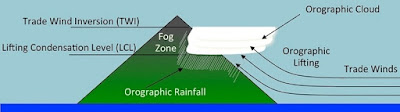
"Because the world is round it turns me on.
Because the wind is high it blows my mind.
Because the sky is blue it makes me cry."

Because by John Lennon and Paul McCartney, 1969

Intrepid explorer and self-taught geologist John Wesley Powell, during his historic expedition down the Green and Colorado Rivers in 1869, astutely recognized the Great Unconformity but at the time was incapable of appreciating its enormous temporal magnitude and scientific significance. Located globally, it's a contact between a Precambrian basement of igneous and metamorphic rock and a cover of Phanerozoic sedimentary strata - both of which can vary in age.

In side-canyon Blacktail at the bottom of the Grand Canyon, it's ~1.2 billion years in duration - almost one-fourth the age of the Earth. You can drag your fingers across the gap of missing strata and time, as Powell assuredly did and every geologist and river runner that followed. At Rattlesnake Mountain anticline in northwestern Wyoming, it's over 2 billion years - nearly twice as long and almost half the age of Earth - and you can drive right up to it!


The Great Unconformity of Shoshone Canyon The roadcut exposes flat-lying, brown, maroon and white Cambrian-age Flathead Sandstone that overlies tilted, crystalline rocks of the Late Archean Wyoming Craton. Notice the concave stream channel above the contact with dislodged blocks of granitic-gneiss incorporated into the sandstone. The vertical striations are from construction of the roadcut.
The Great Unconformity of Shoshone Canyon
Flat-lying, brown, maroon and white Cambrian-age Flathead Sandstone overlies tilted, pink and black crystalline rocks of the Late Archean Wyoming Craton. An early stream channel on land delivers arkosic sands to the Great Unconformity about to form.
The vertical striations are from construction of the roadcut. 


How did this deeply buried geologic feature form? Why is it found worldwide in so many disparate locations and at so many inexplicable elevations? Why is it so much longer in duration at Rattlesnake anticline than in Arizona's Grand Canyon and inclined on the landscape? Let's investigate.
 
ABOUT THIS POST
This is my fourth post on the Great Unconformity. In Part I (here), I discussed its genesis in Grand Canyon. In Part II (here), I offered a more global interpretation of its presence. In Part III (here), I discussed the time-gap at Baker's Bridge in southwest Colorado and its theorized significance to biological evolution. 

In this Part IVmy daughter and science teacher Julia Share, geologist Wayne Ranney (here) and I, while geo-journeying through western Wyoming, visited the celebrated contact. Herein, I discuss the Great Unconformity's relationship to the Archean cratonic evolution of the Wyoming Province and its curious Laramide disposition on the landscape.

Italicized terms are defined, important names and locations are highlighted in boldface where first mentioned, and global coordinates of various sites and locales are provided that can be pasted into an on-line mapping program such as Google Earth, so you can "Go there." 


Promontory Point, Utah
After converging in Salt Lake City and heading into Wyoming, we stopped some 60 km northwest of of the city where the Union and Central Pacific Railroads met and celebrated the event with the Golden Spike Ceremony in May, 1869. We raced to visit the National Historic Park before closing, but were too late. Instead, we got a wonderful private tour of the site by the park ranger. Go there: 41°37'4.78"N, 112°33'3.44"W


WHERE ARE WE?
We're in glorious northwestern Wyoming just west of the small town of Cody and some 50 miles east of Yellowstone National Park's East Entrance. This is "Cody Country" where the town and many of its streets, businesses and landmarks bear the name of Colonel William F. Cody, better known as "Buffalo Bill"We've pulled over to view the Great Unconformity on east-west running US Highway 14-16-20 near the entrance to the most easterly of three tunnels cut into the south face of Rattlesnake Mountain above Shoshone Canyon. 

It's safe to say that most passersby aren't aware of its presence, let alone know of its existence or comprehend its scientific significance. But for geologists, who cherish and revere the iconic geologic feature, it's difficult to miss. For them, with cameras ready, seeing it is a source of anticipation and excitement and requires paying homage, which we assuredly did.


Missing Time in the Excavated South Face of Rattlesnake Mountain
The Great Unconformity is exposed in the roadcut on both sides of  the highway before the first tunnel west of Cody. Buffalo Bill Dam and Reservoir appear ~1.3 km after the third tunnel. Below the tilted contact spans rocks of Wyoming's Archean basement through which the tunnel has been cut. Above the contact lies the dipping base of the Paleozoic sedimentary column that was deposited on Laurentia's passive margin. Go there: 44°30'33.32"N, 109°10'22.11"W


WHAT'S AN UNCONFORMITY?
The norm rather than the exception is that successive strata do not always form in an uninterrupted manner. Interruptions or cessations in deposition result in a geologic contact or inter-stratal boundary between rock layers. It's a "temporal gap" between an older surface that has been subjected to erosion and an overlying, younger one that experienced a hiatus in deposition. Thus, an unconformity is a buried surface of missing strata, unseen until exposed.

They vary in type depending on composition of the juxtaposed layers and occur globally on our ever-evolving planet. They can be thousands or even millions of years in duration, if not more. 
In Grand Canyon, there are so many "time-gaps" (at least 14 disconformities) in the mile-high Paleozoic record that the sum of missing time is greater than that preserved, although there is one 'great' unconformity that exceeds all others.


Three Flavors of Unconformities
A disconformity of irregular topography forms between sedimentary rocks. An angular conformity forms when the underlying rock layer is tilted or contorted. The Tapeats overlying the Supergroup is an example. Nonconformities such as the Great Unconformity occur when the underlying layer is either metamorphic or igneous rock that has been eroded before being covered by sediments.  


WHAT'S THE GREAT UNCONFORMITY? 
It's a profound break in the Earth's rock record. Typically, it resides above a denuded (eroded and exposed) Precambrian basement of igneous and metamorphic rocks and below flat-lying sedimentary rocks deposited at sea level during the Paleozoic (often at the base of the Cambrian system) or Mesozoic. The temporal magnitude of the "buried erosion surface" 
is governed by the age of the juxtaposed strata, which can vary greatly.

Highly recognizable and a composite of many events that occurred, it's found on daughter continents that fragmented from the Late Proterozoic supercontinent of Rodinia and, "rifting and drifting", were tectonically carried afar across the globe. Yet in spite of its ubiquity, it's one of the Earth's most enigmatic features and great challenge for geoscientists to decipher what happened geologically, climatologically and biologically during the immense interval of its formation. 


The Great Unconformity of the Grand Canyon
Easily seen from the canyon's South Rim, the high-points of Late Proterozoic-age Vishnu Schist were islands poking out of a Cambrian sea before being blanketed with the Middle Cambrian Tapeats Sandstone of a rising Cambrian sea above the Great Unconformity. Go there: 36° 6'7.93"N, 112° 7'58.48"W


MISSING TIME WITHIN THE GRANITE GORGE 
Where is it found? One of the Great Unconformity's most celebrated and visited localities is at the bottom of northern Arizona's Grand Canyon within the oldest section of Granite Gorge. In an unsuspecting slot canyon called Blacktail that enters the Colorado River at grade, the contact comes down from its lofty perch along the walls of the gorge and lies only a few feet above Blacktail's ever-changing, flash flood-delivered, cobble-strewn floor.

The contact lies between ~1.75 Ga Vishnu Schist - the collective name for the canyon's Early Proterozoic-age igneous and metamorphosed basement rocks - and the overlying ~500 Ma Cambrian-age Tapeats Sandstone. The missing ~1.25 billion years is almost 25% of the age of our ~4.5 billion year old planet! 


Blacktail Canyon
With walls comprised of slabs of Tapeats Sandstone, the Great Unconformity resides just above the side canyon's river cobbled floor. Go there: 36°14'24.43"N, 112°28'21.10"W


You can touch the contact as John Wesley Powell must have and stand in contemplative awe of its inconceivably immense magnitude and ponder the global events that may have happened during its formation. Like missing pages of a history book, those secrets are slowing being revealed. That's been the challenge of the Great Unconformity since its discovery!


Geologist Wayne Ranney Touches Blacktail's Great Unconformity
A heat and pressure-gnarled Vishnu basement lies beneath earliest transgressing beach sands of the Tapeats. Notice the chunks of metamorphosed granite and schist that were kicked up by turbulent waves of a rising sea a half-billion years ago and incorporated into the sandy matrix. Wayne has explained the Great Unconformity's mystery and geology to countless throngs of geologists and river runners.


Blacktail is flocked to as if a hallowed shrine. Standing in its quiet shadows and soft echoes over a decade ago, geologist Wayne Ranney read a moving poem entitled "The Great Unconformity", which he does on every river trip in Grand Canyon. This is the poem's elegant introduction. You can listen to Wayne read it here

"It is time
Touch it
Trail your fingers over a billion years
Etched in the red rock
There is no monument, no temple more sacred
Than this monumental temple to the whole wide world
Seared this great chasm of whispering, eroded eons
With majesty beyond comprehension" 

by Charlotte Graham-Clark

IN EASTERN GRAND CANYON
Another spectacular place to view the Great Unconformity is from Lipan Point and nearby Desert View on the South Rim of eastern Grand Canyon. It's also where the spectacular Grand Canyon Supergroup is on display. The massive, gently tilted, two-suite complex includes the Mesoproterozoic Unkar and Neoproterozoic Chuar Groups of largely sedimentary and lesser igneous rocks. 

They were deposited within intracratonic basins (versus deep oceanic basins) during the final completion and fragmentation, respectively, of supercontinent Rodinia - the latter thought to have occurred just prior to the onset of "Snowball Earth" global glaciation. The geologic history-revealing Supergroup formed during the interval of the Great Unconformity below the Tapeats and above the Vishnu basement.


The Great Unconformity of the Grand Canyon
The Unkar Group records the arrival of island arcs and continent-continent collisions that completed the formation of Rodinia during the Grenville orogeny. The Chuar Group was deposited in an intracratonic marine basin(s), when extension rifted apart the supercontinent prior to global glaciations of the Cryogenian period at the end of the Proterozoic. The group contains molecular and micro-fossiliferous clues to early eurkaryotic life and biological diversification before the advent of complex multi-cellular organisms. From Karlstrom and Timmons, 2012


FORTUITOUS EXPOSURE
Had it not been for extension in the Proterozoic, faulted crustal blocks of the Supergroup in the Grand Canyon would never have downdropped and tilted that protected them from erosion. Without its fortuitous tectonic preservation and subsequent exposure by action of the Colorado River, we would know far less about global events that happened at the time. 

Viewed from atop Desert View Tower, tilted and faulted Unkar strata contact the flat-lying Tapeats at an angular unconformity (arrows). The size of the 'lesser' Great Unconformity that formed varies in duration contingent on the age of the particular stratum that lies below the contact and grows progressively longer down-sequence beginning with dark, interbedded Cardenas Basalt followed by the purplish, sedimentary Nankoweap Formation and so on.


The Great Unconformity in Eastern Grand Canyon
Go there: 36° 6'20.34"N, 111°52'4.61"W


OFF THE COLORADO PLATEAU IN SOUTHERN NEVADA
West of Grand Canyon and Lake Mead and immediately east of Las Vegas, the Great Unconformity is exposed on the west-facing slope of Frenchman Mountain. A nondescript pullout on Lake Mead Boulevard (SR147) and a short hike will bring you to the contact where interpretative signage marks the spot.

Tilted about 50° synonymous with the strata of the entire edifice, the temporal gap (red arrow) of the Great Unconformity lies between Cambrian Tapeats Sandstone and underlying Proterozoic-age Vishnu crystalline basement rocks. The entire assemblage mimics that of the Grand Canyon and angled in its disposition on the landscape! How did this happen?


West-East Cross-Sectional View of B&R Tilted Frenchman Mountain
Modified from geoscience/unlv.edu/pub/rowland/virtual/geology.html


In every locale of the Great Unconformity, its geologic story involves a discussion of its duration, how its juxtaposed layers formed, how it was tectonically delivered to the locale, how it achieved its elevation and orientation on the landscape, and how the deeply buried contact became exposed.

The hint to the provenance of the tilted, NS-striking, small range of Frenchman and Sunrise Mountains is in its position between Lake Mead Basin on the east and Las Vegas Valley on the west. Collectively, they are a small part of the distinctive landscape of the Basin and Range Province that spans much of inland Western U.S. and northwestern Mexico. Its signature landform are alternating, flat sediment-filled valleys and NS elongate, fault-bound mountain ranges, one after the other, all essentially on strike.


Frenchman and Sunrise Mountains from the East
Traveling west on Lake Mead Boulevard (SR147) across Lake Mead basin, the dark dacitic knob of Lava Butte is in the foreground (and others unseen) form a lava field that emplaced some 13 myr in the mid-Miocene, far younger than the Paleozoic rocks of Frenchman and Sunrise to the north (right) in the distance. Extension transported the Frenchman-Sunrise range and produced associated magmatism across the landscape. Las Vegas Valley lies beyond the range. Go there: 36° 9'13.21"N, 114°53'21.00"W


The demise of the Farallon plate and arrival of the spreading center between the Pacific and North American plates in association with collapse of the Sevier Highlands is responsible for pervasive extension of the crust in the province. In this manner, Frenchman and Sunrise originated some 50 to 65 km from the east, possibly associated with the Gold Butte block located between Lake Mead and the Colorado Plateau. 

Following Sevier phase uplift related to descent of the Farallon (explained below), the Frenchman-Sunrise allochthonous block (transported crust) of Paleozoic and Proterozoic strata (same as the Grand Canyon) with the Great Unconformity sandwiched in between, was transported in the Miocene along detachment (low-angle extensional) and strike-slip (side-to-side) faults to its present location.


Wayne Ranney Identifies the Great Unconformity on Frenchman
Above the extensionally tilted contact lies the basalmost bed of Cambrian-age Tapeats Sandstone and below, pinkish metamorphosed rocks of Proterozoic-age gneiss and schist. Go there: 36°11'57.31"N, 114°59'48.36"W


MISSING TIME IN COLORADO
Here's another example. East of the Colorado Plateau and at an elevation of ~7,500 feet, it's exposed within the towering Painted Wall of Southwest Colorado's Black Canyon of the Gunnison. Only there, without any interposed Paleozoic strata, ~1.5 billion years of time are missing between Paleo- to Mesoproterozoic rocks of Black Canyon gneiss and overlying Entrada Sandstone. What's the genetic explanation there?

The Pennsylvanian-Permian Ancestral Rocky Mountain Range - long-gone predecessor of the modern Rockies - was eroded and buried by the Triassic. At Gunnison, on a planed-off remnant of the highlands, the Great Unconformity formed when a 'sand sea' blanketed it in the Jurassic. The gneiss-blanketing erg formed on the southern terrestrial margin of the Sundance Sea, which was a short-lived, epeiric (shallow continental versus deep marine) embayment of the early Pacific Ocean in western North America.
 

Facing North Toward the Painted Wall in Colorado's Black Canyon of the Gunnison
Go there: 38°34'32.71"N, 107°45'6.94"W


AROUND THE ADIRONDACKS OF NEW YORK STATE
It's located across North America on the periphery of the Adirondack Mountains in northern New York State's Saint Lawrence and western Champlain Lowlands and in the northern Mohawk River Valley. The contact lurks almost at sea level between the Middle Cambrian Potsdam Sandstone and underlying Mesoproterozoic Grenvillian gneiss that emplaced and metamorphosed as Pangaea completed unification during the protracted Grenville orogeny.


Ausable Chasm in Northeastern New York State 
The 1.5 mile-long sandstone gorge of Potsdam Sandstone is a Tapeats-equivalent. The Ausable River runs through it and empties into Lake Champlain in northeastern New York State near the small town of Keeseville. Unseen at this locale, the Great Unconformity lies buried a few hundred feet beneath the basal Sauk sequence. From Wikimedia Commons and Alan Prusila


The Potsdam Sandstone was deposited during the global Salk transgression on proto-North America's eastern margin, as was beach sand of its Tapeats geo-equivalent on the western margin. Only partially understood, ongoing Cretaceous uplift of the Adirondack dome - creating "new mountains from old" - unroofed the Potsdam, while uplifting the Great Unconformity and underlying gneiss. 

In addition, inliers (isolated, older blocks of rock) containing the Great Unconformity lie buried beneath the Appalachian Mountain Range along the continental margin of eastern North America. Following the fragmentation of the late Paleozoic supercontinent of Pangaea in the Mesozoic that opened the Atlantic Ocean and severed the range into the Scandinavian Caledonides, the Great Unconformity was delivered to Norway, Sweden, Estonia and Finland via microcontinent Baltica.
 

Great Unconformity of the Saint Lawrence Lowlands
Here it is again near the shore of southwestern Lake Champlain.
Go there:  43°25'44.05"N,  73°28'10.22"W and  44°28'2.29"N,  75°45'47.64"W


IN THE TETONS
Back in Wyoming, the contact is at nearly 12,610 feet on the summit of Mt. Moran in the Tetons. Vertical en bloc uplift of the Teton range along 40 mile-long Teton fault, elevated the GU beneath a tiny, remnant cap of Cambrian Flathead Sandstone overlying the range's ~2.7 billion year old gneiss of Archean-age - a time-gap of over 2 billion years! 

That places it 6,000 feet above Jackson Hole's valley floor and ~20,000 feet above the sediment-buried unconformity beneath the crustal block's downdropped basin. The magnitude of the time-gap in Wyoming, in contrast to that of the Grand Canyon, is related to the extreme age of its Archean-age basement.


Mt. Moran and Jackson Lake in Grand Teton National Park
Go there: 43°50'1.08"N, 110°46'36.77"W


ON DISPERSED RODINIAN DAUGHTER CONTINENTS
Tectonically severed remnants of the Great Unconformity were transported across the globe following the diachronous, protracted fragmentation of supercontinent Rodinia beginning in the latest Proterozoic. As a result, exposed by erosion and uplift, it's found on "rifted and drifted" continents in places across the globe. 

Examples are South Africa's Table Mountain (on the Kaapvaal craton), at Huaibei (on the North China craton) and Wadi Rum near Jordan's Petra (on the Arabian-Nubian Shield). At each location, the Great Unconformity has a similar and highly recognizable appearance.


The Great Unconformity at Petra
Courtesy of Geologist Wayne Ranney


AT SHOSHONE CANYON IN WYOMING
At Grand Canyon's Blacktail, it saw the light of day facilitated by en masse uplift of the Colorado Plateau and exposure by the Colorado River and its system of tributaries. In contrast at Wyoming's Rattlesnake Mountain where we're pulled over, it too was uplifted and then subsequently wrinkled on the landscape during subduction of the Farallon oceanic plate. It took construction of a new highway facilitated by canyon-forming fluvial incision to expose the buried contact.


The Great Unconformity of Shoshone Canyon
Our view is to the north across the highway in a roadcut excavated into the south face of Rattlesnake Mountain. Cody lies a few minutes to the east and the tunnel entrance is just to the left. The vertical drill lines were created during construction of the highway.


ARCHEAN NORTH AMERICA IN THE BEGINNING
In order to more fully appreciate the evolution and duration of the GU at the Rattlesnake Mountain anticline, let's briefly summarize the geotectonic evolution of North America. To the best of our understanding (or what we think we understand), no large continents existed in the early Archean Eon (4,000 to 2,500 Ma), almost 4 billion years ago.

But, by mid-eon around 3 Ga (although some say much later), the Earth's crust had cooled enough to initiate surface plate rigidity and mobility, mantle recycling and subduction-related processes. As a result, a global mosaic of cratons (stable crustal blocks) and terranes (independent blocks with distinctive histories and composition) began to tectonically collide and accrete (weld together), building a continent of increasingly larger coalesced landmasses. 


Archean and Proterozoic Foundation of Laurentia
The core of the North American continent (Canadian shield) formed in the Proterozoic by plate collisions of Archean continents and smaller Archean continental fragments such as the Wyoming Province. The ultimate orogenetic collision provided Laurentia with the Grenville Province that brought together the known land masses of the world to assemble the supercontinent of Rodinia. Whitmeyer and Karlstrom, 2007.


In Canada, Archean age blocks constitute geologic provinces (sizable areas with common structure, composition and genetic origin) with names like SlaveSuperior, Trans-Hudson, RaeHearne and Wyoming in the US. The cratonic jigsaw puzzle - referred to as the Laurentian craton or just Laurentia - has remained unified within a succession of supercontinents and continents that followed that have cyclically assembled, dissociated and reassembled.

THE ARCHEAN WYOMING PROVINCE
Long considered one of the oldest terranes in North America, the Wyoming Province coalesced from even older amalgamated Archean crustal blocks that accreted to Laurentia's southwestern margin and parts of adjacent states around 1.9 billion years ago. They're distinguished geochemically, petrologically and structurally from older Archean provinces.

Collectively, they form the Canadian Shield, the Laurentian core of North America, which is a large exposed area of stable Precambrian crystalline basement (foundation of igneous and high-grade metamorphic rocks). Wyoming's Late Archean rocks also form a portion of the complex basement of the Cordilleran system of mountain ranges in western North America. It's dominated by 2.8-3.0 Ga gneissic rocks intruded by 2.5-2.7 Ga granitic plutons and overlain by supracrustal rocks of similar age. 


THREE WYOMING SUB-PROVINCES
The Wyoming Province can be subdivided into three major subprovinces of Archean crust. From oldest to youngest and basically NW to SE, they are: the Montana Metasedimentary Province (MMT), the Beartooth-Bighorn Magmatic Zone (BBMZ) and a collage of Southern Accreted Terranes (SAT). South of the Wyoming Province (below the map 'teethed' tectonic collision zone below) are accreted Paleoproterozoic orogenic belts of the Cheyenne Belt (CB), Great Falls Tectonic Zone (GFTZ), Farmington Zone (FZ) and the Trans-Hudson Orogen (THO) of reworked Archean crust.


The BBMZ in Northwest Wyoming and southern Montana contains largely metamorphosed plutonic (igneous solidified at depth) rocks that cratonized (formed) ~2.8 Ga and welded to Laurentia ~2.7 to 2.5 (1.8 and 1.7) Ga. It forms the deeply buried crystalline basement of Bighorn Basin, the exposed walls of Shoshone Canyon and constitutes the lower component of the Great Unconformity in Northwest Wyoming.


Ancient Crystalline Rocks of the Beartooth–Bighorn Magmatic Zone
Much is unknown and conjectured about Wyoming's Archean rocks. In the walls of Shoshone Canyon are ~2.8-3 Ga metamorphosed plutonic rocks that are largely granitoids such as tonalites and granodiorites that are closely related to 'true' granites. Even older Archean gneisses (>3 GA) are present that are interpreted as inherited cores. 


TECTONIC GROWTH OF OF THE SOUTHWEST
Things didn't end in the Archean. In the early and middle Proterozoic (2,500 to 541 Ma), convergent orogenic tectonism continued with tectonic acquisition of the Mojave, Yavapai and Mazatzal provinces. Building mountains and adding crust, they constitute a succession volcanic and plutonic rocks that formed when intra-oceanic volcanic arcs and adjacent ocean basins collided and sutured to Wyoming's southwest and southern margins. 

The southwest of proto-North America was under progressive Proterozoic construction that ended in the Middle Proterozoic with the protracted, multi-stage Grenville orogeny. The Grenville province likely formed when the Amazon craton of South America collided with the southern margin of Laurentia. Characterized by large-scale magmatism and extensive deformation, it represented the final assembly of all known global landmasses into supercontinent Rodinia


Map of Precambrian Provinces in Western North America
The Late Archean cratonic Wyoming Province (encircled) lies juxtaposed to Proterozoic rocks of the Mojave and Yavapai rocks on the south with Mazatzal and Grenville completely the Southwest's assemblage to the southeast. Purple areas represent exposures of Precambrian rocks among a thick cover of Phanerozoic sedimentary rocks. Note the location of Cody just east of the Great Unconformity exposure. Modified from Foster, 20015.


THE BIG PICTURE
The Laurentian core now possessed a basement crust with both Archean (in the north) and Proterozoic (in the south) affinities. It's the foundation of the Great Unconformity, yet to form. All that was needed - an incredibly long temporal requirement - was uplift and erosive denudation of the basement followed by the deposition of sedimentary overburden in the Phanerozoic, typically Cambrian. 

The 'waiting period' between the two components represents the Great Unconformity's profoundly long temporal gap! Thus, in Arizona's Grand Canyon it resides on Yavapai-derived, Late Proterozoic Vishnu crust, while in Wyoming, the contact lies on Archean crust of the Beartooth-Bighorn Magmatic Zone.


Wayne Photographs the Great Unconformity on the South Side of the Highway


TRANSGRESSING SEAS AND OCEAN-DERIVED SANDS
The Great Unconformity formed when rapid rising seas in early to mid-Cambrian time gradually flooded the western margin and accessible interiors of Laurentia, the term for the ancient and stable, continental core of North America. The transgressive process was facilitated by post-rift, thermal subsidence of nascent continental margins and climate change that brought about near-global eustasy (rising levels of the sea). 

In the Cambrian, the Sauk global marine transgression delivered sedimentary sequences over the Laurentian crystalline basement of foundation rocks that are of Archean age to the north and Proterozoic age on the south. It blanketed the coastal margins of long-gone supercontinent Rodinia's rifted daughter continents with a layered mix of sandstone, shale and limestone. 


Transgressing Early Cambrian Sea along Western Laurentia
Beginning in the Cambrian and continuing through most of the Paleozoic, rising seas flooded newly rifted margins of Laurentia and blanketed denuded crystalline basement rocks. Red dots indicate locations of the Great Unconformity discussed in this post. Furthest west, the Frenchman GU formed before the others as the sea flooded the continent. The idealized river at the Grand Canyon GU is not the modern Colorado. Farallon contractional subduction uplifted every GU, whereas Basin and Range extension at Frenchman lowered it somewhat. Modified from Colorado Geosystems of Ron Blakey.


First to form was the Tapeats (and its equivalents such as the Flathead). It's the basalmost sequence of Grand Canyon's mile-high column of flat-lying, Paleozoic rocks that culminated in the formation of the Great Unconformity. 

At that time, western Wyoming and the region of the future Rattlesnake anticline were along the Cambrian coastline. It remained as such though the majority of the Paleozoic, until a number of incoming exotic terranes, island arcs and oceanic plates added to the crustal mass of western North America and 'drove' Wyoming further inland beginning in the Mesozoic.

SOME IMPORTANT FARALLON STUFF
The GU varies in elevation and topographic setting as a result of tectonic changes western North America experienced in the Mesozoic and Cenozoic. It's largely attributable to SW-NE oblique subduction of the oceanic Farallon plate beneath the western edge of the west-migrating continental North American plate

It's also related to the 'interaction' of the Farallon with Laurentia's Precambrian basement, prone-to-fail "zones of weakness" inherited from past tectonic events AND overlying Phanerozoic sedimentary cover.

Farallon descent began in the latest Jurassic and terminated in the Oligocene. It was the longest-lived plate (over 150 myr) and the largest (most of the proto-Pacific basin). It was also the most important for the landscape changes produced AND the daughter plates it spawned. Examples are the subducting Juan de Fuca in the Pacific Northwest, Cocos west of Mexico and Nazca along western South America. 


Early Fragmentation of Pangaea in the Late Jurassic
The nascent continents of the Atlantic realm have formed across a newly formed, widening ocean. Driven by its expansion, the Farallon plate has begun to subduct beneath the western margin of Laurussia, the late Paleozoic core of North America. Its descent will progress in two phases that reflect a progressively shallower angle of descent during the Sevier and Laramide orogenies. Modified from Ron Blakey's Colorado Geosystems Inc.


TWO OVERLAPPING PHASES OF THE TWO-PLATE COLLISION
Collision of the Farallon plate and a number of 'suspected'(not fully resolved), 'exotic' terranes (landmasses made-elsewhere) with the North American plate produced a long line of continental volcanic arcs and crustal (lithosphericcompression in western North America. Its descent initiated at a normally high-angle that shallowed over time and produced a change in the "style of deformation" during a bi-phasic orogeny (mountain-building event) that overlapped in time and space.

The Sevier ororgenic phase...
From latest Jurassic to Middle Eocene, Sevier orogenics did not involve the continent's Precambrian basement. It's referred to as "thin-skinned" deformation of the sedimentary cover that accumulated along western proto-North America's passive margin during the Sauk marine transgression (one of six during the Phanerozoic) that followed in many areas of North America. Part of the cover has decoupled from the basement. The Rocky Mountains provide the best example of this type of tectonics.

Compressive deformation resulted in progressive west-to-east stacking cratonward (continent-ward) in the foreland region (in front of the mountain-belt) of the Farallon subduction zone. Called the Sevier fold-and-thrust belt, the topographically rugged region is largely in Utah and Nevada along the majority of the (then) continental margin from Canada into Mexico. The belt has been largely fragmented by crustal extension in the Cenozoic following and due to demise of the Farallon slab. 


Idealized Schematic of Two-Phase Farallon Plate Kinematics
a) Normal, high-angle, thin-skinned Farallon descent during the Sevier phase of orogenics
b) Low-angle, thick-skinned descent of the overlapping Laramide phase with involvement of both Precambrian basement and overlying Phanerozoic sedimentary rocks


The Laramide orogenic phase...
Often confused with Sevier deformation (I know I was), it occurred from Late Cretaceous through mid-Eocene time (~80 to 45 myr) and continued crustal-shortening but even further east of the plate margin. Driven west at a higher rate of convergence during Pangaea fragmentation, the Farallon assumed a shallower"flat-slab" angle of descent with greater compressive stress. 

The "thick-skinned" event includes deformation of the basement AND overlying marine Phanerozoic sequences further into the interior. The cover has remained welded to the basement and includes a compressional reactivation of inherited basement faults. 

A source of some confusion, the two styles of deformation - thin and thick-skinned - are not mutually exclusive, that is, they may occur coevally. Laramide tectonics uplifted and overprinted portions of the Sevier belt and foreland in central and eastern Utah, western Colorado and most of Wyoming. It produced a pattern of discontinuous, NW to SE "basement-cored" arching uplifts and intermontane basins across the landscape. 


Generalized Tectonic Map of western US in the Paleocene (~60 Ma)
The Laramide belt developed far into the continental interior during the second phase of flat-slab subduction in the Late Cretaceous to Paleogene flat-slab subduction that was oriented SW-NE, oblique to the plate margin. The belt is characterized by an anastomosing network of overall NW-SE to N-S, to locally W-E oriented, fault-bounded, Precambrian basement-cored arches, separated by broad basins Modified from Weil, 2016


A few observations regarding the map...
•  Basement-cored arches (map above) share a similar orientation that is consistent with oblique Farallon compression delivered from the southwest. 
•  Laramide kinematics did not appreciably deform the Colorado Plateau but contributed to ~2 km of en masse uplift of the intact crustal block's Precambrian basement and overlying strata. •  It elevated the Grand Canyon's Great Unconformity, while promoting an unroofing (removal of successive layers of strata) across the Colorado Plateau while enabling carving of the canyon that exposed the temporal gap.

BASEMENT-CORED UPLIFTS AND ADJACENT INTERMONTANE BASINS
Bighorn Basin and surrounding uplifts in Northwest Wyoming are archetype examples of Laramide landforms and thick-skinned foreland deformation that developed far inland from the plate margin in the Laramide belt that spans the region from southern Montana to New Mexico. 

They are characterized by fault-bound, basement-cored arches with steep marginal thrust faults that are bordered by flanking fold systems and separated by broad basins with an overall NW-SE structural grain. Laramide deformation produced most of the across the reactivated craton of western North America and corresponds roughly with the eastern front of Sevier deformation. 


Simplified Cross-Sectional Tectonic Map of the Cordilleran System in the Paleogene (~60-50 Ma)
The Laramide foreland belt developed flat-slab subduction and partly overlapped later phases of Sevier thin-skin thrusting of the fold-thrust belt. Modified from Yonkee, 2017.


A ROAD TRIP THROUGH "CODY COUNTRY"
Let's take a short drive west from the town of Cody to Buffalo Bill Reservoir and Dam in order to experience the tectonic history and unique locale of the Great Unconformity. To get there, we'll pass through a massive, V-shaped gap between Rattlesnake Mountain on the north and Cedar Mountain on the south. Along the way, we'll visit the exposure of the unconformity.

At 1,500 m above sea level, Cody (pop. ~10,000) lies along the Shoshone River on the western edge of Bighorn Basin. A little larger than Vermont at ~10,400 sq mi in northwestern Wyoming and some of south-central Montana, it's an asymmetric oval in shape that feels like a broad, oval-shaped valley. It's one of many large synclinal downwarped depressions formed by Laramide compressional deformation across Wyoming and neighboring states. As such, it's sediment-filled with a Precambrian basement and structurally (fault) bounded by various basement-cored uplifts.


West View of Western Bighorn Basin at Cody and Rattlesnake-Cedar Mountains
Verdant Cody sprawls in the foreground, abreast of the Shoshone River and Highway 14-16-20 that pass through town. The NW-SE ridge is formed by Rattlesnake Mountain and the north and Cedar on the south. The two summits form a massive anticline along the western boundary of Bighorn Basin. In the distance rises snow-capped summits of the Absaroka Volcanic Range with Yellowstone (unseen) lying beyond. Go there: 44°31′24″N 109°3′26″W


THE INTERMONTANE BIGHORN BASIN
The basin's alluvial sediments, as much as 25,000 feet in depth, are derived from the basement arches or uplifts that border the basin. Snow-capped, rugged summits and above 13,000 feet, the Pryor and Bighorn Mountain Ranges lie on the north and east, and the Bridger, Owl,Absaroka and Beartooth Mountains are on the south and west. Bighorn Basin drains to the north by tributaries of north-flowing Bighorn River such as the Shoshone that enters the basin between Rattlesnake and Cedar Mountains to the west of Cody.

Wyoming's basin and uplifts are not to be confused with the extensional landscape of the Basin and Range Province in Nevada and Mexico, which is associated with the Farallon's demise beneath North America. Basins such as the Bighorn are products of Laramide flat-slab subduction and thick-skinned deformation during Cretaceous-Paleogene compression. They possess an Archean basement in Wyoming, which in the basins occurs at depth, being down-warped, and in the ranges more surficially, being up-warped.


Bighorn Basin
Modified NASA Satellite View


STINKING WATER RIVER
Around 1807, so the story goes, Lewis and Clark expedition veteran and later solitary explorer and mountain man John Colter visited the as yet unnamed Cody region and crossed Stinking Water river at the location of a major 'Indian trail' ford. The river was named as such for good reason by the regional Crow Native Americans, who call themselves the Absaroka tribe. It's thought that the Crow, Shoshone, Bannocks and Nez Percé journeyed east over the Absaroka and Beartooth mountains to hunt the plains buffalo and test heralded medicinal values of "stinking waters” baths around Cody.


Cody from the Southeast
Rattlesnake and Cedar Mountains form an imposing ridge across the skyline to the west of Cody (pop. ~500). Geologically enigmatic and highly debated Heart Mountain lies to its north (far right) and the gap to the south (far left). From USGS and Fisher, 1906.


Understandably, the town's residents renamed the river around the turn of the century for obvious reasons, since things were starting to happen in Cody Country. By now, it had a new reservoir and dam built for purposes of agriculture and had a spur from Montana extended by the Chicago, Burlington and Quincy Railroad. 

With federal money pouring in, the town was beginning to prosper and grow, and Buffalo Bill seized the opportunity to take advantage of it. He built the Irma Hotel in 1902. The "Grand Old Lady of Cody", named after his youngest daughter, still stands on the town's main street. Everyone from Colonel Cody, whose personality and fame kept the place packed, to princes and potentates, Indian chiefs and cowboys “came as they were” to the Irma.


Northwest Wyoming in 1897 Rand McNally Map
The town of Cody, the Rattlesnake-Cedar Mountain complex, the roadcut with the Great Unconformity and the region of the future Buffalo Bill Reservoir at the confluence of North and South Forks lie within the circle. Also note Stinking Water River (labelled as such) drained the western Bighorn Basin. Modified from image at mapgeeks.org


COLTER'S HELL
Colter described the area west and southwest of Cody as having a "boiling tar spring" (submerged beneath Buffalo Bill Reservoir), fumaroles (vents of steam and sulfur), numerous sink holes and now-parched travertine cones that he reported to be geysered. The odoriferous river undoubtedly reminded him of nearby Yellowstone, which he had visited, and was later applied to the PArk's geyser area. It begs the question whether their hydrothermal geologies are related.


DeMaris Vents of Colter's Hell
 Along the Shoshone in Cody West of town and delineated by Wyoming Historical Marker, the vents are on the banks of the Shoshone on the north side of 14-16-20. The red strata of the Triassic Chugwater Formation conforms to the dip of the submerged eastern limb of Rattlesnake Mountain anticline. White travertine deposits lie along the banks and eroded ledges above the river. Tilted oil-producing, Permian Phosphoria Formation strata are visible in the banks. Sinkholes and travertine cones dot the landscape. Go there: 44°30'42.48"N, 109° 6'58.30"W


The region's hellaceous name was likely penned by local mountain men and fur trappers. Yet surprisingly, geothermal activity at Colter's Hell is unrelated to Yellowstone. Snowmelt and rainfall hydro-charge Absaroka aquifers to the east of Yellowstone. Flowing down gradient through faults and fractures in the crust, the waters reach sufficient depth, possibly near shallow magma bodies, to heat in excess of 43°C (110°F). 

Rising along faults largely on the east flank of mostly Cedar Mountain, hydrothermal water discharges from vents and hot springs in the oil-rich, Permian Phosphoria Formation. Along the Shoshone River west of Cody, active and paleo-hot springs deposit travertine (precipitated calcium carbonate derived from underlying Mississippian Madison or possibly Ordovician Bighorn limestones) and sulfur (also associated with host limestone strata). The process is reminiscent of nearby Mammoth Hot Springs in Yellowstone near the Montana line.  


Hydrothermal Vents and Mineral Deposits along the Shoshone River
For four days in March, 2020 near Cody, vents spewed noxious sulfur gas with redeposition of travertine and sulfur along its banks that formed between the Gypsum Spring and Sundance Formations. Geologically famous Heart Mountain lies on the horizon. Photograph of Dewey Vanderfoff from BillingsGazette.com. Go there: 44°31'3.18"N, 109° 5'49.15"W


RATTLESNAKE AND CEDAR MOUNTAINS
Back on the highway, we're heading to the gap between Rattlesnake and Cedar. We're on the subtly upturned, synclinal shoulder of downwarped Bighorn Basin that succumbed under Laramide compression. A number of river terraces form benches around us that overlie down-dipping strata on Rattlesnake's hindlimb with an angular unconformity.

To the north, remnants of Cretaceous strata from the Western Interior Seaway form a series of erosion-resistant, sandstone hogback ridges that poke through eroded, softer shales and a blanket of Quaternary colluvium shed from the ridge to the west and alluvium from the meandering Shoshone.


Northwest View of Rattlesnake Anticline
Some 25 km-long and NW-striking, Rattlesnake and Cedar Mountains form an imposing ridge between Cody on the east and the Absaroka Range and Buffalo Bill Reservoir immediately on the west. Shoshone Canyon and River occupies the gap between the two edifices. Note the location of the Great Unconformity, the Paleozoic strata that blankets the anticline and Cretaceous strata on the lowest limbs. 


Hematite-red patches of Chugwater sandstones capped by whitish gypsum off to the north were delivered during the Triassic by the regressing coastal sea and fluvial and lacustrine (lakeenvironments. It's the same formation we spotted in town in the bend in the Shoshone only tilted. As we head further upshoulder, we're travelling back in time through deposits of the eastern epeiric sea that will transition to marine deposition that came from the west.

LARAMIDE ANTICLINES
Imposing Rattlesnake-Cedar Mountain ridge is a landform called an anticline - an upward fold in the strata that slopes bi-laterally downward from the crest. Rattlesnake anticline and the Bighorn synclinal basin formed near the end of the Cretaceous when the landscape succumbed to Laramide compression and wrinkled like a rug squeezed together from the sides. 

As a result, Paleozoic and Cretaceous strata that unconformably rests on an Archean basement bowed up, as the reverse occurred in the down-bowing basin that gradually filled with sediment. It left the Great Unconformity deeply buried in the basin but more shallow (and accessible to viewing) within the anticline. In time, uplift of the anticline unroofed the Mesozoic strata and left patchy remnants and erosion-resistant hogbacks on the lowest limbs.
 

Diagram of an Idealized Anticline
The reverse of a syncline, oldest beds are at the uplifted center and younger are toward the exterior of the convex upfolded arch of strata. An axial plane transects the crest where curvature is greatest at the hinge zone, although, depending on compressive forces, the anticline may be asymmetrical. With relief, youngest strata erosively unroofs from the crest and flanks called limbs. Ridge-shaped anticlines typically develop above thrust faults during crustal deformation. Overturned anticlines are asymmetric with a limb that has been tilted beyond perpendicular and beds in the limb that have flipped over. The ends may be single or double-plunging. From Wikiwand.com 


PALEOZOIC STRATA ON DISPLAY
From a distance in the walls of the gap, we can see once-horizontal, now gently tilted Paleozoic strata from the Cambrian through Permian. And, as we begin to climb the asymmetric anticline's eastern hindlimb, we encounter the Phosphoria Formation, so-named for its marine-derived phosphates. Each formation tells a geologic story of the involving western continent and conditions as it was flooded by rising and falling seas from the west.

For example, the Phosphoria's limestones, shales and sandstones formed in the Permian when epicontinental seas (on shelves and shallow interiors versus deep marine basins) regressed from the sub-ranges of the long-gone Ancestral Rocky Mountains. Trapped hydrocarbons in the stratum have become an important source of oil and gas in Bighorn Basin, while phosphorus for fertilizer became concentrated from evaporating sea water.   


Heading into the Gap from Cody on Highway 14-16-20
Initially deposited horizontally (according to one of Steno's laws of stratigraphy), down-folded Paleozoic strata of the backlimb (plunging flank of the anticline) tilts to the east within the notch. Cody's Yellowstone Regional Airport is built on graded Quaternary alluvium derived from the upfolded Laramide antiform and others in the region.


Further west, we encounter progressively older, anticline-tilted marine strata of Pennsylvanian Tensleep dolomites, Mississippi-Pennsylvanian Amsden shales and sandstones and Madison limestones (Redwall equivalent in Grand Canyon). A time of uplift and erosion, no rocks of Silurian age are known in Bighorn Basin or Wyoming. Further back in time, transgressive deposition resumed with Devonian dolomites of the Three Forks and Jefferson Formation and Ordovician Bighorn Dolomite

A TRANSGRESSIVE SEQUENCE 
Entering the gap, we've crossed over the Shoshone River and arrived within the Cambrian core of Rattlesnake anticline. We're on Laurentia's continental shelf that stretched the length of western North America's coastline from north to south. It's a classic, time-progressive, quiet-water, marginal marine succession that's equivalent to the Grand Canyon's Tonto Group

The sequence consists of lowermost deep-water sands, intermediary muds and uppermost, shallow-water carbonates deposited landward as Cambrian sea level gradually rose. Preserved and lithified, they form the sandstones, shales and limestones that lie above the Great Unconformity both in the Grand Canyon and here in the gap.
 

Cross-Section of an Idealized Marine Trangressive Sequence onto a Continental Shelf
Modified from marlimiller.com


THE CAMBRIAN SEQUENCE
The thickness of the transgressive succession at any given point is dependent both on one's east-west position, since marine waters flooded from the west, and due to topography of the underlying Precambrian basement below the Great Unconformity. 

From top to bottom, the Tonto-like sequence consists of Late Cambrian offshore glauconitic (greenish sandy, micaceous) limestones and shales of the Gallatin Formation that overly the Middle to Late Cambrian Gros Ventre Formation with the Middle Cambrian Flathead Sandstone that forms the base of the tripartite succession.
 

North View of the Hindlimb of Rattlesnake Anticline within the Gap
The gently sloping, east hindlimb of Rattlesnake anticline is clearly visible. Higher up on the flanks of Rattlesnake Mountain are middle and late Paleozoic marine strata. At the bottom of the Paleozoic succession and tilted in concert with the hlindlimb, the Great Uncomfornity is exposed in the roadcut between thickly-bedded strata of Flathead Sandstone and above Northwest Wyoming's Archean basement. 


GEO-ACCOLADES OF THE FLATHEAD
Up to 300 feet thick, its a reddish-brown to pale-orange and yellowish-gray, coarse to fine, cross- and parallel-bedded arkosic sandstone (mica, quartz and feldspar-rich). It's the oldest and basalmost sedimentary strata in Wyoming and the first-to-form Paleozoic strata and Sauk sequence of western North America. It's also the equivalent of the Tapeats Formation in the Grand Canyon and unconformably resides over the region's Archean igneous and metamorphic rocks with the temporal gap of the Great Unconformity interposed.

Crystalline highs were gradually flooded islands, awash in the Cambrian sea. Early in its formation, ephemeral and ever-changing, braided streams and fluvial systems (below) left an indelible, lens-shaped mark as the sea increasingly flooded the landscape.


The Slabby, Ledgey Flathead Sandstone
A planar-laminated lens-shaped stream channel appears in cross-section within the exposure lying below a cross-bedded, rapid facies change and is more sub-angular conglomeritic and feldspathic than later in the formation. Being poorly-sorted, an occasional Archean gneissic fragment is incorporated within the sandstone matrix. The vertical cuts were created during construction of the roadcut and highway.


THE SAUK SEQUENCE OF THE WYOMING SHORELINE
The early fluvial systems (photo above) that delivered minerals seaward from topographic highs were remixed and redeposited by the rising sea. Age and paleocurrent indicators assign provenance of the Flathead's sands from Wyoming's Archean Beartooth-Bighorn Magmatic basement to the north (dotted blue arrow), while Tapeats minerals are from southerly Proterozoic Yavapai-Mazatzal granites (solid arrow).

In both cases, the sources are west of the Transcontinental Arch that stretches from the southwestern U.S. to south-central Ontario. Long gone, the prominent uplift was an extension of the Archean-age Canadian Shield of Laurentia's lower Paleozoic craton. The topographic barrier influenced early sediment transport patterns in the mid-continent of Laurentia from the Late Proterozoic and early Paleozoic by preventing southern and eastern Grenville minerals from reaching Wyoming and northern Arizona.

 
Paleographic Middle Cambrian Reconstruction of Wyoming and Environs
Around 520 Ma, the Sauk seas transgressed over western Laurentia from west to east and deposited the Flathead Sandstone, known as the Tapeats in northern Arizona. Brown shaded rocks are Archean basement. Blue arrows reflect potential zirconic mineral sources via south-flowing streams from the Beartooth-Bighorn Magamtic Zone or north-flowing streams from the Transcontinental Arch. From Malone, 2017. 


PALEOENVIRONMENT OF THE FLATHEAD
Its unassuming sands contain evidence of abundant benthic (bottom-dwelling versus pelagic or open water) marine assemblages preserved as worm trails and trackways. The lifeforms are thought to have been lobopodians, ancestors of modern onychophorons. The soft-bodied worm burrowed vertically into the substrate at a time in evolution when rapid development of seafloor biota and diverse body plans were beginning to occur.

In the earliest Cambrian, seafloor traces and tracks were unbranched, small, simple and oriented horizontally close to the sediment-water interface. But by the Middle Cambrian, deeply vertical-burrowing lifeforms were bioturbating (disrupt) sediments below the interface. 

It was a monumental event that changed the world forever - when latest Proterozoic Ediacaran fauna (largely sessile, soft-bodied, tubular and frond-like organisms) explosively transitioned to Burgess biota that underwent a major taxonomic biodiversification and adaptive radiation.  


Heavily Bioturbated Tapeats at Plateau Point in Grand Canyon
The Tapeats and Flathead Sandstones were likely hosts to the same biota as the famous Burgess Shale in western Canada. Typically, biogenic facies include skolithos (simple, vertically dwelling tube) and cruziana (feeding locomotion trace), which as 


THE PRECAMBRIAN-CAMBRIAN BOUNDARY
The deep burrowing that changed the seafloor marked an important time in Earth history, above which modern ecological systems began to evolve. Soon after, the Middle Cambrian rock record became crowded with the fossils of animals that possessed scales, shells and platy armor. The world's first predators had arrived!

Exposed horizons of Flathead Sandstone reflect this change, albeit subtly, and are part of the mystery and awe that is associated with the Great Unconformity. What global geological events are thought to have led to the formation of the temporal gap? See my post Part  here for some of the answers.


Changes in Seafloor Biota across the Precambrian-Cambrian Boundary of the Great Unconformity
Modified from The Rise of Animals by Mikhail A. Fedonkin et al, 2007.


THE GREAT UNCONFORMITY AT SHOSHONE CANYON
Our westward travel into the gap has finally brought us to the Great Unconformity at the core of Rattlesnake anticline. The temporal gap formed in the Middle Cambrian with the Flathead's deposition over the crystalline foundation of the Beartooth-Bighorn Magmatic Zone. 

Tilt of the strata reflects the gentle dip of the Rattlesnake anticline's eastern hindlimb. A dramatically exposed, steep forelimb lies past the third tunnel through the anticline  The temporally 'greater' Great Unconformity exceeds the duration of the contact in Grand Canyon by over a billion years, again owing to the extreme age of the Northwest Wyoming Province.  


Julia daintily perched on the Great Unconformity
Higher in the four-member, beach to offshore Flathead sequence bedding appears thicker and increasingly interbedded and cross-bedded perhaps as longitudinal bars migrated their locale.


SHOSHONE CANYON 
A visit to the Great Unconformity wouldn't be complete without peering into Shoshone Canyon and River and travelling through the west-east gap and tunnels to Buffalo Bill Reservoir and Dam to the west. The ~5 km-long abyss occupies the gap between Rattlesnake Mountain on the north from smaller Cedar Mountain (formerly called Spirit Mountain) on the south. 

A vertiginous glimpse of Shoshone Canyon and River can be had at the end of a south to the south before the first tunnel. It provides a wonderful view of the Archean concoction of rocks that lie immediately below the Great Unconformity - Beartooth-Bighorn's igneous and metamorphosed plutonic rocks (gneiss, schists and amphibolites) and injected diabase (intrusive basalt) dikes.

 
The Archean-age Crystalline Walls of Shoshone Canyon and Greenish Shoshone River
It's appearance below the Great Unconformity has a familiarity that can be globally observed.


CODY ROAD - OLD AND NEW
At the time Cody was founded, the only practical access to Yellowstone was from the north via Montana by pack train. An alternative but arduous route was around Cedar Mountain and followed the South to the North Fork of the Shoshone to Yellowstone on rugged trails and a primitive wagon-track. Once federally funded, Shoshone Dam and its treacherous and oft-flooded service road along the river changed that. 

Beginning about 1906, the Cody Road began to evolve into today's Buffalo Bill Scenic Highway (aka "Yellowstone Road"). "The most scenic fifty miles in America" according to President Theodore Roosevelt reduced travel between Cody and the park from days to 45 minutes, which became suitable for motor cars by 1916. On a grandeur scale, it's a section of U.S. Highway 14-16-20 that runs across Wyoming.


Shoshone Canyon Facing West and the 'old' Cody Road
With permission of Mark Fisher from GeoWyo.com (here).


In anticipation of a heavily traveled road, Buffalo Bill built the Pashaka Tepee hotel near the entrance to Yellowstone and other lodges followed suit. In addition, there are a number of interesting geologic sites to visit along the way such as the Chinese Wall dike that emanates from Sunrise Volcano and the Holy City of volcaniclastic hoodoos. 


Buffalo Bill on the Porch of the Pashaka Tepee c.1905
From CenteroftheWest.com


SHOSHONE RIVER
Farallon compressional tectonics conferred the landscape of Northwest Wyoming with a domal shape. During the Miocene, Basin and Range extension caused regional uplift that rejuvenated rivers such as the Shoshone, triggering erosional activities. And, being east of the hydrologic Continental Divide that crosses north to south through Yellowstone, rivers such as the Shoshone that drain the uplifts converged and flowed radially from the region. 

As a result, like other rivers and streams in Bighorn Basin, the Shoshone travels WNW some 100 km across the relatively undeformed, downwarped depression, through and around rolling plains, flat mesas, badlands, benches, foothills and mountain ranges. Eventually, it merged with progressively larger rivers Bighorn, Yellowstone, Missouri and finally the Mississippi. 


Major Tributaries and Rivers that Drain Bighorn Basin
The Great Unconformity at Rattlesnake anticline is located at the red arrow just west of Cody. Notice the North and South Forks that headwater in the Absaroka Range and converge at Buffalo Bill Reservoir.


HEADWATERS OF THE SHOSHONE
The 100 mile-long river originates within the rugged Pleistocene-glaciated, fluvially-reworked Absaroka Mountain Range. It's a 9,000 sq mi sub-range of the Middle Rockies that forms Yellowstone's eastern boundary and skyline. Heading due east, Shoshone's North and South Forks converge on the Buffalo Bill Reservoir that is impounded by Buffalo Bill Dam some six miles west of Cody. The road we're on follows the North Fork to Yellowstone's East Gate.

The waters are released from the dam into the Shoshone River that carved narrow Shoshone Canyon between Rattlesnake and Cedar Mountains and, over time, the gap between the two mountains. More on that later. This is the region of the 3,000 acre Buffalo Bill State Park named after Colonel William F. Cody, who owned land in these parts. We'll get to him later too.


West Aerial View of "Cody Country"
With Yellowstone on the horizon, out of view beyond the Absaroka Range, the North and South Forks converge at Buffalo Bill Reservoir. Shoshone Canyon extends between Rattlesnake and Cedar Mountains and begins a serpentine course through Cody and across Bighorn Basin. The approximate location of the exposure of the Great Unconformity is delineated.


A FEW WORDS ABOUT THE ABSAROKAS
It consists of 13 stratovolcanic centers composed of interlayered basalt (and some andesitic) lavas, and volcaniclastic rocks with lahar (volcanic mudflows) and tuffs (compacted and lithified ash-flows) that emplaced in a relatively short-lived but intense event in the Middle Eocene (~53-49 Ma). The volcanic province likely unconformably overlies folded and faulted Paleozoic, Mesozoic and lower Tertiary sedimentary rocks that, as mentioned, partially blanket Rattlesnake and Cedar Mountains and Bighorn Basin, but the difference ends there. 


South View of the Absaroka Range from the Beartooth Range in South-Central Montana
From Beartooth Pass at 10,947 feet, the Absaroka range has been extensively eroded with wind, water and ice since their volcanological inception some 50 million years ago. We're standing in the Beartooth Range across the Wyoming state line in Montana with a similar compositional basement of Archean age but uplifted during teh Laramide orogeny. The Absarokas form the boundary at Yellowstone's Eastern Entrance. Go there: 44°58.1′N, 109°27.9′W


GEOGRAPHICALLY RELATED BUT GENETICALLY DISTINCT
Rattlesnake and Cedar Mountains form the eastern boundary of the Absaroka Range and are often geographically included with it, however, they differ in rock composition, structure, stratigraphy and provenance. Explanations for emplacement of the Absaroka Volcanic Province regard the southwestern edge of the demised Kula plate that subducted beneath the Pacific Northwest directly before arrival of the Farallon plate.

Two major Absaroka genetic theories include extension and accompanying upwelling asthneospheric (upper crust) magmatism that was produced at the Farallon-Kula spreading-ridge. Alternately, Kula plate roll-back that opened a window (or two) allowed ascending magma to initiate a shallow crustal melt in the 'non-arc' inter-plate interlude before being shut-off by incoming Farallon arc-related volcanics. 

In contrast, genetically distinct Rattlesnake and Cedar Mountains succumbed to low-angle Farallon compression in the Late Cretaceous to early Eocene by folding and unroofing.


Holy City along the North Fork
A massive volcaniclastic apron from the Absaroka's Sunlight Volcano left a chaotic, radiating array of layered mudflows, breccia lahars, lavaflows, dikes and tuffs. Visible from the interstate, volcaniclastic sedimentary rocks of the Holy City weathered into fanciful hoodoos. Remnants of Eocene-age petrified wood, preserved by rapid mudflow burial and silicification, can be found in gravel bars along the Shoshone's North Fork. 


Incidentally, similar volcanic belts and fields to the Absarokas are in eastern Washington, British Columbia, Idaho, Wyoming (Devil's Tower) and the Black Hills of South Dakota that emplaced from SW to NE in concert with Kula subduction. In addition, early geologists associated the Eocene Absaroka volcanics with Yellowstone caldera - the largest volcanic system on the North American continent - but it formed more recently in the Pliocene and Quaternary with a hotspot mantle plume genesis that is controversial and actively debated.

A BASEMENT-CORED LANDFORM
Rattlesnake and Cedar Mountains form the Rattlesnake Mountain anticline along with Horse Center anticline, a smaller, eroded extension to the south. Following the period of thin-skinned Sevier tectonics, Laramide compression not only uplifted the ranges that surround downdropped Bighorn Basin but, reactivating inherited (pre-existing) basement faults, folded the basin's Phanerozoic strata into a series of fault-related anticlines around its margins. 

Wrinkling like a rug compressed together from the sides, it formed an elongated, A-shaped arch of Archean basement crust (Ag) blanketed with folded, once-horizontal sedimentary strata. In the case of Rattlesnake, compression from the west and antithetic (opposite-dipping and directed backward) backthrusts on the east that occurred as Bighorn Basin propagated to the east up-folded the anticline. 


North View of "Cody Country"
Defining and deciphering the tectonic events that contributed to basement fractures is challenging, since they may be related to the reactivation of inherited basement faults during Laramide compression and even subsequent Basin and Range extension that followed.  


ANATOMY OF RATTLESNAKE ANTICLINE
It's a classic landform formed from Laramide compression. The west-facing flank or forelimb rises steeply to the crest or hinge-zone and descends gently on the east-facing a hindlimb. The anticline is completely draped with a massive fold of layered Paleozoic strata from which Mesozoic strata assumedly has unroofed.

As a result, progressively older Paleozoic strata is encountered with depth until Archean crystalline rock is reached at the core of the anticline (the reverse of synclines). As a result, facilitated by carving of Shoshone Canyon between Rattlesnake and Cedar Mountains, the Great Unconformity in the roadcut is exposed on the south face of Rattlesnake Mountain where the descending hindlimb is nearly horizontal on the eastern edge of Bighorn Basin.   


Idealized Anticline Diagram
From Speleothem of Wikimedia Commons

 
THE BIG PICTURE
Marine sequences formed on the western passive margin of Laurentia as Pangaea began to assemble in the Paleozoic. At that time, the region of Bighorn Basin was part of the stable continental shelf and intermittently submerged. In the Pennsylvanian-Permian, it was drowned and uplifted as the Ancestral Rocky Mountain Range rose and was beveled by erosion. 

During the Cretaceous, the part of Wyoming that is now the Bighorn Basin was near the western edge of the Rocky Mountain foreland basin, an elongate north-south structural depression that developed east of the tectonically active Western Cordilleran highlands. Throughout much of its history, the subsiding basin (a Farallon compressional, downwarped landform) was flooded by rising eustatic (global) seas that formed the broad Western Interior Seaway from the Arctic Ocean to the Gulf of Mexico, at its greatest extent.


The epeiric sea periodically delivered a complex pattern of intertonguing muds and sands to Northwest Wyoming but withdrew with the first impulses of the Laramide orogenic phase. Mesozoic rocks eroded off the anticline but appear on the shoulder of Bighorn Basin on RMA's lowest flanks (JTu and Ku), where not blanketed by Quaternary alluvium.


Generalized Bedrock Geologic Map of "Cody Country"
The Eocene-age volcanic Absaroka Range dominants the landscape to the west of the Laramide compression-formed Rattlesnake Mountain anticline.
Modified from Wyoming State Geological Survey


ANATOMY OF AN ANTICLINE
Basement-cored, Laramide compression at Rattlesnake Mountain anticline (map below) produced a horizontally-stacked, elongated arch of Paleozoic sedimentary rocks with an underlying foundation of Archean rock. The anticline's forelimb steeply upfolds to the crest, which is assymetrically positioned to the west, drapes across the hingeline (inflection point) and gently downfolds on the backlimb

As a result, progressively older strata is encountered within the anticline's core, which is the inverse of a synclineOn our drive from east to west between Rattlesnake and Cedar we witnessed the anticline's stratal composition. and structure. Furthermore, around Bighorn Basin, compressional and antithetic (opposite-directed) back-thrusts deformed originally flat-lying Paleozoic and unroofed Mesozoic sedimentary successions into a series of synclines and anticlines.


Simplified Geologic Map of Rattlesnake Mountain Anticline
With a steep fore limb and gently sloping hindlimb, Cretaceous strata has been unroofed across the folded Paleozoic sequences. Shoshone Canyon has excavated to the Archean basement as it slices through the anticline that's oriented NW-SE on the landscape. A cross-section of Laramide landform is represented below along an A-A' transect. Modified from Beaudoin, 2012.


BUFFALO BILL RESERVOIR
By now, we've traveled beneath Rattlesnake Mountain some six miles west of Cody and emerged from the third tunnel, the longest in the state. West of the gap on the north side of the reservoir, the landscape dramatically opens up into an expanse occupied by the 8,315 acre Buffalo Bill Reservoir. It's heart-shaped by convergence of the North and South Forks on the west with Sheep Mountain in between, a geological enigma in its own right. 


Confluence of North and South Forks in the Region of the Future Reservoir around 1906
From WyomingTrailsandTails.com


The reservoir lies within Buffalo Bill State Park established in 1957, was named for William Frederick Cody, best known as "Buffalo Bill", who owned land in the region in the 1870s. In addition to founding the eponymous town in 1896, he envisioned and was influential in bringing irrigation and agricultural development to Cody and some 107,000 acres of the northwestern Bighorn Basin's semi-arid pasture and farmland.


Southwest view of Buffalo Bill Reservoir and Dam, Shoshone Canyon and Gap
The U.S. Reclamation Service that conducted the irrigation project required sacrificing settled ranch land along the North and South Forks and flooding of the small community of Marquette. The government bought the properties for roughly $400,000 in 1905.


"BUFFALO BILL"
I would be remiss without further mention of Colonel (an appointed political title) Cody (1846-1917 1917). Born in Iowa, he was a flamboyant, true-to-life living legend, showman and entrepreneur of the Old West. His colorful and varied life included jobs as a ranch hand, wrangler, wagon train driver, gold prospector, fur trapper, Pony Express rider, Civil War veteran, civilian scout and Medal of Honor recipient buffalo hunter.

As if not enough, he's best known for his cowboy, circus-like, open-air, travelling Wild West Show that entertained and delighted common folk audiences, celebrities, dignitaries and royalty in the U.S., Great Britain and continental Europe for over 10 years beginning in 1883. It celebrated America's uniqueness and offered a romanticized version of the Old West. 


Distinguished Portrait of Buffalo Bill from 1911
From the U.S. Library of Congress in the Public Domain


The action packed show featured rifle sharpshooter Annie Oakley and an array of western performers doing rope tricks, chasing live buffaloes and galloping about while enacting mail delivery of the Pony Express, the Battle of the Bighorn of Custer's Last Stand and action packed stagecoach holdups with rifles and pistols blazing. Its Congress of Rough Riders of the World included cavalries, Native Americans and horsemen in full regalia from the West, South America, Turkey, Arabia and Mongolia. It must have been a sight to see, hear and smell!

A must-see while in Cody is the world-class Buffalo Bill Center of the West. It's five award-winning, expansive museums under one roof include - the Plains Indians, Whitney Western Art Museum, Draper Natural History Museum, Cody Firearms Museum and of course the Buffalo Bill Museum. There are countless interactive exhibits and live animal exhibitions. 


Poster of Buffalo's Bills Wild West Shows from 1908


BUFFALO BILL DAM
Buffalo Bill joined John Wesley Powell, famous explorer of the American West and Grand Canyon, and others in the late 1800s to implore Congress to create an energy agency dedicated to developing water systems out West. As a result, the dam was built between 1905 and 1910 by the Bureau of Reclamation below the convergence of the North and South Forks of the Shoshone across the narrowest part of Shoshone Canyon on the west side of the gap. 

Originally called Shoshone Dam, it was renamed for the region's namesake in 1946. At 325 feet high, it was a landmark engineering achievement with accolades that included highest concrete dam in the world, listing on the National Register of Historic Places, declaration as a National Civil Engineering Landmark and prototype for the Hoover Dam completed in 1936. Read about it here.


Julia atop Buffalo Bill Dam


Facing west from the dam , the greenish reservoir is embraced by forelimbs of Rattlesnake (right) and Cedar Mountains (left) comprised of west-dipping limestone strata. In the distance, between converging North and South Forks lies prominent Sheep Mountain, and on the horizon are summits of the Absaroka Range with Yellowstone beyond view.

Sheep's history mimics that of long-enigmatic Heart Mountain just north of Cody. In the Middle Eocene, fed by gravity and possibly thermally-triggered by nearby Absaroka volcanic activity, Heart Mountain formed in the Eocene, when a massive block of Ordovician Bighorn Dolomite - the size of Rhode Island - catastrophically slid some 50 km along a low-angle detachment fault and came to lie allochthonously over Eocene Absaroka volcanics. It's the largest known terrestrial landslide that remains the subject of geological debate.


West View of Buffalo Bill Reservoir from atop Buffalo Bill Dam


Buffalo Bill Dam is classified as a constant radius, concrete (versus masonry used at the time) arch-gravity dam that curves upstream to apply water pressure to the narrow canyon walls. Constructed 68 feet below the bed of the river, the dam was raised another 25 feet in 1993 to increase the reservoir's capacity to its present 646,563 acre-feet of water. Two long outlet tunnels carry water to cropland of western Bighorn Basin. Beginning in 1920, an interconnecting system of hydroelectric power plants was developed. 


Dizzying View into the Narrowest Aspect of Shoshone Canyon
The dam's spillway consists of a rock weir, an intake channel and a tunnel. It allows the controlled release of water into the Shoshone River. An original powerplant , addition 1992


THE ARCHEAN CRATON OF NORTH AMERICA
Facing east from the dam, the geology of the Archean-age granite and granitic gneiss of Shoshone Canyon is on glorious display. High above the chasm, overlying and tilted Paleozoic strata of Rattlesnake Mountain are visible on the anticline's descending hindlimb.

Evidence of reverse, hanging-wall backthrusting, previously mentioned, is exposed in the canyon walls between steeply dipping basement rocks and Cambrian to Ordovician rocks of the anticlnal forelimb, having been Laramide deformed coevally.


East View of Shoshone Canyon from atop Buffalo Bill Dam
The canyon service road (dotted arrow) was built during construction of the dam. A small section of Highway 14/16/20 can be seen emerging from the second of three tunnels (solid) cut into the south face of Rattlesnake Mountain. Due to upward inclination of the anticlinal hindlimb, the Great Unconformity lies above the tunnel. Higher in the gap, middle to late Paleozoic sedimentary strata likewise dip to the east.


FORELIMB OF RATTLESNAKE ANTICLINE
From the parking area, the view to the north reveals the stratigraphy that constitutes the steeply descending limb of the anticline. Thin and thickly bedded, tilted Paleozoic marine sandstones, shales and limestones delivered formed in marine waters of the proto-Pacific from mid-Cambrian to Pennsylvanian time, can be seen rising toward the hingeline. 

It has been unroofed of late Paleozoic marine strata and likely from the Mesozoic as well, the latter delivered from the long-gone Western Interior Seaway on the east. Unseen, the Great Unconformity is buried below the Middle Cambrian Flathead Sandstone at the parking area. The geologic feature formed only after an incredibly long hiatus of erosion, uplift and denudation of the Archean basement before being blanketed by the deposition of Cambrian-age strata. 


Overturned Forelimb of the Western Rattlesnake Anticline


LARAMIDE BASEMENT-CORED FOLDING, THRUST BELTS AND REVERSE FAULTS
The contractional event that resulted in the formation of Rattlesnake anticline involved Archean basement structures and some 7 km of overlying strata from the Paleozoic and Mesozoic. Steeply-overturned strata confirm our position west of the crest of the anticline (parking area at arrow below). 

We are within the region of an overturned forelimb. It's a decoupled basement wedge that formed by multiple superficial and deep, reverse fault splays that are branching faults near the termination of the major fault. As a result, displacement has been spread over a large area over the western flank of the anticline. Theories of the mechanics of fault propagation abound as do the faults themselves (See references).


Fold Geometries and Stratal Relationship of Rattlesnake Anticline Facing North
Thrust faults of the anticline's western aspect were generated during the Laramide phase (orogeny) of Farallon compression in the Late Cretaceous that folded the landform. Note the location of the observer facing north in the parking area in the above photo. Paleozoic forelimb strata is overturned and near vertical, whereas it's gently downfolded on the hindlimb. Cambrian strata are concordant across Shoshone Canyon on Cedar Mountain. Not all formations are indicated. Photo modified from summitpost.org.


WHAT CAME FIRST? THE RIVER OR THE RIDGE
We've witnessed the Shoshone River flowing west to east through Shoshone Canyon between Rattlesnake and Cedar Mountains (dotted white line). Why did the river 'choose' to maintain such an albeit direct but laborious course through erosion-resistant crystalline rock rather than detour to the south around Cedar Mountain (red dotted line) through erosion-susceptible sedimentary rock at a lower elevation? 

It begs the question what formed first on the landscape - the river or the ridge? In other words, is the course of the river older than the uplift of the mountain through which it has carved a canyon? Can river sediments or those shed from Rattlesnake be age-dated and provide clues to the conundrum? It's a question of antecedence or superposition (aka superimposition).


ANTECEDENT AND SUPERIMPOSED RIVERS
Antecedence describes a process whereby a river that flows across a subdued landscape predates the formation of an uplifting mountain and maintains its course, cutting a canyon in spite of resistant lithology and structure. 

In contrast, superpositiondefines a condition where the river downcuts through erodable sediment to a preexisting, buried topographic landform and maintains its course, carving a canyon as the landform is gradually exhumed.


Fluvial Processes of Antecedence and Superposition
In both cases, the river flows from right to left across a subdued landscape and maintains it s course.
With permission, image from Carving Grand Canyon by Wayne Ranney, 2012. See references.


TWO POSSIBLE SCENARIOS WITH IDENTICAL OUTCOMES
Emplacement of the Absaroka Volcanic Field in the Middle Eocene and formation and uplift of the Rattlesnake anticline in the Cretaceous-Eocene time interval overlap, although the anticline likely preceded it, in addition to renewed uplift in the mid-Neogene. If the anticline had been buried beneath sediment or even partially exposed, the Shoshone could have established a course over it and maintained its course during its exhumation. Shoshone-delivered Absaroka rocks in river terraces around Cody support such an antecedent scenario.

On the other hand, if the Shoshone maintained it course as it eroded down to a sediment-buried Rattlesnake-Cedar Mountain range that had previously formed, a likely possibility, it would have maintained its course carving Shoshone Canyon through the anticline. Studies in the greater West support this type of superposition scenario. What's your genetic hypothesis? I cast my vote for superposition. 

I HAD A BLAST THANKS TO MY INTREPID TRAVEL COMPANIONS
Science teacher, field biology aficionado, great photographer and daughter Julia Share


Buffalo Bill Dam Ball Plug
Constructed of wood and concrete, it was one of two used to halt the flow of water through two 42-inch diameter conduits within the base of the dam that facilitated repairs and maintenance of downstream equipment. I'll use flash fill next time!


Renown geologist, author, guide and good friend Wayne Ranney (here)


Buffalo Bill Center of the West in Cody
Me, Buffalo Bill and Wayne
Go there: 44°31'28.71"N, 109° 4'26.00"W 


By the way, the Whitney Western Art Museum of Cody's Buffalo Bill Center, that displays original paintings, sculptures and prints of the American West from the early nineteenth century, has two oils on canvas by William Tylee Ranney (1813-1857). From Connecticut, he's a distant relative of Wayne's best known for his genre paintings of everyday life on the frontier.


"Advice on the Prairie"
In this painting, Ranney portrayed a group of Western immigrants that included a family camped with their wagon for the evening. They're listening to tales from a scout of what they might encounter on their journey. Oil on canvas.


REFERENCES AND RECOMMENDED READING
•  Ancient Landscapes of the Colorado Plateau by Ron Blakey and Wayne Ranney, Grand  Canyon Association, 2012.
•  Carving Grand Canyon - Evidence, Theories and Mystery, Second Edition by Wayne Ranney, 2012.
•  Detrital Zircon Geochronology and Provenance of the Middle Cambrian Flathead
Sandstone, Park County, Wyoming by David Malone et al, Mountain Geologist, April 2017.
•  Fracture Analysis of Circum-Bighorn Basin Anticlines, Wyoming, Montana by Julian Stahl, Montana State University Thesis, November, 2015.
•  Geologic Map of the Cody  1°x2° Quadrangle, Northwestern Wyoming by William J. Pierce, 1997.
•  How Rivers Get Across Mountains: Transverse Drainages by Phillip H. Larson, Anals of the American Association of Geographers, August 2016.
•  Impact of Fracture Stratigraphy on the Paleo-hydrogeology of the Madison Limestone in Two Basement-involved Folds in the Bighorn Basin (Wyoming, USA) by Mickael Barbier et al, Tectonophysics, July, 2012
•  Late Cretaceous–Early Eocene Laramide Uplift, Exhumation and Basin Subsidence in Wyoming: Crustal responses to Flat Slab Subduction by Majie Fan et al, Tectonophysics, March, 2014.
•  Solid Mineral Occurrence and Development Potential Report - Bighorn Basin Resource Management Plan Revision Project by Bureau of Land Management Cody Field Office, Wyoming, 2009.
•  Structural and Microstructural Evolution of the Rattlesnake Mountain Anticline: New Insights into the Sevier and Laramide Orogenic Stress Build-up in the Bighorn Basin by Nicolas Beaudoin et al, Tectonophysics, November 2012.
•  Techniques for Uunderstanding Fold-and-Thrust Belt Kinematics and Thermal Evolution by Nadine McQuarrie et al, Geological Society of America, Memoir 213, 2017.
•  The Great Unconformity - Geology of Wyoming by Ken Steele et al, Geowyo.com (here). •  The Wyoming Province: A Distinctive Archean Craton in Laurentian North America by Paul A. Mueller et al, Canadian Journal of Earth Sciences, 2006.
•  Thick-skinned Tectonics and Basement-involved Fold-thrust Belts: Insights from Selected Cenozoic Orogens by Nicolas Bellahsen et al, Cambridge University Press, January 2016.
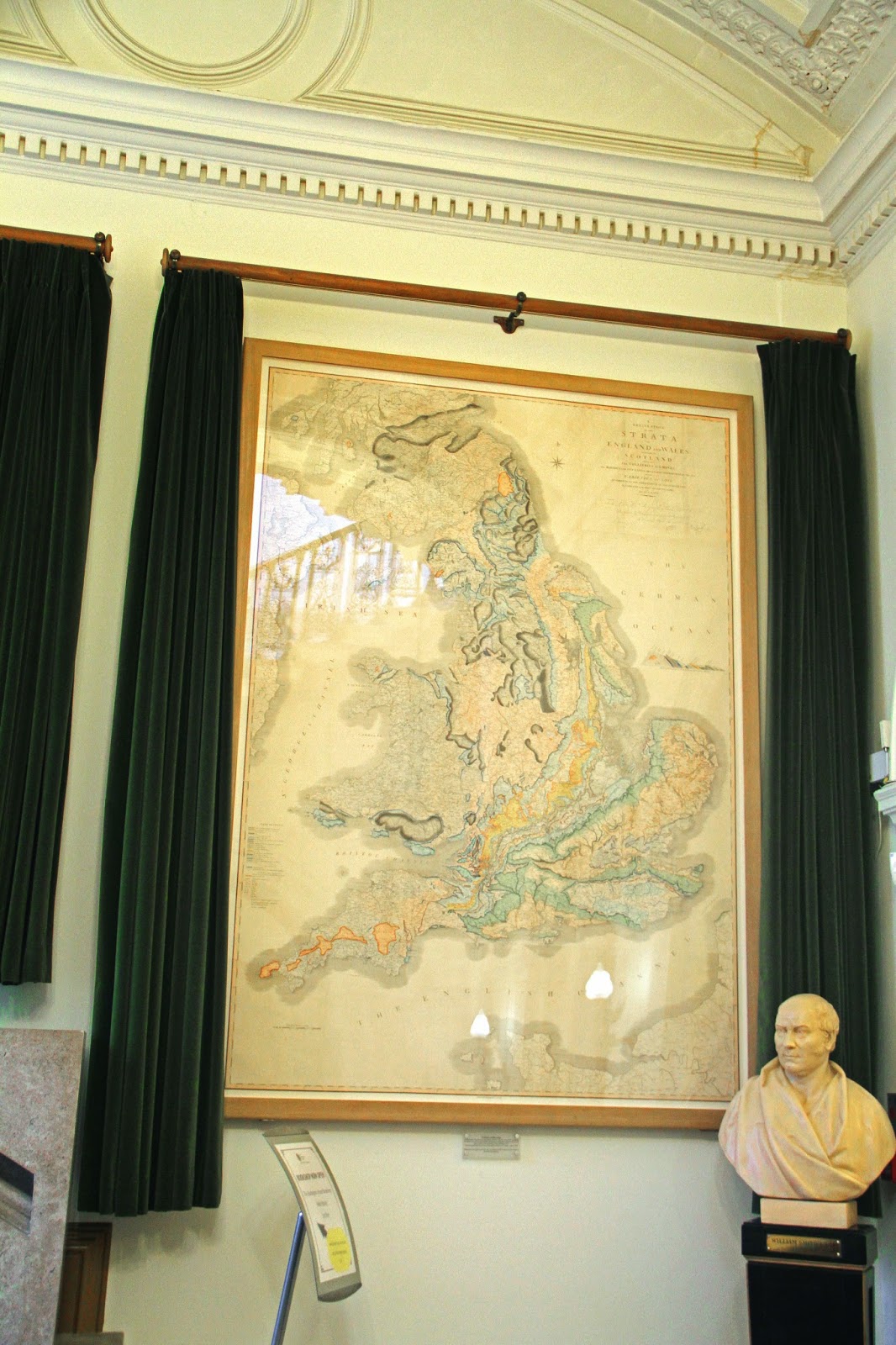
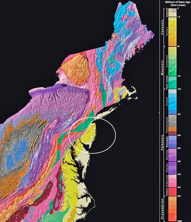
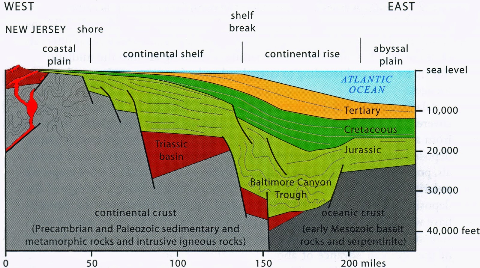
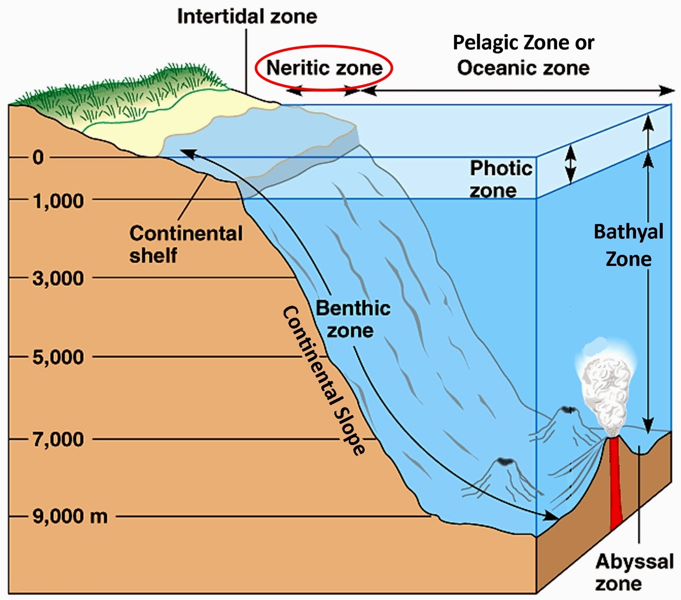
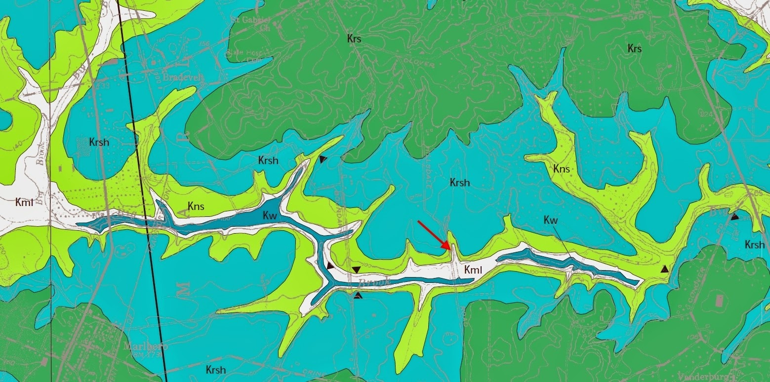
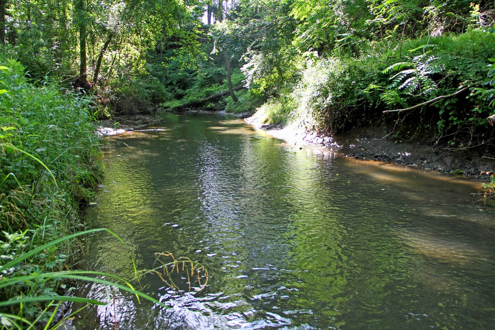
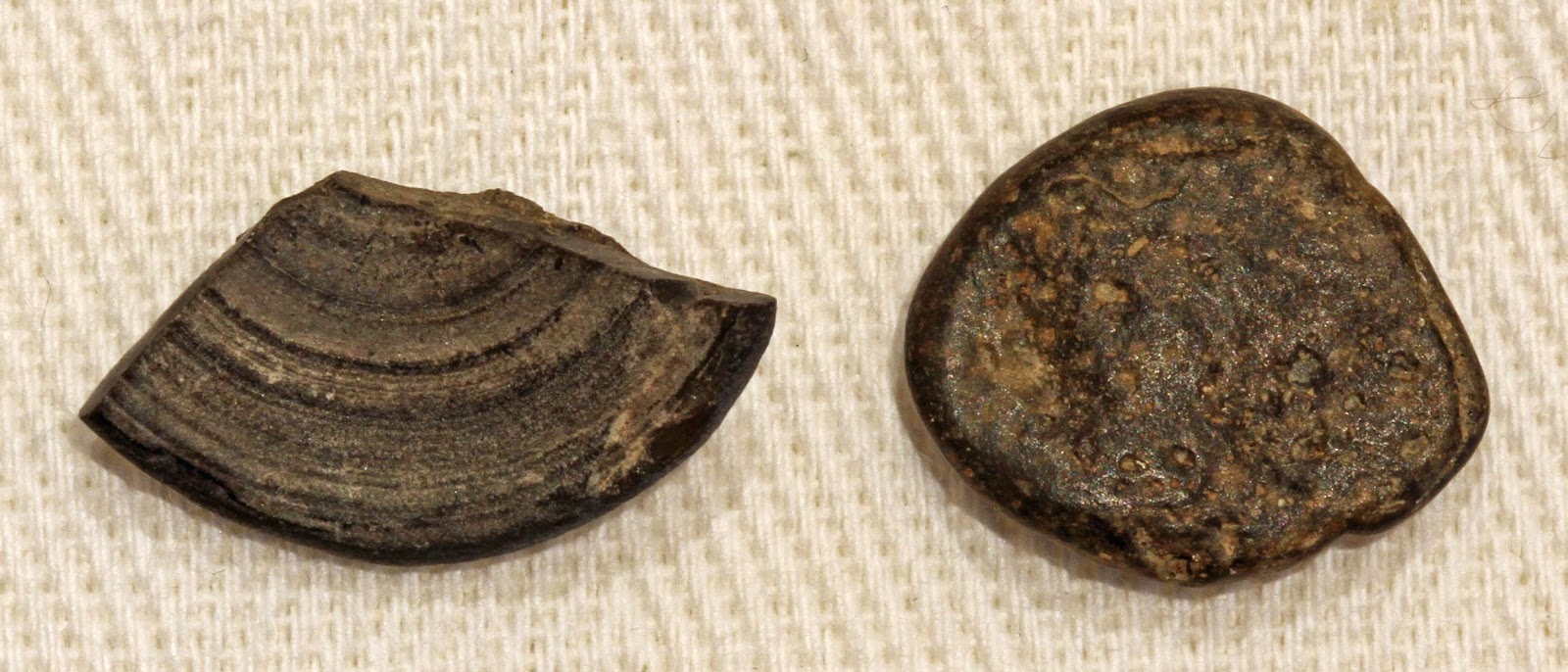
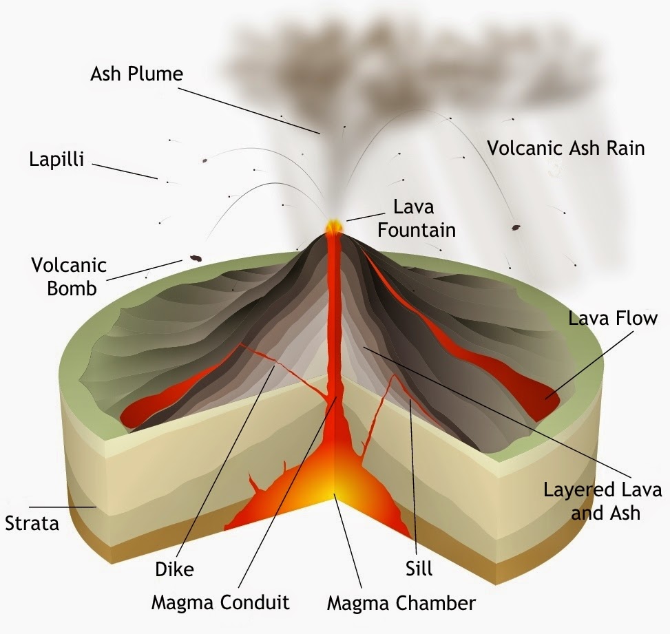
Geology and Paleontology of Marrella splendens of the Middle Cambrian Burgess Shale Formation of British Columbia: Part I - Its Fortuitous Discovery and Eminent Discoverer

$
0
0
“The animals of the Burgess Shale are holy objects... 
We do not place them on pedestals and worship from afar. 
We climb mountains and dynamite hillsides to find them. 
We quarry them, split them, carve them, draw them, 
and dissect them, struggling to wrest their secrets. 
We vilify and curse them for their damnable intransigence. 
They are grubby little creatures of a sea floor 530 million years old, 
but we greet them with awe because they are the Old Ones,
and they are trying to tell us something.“

From Wonderful Life by Stephen Jay Gould, 1989


Every geologist and paleontologist has a favorite locale, stratum, rock or fossil that for them possesses a captivating and informative story about provenance, evolution and significance. In that regard, I offer one from my collection. It's an extinct marine arthropod and iconic fossil of the Burgess Shale biota. From the ancestral shores of tropical western North America, it is entombed in blackish Burgess Shale from Walcott Quarry, located high in the southern Canadian Rockies of British Columbia. 

It's one of the most important sites for the exceptional preservation of uniquely soft-body tissues and organisms of a diverse "Middle" Cambrian paleo-community that thrived in the immediate aftermath of the biological Cambrian Explosion. The some 20-25 million year interval, considered short on the geologic timescale, is when motile and biomineralized multicellular animals made their first uncontested appearance and when nearly all major phyla 'suddenly' appeared in the fossil record.


Half a Billion Year Old Fossil of Marrella Splendens
With its distinctive cephalic array of spines and antennae and paired appendages that emanate from its thoracic flanks, the primitive marine arthropod is exceptionally well preserved in blackish Burgess Shale with both soft and hard body parts. The dark stain at the animal's posterior is thought to be extruded biotic fluids, waste matter or blood-like hemolymph and related to the Burgess Shale biota's particular taphonomy.


ABOUT THIS POST

During the time of COVID restricted travel, I decided to turn my blogging attention to several specimens in my collection. This post is the first of four on an important fossil, its geology, paleontology, discovery and discoverer. Italicized items are defined, and important names and locations are in boldface. Compass directions are in terms of the Cambrian unless stated otherwise. "Middle" Cambrian roughly corresponds to the newly designated Miaolingian Series of Cambrian Stage 3. GPS coordinates are provided for you to "Go there." 


Astounding Detail of a Half-Billion Year Old Fossil of Marrella Spendens
Rapid entombment preserved specimens with extraordinary anatomical detail and with layered three-dimensionality in various captured postures such as oblique rather than strictly parallel to bedding planes. As a result, fossils could be dissected in layers under a stereo microscope. 


MANY QUESTIONS

The discovery of Marrella and the Burgess Shale marine assemblage has revolutionized our understanding of evolution and how early animals experimented with different strategies to adapt to their environment. It has given us greater insight into the tectonic events and geo-chemical processes responsible for its formation and preservation.

And yet, after over 100 years since the discovery, many questions remain unanswered. Here are a few of the more cogent ones that will be addressed over the next few posts.

• What is the taxonomic assignment of Marrella?
• What is the phylogenetic relationship of Marrella to its descendants and the biota to earlier metazoans of the Cambrian Explosion and those of the latest Proterozoic?
• Why are many members of the Burgess Shale biota so difficult to classify in spite of the wealth of fossils at Walcott Quarry?
• What was Marrella's lifestyle and ecological relationship to the paleo-community?
• What is the evolutionary significance of the biota?
• Considering the diversity of the biota and sheer numbers of taxonomic orders, how did each species in competition manage to survive and propagate?
• How did the biota arrive so far inland and so dramatically elevated from their original marine habitat and how and when did temporally-related Burgess Shale type-deposits arrive at so many seemingly disparate localities worldwide?
• How did the fossils became concentrated within such a narrow time interval at Walcott Quarry and other Burgess-type localities?
• What was the process that conferred such a high level of tissue preservation?
• Were the deposits preserved in situ or were they transported en masse?
• Why are there more exceptionally preserved marine deposits in the Cambrian than in the entirety of the remaining Phanerozoic?
• Why did multicellular life appear so late with no simpler precursors in the fossil record? 
• What was Walcott's explanation for the agonizingly fossil-depauperate Precambrian, and what did Darwin have to say about the "dilemma"? 
• What were the triggers and environmental changes that facilitated the biological revolution?
• What big picture views are there regarding the early course of evolution?


Delicate, Elegant and Feathery Marrella Splendens
From the Dorling Kindersley website


INTRODUCING MARRELLA SPLENDENS

The 505 million year old marine arthropod is exceptionally well preserved within fine-grained, blackish sedimentary rock of the Burgess Shale Formation of British Columbia, Canada. Less than one inch in length, it was the most abundant member (~37.4%) and extinct icon of the world famous, shallow-marine paleo-community called the Burgess Shale biotaWith the exception of a heavily debated chordate (pre-vertebrate) and a number of difficult to assign "problematic" members, it was a diverse, arthropod-dominated, "Middle" Cambrian assemblage of more than 150 species.

"Marrella splendens overwhelms anything else in the Burgess by sheer abundance."
Paleontologist and author Stephen Jay Gould in Wonderful Life

Had it not been for the unique taphonomy (circumstance of fossilization) within the Burgess Shale deposit, entire soft-bodied organisms (that represent 98% of the Burgess organisms and 85% of genera) and certain body parts (such as Marrella's appendages, gills and viscera) would stand virtually no chance of preservation. As a result, the site provides important clues to the early evolution of animal lineages, diversity, and early paleo-communities and lifestyles. 


Camera Lucida Drawing of Marrella Splendens in Dorsal View
Photographs taken under angulated UV light and diagrams created with a camera lucida were used during the restudy of the Burgess Shale biota in the mid-19??. It revealed intricate morphological detail and the gills of soft-body appendages, intestines (i) and 'heart' (h) in the cephalic region with blood vessels that course through the abdomen and branch into the appendages. From Garcia-Bellido, 2006.


INTRODUCING THE DISCOVERER

The youngest of four children and born in 1850 near the small town of Utica in Central New York State, Charles Doolittle Walcott (1850-1927) never finished high school. At a young age, he became captivated by and collected marine fossils of trilobites and brachiopods from the region's ubiquitous successions of sandstone, shale and limestone that, being from nearby Syracuse, was also my youthful source of inspiration. 


Charles Doolittle Walcott in c.1908
From Wikimedia Commons 


By the age of 20, he and farmer-landowner William Rust established the small Walcott-Rust Quarry deep in the woods along a brook in 1870. Walcott's insightful descriptions and publications of the strata's diverse invertebrate marine assemblage and previously unknown, well preserved trilobite appendages brought him scientific notoriety. 


Walcott-Rust Quarry in Central New York State
Nearly lost in the woods along a stream, the "Pit", as it's affectionately called by quarry excavator and trilobite aficionado Dan Cooper, was reopened adjacent to the original quarry. I had the honor and privilege of working the quarry with Dan and his fossil-hunting family, the subject of a future post.


Recently rediscovered and reworked by amateur paleontologist William Whiteley in the 1990s, the quarry's Ordovician age stratum has some of the best preserved trilobites from the shores of paleo-continent Laurentia (more on that in the next post) ever found, including enrolled specimens with soft body parts. 

In 1873, Walcott sold the entire fossil collection to Louis Agassiz of Harvard's Museum of Comparative Zoology, who encouraged him to pursue a career in paleontology. It turned out to be good advice for Walcott and the world. The experience would propel Walcott on a lifelong trajectory of Cambrian fossil exploration that took him from discoveries in New York State and Vermont to the American Southwest and Canadian Rockies.


Positive and Negative Casts of Isotelus Gigas in Walcott-Rust Quarry
The four most common trilobites are Ceraurus pleurexanthemus, Flexicalymene senaria, Isotelus gigas and Meadowtownella trentonensis. It's the richest and most varied source of trilobites in the Trenton Group and perhaps the entire suite of New York's Paleozoic rocks.


FROM AMATEUR COLLECTOR TO WORLD FAMOUS PALEONTOLOGIST

Without formal education, he became an astute field geologist and the eminent paleontological and stratigraphic authority on early Paleozoic invertebrates and Cambrian trilobites in particular. He not only found the time to author hundreds of papers but travel and deliver countless lectures and convene conferences on the subject. 

Throughout his life, he served as director of the US Geological Survey, secretary of the Carnegie and Smithsonian Institutions and president of the American Association for the Advancement of Science, and the National Academy of Sciences. He was on the board of the National Parks Association, was science advisor to Theodore Roosevelt and the recipient of countless awards, certificates, medals and honorary degrees in the US and Europe.


Charles Walcott strikes a pose in Walcott Quarry
To this day, the tools of the trade include shovels, chisels, wedges, pick axes and long iron bars (pictured). On occasion, dynamite was also used. Excavated slabs await lowering by rope down to camp where they were split, reinvestigated and sent by horse and then rail to the Smithsonian. Image from Royal Ontario Museum website 


Tireless and ever curious, his explorations took him to the Colorado Plateau, Grand Canyon and eventually to a remote ridge high in the Canadian Rockies of the province of British Columbia. Geo-aficionados will know Walcott penned many of the canyon's iconic features such as the Butte fault that marks the eastern edge of the Kaibab Upwarp. 

He was the first geologist to challenge John Wesley Powell's theory of antecedence theory regarding the genetic river-evolution of Grand Canyon. Read about it in geologist and author Wayne Ranney'sCarving Grand Canyon book here


WALCOTT QUARRY

By accident while on horseback, as the legend goes, but essentially what he had been searching for his entire life, Walcott discovered a Middle Cambrian fossil of Marrella and its shallow marine cohorts on the steep slopes of Fossil Ridge

Located some 2,400 meters (almost 8,000 feet) above sea level between the summits of Mounts Wapta and Field in southern British Columbia, Walcoot and his fossil-hunting wife, sons and daughter established the world famous, UNESCO-acclaimed and protected Walcott Quarry.


Walcott Quarry
About the size of two school buses end to end, shovels, chisels and pick axes rest along the quarry's gradually excavated back wall. Note the slabs of shale awaiting analysis. To this day, even talus refuse are continually being reexamined and protected from theft. From the Royal Ontario Museum


Over the course of some six summers from 1909 to 1925, they hammered, chiseled, blasted, excavated, examined and cataloged thousands of fossils that included over 12,000 specimens of Marrella alone and shipped them off by rail from camp to the Smithsonian some 3,000 miles to the East. 


Charles and Sons at Camp below Fossil Ridge and Walcott Quarry in 1913
Walcott gazes into the fire as his sons sharpen an ax and prepare dinner. From Royal Ontario Museum website


Subsequent expeditions to Walcott and two more on the slope above in the ensuing century by Raymond, Richter, Stormer, Whittington, Collins, Norris, Caron, Garcia-Bellido and others have yielded well over 75,000 Burgess Shale-type specimens. Their ongoing restudies and reclassifications are testimony to the enduring enigma and allure of the Burgess Shale biota and its mysteries that continue to be conjectured and discovered.


East Facing View of Mounts Wapta and Burgess with intervening Fossil Ridge
 The blue color and extreme clarity of lakes in western Canada is due to marl held in suspension. It's a fine glacially-derived, muddy mixture of calcium carbonate (<60%) and clay (rock flour is 10 to 50% carbonate). Shorter red and yellow wavelengths are absorbed, while longer greens and blues are reflected. As the glaciers retreat and disappear (~80% in the next 50 years), the lakes are changing to sapphire blue. Image from Wikimedia Commons.


A few fossils from Walcott Quarry are in general circulation, but the majority (over 65,000) are housed in the National Museum of Natural History at the Smithsonian Institution in Washington, DC (15,000), Toronto's Royal Ontario Museum (9,000), Ottawa's Geological Survey of Canada (800) and Harvard's Museum of Comparative Zoology (202). 

After his death in 1927, his wife (the thrid) donated his personal and official papers and photographs to the Smithsonian. The Charles Doolittle Walcott Medal is awarded by the National Academy of Sciences every five years for outstanding work in the field of Precambrian and Cambrian life and history. Walcott is buried in the Rock Creek Cemetery in Washington, DC.


Charles and Sons at Walcott Quarry in 1913
Sons Sidney and Stuart look on as their father ponders the fossilized contents of a slab of shale resting on his knees. To this day, even the refuse is picked over for specimens. From Royal Ontario Museum website


"MARRELLA THE BRIGHT"

Based on its feathery gills, Walcott nicknamed Marrella the "lace crab" and made the first sketches of it in his field notebook, which is ensconced in the Smithsonian Institution. He thought it was a primitive "phyllopod" crustacean, a term that no longer has taxonomic value but is still used for descriptive purposes. 

Walcott later assigned Marrella the genera designation (principal name) to honor his paleontologist friend Dr. John Edmund Marr. The spendens epithet (species name) means 'brilliant' or "bright" in Latin. Both Marrella splendens and Charles Walcott are synonymous with the world famous fauna and quarry.


Walcott's Field Notebook
Dated Tuesday, August 31, 1909, Walcott made his first sketch of the Phyllopod crustacean he informally called "lace crab" (arrows) that he later named Marrella splendens. The notebook lies in the Smithsonian Institution at Washington, DC. From Royal Ontario Museum website


POST PART II

Please join me for my second post on Marrella, the Burgess Shale biota and the Cambrian Explosion. We'll pay a visit to the UNESCO-protected Walcott Quarry on Fossil Ridge in the Canadian Rockies and the fortuitous events that up to the discovery by Charles Walcott. The posts to follow will include the taxonomy, phylogeny and geo-tectonics of Marrella.


Latest Images